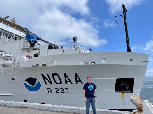
Lisa Carlson: Come Out, Come Out, Wherever You Are, Hake! July 6, 2023

NOAA Teacher at Sea

Lisa Carlson

NOAA Ship Bell M. Shimada

July 5, 2023 – July 19, 2023

Mission: Fisheries: Pacific Hake Survey (More info here)

Geographic Region: Pacific Ocean, off the coast of California

Date: July 6, 2023

Weather Data from the Bridge:

— July 5 Departure
(1800 PT, 2100 EST)

Location: 37° 44.9’N, 122° 39.2’W
Docked at Pier 30/32
San Francisco, CA

Visibility: 10 nautical miles
Sky condition: Overcast
Wind: 17 knots from NW 300°
Barometer: 1012.8 mbar
Sea wave height: 1-2 feet
Swell: 2-4 ft from W 270°
Sea temperature: 14.2°C (57.6°F)
Air temperature: 14.7°C (58.5°F)
Course Over Ground: (COG): N/A
Speed Over Ground (SOG): N/A

— July 6 (1200 PT, 1500 EST)
Location: 35° 38.2’ N, 121° 18.9’ W
16nm (18mi) West of San Simeon, CA

Visibility: 10nm
Wind: 6 knots from 330°
Barometer: 1013.9
Sea wave height: 1-2ft
Swell: 2-4ft from 280°
Sea wave temperature: 14.4°C (57.9°F)
Air temperature: 14.9°C (58.8°F)
Course Over Ground: (COG): W 270°
Speed Over Ground (SOG): 10 knots

– – ⚓ – –

Science and Technology Log

On July 6, our first full day at sea, we gathered in the acoustics lab to observe and keep watch on data from various screens. Data includes our current course plotted on a digital chart, a camera showing current sea state, measurements of the wind speed and direction, and displays of the multiple frequencies at which the Simrad EK80 transmitter emits sound. The EK80 is used while traveling on numbered longitudinal east-west lines called transects. NOAA Ship Bell M. Shimada navigates on these lines while collecting acoustic data along the west coast of the U.S. and into Canada, in hopes of finding schools of Hake to collect for surveying.

A topographic map of a portion of the coast of California. The topographies of the both the land (beige and green scales) and water (blue scale) are depicted. Black dots mark the locations of three coastal cities: Crescent City, near the top of the map; San Francisco, a little more than halfway down; and Morro Bay, toward the bottom of the map. Black horizontal lines mark transects extending west from the coast line. The black lines are marked with red or black x's (showing previous sampling locations, perhaps) and a couple have green triangles.
Map showing transects 1-45 off the coast of California. Transect 1 is south of Morro Bay, CA and transect 45 is near Crescent City, CA.
(We hope to survey transects 8-35 by Cape Mendocino, CA before traveling north to dock in Newport, OR.)

“For acoustic surveys, the ship uses a multibeam echo sounder (MBES) that projects a fan-shaped beam of sound that bounces back to the ship. The ship’s MBES—one of only three systems of its type worldwide—acquires data from both the water column and the sea floor.”

NOAA Office of Marine and Aviation Operations (OMAO): “Bell M. Shimada

The Simrad EK80 emits sound waves from the hull of the vessel down to the sea floor. The process is very similar to a dolphin or bat using echolocation to find prey. Any object the signal hits that has a different density and reflectivity than the surrounding water will cause the waves to bounce back to the ship. An image, called an echo gram, is pieced together each time this occurs and the acoustics team is able to use this information to determine if there are enough return signals that suggest fish are present to attempt a trawl.

Fish that have swim bladders, like bony fish, reflect or echo the sound wave back to the vessel very strongly. Other marine life such as myctophids and zooplankton also have a different density than the sea water, and reflect sound, although not as strongly as fish with air-filled swim bladders. The sea floor itself also reflects sound very strongly, because of the density difference between water and rocks, sand, and mud.

Marine life that have swim bladders (represented in blue) reflect or echo the sound wave back to the vessel. Examples of such marine life include bony fish, myctophids, and zooplankton, as well as the sea floor itself, which has a different density than the sea water.

Image: Cross section example of a Black Sea Bass to show a swim bladder.

an illustrated diagram of the internal anatomy of a bony fish (perhaps a black sea bass). Labels mark the locations of the gills, kidney, swim bladder, urine bladder, gonad, intestine, spleen, stomach, liver, and heart.

If the acoustics team determines there is enough marine life (that they are interested in surveying) to attempt a haul, they will notify the bridge deck and officers that they would like to have the fishing net deployed.

Before an attempted haul, the science team conducts a marine mammal watch for ten minutes. In this time window, several pairs of eyes are observing from the bridge deck and stern for any signs of dolphins, whales, sea lions, seals, and any other marine mammals that are within 500 meters of the vessel. If any marine mammals are spotted within the ten minute observation, we will stand down and wait ten minutes before restarting the marine mammal watch. Net deployment cannot occur until the full observation window has completed.

First haul July 6:
1422-1432 Mammal watch, no marine mammals spotted.
The net deployment started, at which time the vessel continues forward at two knots. Vessel speed increases to three knots when the net is fully deployed with doors and weights in the water, which assist in opening the conical shaped net outwards linearly and laterally. During this time the science team watches displays of the EK80 frequencies and observe the linear width and depth of the net. Scientists can compare these displays to determine if the net is in the correct position to have the best chance of collecting fish.

Hauling back the net occurs after several minutes, at which time the vessel returns to a speed of two knots, and we estimate how many fish were collected. The amount of time in which the net is submerged depends on the depth of the water and acoustic information about the size of the school of fish the net is (hopefully) sampling. After recovery, the haul is deposited into a hopper which feeds onto a conveyor belt in the wet lab, then into large baskets and the wet lab team takes over.

During the first attempt, two sea lions were spotted which required the haul attempt to be paused. We restarted the ten minute marine mammal watch from 1500-1510, the deck department retrieved and reset the net, and the vessel was turned around to return to the start of the noted longitudinal transect. With no marine mammals spotted during the observation period, the second attempt was successful and resulted in:

– 1604-1634: 30 minute haul at 350m depth.

– 11 baskets of Hake collected.

– 4 sample baskets kept at random.

– 541 Hake counted and studied in the wet lab.

Photo: Two deck department members about to open the net to allow the sample to drop into a large collection basket.

Two crewmembers, dressed in orange paints and black and neon yellow coats, face away from the camera, toward a large orange net suspended from above. They may be working to empty the net.

– – ⚓ – –

Personal Log

On July 4 I arrived to pier 30/32 in San Francisco, CA to board NOAA Ship Bell M. Shimada. Although I grew up volunteering on the 441’ WWII Liberty Ship SS John W. Brown in Baltimore, MD, seeing a new ship still resulted in a mix of emotions, nervousness, adrenaline, excitement, and everything in between. After five and a half years, finally seeing the 208’ vessel that would become my home for the next two weeks was a core memory and feeling I will always remember.

NOAA Ship Bell M Shimada in port, as seen from a point on the dock beyond the bow. We can see the NOAA logo and read: NOAA R 227. The water is calm and turqoise; the sky is blue with clouds. A portion of what may be the Golden Gate Bridge is visible in the background.
NOAA Ship Bell M. Shimada docked at Pier 30/32 in San Francisco, CA on July 4

Once onboard, I met Chief Scientist Steve de Blois and Wet Lab Lead Ethan Beyer. I was given a tour of the acoustic, chem, and wet labs and shown to my cabin. After dinner ashore, I joined some of the crew on the flying bridge to watch the July 4th fireworks. I met additional science team members and enjoyed a long night’s rest.

In the morning on July 5, we had a welcome aboard meeting, various trainings, a safety meeting and orientation, fire and abandon ship drills, and a science team meeting. We introduced ourselves, took an official team photo, and soon departed pier 30/32 for our 14 day mission. After passing under the Golden Gate Bridge and heading to the Pacific Ocean, our cold hands were warmed by a wonderful hot dinner of chicken, steak, fresh veggies, salad, and desserts from our galley crew. After dinner, we settled in for our first night at sea, waiting with anticipation for our first trawl on July 6.

– – ⚓ – –

Did You Know?

an orange-gloved hand holds a hake (fish) up so that it faces the camera. We can see the another smaller hake hanging limply across its open mouth

– Hake can be cannibalistic!
– Some larger Hake we have collected have had a smaller Hake in their mouth, throat, or stomach!
– Their very sharp teeth often stick to our thick rubber gloves.

– – ⚓ – –

New Terms/Phrases:

“Salp: Barrel-shaped, planktonic tunicate in the family Salpidae. It moves by contracting, thereby pumping water through its gelatinous body.”

Wikipedia: “Salp

“Myctophid: Lanternfish (or myctophids, from the Greek μυκτήρ myktḗr, “nose” and ophis, “serpent”) are small mesopelagic fish (…) Lanternfishes are aptly named after their conspicuous use of bioluminescence.”

Wikipedia: “Myctophid

Simrad EK80: Multibeam Echo Sounder (MBES) transducer that emits sound waves from the hull of the vessel down to the sea floor. It allows scientists to observe and study returned sound wave signals that may suggest marine life is present.

Transect: Set and numbered longitudinal east-west lines NOAA Ship Bell M. Shimada navigates on while collecting acoustic data.

Lisa Carlson: Anticipation… Does everything happen for a reason? July 3, 2023

NOAA Teacher at Sea

Lisa Carlson

NOAA Ship Bell M. Shimada

July 5, 2023 – July 19, 2023

Mission: Fisheries: Pacific Hake Survey (More info here)

Geographic Region: Pacific Ocean, off the coast of California

Date: July 3, 2023

Introduction and Background

Hello! My name is Lisa Carlson and I am an elementary school teacher in Virginia Beach, Virginia. I have taught third, fourth, and fifth grade general education with Special Education and English as a Second Language (ESL) inclusion. This coming fall I will be a second grade teacher, continuing with ESL inclusion! Although I was surprised to move down from fourth grade, I try to maintain the belief that everything happens for a reason, and the only constant in life is change.

Lisa Carlson on a boat, presumably a sailboat. We can see lines, some navigation equipment, portions of the railing, and water in the background. She's wearing a hat, sunglasses, and a blue life vest.

For example, if I not missed out on previous opportunities to join NOAA as a Teacher at Sea due to the pandemic, a short career change, and other extenuating circumstances; I wouldn’t be writing this blog from a hotel room in San Francisco, California, anticipating boarding and seeing July 4th fireworks from the deck tomorrow.

– – ⚓ – –

My introduction to NOAA’s Teacher at Sea program began in the fall of 2017. After student teaching in the fall/winter of 2016 in a third grade class, and permanent subbing in a fifth grade in the winter/spring of 2017, I accepted a position for my own third grade classroom.

My classroom came together with a nautical theme, shades of blues and calm colors, nautical paintings by my Mom, lots of cleaning and moving by my Dad, sailboat name tags on the door, and our own 3D sailboat in my class library. It soon got around that my room was one to go see!

A closed classroom door papered in shiny blue-green wrap on the top half (representing ocean) and brown on the bottom half (representing sand). Paper sailboats of different colors are taped onto the "ocean;" each has a student's name (not legible). Four yellow flip flops, with more labels, are taped to the "sand." At the top of the door, blue letters on a black paper background say: WELCOME ABOARD.

Door decorations for my first third grade classroom!

Classroom decor: life ring painting, handmade pilings,
fish and life ring pillows, sea creature lights, and 3D sailboat

A corner of a classroom, with shelves, plastic organizer boxes, a small carpet, a nest chair, in nautical theme.

Our Technology Integration Specialist, a NOAA Teacher at Sea Alumnus, visited my room and explained the program to me. The application was due on my birthday, less than a month from when I learned about the opportunity.

– – ⚓ – –

So, I applied in November 2017, 2018, and 2019. One year I just wasn’t selected, one year administrative input was not turned in on time, and other hiccups along the way. Then, my 2019 application was accepted, and I was over the moon in January 2020 to learn that I was a finalist. Of course, we all know what happened that March; and the 2020 and subsequent 2021 sailing seasons were canceled. Slowly, a few teachers were able to sail in the summer of 2022, and I was able to read their blogs from afar with the belief of everything happening for a reason.

My 2023 NOAA Teacher at Sea Assignment!

Now, it’s my turn! I will be sailing off the coast of California for two weeks on NOAA Ship Bell M. Shimada with members of the science team as part of the Integrated Ecosystem and Pacific Hake Acoustic Trawl Survey.

“For three decades, the Teacher at Sea program has helped teachers participate in annual NOAA research surveys conducted by our scientists. Teachers from around the country embark on a two to three week expedition at sea. They gain invaluable on-the-job experience and communicate their journey through a series of blogs and lesson plans.”

NOAA Teacher at Sea Blog: “Looking Back on 30 Years of Teachers at Sea

I am so excited for this opportunity and experience after five and a half years of anticipation. So follow along, wish us fair winds and following seas, and as many schools of Pacific Hake as possible to sample from and research!

– From my king sized bed hotel room, and last night ashore:

Temporarily reassigned teacher, and sailor at heart.

Lisa stands at the door of a streetcar, left hand hanging onto a pole. A San Francisco streetscape extends into the distance to the left side of the photo.

Martha Loizeaux: Salp Confidence, August 24, 2018

NOAA Teacher at Sea

Martha Loizeaux

Aboard NOAA Ship Gordon Gunter

August 22-31, 2018


Mission: Summer Ecosystem Monitoring Survey

Geographic Area of Cruise: Northeast Atlantic Ocean

Date: August 24, 2018


Weather Data from the Bridge

Latitude: 40.15 N

Longitude: 68.71 W

Wind direction: NE

Wind speed: 14 knots

Water temperature: 23.8 degrees C

Air pressure: 1023 millibars

Air temperature: 24.2 degrees C

Water depth: 165 meters


Science and Technology Log

What an exciting first full day out at sea!  I have been so grateful that our science team has allowed me to be completely hands-on and take responsibility for some of the science happening on the ship.  In addition to checking the Imaging Flow Cytobot (IFCB) periodically, I am very much involved in the data collection at each of our stations.

There are specific stations along our course where scientists need to collect data.  The crew announces when we are close to the station.  At that time, along with another volunteer on watch, I don my foul weather gear to head out to the deck.  We get pretty splashed as we are working with the equipment so the gear is a good idea.  We help the crew as they lower “bongo nets” into the water using a cable and pulley system.  Can you guess why they are called bongo nets?  These nets have a very fine mesh that helps collect, you guessed it, PLANKTON!

bongos on deck
bongo nets waiting on the deck to be deployed

bongos in water
The bongo net and the “baby” bongo net being deployed.

We also help raise the bongo nets after several minutes dragging them through the water.  We rinse all of the plankton down to the bottom of the net and then open up the end of the net to allow all of the plankton into a sieve where we will collect it.  I have been surprised by the amount of jelly-like animals that have shown up in the nets!

Then it’s time to use special liquids (ethanol or formalin) and water to wash the plankton into collection jars. These chemicals will preserve the plankton so scientists can study it back in the lab!

It has been so much fun working with this equipment, asking the scientists questions about the plankton, and being a part of it all.

Harvey, our chief scientist, explained to me that many scientists can use the plankton samples for all different studies.  Some of the samples can be used to study larval fish (baby fish) otoliths, the tiny ear bones that can verify the identification of larval hake using genetics.  Knowing this, scientists can do research to determine where the larval fish were born!  What a great example of the beginning of a scientific

Hake larvae
Some examples of larval hake. Photo courtesy of Harvey Walsh

experiment!:

Question – Where are most larval red hake fish born in the Northeast Atlantic Ocean?

Research – Scientists might research currents in the area, wind patterns, and other things that would push plankton from place to place.  They also would research what other scientists have already learned about larval red hake.

Hypothesis – Most larval red hake fish are born in the Southern New England and Georges Bank regions in the northeast US shelf.

Didn’t I tell you plankton were amazing?

At some of the stations, we also lower Niskin bottles and CTD instruments into the water to collect a lot more data!  More on that to come!

Martha and bongos
Here I am getting ready to deploy the bongo nets.

rinsing nets
Jessica and I rinsing the bongo nets.

plankton on sieve
Plankton looks tiny when we filter it into a sieve.

plankton samples
Our plankton samples after being rinsed into the jars.


NOAA Corps Corner

Today I spoke with Lola Ajilore, Officer with NOAA Corps, and asked her a few questions about her important work.  A pod of humpback whales off the bow stole the show! Here’s what we got in before the exciting interruption…

Me – Tell me more about your roles on the ship.

Lola – I am the Navigation Officer, Medical Officer, Environmental Officer, Ship Store Officer, and Morale Officer.  As you can see, we all have multiple roles on the ship.  As Navigation Officer, for example, I plot charts, track directions, and coordinate with the Operations Officer and Commanding Officer on track lines and routes that are requested by the scientists.

Me – Where do you do most of your work?

Lola – I am always with NOAA Ship Gordon Gunter.  The ship’s home port is in Pascagoula, Mississippi.  Our missions often take place in the Gulf of Mexico but we also run these Northeast Shelf cruises for Ecosystem Monitoring every year.

Me – What kind of training is needed for your line of work?

Lola – We undergo an application process that includes several interview steps.  We then train at the Coast Guard Academy.  Much of our training parallels that of the Coast Guard, but we also do our own NOAA Corps training as well.

Me – What tool do you use in your work that you could not live without?

Lola – Radar!  [Radar aids navigation by detecting things that are far away such as an island or another ship]

Nav officer
Lola as Navigation Officer.

humpback from afar
Can you see the little black dot in the middle of the picture? It’s a humpback whale! It looked a lot closer in real life.


Personal Log


sunset view
Sunset on NOAA ship Gordon Gunter

I cannot believe the amazing views that we have on this ship 24 hrs. a day!  The water has been super calm and the sunrise, sunset, breaching whales, and pods of dolphins have taken my breath away.

Yesterday was emergency drill day!  Libby, our Operations Officer, had given us directions on how to respond to emergencies prior to leaving the

Mustering on the deck
Mustering on the deck during the emergency fire drill.

dock.  There are emergency drills for a fire (just like at school!), abandon ship (in the case that we had to immediately leave the ship in an emergency), and man overboard.

We practiced a fire drill and an abandon ship drill.  The Officers on the ship sounded the alarm, using a different number and duration of blast based on the type of emergency.  For a fire, we all “mustered” (got together in one place) in assigned areas.  All of the science team members mustered together.  For abandon ship, we all mustered near the life boats along with our life jackets and immersion suits (suits that can help you survive if you end up in the water).

Martha in immersion suit
Here I am in my immersion suit!


The fun part of the abandon ship drill was donning our immersion suits in one minute or less!  This was a great thing to practice so if there ever was a real emergency, we would know how to put on the suit.  I thought I looked pretty cool in my immersion suit.


Did You Know?

Salps are barrel-shaped planktonic tunicates.  Our plankton bongo nets always contain some jelly-like salps. Where I live in the Florida Keys, we see mangrove tunicates growing on mangrove roots.  Here in the open ocean, salps stick together in long colonies and drift!  Sometimes there are so many salps in our nets, we have to filter them out with sieves and put them back in the water.

salps from web
An example of a colony of salps. Photo courtesy of NOAA


Something to Think About

We have been finding up to 4,000 phytoplankton in 5 mL of water.  A gallon of water is equal to about 3785 mL.  There is about 352,670,000,000,000,000,000 gallons of water in the Atlantic Ocean.  How much plankton is in the Atlantic?  You do the math.

plankton from web
This is what some plankton look like under the microscope. Photo courtesy of NOAA

Christine Webb: August 18, 2017

NOAA Teacher at Sea

Christine Webb

Aboard NOAA Ship Bell M. Shimada

August 11 – 26, 2017


Mission: Summer Hake Survey Leg IV

Geographic Area of Cruise: Pacific Ocean from Newport, OR to Port Angeles, WA

Date: 8/18/2017

Latitude: 48.19 N

Longitude: 125.29 W

Wind Speed: 7.9 knots

Barometric Pressure: 1021.70 mBars

Air Temperature: 55.4 F

Weather Observations: Foggy


Science and Technology Log:

I am learning an unbelievable amount about marine biology! Today I will focus on hake because that is the main type of fish we are surveying on this voyage. Pacific hake are found in great abundance out here off the west coast of North America and Canada. Let me tell you a little bit about what we do.

The first thing we have to do before trawling for hake is find a good aggregation of them based on our acoustics. There is always a scientist in the acoustics lab watching the monitor outputs. The monitors show the acoustics from different frequencies: 18, 38, and 120 KHz. They can “see” when there are things between us and the ocean floor (see picture below). Based on the response of the acoustics to the objects in the water, the scientists make an educated guess about when we are over a hake aggregation. I’ve been learning a lot about how to read these monitors and how to see if we’re over rockfish, phytoplankton, or hake. I think it would be pretty cool to see something giant like a whale go underneath us, but that hasn’t happened. That’s probably for the best – I can’t imagine it’s super safe to have a whale under your ship.

IMG_20170816_090024430_BURST000_COVER_TOP
Acoustic data from the acoustics lab.

Once the acoustic scientists decide we’re over hake, they radio up to the bridge to tell them it’s time to go fishing. The fishermen start getting the nets ready, and the scientists (that’s me!) go up for marine mammal watch. We have to make sure there aren’t any whales or dolphins nearby that might get caught in our nets. I really like marine mammal watch. I get super excited to see whales and dolphins, even though I guess that’s kind of bad because we might have to postpone our trawl. Seeing mammals when we’re not fishing is the most exciting. Today we saw two orcas by the side of our boat – now THAT is cool!

IMG_20170817_103950017_HDR
Me on marine mammal watch

Once the net is fully deployed and well below the surface, the marine mammal watch ends. Then they fish through the sign they saw on the acoustics and bring the net up when they believe they caught an adequate sample. Then it’s time to process the trawl! What we want to see is a majority of hake, but that doesn’t always happen. We’ve had trawls with hundreds of hake, and we’ve had trawls with only seventeen. We sometimes catch a bunch of other stuff too, and we do different things with those creatures (I’ll save that for a different post).

Processing the trawl is pretty intensive. First we have to weigh all of them to get the mass of the entire trawl. Then we sex them to sort into male and female baskets. It’s tricky to tell the difference between males and females. We have to dissect them and find the gonads to be able to tell. Near as I can tell, the male gonads look like ramen noodles and the females look like peach jello. I think of it as, “I wonder what my husband is eating while I’m gone? Probably ramen noodles. Okay, ramen noodles means male.”

IMG_20170818_153044071
Getting ready to sort hake!

Once we have them all sorted, we take length measurements and start extracting the parts we need. The scientists are collecting and preserving the otoliths, gonads, stomachs, livers, and fin clips. We have a LOT of tubes of fish guts in our lab. I’m not entirely sure what scientists will be doing with all of this data, but perhaps I’ll interview our chief scientist about this and put it in a future post.

Personal Log:

Everyone I’ve met on this ship has been so friendly! One of my favorite things about it is that these people seem so passionate about whatever they’re doing. You should have seen my friend Hilarie’s face today when we pulled up a trawl full of pyrosomes (that’s what she studies). Tracie showed me some of the phytoplankton she’s studying, and it was like she was a little kid at Christmas. Personally I’ve never been super interested in phytoplankton, but now I am. She makes it sound like it’s the most exciting subject on earth, and looking at her slides makes me believe her.

IMG_20170817_081818382
Tracie studying phytoplankton

It’s not only the scientists who are passionate about their work. The chief steward, Larry, was so excited about his cauliflower soup today that he seemed personally offended when I didn’t take any. “Take some soup!” he said. “Seriously – it’s really good soup. You’re going to like it.” I took some just to be nice, but after one bite I said, “Larry, will this be out at dinner? Can this please be out at dinner? I LOVE IT.” It was seriously good. I need to learn how to make that.

Our chief scientist takes her job as chief very seriously too. She’s like the momma duck who takes care of all of us (thanks, Julia!). Also, she plans fun and goofy games every day where we can win prizes out of her “bag of goodies.” I haven’t won yet, but I hope I will before this is over. Today Hilarie won some awesome coral reef socks. I’m not sure how I’ve gotten this far in life without owning marine biology socks! It’s great to have Julia around because she makes time for all of us even though her own research is very absorbing and important. She’s a rock star.

IMG_20170818_181046070_HDR
Hilarie choosing her prize

Stay tuned for more info from Leg 4 – bye for now!

Caitlin Thompson: Bottom Trawl, August 11, 2011

NOAA Teacher at Sea
Caitlin Thompson
Aboard NOAA Ship Bell M. Shimada
August 1 — 14, 2011

Mission: Pacific Hake Survey
Geographical Area: Pacific Ocean off the Oregon and Washington Coasts
Date: August 12, 2011

Weather Data from the Bridge

Lat. 48 degrees 07.0 N
Long. 125 degrees 13.7 W
Present weather: partly cloudy 6/8
Visibility: 10 n.m.
Wind direction: 335
Speed 10 kts
Sea wave height: 2-3 feet
Swell waves – direction: —
Swell waves – height: —
Sea water temperature: 15.0 degrees C
Sea level pressure: 1017.3 mb
Temperature – dry bulb: 15.8 degrees C
Temperature – wet bulb: 13.2 degrees C

Science and Technology Log

Third Wire FS70
The Third Wire FS70 provides an image of the net, shown as half circle, and the fish around it.

The big news is that we’re headed to port a day early. There was a electrical component failure in the engine system that converts the diesel power to electricity which powers the electrical motors that turn the propeller shaft. This reduced the Shimada to running on about half power. I can’t believe the cruise is ending!

Yesterday we did a bottom trawl, the first bottom trawl ever conducted on the Shimada. Using the sonars, the scientists on the sonar team saw an interesting aggregation of fish. They couldn’t use the usual mid-water net, which is relatively easy to damage, because the fish were very close to the bottom. Besides, the bottom appeared hard and rocky. I was excited when they decided to test the new net. Unlike the mid-water trawls, which usually bring up a mostly “clean” haul of hake, a bottom trawl tends to bring up a wide array of species. I wanted to learn some new names.

ITI
The ITI shows the distance of the bottom of the ocean from the net. Where the pink lines are highest, the net is lowest.

Deploying the bottom net proved educational. The mid-water net is sent down with the FS70 attached, which provides an image of the objects near and in the net. On the screen shot of the FS70 above and to the right, look for the half-circle, which shows the open net, the silver blue line under the net, which is the bottom of the ocean, and some dots inside the net that are most likely fish already caught in the net. The images are sent through a wire. It would be too easy to damage the wire in a bottom trawl, so the scientists use the ITI instead.

Larry was in charge of fishing today and was disatisfied with the image the ITI System produced of the bottom trawl. The ITI does not produce as good an image of the bottom trawl as the FS 70 did on the midwater trawl. This made it more difficult to decide how much was being caught and how long to fish. The scientists began planning how to get a better system for the ship.

The bottom trawl disappointed the scientists because it brought up fewer hake than they had hoped, but I was happy to see so many new kinds of fish, and to learn to identify many so that I could help sort. This is the list of everything we pulled up:

Ratfish
This spotted ratfish has a venomous spine on its dorsel fin!

Aspot prawn, full of eggs
A spot prawn, full of eggs

Rockfish
Larry, Alicia and I sort rockfish. Initially, the fish on the table looked the same to me, but I soon learned to identify ...

Rex sole
Rex sole

Arrowtooth flounder
Brown cat shark egg case
Cloud sponges
Darkblotched rockfish
Dover sole
Greenstriped rockfish
Hermit crab unident.
Lanternfish unident.
Long honred decorator crab
Longnose skate
Pacific hake
Pacific ocean perch
Pom pom anemonome
Redbanded rockfish
Rex sole
Rosethorn rockfish
Sablefish
Sea cucumber unident.
Sea urchins and sand dollars unident.
Sharpchin rockfish
Shortspine thornyhead
Skate egg case ulnident.
Slender sole
Snail unident.
Spot prawn
Spotted ratfish
Wattled eelpout

Personal Log

Last night, some of us went up to the fly bridge in hopes of seeing the Perseid Meteor Shower. The sky was miraculously clear but the nearly full moon and bright lights on the ship blocked out most of the stars. Still, we saw some truly magnificent shooting stars before the clouds rolled in. I had brought my sleeping bag for warmth and fell fast asleep to the soothing voices of my shipmates. When they woke me up, I dropped by the chemistry lab to see how the nighttime zooplankton sampling was going and discovered that a mallard had arrived on deck. Mallards are not sea birds and are not equipped to be so far out to sea, so we were highly surprised to see her some fifty nautical miles off land. We named her Myrtle. We gave Myrtle food and water and hoped she would stay with the ship until we were close to land, but after a long nap, she took off. I hope she makes it to land.

In cribbage news, I won the semi-finals but lost the championship game. I had such a great time playing.