NOAA Teacher at Sea
Jacob Tanenbaum
Onboard NOAA Ship Miller Freeman
June 1 – 30, 2006
Mission: Bering Sea Fisheries Research
Geographic Region: Bering Sea
Date: June 18, 2006
 Weather Data from the Bridge
Visibility: 10 miles
Wind Speed: 9 miles per hour
Sea Wave Height:2 feet
Water Temperature:41 degrees
Air Temperature:40.8 degrees
Pressure: 1013 Millibars
Personal Log
NOTE: We will arrive in the port of Dutch Harbor, Alaska on June 20. As the project draws to a close, I would like to evaluate how effective it was. There is a link to an electronic survey. I would like to ask students, teachers, parents, and other visitors to the site to take a few moments to let me know what you think of this idea. The survey is all electronic and only takes a minute or two to complete. Thank you in advance for your time. Click here to access the survey.

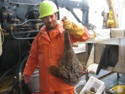
By now, you have met many of the interesting people aboard NOAA ship MILLER FREEMAN. There are three groups of people aboard these ships. The officers on the ship are part of the NOAA Corps. This is a uniformed service of the United States consisting of about 300 officers who complete rigorous training and hold ranks, like ensign, or commander. They are in charge of ships operations and stand watch on the bridge. The scientists aboard are mostly from NOAA research labs, like the Alaska Fisheries Science Center in Seattle. Many of the other members of the crew are civilian wage mariners. These are professional sailors who handle many of the day to day operations of the ship. Some, such as Chief Engineer Bus, have made their home on this ship for close to 30 years. Other sailors are contract workers who come aboard for a few months, go home and take a break, then join the crew of another ship for a different sort of cruise. Sometimes they are on research vessels, sometimes they are on freighters, sometimes they are on tankers. Today, lets meet able-bodied seaman, or AB Michael O’Neal. Click each question to listen to the answer.

What do you do on board the NOAA Ship MILLER FREEMAN?
Where are some of the other jobs you have had at sea?
What does it take to be an able-bodied seaman?
Science Log:

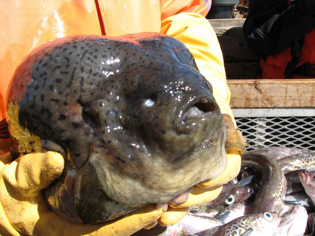
We had another in a series of amazing bottom trawls last night. When the nets trawl along the bottom out here, some of the most interesting creatures of all get swept into our nets. Creatures that live on the bottom are often stranger looking for a few reasons. They are adapted to blend into the bottom so that predators cannot see them. They often wind up looking like rocks or plants as a kind of defense. They are also adapted to an environment with higher pressure and less light than the surface. Some of their adaptations can also make them look very different from other fish. Since they don’t have to worry about predators below them, these fish may be flat and have both their eyes sticking up. These creatures often do not need to be fast swimmers, since their defense is to blend into the environment rather than swim away when predators approach. The basket of sea cucumbers was one of the strangest things I’ve seen so far. These sticky blobs are not plants. They are sea creatures that live on the bottom of the sea and sift through the sand or water to find food. There are several different kinds of sea cucumbers in this basket. Can you see the different types? Mud stars, on the other hand, are soft and sticky, not like the sea stars we have at home. It may be called a mud star, but I think looks like Patrick from Sponge Bob.

Question of the Day
Now that you have seen some of the different jobs aboard NOAA Ship MILLER FREEMAN, if you were on a ship, which job would you prefer? Write me a comment on the blog and let me know!
Answer to Yesterday’s Question
Look at the movements of the ship described above. When the ship drives into the wind and waves, sailors call it a corkscrew motion. Can you think why?
A corkscrew motion occurs when the ship is struck by waves in such a way that it moves in several motions at once. In other words, it may pitch, roll, surge, and sway all at the same time. I’m getting a funny feeling in my stomach just thinking about it!
Answers to Your Questions
Sorry that I left off the link from Friday where you can see the position of the ship. Here it is. Fair warning, the site was down for most of today, so if it does not work, just try again later.
http://info.nmao.noaa.gov/shiptracker/Ship.aspx?ship=Miller%20Freeman
After we put in to port, I’ll have a day or two in Dutch Harbor to look around, before I can get a flight in to Anchorage. After that, I’ll be visiting some friends and family out west before I head back east. Thanks for writing.