Betsy Petrick: Shipwreck! June 29, 2019

NOAA Teacher at Sea

Betsy Petrick

Aboard R/V Point Sur

June 24 – July 3, 2019

Mission: Microbial Stowaways: Exploring Shipwreck Microbiomes in the deep Gulf of Mexico

Geographic Area: Gulf of Mexico

Date: June 29 , 2019

Science Log

I sat with the marine archaeologists and chief scientist and the operators of the ROV in a control room bolted to the back deck of the Point Sur.  Inside were at least 12 video monitors showing views from the ROV in color and infra-red, a sonar scanner, various mapping tools to track the location of the ROV and the ship, and controls for all the equipment on the ROV including cameras, lights, the sampling tray and robotic arms.  For a while we stared at the silty sea floor seeing nothing more than a few shrimp and rockfish and sea cucumbers. Every once in a while the ROV would kick up a cloud of silt and we would watch it swirl across the screen looking much like images of the cosmos.  

sonar of shipwreck
A sonar image shows the shape of the shipwreck on the seafloor. The sonar helps guide the ROV over the ship at a safe operating distance.

Suddenly a ghostly vertical shape appeared ahead, covered in part by a white lacey growth.  The closer we moved the more clear it became – this was the bow of the shipwreck we were looking for!  It stood out on the seafloor like a lone bedraggled sentinel in a watery desert. The ROV hovered around it.  We could see white branching coral called Lophilia, anemones, a long-legged Arrow crab and other species of marine life.  The ROV moved along what we thought was the length of the shipwreck. An anchor lay on its side with one hooked arm lifted and around it we began to see other things: white ceramic plates, a ceramic whiskey jug, some metal rods with a loop on one end that most likely came from the rigging.  

Bow of the Ship
This is the bow of the ship. All that is left is a large beam sticking up off the seafloor. It is covered in life.

The ROV passed over and around the artifacts, trying to see them closely, but at the same time we could not pick up or even move the silt away to see what else lay buried there.  With each new pass over the wreck more things were seen: a copper bell, some ceramic cups with blue decoration. We were not treasure seekers out to plunder. A good archaeologist doesn’t take artifacts out of context without good reason and permission.  Melanie Damour, the marine archaeologist for the expedition likens a shipwreck to a crime scene. Each clue tells the investigator a part of the story of what happened. If a clue is taken away, it becomes harder to piece the story together. Our expedition is to map and photograph the wreck, so we won’t disturb anything we see.  

Fish in and around artifacts
Fish make their home around the anchor of the shipwreck and other artifacts

Finally, the controlled mapping of the shipwreck began.  This is called photogrammetry. The plan was to do three passes lengthwise ten meters apart, and then repeated transects across the whole ship.  From these combined overlapping images, the archaeologists will make a 3-D map of the wreck. Hours later, mapping complete, the ROV returned to the ship.

Personal Log

By evening, a squall had found us, rain fell for a short while, the wind whipped the waves up, the ship pitched and rolled in an uncomfortable way, and to say the least, I lost my newfound sea legs and my cookies.  You don’t want to know the rest. 

waterspout
Every day there are amazing things to see. Here a waterspout has formed between a storm cloud and the sea.


Jill Bartolotta: ROV, CTD, OMG, June 10, 2019

NOAA Teacher at Sea

Jill Bartolotta

Aboard NOAA Ship Okeanos Explorer

May 30 – June 14, 2019

Mission:  Mapping/Exploring the U.S. Southeastern Continental Margin and Blake Plateau

Geographic Area of Cruise: U.S. Southeastern Continental Margin, Blake Plateau

Date: June 10, 2019

Weather Data:

Latitude: 29°04.9’ N

Longitude: 079°53.2’ W

Wave Height: 1-2 feet

Wind Speed: 11 knots

Wind Direction: 241

Visibility: 10

Air Temperature: 26.7° C

Barometric Pressure: 1017.9

Sky: Clear

Science and Technology Log

As part of this mapping mission we are identifying places that may be of interest for an ROV (remotely operated vehicle) dive. So far a few locations have shown promise. The first is most likely an area with a dense mass of deep sea mound building coral and the other an area where the temperature dropped very quickly over a short period of time. But before I talk about these two areas of interest I would like to introduce you to some more equipment aboard.

CTD

CTD stands for conductivity, temperature, and depth. A CTD is sent down into the water column to collect information on depth, temperature, salinity, turbidity, and dissolved oxygen. Some CTDs have a sediment core on them so you can collect sediment sample. There is also a sonar on the bottom of the CTD on Okeanos Explorer that is used to detect how close the equipment is to the bottom of the ocean. You want to make sure you avoid hitting the bottom and damaging the equipment.

Sidney and CTD
General Vessel Assistant Sidney Dunn assisting with CTD launch. Photo Credit: Charlie Wilkins SST Okeanos Explorer

Yesterday we used a CTD because the XBTs launched overnight showed a water temperature change of about 4°C over a few meters change in depth. This is a HUGE change! So it required further exploration and this is why we sent a CTD down in the same area. The CTD confirmed what the XBTs were showing and also provided interesting data on the dissolved oxygen available in this much colder water. It sounds like this area may be one of the ROV sites on the next leg of the mission.

Deep water canyon-like feature
Deep water canyon-like feature with cold water and high oxygen levels. Photo Credit: NOAA OER

ROV

ROV stands for remotely operated vehicle. Okeanos Explorer has a dual-body system meaning there are two pieces of equipment that rely on each other when they dive. The duo is called Deep Discoverer (D2) and Seirios. They are designed, built, and operated by NOAA Office of Ocean Exploration and Research (OER) and Global Foundation for Ocean Exploration (GFOE). Together they are able to dive to depths of 6,000 meters. D2 and Seirios are connected to the ship and controlled from the Mission Control room aboard the ship. Electricity from the ship is used to power the pair. A typical dive is 8-10 hours with 2 hours of prep time before and after the dive.

Seirios and D2 getting ready for a dive. Photo Credit: Art Howard, GFOE

Seirios lights up D2, takes pictures, provides an aerial view of D2, and contains a CTD. D2 weighs 9,000 pounds and is equipped with all types of sampling equipment, including:

  • Lights to illuminate the dark deep
  • High definition cameras that all allow for video or still frame photos
  • An arm with a claw to grab samples, such as rock or coral
  • Suction tube to bring soft specimens to the surface
  • Rock box to hold rock specimens
  • Specimen box to hold living specimens (many organisms do not handle the pressure changes well as they are brought to the surface so this box is sealed so the water temperature stays cold which helps the specimens adjust as they come to the surface)
ROV D2 labeled
D2 with some of her specimen collection parts labeled.

My favorite fact about D2 is how her operators keep her from imploding at deep depths where pressure is very strong and crushes items from the surface. Mineral oil is used to fill air spaces in the tubing and electric panel systems. By removing the air and replacing it with oil, you are reducing the amount of pressure these items feel. Thus, preventing them from getting crushed.

ROV Brain
D2’s “brain” is shown behind the metal bars. The bars are there for extra protection. The panel boxes and tubes are filled with a yellow colored liquid. This liquid is the mineral oil that is used to reduce the pressure the boxes and tubes feel as D2 descends to the ocean floor.

D2 provides amazing imagery of what is happening below the surface. Like I said earlier, one of the areas of interest is mound-building coral. The mapping imagery below shows features that appear to be mound building coral and have shown to be true on previous dives in the area in 2018.

bathymetry features
Multibeam bathymetry collected on this cruise that shows features which are similar to mound building coral that are known to be in the area. Photo Credit: NOAA OER

Mound-Building Coral

Mound-building coral (Lophelia pertusa) are a deep water coral occurring at depths of 200-1000 meters. They form large colonies and serve as habitat for many deep-water fish and other invertebrates. Unlike corals in tropical waters which are near the surface, Lophelia pertusa do not have the symbiotic relationship with algae. Therefore, they must actively feed to gain energy.

mound-building coral (Credit: NOAA OER)
Large amounts of Lophelia pertusa, stony coral, found at the top of the crest of Richardson Ridge during Dive 07 of the Windows to the Deep 2018 expedition. Rubble of this species also appeared to form the mounds found in this region.

Personal Log

We saw whales today!!!! They went right past the ship on our port side and then went on their way. We weren’t able to see them too well, but based on their coloring, low profile in the water, and dorsal fin we think them to be pilot whales, most likely short-finned pilot whales. Pilot whales are highly social and intelligent whales.

Dorsal fin of a pilot whale

There was also the most amazing lightening show last night. The bolts were going vertically and horizontally through the sky. I think what I will miss most about being at sea is being able to see the storms far off in the distance.

Did You Know?

You can build your own ROV, maybe with your high school science or robotics club, and enter it in competitions.

ROV competition
High school ROV competition at The Ohio State University.

References

Mound Building Coral: NOAA, 2010, https://oceanexplorer.noaa.gov/explorations/10lophelia/background/biology/biology.html

Pilot Whales: American Cetacean Society, 2018, https://www.acsonline.org/pilot-whale

Jennifer Dean: Extra Operations and Daily Duties, May 19, 2018

NOAA Teacher at Sea

Jennifer Dean

Aboard NOAA Ship Pisces

May 12 – May 24, 2018

Mission: Conduct ROV and multibeam sonar surveys inside and outside six marine protected areas (MPAs) and the Oculina Experimental Closed Area (OECA) to assess the efficacy of this management tool to protect species of the snapper grouper complex and Oculina coral

Geographic Area of Cruise: Continental shelf edge of the South Atlantic Bight between Port Canaveral, FL and Cape Hatteras, NC

Date: May 19, 2018

Weather from the Bridge
Latitude: 29°55.8590’ N
Longitude: 80°16.9468’ W
Sea Wave Height: 2-4 feet
Wind Speed:  18.1 knots
Wind Direction: 210.6°
Visibility:  1 nautical mile
Air Temperature: 25.3°C
Sky: Overcast

Science and Technology Log

Extra Operations- Zodiac Hurricane Fast Rescue Boat:
Occasionally these Fast Rescue Boats are used for more than real emergencies and drills, practicing the pick-up of a man-overboard and rescue diver missions, in the case of day 2 of my trip on NOAA Ship Pisces, a camera replacement part became necessary.  When a small crew change is needed or to pick up a repair part for an essential item, instead of bringing the ship to dock, the FRB (Fast Rescue Boat)  is sent in.

coxswain
Lead Fishermen, Farron “Junior” Cornell was the FRB coxswain (driver/operator of a ship’s boat

The LF or Lead Fishermen,  Farron “Junior” Cornell was the FRB coxswain (driver/operator of a ship’s boat).  His navigation skills were developed by working in the hydrographic division that performs regular bathymetry readings using these vessels on NOAA Ship Thomas Jefferson, making him a very capable pilot of this small watercraft in the NOAA fleet.  The FRB has seating for 6, with 2 aft of console, 1 forward of engine cover, 2 sitting on foredeck on engine cover and 1 prone on deck by stretcher.

Some other specs on the boat includes the following:
Length overall=6.81 meters including jet
Beam overall=2.59 meters
Fuel capacity=182 litres (48 US Gal)
Bollard Pull ~600 kg/5884 N
Endurance (hours @ 20 knots)~6.75 hours
Max  Horse Power=235kW, 315 hp
At Light Load Operation Displacement = 2150 kg/4750 lbs
Full Speed ~32 knots
Fuel System =48 US gallon tank


Engine Room Tour Pictures and Learnings:

Daily Duties: Freshwater NeedsReverse Osmosis and Evaporators
Freshwater is necessary for a variety of reasons beyond drinking water for the crew.  It is used for laundry, cooking, showers and on NOAA Ship Pisces, to fill the ballast water tanks.  Approximately 31 gallons of freshwater is used on average per person per day, with 29 people on board for 12 days, totaling nearly 11,000 gallons by the end of the trip.   One method to supply this freshwater supply is through reverse osmosis.  Osmosis is the diffusion of water across a membrane.


Normally water moves, without an energy input from high to low concentrations.  In reverse osmosis, water is moved in the opposite direction of its natural tendency to find equilibrium.  The force at which water wants to move through the membrane is called its osmotic pressure.  To get water to move against the osmotic pressure another force must be applied to counteract and overcome this tendency.  Sea water is found in abundance and can be forced across a semi-permeable membrane leaving the ions on one-side and the freshwater to be collected into containment chambers on the other side.  Technology has impacted this process by discoveries of better semi-permeable membranes that allow for faster and larger amounts of sea-water to be moved through the system.  Pisces uses reverse osmosis and a back-up freshwater system of 2 evaporators.  When the temperatures are high (as they were in the first few days of the cruise) the evaporators are the go-to system and make for tasty drinking water.

Evaporators take in sea water and distill the liquid water using waste heat collected from the engines that raises the temperature of water in the pipes.  This temperature provides the energy that forces the liquid freshwater to vaporize and enter its gaseous phase, then under pressure this vapor is condensed and can be collected and separated from the brine that is removed and discharged.


Wastewater:  There are different types of water that can be used for different tasks aboard a ship.  Typically gray water (which is relatively clean wastewater from showers and sinks but may contain soaps, oils, and human hair/skin)  is placed in the MSD (Marine Sanitation Device), which is similar to a septic system.  Black water is wastewater from toilets, or any water that has come into contact with fecal matter and may carry potential disease carrying pathogens. Black water is also treated in the MSD.  This black water sewage is first subjected to a macerator pump that breaks the fecal matter into smaller pieces, enzymes are added to further decompose and before disposal a bit of chlorine is added to ensure no bacteria remain alive.  This water can be disposed of into the ocean if the ship is over 12 miles offshore.  If the ship is within 12 miles the sewage must be either stored in containment system on board the vessel or taken to dock and disposed of by an in-shore treatment facility. For more information on the regulations for wastewater disposal while at sea see the  Ocean Dumping Act.

Valves for ballast water tanks
Valves for ballast water tanks on NOAA Ship Pisces that are filled with freshwater to prevent the spread of nonnative species

Ballast Water and New Regulations:  Ballast water tanks are compartments used to hold water to provide stability for the ship.  This balance is necessary for better maneuverability and improved propulsion through the water.  It can allow the crew to compensate and adjusts for changes in the ships cargo load or fuel/water weight changes over the course of a trip.  Historically this water has been drawn up from the surrounding sea water to fill the tanks.  Unfortunately, in the not so distant past, the ballast water from one location on the globe has been deposited into another area along with it, all of it foreign plants, animals and microbiota.  This act led to the introduction of a host of exotic and non-native species to this new area, some of which became invasive and wreaked havoc on the existing ecosystems.  Today there are a host of case studies in my students’ textbook like the Zebra Mussels (Dreissena polymorpha) and the European Green Crabs (Carcinus maenas) that were introduced in this way that resulted in devastating impacts both environmentally and economically to the invaded area.

The International Maritime Organization (IMO) passed new regulations in September of 2017 calling for better management of this ballast water exchange.  Ballast Water Management Convention 2017.

Another high tech approach to this problem has been the development of a sea-water filtration systems, but these carry a heavy price tag that can range anywhere from  $750,000 to $5 million.

The engine room area is staffed by 7 crew members.  Back-up systems and  the amount of en route repair necessary to keep the ship running and safe was apparent in the engine room.  There were redundancies in the engines, HVAC, hydraulics, and fuel systems.  Spare parts are stored for unexpected breaks or other trouble-shooting needs.  The control panels throughout the tour had screens that not only allowed a check of every level of function on every system on the ship, there was another screen that demonstrated the electrical connections on how all these monitoring sensors were wired, in case a reading needed to be checked back to its source.

Engine 4
One of the 4 NOAA Ship Pisces CAT engines

Pictured here is a diesel engine on NOAA Ship Pisces. Pisces has 4 of these on board: 2 bigger engines that are CAT model 3512 vs. 2 smaller engines that are CAT 3508. When the ship is going at full steam they use 3 of 4 to provide power to turn the shaft, and when they need less power, they can modify their engine choices and power, therefore using less fuel.  CAT engines are models 3512 and 3508 diesel driven at provide 1360 KW and 910 KW, respectively.  There is also an emergency engine (CAT model 3306) on board as well providing 170 kw of power.

Control panels in engine room
Control panel of screens for monitoring and controlling all mechanical and tank/fluid functions


hydraulics
Steven Clement, first assistant engineer, is showing me some of the hydraulics in the engine room.

The pressurized fluid in these pipes are used to move devices.  Pisces is in the process of converting certain hydraulic systems to an organic and biodegradable “green” oil called Environmentally Acceptable Lubricants (EALs).

The Bridge

panopic bridge
NOAA Ship Pisces’ Bridge

This area is command central.  I decided to focus on only a few features for this blog from a handful of screens found in this room that monitor a variety of sensors and systems about both the ships conditions and the environmental factors surrounding the ship.   Commanding Officer CDR Nicholas Chrobak, NOAA demonstrated how to determine the difference on the radar screen of rain scatter vs. another vessel.  In the image the rain gives a similar color pattern and directionality, yet the ship appeared more angular and to have a different heading then those directed by wind patterns.  When clicking on the object or vessel another set of calculations began and within minutes a pop-up reading would indicate characteristics such as CPA (closest point of approach) and TCPA (Time of Closest Point Approach) as seen in the image.


These safety features let vessels avoid collisions and are constantly being calculated as the ship navigates.  GPS transponders on the ships send signals that allow for these readings to be monitored.    ECDIS (Electronic Chart Display and Information System) charts provide a layered vector chart with  information about the surrounding waters and hazards to navigation.  One screen image displayed information about the dynamic positioning system.

ECDIS
ECDIS (Electronic Chart Display and Information System)

Paths and positions can be typed in that the software then can essentially take the wheel, controlling main propulsion, the bow thruster and rudder to keep the ship on a set heading, and either moving on a desired course or hold in a stationary position.  These computer-based navigation systems integrate GPS (Global Positioning System) information along with electronic navigational charts, radar and other sailing sensors to ensure the ship can navigate safely while effectively carrying out the mission at hand.

The Mess Deck and Galley:

This location serves up delicious and nutritious meals.  Not only do the stewards provide the essential food groups, they provide vegetarian options and make individual plates for those that may miss a meal during shift work.

mess deck
The mess

Dana Reid, who I interviewed below, made me some amazing omelets on the trip and had a positive friendly greeting each time I saw him. I decided a few days into the cruise to start taking pictures of my meals as proof for the nature of how well fed the crew is on these adventures.
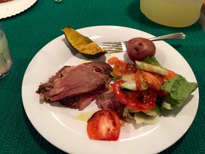


dana and ray
Steward CS Ray Mabanta and 2C Dana Reid in the galley of NOAA Ship Pisces

Each day a new screen of menus appeared on the ship’s monitors, along with other rotating information from quotes, to weather to safety information.

Personal Log

Today a possible shipwreck is evident on the sonar maps from the previous night’s multibeam readings.  If weather permits, the science team plans to check out the unknown structure en route to the next MPA. This scientific study reminds me of one of the reasons I fell in love with science.  There is that sense of discovery.  Unlike pirates and a search for sunken gold, the treasure to be found here is hopefully a diversity of fish species and thriving deep coral communities.  I found myself a bit lost during the discussions of fishing regulations for these areas designated as MPAs (Marine Protected Areas).  I had always thought ‘protected’ would mean prohibitive to fishing.   So I did a little research and will share a little of the basics learned.  And I hope someday these regulations will become more restrictive in these fragile habitats.

The MPA , “marine protected area”  definition according to the implementation of an Executive Order 13158 is “…any area of the marine environment that has been reserved by federal, state, territorial, tribal, or local laws or regulations to provide lasting protection for part or all of the natural and cultural resources therein.” But what that actually means in terms of the size of the area and approach to conservation, or the level protection and the fishing regulations seems to vary from location to location.  The regulations are governed by a variety of factors from the stakeholders, agencies and scientists to the population numbers and resilience of the habitat to distances offshore.
For more information on MPAs visit
https://oceanservice.noaa.gov/facts/mpa.html

Did You Know?
Some species of coral, like Ivory Tree Coral, Oculina varicosa, can live without their zooxanthellae.

Oculina varicosa
Oculina varicosa

Very little is known about how they do this or how their zooxanthellae symbiotic partners return to their coral home after expulsion.

Fact or Fiction?
Oculina varicosa can grow to up to 10 feet high and have a growth rate of ½ inch per year. Check out the scientific validity of this statement at one of the following links:

http://www.sms.si.edu/irlspec/oculin_varico.htm

What’s My Story? Dana Reid
The following section of the blog is dedicated to explaining the story of one crew member on Pisces.

Dana in scullery
Dana Reid pictured here in the scullery, the ship’s kitchen area for cleaning dishes

What is your specific title and job description on this mission?  Second Cook. His job description includes assisting the Chief Steward in preparing meals and maintaining cleanliness of the galley (kitchen), mess deck (tables picture where crew eats), scullery (part of the kitchen where dishes get washed) fridge/freezer and storage areas.

How long have you worked for NOAA?  5th year

What is your favorite and least favorite part of your job? His favorite part of this job is getting a chance to take care of people, putting a smile on people’s faces and making them happy.  His least favorites are tasks that involve standing in the freezer for extended periods of time to stock and rotate foods.  In addition he mentioned that he isn’t too fond of waking up very early in the morning.

When did you first become interested in this career and why?  His initial food as a career-interest started when he was in high school working for Pizza Hut.  He later found himself working for 2 years cooking fried chicken for Popeyes.  His interest in the maritime portion of his career also began right after high school when he joined the Navy.  In the Navy he worked in everything from the galley to a plane captain and jet mechanic.  During his time in the Navy he worked on 5 different carriers and went on 9 different detachments including Desert Storm. After hurricane Katrina in 2006 he found himself interested in finding another job through government service and began working on a variety of NOAA’s vessels.

What is one of the most interesting places you have visited?  He found the culture and terrain of Oahu one of his most interesting.  He enjoys hiking and Hawaii, Alaska and Seattle have been amazing places to visit.

Do you have a typical day? Or tasks and skills that you perform routinely in this job? He spends the majority of his time prepping  (washing and chopping)  vegetables and a majority of his time washing dishes.  In addition he is responsible for keeping beverages and dry goods stocked. 

Questions from students in Environmental Science at Camas High School

  • How is cooking at sea different from cooking on land?
    He said that he needs to spend more effort to keep his balance and if in rough weather the ship rocks. This impacts his meal making if he is trying to cook an omelet and if mixing something in keeping the bowl from sliding across the prep table.  He mentioned that occasionally when baking a cake that it might come out lopsided depending upon the angle of the ship and timing of placement in the oven.
  • What do you have to consider when planning and cooking a meal?
    He plans according to what meal of the day it is, breakfast, lunch or dinner.  The number of people to cook for, number of vegetarians and the part of the world the cruise is happening in are all factored in when planning and making meals. For example, when he has been in Hawaii he’d consider cooking something more tropical – cooking with fish, coconut and pineapple; if in the Southeast they tend to make more southern style cooking, sausage/steak lots of greens; if in the Northeast more food items like lobster and clam chowder make their way onto the menu.
  • What is the best meal you can make on the ship, and what is the worst? He said he makes a pretty good Gumbo. He said one of his weakness is cooking with curry and said that the Chief Steward is more skilled with dishes of that flavor.
  • How many meals do you make in a day? 3; In addition he hosts occasional special events like ice cream socials, banana splits or grilling party with smoker cooking steaks to hamburgers on the back deck.

————————————————————————————————————————————–


Marsha Lenz: And The Hauls Begin, June 14, 2017

NOAA Teacher at Sea

Marsha Lenz

Aboard NOAA Ship Oscar Dyson

June 8–28, 2017


Mission:Geographic Area of Cruise: Gulf of Alaska

Date: June 14, 2017


Weather Data from the Bridge

Latitude: 53 24.35 N

Longitude: 166 58.2 W

Time: 0700

Visibility: 8 Nautical Miles

Wind Direction: 095

Wind Speed: 25 Knots

Sea Wave Height: 7-9 foot swell

Barometric Pressure: 1003.4 Millibars

Sea Water Temperature: 7.2°C

Science and Technology Log

I know that I have already talked about how much science and technology there is on board, but I am amazed again and again by not only the quantity of it, but also the quality of it. I am also impressed by the specialized education and training that the scientists and rest of the crew have in their designed roles on this ship. They know how to utilize and make sense of it all. I keep trying to understand some of basics,  but often I just find myself standing in the back of the room, taking it all in.

We brought in our first haul on Monday.  I was given an orientation of each station, put on my fish gear, and got to work. I was shown how to identify the males from the females and shown how to find the fork length of the fish. Finally, I also practiced removing the otoliths from the fish. I finally felt like I was being useful.


This slideshow requires JavaScript.

I woke up on Tuesday (6/13) to start my 4:00 am shift. After some coffee and a blueberry muffin, I headed down to the “Chem lab.” We had arrived at the Islands of the Four Mountains in the night and were now heading back to start on the transect lines. The scientists had just dropped down the Drop Camera to get an idea of what was happening on the ocean floor. The camera went down to 220 meters to get an idea of what was happening down there. The video images that were being transmitted were mind-blowing. Though it was black and white footage, the resolution had great detail. We were able to see the bottom of the ocean floor and what was hanging out down there. The science crew was able to identity some fish and even some coral. One doesn’t really think of Alaska when one thinks of coral reefs. However, there are more species of coral in the Aleutians than in the Caribbean. That’s a strange thought. According to the World Wildlife Fund, there are 50 species of coral in the Caribbean. Scientists believe that there are up to 100 species of coral in the coral gardens of Alaska that are 300 to 5,000 feet below the surface.

labelled_correct_camdrop
The DropCam took images of life on the ocean floor.


This slideshow requires JavaScript.

Personal Log

Monday, June 12

We have been making progress in getting to the Island of Four Mountains. We should be arriving around noon. At this point the scientists have still been getting everything ready for the first haul. The crew has been working hard to fine-tune the equipment ready for data gathering. I have been sitting in “The Cave” at various times, while they have been working around the clock, brainstorming, trouble-shooting, and sharing their in-depth knowledge with each other (and at times, even with me).

In the afternoon, I was asked to help a member of the Survey Crew sew a shark sling. I was not sure what that entailed, but was willing to help in any way possible. When I found Meredith, she was in the middle of sewing straps onto the shark sling. Ethan and I stepped in to help and spent the rest of the afternoon sewing the sling. The sling is intended to safely return any sharks that we catch (assuming we catch any) back to the water.

IMG_1534
We spent many hours sewing the straps onto the sling.

IMG_1539
The sling is intended to safely remove any shark we catch from the boat.

Tuesday, June 13

I woke up at 3am, grabbed a coffee and then made my way down to the Chem Lab. After downloading the footage from the DropCam and getting a few still pictures, we started identifying what we saw. Using identification key, we were able to identify the fish and some coral. We saw what we thought was an anemone. We spent about and hour to an hour and a half trying to identify the species. We had no luck. Finally, Abigail, with her scientific wisdom, decided to look into the coral species a bit deeper. And then, AHA!, there it was. It turned out to be a coral, rather than an anemone. It was a great moment to reflect on. It was a reminder that, even in science, there is a bit of trial and error involved.   I have also observed that the science, actually everyone else on the ship, is always prepared to “trouble shoot” situations. In the moments where I have been observing in the back of the room, I have been able to take in many of the subtleties that take place on a research vessel like this. Here are some things that I have noticed.
1) Things will go wrong, 2) They always take longer than expected to fix, 3) Sometimes there are things that we don’t know (and that’s ok!) 4) Patience is important, 5) Tolerance is even more important, and 6) Clear communication is probably the most important of all. These have been good observations and reminders for me to apply in my own life.

Animals (And Other Cool Things) Seen Today

I feel very fortunate that I had a chance to participate in the DropCam process.  We were able to identify:

  • Blackspotted rockfish
  • Feathery plumarella
  • Basketstar
  • Pink seafan
  • Grooved hydrocoral
  • Anthomastus mushroom coral


Did You Know?

In the NOAA Corps, an Ensign (ENS) is a junior commissioned officer. Ensigns are also part of the U.S. Navy, Coast Guard, and other maritime services. It is equivalent to a second lieutenant in the U.S. Army, the lowest commissioned officer, and ranking next below a lieutenant, junior grade.

Interview with ENS Caroline Wilkinson

What is your title aboard this ship?

I serve as a Junior Officer aboard the NOAA Ship Oscar Dyson.

How long have you been working with the NOAA Corps?

Since July 2015 when I entered Basic Officer Training Class (BOTC) at the Coast Guard Academy in New London, CT. We train there for 5 months before heading out to our respective ship assignments. I arrived on the Dyson in December of 2015 and have been here ever since.

What sparked your interest in working for them?

I first learned of the NOAA Corps during a career fair my senior year of college at the University of Michigan. I was attracted by all of the traveling, the science mission of the organization, and the ability to serve my country.

What are some of the highlights of your job?

We see some incredible things out here! The Alaskan coastline is stunningly beautiful and there are more whales, sea birds, seals, otters, etc. than we can count. The crew and scientists are incredibly hardworking and supremely intelligent. They are a joy to work with and I love being able to contribute to highly meaningful science.

What are some of challenging parts of your job?

We spend over 200 days at sea each year and operate in remote areas. It is difficult to keep in touch with loved ones and most of us only see family and friends once or twice a year, if we are lucky. That is a huge sacrifice for most people and is absolutely challenging.

How much training did you go through?

The NOAA Corps Officers train for 5 months at the US Coast Guard Academy alongside the Coast Guard Officer Candidates. It is a rigorous training program focusing on discipline, officer bearing, and seamanship. Once deployed to the ship, we serve 6-8 months as a junior officer of the deck (JOOD) alongside a qualified Officer of the Deck (OOD). This allows us to become familiar with the ship, get more practice ship handling, and learn the intricacies of trawling.

What are your main job responsibilities?

Each Junior Office wears many hats. Each day I stand eight hours of bridge watch as OOD driving the ship and often instructing a JOOD. I also serve as the Medical Officer ensuring all crew and scientists are medically fit for duty and responding to any illness, injury, or emergency. I am the Environmental Compliance Officer and ensure the ship meets all environmental standards for operations with regards to things like water use and trash disposal. As the Navigation Officer, I work with the Captain and the Chief Scientist to determine where the ship will go and how we will get there. I then create track lines on nautical charts to ensure we are operating in safe waters. In my spare time I manage some small aspects of the ship’s budget and organize games, contests, outings, etc. as the morale officer.

Is there anything else that you would like to add or share about what you do?

I am really enjoying my time working for NOAA and in the NOAA Corps; I could not have asked for a better career. It is a challenging and exciting experience and I encourage anyone interested to reach out to a recruiting officer at https://www.omao.noaa.gov/learn/noaa-corps/join/applying.


Mary Cook: Day 10 at Sea, March 28, 2016

NOAA Teacher at Sea
Mary Cook
Onboard R/V Norseman II
March 18-30, 2016

Mission: Deepwater Ecosystems of Glacier Bay National Park
Geographical Area of Cruise: Glacier Bay, Alaska
Date: Monday, March 28, 2016
Time: 7:48 am

Data from the Bridge
Temperature:
39.4°F
Pressure: 1022 millibars
Speed: 5.6 knots
Location: N 58°56.540’, W 136°54.153’

Science and Food Log

Blustery Conditions
Blustery conditions in Glacier Bay

This morning at the science meeting, Chief Scientist Rhian Waller expressed that, even though we’ve had blustery weather conditions the last few days, most of the scuba dive and sample collection goals have been met making this scientific cruise a huge success! It’s nice to be able to take a deep breath and realize the science objectives are going to be met before deadline! Everyone’s hard work has paid off. We are all glad for the exceptionally clear skies and good weather during the first half of the cruise. Rain, snow, fog and wind have been the environmental setting for R/V Norseman II in Glacier Bay this weekend.

I am hoping to get to go back out on the little dive boat today or tomorrow one last time, even though it’s a bit choppy out there.

Yesterday, the scuba divers brought up some more fascinating samples from their dives!

Amongst the curious creatures were beautiful sea stars, a jellyfish that reminds me of a jam-drop cookie, a big yellow nudibranch, a fat-looking brown sea cucumber and a one-armed sea star! The one-armed sea star was alive and moving. Did you know that sea stars have the ability to regenerate missing body parts? So this one-armed guy will grow another body!


Hard working scientists, divers, and crew members need good food to sustain their abilities to concentrate and do the physical labor.

Thanks to our ship’s cooks, Harry and Darrin, we have an abundance of delicious and healthful food choices prepared daily onboard the R/V Norseman II. As each mealtime approaches I look forward to finding out what these two guys have whipped up to serve everyone onboard.


According to Head Cook Harry, who is a retired Navy cook with over 26 years of cooking experience, the biggest difference in meal preparation on a ship is the scale. They are preparing four full meals a day for 23 people in a small kitchen!

Their shifts are from 7 to 7. Harry works the day shift preparing lunch and supper. Darrin, the assistant cook, works the night shift preparing midnight meal and breakfast. You may recognize names of some of the famous chefs that Darrin has worked for during his off-season: Emeril and Chappy.

Darrin in the Galley crop
Assistant Cook Darrin works the night shift


The biggest challenge is planning the meals for 14 days without being able to go to the grocery store if something was forgotten. One thing Harry never, ever forgets is coffee. There must be plenty of coffee onboard.

Bunn Coffee Brewer

Improvisation becomes an important skill for the ship’s cook–to make do with what you have. Rotating foods and re-purposing leftovers into something tasty are essential. I must say these guys do a wonderful job of putting on a sumptuous, nutritious meal four times a day every day!

Sumptuous Meal

In addition to the great meals, Darrin is a pastry chef whose baking fills the ship with the delightful scents of cakes and cookies. Darrin shares that when baking on a ship you must rotate what’s in the oven often or it’ll come out lop-sided!

I’m also impressed that we are still having fresh green salads at this point in the voyage.

Harry relates that he buys lettuce in whole heads and keeps them cold. This enables him to get at least two weeks of good out of the fresh produce. A cool, dry place for storage of potatoes, carrots, beets and squash is in the fore peek hold located in the ship’s bow. Every nook and cranny of the ship is used for something! No wasted spaces here.

Good quality food and skilled meal preparation is very important on a lengthy voyage—for the health and overall morale of the hard working people on board the R/V Norseman II.

Hmmm….. I wonder what’s for lunch?

Whats For Lunch

Personal Log

I really can’t express the wonder and awe that I feel when getting to view the creatures from the deep. Seeing pictures is just not as good as seeing them in person and getting to hold them in my hands. They move and creep along exploring their new environs while Dann and Kasey and I take photos. With each new batch I get another wonderful science lesson from one of the scientists explaining the life cycles, behaviors and importance of these animals! Many of you will be happy to know that after their “glamour shots” most of the animals are returned to the ocean.

So, I just found out that I get to go out on the next dive boat! Yay!

This slideshow requires JavaScript.

Mary Cook: Days 5 & 6, March 23-24, 2016

NOAA Teacher at Sea
Mary Cook
Onboard R/V Norseman II
March 18-30, 2016

Mission: Deepwater Ecosystems of Glacier Bay National Park
Geographical Area of Cruise: Glacier Bay, Alaska
Date: Wednesday, March 23 – Thursday, March 24, 2016

Data from the Bridge
Temperature:
46.6°F
Pressure: 1012 millibars
Speed: 11.3 knots
Location: N 58°22.470’, W 135°59.779’

Science Log

Before I left Scammon Bay, all of our students K-12 signed and decorated a Styrofoam cup. I carefully packed these cups and brought them onboard the Norseman II in order to send them to the bottom of the Bay with the ROV Kraken on one of its nighttime dives. So, last night was the night for the deepest dive! I stuffed paper towels into each cup and dropped them into a mesh bag. The ROV crew tied the bag of cups to the frame and down, down, down they went!


About 6:30 the next morning, I hurriedly went up to check on our cups. Wow! All the cups were miniatures! The water pressure had compressed the air from the Styrofoam as the ROV had descended and the cups shrank!

Mary w Tiny Cups 3-24

Now all the students of Scammon Bay have a souvenir from the bottom of Glacier Bay! What a neat object lesson these little cups will be for all the kids at school. I hope it will be something they’ll never forget.

In addition to my excitement about my student’s cups, the scientists were excited about the samples brought up from the dive. A big Red Tree Coral sample was lying on deck. By its name you would think the coral is red. But it’s not. It’s kind of pinkish orange sherbet colored. It does look like a tree, though. The bottom of it looks like a young tree trunk. And it has rings like tree rings! According to Chief Scientist Rhian Waller, unlike tree growth rings, the rings aren’t indicative of yearly growth, but of growth due to abundance of food and living conditions.

Today, we steamed back toward Bartlett Cove. Bartlett Cove is the headquarters for the Glacier Bay National Park Rangers and the little town nearby is Gustavus. Gustavus has a population of 350 and the school has about 70 students. When we arrived in port, a sea otter greeted us, just hanging out. Eating while he floated on his back. He was noisily, crunching and smacking. Sea otters typically eat urchins, clams, and mussels. At one point he crawled out onto the dock to sun himself.

While in port, we had “open-ship” tours for the community of Gustavus. Scientists and ship’s crew took groups of ten through the Norseman II showing equipment, samples and answered questions. We were thrilled that about 65 people, including children with parents and grandparents, turned out and enjoyed learning about scientific research conducted in their Bay!

I rode into the little town of Gustavus with Ranger Sarah to drop Scientist Bob Stone off at the airstrip. Sarah drove us around on a tour. Gustavus is a beautiful little town with a gorgeous view of the Fairweather Mountain Range. One super cool thing that you can see in the Gustavus Public Library: an Orca skeleton hanging from the ceiling! Orca whales stay in Glacier Bay year round.

Orca skeleton in library 3-24
An orca skeleton hangs in the Gustavus Public Library

After the ship tours, the Park Rangers took us on a short walking tour around the visitor’s center. The National Park Service is partnering with the local Tlingit tribes in making this location once again a gathering place for them. They are building totem poles and a tribal meetinghouse designed by the tribal elders.

We learned that the Tlingit tribe lived in the area before the Bay was formed. It wasn’t yet a Bay because it was still covered in a giant glacier. The Tlingit still have songs and stories that tell of the glacier moving as fast as a dog running! So they hurriedly got in their canoes and fled to safety. As the glacier surged it destroyed their homes and scoured the land. They re-settled into places like nearby Hoonah, a native village across the way.

Before we left Bartlett Cove, everyone gathered with Qanuk and I on the dock sign for a photo with the winning banner designed by Scammon Bay 4th graders!

Mary Qanuk Banner on Ships Bow crop
Mary and Qanuk hold up the winning banner from Scammon Bay School


Now we’re all back on the ship and heading out to open waters. The glassy waters of the Bay are gone and it’s looking like a rough ride.

I already feel a bit queasy……

Rougher Water Headed to Open Waters crop


Personal Log

Since the ship’s work is ongoing 24-7, it seems that one day runs into the next because someone is always up and at work. And someone is always asleep in the stateroom. I’m amazed at how smoothly things work. Everyone pulls together to help each other and get the work done. If you think about it, there are LOTS of things going on. For example, the meals must be prepared and dishes washed. The science work must be done—scuba diving and processing during the day and ROV diving at night. The ship must be piloted and navigation is critical at all times. General housekeeping is always going on. It’s all an impressive operation and I’m happy to be here and hopefully a productive part of the team!

Mary Cook: Day 4 at Sea, March 22, 2016

NOAA Teacher at Sea
Mary Cook
Onboard R/V Norseman II
March 18-30, 2016

Mission: Deepwater Ecosystems of Glacier Bay National Park
Geographical Area of Cruise: Glacier Bay, Alaska
Date: Tuesday, March 22, 2016
Time: 7:40pm

Data from the Bridge
Temperature:
37.6°F
Pressure: 1013 millibars
Speed: 0.0 knots
Location: N 58°51.902’: W 137°04.737’

Science Log

Happy Birthday to Cheryl!

Cheryl small
This is Cheryl!

Unbeknownst to Cheryl, Chief Scientist Rhian Waller, even though she was very busy preparing for the cruise, brought balloons, streamers, candles, and noisemakers to celebrate Cheryl’s birthday today.

Birthday Decor small
Surprise Birthday Decor

The ship’s chef is secretly making her a cake. The celebration is slated for tonight at dinner. Shhhhh……

This morning, Chief Scientist Rhian Waller announced that we are steaming toward the end of the west arm of Glacier Bay to Johns Hopkins Glacier. This is a place where cruise ships take tourists in the Fall. But the Park Service has it closed during the Spring and Summertime because it’s a harbor seal nursery. The nightshift workers are trying to catch a few winks of sleep before we get there. No one wants to miss it. We are hoping for clear skies. Johns Hopkins Glacier is one of the few glaciers that is advancing instead of receding. As it advances, it is joining the Gilliman Glacier.

Park Service Map small
Map showing John Hopkins Glacier. Credit: National Park Service

It’s 10:30 am and we’ve arrived sooner than I expected. Johns Hopkins Glacier is really something to see! So massive. Once again everyone is out on deck taking pictures and oohing and aahing.

The glacier has shades of blue and white with streaks of brown and gray. It has a covering of white snow that looks like cake icing. The glassy water is a blue-green color with a multitude of icebergs floating in it. Bob Stone uses a term we all like—“bergy bits”—meaning small pieces of floating ice. He even brought some “bergy bits” onto the ship for us to add to our water or soft drinks. So refreshing!

This slideshow requires JavaScript.

While on deck taking pictures we hoped to see the glacier calve and fall into the sea. It sounds like thunder. We waited and we waited and finally a couple of small ones happened. Also, a couple of snow avalanches slid off the mountains into the water leaving dirty brown streaks along the slopes.

Avalanche medium
Occasional avalanches leave dirty streaks in the glacier’s white snow covering

Our scuba divers went down for another exploratory look and came up with a first! They found Primnoa pacifica in the West Arm! This is the first Primnoa pacifica ever found here. They described it as spindly and small in comparison to the others found in the East Arm.

The scuba divers continue their search for Red Tree Coral.

The significance of this Red Tree Coral being in the shallow water is that it has been considered a deep-water coral. There are two broad categories of coral: warm-water coral and cold-water coral. Generally, warm-water coral live in shallow, tropical waters. Cold-water coral live in deep water. The emergence of cold-water corals like Primnoa pacifica in the shallow waters of Glacier Bay has caused scientists to re-evaluate their understanding and descriptions of these organisms.

The third and last scuba dive for today was described as “mud, mud, and more mud”. A bit of a disappointment but they did bring up an interesting little critter.

Sea Peach small
Maybe a sea peach?

This sea peach is a tan color here in the wet lab, but according to Bob, in its natural habitat it has a bright cherry red color.

Cheryl Birthday Party large
Birthday party for Cheryl!

Well, it’s finally suppertime! That means “Birthday Party Time!” The ship’s chef, Harry served up a delicious meal of salmon, barbeque chicken, steamed kale, baked summer squash, scalloped potatoes and a big salad. For dessert, he prepared a layered chocolate cake with freshly made whipped cream and strawberries. Everyone sang “Happy Birthday” to Cheryl.

After she blew out the candles we went out on the deck and ate cake with new friends in the view of majestic mountains and glaciers.

Eating Cake on the Deck large

A birthday to remember, I’ll say.

Now it’s back to work and the ROV crew is getting ready to deploy Kraken 2 for another night of exploration!

Personal Log

Today has been a day of anticipation and inspiring wonder. I’ve tried to stay out on deck watching the glacier. Hoping for calving and avalanches. It’s really neat to me that no one else is here. We haven’t seen anyone else except four Park Service employees who boated out to meet us today. I found out that there are over 1,000 glaciers in Glacier Bay National Park! Some of them aren’t even named. I enjoyed watching a couple of bald eagles sitting on icebergs. And the absolute coolest thing has been the discovery of Primnoa pacifica in the West Arm of Glacier! I could feel the excitement in the air!

It’s so thrilling to be a part of this scientific exploration and to learn from these world-class researchers!

Mary Cook: Day 3 at Sea, March 21, 2016

NOAA Teacher at Sea
Mary Cook
Onboard R/V Norseman II
March 18-30, 2016

Mission: Deepwater Ecosystems of Glacier Bay National Park
Geographical Area of Cruise: Glacier Bay, Alaska
Date: Monday, March 21, 2016
Time: 7:54pm

Data from the Bridge
Temperature:
45.7°F
Pressure: 1007 millibars
Speed: 1.9 knots
Location: N 58°51.280’: W136°05.795’

Science Log

My Lab Work large
My lab work: a tray of Primnoa pacifica samples labeled and preserved for reproductive studies

Today, the coral processing continued for genetic, isotope, and reproductive studies, which has been very intensive for the last two days and nights. During the daylight hours, the divers collected samples of the coral in shallow water (30 meters) and during the nighttime hours ROV Kraken 2 collected the coral samples from the deep (210 meters).

Chief Scientist Rhian Waller tells me that the coral processing work will slow down for a few days because we are leaving the known sampling sites and heading into the unknown. Unknown territory for Primnoa pacifica, that is.

According to Rhian, the most important task today has been the completion of this collection series for Primnoa pacifica (Red Tree Coral). With both shallow and deep samples, geneticist Cheryl Morrison will be able to map the spreading patterns of the Red Tree Coral in Glacier Bay!

There were a total of four exploratory dives today. The divers are having a blast! They wore GoPro cameras on their helmets and used “underwater scooters” to go faster and farther during their dive time constraints. A scooter is a handheld engine with a propeller that pulls a diver behind it. Bob Stone describes it to be like sledding underwater!

In addition to the Red Tree Coral, they’ve brought up some really interesting specimens, which include sea stars, nudibranchs, shrimps-one very pregnant shrimp loaded with eggs, a polychaete worm, a bioluminescent ctenophore, sea pens, and sponges.

On one of the dive outings, they took Qanuk and sat him on an iceberg! It was a really beautiful blue iceberg. Blue icebergs have ice crystals that are more tightly packed therefore they reflect more blue light wavelengths than other colors of wavelengths.

Qanuk Sitting on Iceberg large

This evening, scientists are once again gathered around the monitor to see what the ROV Kraken 2 will discover. So far, we’ve seen crabs, goose barnacles feeding on plankton floating in the water, anemones, poacher sturgeon, sea cucumbers and moon snails. Sounds like a yummy salad, doesn’t it?

Personal Log

Today everyone settled into their jobs and it was a smooth operation. The scientists and crew are still brimming with excitement about the possibilities for this voyage. I was glad to get the intensive coral processing completed. Though it’s very important work, it’s tedious and repetitive. One very nice bi-product of working with the coral is the scent. Red Tree Coral smell like cucumbers! Also, we get to see all the other curious types of samples brought aboard such as glowing ctenophores and jumping shrimp! I’m getting to see so many things I’ve never seen before and it’s wonderful to have experts help explain everything. They are genuinely interested in sharing knowledge with me in hopes that I will take it back to the classroom for my students in Scammon Bay. Scammon Bay kids have become important to these world-class scientists! Another cool thing about these scientists, even though they are experts in their fields, they are also eager students for learning something new. Enthusiastic lifelong learners— what an inspiration!

All in all, it’s been a good day in Glacier Bay.


Mary Cook: Day 2 at Sea, March 20, 2016

NOAA Teacher at Sea
Mary Cook
Onboard R/V Norseman II
March 18-30, 2016

Mission: Deepwater Ecosystems of Glacier Bay National Park
Geographical Area of Cruise: Glacier Bay, Alaska
Date: Sunday, March 20, 2016
Time: 6:00pm

Data from the Bridge
Temperature:
38°F
Pressure: 1005 millibars
Speed: 0.3 knots
Location: N 59°02.491’ , W136°11.193’
Weather: Sunny with a few clouds

Science Log

Happy First Day of Spring!

Last night the remotely operated vehicle (ROV) Kraken2 dove and collected many samples of Primnoa pacifica (Red Tree Coral). The science crew excitedly gathered around the monitor to see what Kraken2 was “seeing”-lots of rocks, a few fish, a few shrimp, a few crabs, a couple of sponges, an octopus and lots of beautiful Red Tree Coral attached to the rock faces.

The ROV Kraken2 is run by a crew of engineers from the University of Connecticut and makes nighttime dives to deeper depths between 130 and 170 meters.

Today we busily processed the coral for genetics, isotopes, and reproduction studies to be conducted later by a series of scientists in various labs scattered across several states.


For the genetic samples, polyps (one individual) of coral are smashed onto special paper folders that contain a preservative. For the isotope samples, polyps are put into tiny vials then frozen. For the reproductive samples, an intact piece of coral is placed in a 15-milliliter tube and then submerged into formalin preservative. Later the formalin will be poured out and ethanol will be poured into the tubes. Preparing the reproductive samples is my job!

Three divers went down four different times collecting samples, all near White Thunder Ridge and Riggs Glacier in the eastern arm of Glacier Bay.

Riggs Glacier is showing numerous crevasses, which are usually snow-covered at this time of year. A crevasse is a big crack on the topside of the glacier.

As the evening approached, the ship steamed to the northernmost end of the East Arm where Muir Glacier was waiting to greet us. Muir Glacier is named for Naturalist John Muir who explored in Glacier Bay during the late 1800’s.

Muir Glacier was once a tidewater glacier at the water’s edge but in the last ten years has melted and receded back up into the valley.

The sky was clear and the snow-capped mountains and waterfalls were beautifully reflected in the still waters of the Bay. A gibbous moon rose over the mountain peaks just as the Sun was setting.

Personal Log

Today I learned how to process the samples for genetics, isotopes, and reproduction. My responsibility was to put a small branch of coral into a tube of Formalin. Labeling the tubes with place, depth, and species is important so the scientists as they begin working in the laboratory weeks later will know the source of the coral sample.

The Norseman ll as seen from the RHIB leaving for a dive outing
R/V Norseman II as seen from the RHIB (rigid hull inflatable boat) leaving for a dive outing

As we worked, Chief Scientist Rhian Waller came into the wet lab asking if anyone wanted to ride in the skiff, my heart started beating faster! I didn’t want to be pushy so I kept quiet. Then she said, “Mary would you like to go out on the skiff?” “Yes! I loved to go!” was my reply. I donned the Mustang suit, hardhat, and rubber boots. I grabbed Qanuk and went outside to load into the little RHIB, which had been lowered from the deck on to the water beside the ship’s hull. When everyone was ready, we motored closer to White Thunder Ridge. The diver’s entered the water and explored the region at about 70 feet deep. Meanwhile we waited for them and kept a watch on their bubbles rising to the surface. We used binoculars and viewed five fluffy mountain goats moving along the Ridge! It was cool to see the mountain goats but they were creating a “falling rocks” hazard for those of us down below. Our boat driver decided to move the RHIB away from the Ridge in order to avoid the rocks tumbling down into the water.

Later in the day, when the Norseman II got closer to Muir Glacier, almost everyone was on deck getting that perfect photo of the mountains reflected in the mirror-like waters of Glacier Bay. It was a remarkable scene!

This slideshow requires JavaScript.

So at the end a good day, I am feeling very thankful to be a witness to the scientific work in an effort to better understand this pristine wilderness.

Beverly Owens: What Is That? June 23, 2013

NOAA Teacher at Sea
Beverly Owens
Aboard NOAA Ship Henry B. Bigelow
June 10 – 24, 2013

Mission:  Deep-Sea Corals and Benthic Habitat: Ground-Truthing and Exploration in Deepwater Canyons off the Northeastern Coast of the U.S.
Geographical Area: Western North Atlantic
Date: June 23, 2013

Weather Data from the Bridge:
Air temperature: 17.23 oC (63.014 oF)
Wind Speed: 6 knots (6.90 mph)

Science and Technology Log:

We’ve seen amazing and beautiful animals living in these deep water canyons, many of which I did not recognize. During the progression of each tow I find myself asking the scientists around me, “What is that?” But that is what science is all about: being curious and trying to obtain the answers.

No matter how many hours I’ve sat on watch, or how many TowCam images I’ve looked at on the computer monitor, it’s still exciting to be one of the few people who get to see images directly from the ocean floor! It’s incredible that a large metal apparatus with a camera can send images and data thousands of meters through a tiny cable back to computers on the ship. As the pilots navigate TowCam through the water, images are sent back to the ship every 10 seconds.

Image Highlights taken using TowCam during the Canyons CSI research expedition.
Image highlights taken using TowCam during the Canyons CSI research expedition.

So what do we see in the images that are being sent back? I’ve gotten to see amazing things living more than a mile below the ocean. These include octopods and squids,  skates, sea pens, anemones, delicate brittle stars, bivalves, and lush colorful coral gardens. All these organisms live on the  bottom of the ocean in cold, dark water and under extreme amounts of pressure.

Morphology: The structure of a corallum.

How many different kinds of deep-sea corals are living at the bottom of the ocean? At least 71 species are known to occur  off the northeastern coast of the U.S.; and new species are likely to be discovered.  Many of the deep-sea corals look similar in color or structure. How do scientists tell them apart? They use taxonomic keys and DNA analysis to identify species.  Dichotomous keys are a systematic way of identifying organisms by making a series of choices based on an  organism’s characteristics. These keys are particularly useful if you don’t have instrumentation to conduct a DNA analysis.

Earlier this week, marine ecologist Dave Packer from NOAA’s National Marine Fisheries Service taught me how to use a dichotomous key for deep-sea corals. Corals are actually animals, even though many of them look plant-like in shape, so they belong in the Kingdom Animalia, the Phylum Cnidaria, and the Class Anthozoa. We began by discussing animals in the four Orders of deep-sea corals within the Anthozoa that are found off our northeastern coast: Scleractinia (stony corals), Antipatharia (black corals), Alcyonacea (soft corals and sea fans), and Pennatulacea (sea pens). Compare  the corals shown below. You will notice that each group has a different style or appearance.

The Four Orders of Corals.
The Four Orders of Corals

Even though corals appear to be morphologically simple animals, they are highly detailed. Individual corals can be very small. Look at the image to the left to become familiar with some of the structures. Below are some additional features that may be found on different types of corals.

Some additional features that may be found in corals.
Some additional features that may be found in corals

Mr. Packer showed me a piece of coral that we would be “keying out.”  By looking at the surface of it, we could tell it was a stony coral and belonged to the Order Scleractinia. Stony corals are usually very hard to the touch.  Then, we examined its characteristics. Look at the picture to the right, and see if you can identify the characteristics that we examined on this coral:

Try your hand at Taxonomy

  1. Is it solitary (grows alone) or is it colonial (grows with other coral polyps)?
  2. Are the septa (fins sticking out at the top) smooth or rough?
  3. Are the coral polyps only on one side, or scattered in a random pattern?
  4. Is the coenosteum (portion of the skeleton between the polyps that looks like tree branches) porous or smooth?
  5. Corals reproduce by “budding.” Do new corals bud inside an older coral (intratenticular) or are polyps added to the outside near older coral polyps?
  6. Does it have 24 septa?

Check your answers below to see if you got these questions correct!

Drum roll, please… This coral is Solenosmilia. Try pronouncing that one! Going through an actual dichotomous key requires answering many more questions and making more choices. Coral polyps and structures can be so small that often a microscope is necessary to look at some parts. Sometimes corals may look very similar, so DNA testing is conducted to confirm the identification.  Dichotomous keys can be used in identifying many other types of organisms as well, such as plants and fungi.

Want to try your hand at using a dichotomous key? Try this sweet activity using candy! Think about the characteristics of the candy pieces listed in the picture and key: Skittles, M & M’s, Gummy Bears, packaged Lemon Heads, unpackaged Lemon Heads, Dum Dum lollipops, Sugar Babies, Atomic Fireball, Mike and Ike’s, Tootsie Rolls, and Gobstoppers. What characteristics do they have in common? If you were going to sort them, how would you begin? We’re going to start with packaged versus unpackaged. Continue to follow along with the Candy Dichotomous Key until all the candy is sorted. How are the candy pieces similar? How do they differ?  You have now used  a dichotomous key to identify candy!

Candy Dichotomous Key (click to enlarge)

Candy Dichotomous Key (click to enlarge)

Check your answers to the Coral identification:

  1.  Colonial
  2. The septa are rough
  3. The coral polyps  appear to be randomly scattered
  4. The coenosteum is smooth
  5. These corals are intratenticular – notice how some appear to be budding off from one another.
  6. No.

    Beverly Owens, Teacher at Sea, with coral sample of Solenosmilia
    Beverly Owens, Teacher at Sea, with coral sample of Solenosmilia

Personal Log:

One of my favorite marine organisms is the starfish. We have seen many brittle stars during the course of our research expedition. There have been many large white brittle stars, and many tiny pink brittle stars that live symbiotically with certain corals.

Did You Know?

Corals are actually animals? They belong in the Kingdom Animalia. Corals can live colonially, with other coral animals, or can be solitary and develop alone.

Marsha Skoczek: There’s No Place Like Home, July 17, 2012

NOAA Teacher at Sea
Marsha Skoczek
Aboard NOAA Ship Pisces
July 6-19, 2012

Mission: Marine Protected Areas Survey
Geographic area of cruise:  Subtropical North Atlantic, off the east coast of Florida.
Date:  July 17, 2012

Location:
Latitude:  30.4587N
Longitude:  80.1243W

Weather Data from the Bridge
Air Temperature:  26.8C (80.24 F)
Wind Speed:  10.8 knots (12.43 mph)
Wind Direction:  From the SE
Relative Humidity: 79 %
Barometric Pressure:  1017
Surface Water Temperature:  28.9C (84 F)

Science and Technology Log

South Atlantic MPAs

During the thirteen days we have been out to sea doing research, we have sent the ROV down both inside and outside of five different MPAs  from Florida to North Carolina and back again.  This allows the scientists to compare fish populations and densities both inside and outside of the MPAs.  Since we left Mayport Naval Station in Jacksonville, Florida, we have been averaging a distance from shore of between 50 and 70 nautical miles.  It will be fourteen days until we see land once again.  From this distance, the ocean seems to stretch on forever.  Gazing at the beautiful blue water, it is easy to forget an entire other world lies beneath us.  Not all of the ocean floor is flat, there is a small percentage that does have some elevation and structure.  The type of structures on the ocean floor determine what types of species will live there.

For this mission, we have mainly been studying areas within the mesophotic zone of the ocean ranging from 40 to 150 meters (130 – 500 feet) below the surface.  Temperatures here range from 12 – 23 degrees Celsius (50-70 F). Very little sunlight reaches the mesophotic zone, but zooxanthallae are still able to photosynthesize at this depth.  Corals and sponges will also filter feed using the abundant particulate organic matter drifting in the water column they will filter out and eat the plankton.

Tomtates hide in crevices.

The multibeam images help the scientists determine where to launch the ROV.  Areas with a change in elevation tend to indicate that there are rock structures below the surface.  It is around these rocks that the majority of fish prefer to live, so these are often the areas at which the scientists chose to collect data.

The ridges we have seen range in height from 1 meter to 5 meters.  The fish really like areas in the rock that have cracks, crevices and overhangs for them to hide.  Many times as the ROV approached the fish, they would scurry into a nearby hiding place.  I can’t help but imagine that the ROV with its bright lights and unnatural features must seem like an alien spacecraft to these fish that have never had contact with humans before.  But ROVs aren’t the only thing that these fish need to hide from.  I noticed that the larger fish that are toward the top of the food chain were not as skittish as the smaller reef fish.  Sometimes amberjacks and scamp would even follow the ROV as if curious about we were doing.  And lionfish never budged as the ROV passed unless it happened to be sitting in the ROV’s path.

Lobster hiding in rock. Notice how his coloring resembles the reef behind him.

Eel hiding under sponge

Scorpionfish against Diodogorgia

The fish are not the only living things that like these rocky habitats.  Usually when there are rocky surfaces, we find sponges, corals, hydroids and algae growing on top.  These creatures not only give the reef its beautiful appearance, but they also help to provide habitat as well.

Notice how the flounder blends in with the sand?

Sand tilefish make their burrows in the rubble under the sand.

Spider crabs on sandy bottom

Species that live in the sandy bottom habitat have their own set of adaptations. Animals such as the flounder and sea cucumbers have skin colorations that match the speckled appearance of the sand itself.  Sand tilefish carve out burrows from the rubble beneath the sand.  The spider crabs have a carapace that mimics the texture of the rocks it lives near.  The stingrays, with their low profile, sit on the sandy bottom and use their mouth to scour the sand in search of crabs and clams to eat.

Lophelia at artificial reef

Anemone at artificial reef

artificial reef

Artificial habitats are also full of life.  At the shipwreck we visited, not only did we see fish living here, we also saw anemone, tube worms, Venus flytrap anemone, hermit crabs, eels, Lophelia coral to name a few.  Other man-made habitats can help rebuild coral reefs.  John Reed has placed reef balls on the Occulina Reef in an effort to rebuild the original reef damaged by bottom trawling. These reef balls provide a structure for the corals to anchor themselves to and give the fish places to hide. Even oil platforms can be considered as an artificial reef structure giving a wide variety of species a sturdy structure to call home.


Personal Log

The Science Party

While aboard the Pisces I have learned to identify well over 100 different species of fish and invertebrates.   Andy and Stacey quiz me as we are watching the live footage, and I think I finally can tell the difference between a reef butterfly and a bank butterfly.  John frequently hands me a text book and challenges me to look up the species we see on the ROV live feed.  I am extremely appreciative of everyone being so helpful and sharing their knowledge with me.  Each of the scientists have taken the time to answer all of the question that I have.  The crew of the Pisces has also been wonderful to work with.  Everyone has done their best to make me feel at home. This has been such an amazing experience, I am excited to bring it all back to the classroom this fall!  I will never forget my time on the Pisces.

Ocean Careers Interview

In this section, I will be interviewing scientists and crew members to give my students ideas for careers they may find interesting and might want to pursue someday.  Today I interviewed John Reed and Stephanie Farrington.

John Reed

Mr. Reed, What is your job title?  I am the Research Professor in the Robertson Coral Reef and Research Program at Harbor Branch Oceanographic Institute (HBOI) at Florida Atlantic University (FAU).

Why did you decide to become a marine biologist?  I always knew that I wanted a career where I could do my work outside.  My biggest influence came when I was around 13 – 14 years old, I remember watching “The Undersea World of Jacques Cousteau” every Sunday night with my family and thinking that’s what I want to do!

What type of responsibilities do you have with this job?  Currently I am studying deep coral reefs as part of the Robertson Coral Reef and Research Program and several NOAA grants. My focus is primarily off the Florida coast and up through the Carolinas.  My objective is to protect and conserve deep sea coral ecosystems.  Around Florida alone, our group has discovered over 400 individual deep coral mounds some over 300 ft tall.  We have calculated that the area of these deep water reefs may exceed that of all the shallow water reefs in the United States combined.  These reefs habitats are incredibly diverse with hundreds of different species of bivalves, crustaceans and fish just to name a few.  Deep water hard corals grow very slowly, only about half an inch per year, core sampling has dated deep coral mounds at over 1,000,000 years old.  It is vital that we protect these deep reefs from destructive fishing methods such as bottom trawling or energy projects.

I also manage the archives for the biomedical marine division at Harbor Branch where we have over 35,000 deep and shallow marine specimens from around the world.  Each specimen has video footage of it in its natural habitat (in situ from the Johnson-Sea-Link submersible), still photos, museum samples as well as several smaller samples for our biomedical research.  We have discovered novel compounds from some of these marine organisms which may be future cures for cancer or other diseases.  Currently our chemists and biologists are working on the chemical compounds that we discovered in a deep water sponge that grows off Florida.  In the lab it is potent against pancreatic cancer which is a very deadly disease.

What type of education did you need to get this job?  I earned my Bachelors Degree in chemistry and biology from University of Miami and my Masters Degree in marine ecology from Florida Atlantic University.  My Masters Thesis was on The Animal-Sediment Relationship s of Shallow Water Lagoons and took me four years to study and wrote.  While working on my thesis, the Smithsonian had a branch at HBOI, so I would ask the scientists there for help in identifying the animals in my study.  Working with these scientists helped me make the connections that eventually get my job with HBOI.

What types of experiences have you had with this job?  I have been fortunate enough to travel the world visiting over 60 countries and collecting thousands of marine samples for biomedical research at HBOI.  I have been able to dive in the Johns0n-Sea-Link submersible to depths of 3000 ft and scuba dive to 300 ft.  My research on the deep water Oculina coral reefs off the east coast of Florida allowed me to use our submersibles as well as lock-out diving to study the growth rate and fauna associated with these deep water coral.  It is very humbling that my research on these reefs helped to establish the Oculina Marine Protected Area which was the first marine protected area in the world to protect deep sea corals, and more recently the 24,000 sq. mile deep sea coral habitat area of particular concern off the southeastern U.S.

What advice do you have for students wanting a career in marine biology?  Even if people tell you there are no jobs in marine biology, find a way to do it!  Follow what you are passionate about.  Get experiences as an undergrad, do internships, build your resume.  Make the effort!  Do things that are going to set you above everyone else.

When looking at graduate school, compare the course offerings of several universities.  Research the Principal Investigators (PIs) at those same schools and make contact with them.  Get a position as a Teaching Assistant or Lab Aide to build on your resume.  All of these things will help you to get the job you want once you graduate.


Stephanie Farrington

Ms. Farrington, What is your job title?  I am a biological scientist for John Reed at Harbor Branch Oceanographic Institute.

What type of responsibilities do you have with this job?  I accompany John on his research expeditions and help collect data.  When we return to HBOI, I analyze the data and program everything into GIS maps to give us a visual layout of the different habitats we saw and the species that live there.

What type of education did you need to get this job?  I earned my Bachelors Degree in biology and marine science from the University of Tampa.  My Masters Degree is in marine biology from the NOVA Southeastern University Oceanographic Center.  My thesis was on the Biogeography of the Straights of Florida which gave me a solid background in the marine invertebrates of our region.  This is one of the reasons John hired me to work with him.

What types of experiences have you had with this job?  I have been fortunate to travel in our Johnson-Sea-Link submersible six times, twice sitting up front in the bubble, one dive went down to 1700 feet below the surface.  I have also been on 8 research cruises since I started at HBOI two years ago.  I also had the opportunity to sail on the Okeanos Explorer for three weeks.

What advice do you have for students wanting a career in marine biology?  Marine biology is about collecting and analyzing data and doing research and there is so much cooler stuff in the ocean than just dolphins!

Jason Moeller: June 23-24, 2011

NOAA TEACHER AT SEA
JASON MOELLER
ONBOARD NOAA SHIP OSCAR DYSON
JUNE 11-JUNE 30, 2011

NOAA Teacher at Sea: Jason Moeller
Ship: Oscar Dyson
Mission: Walleye Pollock Survey
Geographic Location: Gulf of Alaska
Date: June 23-24, 2011

Ship Data
Latitude: 54.86 N
Longitude: -161.68 W
Wind: 12.1 knots
Surface Water Temperature: 8.5 degrees C
Air Temperature: 9.1 degrees C
Relative Humidity: 95%
Depth: 52.43 m

Personal Log

As I mentioned in the last post, everything here has settled into a routine from a personal standpoint, and on that end there is not much to write about. However, there were three things that broke up the monotony. First, as always, the scenery was beautiful.

Cove
Snow covered hills shield the cove from the winds. Look how smooth the ocean is!

cove2
The view off the back of the ship.

Second, I found out that even with all of the modern equipment on board, catching fish is still not guaranteed. We trawled three times last night on the 23rd and caught a total of 14 fish in all three trawls! Remember, a good sample size for one trawl is supposed to be 300 pollock, so this is the equivalent of fishing all day long and catching a minnow that just happened to swim into the fishing hook.

The first trawl caught absolutely nothing, as the fish dove underneath the net to escape the danger. The second trawl caught two pacific ocean perch and one pollock, and the third trawl caught eleven pollock. All in all, not the best fishing day.

pollock
The lone pollock from the second trawl.

Despite the poor fishing, we did bring up this neat little critter.

isopod
This is an isopod! These animals are very similar to the pillbugs (roly-polys) that we find in the US. Many marine isopods are parasites, and can be a danger to fish!

isopod2
This is the bottom view of an isopod

The third thing to break up the monotony was the Aleutian Islands earthquake. On the evening of June 23rd, a magnitude 7.2 earthquake shook the Aleutian Islands. According to ABC news, the earthquake was centered about 1,200 miles southwest of Anchorage. The quake spawned a brief tsunami warning that caused a large number of Dutch Harbor residents (Dutch Harbor is the home base of the show Deadliest Catch) to head for higher ground. We had been in the Aleutian Islands and Dutch Harbor area on our survey route, but had left two days before, so the Oscar Dysonwas completely unaffected by the earthquake.

Dutch Harbor residents seek higher ground after a tsunami warning was issued. AP photo by Jim Paulin.

Science and Technology Log

In order to obtain photos of all of this neat sealife, we first have to catch it! We catch fish by trawling for them. Some of you may not know exactly what I’m talking about, so let me explain. Trawling is a fishing method that pulls a long mesh net behind a boat in order to collect fish. Trawling is used to collect fish for both scientific purposes (like we’re doing) and also in commercial fishing operations. We have two types of fish trawls onboard the NOAA Ship Oscar Dyson — a mid-water trawl net and a bottom trawl net. We’ve used both types throughout our cruise, so let me tell you a little about each.

The mid-water trawl net is just as it sounds — it collects fish from the middle of the water column — not those that live on the seafloor, not those that live at the surface. The technical name for the net we have is an Aleutian Wing Trawl (AWT) — it’s commonly used by the commercial fishing industry.

trawl net
Part of the mid-water trawl net as it's being deployed.

The end of the net where the fish first enter has very large mesh, which is used to corral the fish and push them towards the bag at the end. The mesh gets progressively smaller and smaller the further into it you go, and at the very end (where the collecting bag is), the mesh size is 0.5 inches. The end (where the bag is, or where the fish are actually collected) is called the codend.

codend
One of the codends on the deck of the Oscar Dyson

This is the kind of net we use when we want to collect a pollock sample, because pollock are found in the water column, as opposed to right on the seafloor (in other words, pollock aren’t benthic animals). Our particular net is also modified a little from a “normal” AWT. Our trawl has three codends (collecting bags) on it, each of which can be opened and closed with a switch that is controlled onboard the ship. The mechanism that opens and closes each of the 3 codends is called the Multiple Opening and Closing Codend (MOCC) device. Using the MOCC gives us the ability to obtain 3 discrete samples of fish, which can then be processed in the fish lab.

MOCC
The MOCC apparatus, with the 3 nets extending off.

bar
The nets are opened and closed using a series of metal bars. (The bar here is the piece of metal running across the middle of the photo). The net has 6 of these bars. When the first bar is released, the first codend is ready to take in fish. When the second bar is dropped, the first codend is closed. The third and fourth bars open and close the second codend, and the fifth and sixth bars open and close the third codend.

trigger
This is the trigger mechanism for the codends on the MOCC. When the codend is released, the trigger mechanism is up. When the codend is locked and ready to go, it is in the down position.

One other modification we have on our mid-water trawl net is the attachment of a video camera to the net, so we can actually see the fish that are going into the codends.

camera
This is the camera apparatus hooked up to the trawl.

When we spot a school of fish on the acoustic displays, we then radio the bridge (where the captain is) and the deck (where the fishermen are) to let them know that we’d like to fish in a certain spot. The fishermen that are in charge of deploying the net can mechanically control how deep the net goes using hydraulic gears, and the depth that we fish at varies at each sampling location. Once the gear is deployed, it stays in the water for an amount of time determined by the amount of fish in the area, and then the fishermen begin to reel in the net. See the videos below to get an idea of how long the trawl nets are — they’re being reeled in the videos. Once all of the net (it’s VERY long — over 500 ft) is reeled back in, the fish in the codends are unloaded onto a big table on the deck using a crane. From there, the fish move into the lab and we begin processing them.

Videos of the net being reeled in and additional photos are below!

http://www.youtube.com/watch?v=I50Q4SJzzaE
http://www.youtube.com/watch?v=VVAqbAGcxRs

net end
This is the end of the trawl net. They are lines that basically hold onto the net.

codend
One of the codends before being opened up onto the conveyor belt. We are inside waiting for the fish to arrive.

open codend
Opening the codend to release the fish catch!

reeled in
The mid-water trawl net all reeled in!

The other type of trawl gear that we use is a bottom trawl, and again, it’s just as it sounds. The bottom trawl is outfitted with roller-type wheels that sort of roll and/or bounce over the seafloor. We use this trawl to collect benthic organisms like rockfish, Pacific ocean perch, and invertebrates. There’s usually a random pollock or cod in there, too. The biggest problem with bottom trawls is that the net can sometimes get snagged on rocks on the bottom, resulting in a hole being ripped in the net. Obviously, we try to avoid bottom trawling in rocky areas, but we can never be 100% sure that there aren’t any rogue rocks sitting on the bottom 🙂

bottom trawl
The mesh and wheels of the bottom trawl.

btrawl2
More of the bottom trawl

btrawlreel
The bottom trawl, all reeled in!

Species Seen

Northern Fulmar
Gulls
Pollock
Pacific Ocean Perch (aka rockfish)
coral
Isopod

Reader Question(s) of the Day!

The first question for today comes from Rich, Wanda, and Ryan Ellis! Ryan is in the homeschool Tuesday class at the Zoo.

Q. We looked up what an anemone was and we found it was some kind of plant. Is that correct?

A. Great question! The answer is both yes and no. There is a type of flowering plant called the anemone. There are about 120 different species, and they are in the buttercup family. For one example of the plant, look below!

Anemone Nemorosa
Anemone Nemorosa. Taken from pacificbulbsociety.org

The sea anemone, however, is not actually a plant but an animal! Anemones are classified as cnidarians, which are animals that have specialized cells for capturing prey! In anemones, these are called nematocysts, which have toxin and a harpoon like structure to deliver the toxin. When the nematocysts are touched, the harpoon structure injects the toxin into the animal that touches it.

Cnidarians also have bodies consist of mesoglea, a non living jelly like substance. They generally have a mouth that is surrounded by the tentacles mentioned above.

Anemone
The Anemone we found.

The second question comes from my wife Olivia.

Q. What has surprised you most about this trip? Any unexpected or odd situations?

A. I think the thing that has surprised me the most is the amount of down time I have had. When I came on, I assumed that it would be physical and intense, like the show Deadliest Catch, where I would spend my whole time fishing and then working on the science. I figured that I would be absolutely toast by the end of my shift.

While I have worked hard and learned a lot, I have quite a bit of down time. Processing a catch takes about one hour, and we fish on average once or twice a night. That means I am processing fish for roughly two hours at most, and my shift is twelve hours. I have gotten a fair amount of extra work done, as well as a lot of pleasure reading and movie watching.

As for unexpected and odd situations, I didn’t really expect to get your camera killed by a wave. Fortunately, I have been allowed to use the scientist camera, and have been able to scavenge photos from other cameras, so I will still have plenty of pictures.

Another technological oddball that I didn’t think about beforehand was that certain headings (mainly if we are going north) will cut off the internet, which is normally fantastic. It is frustrating to have a photo 90% downloaded only to have the ship change vectors, head north, and cut off the download, forcing me to redownload the whole photo.
I also didn’t expect that the fish would be able to dodge the trawl net as effectively as they have. We have had four or five “misses” so far because the fish will not stay in one spot and let us catch them. While the use of sonar and acoustics has greatly improved our ability to catch fish, catching fish is by no means assured.

Perhaps the biggest “Are you kidding me?” moment though, comes from James and David Segrest asking me about sharks (June 17-18 post). An hour after I read the question, we trawled for the first time of the trip, and naturally the first thing we caught was the sleeper shark. Also naturally, I haven’t seen a shark since. Sometimes, you just get lucky.

Sue Zupko: 14 Cnidarians–Get the Vinegar!

NOAA Teacher at Sea: Sue Zupko
NOAA Ship: Pisces
Mission: Extreme Corals 2011; Study deep water coral and its habitat off the east coast of FL
Geographical Area of Cruise: SE United States from off Mayport, FL to Biscayne Bay, FL
Date: June 10, 2011
Time: 09:30 EDT

Weather Data from the Bridge
Position: 26.0°N  79.5°W
Present weather: 5/8 Alto Cumulus
Visibility: 10 n.m.
Wind Direction: 066°true
Wind Speed:  16 kts
Surface Wave Height:  4 ft
Swell Wave Direction: 120° true
Swell Wave Height:  4 ft
Surface Water Temperature:28.5 °C
Barometric Pressure: 1011.8 mb
Water Depth:  307 m
Salinity: 36.187 PSU
Wet/Dry Bulb: 28°/24.8°

This blog runs in chronological order.  If you haven’t been following, scroll down to “1 Introduction to my Voyage on the Pisces” and work your way back.

Take the quiz before reading this post.


Purple pink sea fan on a cobble bottom
This octocoral is a sea fan

Are all cnidarians corals or are all corals cnidarians?  Definitely, all corals are cnidarians (pronounced nye-dare-ee-ans).  Hydroids, corals, jellyfish and sea anemones are all cnidarians, so all cnidarians are not corals.   Part of our mission is to study deep-water corals in the Gulf Stream.   My berth (room) mate, Jana Thoma, is working on her doctoral dissertation (thesis) on corals.  She gave me an elaborate chart explaining all the branches of cnidarians the first day because I couldn’t remember the difference between hexacorals and octocorals.  So, do you know what these are?  If not, you are in good company.  Octocorals are like octopi (octopuses?) (octopodes?) .  As I’m writing this the scientists in the room are discussing the proper plural form of the word.  Checking the internet we have found the answer is…all are correct.   Back to the coral/octopus example.  An octopus has eight tentacles (or arms).  An octocoral has eight tentacles.  Cousins?  I think not, but the prefix octo- in Greek means eight and they both have eight tentacles.  The octocorals are usually soft.  Sea fans, sea pens, and soft corals are all examples of octocorals.  Originally people thought these were plants because they look and act like plants waving in the current.  Jana is helping me write this, and it’s obvious I’m still having trouble.  So, here is a quote from Jana to help us all better understand corals.

a forest of white-colored black sea coral whips
Stichopathes sp

“Uh…great, this is for posterity.  Okay.”  So, when most people hear the term coral they think of hard corals like brain coral, staghorn, or elkhorn coral that are known to build shallow-water reefs.  However, I study those corals that bend and flex in the water current – like sea fans or gorgonians.  As with all rules, there are exceptions and confusion ensues (follows).  Hexacorals are those animals that have six, or multiples of six tentacles; examples include hard corals, black corals, and anemones (that sometimes house clown fish).  Octocorals have……that’s right, eight tentacles; examples include gorgonians (sea fans), soft corals, sea pens, and the strange blue coral.  Last major group of “corals” are…stay with me folks… lace corals, which are actually hydrozoans and more closely related to the Portuguese Man o’War (the colonial jelly-fish like animal that partially floats on the surface and has long tentacles dangling in the water).” (Jana Thoma, doctoral candidate, University of Louisiana Lafayette )

white hard puffy ball of coral
Oculina varicosa

So, if I’m understanding this correctly, the hard corals, such as the Oculina varicosa, more often than not are the primary reef building animals.  They can provide an exposed hard surface for the sea fans to attach to.  This hard surface can also be covered with sediment that can be home to other sessile (sedentary like a couch potato that can’t ever get up) cnidarians.  Jana is nodding to this last statement.  Yeah!   Further, the living portions of corals are made of polyps, the hard skeletons are calcium carbonate and are formed by the polyps.  One sea fan is not a single polyp, but perhaps thousands.  All stacked up like an elaborate apartment building, they create a beautiful sea fan (or things which look like a sea fan).

What do scientists do when they have a few minutes not looking through a microscope or classifying new species?  At my request, they create songs about what they study.  Here is one, written today by Stephanie Rogers, Chuck Messing, and Jana Thoma:

Marine Snow (set to the tune of “Let it Snow”)

Oh, the sea is quite inspectable

Where the light is not detectable

And since we’ve got funds to go

Marine snow, marine snow, marine snow

Oh, the ocean’s gently rolling

And the crew is out aft trolling

The fish are goin’ to an’ fro,

Marine snow, marine snow, marine snow.

When we finally get to depths,

Oh, the critters swimming around

And I start to hold my breath

When we collect from the mound.

The R-O-V is slowly flying

And the scientists are sighing

Since we can’t collect no mo’

Marine snow, marine snow, marine snow.

Grey anemone waving tentacles in water catching food
Anemone

Just a reminder, marine snow is the detritus and plankton floating along in the current.  Most cnidarians are filter feeders, meaning they grab particles passing by.

We have visited several deep-water coral sites to check on their health and condition.  I know we visited places where we expected to find colonies of Oculina and Lophelia.  The first few we visited were in and near a new Marine Protected Area (MPA), others have been in or near a Habitat Area of Particular Concern (HAPC) established in the 1990s and in a giant HAPC established last year.  The soft bottom areas reminded me of the surface of the moon. However when we reached the coral mounds the abundance and variety of life was amazing.  You can see where we went on the NOAA Shiptracker.

Colorful reef shot with pink, purple, white corals
Protected reef

The difference between the protected and non-protected areas was striking.   In the areas protected for over 20 years I almost felt like I was watching a National Geographic documentary, with lots of beautiful fish, interesting coral, and unusual creatures like the sea cucumber.  While there was still life in the non-protected areas, the corals were in much worse condition and there were fewer fish.  Corals are the architects and builders of elaborate reef habitats that provide habitat and shelter for a huge diversity of life. Coral reefs are complex ecosystems. Many reef species are important fishery resources, or the food for important commercial species; some are sources of compounds with medical uses, others help us understand basic biological, ecological and physiological processes. Reefs offer protection to coastlines from erosion by waves and currents.  Coral reefs are very important.  I think I prefer the ones which look alive and healthy because of protections.  We will all benefit as a result even if we do not see the evidence on a daily basis.

Feathery creature like a duster
Hydroid

What did C3PO say to R2D2?

Hi, Droid!

Jana’s purpose for being on this cruise was to collect samples of the coral gathered from the bottom.  These samples would undergo testing and DNA analysis later in the lab.  It’s a challenging process.   Salt water was refrigerated in clear plastic containers to help keep the samples cold and avoid necrosis (death) of the polyps.  Identification tags were prepared.  The numbers help them catalog the specimens they collect.  John Reed uses the following system: 10-VI-11-201 means the specimen was gathered on the 10th day of June 2011 and 201 is a the category of specimen–in this case a dugong rib.  Every scientist has their own way of cataloging their specimens and this is just one example.

Cnidarians have nematocysts with either sticky, spiraling, hooking, or some other form of “harpoons” which sting and/or capture their prey.  If you happen to get in contact with these nematocysts, you might suffer an adverse reaction (like it might hurt or itch).  So, grab the vinegar and pour it on.  Jana tells me urine is a traditional home remedy that she says she has heard of (she won’t tell me if she has experimented with this or not).  The chemicals in these liquids often help ease the sting from contact with nematocysts.

Blue-gloved hands taking black coral sample from the manipulator arm of the ROV
Retrieving a sample from the ROV arm

When the ROV brought up a coral sample in its manipulator arm, the biologists were  prepared.  Wearing latex or nitrile gloves, like what doctors and nurses snap on with a flourish in the movies, they are ready to catch the coral before it hits the deck and gets contaminated.  Cameras at the ready, the specimen is put on a black background with the prepared tag and a ruler to show its size and a photograph is taken.  Parts of the specimen are put in different containers.  Animals are preserved in different chemicals which have different purposes.  Formalin fixes tissues, but can degrade deposits of calcium, and can be used for future morphological (the study of shape or form of an organism).  Ethanol can be used to slow down the process of decay.  Acetone does an even better job, however, its use is limited because it is more difficult to obtain and isn’t what people normally use.  Additionally, you can freeze the specimen, which slows down decay.  This is when they use the cold sea water, put the specimen in that, and place it in a very cold (-80°C) freezer.  Sometimes it is kept dry and frozen.  On the Pisces I saw them use all of these methods to preserve the specimens.  The specimens which must be kept frozen will be packaged in dry ice for the journey back to the lab.  Andy David, our lead scientist, has developed a strategy for getting people to the airport to catch planes or rent a car for their journey home.  After dropping other scientists off to get their cars, he will stop at the grocery store and pick up some dry ice.  We literally had a meeting to discuss needs and time schedules to be as efficient as possible.

Coral oozing
Oculina varicosa with mucus

I also learned that when they are stressed, corals ooze mucus.  Every creature gets stressed.  When I’m stressed I eat.  Others can’t eat when they are upset.  I witnessed the oozing coral when it was brought into the lab.

I felt the scientists were often speaking a foreign language.  Guess what–they were.  Latin.  I learned that in scientific classification different endings mean different things.  Phylums end in -a such as Porifera (sponges), Mollusca (sea shells) or Cnidaria (coral, anemones, jellies).   Classes end in -da, -iae, -ta, -ea, or -oa.  When writing the genus and species of an animal, you capitalize the genus, but not the species name, and italicize both.

Last, what do you do when you discover a new species?  You get to name it. We found a couple I want to share.

Stuffed toy grey pelican lying on black backgroun with id numbers and ruler below
Bigbeakus zupkoii

Yellow toy stuffed duck with a black shirt on, lying on black background with identification numbers and a ruler below it.
Yellowduckus thomaii

Sue Zupko: 13 Who Ya Gonna Call? Mud Busters!

NOAA Teacher at Sea: Sue Zupko
NOAA Ship: Pisces
Mission: Extreme Corals 2011; Study deep water coral and its habitat off the east coast of FL
Geographical Area of Cruise: SE United States from off Mayport, FL to Biscayne Bay, FL
Date: June 9, 2011
Time: 1900

Weather Data from the Bridge
Position: 25.4°N  79.5°W
Present weather: overcast
Visibility: 10 n.m.
Wind Direction: 075°true
Wind Speed:  20 kts
Surface Wave Height:  4 ft
Swell Wave Direction: 100° true
Swell Wave Height:  4 ft
Surface Water Temperature:28.5 °C
Barometric Pressure: 1011.8 mb
Water Depth:  308 m
Salinity: 36.5 PSU
Wet/Dry Bulb: 28°/24.8°

This blog runs in chronological order.  If you haven’t been following, scroll down to “1 Introduction to my Voyage on the Pisces” and work your way back.

Take this quiz before reading this post.


James and Jeff wait for the winch to lift the pyramind-shaped grey grab
Waiting to lift the grab

When I started my journey as a Teacher at Sea, I wondered what scientific research the ship I would be placed on would be doing.  Would it be marine mammals in Alaska or Hawaii, hydrography (bottom mapping), a fishery study, buoy placement, or something I’d never heard of.  When I was told I was placed on the Pisces and we’d be using an ROV (remotely operated vehicle), I only knew we’d be using the vehicle to go to the bottom and look at corals since it is too deep to scuba dive.  I had no real concept of what else would be going on.  I did know my students liked the idea of the ROV since I am the Robotics Club advisor at Weatherly Heights Elementary.

Pyramid shaped grey grabber hanging over the ocean
Benthic Van Veer Grab

We have three missions on the Pisces.  One is to look at the bottom through the eyes of the camera lens to see what is actually happening with the coral and its habitat.  Another purpose was to update existing maps.  The third mission was the most difficult for me to get a grasp of just because it sounds so strange.  Benthic grabbing.  Benthos means bottom in Greek.  Like the soil on land, sediment lying on the bottom of the sea is full of creatures and information needed to fully understand the health of the corals and their habitat.  You don’t see the most of the animals living in soil usually either.  In soil on land and in the sea sediment, the animals living inside are called infauna, and provide food and nutrients to the epifauna (those living above the surface).  What effect has man had on this foundation of the coral reef?  What diversity of life is there and how plentiful are they?  What size are the lithogenic (of rock origin) particles?  It all means something and needs to be studied.

Sand on bottom of ocean
Sandy bottom for grab

According to Dr. Jeff Hyland, NOAA NCCOS (National Centers for Coastal Ocean Sciences), “People may wonder why scientists want to study the seemingly ‘barren’ sand (or muddy sand) layer that covers vast stretches of the ocean floor.  One good reason is because this important habitat is not barren at all!  The unconsolidated (loose) bottom that occupies the majority of the sea floor can be teaming with life.  The types of animals found can include polycheate worms, mollusks, crustaceans, and fish.  Some are large enough to see with the naked eye, but many are so small that you would need to use a microscope to see them. “

Three men in safety gear standing behind the pyramid shaped grey grab
James, Steve, and Jeff harvest their grab

The crew of scientists using the Van Veen grab equipment include: Dr. Jeff Hyland, James Daugomah, and Steve Roth (Grab Guys) of NOAA’s NCCOS Laboratory in Charleston, SC.  Ocean floor mapping is done prior to an ROV dive to help pinpoint the choicest spots for investigation.  After the ROV records the video from its dive, the “Grab Guys” go to work.  The science team confers and selects the best spots for study.  The beginning spot is relayed to the bridge, which then “makes it so” by taking the ship to those coordinates.

So, now what?  Every group on deck must wear hard hats and PFDs (life jackets—Personal Floatation Devices) since the winch will be used and they will be working near the side rail of the ship.   The fishermen (deck hands), scientists (both observers and the Grab Guys), and anyone who happens to be nearby must wear this equipment.  Safety first.

The fishermen and Grab Guys prepare for the sampling by dragging the 300 pound Van Veen grab close to the side.  It sits on a specially constructed table made of 2×4 wood and is painted grey.

Sink with water and plug plus two buckets on the left
Benthic cleaning equipment

Nearby, Steve sets up a smaller table with a sink in it, plus several buckets, a large spoon, and two rectangular plastic tubs nearby.  I really wondered what that was all about.

The winch hook is attached to the Van Veer grab and everyone stands ready.  When the bridge radios to the fishermen that the ship is over the drop site, they spring into action.  The winch operator waits for the signal from the lead fisherman that all is ready and is told by hand signals to raise it up.  As the winch lifts up the grab, those working the equipment help steady it over the deck and release it when it’s over the side.  The grab is lowered to the bottom as the winch operator monitors the amount of cable deployed.  The idea is that when the grab hits the bottom the release bar will pop and close the “grab jaws”.  If the grab isn’t going fast enough or lands on an angle it won’t close.  Plus, it might not go deep enough into the sediment to get a good sample.

Men standing in protective gear looking upward at the winch pulley
Watching the pulley for movement

It takes longer than you would think for that grab to hit bottom.  Remember, patience is a virtue.  The equipment drops 80 meters per minute.  Yesterday we were dropping to 320 meters.  All eyes are targeted on the winch’s pulley.  When the grab hits the bottom, it causes the pulley on the winch cable to swing, meaning that the grab has made contact.  Everyone crosses their fingers that the grab not only closed, but also got a large enough sample for an accurate test.  The winch driver begins to retrieve the gear.  It’s just like doing a science fair project.  You must repeat your experiment and have the right amount of sample so your repeated experiments  are as similar as possible when you repeat your procedure.  They must make three grabs which bring up the correct amount of sediment.  Often trial and error comes into play.  The current not only made things difficult for the ROV operations, it made the grab go down at an angle so it wouldn’t close (grab or fire) a few times.  They had to keep dropping until it worked correctly.  At one point the bottom was 370 meters and we had let out 425 meters of cable.  That meant that the wind and the current were really strong and pulling the grab out at an angle.

Pulley wheel hanging from an orange support
The winch pulley moved

Sieve bucket being swirled around in sink
Cleaning the mud off

Once the grab gets a sample, they scoop out sediment with a spoon and put it in a blue bin.  This is carried over to a sieve bucket and is half submerged and swished around in the sink to get the mud off.  This is repeated until all the sediment particles are clean.

Jeff in white helmet and orange PFD write information on a clipboard
Jeff records important information

The samples are scooped out of the sieve bucket and placed in containers which will be processed back at the laboratory.  In general, they are looking for sediment size (grain size), infauna (living organisms from the sediment), and chemicals from man.  The containers have been labeled with what tests need to be run.  Jeff is recording the numbers on the containers and whether that sediment should be tested for metals, toxicology, total carbon, organics, and sediment size.

Steve in PFD holding container with sediment and pink color
Steve holding organics sample

A special insert is placed in the grab to measure an exact amount of sediment to determine the amount of  the infauna.  This sample is cleaned and put in a large container with formalin mixed with rose bengal.  The rose bengal had been premixed by Dr. Hyland the first day so that when added to the sediment it will turn the living organisms a pink color, making them easier to find.

After the sediment samples are put in the smaller bottles, the top is screwed on, sealed with electrical tape to make sure it doesn’t open, and stored in the refrigerator or freezer. All these benthic samples will be sent to Barry Vittor, a company specializing in sediment analysis.

I have a new appreciation for the sediment in the ocean.  I’ve learned that sediment on the north side of a coral mound in the Gulf Stream usually has less nutrients since the current flows from south to north.  The coral and other plankton-consuming animals eat a lot of the food flowing in the current over the mound so the water on the north side contains less food and can support less infauna.  I hope my students enjoy learning about the benthos as much as I have.  Perhaps with the data we collected, scientists will be able to help determine what we need to do to preserve the corals of the reefs.

Sue Zupko: 11 Belts and Suspenders

NOAA Teacher at Sea: Sue Zupko
NOAA Ship: Pisces
Mission: Extreme Corals 2011; Study deep water coral and its habitat off the east coast of FL
Geographical Area of Cruise: SE United States from off Mayport, FL to St. Lucie, FL
Date: June 7, 2011
Time: 10:00 EDT

Weather Data from the Bridge
Position: 27.3°N 79.6°W
Present weather: 4/8 Alto cumulus
Visibility: 10 n.m.
Wind Direction: 082°
Wind Speed: 4 kts
Surfacel Wave Height: 2-3 ft
Swell Wave Direction: 100° true
Swell Wave Height: 2-3 ft
Surface Water Temperature: 27.1°
Barometric Pressure: 1014.5mb
Water Depth: 80m
Salinity: 36.56 PSU
Wet/Dry Bulb: 27.2/24

This blog runs in chronological order.  If you haven’t been following, scroll down to “1 Introduction to my Voyage on the Pisces” and work your way back.

The first ROV we used on the Pisces for our Extreme Corals 2011 expedition is a custom designed craft called The Arc.  The crew, led by Dr. John Butler at the Southwest Fisheries Science Center, has been developing The Arc since 2007 and launched it in January of 2011.  The Arc is ideal for monitoring fisheries, improving species identification, and developing new methods of studying fisheries.  It can withstand pressures and dive to 1000 meters (actually it dives to 600 meters since that is how long the tether is).  When on land, it weights 264 kg (580 pounds).  It has a rectangular prism shape with a length of 190 cm (75 in), width of 117 cm (46 in), and a height of 84 cm (33 in).  Just for fun, do this math quiz.

 The pilot sits on the ship and tells The Arc what to do.  It’s like playing a video game.  The pilot and his navigator coordinate movements, watching the computer screen with the ship’s and The Arc’s positions clearly showing.  The navigator is in constant communication with the officers on the bridge of the Pisces using a walkie-talkie to relay messages and information between the ship’s pilot and the ROV’s pilot.  The bridge also has a navigation screen to monitor the position of the ship relative to the ROV.  The fishermen on the deck running the winch also have  walkie-talkies so they can be told when to adjust the length of the cable to the ROV.  Communication is very important.

Front of ROV with headlights peering down.  Lots of black tubing and a yellow rectagle.
Front of ROV

The ROV is pretty neat.  It has headlights similar to robots from old Sci-Fi movies so it appears creature-like, but without the spindly legs.  Bright lights are needed because that’s about the only light that is available at great depths.  There are four LED lights with 2600 lumens each.  A 100 watt incandescent light bulb in your lamp has about 1750 lumens.  How many lumens total does the ROV produce?  Again, doing the math it would be 2600×4=10,400 lumens for the ROV.  This is roughly twice as much as your four lightbulbs at home.   Looking at the pictures from the bottom of the sea where it is normally dark and the tiny amount of light reaching the bottom makes everything look dark blue or black (see my earlier post on light in the ocean) we can see the colors almost as they would appear in a tidal pool.

ROV hanging from a cable being lowered into the water.

The ROV has many instruments to measure data and take photographs of what it “sees.”  It has a  CTD ( measures Conductivity, from which we calculate salinity,  Temperature, and Depth) as well as an oxygen sensor.  The best part is the laser beam system which measures things like a ruler.  With the help of the high definition camera, we were able to see the fish and invertebrates we were studying.  Using the laser beams, we could not only measure their size, but how far away they were.

Crab on sandy bottom with 4 red laser beam lights and one green
Cancer borealis

Note the red dots parallel to each other.  The top two red ones are always 20 cm apart and in this picture the two on the bottom are 40 cm apart.  The green light helps measure the distance to the crab.  Apparently this crab is about 20 cm across.  The lasers are fabulous for helping to keep things in perspective.

Yellow hose with some pink covering
ROV Tether

Dave Murfin, one of the ROV crew, was commenting to me about this picture after reading my blog.  He said the pink stuff was the foam jacket used for floatation cut off from an old ROV cable, and he thought it looked ugly.  However, given a new perspective of it, he thinks it looks cool.  The pink foam helps protect the tether on deck and if it scrapes across rocks on the ocean floor.  These ROV engineers added the large floats for the last 40 meters of the tether to keep it off the bottom and avoid becoming tangled in the coral and rocky habitats we are studying.

Spool with yellow tether
Spool of ROV tether

The tether for The Arc is wrapped on a spool for easy retrieval and transport.  It is 610 meters long and has three fiber optic cables in the center surrounded by insulation.  Around that are copper wires to conduct power from the ship, which is why they need a cable.  If it ran on a battery, like a submarine, it could be on the bottom alone and the scientists would have to wait for it to return to see what data was stored inside.  By using a tether, the scientists have much more control and can move the ship to study something of interest.  Although technology is rapidly advancing, it is not quite possible yet to create a vehicle which would do everything the scientists need.  Therefore, we continue to use the tether with the ROVs.

So, what do belts and suspenders have to do with the ROV?  Well, there is an old saying that you don’t rely on just one thing; you always have a backup.  If the belt on your pants doesn’t work, you have the suspenders to hold them up.  The Arc is a new system.  It is the belt and the system with 700+ dives to its credit is the spare (suspenders), just in case.   Technology.  It can be fabulous, but very frustrating when it gives you problems.  As a teacher, I have to plan for technology to be down as well.  I can’t have my whole lesson plan revolving around technology.  What if the internet is down that day?  Well, the students could get pretty wild without a back up plan.  As my mom used to say, “Don’t put all your eggs in one basket.”  What if the basket dropped?  You are out of luck.

As I mentioned before in my blog, these men and women are dedicated professionals.  They have lots of experience with this equipment and know the unexpected can happen.  If you forecast about the unexpected, you can be prepared.  I have always known that duct tape is a useful tool.  Bungee cords are useful.  Redundant cables, nuts, bolts, and spare parts are all on board.  Having the spare ROV was just good planning and good sense.  We have still been able to work our mission with some modifications.  Bravo to this bunch for continuing to make things happen despite the unexpected happening.  Because of them, we have some wonderful video and photographs to see what is happening on the coral reefs we have been studying.

Scott searching for cables in a box
Scott Mau searches for necessary cables

And the answer to the poll at the beginning of this post is…less than 2 knots.  They really prefer currents less than 0.5 knots.  This week we’ve launched in currents which were 3.5 knots.  Sometimes it caused problems, sometimes not.  Here are some pictures from the bottom.

Purple sponge which looks like a jaw opening from the bottom.
Purple barrel sponge

Pinkish purple sea fan on bottom
Sea Fan Octocoral

Sea floor with white whiplike strands
Black coral "forest", Stichopathes

Everyone keeps asking me if I have driven the ROV.  I asked the ROV crew about it and they all just smiled.  Although it looks like a video game, the ROV is not a toy and not to be given to a novice to control.  Considering I can’t get down the stream on Wii Fit without crashing into the side of the stream, they sure don’t want me at the helm of this incredible piece of technology.  With the ROV, there is no opportunity for a second chance if you crash and burn.  Therefore, I’ll leave the driving to them.

Men watching computer screens in control room piloting the ROV
Teamwork. Kevin is piloting the ROV with the help of John and Dave.

Sue Zupko: 10 Steamin’ an’ a Beamin’

NOAA Teacher at Sea: Sue Zupko
NOAA Ship: Pisces
MissionExtreme Corals 2011; explore the ocean bottom to map and study health of corals and their habitat
Geographical Area of Cruise: SE United States deep water from off Mayport, FL to St. Lucie, FL
Date: June 4, 2011

Weather Data from the Bridge
Position: 29.1° N  80.1°W
Time: 11:00 EDT
Wind Speed: calm
Visibility: 10 n.m.
Surface Water Temperature: 27.6°C
Air Temperature:27.6°C
Relative Humidity: 72%
Barometric Pressure:1018.4 mb
Water Depth: 85.81 m
Salinity: 36.55 PSU

When the strong current from the Gulf Stream stretched the tether of  the ROV  and broke one of the three fiber optic cables inside, it was time to come up with a new plan.  What do you do in the middle of the ocean if the main gear is not functioning?  Plan B.  Well, Plan B was using the spare fiber optic in the tether.  The spare one then broke as a result of being rubbed, most likely, by the sharp end of the original broken fiber during the next dive.  Now we had to go to Plan C .  Fortunately the ROV crew is experienced, and, like Boy Scouts, were prepared.  They brought a spare ROV and tethers from their lab in La Jolla (pronounced La Hoya), CA just in case.    The ship is running the sonar gear back and forth over the area we plan to dive tomorrow, mapping out the bottom, looking for coral mounds.  This process is called “mowing the lawn” since you run the beams back and forth to get complete coverage of the bottom, and it looks like the lines on the lawn left by the mower.  Think of the beam as having the shape of a flashlight’s beam shining on the floor.  Another interesting feature is that the acoustic beam can also read what fish are present.  It needs to have a swim bladder for the signal to bounce back.  When it does, based on the sound, an experienced acoustician can read what fish the signal represents.  Sharks don’t have a swim bladder like most fish do so their signals are a bit more difficult to read.

I was just up on the bridge and it seems we hit “pay dirt” (like gold miners).  The captain had been explaining to me a symbol shown on the Electronic Chart Display System (ECS).   It looks like a graphic math problem showing the intersection of lines, in this case one line running on a 110° angle with three lines parallel to each other intersecting it.  The line in the middle is a bit longer than the other two.  I asked how he knew what that symbol meant.  Apparently, there is a book for everything on the bridge.  He whipped out his handy-dandy book entitled, Chart No. 1.  It is a key to reading nautical charts (maps).  He searched for the correct page with bottom obstructions of all types and showed me that symbol and what it means.  Whenever I have a question, the bridge crew whips out a book of some type to let me see the answer.  It’s really interesting.  The Pisces is a really modern ship with the latest electronic navigation and scientific features.  The other day I asked about navigating without power.  There is a book for that.  Bowditch American Practical Navigator has everything you need to know about crossing the ocean without electronics.  As it says on my classroom door, “Reading makes life a lot easier.”  Turns out that symbol is a shipwreck.

Laura sitting in front of computer screen
Laura Kracker looks at maps

But I digress.  Back to the pay dirt (we struck gold).  Laura Kracker, our geographer started getting excited.  “Look at this!  Look at this!  Write down these coordinates.”

She went running back to the acoustics lab (where they use sound echos to map the ocean floor and the presence of fish) to mark the location along the transect (lines we’re running) because we apparently were over coral mounds.  Using  information gathered by others in years past as a guide, they were mowing the lawn with the sonar to find interesting habitat to study with the ROV.  As the ship went back and forth along the planned transect to develop a much better map than existed, Laura would radio the bridge about any changes to the courseto pinpoint the best areas for us to study over the next couple of days.

ROV crew working on transferring gear from one ROV to the other on deck
ROV crew swtiches gear from one ROV to the other

Everyone was very excited.  So, although the ROV had to be switched out, which took a lot of work, we made good use of the time on the ship.  After a whole day of mapping, it’s now late at night and the map looks gorgeous.  This is important work and many cruises are devoted entirely to mapping.  Andy David, our lead scientist, says this acoustic mapping is useful to many people and will allow more precise coral surveys for years to come.

John Schneider, July 11, 2009

NOAA Teacher at Sea
John Schneider
Onboard NOAA Ship Fairweather 
July 7 – August 8, 2009 

Mission: Hydrographic Survey
Geographical Area: Kodiak, AK to Dutch Harbor, AK
Date: July 11, 2009

Position 
Sheet L – Shumagin Islands

Weather Data from the Bridge 
Weather System: Overcast
Barometer: 1021.4
Wind: mild and veering*
Temperature: 12.1º C

Science and Technology Log 

One of the Fairweather's launches
One of the Fairweather’s launches

Today I got to go out on launch 1010.  The two primary launches on Fairweather are 29-foot diesel-powered (Caterpillar) single-screw aluminum boats.  I was real surprised to find that 1010 is 35 years old!  It’s in great shape.  Survey equipment on board includes the multi-beam echo sounder, computers, DGPS (Digital GPS gives positional accuracy to about 6 inches!) radar, radios and Iridium satellite telephones.  For “creature comforts” there’s a microwave and mini-fridge as well as a very efficient heater/defrost system.  Oh, by the way, there are no heads on the launches. (FYI – a “head” is marine-speak for a bathroom!)

Here I am on the launch monitoring all the data that’s being collected
Here I am on the launch monitoring all the data

Knowing this in advance, I didn’t have coffee or tea or a big breakfast. Turns out that when “nature calls” the rest of the crew goes in the cabin, closes the door, and you go over the side! Seems gross at first and then you realize that the 30 and 40 ton whales go in the ocean too (besides, it’s biodegradable!) The launches are carried on the boat deck (E-deck) in custom Welin-Lambie davits made for each launch. Welin-Lambie is a company over 100 years old and made the davits for a few ships you may have heard of – the British Royal Yacht Britannia, the Queen Elizabeth 2 cruise ship and oh, yeah, the RMS Titanic!  The cradles are self-leveling so when the Fairweather is in heavy seas they remain upright and stable.  The picture on the left shows 1010 in its cradle. When it’s time to launch the boat, the securing devices are released, the boat is swung out over the side and two >3 ton winches lower the launch to the rail of D-deck.  There it is boarded by the crew and loaded with the needed gear for the day.  It is then lowered into the water and sent on its way.

Once we got to the area of our polygon (I’ll explain polygons later in the week) we began acquiring data by “mowing the lawn” – the process of sailing back and forth across a defined area collecting soundings1 (bottom depths.)  In every polygon we conduct a CTD cast (CTD = Conductivity Temperature Density.)  These three parameters determine the speed of sound in the water and are used to accurately calibrate the soundings. Once we had been working for a while with me observing – and asking what must have seemed like unending questions – PIC2 Adam Argento and AST3 Andrew Clos guided me to monitoring the data being acquired. As you can see on the left there are 4 monitors all running software simultaneously.  The picture on the right shows the keyboard and mice. The mouse in my right hand controls the windows on the three screens to the right which are data displays of received info. The left mouse controls which data are being acquired.

After a long day on the launch, it was great to see the Fairweather on this rainy day.

After lunch the coxswain4 (“coxin”) – AB Chrissie Mallory – turned the helm over to me to steer.  My first leg was headed North.  The positional displays on the Fairweather and its launches all have North being at the top of the displays.  (This is called – logically enough – “North Up”.)  I rocked! If I had to move off to the right a little, I turned right.  Need to move left, turn left. There’s a little delay between when you turn and the position as displayed on the screen.  Well, we got to the top of the section and turned around to head South.  I needed to adjust a bit to the right, so I turned right . . . BUT . . . the boat is now oriented 180º from the prior run.  So in turning right, I actually made the boat go left on the screen!  Oh NOOO!!! So I overcompensated the other way.  Then had to un-overcompensate . . . and so on.  I’m sure when they downloaded the data back on the Fairweather they were wondering what the h*** was going on. Eventually I got the hang of it and didn’t do too badly after a while, but I have a much greater appreciation of what appeared to be really simple at the outset.

After a successful 8+ hours out (by the way, our lunches contained enough food for 6 people!) we headed back to the Fairweather about 15 miles away.  To see her after a day out kind of felt like seeing home after a long day out. To the unaware, the ship looks like a mish-mash of all kinds of gear all over the place, but it’s remarkably organized.  The reason for the appearance is that the ship is capable of so many tasks that the equipment is stowed in every available space.  Fairweather is capable of deploying 7 small boats and operating independently of all of them in coordinated tasking!  I’d love the opportunity to take a class of students for an all-day field trip aboard and could do so without ever leaving the dock – there’s so much on board!

A launch returning to the Fairwweather

As you can see in the photo of the Fairweather above, there are two large white inflated “fenders” hanging over the starboard side.  This is where we’ll be tying alongside. (I took the next 3 shots from the Fairweather as 1010 approached on a different day.) As the launch approaches, the person on the bow will throw a line to the forward line handler.  Notice there’s not a whole lot of room up there as well as the extended arm ready to catch the line.  That bow line has a mark on it which lets the line handler on Fairweather know where to temporarily tie off the line.  Then the stern line is then thrown to another line handler. Once the launch is positioned properly (no easy task in rolling seas) the hoists are lowered to the launch where they are clamped onto lifting eyes.  Each of the clamps on the boat falls5 weighs close to 40 pounds – that’s why in deck ops everyone wears hardhats – and is controlled by both the winch operator and two more line handlers using “frapping lines6.” (in the picture to the left, as the launch approaches, you can see the boat falls, clamps and frapping lines.)  Once the clamps are secured, the launch is lifted to the deck rail and the crew gets off, and the launch is lifted back to its cradle.

Piece of cake!  Realize, however, that this simply and cleanly executed maneuver, requires: On the Fairweather: 4 line handlers The Chief Bosun 1 or 2 surveyors The bridge crew to maintain position (at least 2 people) 2 or 3 deck personnel to unload gear from the launch A Chief Scientist to task the launch The chefs to feed the launch crew On the launch: Person in charge Coxswain 1 winch operator From 14 to 16 people, all working together.  On January 1, 2008, the Fairweather was authorized to paint a black letter “S” on both sides of the ship indicating that she had gone 433 consecutive days without any injuries.  Considering the environment in which Fairweather works and the tasking which requires constant deployment and retrieval of heavy equipment, the “Safety S” is a reflection of her crew and officers.

Personal Log 

What a great day!

Vocabulary 

  1. Soundings – depths measured
  2. PIC – Person In Charge
  3. AST – Assistant Survey Technician
  4. Coxswain – (<O.Fr. coque “canoe” + swain “boy”) Individual who steers a small boat or launch
  5. Boat falls – the lines used to raise and lower boats from a davit
  6. Frapping lines – Lines used to control the boat falls

By the Way 

It’s time to do some laundry!!!  The laundry room is on D-Deck just forward of the fantail.

See you all tomorrow! 

It’s laundry day!
It’s laundry day!

John Schneider, July 8, 2009

NOAA Teacher at Sea
John Schneider
Onboard NOAA Ship Fairweather 
July 7 – August 8, 2009 

Mission: Hydrographic Survey
Geographical Area: Kodiak, AK to Dutch Harbor, AK
Date: July 8, 2009

Position 
Small boat/launch operations vicinity; Herendeen Island (Shumagin Islands Group)

Weather Data from the Bridge 
Wind: light & variable
Temperature: 12.7ºC
Sea State: 1 foot

National Ocean Service Benchmark

Science and Technology Log 

Today I’ll be heading out on the Ambar (an aluminum hulled inflatable) to check on a tide gauge off Herendeen Island.  It might get chilly being off the Fairweather, but the weather has been fantastic since we left. Waves <1 foot, winds below 5 or 6 knots.  Weather actually got better as we went to the tide station.  (I’ll try to get a good shot of each of the launches.) The tide station is a remarkably simple in concept, yet a terribly complex operation to execute. A month ago, Fairweather personnel installed a tide station on Herendeen Island. This involved sending a launch to the island where personnel did the following setup work:

The tide gauge interface being downloaded to a weather/shockproof laptop computer

  1.  Drill a 1/2 inch hole 3” deep into a solid piece of granite and set a bronze bench mark into it.
  2. Drill 3 more holes into a huge granite boulder at the water’s edge. Construct, on that boulder, a vertical tide gauge with markings every centimeter, ensuring that the bottom of the gauge is both lower and higher than the tide should go.
  3. Precisely and accurately determine the height of the benchmark in relationship to the heights on the tide gauge.
  4. Send a diver down below the lowest tide levels and install a nitrogen-fed orifice connected to a hose and secure it to the sea floor.
  5. Connect the hose to a pressurized tank of nitrogen on shore.
  6. Install a solar power panel near the station with a southern exposure.
  7. Install the data acquisition interface. This piece of equipment forces a single nitrogen bubble out of the orifice every six minutes (one-tenth of an hour) and measures the pressure it takes to release the bubble which is then used to calculate the depth of the water (as a function of pressure.)

Collected data are automatically sent by satellite to NOAA. A month later, the survey team re-visits the site and performs a series of 10 visual observations coordinated with the automated sequences of the nitrogen bubble data recorder.  These visual observations are then compared to the automated data acquired.  If their statistical differences are within accepted parameters, the data are considered valid and will be used further.  If not, the data are discarded and collection is re-started. 

It's a little weird to see the Ambar leave after dropping us off on an island that has seen very few footprints!
It’s a little weird to see the Ambar leave after dropping us off on an island that has seen very few footprints!

Not only is the process painstaking, but the technology and Research & Development needed to design the equipment must have been extremely difficult. However, given the amount of our nation’s dependence on marine commerce and movement of goods, it is time and effort more than well spent. Once we returned to the ship, I was able to lend a hand on the fantail (that’s the aft area of the deck where a LOT of work gets done) where the survey team was collecting samples of the ocean bottom.  Bottom sapling is done at specific locations proscribed by NOAA guidelines for coastal waters.  It is important for mariners to know the type of bottom in an area in case they need to anchor or engage in commercial fishing. 

Bottom samples are collected using a Shipek Grab.  This 130-pound tool captures a 3-liter sample of the bottom. The scoop is spring loaded on the surface and when it strikes the bottom a very heavy weight triggers the scoop to close, picking up about 1/25 of a square meter of bottom. Bottom characteristics are then recorded with the position and will eventually be placed on nautical charts.  Sometimes even small animals get caught in the grab. Today we saw brittle stars, tube worms and a couple of little crabs.  However, the biggest surprise to me was finding numerous small pieces of CORAL in the samples!  I certainly did not expect to see coral in ALASKAN waters!

Personal Log 

A piece of coral on a pebble.  (It's on a 3x5 file card for scale.)
A piece of coral on a pebble. (It’s on a 3×5 file card for scale.)

Lest you think that it’s all work and no play, we anchored tonight after a 12 hour+ work day.  With sunset at around 2330 hrs (11:30) there was still time for some fishing (nothing was kept but we caught a couple small halibut) and movies in the conference room.  There are movies aboard almost every night as well as closed circuit images from 4 areas of the ship.  I’ve also started taking pictures of the menu board every night but won’t post all of them because of space limits on my file size – besides, you all simply wouldn’t believe how well we are fed on the Fairweather. Just as an example: how does blackened salmon wraps sound for lunch??? Oh yeah!!! (You have permission to be jealous!)

Coming back, the Fairweather, after being out of sight from the Ambar, is a welcome sight!

Animals (or other cool stuff!) Observed Today 

Saw a whale in the distance, quite far off, just before lunch. Two seals a couple hundred meters aft of the port quarter. While at the tide station we saw two whales’ spouts near the shoreline, one seal poked his big ol’ head up from the kelp bed and checked us out a couple of times, saw a bunch of loons, cormorants and puffins, and while at the tide station, Dave Francksen (a very helpful member of the survey team) caught sight of an octopus. 

This octopus was about 2 feet across from tentacle-tip to tentacle-tip and changed color when it got over the spotted light-colored rocks.

Questions for Your Investigation 

What phylum and class are octopi?  Are Brittle Stars?

What “day shape” does the Fairweather display when anchored?  When conducting survey operations?

What do you call the kitchen on board a vessel?