Lisa Carlson: One Fish, Two Fish, Rockfish, Hake fish! July 10, 2023

NOAA Teacher at Sea

Lisa Carlson

NOAA Ship Bell M. Shimada

July 5, 2023 – July 19, 2023

Mission: Fisheries: Pacific Hake Survey (More info here)

Geographic Region: Pacific Ocean, off the coast of California

Date: July 10, 2023

– – ⚓ – –

Weather Data from the bridge:

July 7 (1200 PT, 1500 EST)
Location: 36° 00.4’ N, 122° 05.9’ W
16nm (21mi) West of Big Sur, CA

Visibility: 10 nautical miles
Sky condition: Overcast
Wind: 20 knots from NW 330°
Barometer: 1013.1 mbar
Sea wave height: 3-4 feet
Swell: 6-7 ft from NW 320°
Sea temperature: 14.0°C (57.2°F)
Air temperature: 14.4°C (57.9°F)
Course Over Ground: (COG): 323°
Speed Over Ground (SOG): 10 knots

July 8 (1200 PT, 1500 EST)
Location: 36° 34.5’ N, 122° 05.3’ W
17nm (20mi) Southwest of Monterey, CA

Visibility: 10 nautical miles
Sky condition: Few clouds
Wind: 19 knots from NW 330°
Barometer: 1013.8 mbar
Sea wave height: 5-6 feet
Swell: 6-7 ft from NW 330°
Sea temperature: 14.0°C (57.2°F) 13.7
Air temperature: 14.4°C (57.9°F) 14.3
Course Over Ground: (COG): 089°
Speed Over Ground (SOG): 10 knots

July 9 (1200 PT, 1500 EST)
Location: 37° 06.8’ N, 123° 00.5’ W
30nm (35mi) West of Pigeon Point Light Station, Pescadero, CA

Visibility: 10 nautical miles
Sky condition: Overcast
Wind: 13 knots from NW 332°
Barometer: 1016.0 mbar
Sea wave height: 2-3 feet
Swell: 4-5 ft from NW 310° 4-5
Sea temperature: 14.3°C (57.7°F)
Air temperature: 15.2°C (59.4°F)
Course Over Ground: (COG): 093°
Speed Over Ground (SOG): 10 knots

July 10 (1200 PT, 1500 EST)
Location: 37° 26.7’ N, 123° 06.4’ W
32nm (37mi) West of Pescadero, CA

Visibility: 8 nautical miles
Sky condition: Overcast, fog in vicinity
Wind: 20 knots from NW 330°
Barometer: 1015.9 mbar
Sea wave height: 2-3 feet
Swell: 3-4 ft from NW 320°
Sea temperature: 14.5°C (58.1°F)
Air temperature: 13.6°C (56.5°F)
Course Over Ground: (COG): 314°
Speed Over Ground (SOG): 3 knots

– – ⚓ – –

Science and Technology Log

Lisa poses for a photo in the wet lab with a hake fish. She's wearing heavy-duty orange overalls and large orange gloves. With her right hand, she grasps the fish by its open mouth, and her left hand holds on to the tail. We can see metal tables and equipment in the background.
Me holding a Hake before sorting. After observation, we determined this was a developmentally mature female, measuring 50cm (20in) long!

In my July 6 blog post, I explained how NOAA Ship Bell M. Shimada is equipped to collect acoustic data in the form of echo grams. The acoustics team uses the data to determine if there are enough return signals to suggest fish are present and attempt a trawl. In this blog post, I will explain how we get the fish onboard, and what we do with the sample of marine life once it is collected from the net.

One question I had after learning about the acoustics and environmental DNA (eDNA) pieces of the survey mission was, “How does physically collecting and researching Hake samples fit into the puzzle of understanding their ecosystem and supporting sustainable fisheries?” (NOAA Fisheries quick facts and video here)

“While echosounders are useful, they do not provide certain quantitative data that researchers need to understand the ecology of these organisms and the midwater zone. To collect quantitative data, such as biomass, length and weight, and age class distributions, researchers must gather representational samples and take direct measurements of them. The best way to do this is by employing trawls.”

NOAA Ocean Exploration: “Trawls

So, although acoustics and eDNA research is important to the overall survey, they are only pieces of the puzzle, and the puzzle is not complete without conducting trawls and physically researching samples. NOAA Ship Bell M. Shimada uses a midwater trawl net that is deployed from the stern over the transom, and towed behind the vessel. As the name suggests, midwater trawls occur in the middle section of the water column, versus surface and bottom trawls. The net is conical in shape and uses two metal Fishbuster Trawl Doors, and two sets of heavy chain links called Tom weights, in order to keep the trawl in the middle of the water column.

a simple and stylized monochrome illustration of a fishing vessel towing a midwater trawl behind it. The net in tow is conical, attached at four points to two bars that hold the opening apart, and these bars are attached to lines (ropes) extending back from the vessel. This net is capturing two fish and missing a third.
NOAA Fisheries: “Fishing Gear: Midwater Trawls

“The midwater region is especially important because the creatures that inhabit it constitute the majority of the world’s seafood. Understanding the ecology of midwater organisms and their vast environment can provide us with better information to manage these important natural resources and prevent their overexploitation.”

NOAA Ocean Exploration: “Trawls

Deck department assisting in recovering the trawl net after a successful deployment.

Two deck crewmembers work with an orange and white fishing net on the aft deck of NOAA Ship Bell M. Shimada. They are wearing foul weather gear, life vests, and hard hats. At right, one leans over the net, searching for remaining captured fish. The other approaches from the left, looking down at the net, to assist. We can see a cloud-capped mountain range in the distance beyond the water.

Once the net is onboard, the net is emptied one of two ways depending on the size of the sample. For large samples, marine life is deposited into a hopper and subsequent conveyor belt. For smaller samples, the Hake will be put into a large basket then divided into smaller baskets of approximately 100 Hake each. Any other marine life like Salps, Myctophids, Pyrosomes, Rockfish, King of the Salmon, and small bony fish, etc. are recorded in the database and returned to the ocean.

“The ship’s wet lab allows scientists to sort, weigh, measure and examine fish. The data is entered directly into the ship’s scientific computer network.”

NOAA Office of Marine and Aviation Operations (OMAO): “Bell M. Shimada
a large black plastic bin filled with fish - mostly hake, but a few splitnose rockfish (eyes bulging from the pressure change) stand out for their red color. An orange-gloved hand reaches toward the basket from the upper left corner of the image.

Large basket containing a sample of Hake with a few (red) Splitnose Rockfish.

With our boots and bright orange rubber pants and gloves on, our first task is to distribute the sample of Hake into baskets of about 100 each. Based on how many baskets we fill, a random selection of baskets will be kept, and the others will be returned to the ocean. With the remaining groups of Hake, we determine their sex and length.

In order to do this, we use a scalpel to make an incision on the underside/belly of the Hake. Once open, we are able to examine their organs, including the gonads to determine if the fish is male or female, and if they are developmentally immature or mature. Young Hake are difficult to sex, and it takes practice to get over any initial fears of cutting into an animal; let alone being able to locate and identify the gonads. Hake usually spawn in early winter, so many of the smaller Hake we sample from during the summer are age one or younger.

Our largest Hake thus far was a developmentally mature female, measuring 50cm (20in). In order to accurately and consistently measure the length of the sample, we use a waterproof, magnetic plastic board with metric (centimeter and millimeter) markings called an Ichthystick (think: high-tech meter stick). The fish is placed on the board with its mouth touching the black board at 0cm, then a magnetic stylus is placed at the fork of the fish’s tail. Once the magnetic stylus is placed on the board, the length to the nearest millimeter is displayed on the LCD screen and automatically entered into the database program. The length data is grouped with the date, time, and identified sex for later observation and comparison.

Additional information, abstracts and outline about Ichthystick here

Ichthystick’s LCD display, motherboard, magnetic board, and magnetic stylus. Digital scale in background.

Ichthystick’s LCD display, motherboard, magnetic board, and magnetic stylus. Digital scale in background.

An even smaller subgroup is then selected and examined to record weights of individual Hake, collect ear bones called Otoliths for aging, stomach samples for diet, liver for RNA, and ovaries for maturity development. Otolith bones help determine the age of the Hake because they grow a new “layer” of bone each year, similar to coral structures and annual tree rings. Organs and bones removed from the Hake are sent to NOAA Fisheries centers for analysis and included in databases with the date, identified sex, length, weight, and location in which they were collected.

This data is used to build more of the puzzle, along with acoustical information, water samples, and eDNA data in order to further understand the ecosystem, biomass, diet, and

“support sustainable populations of Pacific hake on the West Coast.” (…)
“It provides vital data to help manage the migratory coastal stock of Pacific hake. The hake survey, officially called the Joint U.S.-Canada Integrated Ecosystem and Pacific Hake Acoustic Trawl Survey, occurs every odd-numbered year.”

NOAA Fisheries: “Joint U.S.-Canada Integrated Ecosystem and Pacific Hake Acoustic Trawl Survey

– – ⚓ – –

Personal Log

Although this subtopic of explaining the Integrated Ecosystem and Pacific Hake Acoustic Trawl Survey is a bit easier to understand than my July 6 Acoustics Lab post, it certainly does not mean it’s an easy task!

When I had a tour on July 4, I remarked how clean and
organized the Wet Lab is. I hadn’t see it in action yet, but noticed how everything had its place and use. On July 6 we conducted our first trawl and collected a sample of 11 baskets of Hake (approximately 1,100 Hake since we group about 100 Hake together in each basket.) From that sample, we kept four baskets and counted, sexed, and measured 541 Hake.

Five of us were working together in the Wet Lab for that haul. I’ll admit I probably
didn’t sex 100+ Hake. It took a few minutes of watching the others carefully and swiftly cut into the underside of a fish, open the two sides, and know what to look for to determine the sex of very young Hake. Eventually I found the courage to slice in and take a look. By the fourth or fifth Hake, the uneasiness had subsided and I found the process very interesting and educational. Although young samples are hard to sex as they are often undeveloped, the others encouraged me and answered my questions and guesses with enthusiasm and support.

While working on measuring the lengths of our samples, one Science Team member paused and remarked how beautiful he found the fish. Although they do not have vibrant, bold colors, shimmering scales, or anything else particularly remarkable, he found the beauty in them. He digressed into a conversation of their role in the ecosystem, how they are living and breathing creatures, and how they probably all have their own personalities and slight physical differences. I noticed some of their eyes were shiny and sparkling, and how their faces and expressions were
noticeably unique the more you looked. That “down to earth”, heartfelt discussion was very special and demonstrated how the crew respects the process of catching and sampling Hake, while keeping each other and marine mammals safe.

From the NOAA Corps Officers, to the deck department, to the engineers,
electronics, science team, survey team, galley crew, volunteers, and everyone in between; the crew on NOAA Ship Bell M. Shimada is special. They take pride in their vessel and job, and always seem to have a smile and kind greeting. Being away from land and loved ones for weeks and months at a time will certainly take a toll on the body and mind, but this team is there for each other. To all of the crew, thank you for making me feel so welcomed and appreciated. We’re almost halfway through the mission, and as tired as I may get after (sometimes) 12+ hour days, I sleep well knowing the crew trusts their vessel and each other; and look forward to learning and becoming more and more acquainted each day with the people that make this mission possible. Thank you!

– – ⚓ – –

Did You Know? (FAQs)

1. Are you finding schools of them?

We’ve had seven successful trawls out of nine attempts for Pacific Hake fish. They often come with pyrosomes (Sea Pickle) myctophids (Lanternfish), and salps in the net too. Some trawl attempts are successful without a hitch, but more often than not we have to restart our Marine Mammal watches a few times before deploying in order to keep our ocean life safe and not get tangled in the net. Two trawl attempts have been abandoned because of the amount of persistent marine mammal life and playfulness near the ship. (I think they know we’re watching and show off for our cameras.)

2. What’s your average depth?

The transects (Set and numbered longitudinal east-west lines NOAA Ship Bell M. Shimada navigates on while collecting acoustic data) usually range from 50m – 1,500m (164ft – 4,921ft) in depth.

  • However, right now one of the displays in the Acoustics Lab, the depth reading is 3,240m which is about 10,630ft or just over two miles deep! 
  • This depth is only 1,870ft shallower than the wreck of the RMS Titanic! 
  • (We were on a long transect, we do not often see depths this great.)

3. Have you gotten seasick? Seasickness should subside after about 3 days.

I’ve never gotten seasick thankfully! Knock on wood and all the other premonitions, please.

4. What is the Hake role in the ecosystem?

More info on this coming in later posts after explaining our Chemistry lab and technology aboard! 

  • However, as predators, they can be cannibalistic towards their own kind. 
  • As far as their role in human consumption: They are often used as a substitute for Cod and Haddock, and in fish sticks and imitation crab meat.

– – ⚓ – –

Animals seen July 5-July 10:

Mammals: Sea Lions, Harbor Seals, Dall’s Porpoise, Risso’s Dolphins, Pacific White-Sided Dolphins, Northern Right Whale Dolphins, Humpback Whales

Birds: Gulls, Black-Footed Albatross

Bony Fish: Hake, Lanternfish (Myctophid), Flatfish, King of the Salmon, Split Nose Rockfish, Chili Pepper Rockfish

Other Marine Life: Giant or Humboldt Squid (15 foot tentacles in trawl), Spiny Dogfish Shark, Shrimp, Plankton, Krill, Sea Pickle (Pyrosome), Salp, Eel Larva

Lisa Carlson: Come Out, Come Out, Wherever You Are, Hake! July 6, 2023

NOAA Teacher at Sea

Lisa Carlson

NOAA Ship Bell M. Shimada

July 5, 2023 – July 19, 2023

Mission: Fisheries: Pacific Hake Survey (More info here)

Geographic Region: Pacific Ocean, off the coast of California

Date: July 6, 2023

Weather Data from the Bridge:

— July 5 Departure
(1800 PT, 2100 EST)

Location: 37° 44.9’N, 122° 39.2’W
Docked at Pier 30/32
San Francisco, CA

Visibility: 10 nautical miles
Sky condition: Overcast
Wind: 17 knots from NW 300°
Barometer: 1012.8 mbar
Sea wave height: 1-2 feet
Swell: 2-4 ft from W 270°
Sea temperature: 14.2°C (57.6°F)
Air temperature: 14.7°C (58.5°F)
Course Over Ground: (COG): N/A
Speed Over Ground (SOG): N/A

— July 6 (1200 PT, 1500 EST)
Location: 35° 38.2’ N, 121° 18.9’ W
16nm (18mi) West of San Simeon, CA

Visibility: 10nm
Wind: 6 knots from 330°
Barometer: 1013.9
Sea wave height: 1-2ft
Swell: 2-4ft from 280°
Sea wave temperature: 14.4°C (57.9°F)
Air temperature: 14.9°C (58.8°F)
Course Over Ground: (COG): W 270°
Speed Over Ground (SOG): 10 knots

– – ⚓ – –

Science and Technology Log

On July 6, our first full day at sea, we gathered in the acoustics lab to observe and keep watch on data from various screens. Data includes our current course plotted on a digital chart, a camera showing current sea state, measurements of the wind speed and direction, and displays of the multiple frequencies at which the Simrad EK80 transmitter emits sound. The EK80 is used while traveling on numbered longitudinal east-west lines called transects. NOAA Ship Bell M. Shimada navigates on these lines while collecting acoustic data along the west coast of the U.S. and into Canada, in hopes of finding schools of Hake to collect for surveying.

A topographic map of a portion of the coast of California. The topographies of the both the land (beige and green scales) and water (blue scale) are depicted. Black dots mark the locations of three coastal cities: Crescent City, near the top of the map; San Francisco, a little more than halfway down; and Morro Bay, toward the bottom of the map. Black horizontal lines mark transects extending west from the coast line. The black lines are marked with red or black x's (showing previous sampling locations, perhaps) and a couple have green triangles.
Map showing transects 1-45 off the coast of California. Transect 1 is south of Morro Bay, CA and transect 45 is near Crescent City, CA.
(We hope to survey transects 8-35 by Cape Mendocino, CA before traveling north to dock in Newport, OR.)

“For acoustic surveys, the ship uses a multibeam echo sounder (MBES) that projects a fan-shaped beam of sound that bounces back to the ship. The ship’s MBES—one of only three systems of its type worldwide—acquires data from both the water column and the sea floor.”

NOAA Office of Marine and Aviation Operations (OMAO): “Bell M. Shimada

The Simrad EK80 emits sound waves from the hull of the vessel down to the sea floor. The process is very similar to a dolphin or bat using echolocation to find prey. Any object the signal hits that has a different density and reflectivity than the surrounding water will cause the waves to bounce back to the ship. An image, called an echo gram, is pieced together each time this occurs and the acoustics team is able to use this information to determine if there are enough return signals that suggest fish are present to attempt a trawl.

Fish that have swim bladders, like bony fish, reflect or echo the sound wave back to the vessel very strongly. Other marine life such as myctophids and zooplankton also have a different density than the sea water, and reflect sound, although not as strongly as fish with air-filled swim bladders. The sea floor itself also reflects sound very strongly, because of the density difference between water and rocks, sand, and mud.

Marine life that have swim bladders (represented in blue) reflect or echo the sound wave back to the vessel. Examples of such marine life include bony fish, myctophids, and zooplankton, as well as the sea floor itself, which has a different density than the sea water.

Image: Cross section example of a Black Sea Bass to show a swim bladder.

an illustrated diagram of the internal anatomy of a bony fish (perhaps a black sea bass). Labels mark the locations of the gills, kidney, swim bladder, urine bladder, gonad, intestine, spleen, stomach, liver, and heart.

If the acoustics team determines there is enough marine life (that they are interested in surveying) to attempt a haul, they will notify the bridge deck and officers that they would like to have the fishing net deployed.

Before an attempted haul, the science team conducts a marine mammal watch for ten minutes. In this time window, several pairs of eyes are observing from the bridge deck and stern for any signs of dolphins, whales, sea lions, seals, and any other marine mammals that are within 500 meters of the vessel. If any marine mammals are spotted within the ten minute observation, we will stand down and wait ten minutes before restarting the marine mammal watch. Net deployment cannot occur until the full observation window has completed.

First haul July 6:
1422-1432 Mammal watch, no marine mammals spotted.
The net deployment started, at which time the vessel continues forward at two knots. Vessel speed increases to three knots when the net is fully deployed with doors and weights in the water, which assist in opening the conical shaped net outwards linearly and laterally. During this time the science team watches displays of the EK80 frequencies and observe the linear width and depth of the net. Scientists can compare these displays to determine if the net is in the correct position to have the best chance of collecting fish.

Hauling back the net occurs after several minutes, at which time the vessel returns to a speed of two knots, and we estimate how many fish were collected. The amount of time in which the net is submerged depends on the depth of the water and acoustic information about the size of the school of fish the net is (hopefully) sampling. After recovery, the haul is deposited into a hopper which feeds onto a conveyor belt in the wet lab, then into large baskets and the wet lab team takes over.

During the first attempt, two sea lions were spotted which required the haul attempt to be paused. We restarted the ten minute marine mammal watch from 1500-1510, the deck department retrieved and reset the net, and the vessel was turned around to return to the start of the noted longitudinal transect. With no marine mammals spotted during the observation period, the second attempt was successful and resulted in:

– 1604-1634: 30 minute haul at 350m depth.

– 11 baskets of Hake collected.

– 4 sample baskets kept at random.

– 541 Hake counted and studied in the wet lab.

Photo: Two deck department members about to open the net to allow the sample to drop into a large collection basket.

Two crewmembers, dressed in orange paints and black and neon yellow coats, face away from the camera, toward a large orange net suspended from above. They may be working to empty the net.

– – ⚓ – –

Personal Log

On July 4 I arrived to pier 30/32 in San Francisco, CA to board NOAA Ship Bell M. Shimada. Although I grew up volunteering on the 441’ WWII Liberty Ship SS John W. Brown in Baltimore, MD, seeing a new ship still resulted in a mix of emotions, nervousness, adrenaline, excitement, and everything in between. After five and a half years, finally seeing the 208’ vessel that would become my home for the next two weeks was a core memory and feeling I will always remember.

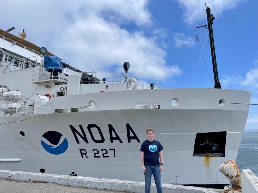
NOAA Ship Bell M Shimada in port, as seen from a point on the dock beyond the bow. We can see the NOAA logo and read: NOAA R 227. The water is calm and turqoise; the sky is blue with clouds. A portion of what may be the Golden Gate Bridge is visible in the background.
NOAA Ship Bell M. Shimada docked at Pier 30/32 in San Francisco, CA on July 4

Once onboard, I met Chief Scientist Steve de Blois and Wet Lab Lead Ethan Beyer. I was given a tour of the acoustic, chem, and wet labs and shown to my cabin. After dinner ashore, I joined some of the crew on the flying bridge to watch the July 4th fireworks. I met additional science team members and enjoyed a long night’s rest.

In the morning on July 5, we had a welcome aboard meeting, various trainings, a safety meeting and orientation, fire and abandon ship drills, and a science team meeting. We introduced ourselves, took an official team photo, and soon departed pier 30/32 for our 14 day mission. After passing under the Golden Gate Bridge and heading to the Pacific Ocean, our cold hands were warmed by a wonderful hot dinner of chicken, steak, fresh veggies, salad, and desserts from our galley crew. After dinner, we settled in for our first night at sea, waiting with anticipation for our first trawl on July 6.

– – ⚓ – –

Did You Know?

an orange-gloved hand holds a hake (fish) up so that it faces the camera. We can see the another smaller hake hanging limply across its open mouth

– Hake can be cannibalistic!
– Some larger Hake we have collected have had a smaller Hake in their mouth, throat, or stomach!
– Their very sharp teeth often stick to our thick rubber gloves.

– – ⚓ – –

New Terms/Phrases:

“Salp: Barrel-shaped, planktonic tunicate in the family Salpidae. It moves by contracting, thereby pumping water through its gelatinous body.”

Wikipedia: “Salp

“Myctophid: Lanternfish (or myctophids, from the Greek μυκτήρ myktḗr, “nose” and ophis, “serpent”) are small mesopelagic fish (…) Lanternfishes are aptly named after their conspicuous use of bioluminescence.”

Wikipedia: “Myctophid

Simrad EK80: Multibeam Echo Sounder (MBES) transducer that emits sound waves from the hull of the vessel down to the sea floor. It allows scientists to observe and study returned sound wave signals that may suggest marine life is present.

Transect: Set and numbered longitudinal east-west lines NOAA Ship Bell M. Shimada navigates on while collecting acoustic data.

Lisa Carlson: Anticipation… Does everything happen for a reason? July 3, 2023

NOAA Teacher at Sea

Lisa Carlson

NOAA Ship Bell M. Shimada

July 5, 2023 – July 19, 2023

Mission: Fisheries: Pacific Hake Survey (More info here)

Geographic Region: Pacific Ocean, off the coast of California

Date: July 3, 2023

Introduction and Background

Hello! My name is Lisa Carlson and I am an elementary school teacher in Virginia Beach, Virginia. I have taught third, fourth, and fifth grade general education with Special Education and English as a Second Language (ESL) inclusion. This coming fall I will be a second grade teacher, continuing with ESL inclusion! Although I was surprised to move down from fourth grade, I try to maintain the belief that everything happens for a reason, and the only constant in life is change.

Lisa Carlson on a boat, presumably a sailboat. We can see lines, some navigation equipment, portions of the railing, and water in the background. She's wearing a hat, sunglasses, and a blue life vest.

For example, if I not missed out on previous opportunities to join NOAA as a Teacher at Sea due to the pandemic, a short career change, and other extenuating circumstances; I wouldn’t be writing this blog from a hotel room in San Francisco, California, anticipating boarding and seeing July 4th fireworks from the deck tomorrow.

– – ⚓ – –

My introduction to NOAA’s Teacher at Sea program began in the fall of 2017. After student teaching in the fall/winter of 2016 in a third grade class, and permanent subbing in a fifth grade in the winter/spring of 2017, I accepted a position for my own third grade classroom.

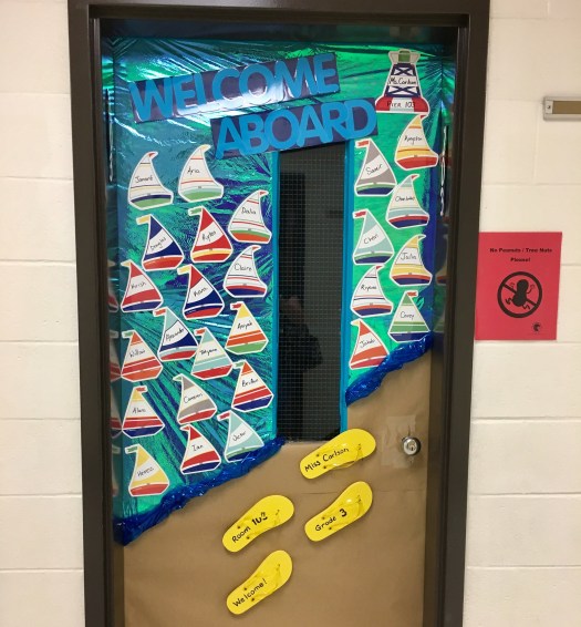
My classroom came together with a nautical theme, shades of blues and calm colors, nautical paintings by my Mom, lots of cleaning and moving by my Dad, sailboat name tags on the door, and our own 3D sailboat in my class library. It soon got around that my room was one to go see!

A closed classroom door papered in shiny blue-green wrap on the top half (representing ocean) and brown on the bottom half (representing sand). Paper sailboats of different colors are taped onto the "ocean;" each has a student's name (not legible). Four yellow flip flops, with more labels, are taped to the "sand." At the top of the door, blue letters on a black paper background say: WELCOME ABOARD.

Door decorations for my first third grade classroom!

Classroom decor: life ring painting, handmade pilings,
fish and life ring pillows, sea creature lights, and 3D sailboat

A corner of a classroom, with shelves, plastic organizer boxes, a small carpet, a nest chair, in nautical theme.

Our Technology Integration Specialist, a NOAA Teacher at Sea Alumnus, visited my room and explained the program to me. The application was due on my birthday, less than a month from when I learned about the opportunity.

– – ⚓ – –

So, I applied in November 2017, 2018, and 2019. One year I just wasn’t selected, one year administrative input was not turned in on time, and other hiccups along the way. Then, my 2019 application was accepted, and I was over the moon in January 2020 to learn that I was a finalist. Of course, we all know what happened that March; and the 2020 and subsequent 2021 sailing seasons were canceled. Slowly, a few teachers were able to sail in the summer of 2022, and I was able to read their blogs from afar with the belief of everything happening for a reason.

My 2023 NOAA Teacher at Sea Assignment!

Now, it’s my turn! I will be sailing off the coast of California for two weeks on NOAA Ship Bell M. Shimada with members of the science team as part of the Integrated Ecosystem and Pacific Hake Acoustic Trawl Survey.

“For three decades, the Teacher at Sea program has helped teachers participate in annual NOAA research surveys conducted by our scientists. Teachers from around the country embark on a two to three week expedition at sea. They gain invaluable on-the-job experience and communicate their journey through a series of blogs and lesson plans.”

NOAA Teacher at Sea Blog: “Looking Back on 30 Years of Teachers at Sea

I am so excited for this opportunity and experience after five and a half years of anticipation. So follow along, wish us fair winds and following seas, and as many schools of Pacific Hake as possible to sample from and research!

– From my king sized bed hotel room, and last night ashore:

Temporarily reassigned teacher, and sailor at heart.

Lisa stands at the door of a streetcar, left hand hanging onto a pole. A San Francisco streetscape extends into the distance to the left side of the photo.

Shelley Gordon: ACCESS Partnership, July 24, 2019

NOAA Teacher at Sea

Shelley Gordon

Aboard R/V Fulmar

July 19-27, 2019


Mission:  Applied California Current Ecosystem Studies Survey (ACCESS)

Geographic Area of Cruise:  Pacific Ocean, Northern and Central California Coast

Date:  July 24, 2019


Applied California Current Ecosystem Studies (ACCESS) is a joint research project conducted by NOAA (Cordell Bank National Marine Sanctuary and Greater Farallones National Marine Sanctuary) and Point Blue Conservation Science. 

NOAA’s Office of National Marine Sanctuaries manages 13 sanctuaries and two marine national monuments, protecting a total of 600,000 square miles of marine and Great Lakes waters within the United States.  Four of the sanctuaries are in California.  Greater Farallones National Marine Sanctuary (GFNMS) is a large sanctuary that protects over 3,000 square miles of California coast and offshore marine habitat from San Francisco to Point Arena.  There are numerous beaches and costal habitats included in this sanctuary, as well as the Farallon Islands.  Cordell Bank National Marine Sanctuary (CBNMS) is a smaller sanctuary around Cordell Bank, a large offshore seamount approximately 22 miles from the coast.  Sitting at the edge of the continental shelf, Cordell Bank is approximately 26 square miles in size, and while you cannot tell it is there from the surface, it supports a huge diversity of brightly colored sponges, corals, anemones, and other invertebrates.  Both sanctuaries protect a wide variety of living organisms across the food chain, from phytoplankton to blue whales.

Cordell Bank and Greater Farallones NMS
Map of Cordell Bank and Greater Farallones National Marine Sanctuaries. Map taken from cordellbank.noaa.gov

Point Blue Conservation Science is a non-profit organization that is working to combat climate change, habitat loss, and other environmental threats by helping to develop solutions that benefit wildlife and people.  They work with local natural resource managers (like National Marine Sanctuaries) to help monitor and improve the health of the planet. 

Scientists from each of these organizations have come together to work on ACCESS.  This project, started back in 2004, collects data on the physical conditions and living things within GFNMS and CBNMS.  Scientists use this data to document wildlife abundance, monitor changes over time, and help inform decisions about conservation efforts.  For example, data collected on the location of whales can help create policies to reduce threats to whales, like ship strikes and entanglements.   There are many huge ships that come in and out of San Francisco Bay on a daily basis.  Scientists are currently working with the industry to support a reduction in ship speed, which can reduce the likelihood of whales coming into dangerous contact with ship hulls.  Another threat to whales are entanglement in fishing gear.  Legal commercial crab fishing using crab pots occurs within the sanctuaries.  In recent years there have been greater incidents of whales being entangled in the buoy lines that fisherman use to help them collect the crab pots from the bottom of the ocean.  As the result of a recent lawsuit filed by ­­­­­the Center for Biological Diversity, the commercial crab season ended early this year to try to help protect the whales.

Adult Common Murre
Adult Common Murre. Photo: Dru Devlin

An interesting, and possibly concerning, phenomenon is being observed on our cruise.  Kirsten Lindquist, the seabird expert on this cruise, has seen a great number of Common Murres on the water during our data collection observations.  However, she has noticed a lack of chicks.  Common Murres nest on rocky outcroppings and the chicks leave the nest 15-25 days after they hatch, before they are able to fly.  The chicks then float on the water are fed by their parents for several weeks until they can feed themselves.  Generally, at this time of year she would expect to see a large number of adult and chick pairings floating on the surface of the water together.  Today we saw quite a few chicks floating with an adult, but this has not been the case during the other days on this cruise.  It is unclear why there are fewer Common Murre chicks than are typically seen.

Did You Know?

Dani and Shelley deploy CTD
Dani Lipski and me deploying the CTD, a device used to measure water conductivity, temperature, and depth. Photo: Jaime Jahncke

Scientists use “conductivity” as a measure of how salty the ocean water is.  If the water is relatively cold and salty that is a sign of “good” upwelling conditions, meaning that the cold water from the deep ocean is moving up over the continental shelf, bringing a high concentration of nutrients with it.  The upwelling along the California coast is a main reason why there is such a diversity of ocean life here.

Shelley Gordon: Life on Board R/V Fulmar, July 23, 2019

NOAA Teacher at Sea

Shelley Gordon

Aboard R/V Fulmar

July 19-27, 2019


Mission:  Applied California Current Ecosystem Studies Survey (ACCESS)

Geographic Area of Cruise:  Pacific Ocean, Northern and Central California Coast

Date:  July 23, 2019

Weather Data: Wind – NW 19-23 knots, gust ~30 knots, wind wave ~7′, swell SSW 1′ at 16 seconds; Partly sunny, with patchy fog early

R/V Fulmar
R/V Fulmar refueling at Spud Point marina in Bodega Bay.

During this week, I am living aboard R/V Fulmar.  The “research vessel” is a 67-foot catamaran (meaning it has two parallel hulls) with an aluminum hull.  This boat was specifically designed to support research projects in the three National Marine Sanctuaries along the central and northern California coast, and was first put in the water in 2007.  Normally, the Fulmar is based out of Monterey Bay harbor in the Monterey Bay National Marine Sanctuary.  However, this week she is being put to work on an ACCESS cruise in the two sanctuaries a little farther to the north, Cordell Bank and Greater Farallones.  

Fishing trawlers at Spud Point marina
Fishing trawlers at Spud Point marina.

Each evening, after a full day of collecting samples, the Fulmar motors back into the harbor for the night.  We are working out of two harbors on this cruise, Sausalito and Bodega Bay.  The vibe in each harbor is quite different.  Sausalito is full of private pleasure yachts, small sailboats, and live aboard boats/houseboats.  Spud Point marina in Bodega Bay is much more of a working marina.  The majority of the boats are large fishing trawlers.  It is currently salmon fishing season, and the boats that are working bring back their daily catch to the marina so that it can be transported to market.

The Fulmar is operated by two crew members on this cruise.  Clyde Terrell is the captain and Rayon Carruthers is the first mate.  In addition to the crew there have been 6-7 scientists on board, and myself.  Jan Roletto is a scientist from Greater Farallones, Kirsten Lindquist and Dru Devlin work at the Greater Farallones Association, and from Cordell Bank we have Dani Lipski and Rachel Pound.  Jaime Jahncke is lead Principal Investigator on ACCESS and works at Point Blue Conservation Scientist.  Kate Davis, currently a post-doc at the University of South Carolina, also joined the first half of the trip.

The boat has 5 main areas.  The “bridge” contains the digital and physical equipment that the crew uses to steer the ship.  There are several computers that display radar signals and a GPS map.  In the main cabin there are bunks for sleeping, a marine head (bathroom) with a toilet, sink, and shower, a fully-equipped kitchen, and a lab/work area.  The back deck is where most of the equipment for sample collecting is stored and put to use when samples are being collected.  On the top deck there are life rafts and safety equipment, as well as an additional steering wheel.  This is also where the team sits to make observations as we move along the transects.  Finally, there are two engine rooms underneath the main cabin.

Shelley in immersion suit
Me, putting on the immersion suit. Photo: Jan Roletto

Safety on the boat is obviously very important.  Before we went the first day, I received a full safety briefing and I got to practice donning an immersion suit, which we would need to wear in the case of an emergency where we might need to evacuate the ship and be exposed to cold water for a prolonged period of time.  The immersion suit is like a full-footed, full-fingered, and hooded wetsuit.  The goal is to be able to get into the immersion suit in less than two minutes, which was actually a little more difficult than I expected given that once you have the full-fingered gloves on it is difficult to effectively use your hands to finish zipping up the suit.  Anyone working on the back deck collecting samples is required to wear a life jacket or float coat and a hard hat. 

The daily activities on the boat vary depending on your role.  In general, we have been leaving the marina between 6:30-7:00am and there has typically been a 1-2 hour transit to the first data collection station.  During that time the team is generally relaxing, preparing for the day, or employing their personal strategy to combat seasickness (napping, lying down, or sitting in the fresh air on the top deck).  I’ve been fortunate to feel pretty good on this trip and haven’t struggled with seasickness.  Once data collection begins, my role on the back deck has been a series of action and waiting.  Since we are using heavy tools to collect data at significant depths, we use a crane and cable to hoist the equipment in and out of the water.  The winch that unwinds and winds the cable can lower or lift the equipment at a rate of ~20 m/min.  For the most part while the equipment is away from the boat we are waiting, and at times we have lowered data collection tools beyond 200m, which means a travel time of ~20 minutes, down and back.

Jaime and Kirsten
Jaime Jahncke and Kirsten Lindquist recording observations along ACCESS transect 3N.

However, today we actually did observation-only lines, so I had a lot of time to relax and observe.  The weather also turned a little bit today.  We had pretty dense fog in the morning, and more wind and rougher seas than on previous days.  But, near the end of the day, as we reached Drake’s Bay in Point Reyes National Seashore, the fog suddenly cleared and Point Reyes provided some protection from the wind.  The marine life seemed to appreciate the sun and wind protection as well as there was a large group of feeding seabirds and humpback whales right off the point.  We ended the day on a pleasant, sunny ride along the coast and underneath the Golden Gate Bridge, docking for the night in Sausalito.


Did You Know?

Humpback whales are migratory.  The population we are able to see here migrate annually from their breeding grounds off the coast of Mexico.  They come each summer to enjoy the nutrient rich waters of the California coast.  Humpback whales thrive here due to upwelling of nutrients from the deep ocean, which helps supports their favorite food – krill!  Humpback whales feed all summer on krill, copepods, and small fish so that they can store up energy to migrate back down to the warmer tropical waters for the winter breeding season.  I hope they get their fill while they’re here since they won’t eat much until they return, next summer.

humpback whale tail.
A humpback whale tail. Photo: Dru Devlin