Mission: Oceanographic and Biological Monitoring of Davidson Seamount Geographic Area of Cruise: Monterey Bay National Marine Sanctuary Departure Port: Alameda, CA Arrival Port: Alameda, CA
Date: July 9, 2025
Yes, I am back for a second chance! Last year, after a wonderful orientation at the Coral Lab in Galveston, I unexpectedly came down with Covid just days before my cruise on Thomas Jefferson. Thanks to the Teacher at Sea Program and specifically the support of Emily Susko, I was placed on a new cruise on Reuben Lasker in the Monterey Bay National Marine Sanctuary. I am so grateful for this chance to sail and learn in my local marine sanctuary. Easier yet, the port of departure- Alameda- is just a 20 minute drive from my home in Berkeley!
In this cruise, the Monterey Bay National Marine Sanctuary (MBNMS) will be working with Point Blue Conservation Science and the Monterey Bay Aquarium Research Institute to study the Davidson Seamount. The Davidson Seamount is an undersea mountain that rises 8,000 feet above the sea floor and hosts a unique ecosystem due to the nutrient rich waters that are pushed to the surface. It is located 50 miles offshore of central California. I am very excited to learn more about seamounts!
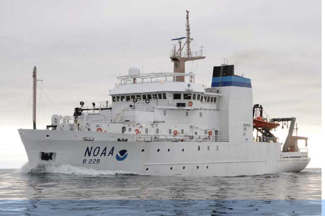
In our survey, we will sample the water above and adjacent to the seamount. We will also be surveying marine mammals and seabirds and their prey and collecting environmental DNA (eDNA) to understand animals that we are not able to observe. This data will help give a more complete picture of oceanography and biology of the entire seamount from its base to the ocean surface and help us to understand connections between climate, ocean conditions and marine life. One goal is to use this data to inform the shipping industry so that ships crossing the Davidson Seamount lower their speed to avoid hitting whales. This work is of great importance to me as I have been saddened by the many whale strikes in the Bay over the recent months. All of our work will be done on board Reuben Lasker, a 208 ft research vessel equipped for both fishery and oceanographic research.
NOAA Ship Reuben Lasker, Photo courtesy of NOAA
While I shared my background in my introductory blog last summer, there have been some new developments. First is the great news that after 9 years of leading student activism to end single use plastics in school meals, we began reusable dishware for school lunch. The change is not just for my school, but will be rolled out in all schools across the district, impacting 9,000 students daily and vastly reducing the plastic waste our schools generate. I am really happy that students will be able to experience more sustainable meals at school — since lunch is school too.
Traditional single-use disposable materialsNew reusable lunch dishes
This school year, I also had the opportunity to travel for 12 days to Antarctica as a Grosvenor Teacher Fellow with National Geographic on the polar expedition ship Endurance. This life-changing experience of exploring the Southern Ocean deeply impacted both myself and my class. We spent the school year diving into a study of Antarctica, interacting with polar scientists and learning of the critical role Antarctica has for the health of our water planet. We discovered how our local actions impact the environment and affect places as far away as Antarctica.
Though I couldn’t take my students on the voyage with me, I did instill in them the curiosity and joy I experienced exploring. Thus, my class became explorers of our local environment — the Berkeley Marina and the San Francisco Bay. In a series of 10 field trips, we learned to identify local birds, trawled and studied plankton and charted and sailed a course on the schooner Pegasus, engaged in multiple beach clean-ups (with data sheets) and camped on the cliffs in Marin overlooking the Pacific Ocean. I hope that through these joyful experiences of learning in nature, my students will be inspired to continue to grow their connection, curiosity and sense of caring for our planet — and especially for our ocean.
The following photos are included courtesy of Oxford Elementary.
Bay scientist studies Trawling as Bay Scientists Beach Clean / Waste Audit Birding at the Berkeley Marina
Sailing on Pegasus (a youth sailing project)
Charting a course to Angel IslandSailing our course to Angel Island
Finally, I am especially excited for my Teacher at Sea experience because Monterey Bay is close to my heart. In 2019, my students and I participated in the Monterey Bay Aquarium’s Ocean Plastic Pollution Summit; it was a life changing 2-day experience where we explored the aquarium at night, slept next to the tanks, listened to inspirational youth ocean activists and connected with students from all over California who were also working to solve the plastic pollution crisis. Many of the students pictured below are still active in working to protect our ocean by volunteering at the Marine Mammal Rescue Center or serving as youth representatives on our city’s Climate Commission.
Ocean Plastic Pollution Youth Summit. Photo courtesy of Monterey Bay Aquarium
As I embark on this voyage of discovery, learning and adventure, these words of the great oceanographer and ocean activist Sylvia Earle, whom I deeply admire, come to mind:
“The ocean is the cornerstone of Earth’s life support system, it shapes climate and weather. It holds most of life on Earth. 97% of Earth’s water is there. It’s the blue heart of the planet — we should take care of our heart. It’s what makes life possible for us.”
With Sylvia Earle and my students (not pictured) in Alameda, CA
Thank you to the scientists and crew of Reuben Lasker for the opportunity to join you in this most important work!
Mission: Rockfish Recruitment and Ecosystem Assessment Survey (RREAS)
Geographic Area of Cruise: Pacific Ocean; U.S. West Coast
Date: June 11th, 2024
Weather Datafrom the Bridge
Date: Tuesday, June 11, 2024 Latitude: 35.42 °N Longitude: 121.22 °W Sea Wave Height: 4-5 ft Wind Speed: 4 knots Air Temperature: 57 ° F Sky: Foggy / light rain
Science Log
Arriving on the Lasker
We’re off! After landing in San Francisco and driving down to Santa Cruz, I arrived on the NOAA Ship Reuben Lasker by way of small boat transfer. The Lasker was anchored in Monterey Bay, and sent a small boat to pick up myself and some of the science team and crew to be taken aboard. We boarded the small boat, the “RL-2 Shark,” then traveled to the side of the Lasker where we were hoisted up via a winch. I then got a full tour around the ship, and the opportunity to meet many people who work on the Lasker, including members of the science team, NOAA Corps, and Lasker crew.
Charlotte boards the RL-2 Shark in Santa CruzApproaching the LaskerRL-2 Shark on board the LaskerThe RL-2 Shark approaches the Lasker
The Night Shift
Running a ship like the Lasker is a 24-hour-a-day operation. At all times there are some groups of people sleeping and others who are working. The majority of the science crew works at night, so my day typically begins with dinner at 5:00 pm and then working with the science team from approximately 9:30 pm until 6:30 am. As a morning person this was very difficult at first! But after two nights working, I’m finally adjusting to our new schedule.
What is the Goal of the Survey?
The main scientific focus of the upcoming mission is the Rockfish Recruitment and Ecosystem Assessment Survey (RREAS). This survey has been conducted since 1983, and collects data on rockfish and other organisms in their ecosystem.
Rockfish are a very important fish commercially and recreationally in California and on the West Coast. One of the primary purposes of the survey is to use the data collected to help provide additional information about the management of commercial and recreational fisheries off the west coast.
CTD Operations
CTD rosette, ready to be deployed into the ocean.
I began my first night shift by observing a CTD deployment. CTDs are instruments that measure Conductivity, Temperature and Depth (CTD). CTD measurements are conducted approximately 5-6 times a day, and twice at night. The CTD descends down into the ocean to a depth of up to 500 m . There are other instruments and sensors attached to the CTD that measure things like chlorophyll levels and oxygen levels. The data taken from the water column serves as a foundation for scientists to understand the ocean environment.
All of the CTD data, and all the data that the Lasker collects, is free and available to the public.
Trawling
Hand-drawn diagram of trawl net, courtesy of scientist Tanya Rogers.
When do we trawl?
The reason the science team trawls at night because there is net avoidance during the daytime, meaning the fish will see the net coming during the day and swim away from it. Other creatures migrate towards the surface at night. In a pattern called vertical migration, these mesopelagic species migrate to shallow waters to feed during the night, while spending day hours at depth.
Having more diverse species to study is useful for the Rockfish Recruitment and Ecosystem Assessment Survey (RREAS). The more data that is collected on rockfish and other species helps scientists to better understand the heath of different fish species, and make predictions and assessments of ocean trends.
How does trawling work?
Each night, the Lasker crew, NOAA corps officers, and science team work together to trawl for different fish species.
In our Rockfish Recruitment and Ecosystem Assessment Survey, the science team conducts midwater trawls, at approximately 30m depth to target the fish and other ocean organisms that are targeted for the study.
The last few days we’ve averaged 5 trawls per night. The process begins by deploying the trawling net behind the ship into the midwater section of the water column, and trawling for fish for either 5 or 15 min. After the net is brought in, the contents of the trawl are sorted, measured, and recorded by the science team. This data will be later analyzed to help better understand the ocean ecosystem.
Teacher at Sea Charlotte with the catch of a trawl.
The science team sort fish and other organisms from the trawl.
Personal Log
NOAA Ship Reuben Lasker: My New Home at Sea
NOAA Ship Reuben Lasker (photo courtesy of NOAA)
My new home for my time at sea is the NOAA Ship Reuben Lasker. The Lasker is a NOAA fisheries vessel, with a home port located in San Diego, CA.
During my time at sea, the Lasker will be sailing off the coast of California, sailing out of Santa Cruz and back into port in San Diego.
Living on the ship reminds me a lot of my college dorm room. On the ship most people have roommates, and we all have shared spaces like the mess (cafeteria), science labs, outside decks and places to relax. Everyone aboard the ship has been extremely welcoming and kind, always answering any questions I might have and teaching me about life aboard a ship. I am happy to call the Lasker home over my trip at sea!
There are three major teams working and living as a cohesive unit aboard the Lasker. The Reuben Lasker crew, NOAA science team, and NOAA Corps officers each have distinct roles and work together each day to accomplish various science projects.
Sunset aboard the Lasker.
Did you know?
Adjusting to working the night shift (approximately 9:00 pm – 7:00 am) as a typical morning person has meant sleep is often on my mind. Chatting before our second night shift, scientist Ily Iglesias shared with me how dolphins sleep. Both dolphins and whales sleep much differently than most mammals. Known as unihemisphericsleep, dolphins
Mission: Hydrographic Survey of the Northern Gulf of Mexico
Geographic Area: Galveston, Texas
Date: June 8, 2024
Weather Data from the “Bridge” (My Deck):
Latitude: 37.8715 º N” Longitude: 122.2730 º W 65º Fahrenheit Wind: 11 kn, Wind direction: SW Air pressure: 1011 hPa Humidity: 70%, Sunny Rainfall: 0 mm
Introduction
Hello! My name is Jacqueline Omania and I am preparing to join a hydrographic project on NOAA Ship Thomas Jefferson originating out of Galveston, Texas on June 17th.
I am a fifth grade teacher at Oxford Elementary School in Berkeley, California. This coming year will be my 20th year teaching. I have a masters degree in Environmental Education and teach with a strong emphasis on outdoor education in my curriculum. Prior to being in the classroom, I founded the first school Farm and Garden Program in our district. Now, every school in our district has a school garden program staffed by a garden teacher. I am known at school as the teacher who takes her students on the most field trips; we go sailing, cycling, hiking, climbing, camping and dragon boating. Since my students do not all have the same access to outdoor experiences, I believe it is essential to experience the natural world as part of school. My goal is for students to fall in love with nature and, thus, be inspired to work together to protect it.
One special feature of my class is our success as a Zero Waste Classroom. For most of the last 9 years, we have made less than a quart of landfill waste for the entire school year. I weave a theme of sustainability into all the academic content areas all year. My students learn to be activists and to use their studies to make a difference. Recently (after 3 years of activism) my students have successfully persuaded our school district to switch from throwaway paper and plastic foodware to reusable foodware for school meals.
Landfill Waste for the ‘23-’24 School Year Photo credit: Jacqueline Omania; student photos courtesy of Oxford Elementary
Outside of teaching in the classroom, I run a local chapter of a youth group called Heirs to Our Ocean through which I continue to mentor my former elementary students in their middle and high school years. Currently, I have two students on our city’s Climate Commission, occupying the first-ever youth seats.
In my free time, I am learning sailing (started in 2022)—both locally in the San Francisco Bay and in the Caribbean, where I have roots. I am also fascinated by Polynesian wayfinding and the journey of Hokulea (a Polynesian double-hulled voyaging canoe which is circumnavigating the Earth to raise awareness of the importance of the ocean) and have been eagerly reading to learn more. I will definitely be working on knots and the star compass while at sea. Besides sailing, I love to be outdoors and enjoy long walks, gardening and trips to local beaches. I have two grown children—Mehrnush (PhD student in Geography at UCLA) and Farhad (working in a restaurant and reflecting on his next steps); I enjoy being a mother of grown children.
Caribbean Sea/ Photo credit: Jacqueline Omania; Hokulea photo Polynesian Voyaging Society Farhad and Mehrnush
Personal Log: Why am I doing this?
I love being at sea. I was fortunate to spend 100 days on Semester at Sea in my second year of college, sailing on the SS Universe from Seattle, Washington around the world to return to Ft. Lauderdale, Florida. This experience gave me a strong experience in shipboard life, a deep respect for the ocean and a glimpse at many diverse cultures around the world. I continue to love exploration and marine science and work to weave ocean literacy into my classroom curriculum to cultivate students who will be inspired to learn more and care to protect our ocean.
I am excited to be selected for the Teacher at Sea program and have the opportunity to assist with hydrographic research, as well as learn about marine science careers. I can’t wait to share all that I learn with my students. They will be interested in how hydrographic surveys work, since we already study charts of the SF Bay. They will also be interested in jobs at sea since many absolutely love our class sail on the Pegasus and want to know more about ways to be at sea. Thank you to NOAA for giving me this opportunity to experience work in marine science in the Gulf of Mexico. This part of the world is new to me and I am very curious about what wildlife I will see.
Science and Technology Log
NOAA Ship Thomas Jefferson is a 208 ft. long hydrographic survey ship that maps the ocean floor to help maritime commerce, to preserve the coastline and to better understand the marine environment. It uses side scan sonar to create images of the seafloor that help locate marine hazards as well as multibeam echo sounders to find accurate depths and create detailed images of the sea floor. The ship became part of the NOAA fleet in 2003 and was named after President Thomas Jefferson because he created the Survey of the Coast in 1807. NOAA Ship Thomas Jefferson has also responded after hurricanes—as well as after other catastrophic events like the Deep Horizon oil spill—to determine when it is safe again for ships to travel.
NOAA Ship Thomas Jefferson. Photo courtesy of NOAA.
Please write if you have comments and questions and I’ll respond to you!
I teach third grade at Nokomis Elementary, The Greatest School In The Universe, in Ukiah, California. Ukiah is a thriving metropolis of about 17,000 people located about 2 hours north of San Francisco. The economy of our beautiful community is primarily agricultural and tourism based. We are known for pears, wine, and redwoods. The coast of Mendocino county is about an hour away, through the redwoods, and features beautiful cliffs, beaches and even the Lost Coast.
I grew up I n South Florida fishing in the mangroves and flats of the Everglades, Florida Bay, the Keys and Biscayne Bay so this is a bit of a return home for me. This will, however, be a very different endeavor. I look forward to being part of a science team collecting data. I want to learn about the sharks and other fish that we catch. I look forward to meeting and working with a variety of people from different professional backgrounds and regions.
I recently completed my 25th year of teaching as a classroom teacher and it has been quite a journey. I have taught grades K-6th and have enjoyed different aspects of each of them. Before becoming a classroom teacher, I taught English in Taiwan and traveled in China, Tibet, and Japan as well as working in schools in Philadelphia. Because I see how my own enthusiasm helps my students to connect with whatever I am teaching, I integrate my own interest in science, nature and the outdoors. The best that I can bring to my students is what I know and love. Through the Teacher At Sea program, I look forward to expanding my experiences and knowledge about applied science and careers at sea so that I can better bring the world of science to my students.
New Terms: Forward is a nautical directional term referring to the bow at the front of the ship while aft refers to the stern at the back of the ship.
Mission: Fisheries: Pacific Hake Survey (More info here)
GeographicRegion: Pacific Ocean, off the coast of California
Date: July 13, 2023
– – ⚓ – –
Weather Data from the bridge:
July11 (1200 PT, 1500 EST) Location: 37° 46.7’ N, 123° 26.6’ W 43nm (50mi) West of San Francisco, CA
Visibility: 2 nautical miles Sky condition: Overcast, fog Wind: 20 knots from N 250° Barometer: 1015.2 mbar Sea wave height: 2-3 feet Swell: 6-7 ft from NW 320° Sea temperature: 12.2°C (57.2°F) Air temperature: 12.7°C (57.9°F) Course Over Ground: (COG): 270° Speed Over Ground (SOG): 10 knots
July 12 (1200 PT, 1500 EST) Location: 38° 06.8’ N, 123° 01.6’ W 7nm (8mi) North of Point Reyes Lighthouse, Inverness, CA
Visibility: 2 nautical miles Sky condition: Overcast, fog Wind: 12 knots from N 350° Barometer: 1016.0 mbar Sea wave height: 1-2 feet Swell: 3-4 ft from W 280° Sea temperature: 11.0°C (57.2°F) Air temperature: 11.5°C (57.9°F) Course Over Ground: (COG): 270° Speed Over Ground (SOG): 10 knots
July 13 (1200 PT, 1500 EST) Location: 38° 17.3’ N, 123° 06.1’ W 2.5nm (4mi) Southwest of Bodega Bay, CA
Visibility: 3 nautical miles Sky condition: Few clouds, fog Wind: 13 knots from NW 300° Barometer: 1015.9 mbar Sea wave height: 1-2 feet 1-2 Swell: 3-4 ft from NW 300° Sea temperature: 10.7°C (51.3°F) Air temperature: 13.7°C (56.6°F) Course Over Ground: (COG): 340° Speed Over Ground (SOG): 10 knots
– – ⚓ – –
In my July 6 post, I explained how NOAA Ship Bell M. Shimada is equipped to collect acoustic data in the form of echo grams and therefore find fish to trawl for. In my July 10 post, I explained how we get the fish onboard, and what we do with the sample once it is collected from the net. These entries described what work is done in the Acoustics Lab and the Wet Lab, but there is one more Lab onboard to explore and explain: the Chemistry Lab.
NOAA Ship Bell M. Shimada leaving Pier 30/32 in San Francisco, CA on July 5, 2023. (Just a nice photo taken by me that I wanted to include)
Science and Technology Log
Each morning after breakfast, we usually gather in the Acoustics Lab, determine what transect we are on, if we are inshore or offshore, and in some ways: hurry up and wait. Once certain patterns and blips show up on the echo grams, the Acoustics team talks with the bridge and may request to turn around and attempt a trawl. After all marine mammal observations are completed, the net is retrieved, and the samples are brought to the Wet Lab, we sort and collect data on the samples. These operations usually take place between 0800 and 2000. (8am to 8pm)
So what happens at night? In the Chemistry Lab, scientists work with the Deck and Surveys Departments to deploy a collection of electronic instruments and 12 Niskin bottles (open bottles used to collect and hold water samples, about one meter long) secured to a cylindrical frame called a rosette. It is deployed from the side sampling station instead of the stern. Scientists onboard NOAA Ship Bell M. Shimada use the instruments and collection of water samples in two ways: measuring Conductivity, Temperature, and Depth (CTD) within a water column to study oceanography, and collecting environmental DNA (eDNA).
CTD Niskin bottles arranged on a circular rosette frame.
“Nighttime operations primarily consists of deploying the Conductivity-Temperature [-Depth] (CTD) rosette which gathers oceanographic data such as conductivity, temperature, dissolved oxygen, and chlorophyll fluorescence. The CTD can also be triggered to collect water at specific depths.”
CTD stands for conductivity (ability to pass an electrical current), temperature, and depth. Scientists use the rosette frame, which is attached to the ship by cables, and has the CTD and 12 Niskin bottles attached, to collect electronic data and multiple water samples.
“A CTD device’s primary function is to detect how the conductivity and temperature of the water column changes relative to depth. Conductivity is a measure of how well a solution conducts electricity and it is directly related to salinity. By measuring the conductivity of seawater, the salinity can be derived from the temperature and pressure of the same water. The depth is then derived from the pressure measurement by calculating the density of water from the temperature and the salinity.”
Senior Survey Technician Elysha Agne gives commands to the Deck Department running the winch and cable to the rosette, and ensures quality data is being collected at each sampling depth.
“For more detailed analyses back in the lab, each of the large gray bottles captures a water sample at a different depth. The data provide scientists important information about the local aquatic environment.”
Depending on the depth at which the vessel is currently operating, the rosette will descend to one to five predetermined depths (50m-500m) for sampling. For example, if the vessel depth reads 400m, water samples will occur at 50m, 150m, 200m, and 300m (more information in Table 1 below). A water sample is also taken just below the ocean surface using a through hull fitting, which allows seawater to be collected via a hole in the hull that feeds directly to the Chem Lab.
Table 1 in Protocol manual, written by Chem Lab member and eDNA scientist Abi Wells.
While the rosette descends, data is recorded from multiple sensors and are later used by scientists to compare with Acoustic and Wet Lab data and compile and categorize new information from the survey. Pressure, depth, temperature, conductivity, salinity, oxygen, fluorescence, and turbidity were all being recorded during this leg of the survey mission.
Program displaying data collected from the CTD rosette in real time.
Environmental DNA: eDNA
During the day, Hake stay in deeper waters, averaging around 200-350m, but at night the nocturnal feeders start their daily migration through the water column to shallower depths. They feed primarily on zooplankton, shrimp, myctophids (Lanternfish), and even young Hake at this depth. As Hake move throughout the water column, they leave behind DNA in the water that can be collected later as sort of a signature of their presence in that location. The collection, filtering, and preservation of sampled water in the ocean environment is categorized as collecting eDNA. This environmental DNA can be in the form of gametes (reproductive cells), fish scales, feces, etc.
Collecting water samples at different depths in the same vertical column can show what marine life was present at that location, and what depth they were at. I relate it to reviewing school security cameras or talking to other teachers at the end of the school day, to determine where a student was at a certain time and why.
Chem Lab member and eDNA scientist Abi Wells collecting a 2.5L water sample from a Niskin bottle after a successful CTD deployment.
When the rosette is back on deck, scientists use gloves and new collection bags called Whirlpacks, to collect approximately 2.5L of water from each 10L Niskin bottle. This process is conducted with a great emphasis on sterility, including wiping the bottle spigot with DNAway to remove any contaminants, using new materials, and not allowing fingers or the spigot to touch the collection bag.
Sterile work site being set up to pour water samples into the cups and strain through the filters.Chem Lab member and eDNA scientist Abi Wells pouring a 2.5L water sample into the corresponding cup to strain through the filter.
Once the collection bags are filled and brought to the Chem Lab, filtration occurs using 1.0 micron filters. Although this size of filter, compared to smaller filters, allows some cells to pass through and not be collected, it is faster and results in less breakage of cells and loss of DNA. After 2.5L of the water sample is poured through individual filters for each depth sample, they are placed in pre-labeled (location and depth information) tubes with 2mL of preservative buffer. The tubes are stored at room temperature and away from UV light until NOAA Ship Bell M. Shimada is back in port and the samples can be further researched in on-land laboratories. Results from additional studies help to compile lists of marine life that was present in the water column and can be compared to acoustic data and species caught and logged in the Wet Lab.
– – ⚓ – –
Personal Log
So, there you have it. Three Labs onboard that conduct very different research, but fit together in the puzzle of Hake development, migration, diet, niches, ecosystem, biomass, and supporting sustainable commercial fisheries. Each additional piece of data; whether it be echo sounds, physical samples, eDNA, or CTD information, strengthens the others and helps to create a cohesive summary of the data.
This was a lot to learn in the first few days, but as I’ve said before, all of the crew has been welcoming, supportive, and educational. Having a strong team that works together is priceless, and thoroughly noticed and appreciated.
A few days into the mission my Mom asked me what the best part of my day was. I had three answers and haven’t had a day yet with only one answer. I replied that it was the great salmon dinner, clean clothes, and seeing Risso’s Dolphins for the first time.
Video taken by me of Risso’s Dolphins surfacing for air. (Plays on loop)
We are now a little more than halfway through the mission and it has truly flown by. We’ve shared riddles and daily Final Jeopardy questions. We’ve laughed over daily experiences and the faces Hake fish make. We’ve played music and watched baseball during dinner. We enjoy watching marine life and breathe in the salt air while strengthening our sea legs. Sometimes we just drink coffee and snack and enjoy this opportunity with each other, and that makes every part of the day the best part.
– – ⚓ – –
Did You Know?
Although Hake are occasionally cannibalistic, they are not at the top of their food chain. Humboldt Squid (Remember those 15 foot long tentacles in my Wet Lab post?), Dogfish Sharks, and marine mammals are all predators, as well as commercial fishing. Today well over 100 Spiny Dogfish Sharks were inadvertently caught in the trawl, in the same location as the baskets of Hake we sampled from. Maybe there were baby Hake fish in the sharks’ stomachs… we didn’t attempt to find out.
Basket one of Spiny DogfishBasket two of Spiny Dogfish
– – ⚓ – –
New Terms/Phrases
Although I had learned the terms a few days earlier, I got to help Wet Lab Lead Ethan Beyer collect otolith and stomach samples for the first time from a sub-sample of Hake the other day.
I watched and learned, then helped scan barcodes of otolith sample bottles, add 95% ethanol that is diluted 50/50 with water, and delicately pick up the ear bones with tweezers and place them in the bottle.
Additionally, each Hake in the sub-sample has its weight recorded, along with length, sex, and developmental stage. From that sub-sample, five stomachs are removed for later analysis, and five have their stomachs opened and their diet is recorded. We often find Lanternfish (Myctophids), Krill (Euphausiidae) and small Hake.
Wet Lab Lead Ethan Beyer weighing a Hake sample. Otolith tubes are in the foreground, those with lids have samples inside them and have been scanned into the database with other measurements and samples data from the Hake.