Geographic Area of Cruise: Pacific Northwest (Off the coast of California)
Date: 9/7/2019
Weather Data from Marietta, GA:
Latitude: 33.963900 Longitude: -84.492260 Sky Conditions: Clear Present Weather: Hot Visibility: 9 miles Windspeed: Less than 1 knot Temperature: Record high 97 degrees Fahrenheit
It’s been weeks since I disembarked in Newport, Oregon and left Fairweather behind. I still feel like I’m a part of the crew since I was welcomed so seamlessly into any job I tried to learn while Teacher at Sea. However, the crew is still working away as I continue to share my experiences with my students in Marietta, Georgia.
As I have been working on lessons for my classroom, I keep finding fun facts and information about ship life that I didn’t share in my previous posts. So, here is my final post and some of my most frequent questions by students answered:
Question 1: Where did you sleep?
I slept in a berth, I had a comfortable bed, drawers, a locker, and a sink. There was a TV too, which I never watched since a) I like to read more than watch TV and b) the ship would rock me to sleep so fast I could never stay up too long at bedtime!
Bunk
Sink
Door
My room aboard Fairweather
Question 2: What was the weather like when you were at sea?
Sunny!
Cloudy and foggy
Clear at sunset
Windy days!
Windy nights!
Really foggy some nights!
Some days (and nights) so foggy that they had to use the fog horn for safety!
Question 3: What animals did you see?
I highlighted animals in all of my posts and linked sites to learn more, go check it out! There is one animal I didn’t include in my posts that I would like to share with you! The first is the California Sea Lionfound in the Newport harbor. You could hear them from across the harbor so I had to go check them out!
See the video below:
California Sea Lions
Question 4: What happens next with the hydrographic survey work?
This is one of my favorite questions from students! It shows how much you have learned about this very important scientific work and are thinking about what is next. The hydrographic survey maps are now in post processing, where the survey technicians, Sam, Bekah, Joe, and Michelle are working hard to make sure the data is correct. I shared in a previous hydrographic survey blog an example of Fairweather’s hydrographic survey maps, I also checked in with the USGS scientists James Conrad and Peter Dartnell to see what they were doing with their research and they shared some information that will help answer this question.
From Peter Dartnell, USGS research scientist: “Here are a few maps of the bathymetry data we just collected including the area off Coos Bay, off Eureka, and a close-up view of the mud volcano. The map off Eureka includes data we collected last year. I thought it would be best to show the entire Trinidad Canyon.”
From James Conrad USGS research geologist: “Here is an image of a ridge that we mapped on the cruise. The yellow dots are locations of methane bubble plumes that mark seafloor seeps. In the next few weeks, another NOAA ship, the Lasker, is planning to lower a Remotely Operated Vehicle to the seafloor here to see what kinds of critters live around these seeps. Methane seeps are known to have unique and unusual biologic communities associated with them. For scale, the ridge is about 8 miles long.”
Bathymetry map showing ridge
So, even though the research cruise is over, the research and follow up missions resulting from the research are ongoing and evolving every day.
Question 5: Would you go back if you could be a Teacher at Sea again?
YES! There is still so much to learn. I want to continue my own learning, but most importantly, lead my students to get excited about the important scientific research while keeping the mission of the NOAA close to their hearts: “To understand and predict changes in climate, weather, oceans, and coasts, to share that knowledge and information with others, and to conserve and manage coastal and marine ecosystems and resources. Dedicated to the understanding and stewardship of the environment.“
Fair winds and following seas Fairweather, I will treasure this experience always.
What
is Bathymetry and why is it important? Bathymetry is the foundation of the science of hydrography, which measures the
physical features of a water body.
We covered Hydrography
in the last blog post so we know it includes not only bathymetry, but
also the shape and features of the shoreline and more.
Bathymetry is defined as “the study of the “beds” or “floors” of water bodies, including the ocean, rivers, streams, and lakes.”
The term “bathymetry”
originally referred to the ocean’s depth relative to sea level, although it has
come to mean “submarine topography,” or the depths and shapes of underwater
terrain. In the same way that
topographic maps represent the three-dimensional features of land, bathymetric
maps illustrate the land that lies underwater. Variations in sea-floor relief may be depicted
by color and contour lines called depth contours or isobaths. (Click
here for source credit and more information from NOAA)
A bathymetric map looks like this (thanks Sam!):
Latest bathymetric maps! Can you see the newly discovered undersea canyon? (Southern coverage)
Latest bathymetric maps! Can you see the newly discovered mud volcano? (Northern Coverage)
Above are the first views of this part of the seafloor with a bathymetric map! (Color coded for depth – see the chart on the left)
Science and Technology Log:
Among the NOAA officers Navigating the ship, Hydrographic Technicians, and wage mariners aboard Fairweather, and the Teacher at Sea, there are also two guest USGS scientists: James Conrad, a research Geologist and Perter Dartnell, a physical scientist. USGS stands for United States Geographical Survey. The USGS was created by an act of Congress in 1879 and is the sole science agency for the Department of the Interior.
As a Teacher at Sea, I had time to talk with these USGS scientists and learn more about Bathymetry and why it is important not only to scientists, but also how this information can be used to keep us safe.
Discussion with James Conrad research Geologist who is utilizing the science of Bathymetry among others to map the Cascadia Region of the Pacific seafloor. The USGS scientists’ focus is mapping the Cascadia Subduction Zone where the Juan de Fuca tectonic plate is “diving” below the North American tectonic plate. Areas of particular interest to these scientists are finding new faults, faults that are known but we have little information about, mud volcanoes and subsequent “seeps,” and the overall goal is to understand the behavior of the mega thrusts in the Cascadia Region.
Image Credit: USGS scientists Peter Dartnell and James Conrad
About
the visiting scientists:
James Conrad has a bachelor’s degree from U.C. Berkley and a master’s degree from San Jose State and has been at the USGS for 38 years.
A conversation with Research Geologist James Conrad:
What
do you want students to know about Geology?
Geology is a field where
there is still so much to discover, especially if you are doing hazards research
work-like earthquakes, tsunamis, landslides, coastal change, and climate change
issues
Were
you always interested in geology?
Not as a child, but I became a geology major because I had taken an introductory course – and was guided to geology by the university.
I
met you on a ship-where do most of your work?
Office is in Santa Cruz, but we go out in the field 1-4 times a year for a week up to 3 weeks.
Geology is a very young
science, the fact that continents move wasn’t proven until 1963. There is very little known about the earth,
and there is so much more to discover.
Peter Dartnell:
Peter Dartnell has Bachelor of Science in Oceanography from Humboldt State University and a Masters of Geography from San Francisco State and has been with the USGS for 28 years.
A conversation with Physical Scientist Peter Dartnell:
What
does a physical scientist study?
Physical Science is a
combination of the studies earth and computer sciences using computers &
technology to study earth.
Physical Science allows you
to do everything along the scientific “study train” from data collection, interpretation,
to publications.
What
are your publications used for?
Scientific publications from
the USGS (which is the science agency of the government) are used widely to
inform about potential geohazards and changes in the earth. We don’t make policy, but the information we
provide may be used drive policies, especially safety.
Anything
you want an aspiring physical scientist to know?
Even though you are studying
earth sciences in school, you’ll truly enjoy once you get out and start applying
what you’ve learned in the field with hands on science.
We’ve
met on a ship, where is it you do most of your work?
I spend 75% of my time in the
office and 25% in meetings or traveling to study
What
is your favorite part of being a Physical Scientist?
Seeing part of the ocean that nobody has ever seen for the first time. We are the first ones to see these recently mapped parts of the sea floor.
What
types of technology you use in physical science?
We use specialized software to acquire data and analyze the data we collect.
We also use Multibeam sonar software – bathymetry and acoustic backscatter
What
do you think are some misconceptions about physical science?
Because we are working off shore and water covers 71% of the earth, marine geology is in its infancy — we really need to have a complete map of the sea floor which is vitally important to understand the geology of the earth. When we don’t have all of these details, we are essentially operating blind. That’s why the work that NOAA is doing is so important and the research partnerships with USGS are so valuable.
Much of the geography of the
seafloor is driven by the oil industry which is required to release their acquired
data every 25 years. A lot of the deep
penetration data is all from oil surveys. Sea floor mapping is limited for pure research
purposes due to limited resources.
Interested in learning more from
the USGS?
Check out these resources for students and teachers:
More about bathymetry and the NOAA and USGS mission:
I was lucky enough to attend a “Science Talk” by these USGS scientists which was titled the Subduction Zone Coastal & Marine Geohazards Project. The USGS scientists are guests aboard Fairweather like me.
The focus of the USGS research is along the 700-mile CascadiaSubduction Zone:
Map of Study Area. Image Credit: USGS scientists Peter Dartnell and James Conrad
This area is where the Juan de Fuca plate dives below the North American Plate at an approximate rate of 1.6 inches per year.
Subduction Zone
Image Credit: USGS scientists Peter Dartnell and James Conrad
Why is this subduction zone so important and why is NOAA Ship Fairweather out surveying the ocean floor in this area? That’s because the world’s largest and most destructive earthquakes occur along subduction zones. If we know the potential hazards, we can prepare people and potentially save lives.
To properly prepare, we need the following details:
What We Need to Prepare for Future Earthquakes Image Credit: USGS scientists Peter Dartnell and James Conrad
This is why the bathymetric maps of the sea floor are important, they can help predict the area and amount of shaking that may occur during an earthquake and predict the tsunami danger zones. Then we can make decisions for building codes, infrastructure (like strength of bridges), and escape routes for Tsunamis. I took the pictures below when I arrived in Newport, little did I know how the research the Fairweather is conducting and the science of hydrography and bathymetric maps play a part in warnings like these! (See below)
Through the hydrographic surveying being conducted aboard Fairweather, the NOAA crew and USGS scientists are creating bathymetric maps which have reveled exciting new finds, such as: new seafloor faults, mapping known faults in greater detail, discovering mud volcanoes and submarine landslides, and using the water column data to discover the “seeps” which are most likely releasing methane gas. See below.
(Image Credits: USGS scientists Peter Dartnell and James Conrad)
Mapping Seafloor Faults
Mapping Seafloor Seeps
Submarine Landslides
When I first heard the term BATHYMETRY I had no idea how these detailed maps of the seafloor could hold so much critical information! It’s fascinating to watch this science happen right here and see the discoveries in real time.
Personal Log
This post begins the last week aboard Fairweather. I’m surprised about how quickly the ship has begun to feel “normal” to me. I know my way around backwards (aft) and forwards (bow) and enjoyed getting to know everyone better. Sean the IT specialist makes an amazing pot of French press coffee around 10:00 am and is kind enough to share with all. Bekah, Sam, Joe, and Michelle in Hydrography patiently answer dozens of questions and allow me to participate when possible. And the officers on the bridge answer all the questions and are very welcoming and generous with sharing information and their amazing views! Carrie and the kitchen crew make 3 amazing meals a day, and I’ve made some new workout buddies to try to stay healthy with all this wonderful food! The visiting scientists have been very nice about answering all my questions about bathymetry and geology. It’s great when you are writing and studying about geology to be able to turn around and ask a geologist a question!
I can’t believe how well I sleep on a ship! The ship is constantly rocking and for this teacher at sea, and for me, that means some seriously deep sleep. One thing I learned is to make sure all my belongings are secure before I go to bed. If you leave something unsecured, chances are they will be banging around in the middle of the night or get tossed off a shelf (not the best middle of the night surprise!). My room is very dark at night and I really don’t hear anything beyond the noise of the engines. You can barely hear the foghorn from my area towards the back of the ship which is lucky since those sleeping in the front of the ship could hear it all night! (Those friends look a little weary today.) I have to set an alarm, or I will just keep sleeping with the constant rocking motion that is so relaxing! Only 3 more nights of good ship sleep for me!
The fog horn sounds every 2 minutes when the conditions are, you know, foggy!
Following the excellent tutelage of the NOAA officers, hydrographers, and USGS scientists, it’s exciting to look at the screen in the hydrography lab and start a conversation about features of the sea floor that we are seeing (or seeing in detail) for the first time. On this mission, there have been new faults, mud volcanoes, and underwater canyons discovered. The science is so fascinating and so little is known about the research being conducted aboard Fairweather. I honestly had to “Google” the terms I am now so familiar with like Hydrographic survey, multi beam echo sounders, bathymetry, water column data, just to name a few.
That’s the thing about science that has been reinforced being a Teacher at Sea, no matter how much you think you know about the earth, you learn just how much we don’t know yet, and we’re just beginning to realize the vast amount that is left to discover.
Did You Know?
-The ocean covers 71% of the
earth’s surface, but we actually know more about the surface Mars than the Earth’s
ocean floor- (Credit-Peter Dartnell)
-The
Juan de Fuca Plate is part of the famous Ring of Fire, a zone responsible for volcanic
activity, mountainous regions, and earthquake activity.
Question of the Day:
Do
you know how many tectonic plates there are?
Did you know they are all constantly moving?
Challenge Yourself
Can
you name the Earth’s major tectonic plates?
Can you find on a map the Pacific and Juan de Fuca plates that we are surveying
right now?
Geographic Area of Cruise: Bering Sea and Bristol Bay, Alaska
Date: July 23, 2019
Weather Data from Home Latitude: 41°42’25.35″N Longitude: 73°56’17.30″W Wind: 2 knots NE Barometer: 1011.5 mb Visibility: 10 miles Temperature: 77° F or 25° C Weather: Cloudy
Science and Technology Log
As you can tell from 1) the date of my research cruise and 2) my latitude and longitude, I am no longer in Alaska and I am now home. For my final NOAA Teacher at Sea post, I am pleased to show you the results of the hydrographic survey during the Cape Newenham project. The bathymetric coverage (remember that bathymetry means the topography underwater or depth to the bottom of oceans, seas and lakes) is not final as there is one more leg, but it is pretty close. Then the hard part of “cleaning up” the data begins and having many layers of NOAA hydrographers review the results before ever being placed on a nautical chart for Cape Newenham and Bristol Bay. But that day will come!
Fig 1. First, here is a reminder of the location area for the project in Alaska, in the Bering Sea and Bristol Bay (circled in red).
Fig 2. Here is the entire coverage of the project area to date. Notice that some of the coverage is complete and some is in spaced line segments. The red areas on the map are shallow and vessels should avoid those. The dark blue to purple zone is the deepest shown on the map and that is where ships should navigate and mariners will know that by looking on the future navigational chart. During the project, the Chief Hydrographer began to notice that the sea bed was nearly flat and gently sloping. The decision was made to use set line spacing for the rest of the project. (Hint: Click on the image to see more detail)
Fig 3. Going in a little more closely, I’ll show you the Cape Newenham area, shown in the dashed line region. You may recall that this is the nautical chart from three blog posts ago.
Fig 4. Now, we’ve zoomed in one of the cool parts of the bathymetric map. As I said above in Fig 2, most of the Cape Newenham sea floor surface is gently sloping. There are no obvious obstructions such as large boulders or shipwrecks; if there were, those would show up in the hydrographic survey. I’ll talk more about the red (or shallower) part of the map in the next figure.
Fig 5. This is a 3D side view of the upper part of Fig 4. The red that you see is 5 meters or about 16 feet below the ocean surface. The light blue area is about 36 or so meters deep which is about 120 feet deep. What the hydrographers noticed were sand waves, which they found interesting but non-threatening to navigation unless the crests neared the ocean surface. Sand waves can migrate or move around and they can also grow larger and possibly become a navigational hazard in the future. As a geologist, I think the sand waves are excellent. These waves (sometimes they are called ripples) of sediment form as a result of ocean currents and show the direction of flow. See the next figure for a profile view (cross section view) along the light blue line on this map.
Fig 6. This is 2D profile view along the surface of the light blue line shown in Fig 5. This is the top of the sand waves. I’ve pointed to a couple of sand wave crests; there are five crests shown in this profile length. Notice that there is a gently sloping face of the wave and a steeper face. The ocean current direction is moving from the gentle face towards the steep face in this location on Cape Newenham which is from north to south. The hydrographers told me that, though the ocean flow may be north to south here now, it is possible that in the winter, the current reverses. There is also a tidal influence on the current here, too.
Part II – Careers at Sea Log, or Check Out the Engine Room and Meet an Engineer
Photo 1. Klay Strand, 2AE, showing us around the Fairweather engine room.
This is Klay Strand who is 2nd Engineer on the Ship Fairweather. He’s been on the ship for about a year and a half and he graciously and enthusiastically showed three of us visiting folk around the engine room towards the end of our leg. It was truly eye-opening. And ear-popping.
Before I get to the tour, a little bit about what Engineering Department does and how one becomes an engineer. There are currently nine engineers on the Ship Fairweather and they basically keep the engines running right. They need to check fluid levels for the engine (like oil, water and fuel) but also keep tabs on the other tanks on the ship, like wastewater and freshwater. The engine is on the lower level of the ship.
Klay Strand’s path to engineering was to go to a two-year trade school in Oregon through the JobCorps program. Strand then worked for the Alaskan highway department on the ferry system and then he started accruing sea days. To become a licensed engineer, one needs 1,080 days on a boat. Strand also needed advanced firefighting training and medical care provider training for his license. There are other pathways to an engineering license like a four-year degree in which you earn a license and a bachelor’s degree. For more information on becoming a ship’s engineer, you can go to the MEBA union, of which Strand is a member. On Strand’s days off the ship, he likes to spend time with his niece and nephews, go skydiving, hike, and go to the gun range.
The following photos are some of the cool things that Klay showed us in the engine room.
Photo 2. There are two engines that power the ship. Ear protection is a must. Standing between the two engines felt like standing inside a running car engine if you were a tiny mouse. I didn’t get a shot of us standing there, so I drew an approximate line for reference.
Photo 3. The ceiling in the engine room is very low. There are A LOT of moving parts. And wires, cords, pipes, valves, enormous tools, tanks, meters and things I’ve never seen before. This part in the foreground, with the yellow painted on the cylinder, is akin to a car’s driveshaft.
Photo 4. This shows how much black water and gray water the ship currently has in the tanks. Those tanks are located in the engine area and the engineers keep a close eye on that information. Gray water is wastewater from washing dishes, clothes washers, and the showers. Black water is from the toilets, I mean ship’s heads. Black water is treated through a chlorination process. Both wastewaters are released at sea, where permissible.
Photo 5. Recall in my last “Did You Know?” that I said the ship makes its own freshwater from sea water. This is the reverse osmosis monitor showing how much freshwater is being produced. Yes, the engineers keep an eye on that, too.
Personal Log
Before I boarded the small plane that took off from Dutch Harbor to take me to Anchorage, AK, I looked out over the harbor. It was so lovely in Alaska. There’s so much space and untouched landscape. The green, pointed hill on the right side of the image is called Mount Ballyhoo, which I hear was named by Jack London on a swing through Dutch Harbor in the late 1800s.
Now that I’ve been home for a few days, I’ve had a chance to reflect on my time on NOAA Ship Fairweather. When I tell people about the experience, what comes out the most is how warm and open the crew were to me. Every question I had was answered. No one was impatient with my presence. All freely shared their stories, if asked. I learned so much from all of them, the crew of the Fairweather. They respected me as a teacher and wondered about my path to that position. I wondered, too, about their path to a life at sea.
My first week on the ship, I spent a lot of time looking out at the ocean, scanning for whales and marveling at the seemingly endlessness of the water. Living on the water seemed fun and bold. As time went by, I could tell that I may not be cut out for a life at sea at this stage of my life, but I sure would have considered it in my younger days. Now that I know a little bit more about these careers on ships, I have the opportunity to tell my students about living and working on the ocean. I can also tell my educator colleagues about the NOAA Teacher at Sea Program.
Though I loved my time on the Ship Fairweather, I do look forward to seeing my West Bronx Academy students again in September. I am so grateful for all I learned during my time at sea.
Did You Know?
Using the interactive Marine Protected Area map, I zoomed in on the Cape Newenham area. Though there is a Walrus Protection Area there, we did not see any on our leg.
If you are interested in finding out about areas of the ocean that are protected from certain types of human activity because of concerns based on habitat protection, species conservation and ecosystem-based marine management, here are some links to information about Marine Protected Areas. Marine Protected Areas are defined as “…any area of the marine environment that has been reserved by federal, state, territorial, tribal, or local laws or regulations to provide lasting protection for part or all of the natural and cultural resources therein.” Did you know that there are over 11,000 designated MPAs around the world?
“All of us have in our veins the exact same percentage of salt in our blood that exists in the ocean, and, therefore, we have salt in our blood, in our sweat, in our tears. We are tied to the ocean. And when we go back to the sea – whether it is to sail or to watch it – we are going back from whence we came.” – John F. Kennedy
Geographic Area of Cruise: U.S. Southeastern Continental Margin, Blake Plateau
Date: June 10, 2019
Weather Data:
Latitude: 29°04.9’ N
Longitude: 079°53.2’ W
Wave Height: 1-2 feet
Wind Speed: 11 knots
Wind Direction: 241
Visibility: 10
Air Temperature: 26.7° C
Barometric Pressure: 1017.9
Sky: Clear
Science and Technology Log
As part of this mapping mission we are identifying places that may be of interest for an ROV (remotely operated vehicle) dive. So far a few locations have shown promise. The first is most likely an area with a dense mass of deep sea mound building coral and the other an area where the temperature dropped very quickly over a short period of time. But before I talk about these two areas of interest I would like to introduce you to some more equipment aboard.
CTD
CTD stands for conductivity, temperature, and depth. A CTD is sent down into the water column to collect information on depth, temperature, salinity, turbidity, and dissolved oxygen. Some CTDs have a sediment core on them so you can collect sediment sample. There is also a sonar on the bottom of the CTD on Okeanos Explorer that is used to detect how close the equipment is to the bottom of the ocean. You want to make sure you avoid hitting the bottom and damaging the equipment.
General Vessel Assistant Sidney Dunn assisting with CTD launch. Photo Credit: Charlie Wilkins SST Okeanos Explorer
Yesterday we used a CTD because the XBTs launched overnight showed a water temperature change of about 4°C over a few meters change in depth. This is a HUGE change! So it required further exploration and this is why we sent a CTD down in the same area. The CTD confirmed what the XBTs were showing and also provided interesting data on the dissolved oxygen available in this much colder water. It sounds like this area may be one of the ROV sites on the next leg of the mission.
Deep water canyon-like feature with cold water and high oxygen levels. Photo Credit: NOAA OER
ROV
ROV stands for remotely operated vehicle. Okeanos Explorer has a dual-body system meaning there are two pieces of equipment that rely on each other when they dive. The duo is called Deep Discoverer (D2) and Seirios. They are designed, built, and operated by NOAA Office of Ocean Exploration and Research (OER) and Global Foundation for Ocean Exploration (GFOE). Together they are able to dive to depths of 6,000 meters. D2 and Seirios are connected to the ship and controlled from the Mission Control room aboard the ship. Electricity from the ship is used to power the pair. A typical dive is 8-10 hours with 2 hours of prep time before and after the dive.
Seirios and D2 getting ready for a dive. Photo Credit: Art Howard, GFOE
Seirios lights up D2, takes pictures, provides an aerial view of D2, and contains a CTD. D2 weighs 9,000 pounds and is equipped with all types of sampling equipment, including:
Lights to illuminate the dark deep
High definition cameras that all allow for video or still frame photos
An arm with a claw to grab samples, such as rock or coral
Suction tube to bring soft specimens to the surface
Rock box to hold rock specimens
Specimen box to hold living specimens (many organisms do not handle the pressure changes well as they are brought to the surface so this box is sealed so the water temperature stays cold which helps the specimens adjust as they come to the surface)
D2 with some of her specimen collection parts labeled.
My favorite fact about D2 is how her operators keep her from imploding at deep depths where pressure is very strong and crushes items from the surface. Mineral oil is used to fill air spaces in the tubing and electric panel systems. By removing the air and replacing it with oil, you are reducing the amount of pressure these items feel. Thus, preventing them from getting crushed.
D2’s “brain” is shown behind the metal bars. The bars are there for extra protection. The panel boxes and tubes are filled with a yellow colored liquid. This liquid is the mineral oil that is used to reduce the pressure the boxes and tubes feel as D2 descends to the ocean floor.
D2 provides amazing imagery of what is happening below the surface. Like I said earlier, one of the areas of interest is mound-building coral. The mapping imagery below shows features that appear to be mound building coral and have shown to be true on previous dives in the area in 2018.
Multibeam bathymetry collected on this cruise that shows features which are similar to mound building coral that are known to be in the area. Photo Credit: NOAA OER
Mound-Building Coral
Mound-building coral (Lophelia pertusa) are a deep water coral occurring at depths of 200-1000 meters. They form large colonies and serve as habitat for many deep-water fish and other invertebrates. Unlike corals in tropical waters which are near the surface, Lophelia pertusa do not have the symbiotic relationship with algae. Therefore, they must actively feed to gain energy.
Large amounts of Lophelia pertusa, stony coral, found at the top of the crest of Richardson Ridge during Dive 07 of the Windows to the Deep 2018 expedition. Rubble of this species also appeared to form the mounds found in this region.
Personal Log
We saw whales today!!!! They went right past the ship on our port side and then went on their way. We weren’t able to see them too well, but based on their coloring, low profile in the water, and dorsal fin we think them to be pilot whales, most likely short-finned pilot whales. Pilot whales are highly social and intelligent whales.
Dorsal fin of a pilot whale
There was also the most amazing lightening show last night. The bolts were going vertically and horizontally through the sky. I think what I will miss most about being at sea is being able to see the storms far off in the distance.
Did You Know?
You can build your own ROV, maybe with your high school science or robotics club, and enter it in competitions.
High school ROV competition at The Ohio State University.
Mission: Hydrographic Survey- Approaches to Houston
Geographic Area of Cruise: Gulf of Mexico
Date: July 1, 2018
Weather Data from the Bridge
Latitude: 29° 10.1’ N
Longitude: 093° 54.5’ W
Visibility: 10+ NM
Sky Condition: 3/8
Wind: 16 kts
Temperature:
Sea Water: 29.4° C
Air: 27° C
Science and Technology Log
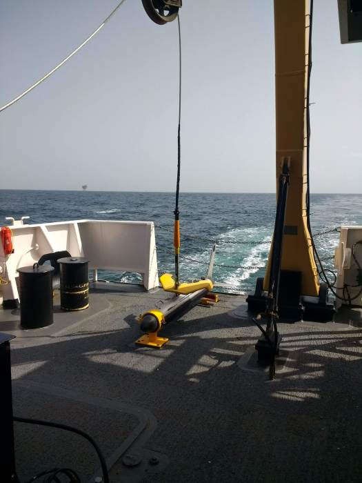
At this point I have been able to understand more of the sonar technology taking place during the survey aboard the Thomas Jefferson. The ship uses two types of sonar: multibeam and side scan. Both work together transmitting and receiving sound pulses to and from the ocean floor. This provides a multispectral analysis.
Julia Wallace, a physical scientist, works at the sonar acquisition station. This requires a large amount of multitasking as she communicates with the bridge (ship steering deck), watches the safety cameras, and makes sure both sonar devices are working correctly.
Multibeam sonar is located underneath the hull of the ship. Multibeam is used to detect bathymetry (the depth of the ocean floor). Multibeam backscatter (reflected wave energy) gives a reading of the surface intensity. For example, a strong signal would mean a harder surface like rock or pipeline. With multibeam sonar, you can also adjust the sound wave frequency. For example, high frequency (primarily used during this survey in the Gulf of Mexico) is used for shallower waters allowing for higher resolution images. Images from multibeam have a color gradient to allow for clear vision of contours and depth differences. One way surveyors aboard the TJ may use backscatter images is to determine areas where bottom sampling might be applicable.
A NOAA ship using mulitbeam sonar. (Courtesy of NOAA)
Bathymetry acquired using multibeam echosounder layered over a nautical chart. Blue and green wave lengths penetrate further in water, so the coloring corresponds to this observation. This poster is from a previous Thomas Jefferson hydrographic survey near Savannah, Georgia. (Prepared by CHST Allison Stone)
3D bathymetry imagery from the Okeanos Explorer. (NOAA)
A close-up view of multibeam data. The third window down shows multibeam backscatter.
The side scan sonar is used alongside multibeam to provide black and white scans of images. Like multibeam backscatter, side scan measures the intensity of the sound returning from the sea floor. For example, a side scan return with high intensity could indicate a difference in material like pipeline or a wreck. A low intensity value could mean that the side scan sonar waves have reached a muddy substrate. Julia used the analogy of a tennis ball being bounced against a wall of different materials. For example, the tennis ball hitting a concrete wall would bounce back with higher intensity than one being bounced against a soft wall. Side scan sonar is very effective at detecting features that protrude off the sea floor, and for shallow water surveys, typically can see farther and cover a greater area the sea floor than multibeam echosounders alone.
The side scan sonar sensor is located on a torpedo-shaped “towfish” and pulled behind the boat. When viewing side scan images, surveyors typically look for the acoustic shadow cast by a feature protruding off the sea floor. By measuring the length of the acoustic shadow, hydrographers can determine whether the feature requires additional investigation. For example, the outline of a shipwreck, bicycle, or pipeline. However, it can also detect mammals like dolphins or schools of fish.
Diagram of side scan sonar. (Courtesy of thunder bay 2001, Institute for Exploration, NOAA-OER)
The Thomas Jefferson sidescan sonar on deck.
In the early morning, the sidescan sonar picked up the image of an incorrectly charted shipwreck. Height is estimated using the “shadow” of the wreck.
Sidescan sonar imagery layered on a nautical chart. It is important to remember that sidescan data does not account for depth, it is a measure of differences in sea floor substrate.
Look closely and you can see arc lines in the sidescan imagery. Lt. Anthony Klemm explains that these arcs are from ships dragging anchor and stirring up the sea floor.
While this is happening, surveyors are also towing a MVP or Moving Vessel Profiler to capture information about the water column. This is important because multiple factors in the water column need to be corrected in order for accurate sonar calculations. For example, the speed of sound in salt water is roughly 1500 m/s but may change while the ship is traveling over different parts of the sea floor or passing through a thermocline (steep temperature gradient) or halocline (steep salinity gradient). The MVP is similar to the CTD used on the launch boat (see previous post), but the MVP allows the ship to continue moving at about 10 knots (average survey speed), while the CTD must be cast when the ship is stationary.
Information from the Moving Vessel Profiler. From left to right, the MVP tracks sound speed, temperature, and salinity in relation to depth.
For more information on multispectral analysis and sonar, see these resources:
One of my goals in the classroom is to teach students to be comfortable making and learning from mistakes. Making mistakes in math and science is common and welcome because they lead to great discussion and future change. Often, my sixth graders get discouraged or so caught up in failure that they become paralyzed in making further attempts. While aboard the Thomas Jefferson, I have witnessed several aspects not go according to plan. I think these experiences are important to share because they provide real-life examples of professionals coming together, learning from mistakes, and moving forward.
Around 4:00 am, the towfish side scan sonar became entangled with the MVP. This was a horrendous disaster. The crew spent about 16 hours contemplating the issue and collecting data using the multibeam only, which is less than ideal. One of XO LCDR McGovern’s many roles aboard the ship is to serve as the investigator. She reviewed tapes of the early morning, talked with the crew, and later held a debrief with all involved. When something like this happens, the ship must write a clear incident report to send to shore. There were many questions about why and how this happened as well how to best proceed. In the end, the towfish and MVP were untangled with no damage present to the sensor. Within the same day, both were cast out and back in use.
I find this to be an astounding example of perseverance and teamwork. Despite being disappointed and upset that a critical tool for collecting accurate data was in dire shape, the crew came up with a plan of action and executed. Part of the engineering and scientific processes include evaluation and redesign. Elements of the sea and a center drift of the side scan lead to a documented new plan and refiguring the process so that this is unlikely to happen again.
Lt. Charles Wisotzsky’s sketch of the complications with launching both the sidescan sonar (which tends to centerline) and MVP towfish with a current coming from port side.
This camera image captures the entanglement of the sidescan sonar and MVP.
Peaks
+Saw a tuna eat a flying fish
Flying Fish. (www.ocean.si.edu)
+There is a large sense of purpose on the ship. Despite complex sleep schedules to enable 24 hour operations with a smaller crew, people are generally happy and working hard.
+ There seems to be an unlimited supply of ice cream in the ice cream freezer. Junior Officer, ENS Garrison Grant introduced me to a new desert- vanilla ice cream, a scoop of crunchy peanut butter, and chocolate syrup. I also found the rainbow sprinkles.