Angela Hung: Fortitude, July 23, 2018

NOAA Teacher at Sea

Angela Hung

Aboard NOAA Ship Oregon II

June 27-July 5, 2018


Mission: SEAMAP Summer Groundfish Survey

Geographic Area of Cruise: Gulf of Mexico

Date: July 23, 2018


Weather Data from Home

Conditions at 2101

Latitude: 41.54°N

Longitude: 87.53°W

Temperature: 21° C

Wind Speed: N 3 mph


Science and Technology Log

Back at home but there’s still so much to share! I’ll wrap up my amazing experience as a Teacher at Sea by introducing three more members of the NOAA Ship Oregon II family: Alonzo Hamilton, Executive Officer Andrew Ostapenko and Commanding Officer Captain Dave Nelson. At the start of my adventure, I wrote about flexibility. The Teacher at Sea Program also stresses that cruises “require high-intensity work that demands physical adeptness, endurance, and fortitude”. These three exemplify how fortitude, the ability to endure through life’s challenges and change, brings rewards throughout life.


Fishery Biologist Alonzo Hamilton

Alonzo Hamilton, left, and Taniya Wallace, right, enter species into FSCS.

Alonzo Hamilton has been a fishery biologist for 34 years! He likes to say that he stumbled into NOAA. He graduated from community college before enrolling at Jackson State University, a historically black university in Mississippi with a full scholarship. Actually, he was offered two scholarships, one for minority biomedical researchers to become a surgeon and the other for general studies. He arrived on campus to discuss his options in the science department. It turned out that the biomedical research scholarship was given to another recipient. On the bright side, it made the decision to accept the general studies funding much simpler. Now he had to make a choice of which field to pursue. As he explored the halls of the science building, he happened upon the office of the head of the marine science program and popped in to ask some questions. After learning about the program, he decided to apply his scholarship toward coursework in this field.

After college, he began working on a research project for the Navy which paid for a master’s degree. Soon after, President Reagan froze research funding for the Navy. Fortunately, Alonzo was tipped off that NOAA did very similar research with an active, albeit smaller budget. So began a 34 year career as a NOAA fishery biologist.

Being an African American scientist in the deep south came with challenges, but he reminded his supervisors and others around him that, “I won’t limit myself to your box”, which has carried him through a long and storied career. Today, he is happy that he gets “paid to play in the ocean”, which sounds like a pretty good deal to me.


Executive Officer (XO) Andrew Ostapenko

Andrew Ostapenko
Andrew Ostapenko

Most of the NOAA Corp officers you meet have a degree in science. I had the fortune of sailing with one of the few who doesn’t— the XO, LCDR Andrew Ostapenko. XO has a degree in political science from the University of St. Thomas in St. Paul, Minnesota. His goal was to become a lawyer, but after considering the job prospects and the lifestyle—”no one ever calls lawyers when they are happy”, and they never retire —he looked into some other options. In 2005 he applied for the NOAA Corps. Although he didn’t have a science degree, the general education requirements at the University of St. Paul, which included calculus, chemistry and physics, met the NOAA Corps requirements.

Since joining NOAA, LCDR Ostapenko has held a variety of assignments. In Maryland he managed budgets and projects for the National Centers for Environmental Prediction, a part of the National Weather Service that provides forecasts for the nation. He worked in small boat life cycle management as a Port engineer/small boat officer in Norfolk, Virginia, disseminating policies across the NOAA fleet.

His sailing experience began on NOAA Ship Thomas Jefferson which performs hydrographic surveys that map the oceans to continuously update and improve nautical charts. He was a member of the first crew on NOAA Ship Reuben Lasker, accompanying her from Wisconsin where she was built to her homeport of San Diego. Last but not least, XO has been an augmenting officer for three months on NOAA Ship Oscar Dyson, another fisheries survey vessel based in Alaska where high seas and storms are a part of a normal day’s work.

NOAA assignments are three years for shore tours and two years for sea tours. LCDR Ostapenko currently has about a year left with Oregon II. As XO shows, there is no danger of getting stuck in mundane office job as a NOAA Corps officer.


The Captain

Captain Dave Nelson of NOAA Ship Oregon II

“Lunch is on me!” invites the captain if you arrive to the galley after him. Captain Dave Nelson is the commanding officer (CO) of NOAA Ship Oregon II, and he’s gone a long way to realize that title. This is his 10th year as the captain of Oregon II, but he’s worked onboard since 1993. He refers to himself as a “hawsepiper”, urging me to look it up on the internet. Informally, it means to have started at the bottom as a deckhand and working up to becoming a captain. Captain Nelson is a Mississippi native and grew up shrimping and fishing with his dad. After high school he went to work on commercial boats that bring supplies to oil rigs. After over a decade, he felt that he needed a plan for the future– a stable pensioned job. He serendipitously stopped into the NOAA office as he was driving by on a day that someone had just quit and there was an opening to fill. The rest is Oregon II history.

The progression as a civilian begins with being a deckhand and progressing to Chief Boatswain. It takes 750 days at sea to qualify for the first license, the 3rd Mate license administered by the U.S. Coast Guard. It then takes 1100 more days to be eligible to test for the Masters license to become a captain. In 2008 the prospective captain lived in Seattle on a NOAA ship for 12 weeks for a prep course for the Masters exam. At this point, it’d be almost 30 years since he had been a student; not only did he have to learn the material for the test, he also had to learn how to study again.  Soon-to-be Captain Nelson committed seven days a week for the entire 12 weeks to study and reviewing material to pass. He knew he wanted it.

CO Nelson’s joking attitude belies the pressure of being the captain of a ship. It’s a tremendous responsibility because he is accountable for everything, particularly the safety of everyone onboard. Every decision is made or approved by the captain and he sends reports to his supervisors every day.

He is one of a few captains in the NOAA fleet who is a civilian; most NOAA Commissioned officers rotate between boats every two years. This means that he is always training the new officers joining Oregon II from ensigns like Andy Fullerton and Chelsea Parrish to XO’s like Andrew Ostapenko. It takes a lot of patience; everyone comes in with different strengths, weaknesses and of course, personalities. The key, he says, is to “treat people like people” no matter who they are.


Personal Log

I somehow made it through almost three weeks living on Oregon II without falling down any stairs or tripping and landing on my face over a bulkhead door. Sure enough, it was hard to fall asleep at home without the rocking of the boat, but I’m happy to have my own shower again.

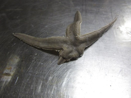
I’m so excited to show my students photos of so many of the things that I cover in class, or that they ask about, such as starfish regenerating lost arms and a video of wiggling tube feet on a severed arm (I accidently broke it off). I imagine they’ll also get to see critters they haven’t imagined-arrow and calico crabs, triggerfish, batfish…

A sea star that is regenerating its lower right arm.
A sea star that is regenerating its lower left arm.

I can’t believe how much I learned in such a short time about life and work at sea, careers, seafood, NOAA and its online resources. What I’ve shared in blogs is such a small fraction of everything I’ve experienced. I’m extremely grateful to everyone on Oregon II for being so welcoming and friendly, and for being so willing to speak with me. Although there were some setbacks, I got the chance to visit the lab and meet the wonderful scientists who showed me around. It’s hard work, but everyone agrees that it’s meaningful, rewarding and exciting.

Since coming home, my colleagues have commented that this is a once in a lifetime opportunity; that thought has crossed my mind as well. But watching everyone work, this is the everyday life of NOAA crew. I can’t help but think how few decisions it might have taken, maybe only 2-3 different choices, that might have made this my regular life too.


Did You Know?

NOAA Ship Oregon II earned the Gold Medal Award for rescuing three people off the coast of Cape Canaveral on Florida’s east coast. (This is where NASA’s Kennedy Space Center is located.) In 1998 when Captain Nelson was still a deckhand, he was woken from sleep between his watches. At about 2:30pm, a small overturned boat was spotted with a man, woman, and young girl on top. Captain Nelson was a small boat driver then; he launched a boat from Oregon II to rescue them and bring them to the Coast Guard.

NOAA Ship Oregon II earned the Gold Medal Award in 1998 for rescuing three people off of the coast of Florida.

Captain Dave surmises that they left port in Miami almost 200 miles south and got swept up in the Gulf Stream, a strong current of water that originates in the Gulf of Mexico and flows to Canada, affecting the climate even to Europe. It can create choppy conditions that capsized their boat.

The Gulf Stream is visible in red as it carries warm water from the south into the northern Atlantic. Photo from: https://en.wikipedia.org/wiki/Gulf_Stream#/media/File:Golfstrom.jpg

They were extraordinarily lucky; the ocean is vast so the chances of Oregon II coming by and being spotted were slim. Their boat was too small to be detected by radar; if it had been dark, they might have been run over. Those are three people who are alive today because of NOAA Ship Oregon II.

Angela Hung: The Sauce Bosses, July 4, 2018

NOAA Teacher at Sea

Angela Hung

Aboard NOAA Ship Oregon II

June 27-July 5, 2018


Mission: SEAMAP Summer Groundfish Survey

Geographic Area of Cruise: Gulf of Mexico

Date: July 4, 2018


Weather Data from the Bridge

Conditions at 2012

Latitude: 28° 36’ N

Longitude: 89° 26’ W

Relative Humidity: 75%

Temperature: 28.5° C

Wind Speed: 2.5 knots


Science and Technology Log

“Everyone’s a sauce boss on Oregon II.

-ENS Andy Fullerton


Happy Independence Day! Valerie and Arlene broke out the festive tablecloths, beads, an ice cream sundae bar and even some soda. In the fridge, there are a half a dozen types of mustard alone for midnight hot dogs on the Fourth. And always, each of the two tables in the galley is a stocked with its own assortment of about 20 hot sauces and seasonings.

The Fourth of July is often a day of transitions for me. In 1994, it was the day my family moved from Virginia to Florida. In 2014, it was the day I left New Mexico where I earned my graduate degree to Illinois. This year, I have the pleasure of spending the Fourth with the Oregon II family. The research is complete for this leg and we are heading back to land; after three weeks onboard, it feels like leaving another home.

The sauce bosses are about 30 men and women who work aboard NOAA Ship Oregon II: 20 crew and 10 scientists. Behind the scenes, or rather, below deck, the engineers are hard at work operating, refueling and otherwise monitoring the ship’s engines. Of course, these are the engines that propel the ship, but they also include the machinery that powers the winches on deck for trawls and CTD casts. They warm up the engines ahead of data collection so that the winches are ready when we reach each station. It’s another hard job on the boat; below deck in the engine rooms, even with air conditioning it can still reach over 40˚C or 110˚F. Shifts are four hours long and eight hours off so meals and sleep alternate with watches.

Vincent Perry is one of the engineers and was raised with the mindset that travelling and experiencing different cultures is an essential to a meaningful life. He joined the Navy which took him around the world to places like Japan and the Middle East. After retiring from the service, he joined NOAA to continue travelling by visiting different ports. Although the work is hard, he enjoys visiting new places and trying foods around the country. Another benefit of being crew is that the weeks spent at sea are balanced by weeks of leave between trips that he can spend with his family.

On deck, the Deck Department handle and deploy the trawl nets and CTD, including the winches. Many of these men also have Navy experience that allowed them to see the world while using the mariner skills that many from the Gulf coast learned as members of fishing families. Lead Fisherman Chris Nichols always had a strong sense of adventure, and was especially inspired by Rudyard Kipling’s novel, Captains Courageous, which he found among his father’s things when he was a boy. The novel is a story of a wealthy teen that falls off an ocean liner and is picked up by a fishing boat where he is eventually shaped into a hard working member of the crew. Following Naval service, Chris served as a US Merchant Marine, which are civilian mariners who transport cargo and passengers to Navy vessels. He also worked on charter fishing boats out of Florida and then joined NOAA and Oregon II’s crew.

Captains Courageous by Rudyard Kipling
Captains Courageous by Rudyard Kipling. Photo credit: amazon.com

NOAA Corps officers are primarily posted in the bridge. Although they are required to have science backgrounds and coursework, ship navigation is their primary duty; they chart our course from station to station and steer. Naturally, the bridge has the best view and crew often spend time there chatting with the officers if there isn’t too much traffic. However, at night when other fishing boats and defunct oil rigs are difficult to see, this can be a daunting task. Even during the day, navigating around the MANY oil rigs that dot the Gulf coastline makes this job less than straight forward.

The bridge of Oregon II boasts a number of “antique” parts, another reminder of its years of service. Today, alongside the table of paper charts are electronic counterparts. A raster navigation chart (RNC) computer system displays scans of paper maps. Next to that is the newest addition, the electronic navigation computer charting (ENC) system which is a clickable map that displays other ships and reports their bearings, information about geographic points such as depth if available. These and other data can be layered on the map and is continuously updated with new information.

A large radar screen is posted at either end of the bridge, one that detects larger ships and one that picks up signals from smaller boats. Even though the expanse of water seems large, traffic jams can still occur around busy ports. Executive Officer (XO) Andrew Ostapenko explains to me the stress-inducing calculations that continuously run through his head when he looks at the radar screens. The radar displays are able to show lines of where each boat will be in the next hour given each one’s speed and direction, thus showing if and when our paths would cross. It’s too busy on the screen to keep it that way, but it seems that’s the picture XO has running through his mind all the time. A large tanker over 20 miles away holds his attention because he can predict that we would cross paths in 45 minutes. That means you have start correcting your speed and bearing now to maintain a safe distance when we pass in 40 minutes to avoid a collision. That’s just one of at least 20 vessels clustered around New Orleans on the ENC screen and the weather is fair.

Newer instruments in Oregon II's bridge. Radar screen on left, electronic navigation charting system in the center, raster navigation charting system on right.
Newer instruments in Oregon II’s bridge. Radar screen on left, electronic navigation charting system in the center, raster navigation charting system on right.

They also drive the boat during trawls. When we come to a station, the officers bring the boat to a complete stop in order for us to launch the CTD. As soon as the CTD is back onboard, the trawl begins. There is a set procedure for the trawl and the wind direction is taken so the net doesn’t blow back towards the boat. The bridge, deck and scientists in the dry lab are in communication about the time and length of the trawl to coordinate the speed of the boat with each stage of the trawling process. The boat cruises at 5-5.5 knots to shoot the doors of the net, and slows to about 2.5 knots for the half hour during the trawl. We speed up slightly to 3.5 knots to haul back the net.

ENS Chelsea Parrish on the left with ENS Andy Fullerton on the left on watch in the bridge.

Navigation is mainly done be ENS Chelsea Parrish and ENS Andy Fullerton who are supervised by XO and CO, the commanding officer. ENS Fullerton grew up in Florida, but his adventurous spirit took him to Colby College in Maine; as far north as he could get from Florida without his mother having a “conniption fit”. He earned a bachelor’s degree in biology with a minor in environmental science and heard about NOAA in college. He applied to NOAA Corps and was accepted.

ENS Parrish comes from a military background, but would say she’s from Savannah, GA. Following a love of science took her through a Master’s degree in Marine Science at Savannah State University. She was introduced to NOAA in her first year of graduate school and decided to join.

NOAA officers rotate ship assignments every two years. Her term with Oregon II is coming to an end in the next few months, but she is looking forward to her new post in La Jolla, CA where she will be a drone pilot for marine mammal surveys. She found a great way to combine NOAA service with a more hands on way to do the science she loves.


 Personal Log

I’m not a “Star Trek” fan, but I feel like I finally understand the premise of the show. Research vessels such as NOAA Ship Oregon II are like the USS Enterprise’s of Earth, and there are many places on our planet where “no man has gone before”. However, Oregon II actually goes to the same places every year—the Gulf of Mexico and Caribbean–to create long term data sets, because we don’t know what kinds of changes might happen from year to year. Long term data helps scientists identify cause and effects of population explosions or crashes, for example of shrimp and plankton, and the effects of fishing practices on red snapper.

Anyway, Oregon II’s only mission is to support scientific study, and the entire crew, from the captain and NOAA officers in the bridge, to the deck crew operating the winches and launching the CTD, to the engineers monitoring and running the engines of the boat, winches, electrical, air conditioning, and everything in between, are seamlessly coordinated with scientists to conduct research. Scientists aren’t the only people who do science. The men and women aboard NOAA ship Oregon II, and the various ships in the fleet have found their different contributions to science through their particular skill sets. It’s inspiring to see people practice strong support for science with such a range of skill sets.

I was also reminded of “Gilligan’s Island”, of which I am a fan. For the younger readers, it’s a comedy show from the 1960s where seven people—a two man crew and five passengers, including “The Professor”— on a small charter boat get shipwrecked by a storm on an island during a “three hour tour”. The series is about the living they make on the island as their boat is beyond repair. In contrast to the SS Minnow, our story would follow a very different track, but still make a great TV show. Oregon II has been in NOAA’s service for just over 50 years, and that’s only part of its career. The ship itself is reliable in large part to the dedicated crew who keep her running. Many of them, including Captain Dave Nelson, have been with Oregon II for over 20 years! They are a close knit team, really family, that are the epitome of a well-oiled machine when they work. The remaining “passengers” on board are the scientist party who work in conjunction with the crew, many for a decade as well. And of course, there’s “Teach”, the current Teacher at Sea. Either the ship would be quickly repaired and back in Pascagoula before anyone noticed it wrecked, or, if they chose to stay, this team of 30 skilled people would build a pretty comfortable and sophisticated settlement on that tropical island.

Shiprecked on "Gilligan's Island".
Shiprecked on “Gilligan’s Island”. Phot from: https://www.rcgroups.com/forums/showthread.php?2728654-ss-minnow-studio-prop-from-gilligans-island

Fortunately for us, the second leg of the SEAMAP Summer Groundfish Survey went smoothly once we got going. When we pull back into port in Pascagoula, I get to see the workings of the machine one more time. The whole crew is on deck to dock the boat, reconnect to land-based utilities and hug their waiting families on land. Despite the invitations to stay for the third leg, I have to make way for the next Teach, but hopefully I’ll find a way back next year.


Did You Know?

Captain Dave Nelson is one of two civilian CO’s in the NOAA fleet. CO’s are usually NOAA Corp Commissioned officers. Like other NOAA Corp officers, a ship’s CO would rotate every two years to a different ship. Captain Nelson however, will spend his entire NOAA career of 30 years aboard Oregon II.

Angela Hung: “The Solution to Pollution is Dilution”, July 3, 2018

NOAA Teacher at Sea

Angela Hung

Aboard NOAA Ship Oregon II

June 27-July 5, 2018


Mission: SEAMAP Summer Groundfish Survey

Geographic Area of Cruise: Gulf of Mexico

Date: July 3, 2018


Weather Data from the Bridge

Conditions at 1610

Latitude: 29° 30’ N

Longitude: 92° 51’ W

Relative Humidity: 83%

Temperature: 26° C

Wind Speed: 13 knots

Cloudy with rain


Science and Technology Log

“The solution to pollution is dilution” was a common refrain during the midcentury as large scale factories became more common. This mindset applied to both air and water as both seemed limitless. Looking out over the Gulf of Mexico, a relatively small body of water, it’s easy to see how this logic prevailed. Even the Great Lakes, the largest body of fresh surface water in the world, accepted incalculable amounts of pollution and sewage from coastal factories, steel and wood mills, and of course major cities.

Sky and water as far as the eye can see. (It's hard to take a steady shot on a rocking boat!)
Sky and water in the Gulf of Mexico as far as the eye can see from the deck of NOAA Ship Oregon II. (It’s hard to take a steady shot on a rocking boat!)

The rise of the modern technological age that took humans to the moon gave us the first glimpse of the fallacy of the “solution”. “Earthrise” is the first photo of the entire Earth taken from space, showing us how thin our protective atmosphere really is and how delicately the Blue Planet floats in the vastness of space. This is the beginning of the modern environmental movement.

"Earthrise" Photo courtesy of nasa.gov
“Earthrise” Photo courtesy of nasa.gov

To truly guide the development of national policies including those that protect air and water quality, federal agencies such as NOAA are responsible for collecting data about our atmosphere and oceans, now knowing that these ecological compartments cannot endlessly dilute the pollution we generate. What seemed to be an obvious solution has today ballooned into a number of serious problems, from acid rain and blinding smog in cities to burning rivers, mass fish die offs that wash up on Lake Michigan beaches and dying coral reefs in the oceans.

The Cuyahoga River that runs through Cleveland, OH caught fire over a dozen times. This fire in 1969 finally motivated action towards creating the Clean Water Act.
The Cuyahoga River that runs through Cleveland, OH caught fire over a dozen times. This fire in 1969 finally motivated action towards creating the Clean Water Act. Photo from: https://www.alleghenyfront.org/how-a-burning-river-helped-create-the-clean-water-act/

A major pollutant in the Gulf is sourced from industrial agriculture practices from as far away as Illinois and the rest of the Midwest farm belt. Fertilizer and pesticides enter local rivers that find their way to the Mississippi River which carries contaminants into the Gulf of Mexico.

We have reached the Gulf’s “Dead Zone”, yielding a few tiny catches. Station W1601 may have given the smallest catch ever—a clump of seaweed and a whole shrimp.

The case of the shrinking trawls. On left, a catch from the night of July 2. Center and right, samples from two stations in hypoxic waters. The fish in the right photo may have been stuck in the net from the previous trawl.
The case of the shrinking trawls. On left, a catch from the night of July 2. Center and right, July 3 samples from two stations in hypoxic waters. The fish in the right photo may have been stuck in the net from the previous trawl.

Hypoxia literally means “low oxygen”. When fertilizers used to grow corn and soy enter bodies of water, they likewise feed the growth of algae, which are not technically plants but they are the aquatic equivalent. But plants make oxygen, how can this lead to low oxygen? Algae and land plants only produce oxygen during the day. At night, they consume oxygen gas through respiration. They do this during the day as well, but overall produce more oxygen in the light through photosynthesis. For hundreds of millions of years, that’s been fine, but the recent addition of fertilizers and the warm Gulf waters cause an explosion of the kind of microscopic algae that are suspended in the water column and turn water bright green, or red in the case of “red tides”. These explosions are called algal blooms.

Red tide. Photo credit: https://ocean.si.edu/ocean-life/plants-algae/red-tide

Algal blooms can cloud up water, making life hard for other photosynthetic organisms such as coral symbionts and larger seaweeds. At night, animals can suffocate without oxygen. During red tides, some algae release toxins that harm other life. When these organisms die and sink, bacteria go to work and decompose their bodies. The population of bacteria explodes, consuming the remaining oxygen at the sea floor. Animals that wander into the hypoxic zone also suffocate and die, feeding more decomposer bacteria that can survive with little to no oxygen. Thus, hypoxic areas are also called “dead zones”.  The hypoxic zone is just above the sea floor, as little as a half a meter above, and oxygen levels can drop precipitously within a meter of the bottom.

NOAA scientists including those conducting the SEAMAP Summer Groundfish survey on Oregon II track the location, size and movement of the Gulf hypoxic zone using the conductivity-temperature-dissolved oxygen probe, or CTD. The CTD is sent into the water before every trawl to take a variety of measurements. Besides conductivity (a measure of ions), temperature and oxygen, the CTD also checks the salinity, clarity and amount of photosynthetic pigments in the water, which gives an idea of plankton populations. Ours uses two different sensors for conductivity, salinity, temperature and oxygen, double-checking each other. A pump pulls water through the various sensors and the measurements are sent directly to a computer in the dry lab to record these data.

The CTD is lowered to just under the surface of the water to make sure the pump is working and to flush the system. Then it is lowered to within a meter of the bottom. The CTD also has an altimeter to measure the distance from the bottom, while the ship also uses sonar to determine the water depth at each station. Water is measured continuously as the CTD is lowered and raised, creating a graph that profiles the water column. Crewmen are on deck controlling the winches according to the directions from a scientist over the radio who is monitoring the water depth and measurements in the dry lab.

Conductivity, temperature, dissolved oxygen sensor (CTD). The gray cylinders are bottles that can store water samples.
Casting the CTD is a coordinated effort.

The CTD also has bottles that can store water samples so oxygen can be tested a third time in the lab onboard. When we only get a few fish where the CTD recorded normal oxygen, the CTD is launched again to verify oxygen levels using all three methods. In the CTD output, oxygen is coded in green as a line on the graph and in the data tables. Most stations read in the 5-6 range, the cutoff for hypoxia is 2. We are reading less than 1 in the Dead Zone.

CTD output. Depth is on the vertical axis and each measurement is scaled on the horizontal axis, showing how each variable changes as the CTD moves to the bottom and back to the surface.
Quadruple check on dissolved oxygen in Gulf waters the "old fashioned" way using a Winkler titration.
Triple check on dissolved oxygen in Gulf waters the “old fashioned” way using a Winkler titration.

 With storms in the path and not-so-plenty of fish in the sea, today is a slow day.


Personal Log

Looking out over the water, I can’t help but think how intrepid, even audacious, early mariners must have been. I know we are within a couple miles of the coast but there’s no sign of land anywhere in any direction. Even with the reassurance that satellites, radar, radios, AND trained NOAA Corps officers steering in the bridge are all keeping track of us, I still swallow a moment of panic. What kind of person decides to sail out in search of new continents when it only takes a couple hours to lose track of where you came from? And yet, the Polynesians set out thousands years ago in canoes from mainland Asia, the Aborigine ancestors managed to find Australia, and of course, Europeans sailed across the Atlantic to the Americas, whether they knew it or not. It was all possible through careful observations of the winds, waves, ocean currents, stars and other indications of direction, but I still have to think that that’s a pretty bold move when you don’t know if land lies ahead.

No land in sight.
No land in sight.

At least we’re not alone out here. These are some other animals that we’ll leave for the mammal survey and birders to count.


Did You Know?

The CTD also shows the layers of ocean water. Looking at the graph again for the red (salinity) and blue (temperature) lines, we can see where they cross at about 15 meters. This shows where colder, saltier water starts compared to the warm surface water that is diluted by fresh water and mixed by wind.

Angela Hung: “Don’t Give it A Knife!”, June 30, 2018

NOAA Teacher at Sea

Angela Hung

Aboard NOAA Ship Oregon II

June 27-July 5, 2018


Mission: SEAMAP Summer Groundfish Survey

Geographic Area of Cruise: Gulf of Mexico

Date: June 30, 2018


Weather Data from the Bridge

Conditions at 2112

Latitude: 28° 40’ N

Longitude: 95° 43’ W

Relative Humidity: 76%

Temperature: 28.4° C

Wind Speed: 18 knots


Science and Technology Log

What are groundfish? They are basically what they sound like, the fish that live in, on or near the bottom of a body of water. NOAA Ship Oregon II samples waters in coastal Gulf regions from Florida to Texas using an otter trawl net. Our net includes a “tickler chain” that moves just ahead of the opening to disturb the bottom sediment so that organisms swim up to be scooped up.

Diagram of an otter trawl net
Diagram of an otter trawl net used collect groundfish. Photo credit: http://www.fao.org/docrep/008/y7135e/y7135e06.htm

We tow for a short half hour at each station to get an idea of what species can be found at different locations. Fishing boats tow for much longer, hours at a time with larger nets. The cod end where the fish collect, is created by a knot beautifully tied by Chief Boatswain Tim Martin that holds during the tow but easily pulls open to release the catch which drops into large baskets. Tim works on the deck to launch the CTD (conductivity-temperature-dissolved oxygen probe) and the trawl net. The baskets are weighed and then dumped onto a conveyor belt to be sorted.

The otter trawl in action.
knot
This knot closes the net during a trawl but pulls open to release a catch.


We start by putting whatever looks alike together, which is much easier said than done. If it turns out to be tricky, the wet lab is equipped with a range of resource guides to reference. Once everything is sorted out, each species is individually sampled: the count of individuals, the total weight of that species, the lengths of up to 20 individuals, and the weight and sex of every fifth individual. This information is entered into Fisheries Scientific Computer Systems (FSCS) and added into a database that gets uploaded for public knowledge.

Everyone is lined up and sorting through fish. It's the first trawl of the cruise so the night shift got excited and joined us.
Everyone is lined up and sorting through fish. It’s the first trawl of the cruise so the night shift got excited and joined us.


For commercial species, such as shrimp and red snapper, every individual is measured and sexed; up to 200 for shrimp and up to 20 red snapper.

Shrimp and more shrimp. Brown shrimp, Farfantepenaeus aztecus to be specific!
Shrimp and more shrimp. Brown shrimp, Farfantepenaeus aztecus to be specific! NOAA’s FishWatch recommends them as a “smart seafood choice”. https://www.fishwatch.gov/profiles/brown-shrimp

It’s a lot of work, but data entry is relatively easy using a magnetic board. You line the specimen up at the end of the board and simply press the magnet at the end of the animal’s body. The board is connected to a computer and automatically sends the measurement when the magnet is pressed. The scale is also connected to a computer and sends that information directly. However, every species’ scientific name is manually entered into a list for each station before measurements are taken.


So many kinds of fish, but color is not a way to sort!

These data are primarily used by NOAA for stock assessments. By documenting species abundances, size and distribution, fishery managers can calculate catch quotas for the year that maintains healthy stocks. These data are also used by NOAA for their database to help you make sustainable seafood choices: https://www.fishwatch.gov/ .  It is also part of NOAA’s mission to be “Dedicated to the understanding and stewardship of the environment,” which is why everything that is captured is counted. Federal data are publicly available, so these surveys might be used by scientists to study a range of questions about any species that we counted, including the ecology of non-commercial species.

It’s really interesting to see exactly where seafood comes from. In the 10 miles or so between stations, the communities change drastically. Shrimp are abundant in east Texas, but not where blue crab start to appear in west Texas. It’s also interesting to see the different sizes (ages) of fish change between stations. One station brought in snapper over 10” long, while the next two stations delivered their 5-6” juveniles. Aside from that, I got the chance to handle so many species I’ve only seen on TV and never imagined that I would get to hold in my hand!


This slideshow requires JavaScript.


Blue crabs, Callinectes sapidus. The two upturned crabs are females carrying eggs.

“Don’t give it a knife!”

“Stop giving it things!”

-things you say when trying to separate blue crabs that are latched onto each other

It’s reassuring to see the Gulf teeming with gorgeous biological diversity as evidence that U.S. fisheries are responsibly managed and that we have a strong model of stewardship in our seas—SEAMAP Groundfish Survey literally only scratches the surface of the coastline.


Personal Log

The meals in the galley are great. Valerie McCaskill of Naples, FL and Arlene Beahm from Connecticut are the Stewards onboard and they work diligently to feed us delicious home cooked meals. I’ll be a few pounds heavier when you see me after this trip. “Arlene’s trying to kill you with food!” Tim observed. These two ladies are stand-in moms, making sure we have heaping plates at meal times and snack times and anytime in between.

Lunchtime
Finally got to eat some of the white shrimp we caught. And a whole steak for good measure. (Only the galley is allowed to take a part of the catch cook it for the ship.)

That’s a great thing because the 12 hour shifts work up an appetite. NOAA Ship Oregon II sails from one sampling station to the next, ranging from 5-12 miles in between, but as many as 20+ miles. On short runs, the next station comes up pretty quickly and we find ourselves finishing one just in time to start the next. We process four to five stations each shift with only short breaks during trawls.

It’s hugely humbling and an exercise in insecurity to watch the scientists work. At a glance they can recite the full scientific name of the hundreds of species that pour out of the net. I’ll be happy if I can come back with ten new species in my memory bank.

C. similis
Baby blue crabs? Nope, these are adult Callinectes similis, blue crabs are C. sapidus.

The researchers onboard have been doing this for years. Identifying species takes time and practice to learn like any other skill, and it showcases the dedication and fulfillment they find in this kind of work.

Alonzo Hamilton, left, and Taniya Wallace, right, enter species into FSCS.

It’s hot, dirty work.  There’s no air conditioning in the wet lab and around 1000+ fish can be brought aboard at a station. I, and probably everybody else within smelling range, am grateful to have hot showers and laundry onboard. Kristin Hannan emphasizes that “field work isn’t for everyone, but you don’t have to work in the field to study marine science.” But, the wet lab is where you witness the enthusiasm that brings the crew and the scientists back day after day in the heat of July, year after year. Squeals of excitement and giant grins appear with favorite species: Calappa crabs (I learned a name!), triggerfish, beautiful snail and clam shells, the infamous mantis shrimp, a chance sea anemone and of course sharks to name a few. Fisherman James Rhue, a crewman who works with Tim and operates the winches, comes to check out (as in play with) the catch a couple times a day; the fishing crew must be as skilled with identifications as the researchers—they do it during their off hours. During the half hour of the tow, we are often talking about plankton diversity in the dry lab.

Kristin Hannan, a shark researcher, pauses to examine a young hammerhead.

As satisfying as the work can be for some, the challenges certainly come with living on a relatively small boat built in a different time. While long overnight shifts sound tough, seasickness jumps to mind more readily when you say “boat”.  When you’re seasick, everyone volunteers a range of interesting remedies, from watching the horizon, which is qualified as BS; lying down; sleeping, which isn’t easy when you’re sick; eating to keep your stomach full, counterintuitive but actually a useful one; ginger candy; staying cool, which does not describe the wet lab; to just chewing on a chunk of raw ginger, distracting, I’m sure! The Teacher at Sea organizers recommend working to keep your mind off of the nausea. Arlene was also very kind and donated a couple of her seasickness patches to my cause. For me, standing outside and watching the waves for flying fish helped immensely in the few minutes between processing catches. And there is far too much work and creatures to see to think about my stomach.

The blue dots are sampling stations along the Texas coastline. The red line shows where we've been. Thankfully, we're not trying to hit every station, but there's plenty to do!
The blue dots are sampling stations along the Texas coastline. The red line shows where we’ve been. Thankfully, we’re not trying to hit every station, but there’s plenty to do!


Did You Know?

Although scientific names sound like gibberish, they are in Latin and often physical descriptions of the species. Portunus spinicarpus for example is a crab named for the long spike (spini) on its wrist (carpus).

P. spinicarpus
P. spinicarpus

Lagocephalus translates to “rabbit head”, the name given to the group of puffer fishes, but you might have to squint to see it.


Angela Hung: A Day in the Land Life, A Day at Sea, June 26, 2018

NOAA Teacher at Sea

Angela Hung

Aboard NOAA Ship Oregon II

June 27-July 5, 2018


Mission: SEAMAP Summer Groundfish Survey

Geographic Area of Cruise: Gulf of Mexico

Date: June 26, 2018


Weather Data from Biloxi, MS

Conditions at 1356

Latitude: 30.42° N

Longitude: 88.92° W

Temperature: 34° C

Wind Speed: S 10mph


Science and Technology Log

Ship repairs are ongoing so I’m reporting from Biloxi, MS. Last week, I got the chance to visit the NOAA Southeast Fisheries Science Center, Pascagoula lab onshore to learn about what the scientists do when they are not at sea.

NOAA Lab in Pascagoula, MS
NOAA Lab in Pascagoula, MS. Image credit: https://www.sefsc.noaa.gov/labs/mississippi/

I got to see the variety of projects described on their website (https://www.sefsc.noaa.gov/labs/mississippi/surveys/index.htm) , from video reef fish surveys (https://www.sefsc.noaa.gov/labs/mississippi/surveys/reeffish.htm#video) to seafood inspection, sharks, and the effects the Gulf oil spill from Deepwater Horizon on plankton in addition to groundfish survey. Chrissy Stepongzi, another fisheries biologist, was willing to take me on an impromptu tour of the warehouses at the pier and then brought me over to the labs.

The Labs

This slideshow requires JavaScript.

Andre and Taniya with the Southern Stingray
Andre and Taniya holding the stingray.

Because we spent so much time at the pier (below) Andre Debose took over the tour. We got a sneak peek at the seafood inspection lab. You need a pretty high clearance to get in, but we ran into a researcher (I didn’t get his name) who was kind enough to take a few minutes to explain what they do:

The U.S. imports a lot of seafood from overseas as well. All ready-to-eat seafood that comes in is inspected by NOAA. A sample from every batch is tested for contaminants and pollutants to ensure it is safe for consumption. We happened to be at the lab that inspects menhaden, a fish typically ground into “fish meal” which is commonly used in pet foods. The lab also checks fish oil, a dietary supplement. Down the hall are labs that inspect Gulf seafood for petroleum oil.  After speaking with him, I felt much more confident in my seafood dinners and my cats’ food.

We went down to the reef unit which Andre has worked on and was introduced to Kevin Rademacher who studies reef fish and was watching video data from their camera array. He showed me a few videos recorded from their past surveys. Today, they use an array of five video cameras to create a single, 360˚ field of view for accurate fish counts. Fisheries use these data to determine the health of a fishery, as in the population and sizes of commercially important fish. This information guides the quotas of how many fish people are allowed to take while maintaining resources for the future.

Up to a few years ago, they used four separate cameras—four different fields of view that had to be watched individually to count fish. The new setup also features two levels to create stereoscopic or 3-D images so scientists can digitally measure the lengths of the fish, which was not possible before. However, species identification is still done using good old-fashioned human eyeballs in an experienced scientist.

Down the hall is Kristin Hannan’s office, my day shift manager aboard Oregon II. She studies sharks, which are caught using longlines (https://www.sefsc.noaa.gov/labs/mississippi/surveys/longline.htm), and she let me examine her collection!

We stopped by the plankton lab. Plankton is a collective term for very small marine organisms—algae and animals that form the foundation of marine food chains. The very small animals are usually the larvae of larger animals, but I didn’t realize how many were vertebrates, i.e. baby fish. I had imagined that plankton were primarily invertebrates such as sea sponge, coral, crustacean and squid larvae.

A sample of fish larva that make up plankton.
A sample of fish larva that make up plankton. Photo credit: https://www.sefsc.noaa.gov/labs/mississippi/surveys/plankton.htm

Finally, Andre showed me his otolith samples. Otoliths are small bony disks in the ears of fish that allow them to sense gravity and speed, which maintains their balance. (Yes, fish have ears and earbones like humans.) A layer of calcium is added every year of a fish’s life so these give us data about the ages of fish.

Overall at NOAA’s Pascagoula labs, researchers are hard at work studying marine life in the Gulf of Mexico to learn where they are and when to find them, at every stage of life, from larval plankton, to juveniles, adults and to food for others such as sharks and dolphins. While “economic” species are the focus of fisheries industries, “ecological” species are deservedly monitored here as well. In such a vast ecosystem, every organism has hundreds or likely thousands of ecological ties to those around it, as predator, prey, competitors or symbiotic partners. Humans aren’t the only ones who enjoy crab legs and fish sticks for dinner. As biologist Alonzo Hamilton puts it, “fish are a product of the environment”, referring to the collective forces that create an ecosystem.

To top off the lab visit, I was presented with a fabulous goody bag! I have some great materials to use in class, and I’m particularly grateful for the coffee mug so I can stop using paper cups in the ship’s galley.

Goody bag from Pascagoula Lab

The Warehouse

So where does all this equipment for these different projects come from? Sadly, there isn’t a “science store” for weird and wonderful devices that seamlessly combine into “cutting edge technology”. I mentioned in the last post that scientists often have to build what they need.  In fact, part of NOAA’s mission to support sustainable fishery practices is inventing the tools to fish sustainably! They may not have a store to go shopping in, but they have something much better: Captain James Barbour, master welder extraordinaire! (His actual title is something like Engineering Tech/Gear & Equipment Specialist.)

Chrissy took me to visit him in the warehouses and that was a fun place! We walked into his current project—a stainless steel work table for a scientist, but custom built to include clipboard hangers, blood sample holder, holes for hand sanitizer bottles…like a home renovation show but for research vessels.

The camera arrays for reef survey are his handiwork. He’s built traps with camera housing to record what’s going on under water. He has also modified smaller boats to create platforms for scientists to safely wrangle fish, and apparatuses to operate nets and other equipment. He is steeped in the design of TEDs-turtle excluder devices, and bycatch reducers. Bycatch are animal species that are caught with commercial ones, especially by nets. Often, these are not returned alive to the ocean. TEDs are metal, circular grids about three feet across that are attached to the end of fishing nets, forming a cone. When a turtle is caught, it hits the excluder and slides out of an escape chute. Fish pass through the excluder and into the blind end of the net.

If you have ever heard or worried about sea turtles or wasted bycatch getting trapped in nets, rest assured that U.S. fisheries are using these devices to reduce their environmental impact. And chances are Capt. Barbour welded them!

This is just a small sample of what he’s accomplished in his long career at NOAA. He continues his research with other scientists to collect data and improve the design, for example, to screen out smaller turtles without sacrificing the fish catch.

As a scientist observing the decline in science literacy and confidence from the general public, I often come across the Strawman fallacy that “science has no place in politics”. This doesn’t make sense considering the various U.S. agencies that employ scientists to make discoveries about our world and outside of it, because objective knowledge is where sound policies should originate. Science has always has an important role in American politics. Another classic are the cries for “less government regulation and interference” but I’m certain those people have no idea what that means. In U.S. seafood industries, regulations require TEDs and bycatch reducers because ecological species support the health of economic ones. In U.S. markets, regulations require safety testing of seafood imports. In Gulf fisheries, regulations limit how many red snapper one can take and when shrimpers can open season because this ensures consumers can enjoy seafood next year and every year after. They ensure that fisherman have employment next year and every year after. Government, as well as university, scientists are third party to all companies and have no personal financial incentives besides their regular salaries. Scientists are public servants who work for everyone.

Captain Barbour is a modest man, but it’s clear that he takes pride in the devices he builds because he accepts the responsibility of humans to be stewards of this planet and the other creatures we share it with. Thus, he genuinely cares about the well-being of dolphins and turtles. He takes personal action for what he believes by coming to work everyday and engages with optimizing the design of scientific equipment by communicating with collaborators, analyzing data, and building with his own hands. While most of us don’t get to be so directly involved with our contributions to society there are two things to think about:

  1. The NOAA is recruiting (quite a few retirements are coming up). College students can try out through an internship: https://coastalscience.noaa.gov/about/internship/
  2. All of us together through our own strengths can make many small actions great: refuse those single use plastics, recycle always, VOTE (or don’t complain), and practice lifelong learning.


Personal Log

At about 1500 on the first day of the survey, I find out that I’m assigned to the day shift that runs from 1200 to 2400. Roommates are assigned with opposite shifts so that each person can have the stateroom while the other works. Typically, you have a backpack to carry anything you might need to avoid entering the room and disturbing a sleeping roommate. The operations of the vessel are 24 hours and other members of the crew work different shifts around the clock: engineers might be scheduled six hours on, six hours off, officers four hours on/off, etc.

“Someone is sleeping all the time on every deck.” –LT Ryan Belcher

So, on day one, my roommate tries to get some sleep and I’m out of the room. For the rest of the day, I experience something called “down time” with nothing really to do. I don’t know when the last time this happened was. Everyone is busy at work or sleeping before their shift and I find myself curiously alone. I find my way back to a higher deck that Chrissy had shown me earlier where a deck chair (no pun intended) has been stashed. The indoor lounge features a large collection of movies on loan from the Navy, including recent releases. After I come in from spending some time relaxing outside, I reenter the lounge to find some of the scientists starting Justice League. When that finishes, we put in Winchester which is inspired by the true story, whatever that means, of the famous haunted house built by Sarah Winchester of the family that developed rifles. Not too bad if you are a fan of ghost stories.

Justice League and Winchester
Justice League. Image from: https://www.warnerbros.com/justice-league; Winchester: The House that Ghosts Built. Image from: http://www.impawards.com/2018/winchester_the_house_that_ghosts_built_ver6.html


It’s a long day and I finally get to go to bed.

Did You Know?

From the last blog we learned that NOAA is a Department of Commerce (DOC) agency that collects scientific data for economic purposes. On this cruise, and those of the past 40 years, Texas shrimp fisheries use NOAA data collected by Oregon II to determine when to open shrimping grounds every year to ensure a sustainable supply. NOAA Ship Oregon II also trawls during the summer for red snapper for fisheries around the entire Gulf to determine when fishing can begin.

Angela Hung: Flexibility, June 22, 2018

NOAA Teacher at Sea

Angela Hung

Aboard NOAA Ship Oregon II

June 22-July 5, 2018

June 19-July 5, 2018

June 23-July 5, 2018

Mission: SEAMAP Summer Groundfish Survey

Geographic Area of Cruise: Gulf of Mexico

Date: June 22, 2018

Weather Data from the Bridge

(Actually from weather.gov, the program in the bridge is off)

Conditions at 1454

Latitude: 30.46° N

Longitude: 88.53° W

Temperature: 34° C

Wind Speed: SW 12 mph

Science and Technology Log

Taniya Wallace-Chief Scientist, Fisheries Biologist

If you enjoy a good seafood steam pot or boil—overflowing with shrimp, crabs, clams and corn and potatoes mixed in, rounded out with fish filets blackened/broiled/fried to your preference—then you have to thank hardworking scientists like Taniya Wallace. Taniya is a fisheries biologist and is the Chief Scientist aboard Oregon II for this leg of the 2018 SEAMAP Summer Groundfish Survey. On top of assessing the health of the Gulf fisheries that feeds Americans across the country, she is busy coordinating the group of scientists that form the research party on the boat. The specifics of the research will follow in upcoming posts, but today, I’d like you to meet a scientist.

Taniya Wallace
Taniya entering data into the computer.

Taniya was certain of becoming a nurse. Her high school offered vocational coursework in nursing to give students an early start into college degree programs. She was on track, until it came to clinicals. Nursing clinicals are the part of the program where students begin their training in real work settings to apply what is learned in the classroom. More importantly, clinicals introduces students to the realities of the job.

Nurses are among the ranks of hard working, underappreciated sectors of the health field because much of what they do goes unseen. For many in pre-nursing and nursing programs, clinicals ensures that students are experiencing what they are signing up for. For Taniya Wallace, her experience during this class compelled her to make the difficult decision to pursue a different program of study.

Taniya was accepted in Mississippi Valley State University, a historically black university, where she earned her bachelor’s degree in biology with a minor in chemistry. She began a position as a laboratory scientist until the 2010 explosion on the Deepwater Horizon oil drilling rig that caused 11 deaths and the largest oil spill in history. Four million barrels of oil flowed into the Gulf of Mexico over three months before the underwater well was finally capped.

Taniya has always loved the water, and had previously shadowed her cousin who is also a marine scientist. Her aunt builds boats for Austal Shipyard in Alabama and her father works at Ingalls Shipbuilding in Pascagoula, MS, the very company that built Oregon II. With an urgent need to study the critical impacts of crude petroleum oil on the Gulf ecosystems, an opportunity on Oregon II was a natural fit. Taniya signed a three month contract–she’s been here ever since.

Plaque aboard Oregon II

What has kept her going for eight years? As a scientist on a ship, she sees “something new every day” on the boat and on land when they stop at different ports. With a love of water, working in a lab at sea is a win-win.

Personal Log

The Teacher at Sea Program emphasizes to applicants that “flexibility and the ability to cope with the uncertain is crucial to the character of those who go to sea.” Taniya Wallace demonstrates this quality by shifting to a research program in college, joining NOAA Ship Oregon II, and by working at sea.

It is no exaggeration that flexibility is a requirement for working on a boat. In fact, I was scheduled to participate in the second leg of the SEAMAP summer groundfish survey on June 21, departing from Galveston, TX on the 22nd. Unfortunately, the trawl winch broke during the first leg (the first time ever for Oregon II which has been sailing for 50 years!), cutting their trip short. To try to make up the time, it was decided that the second leg would get an early start from Mississippi as soon as repairs were completed in Pascagoula, MS.

What originally was a week to get packed, find a plant sitter and cuddle with my cats became a last minute scramble to find rain boots and mow the lawn in the middle of a heat wave—I boarded a plane to Gulfport, MS on June 18 instead. (It was explained that this was not the typical direction in scheduling shifts.) I got to meet some of the fantastic crew members of Oregon II, as well as from neighboring Gordon Gunter, who invited me to play corn hole for the first time. This is the game where you are trying to throw bean bags through a hole cut in a plywood board that’s set on an incline.  I spent the night on the boat in port.


The boat bustled the next morning as everyone arrived: crew, scientists and a couple of interns. [Find your internship here! https://coastalscience.noaa.gov/about/internship/  ] At 1400, we were off!

There’s the requisite training and safety information for the ship in general. Taniya took over the interns and me for science brief. I learn that I’m assigned to the day shift which begins at 1200 noon the next day. Night shift starts at 2400 midnight that same day. The operations of the ship are 24 hours. It’s a long wait to get started and I’m looking forward to it.

We spend a night out at sea and I’m up and ready to sort some fish and shrimp. When I get to the galley, I find out that we are in fact, returning to Pascagoula because the trawl winch wasn’t fully repaired.

While issues like this are rare on Oregon II, a vessel that is widely regarded as extremely reliable, the process of science frequently hits stumbling blocks. TV shows like CSI and Bones and movies like Jurassic Park feature futuristic laboratories with state-of-the-art, if wildly impractical, equipment with colorful liquids, holograms, and scientists in lab coats and goggles who complete experiments in mere minutes. In reality, science is a lot messier and SLOWER. While wiling away the time today, I learned about a new hashtag for scientists full of internet examples: #badstockphotosofmyjob.

Real labs tend to have old equipment, space is limited so rooms are often crowded with large machines and many computers, and most liquids are colorless, stored in small, like the size of your pinky, tubes in a refrigerator or freezer. Particularly if you work outside, aka “the field”, and even if you don’t, a lot of equipment might be jerry-rigged from things picked up at Wal-Mart or Home Depot. Not to say that science is unreliable or not credible, but that projects are unique and a lot of times, you have to be creative and build what you specifically need. Then modify it until it works.


So here we are in a typical day of a scientist. A piece of equipment isn’t working, we’re losing data collection by the minute, but remember, we’re going to be flexible.

Did You Know?

The National Oceanic and Atmospheric Administration (NOAA) is operated by the U.S. Department of Commerce, which is tasked with promoting job creation and economic growth by providing tools and programs for the scientific collection and analysis of data. NOAA is one of these scientific research agencies employing scientists to study the atmosphere to provide us with weather and climate data, and the oceans, providing information for the operation of fisheries, for example. Good policies are informed by basic research, making the work of these agencies invaluable to the US economy.

Angela Hung: The First Day of Summer, June 12, 2018

NOAA Teacher at Sea

Angela Hung

Aboard NOAA Ship Oregon II

June 19-July 5, 2018


Mission: SEAMAP Summer Groundfish Survey

Geographic Area of Cruise: Gulf of Mexico

Date: June 12, 2018


Weather Data from Prairie State College

Conditions at 1510

Latitude: 41.45° N

Longitude: 87.53° W

Temperature: 26° C

Wind Speed: S 6mph


Science and Technology Log

How did we decide that June 21 is the first day of summer? Is this the day the pool opens? Is it the hottest day of the year? The critical date when students have de-stressed from the last school year and the next still seems far away?

In fact, the first day of summer says a lot about planet Earth’s annual journey around the sun. June 21 (sometimes June 20) is also called the Summer Solstice—the longest day of the year in the Northern Hemisphere. Because Earth rotates on a tilted axis, this is the day that the North Pole is most directly pointed at the sun. From our view on the ground in Chicago Heights, the sun appears farthest north in the sky.

The seasons are a result of the Earth's tilted axis as it travels around the sun. Summer Solstice occurs between June 20-22 when the North pole is tilted towards the sun.
The seasons are a result of the Earth’s tilted axis as it travels around the sun. Summer Solstice occurs between June 20-22 when the North pole is tilted towards the sun. Image credit: NOAA National Weather Service, https://www.weather.gov/cle/seasons

Conversely, winter begins on a solstice as well—the shortest day of the year when the planet is leaning away from the sun. In between, Spring and Fall correspond to “equinoxes”, the days when night and day are “equal” or roughly the same lengths.

It follows that in the Southern Hemisphere, the seasons are reversed. On June 21 while the North Pole is soaking in the sun, the South pole is in the shadows for the longest night of the year. A common misconception is that summer is when the entire Earth is close to the sun in an elliptical orbit and winter is when the planet is far away. If this was true, the Northern and Southern hemispheres would experience winter and summer at the same time. Actually, Earth’s orbit is fairly circular and the planet as a whole remains the same distance all year. Only the poles change their relative positions to the sun.


Introductory Personal Log

June 21 is a bittersweet day for me. As an avid gardener, the flip side of the Summer Solstice is that the days begin to get shorter and shorter until December 21. I start accounting foot by foot around the yard where “full sun” areas disappear and the infamous Chicago winter looms ahead. But this year, the Solstice brings a new excitement. Next week, Earth’s and my summer officially begins with a trip to Pascagoula, Mississippi to begin the second leg of the SEAMAP (Southeast Area Monitoring and Assessment Program) Summer Groundfish Survey aboard NOAA Ship Oregon II. Oregon II is a research ship that surveys various types of marine life in the Gulf of Mexico, Atlantic Ocean and Caribbean Sea. I can’t think of a better way to spend summer in these bodies of water.


How would I know about the Gulf, Atlantic and the Caribbean? I’ve lived in a few places around the U.S. My early childhood was spent in northern Virginia before moving to Florida where I stayed until I left for graduate school. That took me to New Mexico (truly enchanting!) and my current position brought me here to the south suburbs of Chicago, Illinois. My parents still live in Florida by the Indian River on a barrier island in the Atlantic Ocean. My bachelor’s degree is from New College of Florida which sits on a bay in the shimmering Gulf of Mexico. I haven’t had the pleasure of living in the Caribbean, but I have visited a couple of times.


[Break to answer the burning questions on everyone’s minds]

Florida its has drawbacks to beaches, such as the crushing summer humidity, hurricanes, mosquitoes, giant spiders–it’s not that hard to leave.

New Mexico is amazingly beautiful, boasting the best sunsets in the country. There are more plants, less oxygen and colder winters than you think. The elevation in Albuquerque is over 5,000 feet rising to 10,000 feet in the Sandias Mountains that border the city. I learned to ski here.

I like Chicago, the native wildflowers are the most impressive I’ve ever seen. The cold, dark winter, which aren’t terribly worse than Albuquerque, is balanced by fall leaves and an invigorating appreciation for spring as everything seems to rise from the dead. Hence the keen interest in solstices and equinoxes. Finally, Northeast Illinois is strongly nostalgic. The climate, plants and animals are very similar to Virginia so I actually often feel like a kid again.

I’m a biology professor at Prairie State College. We are a community college located 30 miles south of Chicago. While my educational background is in animal behavior and ecology, my graduate research spanned genetics, cell biology and immunology. Biologists often say they prefer cells or organismal biology over the other, but it is important to study the parts and the whole of any study organism, both of which respond to the ecological context. I typically teach Organismal Biology, which surveys the diversity of life on Earth with an introduction to ecology and evolution, and Environmental Biology. This fall, Cell and Molecular Biology will be added to my regular course rotation.

Community colleges are dedicated teaching institutions. However, Prairie State College supports faculty who engage with students outside of the classroom through research. I teach full time but I sometimes have the privilege of mentoring a research student. This past spring, my mentee won First Place in the STEM (Science, Technology, Engineering and Math) Skyway Poster Competition! Community college students in the region present their original projects which are judged by scientist volunteers from Argonne National Lab.

Tylar tested different types of alternative plant growing systems such as hydroponics and aeroponics to grow lettuce. He is committed to developing and promoting practices that reduce the environmental impact of industrial agriculture while meeting the needs of a growing world population. My experience as a Teacher at Sea in the Gulf of Mexico is timely because agriculture in Illinois generates pollution that ultimately impacts the marine ecosystems of the Gulf. Additionally, his project is now a teaching tool that I can use in each of my classes along with what we learn on Oregon II.


Let’s get summer started!