Jenny Hartigan: Whales and Birds Everywhere! July 23, 2017

NOAA Teacher at Sea
Jenny Hartigan
Aboard NOAA Ship R/V Fulmar
July 21 – July 28, 2017


Mission:  Applied California Current Ecosystem Studies: Bird, mammal, zooplankton, and water column survey

Geographic Area: North-central California

Date: July 23

Weather Data from the Bridge:

Latitude: 37.8591° N,

Longitude: 122.4853° W

Time: 0700

Sky: 100% cloud cover

Visibility: 8 nautical miles

Wind Direction: NW

Wind speed: 10-20 knots

Sea wave height: 2-4 feet

NW Swell 7-9 feet at 8 seconds

Barometric pressure: 30.02 inches

Sea Water Temperature: 58.6

Air Temperature: 52 degrees F

Wind Chill: 34 degrees F

Rainfall: 0mm

Scientific Log:

Saturday was my first day out, and it was an excellent day for wildlife observation. In fact, that is what I did for most of the day. A highlight of my day was seeing two blue whales spouting right in front of the Fulmar. I tried to get a photo, but they went below the surface quickly. Blue whales are the largest marine mammals, averaging 20-25meters long and blue grey in color. It is called a cetacean, which means it has flukes, (tail fin), and may or may not have a dorsal fin (the fin on the back or top of the body.) This is in contrast to pinnipeds, which are marine mammals that use their flippers to walk. The blue whale is a baleen whale, which feeds by chasing prey up to the surface of the water. There it forages by swimming with its mouth open to catch small invertebrates such as krill and copepods. The baleen in its mouth filters out the invertebrates from the water.

The whale we saw most often was the humpback whale. This baleen whale averages 11-13 meters in length, and is dark grey to black in color. I was so excited to observe 3 tail flukes of humpbacks today!

The scientists spotting marine mammals from the flying bridge.


Cassin’s auklets and humpback whales – Video credit: J. Jahncke/NOAA/Point Blue/ACCESS

Marine mammals seen Saturday:

6 blue whales

23 humpback whales

22 unknown whales

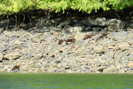
several harbor porpoise

4 California sea lions


Layman’s albatross – Video credit: J. Jahncke/NOAA/Point Blue/ACCESS

Birds seen Saturday:

Cassin’s auklets

Black–footed albatross, layman’s albatross

Western gulls

Hearman’s gull

Common murre – including the first murre chicks of the season the ACCESS crew has sighted.

Many marine animals tend to be found where upwelling occurs. Deep ocean nutrient-filled waters are brought to the surface by changes in sea floor topography, winds and currents. These nutrients fertilize phytoplankton (tiny plant life) that serves as the base of the food web. Whales return to these areas to feed on the small invertebrates that flourish there. These hotspots occur just off the Ca Coast. Protecting and managing these ecosystems is one major reason we have established National Marine Sanctuaries such as The Greater Farallones National Marine Sanctuary, Cordell Bank, and Monterey Bay. In a later post, I’ll tell you more about the procedures the scientists use to observe and record the mammal and bird sightings.

Personal Log:

That’s me, in front of the Fulmar!

I settled into my berth onboard the R/V Fulmar. The ship can sleep 10 people, has a galley (shipspeak for kitchen), a wet lab (place to conduct experiments that are wet!) and one head (shipspeak for bathroom). Although the ship is only 67 feet long, the scientist and crew work together so efficiently that it is very comfortable. It has everything we need. I am rooming with Dani Lipski, who is one of the scientists. I’m on the bottom bunk. I’ll introduce her to you later on. She has spent a lot of time teaching me how to use the equipment to take samples. She has graciously answered my millions of questions!

My bunk on the bottom. Do you see the ladder to the escape hatch on the right?

I am delighted to find that I am not feeling seasick. My doctor did prescribe me the patch to wear behind my ear, and I guess it’s working! In any case, I’m not taking it off to test it out. We have had some pretty bumpy experiences transiting to sampling sites and so far so good.I have learned to always keep one hand on the boat when walking around, and not to go below deck when the ship is moving. It surprises me to experience what a workout my legs are getting simply by working to maintain my balance. Even while sitting here writing on my computer I have to constantly engage my legs so I don’t fall over.

Did you know?

The Traffic Separation Scheme (TSS) separates ship traffic going in opposite directions, much like a median strip separates opposing lanes of cars on a freeway. The TSS is marked on nautical charts so that traffic proceeds safely.

I love hearing from you. Keep those comments coming!

Helen Haskell: Watching the Wildlife, June 15, 2017

NOAA Teacher at Sea

Helen Haskell

Aboard NOAA Ship Fairweather

June 5 – 26, 2017


Mission: Hydro Survey

Geographic Area of Cruise: Southeast Alaska – West Prince of Wales Island Hydro Survey

Date: June 15, 2017

Weather Data:

Wind: 3 knots from the west

Visibility: 6 nautical miles

Barometer: 997.6 hPa

Air temperature: 9°C

Cloud: 100% cover, 1000’

Location:

54°54.4’N 132°52.3’W

Science and Technology Log:

While Fairweather is a hydrographic research ship, responsible for collecting data for navigational charts, one of the side reports the survey crew makes is a Marine Mammal Observation Log. When a marine mammal is spotted on a survey, its location is noted, the species is identified if possible and notes about the numbers, behavior and any other observations are documented. Along with documenting sightings of these animals, the coxswains also follow protocols for minimizing disturbance and impact to these creatures.

Since joining this leg of the hydrographic research, humpback whales (Megaptera novaeangilae) have been the most numerous whale species seen. These whales that spend the summer in South-east Alaska winter mainly in Hawaii. Mating happens during the winter and the calves are born 11 months later. The calves stay with their mother for about 11 months after they are born. Individuals can grow up to 60 feet in length and live 50 years. These large grey whales have numerous barnacles that attach to their skin and filter feed as the whale travels. It is thought that the whales find shallower rocky areas to swim alongside in order to rub off the barnacles. It was in some of the shallower survey areas that I first saw humpbacks.


Harbor seals have fast become one of my favorites during my time here in Alaska. Growing to about six feet in length, the harbor seal, Phoca vitulina, have a diet of shellfish, crustaceans and fish and appear to be non-migratory, staying here year round. They are grey in color and can weigh up to 250 lbs as a mature male. Data seems to suggest that in some areas of their range in Alaska, the populations are declining but in other areas, seem stable. As the seals give birth in the summer, we’ve been fortunate enough to see seal pups too on this leg of the research.


The Northern sea otter, Enhydra lutris kenyoni, has perhaps been the most numerous marine mammal so far on this trip. Appearing small next to the seals and whales, upon reading more about them, I learned that they not small creatures, as they measure up to five feet in length and weigh up to 100 lbs. Feasting on a diet of invertebrates, such as clams and sea urchins, the sea otters are often spotted floating on their backs and are often associated with kelp beds. The otter fur trade began in the 1700’s and by 1900 populations were on the brink of extinction. Legislation has allowed the populations to rebound in most areas in the last 100 years, and they are seen regularly by survey crews and from the bridge.


Another species I saw here, up a small shallow cove, was the river otter, Lutra Canadensis. Five heads popped up in front of me and then bobbed under. Seconds later the otters were up on land running in to the trees. Seemingly fast and sleek, they were not acting like sea otters. It was not any behavior we had observed before. A little bit of research confirmed our suspicions that these were indeed river otters. Sea otters rarely come out on land, and when they do, do not move swiftly, having more flipper-like back legs, making land movement more arduous. River otters are smaller than sea otters weighing up to 35lbs and are 40-60 inches in length.

IMG_0109

While obviously not a marine mammal, the bald eagle is pretty much a guaranteed daily sight as the surveys are being done. A friend referred to the bald eagle as an Alaskan pigeon, and while I have not experienced as many bird species or numbers of birds here as I thought I would, the eagle has been one of the main species sighted. With an estimated population of 30,000 in Alaska, more numerous here than any other state, that hasn’t always been the case. With bounties on them at the turn of the 20th century, and population reductions due to pesticides and habitat loss, especially in the lower 48 states, the bald eagle, Haliaeetus leucocephalus, was put on the Endangered Species List in 1967. Measures put in place both locally and nationally have been so successful that in 2007 the bald eagle was removed from the Endangered Species List.


Another species I have seen regularly but not up at close range, is the Marbled Murrelet, Brachyramphus marmoratus. These small, almost 10 inch long marine birds are in breeding plumage right now and, although they have been hard to see, due to distance and poor light conditions in the rain, are beautiful shades of brown and cinnamon. They build nests here in southeast Alaska in the mossy branches of old growth conifer trees or on the ground.

IMG_0346
A little blurry but here are the Marbled Murrelets


Personal log

While it’s easy to get sidetracked with the mammals and birds here, there is a host of other species here that play significant roles in the food web. Kelp has been one of the organisms that I’ve seen a lot while doing the small boat surveys, and on our first completely sunny day, I got the chance to get up close and personal with the kelp from the vantage point of a kayak. The Fairweather has several kayaks that on occasion the crew uses to explore the local area. Together with NOAA Corps Junior Officer ENS Peter Siegenthaler and Hollings scholar Carly Laroche, we filed a Small Boat Plan with the bridge, stating where we were going and our anticipated return time, picked up radios, and carried the kayaks down from the top deck. It’s a little tricky to get a small kayak in the water from a large ship, but with the help of a small boat, we launched and paddled, in almost glassy water, over towards the shoreline.

FullSizeRender (1)
Me in one of the kayaks

Being even closer to the water in a shallow keel-less boat, allowed us to paddle through those kelp forests, pick up the otter-opened clamshells and explore the intertidal community much more easily. We were also able get close to some of the terrestrial species, the Sitka spruce and the other trees species growing vertically out of often steep slopes, right down to the high tide mark. We paddled along these inter-tidal edges listening to hermit thrush sing from the trees up the hillsides as we debated how logging companies actually cuts trees on such steep slopes. It was a glorious day, a rare sunny, calm day in the early summer of southeast Alaska, and perfect for paddling. This area is filled with small islands and coves, waiting to be explored, especially at low tide, when more inter-tidal life is exposed. My fingers are crossed that the weather and water conditions will allow for more explorations by kayak before I have to leave Fairweather in Kodiak.


Fact of the day: KELP

There are three species of kelp found here in southeast Alaska: bull kelp, ribbon kelp and sugar kelp. Kelp is an algae, not a plant, although it does photosynthesize. It is an essential part of the ecosystem here and many species are dependent on it.

Word of the day: Baleen

Humpbacks are a baleen whale, meaning that they have these plates, up to 600, make out of a substance called keratin in their mouths that act as filters in feeding. The keratin is referred to as baleen and is similar to our fingernails. In an earlier blog posting I held up a piece of baleen in an art store in Ketchikan. Below is a picture of baskets woven out of strips of baleen.

IMG_0122

What is this?

(Previous post: The picture is of the sonar equipment on the bottom of the small boats).

IMG_0147

Jeannine Foucault, November 17, 2009

NOAA Teacher at Sea
Jeannine Foucault
Onboard NOAA Ship Pisces
November 7 – 19, 2009

Mission: Ecosystem Survey
Geographic Region: Southeast U.S.
Date: November 17, 2009

Taking a first look at the data

Science Log

What an exciting day! The first time we launched the ROV (Remote Operated Vehicle) into the ocean at our first MPA (Marine Protected Area) in North Florida. The amount of manpower and communication that goes into something like this is just extraordinary. The deckhands must be available and working with the crane to gradually place the ROV into the water, the crew must be on the bridge communicating with the scientists and the deckhands to maneuver the ship where needed, and finally the scientists have to be working gathering data and making sure the ROV is placed where the MPA site is located. Even before the ROV is launched something called a CTD (Conductivity Temperature and Depth) is lowered into the ocean to gather water temperature, salinity, and depth. This CTD device is lowered twice in one day, once at the beginning of the day and once at the end of the day to give the scientists some raw data of the waters.

The ROV will usually “dive” for about an hour while the scientists record live footage. One scientist is actually driving the ROV from inside the ship. The ROV has four propellers that run from an electric motor supplied by the electricity source provided by the ship. It almost looks like he’s playing a video game when he is driving. It’s got two joysticks and a monitor that he follows.

Fish on the screen from the ROV

Another job is where a scientist is keeping track of the 37″ TV monitor. He or she records the species of fish seen along with longitude, latitude, depth, and floor surface. Yet another scientist is working taking still and video photographs from the ROV while providing audio narration to aid in video analysis when reviewing back in the lab.

All the above is going on and still don’t forget the communication between the bridge and the scientists. If the scientists want to move the ship just about 400m due East then he will radio up to the captain on the bridge and the ship will move 400 m due East being very careful not to run over the ROV or cause any other safety concerns. Safety is NOAA’s biggest concern!

Take a look at the animals I have seen today:

Amberjack fish
Red snapper fish
Yellow tail snapper fish
Lion fish
Toad fish
Hog fish
Shark
Ramora fish
Reef butterfly fish
Soldier fish
Black coral
Goliath grouper!!!
Scamp fish
Moray eel
Sea turtle
Barracuda fish

Look these up and send me a photo….. I’ll let you know if that’s what I see!

Rita Larson, August 19, 2009

NOAA Teacher at Sea
Rita Larson
Onboard NOAA Ship Rainier
August 10 – 27, 2009 

Sunset over Kachemak Bay

Mission: Hydrographic Survey
Geographical Area of the Cruise: Kasitsna Bay, AK
Date: August 19, 2009

Weather Data from the Bridge 
Latitude: 59° 28.339′N Longitude: 151° 33.214′W
Sea Water Temperature: 10°C (50°F)
Air Temperature: Dry Bulb: 11.1°C (52°F) Wet Bulb: 10.0°C (50°F)
Visibility: 5 miles

Science and Technology Log 

A launch from the Rainier

I would like to give a very brief explanation of how surveying becomes a nautical chart. When all the surveying launches return to the Rainier, a debriefing meeting takes place in the wardroom. All the hydrographersin-charge or “Hicks” give a short discripition of the successes and complications they had during surveying for the day. At least one night processor attends these debriefing meetings to have a good understanding of what to expect as they process this data. Some of the things the night processors are looking for are:  How many CTD (conductivity, temperature, depth) casts were made from each launch? Were there any data problems, such as noisy data or gaps in coverage? Then, the night processors collect the Hypack and Hysweep data from the launches and transfer the surveys to the ship’s computers where they will process it with CARIS. The night processors use the program CARIS to convert the “RAW” information from the launches into processed data. This processed data has correctors such as tide and SVP applied to it. This is completed in the plotting room on board the Rainier. The data is then cleaned and examined for problems.

Polygons regions
Polygons regions

This process produces a smooth image depicting the water depth over the area surveyed for the sheet managers. When this is complete, the sheet manager sets up for the next day’s acquisitions and polygon plans for all of the launches. Then, this information is sent to the Pacific Hydrographic Office to further examine the bathymetric data. After that, cartographers use this information to create nautical charts. The U.S. Coast Guard, U.S. Navy, as well as civilian mariners use nautical charts worldwide. This entire process may takes up to a year to complete.

These are various images of data completed during night processing. (Pictures taken by Nick Mitchell.)
Various images of data completed during night processing. (Pictures by Nick Mitchell.)

Personal Log 

I am so amazed in the way the professionals from NOAA work together and share the responsibilities for the purpose of creating safety for others. By creating these nautical charts, it makes the waters of the world a safer place to be. Everyone on the ship has a meaningful purpose and it is clear to me that they take great pride in what they contribute in the mission of the Rainier. I feel like I belong here after such a short time.

Animals I Saw Today  
A bald eagle in a tree using the large binoculars nicknamed, “big eyes” from the Rainier. I also saw a sea otter.

Nautical chart of the geographical area the Rainier is surveying at this time.
Nautical chart of the area the Rainier is surveying at this time.

Rita Larson, August 15, 2009

NOAA Teacher at Sea
Rita Larson
Onboard NOAA Ship Rainier
August 10 – 27, 2009 

Beautiful Kachemak Bay

Mission: Hydrographic Survey
Geographical Area of the Cruise: Kasitsna Bay, AK
Date: August 15, 2009

Weather Data from the Bridge 
Latitude: 59° 36. 952′N Longitude: 151° 24. 490′W
Sea Water Temperature: 9.4°C (49°F)
Air Temperature: Dry Bulb: 13.3°C (56°F) Wet Bulb: 12.2°C (54°F)
Visibility: 10
Wind: Light

Science and Technology Log 

I am deploying and retrieving the CTD. (Picture taken by Asst. Survey Tech. Nick Mitchell)

The one unique feature I witnessed here at Kachemak Bay is a phenomenon called glacial flour, which was mixed in with a very strong tidal rip current. If you can imagine a grayish white top layer almost like foam on a good cappuccino and as soon as you motor through it, you could see the normal clear Alaskan water underneath in its wake. There was a definite line between the outgoing bay waters and the in-coming seawaters.  This was really awesome to see up close and for the first time! The Rainier uses specialized sonar systems and equipment, such as the CTD, which collects conductivity, temperature, and pressure samples.  This instrument collects the necessary correction factors to aid in the post processing of the sonar data in determining the bottom depth. One factor that is considered while collecting bathymetric data is that fresh water is less dense than salty ocean water, so it will float or suspend on the top of the ocean water. Because these differences in sound speed through the water can have a major impact on the accuracy of the soundings generated by the sonar.

Mid-summer melting from snow capped mountains.

The CTD cast is used to detect these differences and measures the sound speed at various depths to correct the sonar readings. Another influence while collecting bathymetric data is glacial flour. Glacial flour is known as clay-sized particles of rock, generated by glacial erosion. This material is very small and creates a suspended silty covering over the ocean waters. While collecting data in Kachemak Bay, which is located in Cook Inlet, we experienced a current shift during high tide, which was heavily emerged with glacial flour. More than likely, the flour came from the Kenai Fjords Glaciers, which are located north of Homer, Alaska. Normally, during mid-summer, it is expected to flood and have high standing water in glacial areas. When the glaciers melt, the glacial flour also mixes with glacier till and erodes into the oceans. Since the glacier mix is fresh water, this blanket of glacial flour suspends on top of the ocean water until it becomes sediment on the bottom of the ocean floor.

Less dense fresh water suspended over the denser salty ocean water.
Less dense fresh water suspended over the denser salty ocean water.
This is during high tide on August 15, 2009 with evidence of glacial till.
This is the same water; two hours later after the tides and currents had changed.

Personal Log 

While surveying, it is hard to ignore the beauty that is all around you. When the sun is shining and the wind on your face, Alaska is just breathtaking. It is still hard to believe I am working in Alaska for NOAA all the way from Woodbridge, Virginia. Every day brings wonderful first-time experiences and I am so glad to be a part of it. It is nice to have this opportunity to become the captain of your destiny and navigate towards your own TAS (Teacher at Sea) adventures.  

Here I am driving the launch! (Pictures taken by Seaman Surveyor, Steve Foye.)

New Term/Phrase/Word 
Sailors use charts, navigational tools, and landmarks, to help find their way around the oceans. While surveying today, we came across a landmark called a “Lighted Day Mark” which signifies, on nautical charts, hazards or changes in the directions of channel patterns.

Did You Know?  
Did you know that there are eight active volcanoes around Cook Inlet, Iliamna, Redoubt, Double Glacier, Spurr, Hays, Douglas, Four Peaked, and Mt. Augustine? Today, while we were surveying, Mt. Augustine was venting or letting out steam, gases, and ash.  We were able to observe this volcanic activity through the binoculars.  If you would like to see it visit the website.

A “Lighted Day Mark” landmark which signifies a hazard or change in the direction of channel patterns.

Justin Czarka, August 14, 2009

NOAA Teacher at Sea
Justin Czarka
Onboard NOAA Ship McArthur II (tracker)
August 10 – 19, 2009 

Mission: Hydrographic and Plankton Survey
Geographical area of cruise: North Pacific Ocean from San Francisco, CA to Seattle, WA
Date: August 14, 2009

Weather Data from the Bridge 

Sunrise: 6:29 a.m.
Sunset: 2033 (8:33 p.m.)
Weather: patchy mist
Sky: partly to mostly cloudy
Wind direction and speed: Northwest 10-15 knots (kt)
Visibility: unrestricted, reduced to 1-3 nautical miles (nm) in mist
Waves: northwest 3-6 feet
Air Temperature: 17.50°C
Water Temperature: 17.63°C

Science and Technology Log 

Today I rotated to a new job assignment. I have been working with the CTD water samples, storing nutrient samples, and preparing chlorophyll samples.  Now I work with Jay Peterson, researcher from Oregon State University, Hatfield Marine Science Center, Newport, Oregon, deploying, retrieving, and preparing live samples from the vertical net and bongo net on a cable.

The vertical net gets rinsed off after the tow.

The nets collect all types of plankton, both plants and animals.  As with all the sample collections occurring aboard the McArthur II, communication is the backbone of the operations, or “ops.” For the vertical net and bongo net, two people manually place the nets over the ship’s starboard side, while a winch operator deploys and retrieves the nets from the ocean, and the bridge navigates the ship. For vertical nets, the goal is to take the net to 100 meters (m) depth and then hauled up vertically. The purpose is to catch organisms from the entire water column up to the surface.  It is the same depth for the bongo net, but the goal is to have the cable at a 45° angle with the ship moving at a steady 2 knots (kt). Both nets have flowmeters to determine the volume of water that goes through the net. Once back on the deck, the nets are rinsed from the top to the bottom so that everything in the net can be analyzed. The samples are placed in jars or buckets to observe under microscope.  We find euphausiids (krill), copepods, Tomopteris, Chaetognatha (arrow worms), fish larvae, Phronima, and even bird feathers!  You have to check out these animals online, as they all have fascinating features. More importantly, while small in size, they are an essential part of the food web. Without them, many species would struggle to find food.

Personal Log 

Today we a day of plenty in terms of sighting marine mammals and other species as well!  The day started out near shore at Newport, Oregon and the Yaquina Head Lighthouse.  The McArthur II travels roughly in a zigzag approach near shore to off shore and back for this mission.  Getting ready for the day watch, I saw some whales off the port (left side facing forward on a ship). That was just the beginning. As we headed due west on the Newport transect line (44 39.1′ N latitude) we spotted brownish and reddish jelly fish, albatross following along the starboard side during bongo tows, sea lions skirting by the stern, and a shark fiddling with driftwood presumably looking for small fish that were utilizing the log as a habitat. Later in the day, we navigated near breaching humpback whales on the starboard side. Towards evening, a group of 5-6 pacific white-sided dolphins followed along for 10 minutes or so.

A Doliolid, which feeds on plankton, was caught in the vertical net before being released into the ocean.  Note the pinkish lines, the muscle bands, and blimp-like shape.
A Doliolid, which feeds on plankton, was caught in the vertical net before being released into the ocean. Note the pinkish lines, the muscle bands, and blimp-like shape.

Being out here witnessing the wildlife in their environment is fascinating.  You start to internalize the ocean planet as more than a vast emptiness.  There exists a tremendous amount of species diversity living above and below the surface. Yet sadly, since few of us spend regular time away from our land habitats, we tend to neglect the essential nature of the ocean.  The ocean truly sustains us, whether providing the majority of our freshwater (through evaporation and, consequently, rain), supporting our nutritional diets, and driving the weather we experience daily.  Teacher at Sea really reinforces this revelation since I get to spend an extended amount of time away from my terrestrial existence learning to appreciate the ocean’s influence on our lives.  May we gain enough understanding to ensure the sustainability of the ocean ecosystem.

Animals Seen 

Humpback whales
Shark
Jellyfish
Doliolid
Albatross
Albacore tuna
Sea lion
Pacific white-sided dolphin

Rita Larson, August 13, 2009

NOAA Teacher at Sea
Rita Larson
Onboard NOAA Ship Rainier
August 10 – 27, 2009 

Mission: Hydrographic Survey
Geographical Area of the Cruise: Kasitsna Bay, AK
Date: August 13, 2009

RA-4 launch, one of the Rainier’s small boats

Weather Data from the Bridge 
Latitude: 59° 28.515′N Longitude: 151° 33.549′W
Sea Water Temperature: 9.4°C
Air Temperature: Dry Bulb : 14.4°C (46°F); Wet Bulb: 12.2°C (54°F) (Dew Point)
Visibility: 10 miles

Science and Technology Log 

The Rainer deploys launches or small boats such as the RA-4 that have different tasks assigned to them listed on the POD or the Plan of the Day. Today, our mission was to survey a section of the sea floor in Kachemak Bay. Once the survey has been completed, the raw data is processed and then is sent to other NOAA’s National Ocean Service divisions to create nautical charts of the sea floor for either updating for accuracy or created for the first time.

Each launch is equipped with multi-beam sonar devices. The crew is currently collecting bathymetric as well as backscatter data simultaneously. Backscatter data can be analyzed to categorize the bottom type of the sea floor indicating changing sediment types such as rock or mud. This information is of particular use to fisheries biologists, ecologists, and others who are interested in habitat mapping. The lead hydrographers are given a polygon region, which defines the area in which they are going to survey.  This is what ours looked like for today:

This was our chart at the beginning of the day.
This is our chart after a hard days work!

Can you see what we surveyed? Yes, you are correct if you said the purple and green-blue mixture. The first step that was taken was putting a cast in the water, which is called a CTD and stands for Conductivity, Temperature, and Depth. The CTD is used to see the changes in sound velocity all the way to the bottom.  This process is repeated at least every four hours for readings. This sound velocity data is used to correct the multi beam sonar data. The computer is able to translate the multi-beam sonar data in a 3-D image of the sea floor.

The CTD, which measures conductivity, temperature, and depth.

Personal Log 

I am getting used to my routine living on a ship. The main idea is respecting others and their space. Listening to others and following the rules. Asking lots of questions will help you transition easily. Following others advice. Enjoying the company you are with. Having fun on every adventure that is given to you. I am learning so much, and each day I am feeling more and more comfortable here in my new home on the Rainier. 

New Term/Phrase/Word 

Wow, I am a student here on the Rainier! I am learning new words and terms everyday. Just today I found out a FISH is not an animal, but an instrument that is towed behind a boat on a cable and “swims” through the water. One example is a Moving Vessel Profiler or a MVP. This apparatus collects the same information as the CTD; however, it collects the information in real time. It is smart to have the CTD and the MVP on the launch to compare the same data to make sure it is correct.

This is a screen that is read by the hydrographers that shows the 3-D sonar images of the bottom of the sea floor.  Today, some of our readings were more than 500ft deep. WOW!
This is a screen that is read by the hydrographers that shows the 3-D sonar images of the bottom of the sea floor. Today, some of our readings were more than 500ft deep. WOW!

When we survey a section of the sea floor that was previously surveyed that is called junctioning, or overlapping. Holidays are not the days on a calendar, but stands for “holes in the data”. That means after you survey a section of the sea floor, if there is a missed section on the computer screen you must go back and re-survey that area.

Rita Larson, August 12, 2009

NOAA Teacher at Sea
Rita Larson
Onboard NOAA Ship Rainier
August 10 – 27, 2009 

Mission: Hydrographic Survey
Geographical Area of the Cruise: Kasitsna Bay, AK
Date: August 12, 2009

Weather Data from the Bridge 
Latitude: 59° 28.515′N Longitude: 151° 33.54′W
Sea Water Temperature: 9.4°C
Air Temperature: Dry Bulb: 14.4°C (58°F); Wet Bulb: 12.2°C (55°F)
Visibility: 10 miles
Wind: 06

The skiff RA-8 being launched from NOAA Ship Rainier.

Science and Technology Log 

Last night (Aug 11, 2009) the P.O.D (Plan of the Day) was posted and I found out that I was assigned to work with the Survey Team. We would go out on the skiff identified as RA-8.  We had a special guest that came with us today, Mr. Randall, from the NOAA Headquarters located in Silver Spring, Maryland was in Homer Alaska, so we drove RA-8 to Homer, Alaska to pick him up. Then we proceeded to Bear Cove to complete our main mission, which was to observe the tides and complete the leveling of the remote tide gauge. NOAA uses tide gauges to verify long-term assessment of sea level changes and establishes the vertical datum, or frame of reference, for their nautical charts. Mr. Randall was retrieving a GPS (Global Positioning System) unit that was planted in Bear Cove the previous day to collect data.

Our crew consisted of Matt Abraham, our coxswain, was responsible for driving the open skiff (RA-8). Our hydrographer in charge was ENS Schultz; she surveyed Bear Cove and retrieved the data from the tide gauge. Manuel Cruz and Tony Lukach were responsible for holding the leveling rods to help complete the survey. My responsibility was to write the data given to me and record it on the leveling sheets and find the difference between each measurement. Mr. Randall also worked with us throughout the day. While surveying we used a three-wired level that sits on a tripod, level rods, measuring tape, turtles, pencil, and a calculator.

Personal Log 

Looking through a three wire level.

I was so excited about this mission since it was my first one. I was very cold in the morning since we were a little bit wet from the spray of the ocean, even though I was dressed very warmly. By the afternoon I was only wearing a t-shirt and jeans. The scientists were telling me the last time they were at Bear Cove they actually saw a bear. So, I was looking around constantly to keep an eye out for them. At one point of the day I went with ENS Schultz to collect the initial tide measurements from the tide gauge and check the flow of the nitrogen gas to make sure it was operating smoothly. Little did I know that I had to climb a wooded hill to help collect this data. One has to be in great physical shape to perform these types of tasks. It was unbelievable to see such sophisticated equipment in such a remote area.

After observing these remarkable scientists doing their jobs in the middle of a mosquito-infested area, I applaud everything they do. I felt comfortable and I felt safe in their care. They are all so knowledgeable in their fields. One can really sense the teamwork that is needed for all the missions NOAA  expects from them. I am proud and honored to be a part of the project called Hydropalooza, which provides a deeper understanding of Alaska’s Kachemak Bay.

New Term/Phrase/Word:  Turtles in surveying are not animals. They are used as half way marks from the benchmark item to the surveyor. The ones we used were round and heavy with a silver handle on them. They are heavy for a reason, so they do not move once they are placed on the ground. Surveying is very important to this mission since the measurements must be within 2.5mm.

Animals Seen Today 
Puffins and Sea Otters

Collecting data from the tide gauge in Bear Cove

larson_log1e larson_log1d

As we were bringing Mr. Randall back to Homer we saw this glacier in the distance.

John Schneider, July 11, 2009

NOAA Teacher at Sea
John Schneider
Onboard NOAA Ship Fairweather 
July 7 – August 8, 2009 

Mission: Hydrographic Survey
Geographical Area: Kodiak, AK to Dutch Harbor, AK
Date: July 11, 2009

Position 
Sheet L – Shumagin Islands

Weather Data from the Bridge 
Weather System: Overcast
Barometer: 1021.4
Wind: mild and veering*
Temperature: 12.1º C

Science and Technology Log 

One of the Fairweather's launches
One of the Fairweather’s launches

Today I got to go out on launch 1010.  The two primary launches on Fairweather are 29-foot diesel-powered (Caterpillar) single-screw aluminum boats.  I was real surprised to find that 1010 is 35 years old!  It’s in great shape.  Survey equipment on board includes the multi-beam echo sounder, computers, DGPS (Digital GPS gives positional accuracy to about 6 inches!) radar, radios and Iridium satellite telephones.  For “creature comforts” there’s a microwave and mini-fridge as well as a very efficient heater/defrost system.  Oh, by the way, there are no heads on the launches. (FYI – a “head” is marine-speak for a bathroom!)

Here I am on the launch monitoring all the data that’s being collected
Here I am on the launch monitoring all the data

Knowing this in advance, I didn’t have coffee or tea or a big breakfast. Turns out that when “nature calls” the rest of the crew goes in the cabin, closes the door, and you go over the side! Seems gross at first and then you realize that the 30 and 40 ton whales go in the ocean too (besides, it’s biodegradable!) The launches are carried on the boat deck (E-deck) in custom Welin-Lambie davits made for each launch. Welin-Lambie is a company over 100 years old and made the davits for a few ships you may have heard of – the British Royal Yacht Britannia, the Queen Elizabeth 2 cruise ship and oh, yeah, the RMS Titanic!  The cradles are self-leveling so when the Fairweather is in heavy seas they remain upright and stable.  The picture on the left shows 1010 in its cradle. When it’s time to launch the boat, the securing devices are released, the boat is swung out over the side and two >3 ton winches lower the launch to the rail of D-deck.  There it is boarded by the crew and loaded with the needed gear for the day.  It is then lowered into the water and sent on its way.

Once we got to the area of our polygon (I’ll explain polygons later in the week) we began acquiring data by “mowing the lawn” – the process of sailing back and forth across a defined area collecting soundings1 (bottom depths.)  In every polygon we conduct a CTD cast (CTD = Conductivity Temperature Density.)  These three parameters determine the speed of sound in the water and are used to accurately calibrate the soundings. Once we had been working for a while with me observing – and asking what must have seemed like unending questions – PIC2 Adam Argento and AST3 Andrew Clos guided me to monitoring the data being acquired. As you can see on the left there are 4 monitors all running software simultaneously.  The picture on the right shows the keyboard and mice. The mouse in my right hand controls the windows on the three screens to the right which are data displays of received info. The left mouse controls which data are being acquired.

After a long day on the launch, it was great to see the Fairweather on this rainy day.

After lunch the coxswain4 (“coxin”) – AB Chrissie Mallory – turned the helm over to me to steer.  My first leg was headed North.  The positional displays on the Fairweather and its launches all have North being at the top of the displays.  (This is called – logically enough – “North Up”.)  I rocked! If I had to move off to the right a little, I turned right.  Need to move left, turn left. There’s a little delay between when you turn and the position as displayed on the screen.  Well, we got to the top of the section and turned around to head South.  I needed to adjust a bit to the right, so I turned right . . . BUT . . . the boat is now oriented 180º from the prior run.  So in turning right, I actually made the boat go left on the screen!  Oh NOOO!!! So I overcompensated the other way.  Then had to un-overcompensate . . . and so on.  I’m sure when they downloaded the data back on the Fairweather they were wondering what the h*** was going on. Eventually I got the hang of it and didn’t do too badly after a while, but I have a much greater appreciation of what appeared to be really simple at the outset.

After a successful 8+ hours out (by the way, our lunches contained enough food for 6 people!) we headed back to the Fairweather about 15 miles away.  To see her after a day out kind of felt like seeing home after a long day out. To the unaware, the ship looks like a mish-mash of all kinds of gear all over the place, but it’s remarkably organized.  The reason for the appearance is that the ship is capable of so many tasks that the equipment is stowed in every available space.  Fairweather is capable of deploying 7 small boats and operating independently of all of them in coordinated tasking!  I’d love the opportunity to take a class of students for an all-day field trip aboard and could do so without ever leaving the dock – there’s so much on board!

A launch returning to the Fairwweather

As you can see in the photo of the Fairweather above, there are two large white inflated “fenders” hanging over the starboard side.  This is where we’ll be tying alongside. (I took the next 3 shots from the Fairweather as 1010 approached on a different day.) As the launch approaches, the person on the bow will throw a line to the forward line handler.  Notice there’s not a whole lot of room up there as well as the extended arm ready to catch the line.  That bow line has a mark on it which lets the line handler on Fairweather know where to temporarily tie off the line.  Then the stern line is then thrown to another line handler. Once the launch is positioned properly (no easy task in rolling seas) the hoists are lowered to the launch where they are clamped onto lifting eyes.  Each of the clamps on the boat falls5 weighs close to 40 pounds – that’s why in deck ops everyone wears hardhats – and is controlled by both the winch operator and two more line handlers using “frapping lines6.” (in the picture to the left, as the launch approaches, you can see the boat falls, clamps and frapping lines.)  Once the clamps are secured, the launch is lifted to the deck rail and the crew gets off, and the launch is lifted back to its cradle.

Piece of cake!  Realize, however, that this simply and cleanly executed maneuver, requires: On the Fairweather: 4 line handlers The Chief Bosun 1 or 2 surveyors The bridge crew to maintain position (at least 2 people) 2 or 3 deck personnel to unload gear from the launch A Chief Scientist to task the launch The chefs to feed the launch crew On the launch: Person in charge Coxswain 1 winch operator From 14 to 16 people, all working together.  On January 1, 2008, the Fairweather was authorized to paint a black letter “S” on both sides of the ship indicating that she had gone 433 consecutive days without any injuries.  Considering the environment in which Fairweather works and the tasking which requires constant deployment and retrieval of heavy equipment, the “Safety S” is a reflection of her crew and officers.

Personal Log 

What a great day!

Vocabulary 

  1. Soundings – depths measured
  2. PIC – Person In Charge
  3. AST – Assistant Survey Technician
  4. Coxswain – (<O.Fr. coque “canoe” + swain “boy”) Individual who steers a small boat or launch
  5. Boat falls – the lines used to raise and lower boats from a davit
  6. Frapping lines – Lines used to control the boat falls

By the Way 

It’s time to do some laundry!!!  The laundry room is on D-Deck just forward of the fantail.

See you all tomorrow! 

It’s laundry day!
It’s laundry day!

John Schneider, July 8, 2009

NOAA Teacher at Sea
John Schneider
Onboard NOAA Ship Fairweather 
July 7 – August 8, 2009 

Mission: Hydrographic Survey
Geographical Area: Kodiak, AK to Dutch Harbor, AK
Date: July 8, 2009

Position 
Small boat/launch operations vicinity; Herendeen Island (Shumagin Islands Group)

Weather Data from the Bridge 
Wind: light & variable
Temperature: 12.7ºC
Sea State: 1 foot

National Ocean Service Benchmark

Science and Technology Log 

Today I’ll be heading out on the Ambar (an aluminum hulled inflatable) to check on a tide gauge off Herendeen Island.  It might get chilly being off the Fairweather, but the weather has been fantastic since we left. Waves <1 foot, winds below 5 or 6 knots.  Weather actually got better as we went to the tide station.  (I’ll try to get a good shot of each of the launches.) The tide station is a remarkably simple in concept, yet a terribly complex operation to execute. A month ago, Fairweather personnel installed a tide station on Herendeen Island. This involved sending a launch to the island where personnel did the following setup work:

The tide gauge interface being downloaded to a weather/shockproof laptop computer
  1.  Drill a 1/2 inch hole 3” deep into a solid piece of granite and set a bronze bench mark into it.
  2. Drill 3 more holes into a huge granite boulder at the water’s edge. Construct, on that boulder, a vertical tide gauge with markings every centimeter, ensuring that the bottom of the gauge is both lower and higher than the tide should go.
  3. Precisely and accurately determine the height of the benchmark in relationship to the heights on the tide gauge.
  4. Send a diver down below the lowest tide levels and install a nitrogen-fed orifice connected to a hose and secure it to the sea floor.
  5. Connect the hose to a pressurized tank of nitrogen on shore.
  6. Install a solar power panel near the station with a southern exposure.
  7. Install the data acquisition interface. This piece of equipment forces a single nitrogen bubble out of the orifice every six minutes (one-tenth of an hour) and measures the pressure it takes to release the bubble which is then used to calculate the depth of the water (as a function of pressure.)

Collected data are automatically sent by satellite to NOAA. A month later, the survey team re-visits the site and performs a series of 10 visual observations coordinated with the automated sequences of the nitrogen bubble data recorder.  These visual observations are then compared to the automated data acquired.  If their statistical differences are within accepted parameters, the data are considered valid and will be used further.  If not, the data are discarded and collection is re-started. 

It's a little weird to see the Ambar leave after dropping us off on an island that has seen very few footprints!
It’s a little weird to see the Ambar leave after dropping us off on an island that has seen very few footprints!

Not only is the process painstaking, but the technology and Research & Development needed to design the equipment must have been extremely difficult. However, given the amount of our nation’s dependence on marine commerce and movement of goods, it is time and effort more than well spent. Once we returned to the ship, I was able to lend a hand on the fantail (that’s the aft area of the deck where a LOT of work gets done) where the survey team was collecting samples of the ocean bottom.  Bottom sapling is done at specific locations proscribed by NOAA guidelines for coastal waters.  It is important for mariners to know the type of bottom in an area in case they need to anchor or engage in commercial fishing. 

Bottom samples are collected using a Shipek Grab.  This 130-pound tool captures a 3-liter sample of the bottom. The scoop is spring loaded on the surface and when it strikes the bottom a very heavy weight triggers the scoop to close, picking up about 1/25 of a square meter of bottom. Bottom characteristics are then recorded with the position and will eventually be placed on nautical charts.  Sometimes even small animals get caught in the grab. Today we saw brittle stars, tube worms and a couple of little crabs.  However, the biggest surprise to me was finding numerous small pieces of CORAL in the samples!  I certainly did not expect to see coral in ALASKAN waters!

Personal Log 

A piece of coral on a pebble.  (It's on a 3x5 file card for scale.)
A piece of coral on a pebble. (It’s on a 3×5 file card for scale.)

Lest you think that it’s all work and no play, we anchored tonight after a 12 hour+ work day.  With sunset at around 2330 hrs (11:30) there was still time for some fishing (nothing was kept but we caught a couple small halibut) and movies in the conference room.  There are movies aboard almost every night as well as closed circuit images from 4 areas of the ship.  I’ve also started taking pictures of the menu board every night but won’t post all of them because of space limits on my file size – besides, you all simply wouldn’t believe how well we are fed on the Fairweather. Just as an example: how does blackened salmon wraps sound for lunch??? Oh yeah!!! (You have permission to be jealous!)

Coming back, the Fairweather, after being out of sight from the Ambar, is a welcome sight!

Animals (or other cool stuff!) Observed Today 

Saw a whale in the distance, quite far off, just before lunch. Two seals a couple hundred meters aft of the port quarter. While at the tide station we saw two whales’ spouts near the shoreline, one seal poked his big ol’ head up from the kelp bed and checked us out a couple of times, saw a bunch of loons, cormorants and puffins, and while at the tide station, Dave Francksen (a very helpful member of the survey team) caught sight of an octopus. 

This octopus was about 2 feet across from tentacle-tip to tentacle-tip and changed color when it got over the spotted light-colored rocks.

Questions for Your Investigation 

What phylum and class are octopi?  Are Brittle Stars?

What “day shape” does the Fairweather display when anchored?  When conducting survey operations?

What do you call the kitchen on board a vessel?