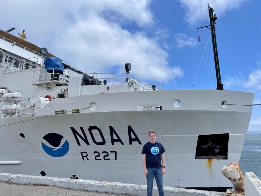
NOAA Ship Bell M. Shimada was built by VT Halter Marine, Inc. in Moss Point, Mississippi. The ship was commissioned on August 25, 2010 and is currently homeported at NOAA’s Marine Operations Center—Pacific in Newport, Oregon. The ship primarily studies a wide range of marine life and ocean conditions along the US West Coast, from Washington state to southern California.
The ship’s design allows for quieter operation and movement through the water, giving scientists the ability to study fish and marine mammals without significantly altering their behavior.
Bell M. Shimada conducts acoustic and trawl surveys. For acoustic studies, the ship uses a multibeam echo sounder (MBES) that projects a fan-shaped beam of sound that bounces back towards the ship. The ship’s MBES, one of only three such systems in the world, acquires data from both the water column and the seafloor. Scientists can detect fish when the boat passes over them, measuring the signal reflected by the fish to estimate their size and number. The system can also create a map and characterize the sea floor.
MBES
Science team working in the acoustic lab
Hydrovents?
The ship conducts trawl sampling with a standardized, three-flange, four-seam bottom survey net equipped with a skipping rock sweep: sweeps with large rubber discs that allow the nets to be towed over rocky and uneven seabeds. Trawls sample fish biomass in a given study area. This helps scientists learn what species are in observed schools of fish and collect other biological data.
Trawl system
The ship’s wet lab allows scientists to sort, weigh, measure and examine fish. Data is entered directly into the ship’s scientific computer network. The Bell M. Shimada Bird and Marine Mammal Observation Stations are equipped with sensors to help researchers identify and track protected species.
Wet Lab
Gear to use in wet lab
Bell M. Shimada was named by a team of students from Marina High School in Monterey, California, who won a regional NOAA contest to name the ship. The ship’s namesake served in the Bureau of Fisheries and the Inter-American Tropical Tuna Commission. He was known for his contributions to the study of tropical Pacific tuna populations, which were important to the development of West Coast commercial fisheries after World War II. Bell M. Shimada’s son, Allen, is a fisheries scientist with NOAA Fisheries.
Personal Log
This has been an experience that I never imagined, on Thursday, August 11, when I entered the port and saw the ship in the distance, I felt a lump in my throat, it is much larger and more imposing than I imagined. The scientist in charge of the expedition, Beth Philips, welcomed me to the ship. She was extremely jovial and pleasant and gave me a tour of the ship, which let me tell you, this is a labyrinth. The crew has been excellent, all with a kind and respectful treatment towards me. On the other hand, I hope I can loosen up a bit more with everyone on the ship since I’m a bit in my head because of my English speaking.
I want to introduce you to the excellent team of scientists
Science Team: John Paul, Ethan Beyer, Toby Auth, Steve de Blois, Michael Gutiérrez (me) and Beth Phillips
Celebrating Beth’s Birthday!
In just a few days of meeting them, they have taught me a lot. They have all been patient and have explained and answered questions regarding the work they do on the high seas. Their knowledge and experiences have led me to create great admiration for them. In the next blogs you will learn more about each of them and you will see them in action!
Not Just One, But Two Puerto Ricans on the High Sea!
LT Erick Estela
That’s right I’m not the only Puerto Rican on NOAA Bell M. Shimada, this is LT Erick Estela from Ciales, Puerto Rico. Erick is one of the NOAA Corps officers serving at sea, on land and in the air to support NOAA’s environmental science and management mission. Erick have been serving with NOAA Corps nine and a half years. We met in the middle of a drill and it was very exciting to know that there’s another Puerto Rican on board. Puerto Rico is proud to have Erick in such an important role within NOAA!
LT Erick driving the ship
Welcome to the Bridge
Central Control System
Around fishing fleet (green boats)
Radar image
Live images around the ship
Before I go, I want to share some photos taken by Teacher at Sea Alumni Association Manager Britta Culbertson, who met us at Whidbey Island to wave goodbye from shore. Thank you for the beautiful photos and for all your support. Thanks also to TAS Alumni Denise Harrington for your messages of support, much appreciated!
NOAA Bell M. Shimada from Whidbey IslandNice view of the mountains and seabird NOAA Bell M. Shimada
See you in my next blogs where I will be talking about our study of hake populations and the data received from the echo sounder. I’m gone fishing, see you next time!
Weather at 1600 Pacific Standard Time on Thursday 11 July 2019
Happy to report we’re back to a much calmer sea state! I finally made it up to the flying bridge again since it isn’t raining or choppy anymore. It’s the first time in two days I’ve needed to wear sunglasses. The ocean looks almost level with scattered patches of wavelets which indicates about a 5 knot wind speed. It reminds me of the surface of my palms after I’ve been in the water too long – mostly smooth but with lots of tiny wrinkles. Check out this awesome weather website to look at what the wind is doing in your area!
A weather map from Windy.com
PERSONAL LOG
Stretch everyday. I should stretch everyday. I do not. On the ship it’s even more of a necessity. One of the scientists calls it “Boaga” – like mixing “boat” with “yoga.” Try doing yoga on the ship and the rocking might cause you to tumble, but I enjoy a good challenge. Fitness requires strength and flexibility, so if I do some yoga and have to work harder to stay balanced since the ship is rocking, all the better.
A combination of the good food, constant access to homemade snacks, and lack of natural ways to burn calories on the ship, I need to turn to deliberate exercise. I just haven’t started that routine yet. The ship does have a nice, albeit small, gym on the same floor as my stateroom. It includes free weights, kettlebells, a treadmill, and a few other pieces of equipment. Now that our first week is coming to a close, my goal for today – and everyday forward – is to develop a routine for stretching and cardio. Sigh. Otherwise the five pounds I’ve already gained will turn into fifteen. And I have no desire to work off fifteen pounds of belly fat when I get home.
THE SCIENCE
“Trawl” has its origins in Latin. The original word meant “to drag” and it still carries a similar denotation. Fishermen use trawl as a noun, verb, and adjective. On NOAA Ship Reuben Lasker we use a Nordic 264 Surface Trawl to conduct the Coastal Pelagic Species Survey each night. The trawl is spooled onto a giant iron net reel which connects to the deck with sixteen 2.5 inch bolts and is securely welded. We try to get three trawls in per night, but sometimes we don’t quite make it. Poor weather, issues with the net, or sighting a marine mammal can all put a quick end to a trawl.
Now let’s use it as a verb. The origin “to drag” deals more with how you operate the net than the construction of the net itself. To trawl for fish like we do each night means to slowly unravel 185 meters in length of heavy ropes, chains, and nylon cord mesh into the water off the stern with an average of 15,000 pounds of tension while the ship steams at a steady rate of about 3 knots. Getting the net into the water takes about 15 minutes.
Scott Jones, Chief Bosun, took me on a tour of the equipment. Two reels below deck spooled with cable the diameter of my forearm, one even larger reel on the fantail to house the net and ropes, a winch to lift the weight of the trawl as it transitions from deck to water, plus two work stations for the Chief Bosun to manually monitor and control all those moving pieces. There are three additional nets on board in case they need to replace the one we’ve been using all week, but the deck crew are pretty adept at sewing and mending the nets as needed.
As I stand on the bridge watching the net snake its way into the water behind the ship, everything pauses for a brief moment so the deck crew can use daisy knots to sew floatable devices into the kites. Later, they attach two more of these floats to the headrope (top line). The floats keep the mouth of the net open vertically. A couple minutes later they stop to attach 250lb Tom weights to the footrope (bottom line) of the trawl opening. When fully deployed, this roughly 25 meter vertical opening is as tall as an 8-story building!
It’s like watching choreography – every detail must be done at exactly the right moment, in the right order, or it won’t work. The Chief Bosun is the conductor, the deck crew the artists. Hollow metal doors filled with buoyant wood core – together weighing more than a ton on land – are the last to enter the water. Each hangs on large gallows on the starboard and port side of the ship, just off stage, until they’re cued to perform. These doors are configured with heavy boots and angled in the water to act as a spreading mechanism to keep the net from collapsing in on itself.
If unspooled properly, the net ends up looking like an enormous largemouth bass lurking just under the surface.
Commercial fishermen use all kinds of nets, long lines, and pots depending on the type of catch they’re targeting, fishing regulations, and cultural traditions. But if we use “trawl” as an adjective, it describes a specific kind of net that is usually very large and designed to catch a lot of fish all at one time. It looks like a cone with a smaller, more narrow section at the very end to collect the fish.
I imagine something like a cake decorating bag that’s being used to fill a mini eclair. Except, instead of squeezing delicious icing into the pastry, we’re funneling a bunch of fish into what fishermen call a “codend.” This codend (pronounced cod-end, like the fish) houses the prize at the end of the trawl! When they haul everything back in – taking a little longer, about 45 minutes to complete the haul back – they end up with (hopefully) a codend full of fish to study.
Two Mini Eclairs Filled with Pastry Cream
A trawl net can either be used like we are to collect fish close to the surface or it can be weighted and dropped to the sea floor in search of groundfish. We’re searching for pelagic fishes that come up to the surface to feed at night, so it makes sense for us to trawl at the surface. Think of pelagic fish as the fishes in the water. Sounds funny to say, but these fishes don’t like to be near the seabed or too close to the land by the coast. They like to stay solidly in the water. Think of where anchovies, mackerel, tuna, and sharks like to hang out.
To catch groundfish on the other hand, we’d need to trawl the bottom of the ocean since they prefer to stay close to the ocean floor. Trawling the seabed in the Northeast Pacific Ocean would bring in flavorful rockfish and flounder, but we’re not looking for groundfish during this survey. One very lucrative and maybe less known groundfish in this area is the sablefish. In commercial fishing, they use bigger nets, and a trawl can bring in tens of thousands of pounds in just one tow. When I spoke to someone on board who used to work on a commercial trawl boat, he said catching sablefish are a pain! They live in very deep waters. Plus, the trawl must hit the seabed hard and drag along the bottom in order to catch them. This causes huge tears, many feet wide, in the mesh. He said they used to keep giant patches of mesh on the boat deck so they could patch up the holes in between trawls. When I get home, I’m definitely going to purchase sablefish and try it for dinner.
Trawl Net Spooled on the Net Reel on the Fantail
Chief Bosun Scott Jones at a Control Station
Trawl Entering the Water
Codend Floating in the Water
Trawl Net Snaking off the Stern
Floats Sewn into the Kites
Floats When They’re Not Sewn In
Daisy Knot
Getting Ready to Add the Tom Weights (chains)
Reversing the Process – Hauling the Net back on Deck
Prepping the Codend before Emptying the Catch
Emptying the Catch
TEACHING CONNECTIONS
I’ve never once wondered how the fish I buy at the grocery store ends up on my plate. Now I can’t seem to stop asking the scientists and deck crew questions. There are all these regulations to follow, methods to learn based on what type of fish you’re targeting, and so much that someone would need to understand about traveling in the ocean before even attempting to fish commercially. I’ve been immersed in a world I don’t recognize, and yet the fishing industry impacts my life on a daily basis. We are so far removed from what we eat.
The other aspect to the trawling topic that interests me is just how effortless it looks. The deck crew make such an intricate task look, truly, easy. An article on BBC News called Can 10,000 Hours of Practice Make You an Expert? does a nice job of summarizing how this might be possible. Of course, it doesn’t hurt that I’m currently reading Grit: The Power of Passion and Perseverance by Angela Duckworth, that I’ve already read Outliers: The Story of Success by Malcolm Gladwell and Mindset: The New Psychology of Success by Carol Dweck, and that as a teacher I’m familiar with Ericsson’s work on deliberate practice. I know how many years and cumulative hours they each must have put in to make it appear seamless.
Like most teachers, I want my students to find a career that they love enough to practice with such diligence. I want them to find a vocation instead of just work to pay the bills. I feel very much led to making sure my students have access to as much information as possible about post-secondary career and training options. For that reason, I’m glad to have met these folks and learn from them so I can share their practice with the hundreds, possibly thousands of teenagers I’ll teach over the course of my career.
It’s easy for me to do this as a reading specialist since I can read career profiles with students, let them annotate the text, and then engage them in a discussion on a regular basis. Reading, analyzing, and discussing text are kind of my bread and butter. For other disciplines, it might take a bit of a re-work to fit this in, but certainly not impossible. A science, math, art, STEM, you-name-it teacher could post a career profile specific to their discipline to their digital classroom space each week for students to read at their leisure. Or you could bring discipline specific literacy skills into your classroom by incorporating short texts into your lessons a few times each quarter.
I’m planning now to read a career profile with my
students one time per week. I’ll keep the texts short so that reading,
annotating, and discussing the text will stay under 15 minutes. Some careers from the ship they might find
interesting are the Chief Bosun position or a NOAA
Corps Officer, but I’ll share a wide variety of career profiles from many
disciplines based on the students’ interests once I meet them this year.
I departed Chattanooga, TN, for San Francisco, CA, on May 28th to participate as a NOAA Teacher at Sea on Leg 2 of NOAA’s Juvenile Rockfish Recruitment and Ecosystem Assessment Survey. My job as a Teacher at Sea will be to share my experience and knowledge acquired over the next 10 days working alongside NOAA scientists with MY AUDIENCE. Who is my audience? You! I hope that you all can be my students! You, my McCallie students and colleagues, my friends, my swimming community and my family members. My intention here is to explain in layman’s terms what I learned, and especially, what I thought was cool.
After tapas in North Beach with my San Francisco friends Cathy Delneo and Evan Morrison, they dropped me off at Pier 15 to sleep in my stateroom on the NOAA Ship Reuben Lasker. I felt rocking even while docked in the San Francisco Bay, but I slept great and am happy to report that my CVS brand “less drowsy” Dramamine tablets seem to be working as I am prone to motion sickness. This morning Evan and I got to explore the ship and take a bunch of photos of The City from the top deck of the ship, called the Flying Bridge. I imagine I will be spending many hours up here over the next 10 days!
Karah and Evan on the Flying Bridge the morning of departure.
Meeting the Science Team
The first science team member I met was Kelly Goodwin, Ph.D., an environmental molecular biologist from NOAA National Marine Fisheries Service (NMFS), Southwest Fisheries Science Center (SWFSC) La Jolla, and NOAA Atlantic Oceanographic and Meteorological Laboratory. Kelly is here along with Associate Researcher Lauren Valentino to collect environmental DNA (eDNA) from water collected at three depths (5 meters, the chlorophyll maximum, and 100 meters) during deployment of the Conductivity, Temperature and Depth (CTD) Rosette. There will be more about these marine scientists and the cool biotechnology they will be employing to come in a future post!
Next, I met my stateroom bunkmate Flora Cordoleani, Ph.D., of NOAA NMFS, SWFSC,Fisheries Ecology Division (FED). Her research lab at the University of California Davis focuses on the management of the endangered king salmon in the Central California Valley. I will definitely interview her for a future blog!
Meet the rest of the team: Doctoral student Ilysa (Ily) Iglesias, NMFS SWFSC FED/ University of California Santa Cruz (UCSC), works in John Field’s Lab. Ily will be analyzing the myctophids (one of the most abundant mesopelagic fish groups) collected on this survey and elucidating their role in the trophic cascade. She was on the cruise last year as well and I can already tell is psyched about this opportunity and wants to teach everyone.
John Field, Ph.D., was on the previous leg of the cruise and is the Principal Investigator for this project while Keith Sakuma, of NMFS SWFSC FED, is the Chief Scientist and has been working on this survey for 30 years as of this cruise!
Kristin Saksa of NMFS SWFSC FED/ Moss Landing Marine Lab (MLML) and Kaila Pearson, NMFS SWFSC FED, of Scripps, who are both working on master’s degrees in marine science.
Jarrod Santora, Ph.D., an ecologist from NMFS SWFSC FED/UCSC, will be on the day shift. Brian Hoover, Ph.D., an ornithologist who works for the Farallon Institute for Advanced Ecosystem Research (FIAER), will be observing birds and marine mammals on the day shift.
Keith Hanson is a NOAA Corps Officer representing NMFS SWFSC FED and is also a valuable member of the science team.
Night shift fish sorting crew. From left: Karah Nazor, Ph.D., Flora Cordoleani, Ph.D., Kristin Saksa, Keith Sakuma, Keith Hanson, Kaila Pearson, and Ilysa Iglesias.
After a welcome aboard orientation and safety briefing given by NOAA Corps Officer David Wang, we enjoyed a delicious reuben sandwich in the galley (cafeteria) of the Reuben Lasker. Meals are served at 7 AM, 11 AM and 5 PM. Since I will be on night shift I can request to have meals put aside for me to eat whenever I want. Below is a typical menu. The food is superb! See a menu from one of our last days below.
Menu for my last day.
After a noon departure the engineers spent a couple of hours testing the dynamic positioning system just north of the Bay Bridge. This system takes inputs from ocean conditions such as the tide, wind, waves and swell and uses the propulsion and thrusting instruments on board to maintain a fixed position on the global positioning system (GPS). Most of the night shift science crew used this opportunity to nap since we had to stay up all night!
Kaila Pearson woke me up just in time as we exited San Francisco Bay to take in the spectacular view of passing under the Golden Gate Bridge. It was a gorgeous sunny day in San Francisco and I felt super grateful to be a part of this research team, excited to get to know the team of amazing (mostly) female scientists I had just met, and ready to start fishing! It was fun to get to serve as a impromptu San Francisco tour guide as we departed the Bay, since I am quite familiar with this landscape. This body of water was my first open water swimming playground when I used to live in San Francisco during my postdoc at UCSF and was a member of the South End Rowing Club.
Our departure from the San Francisco Bay. Photo taken on the flying bridge. From Left: Kaila Pearson, Flora Cordoleani, Ph.D., Lauren Valentino, and Ilysa Iglesia with Teacher at Sea Karah Nazor, Ph.D., in front.
Night 1 of Cobb Trawl and Fish Sorting
We arrived at our first trawl line, Monterey Bay, around 11:00 P.M. My job as part of the night crew is to participate in marine mammal watches before and during fishing, and then to sort, count and measure the different species of animals collected, as well as bag and freeze specimens for various research organizations. The fishing method used on this survey is a modified Cobb midwater trawl. The net is deployed to fish at 30 meters depth and has a 9.5 mm codend liner (mesh at the end of the net where the fish gather). Trawl operations commence just after dusk and conclude just before dawn, with the goal of conducting up to 5 trawls per night. The duration of fishing at target depth before “haul back” of the net can be either 5 minutes or 15 minutes. Five minute trawls are used in areas of high abundance of gelatinous organisms such as jellyfish in order to reduce the size of the catch (e.g., fishing the additional 10 minutes would result in catches large enough to damage the net).
From left, Keith Hanson, NOAA Operations Officer, and Chief Scientist Keith Sakuma, help release the catch from the first haul of the survey.
At first glance, it appeared the catch consisted mostly of Northern anchovies.
UCSC graduate student Ilysa Iglesias examines the first sort of the first haul, with the organisms arranged by species.
There are two marine mammal watches per trawl: the inside watch and the outside watch. The inside watch goes to starboard side of the bridge 30 minutes prior to reaching the planned trawl station. If any marine mammals such as sea lions, seals, dolphins or whales are spotted within one nautical mile of the planned trawl station, then the ship must move. This protocol is employed for mitigating interaction with protected marine species.
If the inside watch does not see any marine mammals, then trawl operations can begin. This is when the outside mammal watch takes over and looks for marine mammals during net deployment, trawling, and haul in. The outside watch is conducted one floor above the fishing deck, and the person must wear foul weather gear, a life vest, and a helmet. This is summer, but it is the Pacific, and it is COLD out there. If a marine mammal is spotted by the outside watch then the trawl net must immediately be reeled in.
I spotted a school of dolphins in Monterey Bay during haul back and reported the sighting via radio to the bridge officers and recorded my observations in the lab on the provided data sheet in the lab.
The duration of the entire fishing operation from net deployment, dropping the two “doors” (large metal plates weighing 900 pounds each) used to spread the net mouth open, fishing, haul in, properly wrapping the net on the winch, and finally, dispensing the harvested fish into the collection buckets, takes between 45 minutes to an hour and a half, depending on conditions.
Our first catch consisted primarily of Northern anchovies (Engraulis mordax) and California market squid, Doryteuthis (Loligo) opalescens. Ily was excited by the presence of a few plainfin midshipman, Porichthys notatus, and showed us their beautiful pattern of large photophores located on their ventral surface. These fish are quite hardy and survive the trawling procedure, so as soon as we saw one in the bucket, we placed it in a bowl of sea water for release after obtaining its length. Photophores are glandular organs that appear on deep sea or mesopelagic fish and are used for attracting prey or for confusing and distracting predators.
Northern anchovies, Engraulis mordax,, are one of the most abundant species we catch.
Photophores on ventral surface of Plainfin midshipman, Porichthys notatus.
Mesopelagic depths start around 200 meters, a depth at where 99% of the sunlight can no longer penetrate, and extend down to 1000 meters below the ocean surface. Above the mesopelagic zone is the epipelagic zone where sunlight reaches from the ocean surface down to 200 meters and, in California, corresponds to the ocean above the continental shelf.
In this survey, we will conduct trawls at 30 meters, which is technically the epipelagic zone, so why do we catch deep sea creatures? Many deep sea creatures participate in a daily vertical migration where they swim up into the upper layer of the ocean at night as that area is relatively rich in phytoplanktonic organisms. Phytoplankton are the sun-powered primary producers of the food chain, single-celled photosynthetic organisms, which also provide the majority of the oxygen we breath.
After the first night of work I feel confident that I can identify around 10 species of mesopelagic fish and forage organisms, the California Headlight Fish (more to come on these amazing myctophids from my interview with Ily), a juvenile East Pacific red octopus, Octopus rubescens, (alive), and ctenophores! Thanks to the Tennessee Aquarium’s Sharyl Crossly and Thom Demas, I get to culture ctenophores in my classroom.
Two large photophores in between the eyes of a Californian Headlightfish, Diaphus theta
Small octopus – Octopus rubescens.
Karah Nazor with a handful of ctenophores! These are Hormiphora – Undescribed Species.
Scientist Spotlight: Ornithologist Brian Hoover
Brian Hoover, Ph.D., an ornithologist who works for the Farallon Institute for Advanced Ecosystem Research (FIAER) in Petaluma, CA, observes birds and marine mammals on the day shift of this NOAA research cruise.
Brian Hoover, Ph.D., at his office in the San Francisco Bay
Brian Hoover, Ph.D., and Jarred Santora, Ph.D., watching for birds and marine mammals as we went underneath the Golden Gate Bridge.
Brian is from Colorado and earned his doctorate
at UC Davis in 2018. On this cruise we will be traversing through
biological hotspots that occur near islands, underwater canyons, and where
there is strong upwelling of the cold and nutrient rich deeper waters of the
California Current. Small fish feed on these nutrient rich waters, and
birds feed on these fish. Hotspots on this cruise included the Gulf of the
Farallons (just south of the Point Reyes upwelling plume) , the Channel Islands,
and Monterey Bay with its submarine canyon. Brian’s hours on the ship are from
7am to 7pm.
Brian can be found perched on the flying bridge during the day shirt with a pair of binoculars in his hand and his laptop off to his right on a table. Every time a bird or marine mammal is spotted within 300 yards of the ship to the right of the mid centerline of the bow, Brian records the species and numbers of animals observed in his database on his laptop. The objective of Brian’s work aboard the ship is to study how what is present underwater correlates with birds observed above the water. In other words, he aims to find correlations between the distribution and abundance of seabirds and marine mammals to the species and abundance of prey we collect during our night trawls and data collected from the ship’s acoustic krill surveys which collect data during the day. Brian explains that such information teaches us about what is going on with the bird’s prey base and how well the ecosystem is functioning as a whole. His observations allow him to observe shifts in the system over time and how this affects tertiary and apex predators. To find trends in these datasets, he used R software, Python, and ArcGIS mapping software to run spatial statistics and linear models.
Since 2010 Brian has been on 12 to 13 cruises and this is his third on the Reuben Lasker. Brian is excited to perhaps spot the Cooks Petrel, Pterodroma cookii, or the Short-tailed albatross, Phoebastria albatrus, which only lives in a volcano in japan. His favorite birds are the storm petrels because these birds are small and live in open ocean, only coming onshore to breed once a year. His dissertation focus was on the reproduction and behavior of the leeches storm petrol. He explains that seabirds have an incredible sense of smell which they utilize to find a mate and food. Brian was able to collect blood samples from burrowing birds for genotyping. He found that the major histocompatibility complex (MHC) molecules located on antigen-presenting cells may play a role in odor detection and mate selection in these birds. He found that males chose and avoided particular genotypes combinations and that healthier birds had more diverse MHCII complexes.
Brian is a sensory ecologist and studies how
seabirds interact with their environment through observations of their
behavior and physiology. When Ily asked Brian how do the seabirds know where
the fish are in the open ocean, he explained that birds have a sense of smell
that is as good or better than any commercial sensor that detects sulfur.
Why have some seabirds evolved to be so good at sniffing out traces of sulfur
in the ocean breeze up to 10 miles away from its source? Brian explained that
sulfur is an important part of the photosynthetic pathway for phytoplankton
(algal cells) and that when krill eat the algae, the algae releases the
chemical dimethyl sulfide (DMS). Marine plastic debris floating on the
sea surface also release DMS and provides an explanation as to why seabirds eat
plastic.
Weather Data from the Bridge
Date: 2018/10/21
Time: 12:52
Latitude: 029 23.89 N
Longitude 094 14.260 W
Barometric Pressure 1022.22mbar
Air Temperature: 69 degrees F
The isness of things is well worth studying; but it is their whyness that makes life worth living.
– William Beebe
My last sunset aboard the Oregon II.
Science and Technology Log
Today is our last day at sea and we have currently completed 53 stations!At each station we send out the CTD. CTD stands for Conductivity, Temperature and Depth. However, this device measures much more than that.During this mission we are looking at 4 parameters: temperature, conductivity, dissolved oxygen and fluorescence which can be used to measure the productivity of an area based on photosynthetic organisms.
Some of the science team with the CTD.
Once the CTD is deployed, it is held at the surface for three minutes.During this time, 4,320 scans are completed!However, this data, which is used to acclimate the system, is discarded from the information that is collected for this station.
The crane lifts the CTD from the well deck and deploys it into the water.
Next, the CTD is slowly lowered through the water until it is about 1 meter from the bottom.In about 30 meters of water this round trip takes about 5 minutes during which the CTD conducts 241 scans every 10 seconds for a grand total of approximately 7,230 scans collected at each station.
The computer readout of the data collected at one of the stations.
Our CTD scans have gathered the expected data but during the summer months the CTD has found areas of hypoxia off the coast of Louisiana and Texas.
Data from CTD scans was used to create this map of hypoxic zones off the coast of Louisiana in summer of 2018.
Personal Log
The gloomy weather has made the last few days of the voyage tricky. Wind and rough seas have made sleeping and working difficult. Plus, I have missed my morning visits with dolphins at the bow of the ship due to the poor weather.But seeing the dark blue water and big waves has added to the adventure of the trip.
The gloom is lifting as a tanker passes in the distance.
We have had some interesting catches including one that weighed over 800 pounds and was mostly jellyfish.Some of the catches are filled with heavy mud while others a very clean. Some have lots of shells or debris.I am pleasantly surprised to see that even though I notice the occasional plastic bottle floating by, there has not been much human litter included in our catches.I am constantly amazed by the diversity in each haul.There are species that we see at just about every station and there are others that we have only seen once or twice during the whole trip.
A few of the most unique catches.
I am thrilled to have had the experience of being a NOAA Teacher at Sea and I am excited to bring what I have learned back to the classroom to share with my students.
Challenge Question:
Bonus points for the first student in each class to send me the correct answer!
These are Calico Crabs, but this little one has something growing on it?What is it?
Calico crabs… but what is that growing on this small one?
Did you know…
That you can tell the gender of a flat fish by holding it up to the light?
The image on the top is a female and the one of the bottom is the male. Can you tell the difference?
Today’s Shout Out!
Kudos to all of my students who followed along, answered the challenge questions, played species BINGO, and plotted my course!You made this adventure even more enjoyable!See you soon 🙂
Weather Data from the Bridge
Date: 2018/10/17
Time: 13:10
Latitude: 027 39.81 N
Longitude 096 57.670 W
Barometric Pressure 1022.08mbar
Air Temperature: 61 degrees F
Those of us who love the sea wish everyone would be aware of the need to protect it. – Eugenie Clark
Science and Technology Log
After our delayed departure, we are finally off and running! The science team on Oregon II has currently completed 28 out of the 56 stations that are scheduled for the first leg of this mission. Seventy-five stations were originally planned but due to inclement weather some stations had to be postponed until the 2nd leg. The stations are pre-arranged and randomly selected by a computer system to include a distributions of stations within each shrimp statistical zone and by depth from 5-20 and 21-60 fathoms.
Planned stations and routes
At each station there is an established routine that requires precise teamwork from the NOAA Corps officers, the professional mariners and the scientists. The first step when we arrive at a station, is to launch the CTD. The officers position the ship at the appropriate location. The mariners use the crane and the winch to move the CTD into the water and control the decent and return. The scientists set up the CTD and run the computer that collects and analyzes the data. Once the CTD is safely returned to the well deck, the team proceeds to the next step.
Some members of the science team with the CTD
Step two is to launch the trawling net to take a sample of the biodiversity of the station. Again, this is a team effort with everyone working together to ensure success. The trawl net is launched on either the port or starboard side from the aft deck. The net is pulled behind the boat for exactly thirty minutes. When the net returns, the contents are emptied into the wooden pen or into baskets depending on the size of the haul.
This unusual haul weighed over 900 pounds and contained mostly red snapper. Though the population is improving, scientists do not typically catch so many red snapper in a single tow.
The baskets are weighed and brought into the wet lab. The scientists use smaller baskets to sort the catch by species. A sample of 20 individuals of each species is examined more closely and data about length, weight, and sex is collected.
The information gathered becomes part of a database and is used to monitor the health of the populations of fish in the Gulf. It is used to help make annual decisions for fishing regulations like catch and bag limits. In addition, the data collected from the groundfish survey can drive policy changes if significant issues are identified.
Personal Log
I have been keeping in touch with my students via the Remind App, Twitter, and this Blog. Each class has submitted a question for me to answer. I would like to use the personal log of this blog to do that.
3rd Period – Marine Science II: What have you learned so far on your expedition that you can bring back to the class and teach us?
The thing I am most excited to bring back to Marine 2 is the story of recovery for the Red Snapper in the Gulf of Mexico. I learned that due to improved fishing methods and growth in commercial fishing of this species, their decline was severe. The groundfish survey that I am working with is one way that data about the population of Red Snapper has been collected. This data has led to the creation of an action plan to help stop the decline and improve the future for this species.
4th Period – Marine Science I: What challenges have you had so far?
Our biggest challenge has been the weather! We left late due to Hurricane Michael and the weather over the past few days has meant that we had to miss a few stations. We are also expecting some bad weather in a couple of days that might mean we are not able to trawl.
5th Period – Marine Science I: How does the NOAA Teacher at Sea program support or help our environment?
The number one way that the NOAA Teacher at Sea program supports our environment is EDUCATION! What I learn here, I will share with my students and hopefully they will pass it on as well. If more people know about the dangers facing our ocean then I think more people will want to see changes to protect the ocean and all marine species.
7th Period – Marine Science I: What is the rarest or most interesting organism you have discovered throughout your exploration?
We have not seen anything that is rare for the Gulf of Mexico but I have seen two fish that I have never seen before, the singlespot frogfish and the Conger Eel. So for me these were really cool sightings.
Singlespot Frogfish
Conger Eel
8th Period – Marine Science I: What organism that you have observed is by far the most intriguing?
I have to admit that the most intriguing organism was not anything that came in via the trawl net. Instead it was the Atlantic Spotted Dolphin that greeted me one morning at the bow of the boat. There were a total of 7 and one was a baby about half the size of the others. As the boat moved through the water they jumped and played in the splashing water. I watched them for over a half hour and only stopped because it was time for my shift. I could watch them all day!
Do you know …
What the Oregon II looks like on the inside?
Here is a tour video that I created before we set sail.
Transcript: A Tour of NOAA Ship Oregon II.
(0:00) Hi, I’m Andria Keene from Plant High School in Tampa, Florida. And I’d like to take you for a tour aboard Oregon II, my NOAA Teacher at Sea home for the next two weeks.
Oregon II is a 170-foot research vessel that recently celebrated 50 years of service with NOAA. The gold lettering you see here commemorates this honor.
As we cross the gangway, our first stop is the well deck, where we can find equipment including the forecrane and winch used for the CTD and bongo nets. The starboard breezeway leads us along the exterior of the main deck, towards the aft deck.
Much of our scientific trawling operations will begin here. The nets will be unloaded and the organisms will be sorted on the fantail.
(1:00) From there, the baskets will be brought into the wet lab, for deeper investigation. They will be categorized and numerous sets of data will be collected, including size, sex, and stomach contents.
Next up is the dry lab. Additional data will be collected and analyzed here. Take notice of the CTD PC.
There is also a chemistry lab where further tests will be conducted, and it’s located right next to the wet lab.
Across from the ship’s office, you will find the mess hall and galley. The galley is where the stewards prepare meals for a hungry group of 19 crew and 12 scientists. But there are only 12 seats, so eating quickly is serious business.
(2:20) Moving further inside on the main deck, we pass lots of safety equipment and several staterooms. I’m currently thrilled to be staying here, in the Field Party Chief’s stateroom, a single room with a private shower and water closet.
Leaving my room, with can travel down the stairs to the lower level. This area has lots of storage and a large freezer for scientific samples.
There are community showers and additional staterooms, as well as laundry facilities, more bathrooms, and even a small exercise room.
(3:15) If we travel up both sets of stairs, we will arrive on the upper deck. On the starboard side, we can find the scientific data room.
And here, on the port side, is the radio and chart room. Heading to the stern of the upper deck will lead us to the conference room. I’m told that this is a great place for the staff to gather and watch movies.
Traveling back down the hall toward the bow of the ship, we will pass the senior officers’ staterooms, and arrive at the pilot house, also called the bridge.
(4:04) This is the command and control center for the entire ship. Look at all the amazing technology you will find here to help keep the ship safe and ensure the goals of each mission.
Just one last stop on our tour: the house top. From here, we have excellent views of the forecastle, the aft winch, and the crane control room. Also visible are lots of safety features, as well as an amazing array of technology.
Well, that’s it for now! Hope you enjoyed this tour of NOAA Ship Oregon II.
Challenge Question of the Day
Bonus Points for the first student in each class period to come up with the correct answer!
We have found a handful of these smooth bodied organisms which like to burrow into the sediment. What type of animal are they?
What type of animal are these?
Today’s Shout Out: To my family, I miss you guys terribly and am excited to get back home and show you all my pictures! Love ya, lots!
At the time of writing, we’ve completed the “stations” (i.e., the appointed stops where we trawl to collect specimens) in the western Gulf of Mexico, and are headed to the Florida coast, where we’ll conclude the 3rd leg of the Summer Groundfish Survey. Sometime tonight we’ll arrive and resume work, trawling and identifying fish. What follows is my attempt to furnish a detailed description of where we are and what we’re doing.
Stations: Where We Stop & Why
As I explained in my previous blog post, “Learner at Sea: Day 1,” the survey work being performed on this cruise contributes to a larger collective enterprise called SEAMAP, the Southeast Area Monitoring and Assessment Program. The “sample area” of SEAMAP is considerable, ranging from Texas-Mexico border to the Florida Keys.
Spatial coverage of SEAMAP Summer and Fall Trawl Surveys in the northern Gulf of Mexico
Fisheries biologist Adam Pollack tells me that the total trawlable area–that is, excluding such features as known reefs, oil rigs, and sanctuaries–consists of 228,943.65 square kilometers or 88,943.65 square miles. That’s a piece of ocean of considerable size: nearly as big as Louisiana and Mississippi combined.
SEAMAP divides the sample area into a series of statistically comparable “zones” (there are two zones within each of the numbered areas in the diagram above), taking into account a key variable (or stratum): depth. It then assigns a proportionate number of randomized locations to every zone, arriving at 360-400 stations for the sample area as a whole. Statisticians call this method a “stratified random design.”
While Louisiana, Mississippi, Alabama, and Florida participate in the SEAMAP, the lion’s share of stations are surveyed by NOAA.
These are the 49 stations we sampled during the first half of the cruise, off the shore of Louisiana:
Stations covered in the western Gulf during the 3rd leg of the Summer Groundfish Survey
The data from the Summer Survey is analyzed in the fall and available the following spring. NOAA’s assessments are then passed along to the regional Fisheries Management Councils who take them into account in setting guidelines.
The Trawl: How we Get Fish Aboard
NOAA Ship Oregon II brings fish aboard using an otter trawl. As described in “Mississippi Trawl Gear Characterization,” “The basic otter trawl is the most common type of trawl used in Mississippi waters to harvest shrimp. The otter trawl is constructed of twine webbing that when fully deployed makes a cone shape. Floats on the head-rope (top line) and chains on the foot rope (bottom line) of are used to open the mouth of the trawl vertically. To spread the mouth of the trawl open as large as possible, each side (wing) is attached to trawl doors” (http://www.nmfs.noaa.gov/pr/pdfs/strategy/ms_trawl_gear.pdf). Positioned by chains so that their leading edges flare out, those doors are sizable and heavy, 40 inches high and 8 feet long, and help not only to spread the net open (and ‘herd’ fish in) but also to keep it seated on the ocean floor.
An otter trawl deployed
To mitigate environmental harm–and, in particular, to help save inadvertently caught sea turtles—trawling time is limited to 30 minutes. The trawl is 40 feet wide and is dragged over 1.5 miles of ocean bottom.
Here are the trawl’s technical specifications:
Trawl schematic, courtesy of NOAA fishing gear specialist Nicholas Hopkins
It should not go without saying that deploying and retrieving gear like this is mission critical, and requires physical might, agility, and vigilance. Those tasks (and others) are performed expertly by the Deck Department, manned on the day watch by Chief Boatswain Tim Martin and Fisherman James Rhue. Fisherman Chris Rawley joins them on the swing shift, coming on deck in the evening.
The process of bringing the trawl aboard looks like this:
Trawl doors on their way up toward the starboard outrigger
Seizing the “lazy line” with the hook pole
The “elephant ear” (orange section) secured
Chief Boatswain Tim Martin brings a catch over the rail
The bottom of the trawl is secured with a special knot that permits controlled release of the catch.
Among other names, this piece of handiwork is known as the “double daisy chain” or “zipper knot”
The catch emptied into baskets
CTD
Before every trawl, the CTD is deployed from the well deck (port side) to collect data on, as its acronym suggests: Conductivity, Temperature, and Depth. According to NOAA’s Ocean Explorer website, “A CTD device’s primary function is to detect how the conductivity and temperature of the water column changes relative to depth. Conductivity is a measure of how well a solution conducts electricity. Conductivity is directly related to salinity, which is the concentration of salt and other inorganic compounds in seawater. Salinity is one of the most basic measurements used by ocean scientists. When combined with temperature data, salinity measurements can be used to determine seawater density which is a primary driving force for major ocean currents” (https://oceanexplorer.noaa.gov/facts/ctd.html).
The CTD secured on deck
The CTD suspended at the surface, awaiting descent
During daylight hours, a scientist assists with the deployment of the CTD, contributing observations on wave height and water color. For the latter, we use a Forel-Ule scale, which furnishes a gradation of chemically simulated water colors.
Forel-Ule scale
The Wet Lab: How We Turn Fish into Information
Once in baskets, the catch is weighed and then taken inside the wet lab.
The wet lab: looking forward. Fish are sorted on the conveyor belt (on the right) and identified, measured, weighed, and sexed using the computers (on the left).
Once inside the wet lab, the catch is emptied onto the conveyor belt
Fish ready for sorting
A small catch with a big Snapper
Next the catch is sorting into smaller, species-specific baskets:
Emily McMullen sorting fish
Say hello to the Bat Fish: Ogecephalus declivirostris
Calico Box Crab, Hepatus epheliticus
Blue Crab, Callinectes sapidus
At this stage, fish are ready to be represented as data in the Fisheries Scientific Computing System (FSCS). This is a two-step process. First, each basket of fish is entered by genus and species name, and its number recorded in the aggregate.
Andre DeBose entering initial fish data in FSCS
Then, a selection individual specimens from each basket (up to 20, if there are that many) are measured and weighed and sexed.
Andre and Emily measuring and sexing fish
Occasionally researchers from particular laboratories have made special requests for species, and so we label them, bag them, and stow them in the bait freezer room.
Special requests for specimens
Red Snapper, Lutjanus campechanus, for Beverly Barnett
Once every animal in the trawl has been accounted for and its data duly recorded, it’s time to wash everything down and get ready to do it all over again.
Late afternoon view from the wet lab porthole
Personal Log
The key to enjoying work in the wet lab is, as I see it, the enduring promise of novelty: the possibility of surprise at finding something you’ve never seen before! For me, that promise offsets the bracing physical rigors of the work and leavens its repetitiveness. (Breathtaking cloudscapes and gorgeous sunsets do, too, just for the record. Out here on the water, there seem to be incidental beauties in every direction.) Think of the movie Groundhog Day or Camus’s “The Myth of Sisyphus” and cross either of them with the joys of beach-combing on an unbelievably bounteous beach, and you’ll have a sense of the absurd excitement of identifying fish at the sorting stage. Life in the wet lab is a lot like Bubba Gump’s box of chocolates: “You never know what you’re gonna get.”
At the next stage, data entry, the challenge for the novice is auditory and linguistic. Between the continual growl the engine makes and the prop noise of the wet lab’s constantly whirring fans, you’ve got the soundscape of an industrial workplace. Amid that cascade of sound, you need to discern unfamiliar (scientific) names for unfamiliar creatures, catching genus and species distinctions as they’re called out by your watch-mates. The good news is that the scientists you’re working with are living and breathing field guides, capable of identifying just about any animal you hold up with a quizzical look. It’s a relative rarity that we have to consult printed guides for IDs, but when we do and that task falls to me, the shell-collector kid in me secretly rejoices.
I found it! Ethusa microphthalma (female)
I’m enjoying the camaraderie of my watch, led by Andre DeBose, and, as my posts suggest, I’ve had some good opportunities to pick Adam Pollack’s brain on fisheries issues. My partner in fish data-entry, Emily McMullen–an aspiring marine scientist who’ll be applying to graduate programs this fall–did this cruise last summer and has been an easy-going co-worker, patient and understanding as I learn the ropes. I’ve also had some wonderful conversations with folks like Skilled Fisherman Mike Conway, First Assistant Engineer Will Osborn, and Fisheries Biologist Alonzo Hamilton.
It’s been a busy week, as you’ll have gathered, but I’ve still managed to do some sketching. Here’s a page from my sketchbook on the CTD:
Sketch of the CTD. The main upright tanks, I learned, are Niskin Bottles
And here’s a page from my journal that pictures three species we saw quite often in the western Gulf:
Longspine Porgy (Stenotomus caprinus), Butterfish (Peprilus burti), and Brown Shrimp (Farfanepenaeus aztectus)
Had I the time, I’d sketch the rest of my “Top 10” species we’ve seen most commonly in the western Gulf. That list would include (in no particular order): the Paper Scallop, Amusium papyraceum; Lookdown, Selene vomer; Blue Crab, Callinectes sapidus; Squid, Loligo; Lizardfish, Synodus foetens; Croaker, Micropogonias undulatus; and Red Snapper:
Presented for your inspection: Red Snapper, Lutjanus campechanus
Did You Know?
Four of the species visible on the surface of this basket have been identified in the blog post you’ve just read. Can you ID them? And how many of each would you say there are here on the surface?
Trawl hauls are how fishing is conducted. A large net is dropped into the water for a specific amount of time. By catching exactly what is in the ocean, the acoustic backscatter can be identified (what the various colored pixels on the echograms represent). Below is an echogram on the screen, the black line is the path of the trawl through the backscatter, the little red circle indicated where the camera was, and the picture at left is pollock passing by the camera and into the back of the net at that point.
Screenshot of an echogram. The black line is the path of the trawl through the backscatter, the little red circle indicates where the camera was, and the picture at left is pollock passing by the camera and into the back of the net at that point.
Samples of pollock and other organisms can be studied and other biological data collected. By counting, measuring, and weighing the pollock and other animals caught in each haul, calculations can estimate the amount of fish in a given area. Acoustic data can be used to determine the number of fish by dividing the measured backscatter by the backscattered energy from one fish (target strength, discussed in the last blog). That gives the number of fish:
To get the backscatter from one fish for the above calculation, we need to know the size and species of the fishes. The trawl provides that information. In the fish lab, species including pollock are identified, lengths are taken, and the number of fish at each length is entered in the computer. Also, the animals including pollock are weighed and a mean weight is determined. The number of fish computed from the acoustic and trawl data multiplied by the mean weight of a fish equals the biomass of the fish (total weight of the population in a given area).
The fisheries biologists developed the software used for all these calculations. This information coupled with the echograms can answer those earlier questions…Where are the pollock in the Bering Sea? How many are there? How big are they? How many adult pollock are there (fish that can be caught) and how many young pollock are present (providing information about future availability and how healthy the population is)?
When I first boarded the ship, I asked the fisheries biologists how they would describe what they do. They responded that they count fish, it’s not rocket science. But you know what? It kind of is!
TAS Joan Shea-Rogers at work in the Fish Lab
What is this information used for?
This information is used to manage the Pollock fishery. Numerical data is given to the entities that set the fishing quotas for the Bering Sea area. Quotas are then divided up between the commercial and individual fishing companies/boats. Once fishermen reach these quotas they must stop fishing. This protects the fishery to ensure that this food source will be healthy and strong for years to come. A similar example from my home state is that of the Illinois is the Department of Conservation. One of their responsibilities is to manage the deer population. Then they can determine how many deer can be harvested each season that still allows for the deer population to thrive.
Personal Blog:
In my last blog post, I talked about preparing for and “weathering the storm”. As with most things at sea and on land, things don’t always turn out as we plan. The stormy weather began with wave heights between 8-10 feet. The ship continually rocked back and forth making walking and everything else difficult. You can tell the experienced sailors because they were much more graceful than I was. I held on to every railing and bolted down piece of furniture that I could. And even then, I would forget and place a pen on the table, which immediately rolled off. While eating I held onto my glass and silverware because as I ate and placed my knife on my plate it rolled off. Dressing was a balancing act, which I was not good at. I finally figured out it was better if I sat in a chair. Luckily for me, my patch for seasickness worked.
While I was sitting in the mess hall (dining room) an alarm rang. The engineers got up read the screen and left. The decision was made by the acting CO (Commanding Officer) that we would have to go back to Dutch Harbor. And now, as I write this, we are docked in Dutch Harbor waiting for word about the status of our voyage. Out here in Dutch Harbor, everything must be shipped in. We wait until parts and people are flown in. The fisheries biologists also have to determine the validity of the data collected on such a short voyage. They also must decide in a timely matter, can this data collection continue after returning to port?
For me, I am holding out hope that all these factors are resolved so that we can go back out to sea. Since November when I turned in my application, this voyage has been such a focal point of my life. If it doesn’t work out (I’ll try not to cry), I will still have had the adventure and learning experience of a lifetime. So here’s hoping……
What are groundfish? They are basically what they sound like, the fish that live in, on or near the bottom of a body of water. NOAA Ship Oregon II samples waters in coastal Gulf regions from Florida to Texas using an otter trawl net. Our net includes a “tickler chain” that moves just ahead of the opening to disturb the bottom sediment so that organisms swim up to be scooped up.
We tow for a short half hour at each station to get an idea of what species can be found at different locations. Fishing boats tow for much longer, hours at a time with larger nets. The cod end where the fish collect, is created by a knot beautifully tied by Chief Boatswain Tim Martin that holds during the tow but easily pulls open to release the catch which drops into large baskets. Tim works on the deck to launch the CTD (conductivity-temperature-dissolved oxygen probe) and the trawl net. The baskets are weighed and then dumped onto a conveyor belt to be sorted.
The otter trawl in action.
This knot closes the net during a trawl but pulls open to release a catch.
A look at what we caught at a station on June 30.
Another look at what we caught at a station on June 30.
This was one of the larger samples, filling up the entire conveyor belt!
We start by putting whatever looks alike together, which is much easier said than done. If it turns out to be tricky, the wet lab is equipped with a range of resource guides to reference. Once everything is sorted out, each species is individually sampled: the count of individuals, the total weight of that species, the lengths of up to 20 individuals, and the weight and sex of every fifth individual. This information is entered into Fisheries Scientific Computer Systems (FSCS) and added into a database that gets uploaded for public knowledge.
Everyone is lined up and sorting through fish. It’s the first trawl of the cruise so the night shift got excited and joined us.
Identification guides in the wet lab.
“Flatfish” is not descriptive enough. Andy Millett checks the keys on a computer loaded with identification keys.
Identifying a new friend.
How the catch looks once everything that looks alike is put together.
Counts and weights of each species are taken and entered into a computer workstation.
I take a crack at entering individual lengths and weights. Then I do this many more times.
For commercial species, such as shrimp and red snapper, every individual is measured and sexed; up to 200 for shrimp and up to 20 red snapper.
It’s a lot of work, but data entry is relatively easy using a magnetic board. You line the specimen up at the end of the board and simply press the magnet at the end of the animal’s body. The board is connected to a computer and automatically sends the measurement when the magnet is pressed. The scale is also connected to a computer and sends that information directly. However, every species’ scientific name is manually entered into a list for each station before measurements are taken.
Fish are sorted and measured in the wet lab in Oregon II
The red handle contains a magnet. The length is recorded when the magnet touches the board. The fish is an Atlantic moonfish, Selene setapinnis.
Measuring butterfish, Peprilus triacanthus
So many kinds of fish, but color is not a way to sort!
These data are primarily used by NOAA for stock assessments. By documenting species abundances, size and distribution, fishery managers can calculate catch quotas for the year that maintains healthy stocks. These data are also used by NOAA for their database to help you make sustainable seafood choices: https://www.fishwatch.gov/ . It is also part of NOAA’s mission to be “Dedicated to the understanding and stewardship of the environment,” which is why everything that is captured is counted. Federal data are publicly available, so these surveys might be used by scientists to study a range of questions about any species that we counted, including the ecology of non-commercial species.
It’s really interesting to see exactly where seafood comes from. In the 10 miles or so between stations, the communities change drastically. Shrimp are abundant in east Texas, but not where blue crab start to appear in west Texas. It’s also interesting to see the different sizes (ages) of fish change between stations. One station brought in snapper over 10” long, while the next two stations delivered their 5-6” juveniles. Aside from that, I got the chance to handle so many species I’ve only seen on TV and never imagined that I would get to hold in my hand!
This slideshow requires JavaScript.
Blue crabs, Callinectes sapidus. The two upturned crabs are females carrying eggs.
“Don’t give it a knife!”
“Stop giving it things!”
-things you say when trying to separate blue crabs that are latched onto each other
It’s reassuring to see the Gulf teeming with gorgeous biological diversity as evidence that U.S. fisheries are responsibly managed and that we have a strong model of stewardship in our seas—SEAMAP Groundfish Survey literally only scratches the surface of the coastline.
Personal Log
The meals in the galley are great. Valerie McCaskill of Naples, FL and Arlene Beahm from Connecticut are the Stewards onboard and they work diligently to feed us delicious home cooked meals. I’ll be a few pounds heavier when you see me after this trip. “Arlene’s trying to kill you with food!” Tim observed. These two ladies are stand-in moms, making sure we have heaping plates at meal times and snack times and anytime in between.
Finally got to eat some of the white shrimp we caught. And a whole steak for good measure. (Only the galley is allowed to take a part of the catch cook it for the ship.)
That’s a great thing because the 12 hour shifts work up an appetite. NOAA Ship Oregon II sails from one sampling station to the next, ranging from 5-12 miles in between, but as many as 20+ miles. On short runs, the next station comes up pretty quickly and we find ourselves finishing one just in time to start the next. We process four to five stations each shift with only short breaks during trawls.
It’s hugely humbling and an exercise in insecurity to watch the scientists work. At a glance they can recite the full scientific name of the hundreds of species that pour out of the net. I’ll be happy if I can come back with ten new species in my memory bank.
Baby blue crabs? Nope, these are adult Callinectes similis, blue crabs are C. sapidus.
The researchers onboard have been doing this for years. Identifying species takes time and practice to learn like any other skill, and it showcases the dedication and fulfillment they find in this kind of work.
Alonzo Hamilton, left, and Taniya Wallace, right, enter species into FSCS.
It’s hot, dirty work. There’s no air conditioning in the wet lab and around 1000+ fish can be brought aboard at a station. I, and probably everybody else within smelling range, am grateful to have hot showers and laundry onboard. Kristin Hannan emphasizes that “field work isn’t for everyone, but you don’t have to work in the field to study marine science.” But, the wet lab is where you witness the enthusiasm that brings the crew and the scientists back day after day in the heat of July, year after year. Squeals of excitement and giant grins appear with favorite species: Calappa crabs (I learned a name!), triggerfish, beautiful snail and clam shells, the infamous mantis shrimp, a chance sea anemone and of course sharks to name a few. Fisherman James Rhue, a crewman who works with Tim and operates the winches, comes to check out (as in play with) the catch a couple times a day; the fishing crew must be as skilled with identifications as the researchers—they do it during their off hours. During the half hour of the tow, we are often talking about plankton diversity in the dry lab.
Kristin Hannan, a shark researcher, pauses to examine a young hammerhead.
As satisfying as the work can be for some, the challenges certainly come with living on a relatively small boat built in a different time. While long overnight shifts sound tough, seasickness jumps to mind more readily when you say “boat”. When you’re seasick, everyone volunteers a range of interesting remedies, from watching the horizon, which is qualified as BS; lying down; sleeping, which isn’t easy when you’re sick; eating to keep your stomach full, counterintuitive but actually a useful one; ginger candy; staying cool, which does not describe the wet lab; to just chewing on a chunk of raw ginger, distracting, I’m sure! The Teacher at Sea organizers recommend working to keep your mind off of the nausea. Arlene was also very kind and donated a couple of her seasickness patches to my cause. For me, standing outside and watching the waves for flying fish helped immensely in the few minutes between processing catches. And there is far too much work and creatures to see to think about my stomach.
The blue dots are sampling stations along the Texas coastline. The red line shows where we’ve been. Thankfully, we’re not trying to hit every station, but there’s plenty to do!
Did You Know?
Although scientific names sound like gibberish, they are in Latin and often physical descriptions of the species. Portunus spinicarpus for example is a crab named for the long spike (spini) on its wrist (carpus).
P. spinicarpus
Lagocephalus translates to “rabbit head”, the name given to the group of puffer fishes, but you might have to squint to see it.
Mission: Rockfish Recruitment and Ecosystem Assessment Survey
Geographic Area of Cruise: Pacific Ocean along the California Coast
Date: June 6, 2018
Data from the Bridge
Latitude: 36° 59.462 N
Longitude: 122° 31.056 W
Wind Speed: 12.77 knots
Wind Direction: Northwest winds
Wave height: 2 to 3 feet with 4-6 foot swells
Air temperature: 12.76° C
Science and Technology Log
Our first official night on the Job was Sunday, June 4th. My shift is technically 6:00 pm to 6:00 am, but we could not begin trawling until the evening when skies were dark. If fish can see the net, they can avoid it. The method we use to catch fish is a midwater trawl, also known as a pelagic trawl, because the net fishes in the water column. It’s called a modified Cobb midwater trawl net. It has a cod end, the narrow end of a tapered trawl net where the catch is collected during the trawl.
Diagram of a Trawl net used on NOAA Ships
Before we lower the net, the water around the ship must be clear of marine mammals. Thirty minutes prior to each trawl, someone stands the marine mammal watch on the bridge. Once the net is deployed, someone must be watching for marine mammals outside the entire time. If any marine mammals are spotted (this includes dolphins, porpoises, seals, and sea lions), we report it to the officer on the bridge. The rule is that if we spot a marine mammal, the net must be hauled back in and we sail a mile away from the sighting. Marine mammals are protected and we do not want any caught in the net.
When the net is in the water, we trawl for 15 minutes at 30 m deep. Optimal speed is about 2 knots, but that is weather dependent. During this time, our deck crew, and Survey Technician monitor each step of the haul, reporting back to the officer on the bridge. As they haul the net in, the deck hands and Survey Technician work together to make sure the catch goes into the bins for sorting.
The winch used to deploy and haul in the trawl net on the Reuben Lasker
Survey Technician Jaclyn Mazzella, Deck Hands Ethan Skelton and Raymond Castillo, and NOAA Fisheries Intern Thomas Adams dropping the cod end of the net into a bin to collect our catch.
First catch of the first trawl. Some fish and squid are present, but this catch was dominated by salps and pyrosomes.
I didn’t know what to expect from our first catch. Maybe we would have some fish, crabs, squid…However the first catch brought something I never saw before. Lots of Thetys!
Thetys
Thetys are a type of salp. Salps are planktonic, colonial tunicates from the phylum Chordata. We also had pyrosomes, another type of colonial tunicate. They are efficient feeders, filtering particles of plankton from the water. It is expected that in areas where salps are prevalent, one can expect to find less of other species from the same trophic level. For this catch, that happened to be the case.
Pyrosomes, another type of planktonic, colonial tunicate.
As of today, I officially completed 3 shifts on the job, which included 12 trawls in total. It seems that each catch was dominated by 1 or 2 species. There were other species present, but we had to sort through the catch to find them.
We had a catch that was loaded with anchovies, another with krill, and one full of pelagic red crabs. I find this to be one of the most interesting parts of the work, anticipating what we will find. There are many variables that can impact the productivity of an ecosystem, and therefore can determine what we find. Things like salinity, sea surface temperatures, upwelling, proximity to land or open ocean, and human impact, can all influence an ecosystem.
This is me with Fisheries Intern Thomas Adams, stunned by the amount of anchovies we had in this catch. Photo by Keith Sakuma
This catch consisted predominantly of krill species. Some catches will have 3 to 4 different species of krill
So, what do we do with our catches once we have them? We count them, and there is a method to the count. Depending on the size of the catch, we may measure out 1,000 ml, 2,000 ml, or 5,000 ml. We start with that first bucket and count every individual (species like krill or salps are measured by volume). The numbers are reported to Keith Sakuma, our chief scientist, and recorded in a handwritten data sheet, then transferred to an excel document. After the first bucket, we may focus on sorting for all other species except the predominant species. For example, for our large anchovy catch, we sorted through approximately 60 liters of fish. We didn’t count every single anchovy, but based on our primary count, we can use the total volume to estimate. However, we sort through looking for all other species and record the findings.
Here we are counting the first 5,000 ml bucket of anchovies. Here you can see we separated out the other species and count them as well.
Here is the team starting clockwise from the left: Melissa Monk, Stephanie Oakes, Thomas Adams, Becky Miller, and Kimberly Godfrey. Photo taken by Keith Sakuma
We will record each species we find, and then we have a list of specified species that need to be measured. We take the first twenty specimens of each so we have a record of the average size fish caught in that specific location and time. We focus on measuring the species of fish that have the most ecological and economic importance. These are the prey and those that are consumed by us. Therefore, they are also likely to suffer from human impact. Learning about these species are important to the understanding of what makes them successful, and how to mitigate the things that negatively impact their productivity.
This is me, measuring species of focus for this survey. Afterward, we bag and freeze those needed for further analysis back on land, and the rest get washed back to sea.
Electronic caliper used to measure the specimens. It has a USB cable that connects to the computer and immediately records data into a spreadsheet.
This data sheet is a record of all the measured species from our catches.
So far this is our routine. Tonight, we had a break from trawling as we transit up to Davenport, just North of Santa Cruz. The current conditions are not favorable for trawling, so we will get back to work tomorrow evening. While we take it easy, our NOAA officers navigate the ship up the coast. I had the opportunity to speak to our Executive Officer (XO), Lieutenant Commander Emily Rose.
How did you come to work for NOAA?
I went to the University of Hawaii and got my degree in Meteorology. From there, my friend referred me to someone who currently worked in the NOAA Corps. The things she told me about the job piqued my interests, so I applied. I was selected in 2008. There was a 5-month training period, and then I was stationed in Hawaii on the Ka’imimoana, a ship that has since been decommissioned. I was sent to Santa Rosa, CA to work for National Marine Fisheries Service (NMFS) during my first land assignment, then I became the Operations Officer aboard the Okeanos Explorer. Before I joined the Reuben Lasker, I was stationed at the National Centers for Environmental Information (NCEI) in Boulder, CO for 2 years.
Since you have a degree in Meteorology, do you get to use what you’ve learned for your current position?
Every time I’ve been on a ship, I’ve been the defacto weather officer. On the Reuben Lasker, I haven’t had to do too much with weather so far, but on other assignments I’ve done weather presentations and helped others like the CO (commanding officer) interpret weather patterns, and just to provide information to those who are interested in learning. It’s is not a career in Meteorology, but having a degree in a science that relates to what NOAA is beneficial. You use critical thinking skills throughout the job. If there is a challenge, you can come up with a solution. You also have math and physics, and a basic understanding of how things work. All these things help make operations successful.
What is the most important part of your job now?
The most important part of my job is to manage the ship’s crew. I make sure they are put first. I manage their time and attendance, their pay, their leave time, any personnel issues, etc. Anything they need, I am there for them. They are the reason we (the ship) are successful.
What is your favorite part of your job?
All of it! The variety. My job changes from day to day; there are new challenges each day. The variety makes it interesting.
What tool is the most important for you to do your job?
For me I would not be able to do a good job if I did not have a positive attitude. Sometimes we are faced with challenges that are not easy to fix without support and understanding. Having a positive attitude helps me get through it and helps others around me.
I also think it is important to be open-minded and be willing to try new things. There is a lot that we deal with that some have never dealt with before. Having an inquisitive mind and ability to be ready for anything are important.
When you applied for NOAA, did you know this is what you wanted to do?
Yes. Once I applied, I thought it would be pretty cool. I was also thinking about being a math teacher, or to pursue weather in the air force. I’m glad I didn’t because I get to do a whole lot more here than I would if I were in an air force weather center. Once the application process got rolling, and then I got an interview, I thought “Yeah, this is what I want to do.”
Was there something you found surprising about your job when you started?
There were a lot of surprises! You always have an idea of what you expect, but once we all got together for training, we learned something new every day. Some of us had never been on a ship before, some have never driven a small boat, some have never done any charting. And I still feel like I learn something new each day. Everybody that I’m around has a different background and experience, so it’s fun to learn from them.
If you weren’t working for NOAA, what would you be doing now?
I don’t think I would be doing something else. I don’t feel like I’ve missed out on something. In fact, I tell people all the time about what they are missing! I’ve got to do more in this job than I ever thought I would. I’ve been all over the world, included places like Western Samoa, The French Marquesas, and the Marshall Islands.
If you were give advice to a young person considering a NOAA career, what would you recommend?
Anyone who is interested in going into NOAA as a scientist, crew member, or Corps Officer, one important piece would be to study hard and work hard, but keep in mind, grades are not the end-all be-all. Try hard and learn the material, and learn how to problem solve. Don’t be afraid of a challenge, and be ready to give 110% because that will help get you to the next level. For NOAA Corps specifically, having some experience working on a ship and understanding of nautical operations is beneficial. And don’t be afraid to reach out to someone from the NOAA Corps because they are willing to offer guidance.
What are your hobbies?
Sports! I play any sport that you ask me to, but I play on teams for soccer, softball, ice hockey, tennis, and a basketball league not too long ago. When I’m on land, I join as many teams as I can. I love riding my bike. On my last land assignment I went two years riding my bike to work and didn’t drive at all. My husband even bought me snow tires. You name it I’m game!
Did You Know…
Before you can set out, you must have multiple permits. Depending on where trawling occurs, one may need a permit for state waters and federal waters. Those conducting research may receive permits to trawl in both state and federal protected areas.
We keep some of the specimens for further analysis in the lab (back on land). There are various reasons scientists want to study further, including learning about their genetics, development, and reproduction. One group includes all the juvenile rockfish we find. Please stay tuned for the next blog to learn more about this part of the research.
After spending a few days observing what happens in the Acoustics lab and listening to our Chief Scientist Rebecca (RT) Thomas and acoustician Julia Clemons brainstorm aloud, I had one overriding question…”How do you decide when to fish?”
I asked RT this question and it is a multi-factored decision for sure, but seems like the decision could be broken down into 3 parts: what we see, what we know and what is currently happening.
What they see when deciding to fish or not is an echogram created by three acoustic sounders on the ship that send out 3 different frequency wavelengths. The image shows a relatively low frequency 18 kHz, 38 kHz, and a longer wavelength of 120 kHz. Keep in mind that sound travels faster in water than on land so this is a great way to gather information while being minimally invasive to the marine environment.
Bridge of Bell M. Shimada. The 3 screens we watch during a AWT trawl for Hake.
The backscatter, sound that scatters off of an object or its echo, on the echogram is what they look at to determine what marine life is on the transect we are scouting. As the sound wave bounces off of material in the ocean be it rock, flora or fauna it will create a spot or colored pixel on the echogram. Hake has a particular “look” of backscatter. When the echogram shows this particular hake sign we move in the direction of fishing.
Of course they only know what “hake sign” is because of gathering evidence throughout the course of this multi-year survey. During this survey they have created a huge reference database of hake sign and sign of other integral species to the hake’s environment, for example Euphausiid sp., one of the hake’s favorite food. RT and Julia have both interpreted many echograms and fished to confirm the identity the organisms that created the sign. They are able to rule out images on the echogram until they find the backscatter that most resembles what they have historically experienced as hake.
The third part of this decision making process is the most variable…what is currently happening. As the boat travels and the sounders are sending out the trio of wavelengths an image of the ocean shelf is created. The scientists are able to see topography and measure the depths of the shelf’s different contours. The Shimada is a 209 foot long boat weighing over 2,400 tons. When deciding to trawl for hake that we suspect are present because of backscatter sign in the echogram the scientists and Commanding Officer always consider the depth to bottom, contours, wind and the maneuverability of the ship. Deploying the Aleutian Wing Trawl (AWT) net to catch hake is a task that involves cooperation and communication between the deck crew, Boatswain, bridge officers and the Chief Scientist. When RT sees a sign on the echogram that she wants to fish, she and Commanding Officer Kunicki quickly discuss the approach, wind direction and depth to get an idea on how the net will be affected and how close the ship can get to the exact sign that she wants to sample.
This is my bare bones description of the process that goes into deciding when to fish on Leg 5 of the Pacific Hake Survey. Stay tuned to see what we learn from comparing the echogram of sign to the actual yield from the AWT fishing net.
This ship is filled with kind, creative and industrious people. I am reminded of this constantly and appreciate this often. To me it is astounding to consider all the work and thought that is involved in a fifteen-day research survey at sea. This is a science survey so there are specific tools, computer programs and labs that must run well. To me, coming in with a science focus, this is most obvious. What I am blown away by are all of the additional layers that work together to make science even possible on this successful voyage. There are several teams at play: engineering, technology, deck, science and the bridge officers. Engineers are constantly maintaining engines, generators (this ship has 4), plumbing, ventilation and so much more. I had a tour today with Engineering Chief Sabrina Taraboletti that I am still trying to process through.
Technology is handled by one person on this ship. He maintains and trouble shoots computers in the acoustics lab, the bridge, the chemical lab and even found time to help maximize signal for the Fantasy Football draft. The deck crew is as versatile as anyone on this ship. We have two types of nets that we fish with. The deck crew is responsible for getting the nets out to fish and back in with the catch. Way easier said than done when we are talking about over a ton of weight with net, camera, chain, and doors. On top of all their other responsibilities many of the men in the deck crew have been helping out in the galley (kitchen) on this leg of the hake survey. Larry is the chief steward (chef) on board this leg and he typically has someone working with him but not on this leg of the Survey. So in addition to working their 12 hour shift, many of the deck crew have been working with Larry to prep food, clean up the mess (dining area), do dishes or even create their own personal specialties for dinner. We have been spoiled by Matt’s rockfish, Joao’s fresh salsa and soups and our Operations Officer Doug’s amazing BBQ. Liz and I even got to help out and make some donuts with Larry. Eating is great on the Shimada!
Liz and OCB making the donuts – thanks for the lesson Larry.
The Shimada team is rounded out with the bridge crew made up of 4 officers. The officers on a NOAA ship have a foundation of science knowledge and extensive nautical training. Before we go fishing I get to participate in the marine mammal watch up in the bridge. As I look for whales, dolphins and other marine mammals near the boat I can listen to the Captain and officers working their magic. We have had an incredibly smooth trip thus far which I credit to our Officers and of course Mother Nature.
Did You Know?
Who is this?
Crazy cool catch of the day…can you figure out what type of fish this is?
Here is a clue…they have specially adapted cells called photocytes that create light producing organs called photophores. The photophores run along the sides of the fish and help them to lure prey and attract mates.
Viperfish live in the deep ocean and migrate vertically as the day goes on in order to catch prey. They typically live around 1,500m (4,921 ft) and in the night will end up around 600m (1,969 ft) at night. This particular fish appears to have photophores along its mouth but it is difficult to be 100% sure from this specimen.
We are now off the coast of Western Florida. After completing many stations in East Texas and Louisiana, we headed over to the Emerald Coast. State agencies in Louisiana and Mississippi, who are SEAMAP partners, have already completed stations in their states using the same trawling protocol which allowed us to push on to Florida.
The change in species has been dramatic. We are now trawling in sandy bottom areas, which have also been shallower than most of our Texas trawls with muddy bottoms. Generally, the fish here in Florida have more coloration and our catches have been smaller with fewer, but often slightly larger fish. Below is a side by side comparison of fish diversity between a Texas trawl catch and a Florida trawl catch.
Florida trawl catch
Texas trawl catch
The increased coloration in the fish actually helps the fish hide better in the sandy bottomed blue waters, yet at the same time allowing potential mates to find each other more easily. In the murky bottom waters of Texas, the fish tend to blend in better with duller colors. Here are some of the interesting species we found in the Emerald Coast waters.
Sand Perch
Pearly Razorfish
Scrawled Cowfish
Ridged Slipper Lobster
Urchin
Batfish
Snakefish
Butterfish
Jackknife fish
One new fish we have caught in Florida is the lionfish (Pterois volitans ). In less than 10 years, the Lionfish has become widely established as an invasive species in the US Southeast and Caribbean coastal waters. It is native to the Indo-Pacific region, but was introduced into this area of the Gulf.
It is believed that lionfish were introduced off the Florida coast in the mid-1980’s, then expanded their way up the east coast. By 2004, NOAA scientists confirmed breeding populations off the coast of North Carolina which then worked their way into the Gulf of Mexico by 2005-2008. Lionfish are a popular aquarium fish and it is hypothesized that people released them into the Atlantic when they no longer wanted them as aquarium pets. Their large eggs masses floated up the coast via the gulf steam allowing them to spread easily. According to the National Centers for Coastal Ocean Sciences, it is estimated that their population has reached roughly 1,000 per acre in some locations of the Gulf.
Lionfish from one trawl
Melissa with the Lionfish
Lionfish are top predators which compete for food and habitat with native predators that have been overfished like snapper and grouper.
Lionfish Infographic by the National Centers for Coastal Ocean Science (NCCOS)
They consume over 50 species including some that are economically and ecologically important. For example, they can consume important algae-eating parrot fish, allowing for too much vegetation build in reef areas. They have no known predators and reproduce all year long. You have to be careful when handing lionfish because they can deliver a venomous sting with their spines that can cause pain, sweating and respiratory distress. There has been a push to encourage harvesting lionfish for consumption in an attempt to reduce their population, but unfortunately there is currently no known mechanism to control or eliminate the population. (Source: NOAA National Ocean Services)
Interviews with the People of the Oregon II- PART 2
I’ve spent some time talking with people who work on the ship from the different departments trying to understand their jobs and their desire to work at sea. I have posted three interviews in my previous blog and have three more to share with you here.
Commanding Officer Dave Nelson
Captain Dave Nelson in the captain’s chair
Captain Nelson’s number one responsibility is safety on board. He is also responsible for the operations, such as getting the data that the scientists need. Additionally, he has a significant teaching and mentoring role for the Ensigns, new Officers. He is one of only two civilian captains in the NOAA fleet and has been training junior officers for 15 years. In 2016, the Oregon II won NOAA Ship of the Year, partially due to the culture that Captain Nelson has cultivated on the ship. Since he worked his way up from the deck, he really can appreciate the role that each individual on the boat plays and says it is critical that everyone works together for the safety and the success of the science mission of the ship.
What did you do before working for NOAA?
After high school, I fished commercially and worked as crew on oil field supply boats. I captained a shrimp boat, but knew I wanted to find a career.
How did you get to where you are today?
I started as a deck hand and worked my way up to Third mate, then Operations Officer (OPS), Executive Officer (XO) and finally Commanding Officer (CO) over the course 25 years. I had all the nautical knowledge and NOAA gave me the opportunity to take the Master Captains License test. I had to go back to the books to study hard and then passed with flying colors.
What do you enjoy most about working on the Oregon II?
I enjoy training the Junior Officers and seeing them make progress. And of course, the joy of going to sea.
What advice or words of wisdom do you have for my students?
Set a goal and stick to it. Don’t let anyone get in your way. At 47, I had to go back to the books and study harder than I ever had for my Master Captains exam. There will be set backs and hard work will be required, but sticking with your goal is worth it in the end.
Science Field Party Chief Andre DeBose
Field Party Chief Andre DeBose holding a Sphoerodies pachygaster (Blunthead Puffer)
Andre has been working at the NOAA Mississippi Lab in Pascagoula as the education coordinator and a member of the trawl unit for 21 years. He has been working on the Oregon II for 19 years. When at the lab he coordinates the education interns, collects and compiles trawl data and compiles historical trawl protocols. He is also the foreign national coordinator and get them cleared for sea duty. I’ve worked closely with Andre on the boat and appreciate all his patience and willingness to share his knowledge and insight with me.
What does it mean to be Science Field Party Chief?
I am the liaison between the lab and the ship and help mediate requests from both parties. On board, I supervise all scientific activities and personal.
What did you do before working for NOAA?
My degree is in general biology, which I linked to aquaculture. Right out of college, I worked at the Sea Chick aquaculture plant raising large mouth and hybrid striped bass. The facility was trying to make farmed grown fish as important as farmed raised chicken.
How did you come to work for NOAA?
I was hired as a temporary scientist for a Groundfish survey for 40 days aboard NOAA Ship Chapman. After that, I worked with a Red Drum tagging crew aboard the R/V Caretta then was hired on permanently by NOAA and been working at the lab ever since.
Tell me about one challenging aspect of your job?
Being out at sea. I miss my family and my normal day to day life.
What do you enjoy most about working on the Oregon II?
Going to sea. Even though it is hard to be away, I love being out there and the work we do.
What advice or words of wisdom do you have for my students?
The goals that you desire may become your livelihood, always make sure to make your work fun and it will never bore you.
Second Engineer Darnell Doe
Darnell has been the Second Engineer aboard the Oregon II for three years. His job is a critical one as he is responsible for the maintenance and upkeep of the engines and generators. We are typically running on one engine and one generator with a second of each for back up. He changes filters, checks oil sump levels and makes sure everything is running smoothly.
What did you do before working for NOAA?
I worked in the Navy for 20 years as an engineer doing repair as a machinist through three wars. Then I worked doing combat support for the military sea lift command.
Why work for NOAA?
A friend told me about a job opening on a NOAA ship. I applied and got it.
Tell me about one challenging aspect of your job?
I’m used to working on much bigger ships, so working on the Oregon II is like working on a lawn mower in comparison. I tackle problems in a routine way and solve them as they arise.
What do you enjoy most about working on the Oregon II?
Working on this ship is new and interesting, which I like. I’ve seen some weird stuff come out of that water and enjoy learning about the science that is happening onboard.
What advice or words of wisdom do you have for my students?
If your mind is set on something, proceed on that road and keep persisting. Stick with your goal.
Personal Log
It’s the 4th of July and folks are getting patriotic on the Oregon II. The ship got a new flag today and we had festive lunch, which is typically the biggest meal on the ship due to the shift change. The day shift folks eat first and then start their shift, while the night shift folks end their shift, eat and head to bed.
Chelsea getting festive
The galley decorations
Fourth of July decorations
Yesterday we saw land. It has been 10 days since I’ve seen hard ground which is a lot for this land lover. I’m not sure why, but for some reason I imagined we would be close enough to see land more often. However, it was strange to see beach hotels and condos at a distance today; we are between 3.5-8 miles off shore for a few of our stations. I’ve come to enjoy the endless sea view.
Tire pulled up in our trawl net
While trawling yesterday we caught a tire. We’ve actually found very little trash in our trawls, so the tire was a bit of a surprise. Then we caught another tire in the next trawl. Apparently, it is common for people to dump tires and other large trash items into the ocean and GPS the location. These items are used as fish aggregating devices. Vegetation will grow on them and attract small fish. Larger fish are then drawn to the area to feed. Using the GPS location, people will come back to fish this area. I guess it is helpful that we are picking up the tires.
It is hard to believe that I am almost at the end of my journey. We’ve finished our trawling and are making the trek back to Pascagoula, MS. It feels strange to be awake with no fish work to do, but I’m enjoying a little down time as it has been a busy two weeks full of fun and learning.
Did You Know?
The northwest coast of Florida from Pensacola Beach to Panama City Beach is referred to as the Emerald Coast, which is where we are now. According to the Northwest Florida Daily News, the term Emerald Coast was coined in 1983 by a junior high school student who won $50 in the contest for a new area slogan.
Dawson Sixth Grade Queries
What is the coolest/craziest animal you found? (Alexa, Lorna, Blaine)
Lionfish (Pterois volitans)
Of all the fascinating new species I’ve seen, I think lionfish are the coolest and craziest organism of them all. I also find it interesting that a native species in one area of the world can be problematic and invasive in another part of the world.
Why do you think we only discovered/explored only 5% of the ocean? (Kale)
There are several reasons when we have explored so little of the ocean. One main reason is that ocean exploration is expensive, roughly $10,000 per day. Fish and other aquatic organisms are concentrated by the coast, so that is the area that is prioritized for exploration and where our major fisheries are located.
How many fish died for the research? (Mia, Bennett)
Most of the fish that come aboard end up dying for the purpose of science. I would estimate that in a typical trawl we have might pull in between 250 to 300 organisms. This is a pretty small amount when compared to the amount of fish removed by the commercial finishing industry and the unintended catch associated with the fishing industry. We often split the catch and end up sending half of the organisms back into the ocean fairly quickly. However, the ones we keep aboard give us important data that allow fisheries manager to assess the health of the fisheries in their states. We also keep and freeze certain species for other researchers who will use them off the boat. Ultimately the ones we don’t keep are returned to the ocean and will be eaten by larger fish and marine mammals.
Mission: Pelagic Juvenile Rockfish Recruitment and Ecosystem Assessment Survey
Geographic Area of Cruise: Pacific Ocean off the California Coast
Date: June 4, 2017
Science and Technology Log
All of the work for the Juvenile Rockfish Survey is completed at night – we probably will not even get going most nights until after 9 PM. Wonder why so late? Any guesses?
This is a night time operation because we are focused on collecting prey species – we are not catching full grown rockfish, only juveniles which are less than a years old (YOY = Young of the Year). As Keith Sakuma, the Chief Scientist for the Reuben Lasker, explained – this survey gathers information about the juvenile rockfish so that NOAA can pass information onto the states in order to establish a sustainable fishery. This could lead to changes in fishing regulations based on the abundance of the juvenile stocks, which would be adults down the road. They trawl at night for two main reasons- during the day time, the rockfish would simply see the net and swim away. Also, many of the other creatures being catalogued are prey species that hide in the depths during the day to avoid predators, rising to the surface as the night moves on.
The night shift includes the science personnel and the crew of the boat. The boat crew not only operates the ship, but the fisherman also send out the trawl net and bring it back in. While the boat crew rotates on a specified schedule, the night-time science group keeps going until the work is done. However, these two groups are very much in sync and really work well together. This blog entry will be my introduction into the procedures and initial results of our work from the first couple nights. I will provide much more detail in later posts.
The science personnel for this leg of the voyage includes myself and Chief Scientist Sakuma as well as Cherisa and Ryan, who are members of the NOAA Corps; Thomas, an undergrad student from Humboldt State; Rachel, a PhD student at UC-Santa Cruz; and Maya, a Hollings undergraduate scholar from UNC-Wilmington.
The Night Crew at work separating species during the shrimp haul. Photo by Keith Sakuma.
The Juvenile Rockfish Survey, boiled to its simplest terms, consists of a midwater trawling net behind the ship, meaning it does not float and it never touches the bottom. Anything caught will be sorted and analyzed by the science crew. In reality, it is a bit more complicated.
First of all, net operations take place at specified stations that the ship revisits periodically and have been used for some time. The stations for a night run on the same latitude line, running west away from the coast.
Before sending the net out, we need to run a Marine Mammal Watch from the bridge for 30 minutes. If a marine mammal, such as a sea lion, dolphin or whale, is spotted, then they make efforts to avoid getting them tangled in their nets, or alter their behavior in any way. Sometimes the trawl for that station has to be abandoned due to wildlife activity, although we have not seen any marine mammals during our investigation so far.
Getting ready for my shift on the Marine Mammal Watch
Once the ship arrives at a station, the boat crew sends out the net. After it reaches the depth of 30m, they trawl for a 15 minute interval. A science crew member is also sent outside on deck to continue the marine mammal watch for the duration of the trawl. Finally, after the time is up, they bring in the net and empty its contents into buckets, which are then transferred to the science crew.
This is when our work began. While we are on the lookout for rockfish, we actually found very few of these. A majority of our catch consisted of pyrosomes and krill. The science crew employed a number of measures to estimate the numbers of these creatures, as counting them one-by-one would have taken a long, long time to do. We did volume approximations and analysis of representative samples for these creatures. When we found fish or other species of note, we would pull the individuals out, classify them and record their lengths. Samples were frozen for use by researchers working at other locations on the West Coast.
Measuring the mantle of a Market Squid. Photo by Rachel Zuercher.
Some examples of the species we collected:
Juvenile Rockfish collected off the “Lost Coast”
Sample of other species collected and catalogued, including: Medusa Fish, Gonatus Squid, Thetys and California Headlight Fish
We worked solid through four stations on the first night, wrapping up just before 6 AM. We will be at it again, if weather permits, every night of the voyage.
Personal Log
Thursday, June 1st
This was a very long day. I left my house in Syracuse, NY at 6 AM, flying out of the airport around 8 AM. After a quick transfer in Chicago, I flew in a Boeing 737 all the way to San Francisco. I then made it to Eureka, California around 4 PM (West Coast time) for an overnight stay. Fortunately, I met up a few of the science personnel for dinner who were also headed to the Reuben Lasker in the morning. Eureka was beautiful, surrounded by oceans and redwoods.
Sunset in Eureka, CA
Friday, June 2nd
In the morning, we caught a transfer boat at the public marina out to the Reuben Lasker, anchored a few miles away off the coast. Once the passage was done, we settled in and met some of the crew. I even shared a coffee with the CO- or Commanding Officer. Everyone onboard has been so open and welcoming – you can tell they enjoy their work.
Transfer boat that to us to the Reuben Lasker
After dinner, we finally got down to sciencing. (That’s my word – I’m sticking to it.) I was impressed by how different the catch was from each station, even though they are only a few miles apart. You can try to start telling a story right there. That’s kind of the point to this whole survey. To try to tell a story about the overall health of the pelagic ecosystem based on representative samples. Piece by piece, year by year, data points can turn into meaning when connections are made. I think it is science in the purest form -gathering data for the sake of having information. By having a long-term data base of information about all of the other creatures collected, not just the rockfish, we can decipher meaning by analyzing population trends and collating them with other phenomena, such as weather, fishing or pollution.
Saturday,June 3rd
I am getting adjusted to the day/night pattern of the Night Shift. I got to sleep around 6:30 AM and woke up close to 2 PM. I was able to grab a quick cereal from the Galley and then started in on some work. Dinner was served at 5 PM – filet mignon with crab legs? The cooks, or stewards, Kathy & Patrick do an amazing job. They also save meals for people running the late schedule. For the next week and change, lunch is served around midnight and breakfast will be close to 6 AM, before we head to sleep.
Today, the wind picked up and the waves kicked up with it. We cruised around the “Lost Coast” and ran two stations at night. We were scheduled for more, but the waves got larger the further the ship is off the coast. Today’s word is shrimp – we hauled in more shrimp than you could count. We also found a number of rockfish in one of the stations, although there were very few found in our second trawl.
Science Log:
Last night we passed through the Cape Cod Canal. It was exciting to go under the bridges I have traveled over many years for a summer vacation. It was a clear night with plenty of stars shining. We collected our first haul to survey just after arriving in the bay. I was surprised by the variety of fish that we sorted, weighed, measured and took samples. The scientists I am working with are a very dedicated, professional, hard working and friendly bunch. By the time we finished it was midnight and I was done with my day assignment.
I awoke to a view of Provincetown at the tip of Cape Cod in the distance. About two dozen right whales were spotted in the area. Later, I was able to observe the nets being lowered into the sea. The instruments placed along the opening of the net will measure the depth and opening area of the net. The nets are in the water for 20 minutes. The catch also included skates, lots of red hake, a few cod, lobsters of all sizes, a few star fish, alewife, mackerel and others I hope to learn more about. Sorting is done along a conveyor, 6 of us each at our stations. In my wet weather gear and rubber gloves, I place the fish in an array of buckets and baskets. I never would have imagined me holding a handful of small octopi! There must’ve been 8-10 of them!
The first octopus
A few small octopi
Missed the bucket! An octopus lands on my sleeve!
Once the full catch is sorted, I assist alongside scientist Christine by recording the data she is collecting into the computer. We work with one species at a time, then onto the next basket or bucket.
The specimen that is mostly retained for further study is the otolith, a small bone within the fish’s ear. It determines the fish’s age much like the ring on a tree. The bone acquires a growth ring everyday for at least the first six months of the fish’s life. (The haddock otoliths I observed were between 1 – 2 cm, depending on the size/age of the particular haddock) (Image Compana Lab: http://www.uni.hi.is/compana/ )
“Once the ages are known for a sample of fish, scientists can measure the rates of various processes affecting these fish. For instance, data on fish size can be combined with age information to provide growth rates. Also, the decrease in abundance from one year (age) to the next gives a measure of mortality rates (due to the combination of fishing and natural causes). Finally, age data can be used to determine how long it takes individuals of a species to mature. Any of these vital rates may change over time, so it is important to examine age samples regularly.
Knowledge of fish age also allows scientists to learn more from capturing and measuring fewer fish. It is impossible to catch all the fish in the ocean. However, if a small portion of the fish are captured and aged, the relative abundance of fish at each age can be determined. These age data, with data from other sources, can then be expanded to estimate the total number of fish in the wild. Population models, using such data, enable scientists to monitor trends in the size of fish populations and to predict potential effects of fishing on those populations. The most detailed models include age-specific estimates of weight, mortality, and growth; this requires that larger numbers of fish be aged.” (1)
Personal Biography
How did I hear about the Teacher At Sea Program?
Last summer, I was fortunate to attend the Maury Project, a summer teacher development program of the American Meteotological Society held at the Naval Academy in Annapolis, MD. A few other teachers in attendance had been Teachers at Sea and sang its praises. Teachers inspiring other teachers!
What a coincidence:
The Maury Project mentioned above is named for Matthew Fontaine Maury (1806- 1873) the Father of Oceanography and the NOAA ship I am aboard is the Henry B. Bigelow (1879-1987) named for the Modern Father of Oceanography.
Mission: Spring Coastal Pelagic Species (Anchovy/Sardine) Survey
Geographic Area of Cruise: Pacific Ocean
Date: April 12, 2017
Weather Data from the Bridge:
Lat: 35o 21.1’ N Long: 121o 26.9’ W
Overcast, rainy with quite a bit of fog
Temperature: 14oC (56oF)
Wind speed: 9.26 knots
Barometer: 1015.17 mbar
Visibility: Very limited
TAS Mark Wolfgang on board NOAA Ship Reuben Lasker, passing under San Francisco’s Golden Gate Bridge
Scientific and Technology Log:
Last night/this morning, we did our first two trawls. These two trawls were kind of “blind” because they had not started doing acoustic trawls. I think I am starting to get the hang of how things happen during a trawl, which I know will be put to the test tonight.
The deck crew reels in the trawl net
As the net is pulled in, a team goes out and removes the camera from the net. The camera is used to monitor the net during the trawl, as well as monitoring the MMED (Marine Mammal Excluder Device) which records animals and their condition as they encounter the metal bars and are excluded through the opening in the top portion of the net. The deck crew continues to pull in the net. The organisms collected in the end of the net are put into buckets and brought into the wet lab. The first trawl had a small sunfish in the catch, but I missed it because I was putting my foul-weather gear on.
Contents of the trawl (mostly pyrosomes and market squid) on the sorting table
The organisms are dumped onto a table and sorted. After sorting, the organisms are put on the scale and the mass is recorded. The number and type of fish were recorded. Both trawls had mostly pyrosomes (a colonial tunicate) and market squid. I have taught about tunicates in my zoology class, but never knew they were so common in the Pacific Ocean. Other than the pyrosomes and squid, the two trawls contained some lantern fish, several red pelagic crabs, and some other very small fish as well as a moon jelly.
Since we had no sardines or anchovies to process, we focused our time on the market squid. A random sample of 50 squid are taken. For each squid, we measure the length of the mantle, place the squid on a balance and record the mass. If the squid were larger than 75 mm, the squid was given a tag and placed in a bag. The squid smaller than 75 mm are all placed together in a bag.
Measuring squid
Weighing squid
It was impressive how all team members got right to work and functioned like a well-oiled machine. I am also impressed with how all individuals think of safety first. Starting at sunrise, they began doing acoustic trawls, so we may have better luck catching sardines and anchovies tonight.
Personal Log:
I have enjoyed my first days on the Reuben Lasker. The crew and science team have been very accommodating and welcoming. I am trying to be helpful and not get in the way. My roommate is a UAS drone pilot, but the weather has not been good enough to fly today – it is quite foggy and rainy and the seas are choppy. I hope I get a chance to see it fly sometime soon. I am trying to get used to the sleeping schedule and since I couldn’t sleep this morning, I took a little tour today and went to the bridge and spoke to some of the crew on the bridge as well as the Commanding Officer (CO). They showed me around a little and described some of the different navigational equipment. The chief electrician showed me around the computers in the acoustic lab. It is crazy to see all of the technology and to hear about how they handle all of this data with limited internet access on the boat. I am so pleased that everyone was been so friendly. The food has been great (we had an incredible crème brulee last night) and I have not been sea sick so far.
Did you know?
Pyrosomes are colonies of hundreds of individuals known as zooids. These zooids are joined by a gelatinous tunic and work in unison to propel the colony through the water.
Geographic Area of Cruise: Pacific Ocean from San Diego, CA to San Francisco, CA
Date: March 27, 2017
Weather Data from the Bridge
Time 3:35 PDT,
Current Location: near San Nicolas Island, Latitude 33.3 N Longitude -119.2 W
Air Temperature 16.0 oC (59.5 oF)
Water Temperature 14.9 oC (58.6 oF)
Wind Speed 19 kts
Barometric pressure 1014.64 hPa
San Nicolas Island from the Reuben Lasker
Science and Technology Log
Acoustic Trawl
There is a lot of advanced equipment that is used to do a survey of fish that spans the coast of California. The Reuben Lasker has been fitted with state of the art echo-sounders (Figure 1), which send out pulses of sound that bounce off objects and return to the ship in the form of backscatter. Looking at the backscatter data you can create a profile of the water column and see a variety of organisms swimming beneath the ship. The target species for the research is the Northern anchovy (Engraulis mordax) and Pacific sardine (Sardinops sagax). The schools of fish are detected using a range of frequencies. Looking at graphical representations of these data, or echograms, you can see the bottom as an area with strong echoes and, at times, you can see an area of high-intensity back scatter higher in the water column such as a school of fish or an aggregation of krill or plankton (figure 2). This would be a school of fish, krill or other organisms. The geographic location of the school is marked for a return by the ship at night for collection using a trawl. To conduct a thorough survey, the ship travels back and forth between the coast and a predetermined distance out to sea across the predicted habitat of the target species (Figure 3.) Scientists referred to this as “mowing the lawn.”
Figure 2: An example echogram, showing the seabed and various sound scatterers in the water column.
Figure 3 : Survey Map of the Spring Coastal Pelagic Species Survey 2017
Scientist Profile:
The Cruise Leader, Kevin Stierhoff, is a fisheries scientist who works for the Advanced Survey Technologies group at NOAA Southwest Fisheries Science Center (SWFSC) in San Diego, CA. Not only has he been effectively managing this complex science expedition, he has gone out of his way to make me feel welcome and a part of this scientific endeavor.
How did you become a NOAA scientist?
I earned a B.S. in Biology, a Ph.D. in Marine Studies, and completed several postdoctoral research appointments prior to getting hired by NOAA. The work that my colleagues and I do at the SWFSC is very interdisciplinary, and the variety of educational and research experiences that I’ve had prepared me become a researcher at NOAA.
What do you like best about your career?
I consider myself lucky to have a job with a variety of duties. Not only do I spend time in the office analyzing data, but I also get to spend time at sea conducting survey and collecting data. When I’m not using acoustics to study pelagic fishes that migrate between Canada and Mexico, I use remotely operated vehicles (ROVs, or undersea robots) to survey endangered abalone that live on rocky reefs in the deep sea. When I’m not at sea, I’m analyzing the data that we collected at sea to communicate the results of our work.
What advice would you give to a student who would like to follow a similar career path?
Increasingly, a research career in marine biology requires a graduate degree to allow for maximal career advancement. If possible, take some time after undergrad to work in a job related to your career goals. This will allow you to focus your interests before choosing a graduate program, or perhaps discover that you don’t actually like that career path (better to find out sooner than later!) or that you don’t require a graduate degree to do the job that really interests you (which will save you lots of time and money). Most importantly, choose a job that you look forward to going to every day.
Personal Log
It is dark out, but as I look down from high atop the ship through an open window from the bridge, the lights of Long Beach reflect on the placid expanse of ocean and I come to a great moment of reflection. One of the busiest ports in the world is just off in the distance and I am looking for marine mammals in this suburban wilderness. Beside the glow of humanity, nature continues on.
Long Beach, California
I have been mostly helping with analyzing organisms that came up in the trawl at night, so my work schedule has moved to a 6 pm to 6 am. I am struck by how hardworking, dedicated, and driven all members of this expedition are. The crew, scientists, and NOAA Corps collaborate to continuously run surveys 24 hours a day, 7 days a week. I am enjoying working at night now even though it took me a few days to get use to all of the adjustments in my schedule. I particularly enjoy doing the marine mammal watch from the bridge. It gives you this aerial point of view of all the action the NOAA Corps expertly navigating the ship and coordinating operations, the deck crew masterfully deploying nets and equipment, and the scientists excitedly exploring the organisms we collect.
Catch of the Day!
Haliphron atlanticus – This strange creature is a gelatinous octopus, whose body resembles a jellyfish, but when you look close, you see eyes looking at you!
Ocean Sunfish (Mola mola) is the strangest fish I have ever seen! It is one of the heaviest bony fish, surprisingly from a diet high in jellyfish and salps. We caught a small and large sunfish.
TAS Chris Tait holds an Ocean Sunfish (Mola mola)
Measuring the ocean sunfish…
Slide to Freedom!
Pacific Saury (Cololabis saira): This fast looking fish hunts plankton at night near the surface.
Pacific Saury (Cololabis saira)
Curlfin Turbot (Pleuronichthys decurrens): This juvenile flatfish rises to the water surface at night to hunt zooplankton. Flatfish have an eye that migrates from one side of their body to the other as they develop.
Geographic Area of Cruise: Pacific Ocean from San Diego, CA to San Francisco, CA
Date: March 21, 2017
The Spring Coastal Pelagic Species Survey will be conducted in 2 legs between San Diego and Cape Mendocino, CA. The ship will have a port call in San Francisco, CA between survey legs.
Weather Data from the Bridge
Time 4:38 PDT,
Current Location: near San Clemente Island, Latitude 32.9 N Longitude -118.96 W
Air Temperature 15.3 oC (59.5 oF)
Water Temperature 14.8 oC (58.6 oF)
Wind Speed 13 kts
Barometric pressure 1021.15 hPa
Science and Technology Log
Trawling
The ship trawls for schooling coastal pelagic fish from sundown to sunrise. This is because, under the protection of darkness, the zooplankton come up toward the surface to feed on phytoplankton and the planktivorous fish, in turn, follow the zooplankton. Before the trawl net can be deployed, you have to go to the bridge, or the upper floor on the ship where all navigation and operations occur, to do a marine mammal watch for 30 minutes. A marine mammal watch is a lookout for dolphins or other marine mammals that might be in the vicinity of the ship to avoid catching them in the trawl. It is difficult to see any dolphins or sea lions in the inky blackness of the night ocean, but this is important to prevent incidental catch. My first time up to the bridge at night was a surprise. Walking up the lit stairs, you open the door to the bridge and the whole area is in darkness with just faint red lights so you can see. After a while your eyes adjust and you make you way to the port or starboard sides of the bridge to start the watch. After you determine that the coast is clear, it is time for the deck crew to start deploying the net. There is big overhead rigging with winches to help lift the net, ropes, chains, and buoys up to lower them down into the water. We drag the net behind the boat for 45 minutes and then haul it in, hopefully full of fish! When the fish are on the boat there is an elaborate process to gather information about the catch.
Catch of the Day
Pelagic Red Crab (Pleuroncodes planipes)
Sorting buckets filled with Pelagic Red Crab
Market Squid (Doryteuthis opalescens)
Pyrosome (colonial tunicate)
Greater Argonaut (Argonauta argo)
King of the Salmon (Trachipterus altivelis)
The Wet Lab where the catch is sorted.
Personal Log
3/21/17
Today is the first day at sea and everyone is busy setting up their labs and calibrating their equipment. The goal of the research is to survey the distributions and abundances of the coastal pelagic fish stocks, their prey, and their biotic and abiotic environment in the California Current Ecosystem. The Reuben Lasker is a state of the art research vessel with many specialized research laboratories.
NOAA Ship Reuben Lasker
Coronado Bridge out my window. My State Room
Coronado Bridge out my window
My state room
3/22/17
I’m getting used to the 24 hour nature of the expedition. Everyone is assigned a 12 hour shift and I’m working 12 pm to 12 am. During the day I am currently observing the methods and trying to assist where I can. At night there are multiple trawls. 2 to 5 trawl are planned each night. We caught a variety of different organisms, which are weighted, measured for length, and some saved for further studies such as genetic analysis.
3/23/17
Today I woke up to rough seas with waves about 8 feet, which made it very difficult to get moving! As I moved around the ship everyone smiled because we know how each other are feeling. The seas calmed later in the day and everyone felt much better. Looking forward to doing our trawl tonight!
Did You Know?
The King of the Salmon got their name from the Makah people who believed the fish lead salmon to their spawning rivers.
The Argonaut looks like a nautilus, but they are really an octopus in which the female creates an egg case that wraps around the body.
NOAA Teacher at Sea Cathrine Prenot Aboard the Bell M. Shimada July 17-July 30, 2016
Mission: 2016 California Current Ecosystem: Investigations of hake survey methods, life history, and associated ecosystem
Geographical area of cruise: Pacific Coast from Newport, OR to Seattle, WA
Date: July 18, 2016
Weather Data from the Bridge: Lat: 45º19.7 N
Lon: 124º21.6 W
COG: 11.2
Speed: 17.1 knots
Air Temp: 16.4 degrees Celsius
Barometer (mBars): 1019.54
Relative Humidity: 84%
Science and Technology Log
It is exciting to be out to sea on “Leg 2” of this cruise! The official title of our research is “2016 California Current Ecosystem: Investigations of hake survey methods, life history, and associated ecosystem.” One of the key portions of this leg of the trip is to collect data on whether or not a piece of equipment called the “Marine Mammal Excluder Device” (MMED) makes any difference in the fish lengths or the species we catch. Here is how it works (all images from Evaluation of a marine mammal excluder device (MMED) for a Nordic 264 midwater rope trawl):
The catch swim towards the codend of the net and encounter the MMED
Some of the catch go through the grate (to the codend) while others escape the net through the hatch (shown by the orange buoy).
Why is this important? For example, if all of one type of fish in a trawl escape through this MMED, we would be getting a different type of sample than we would if the equipment was off the nets. Our lead scientist, Dr. Sandy Parker-Stetter explained: “If all the rockfish go out the top escape panel, how will we know they were there?” To collect data on this, we will be doing a lot of trawls—or fishing, for those non-sea faring folk—some with the MMED and others without it. These will be small catches, we need about 300-400 fish, but enough to be able to make a determination if the equipment effect the data in any way.
We have done a few trawls already, and here are some of the photos from them:
‘Young of the Year’ Hake
Pacific Hake sample
Wanted: must love fish. And science.
All of this reminds me of why we are so concerned with accurately estimating the population of a little fish. To illustrate, let me tell you a story—a story of a fishery thought too big to fail—the Great Banks Atlantic Cod fishery. Why don’t you click on Issue 2 of Adventures in a Blue World: A Fish Tale, Too Big to Fail.
Adventures in a Blue World, CNP. A Fish Tale: Too Big to Fail
Cod populations decreased to such a degree (1% of previous numbers), that the Canadian Government issued a moratorium on Cod fishing in 1992. Our mission—to investigate of hake survey methods, life history, and associated ecosystem—is designed to prevent such a devastating result. We don’t want Hake or other species to go the same route.
We left the left the dock on Sunday at 1145, and made our way under the Newport Bridge and out to sea. It was really wonderful to watch the ship leave the harbor from way up on the Flying Bridge—the top-most deck of the ship. There are four tall chairs (bolted to the deck) at the forward end of the deck, an awning, and someone even rigged a hammock between two iron poles. It is rather festive, although again, there were no drinks with umbrellas being brought to us.
View of Newport, OR from the flying bridge of the Shimada
I didn’t have any problems with seasickness on my last voyage, but I did take some meds just in case. One of the researchers said that he doesn’t take any meds any more, he just gets sick once or twice and then feels much better. If you are interested, here is a link to my previous cartoon about why we are sea-sick, and how and why ginger actually works just as well as other OTC drugs. All I can say now is that I’m typing this blog in the acoustics lab, and the ship does seem to be moving rather alarmingly from fore to aft–called pitching. Maybe I should find a nice porthole. In the meanwhile, you can read “Why are we seasick.”
Did You Know?
The end of the fishing net is called the codend. Who knew? This and many more things can be learned about fishing from reading this handy reference guide.
NOAA Teacher at Sea Andrea Schmuttermair Aboard NOAA Ship Oscar Dyson July 6 – 25, 2015
Mission: Walleye Pollock Survey Geographical area of cruise: Gulf of Alaska Date: July 12, 2015
Weather Data from the Bridge: Latitude: 55 25.5N
Longitude: 155 44.2W
Sea wave height: 2ft
Wind Speed: 17 knots
Wind Direction: 244 degrees
Visibility: 10nm
Air Temperature: 11.4 C
Barometric Pressure: 1002.4 mbar
Sky:Overcast
Science and Technology Log
I’m sure you’re all wondering what the day-to-day life of a scientist is on this ship. As I said before, there are several projects going on, with the focus being on assessing the walleye pollock population. In my last post I talked about the transducers we have on the ship that help us detect fish and other ocean life beneath the surface of the ocean. So what happens with all these fish we are detecting?
The echogram that shows data from the transducers.
The transducers are running constantly as the ship runs, and the information is received through the software on the computers we see in the acoustics lab. The officers running the ship, who are positioned on the bridge, also have access to this information. The scientists and officers are in constant communication, as the officers are responsible for driving the ship to specific locations along a pre-determined track. The echograms (type of graph) that are displayed on the computers show scientists where the bottom of the ocean floor is, and also show them where there are various concentrations of fish.
This is a picture of pollock entering the net taken from the CamTrawl.
When there is a significant concentration of pollock, or when the data show something unique, scientists might decide to “go fishing”. Here they collect a sample in order to see if what they are seeing on the echogram matches what comes up in the catch. Typically we use the Aleutian wing trawl (AWT) to conduct a mid-water trawl. The AWT is 140 m long and can descend anywhere from 30-1,000 meters into the ocean. A net sounder is mounted at the top of the net opening. It transmits acoustic images of fish inside and outside of the net in real time and is displayed on a bridge computer to aide the fishing operation. At the entrance to the codend (at the end of the net) a CamTrawl takes images of what is entering the net.
This slideshow requires JavaScript.
Once the AWT is deployed to the pre-determined depth, the scientists carefully monitor acoustic images to catch an appropriate sample. Deploying the net is quite a process, and requires careful communication between the bridge officers and the deck crew. It takes about an hour for the net to go from its home on deck to its desired depth, and sometimes longer if it is heading into deeper waters. They aim to collect roughly 500 fish in order to take a subsample of about 300 fish. Sometimes the trawl net will be down for less than 5 minutes, and other times it will be down longer. Scientists are very meticulous about monitoring the amount of fish that goes into the net because they do not want to take a larger sample than needed. Once they have determined they have the appropriate amount, the net is hauled back onto the back deck and lowered to a table that leads into the wet lab for processing.
Here the scientists, LT Rhodes, and ENS Kaiser assess the catch.
We begin by sorting through the catch and pulling out anything that is not pollock. We don’t typically have too much variety in our catches, as pollock is the main fish that we are after. We have, however, pulled in a few squid, isopods, cod, and several jellies. All of the pollock in the catch gets weighed, and then a sub-sample of the catch is processed further. A subsample of 30 pollock is taken to measure, weigh, collect otoliths from, and occasionally we will also take ovaries from the females. There are some scientists back in the lab in Seattle that are working on special projects related to pollock, and we also help these scientists in the lab collect their data.
The rest of the sub-sample (roughly 300 pollock) is sexed and divided into a male (blokes) and female (sheilas) section of the table. From there, the males and females are measured for their length. The icthystick, the tool we use to measure the length of each fish, is pretty neat because it uses a magnet to send the length of the fish directly to the computer system we use to collect the data, CLAMS. CLAMS stands for Catch Logger for Acoustic Midwater Survey. In the CLAMS system, a histogram is made, and we post the graphs in the acoustics lab for review. The majority of our pollock so far have been year 3. Scientists know this based on the length of pollock in our catch. Once all of the fish have been processed, we have to make sure to clean up the lab too. This is a time I am definitely thankful we have foul weather gear, which consists of rubber boots, pants, jackets and gloves. Fish scales and guts can get everywhere!
This slideshow requires JavaScript.
Personal Log
Here is one of many jellies that we caught. .
I am finally adjusting to my nighttime shift schedule, which took a few days to get used to. Luckily, we do have a few hours of darkness (from about midnight until 6am), which makes it easier to fall asleep. My shift runs from 4pm-4am, and I usually head to bed not long after my shift is over, and get up around noontime to begin my day. It’s a little strange to be waking up so late in the day, and while it is clearly afternoon time when I emerge from my room, I still greet everyone with a good morning. The eating schedule has taken some getting used to- I find that I still want to have breakfast when I get up. Dinner is served at 5pm, but since I eat breakfast around 1 or 2pm, I typically make myself a plate and set it aside for later in the evening when I’m hungry again. I’ll admit it’s a little strange to be eating dinner at midnight. There is no shortage of food on board, and our stewards make sure there are plenty of snacks available around the clock. Salad and fruit are always options, as well as some less healthy but equally tasty snacks. It’s hard to resist some of the goodies we have!
Luckily, we are equipped with some exercise equipment on board to battle those snacks, which is helpful as you can only walk so far around the ship. I’m a fan of the rowing machine, and you feel like you’re on the water when the boat is rocking heavily. We have some free weights, an exercise bike and even a punching bag. I typically work out during some of my free time, which keeps me from going too crazy when we’re sitting for long periods of time in the lab.
Up on the bridge making the turn for our next transect.
During the rest of my free time, you might find me hanging out in the lounge watching a movie (occasionally), but most of the time you’ll find me up on the bridge watching for whales or other sea life. The bridge is probably one of my favorite places on the ship, as it is equipped with windows all around, and binoculars for checking out the wildlife. When the weather is nice, it is a great place to sit outside and soak in a little vitamin D. I love the fact that even the crew members that have been on this ship for several years love seeing the wildlife, and never tire of looking out for whales. So far, we’ve seen orcas, humpbacks, fin whales, and Dall’s porpoises.
Did you know? Otoliths, which are made of calcium carbonate, are unique to each species of fish.
Where on the ship is Wilson?
Wilson the ring tail camo shark is at it again! He has been exploring the ship even more and made his way here. Can you guess where he is now?
NOAA Teacher at Sea David Walker Aboard NOAA Ship Oregon II June 24 – July 9, 2015
Mission: SEAMAP Bottomfish Survey Geographical Area of Cruise: Gulf of Mexico Date: July 5, 2015
Weather Data from the Bridge
NOAA Ship Oregon II Weather Log 7/5/15
This has been some of the smoothest water I’ve seen yet on the ocean. At times, you can’t even see wave motion on the surface of the ocean, and it looks more like a lake. On July 5, 2015, waves were estimated to be 1 ft. in height, at most (see above weather log from the bridge). Sky condition on July 5 began as scattered (SCT, 3-4 oktas), moved to broken (BKN, 5-7 oktas) and overcast (OVC, 8 oktas) by the afternoon and evening, and then returned to FEW (1-2 oktas) by 11 PM. There was rain observed in the vicinity (VC/RA) at 4 PM, and some lightning (LTG) was observed in the late evening.
Science and Technology Log
The survey is still progressing smoothly. We have just crossed the Mississippi River delta, and I have observed a much greater human presence in the water — many ships, mostly commercial shrimping vessels, and even more oil rigs than usual.
A shrimping boat near the Mississippi River delta
Oil rigs near the Mississippi River delta
Of particular interest to me, we have caught many new species over the past couple of days. One notable new catch on Day 11 was a giant hermit crab (Petrochirus diogenes), the largest species in the Gulf of Mexico. In most cases, hermit crabs need to be removed from their shells in order to be successfully identified. This process was much more difficult than I had imagined, and I ended up having to use a hammer to crack the shell. The crab contained within was indeed large – it amazed me that such a large species could occupy such a moderately-sized shell. After analyzing the crab in the laboratory, we quickly returned it to the ocean, in the hope that it would find another shell in which to occupy and survive.
Another interesting catch on Day 11 was a seabiscuit (Brissopsis alta). This organism was caught at a station overlying a sandy/muddy bottom, this type of seafloor environment providing a habitat for these unique creatures. We were able to prep the seabiscuit with bleach in the same manner in which we prepped the sand dollars a couple of days ago. The product was a purely white – a very delicate, yet quite beautiful specimen for my classroom. Much thanks to fisheries biologist Kevin Rademacher for his help in preparing these organisms.
Giant Hermit Crab (Petrochirus diogenes), freshly extricated from shell. This is the largest hermit crab species in the Gulf, and they can get up to three times this size.
Seabiscuit (Brissopsis alta), as taken from the ocean
Seabiscuit (Brissopsis alta), after treatment in bleach solution
On Days 11 and 12, we caught some particularly large individuals, which made for great photo opportunities. On Day 11, we caught the largest roundel skate (Raja texana) that we’ve seen yet, and on Day 12, we netted a large gulf smoothhound (Mustelus sinusmexicanus), a shark species that interestingly has no teeth. The rest of the night shift was encouraging me to take a photo with my hand down the shark’s mouth, but I settled for the typical catch photo. This shark was swiftly returned to the water (head first) after laboratory analysis was conducted, and it survived the catch.
The roundel skate caught on Day 11
The gulf smoothhound, a shark sans teeth
As we have to open up fish in order to sex them, it is a natural investigative temptation to look at the other anatomy inside the fish. A usual focal point is the stomach, as many times, fish stomachs are very disproportionately bloated. Many times, enlargement of organisms such as the air bladder, stomach, and eyes of caught fish is due to barotrauma. When a fish is quickly taken from deep waters to the surface, the pressure rapidly decreases, causing internal gases to expand. In certain cases, we have discovered very recently eaten fish inside organisms’ stomachs. One particularly interesting example was the stomach of a threadtail conger (Uroconger syringinus), in which we found a yellow conger (Rhynchoconger flavus) of equal size!
We found the yellow conger on the right inside the stomach of the threadtail conger on the left! Photo credit to Kevin Rademacher.
I have started to realize the very subtle differences between some species. One great example of such subtle variance is found in two similar sole species – the fringed sole (Gymnachirus texae) and the naked sole (Gymnachirus melas). The naked sole contains a faint secondary stripe in between each of the bold stripes on its back; the fringed sole does not have this stripe. During our initial sorting of species, I unwittingly threw both of these species into the same basket. Fortunately, fisheries biologist Kevin Rademacher noticed what I was doing and identified the distinguishing phenotypic difference. I have adjusted the brightness, contrast, and shadowing of the below photos to make the difference in striping more apparent.
Fringed Sole (Gymnachirus texae)
Naked Sole (Gymnachirus melas)
Flatfish, such as the soles above, have a very interesting developmental pattern from juvenile to adult. Fisheries biologists Kevin Rademacher and Alonzo Hamilton were able to nicely summarize it for me. As juveniles, they start off with eyes on both sides of their heads and swim in the same manner as normal fish. However, once they get large enough to swim out of the current, they “settle out” onto the seafloor. At this time, a very interesting series of morphological changes takes place. Notably, the eyes of the fish migrate such that they are both on one side of the fish’s body. This morphological change has clearly been evolutionary favored over generations, as it allows the fish to see with both of its eyes while slithering along the seafloor. The side of the fish on which the eyes end up depends on the particular species of fish. Flatfish are accordingly categorically defined as “right-eyed” or “left-eyed,” based on the side of the fish containing the eyes. The procedure is fairly simple to define a flatfish a right-eyed or left-eyed.
Look down at the side of the fish containing both of the eyes.
Orient the fish such that the eye that migrated from the opposite side is on top.
If the head faces left, the flatfish is defined as left-eyed.