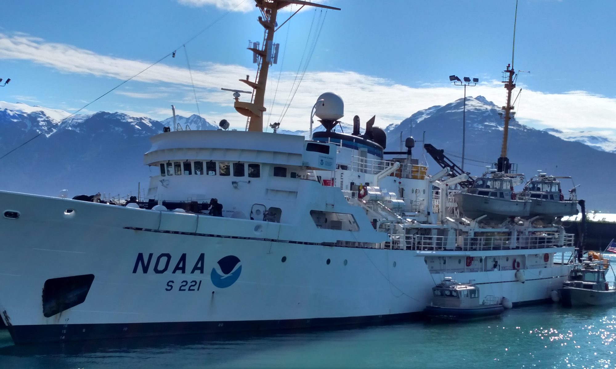
Sue Zupko: 16 The NOAA Corps

NOAA Teacher at Sea: Sue Zupko
NOAA Ship: Pisces
Mission: Extreme Corals 2011; Study deep water coral and its habitat off the east coast of FL
Geographical Area of Cruise: SE United States from off Mayport, FL to Biscayne Bay, FL
Date: June 13, 2011
Time: 14:00 EDT

Weather Data from the Bridge
Position: 30.4°N 88.6°W
Present weather: 2/8 Cumulus
Visibility: 10 n.m.
Wind Direction: 192° true
Wind Speed: 12.5 kts
Surface Water Temperature: 30.9°C
Barometric Pressure: 1013.5 mb
Water Depth: 10.9 m
Salinity: 36.5 PSU
Wet/Dry Bulb: 35°/25.5°

This blog runs in chronological order. If you haven’t been following, scroll down to “1 Introduction to my Voyage on the Pisces” and work your way back.

Take the quiz before reading this post.

I think it would be fun to be in the NOAA Corps (listen to the NOAA Corps song, “Forward with NOAA”).  To be an officer in the NOAA Corps you need at least a Bachelor’s degree and must be younger than 42 years old so you can give 20 years to the Corps before age 62.  An interest in science would be very helpful since that is NOAA’s mission,  to support science.  Basic officer training is 22 weeks long.  However, once assigned to a ship the real  training begins.  I observed how seasoned officers helped to lead the ensigns, the least experienced and lowest ranking officers, to build upon the training they received in basic training.  It’s OJT (on-the-job-training) at its best.  There is so much to learn.

Purple barrel sponge
Purple Barrel Sponge

I didn’t realize that NOAA did anything other than forecasting the weather.  I have the NOAA weather page on my favorites on all my computers.  After applying to be a Teacher at Sea, I realized that NOAA does so much more than the weather. According to NOAA’s home web page, “The National Oceanic and Atmospheric Administration (NOAA) is a scientific agency providing information and data about life on earth, our oceans, atmosphere, and the Nation’s living marine resources. NOAA’s programs range from marine sanctuaries, environmental satellites, global climate change, and ocean exploration initiatives to climate, weather, and water services.”    The ocean creates weather.  Without the ocean, there wouldn’t be hurricanes.  The water cycle begins and ends with the ocean.  It didn’t occur to me that NOAA actually works with fish, coral, and the environment in general, not just the weather.   I have decided that Teacher at Sea is an incorrect term for me.  Learner at Sea makes more sense.  Although I will take what I learned here on the Pisces back to my classrooms and to my colleagues, I have been a learner first.  Lindsey, one of the NOAA officers on the bridge, said I’ll probably be glad to be home since I’m constantly taking in information while on the ship.  Nah!  I’m a professional student at heart.  I even considered calling myself the Sponge at Sea since everyone has been so generous in sharing their thoughts and information with me, and I just soak it in.

Hands using a compass on a map
Figuring Distance

While on the bridge, I asked questions about so many things, but only touched on the surface of what they know.  It was interesting learning how to use a compass to see how far we were from land.  This compass is a ‘V’ shaped tool with the legs of the ‘V’ hinged at the top which adjusts the distance between the points at the bottom of the ‘V’.  There is also a compass used to tell which way is north. Same name, but different tools.  I used it to measure how far it was from 29° N latitude to 30° N latitude.  1 minute = 1 nautical mile and 60 minutes = 1°.  Therefore, 60 miles = 1° latitude.  I put one of the points on each of the latitude lines to get the measurement.  Then, went to where our present position and put one point on it.  The other point was then 60 miles.  I “walked” the compass across the map to the nearest point of land and counted my “steps”.  I tried again later and found I could do it.  That was fun.  I love math.

US flag unfurled off back of ship at sunset
Retiring the Colors

I am interested in flags.  When in Mayport, FL at the naval base,  I was moved by the striking of the colors and the playing of taps on the base.  The sailors on the naval vessel next to us, and the NOAA crew, stood at  attention as the sun was setting and they slowly lowered the flag into a waiting seaman’s arms.  Both ships were sitting side by side and with great ceremony each proceeded to fold their ship’s flag.  When I was in the Army, this was my favorite service to perform.  It always brings a swell of emotion to hear taps played and see people showing respect to our country’s flag by standing at attention.

Intricate mast with American flag in center, 4 flags flying vertically, the NOAA flag, and AL state flag
Mast with call sign flags on left

I noted that the flag on the back of the ship only flies while in port.  When we left the dock, we again struck the colors and hoisted (put up) a smaller flag over the flying bridge.

Cabinet with flags rolled up, letter posted on left of cube
Flag Cabinet

There is a cabinet on the bridge with an assortment of flags.  I asked what they all meant.  My gaze was directed to the side of the cabinet to help answer my question.

Poster with flags in two vertical columns going 3/4 of way down, and 2 rows of flags across bottom
International Flag Chart

Posted on the side of the cabinet is a chart which explains what the flags stand for.  The Pisces’ call sign is WTDL.  A call sign is used to communicate who you are.  It’s easier than going through a long explanation on a radio or over long distances.  Airplanes, ham radio operators, ships, etc. all have call signs to identify themselves.  In addition, the ship can use its flags.  Each letter in the call sign has a specific flag as you can see in the picture above.  These flags are flown from the mast at the top of the ship to communicate information.

Red and white tugboat with a white waves around it
Tugboat

Flags are used to communicate on a ship, but ships use lights and shapes to communicate as well.  When a ship has restricted ability to move, the ship displays vertically (up to down) from the mast a black ball, diamond, and black ball.  At night a white light between two red lights vertically lets everyone know the ship has limited movement for some reason, such as an ROV underwater or engine trouble.  Don’t forget that the ship has a red light on its port (left) side and a green light on its starboard (right) side.  These lights help other boaters know whether the other boat  is coming or going.

Lindsey shows Mike a white card/instrument to help determine vectors
Studying Vectors-More Math

What do the NOAA Corps personnel “do” on the ship?  The Corps members, who are the ship’s officers, are lead by the captain, in this case CDR Jeremy Adams.  The captain is ultimately responsible for everything which happens on the ship.  An analogy would be he is the processor on a computer.  Just as a computer assigns tasks or jobs to the peripheral equipment, the captain is the person responsible for delegating jobs.  Some of the jobs the Corps are responsible for knowing include navigation, recovering fishing equipment (the Pisces supports scientists who are learning about diverse fish populations so they must fish for them), currents and how they affect the ship, working oceanographic sampling equipment (such as the CTD), underwater cameras and sonar devices, etc.  Of course, he has heads of departments, such as the steward (food), bosun (deck), and engineer (workings of the ship) who do the daily delegating within each department.

Captain bending over a desk and looking in a book
CDR Adams refers to a book for me

Here are some specifics I noticed aboard the Pisces.  The captain decides who is qualified to be in charge on the bridge (officer of the deck).   These responsibilities include, but are not limited to: steering, looking for safety hazards, responding to alarms, communicating directions and information to the ship’s personnel, and so much more.  Think about it.  He is responsible for the safety of the people on the ship, the safety and working of the ship, the support of the scientists and their missions, and all the paperwork which shows these things have been done.  To be designated an OOD, you must demonstrate a cool head under pressure, a knowledge of the workings of the ship, and an understanding of the ocean systems themselves.  It takes a lot of practice as I’ll explain later.

Round disk on left with red and green buttons to the right
Ship's Bell

Oh, yes.  One of the responsibilities of the noon watch was to ring the bell and announce the time.   I hoped to watch this and ring the bell myself.  I would think about it daily, but would either be busy or forget about it.  I wanted to see the bell rung from the bridge and the announcement made that it was “12:00 aboard the Pisces.”

Ensign Schill speaks into microphone
Ensign Schill announces time

Another announcement they made was, “The following  is a test of the ship’s alarm.  Please disregard.”  One of my favorites was, “The ship’s store will be open in 10 minutes in the lounge.”  I needed a few things.

Let’s look at some interesting things.  First, drills.  As I have mentioned, the ship is running 24 hours a day, so someone is always sleeping.  Our first drill was at 4:00 in the afternoon.  Drills are run weekly.  The second week, the drill was at midnight.  I wore earplugs on the ship so strange noises wouldn’t disturb me.  Well, I did hear the fire alarm through my earplugs.  I had just gotten to sleep.  The captain later explained another reason for having a midnight drill besides not always waking up the day sleepers.  Emergencies don’t always happen in the day.  You must be prepared for emergencies whenever they occur.  I hadn’t thought of that.  At night on the bridge, they use red light so their eyes stay adjusted to the darkness while on watch.  Writing with red light is a bit different from with white lights so practicing at night helps the bridge crew practice this.

Red sunset reflecting off the surface of the ocean
Sunset

Weather Report

One of my opportunities as a Teacher at Sea was to report the weather with my blog posts.  I have participated in The Globe Program at my schools in the past where students monitor weather and share observations with scientists around the world.  I have always been interested in the weather.  It was a natural fit for me to get to go to the bridge and learn more about it from the crew.  The most interesting was the dry/wet bulb thermometers located just outside the bridge’s watertight doors on either side.

Two thermometers sitting side by side in an orange case inside a white box
Dry/Wet Bulbs

The bulb on the left is just the regular air temperature.  The bulb on the right has a wick which surrounds the bulb and trails off into a water reservoir underneath.  This measures the temperature of the water as it evaporates.  When the dry and wet bulb temperatures are close together, it means it is humid (there is a lot of water vapor in the air).  What happens when there is a lot of water vapor?  Think about a glass of water sitting on the table.  Have you noticed it gets beads of water on it if you have ice cubes inside?  What happens when water vapor hits something cold?  Yep, it condenses and turns to a liquid.  No, the water from the glass isn’t leaking through the glass.  The water vapor in the air condenses on the glass.  Make sure you use a coaster under a glass sitting on a wooden table. That condensation will not make your parents happy because it will leave a water ring.  Isn’t science great?  So, if the dry/wet bulb temperatures are real close and there is a lot of water vapor in the air floating up to the cold air above, what might happen next?  If you suggest that clouds will form, you are correct again.  That probably means it will rain soon.  We rarely had dry/wet bulb temperatures close together.  What was the weather like during my time on the Pisces off the coast of Florida?  If you said gorgeous for the most part, you are correct.  We had lovely weather except for June 1, the first day of hurricane season, when a tropical disturbance formed right over us.  We had thunder, lightning, and rain for a short time and we had to postpone launching the ROV for a while.  I thought the boat would rock terribly, but it wasn’t bad at all.  Yeah!

Man Overboard

Man wearing a helmet holding onto a pole
Ryan in Rescue Boat Recovery

Having someone fall overboard would be awful at any time.   It would be much more difficult to find someone at night than during the day.  It’s hazardous to run a man overboard drill during the day.  I’d hate to have them do it at night.  During our man overboard drill, everyone went to their assigned positions.  Three people went out on the rescue boat.  One was the driver, one was a rescue swimmer, and one kept his eye on the person who was in the water.  I didn’t see them get on the rescue boat since I was at my muster station in the conference room, which is on the starboard side of the O-1 deck and the rescue boat launches off the port side.  The rescuers got in the boat and those assigned to the winch which was to lower the boat, mostly the fishermen,  lowered the boat into the water.  Now, I can only imagine, but most people aren’t going to fall overboard in nice calm seas.  There are railings in the way.  I would bet that if someone fell over it was because they were jostled over during violent seas–perhaps while working recovering fishing nets or equipment.

The victim, a dummy in orange, is brought aboard
The Victim is Rescued

Going down in that rescue boat from the O-1 deck would be scary to me.  The crew on deck had someone watching the rescue boat on both sides of the deck, someone watching the victim from both sides, people with medical training standing by to administer first aid, and those on the bridge were driving based on where the victim and rescue boat were.

Orange rescue boat speeding along the ocean's surface
Rescue Boat Returns

Wouldn’t be good to run over either, nor to leave them behind.  Everyone worked as a team.  I was able to witness the drill with special permission once I checked in at my muster station to make sure I wasn’t the victim.  Also, they probably want to keep us out of the way:)  From my observation, everyone was professional and treated this as if our dummy they threw over was a real victim.  Just as we practice fire and tornado drills at school and expect students and teachers to treat it seriously in case there ever is a real emergency so everyone will be prepared, so did the crew.  As I watched, I noted the concern on the faces of the fishermen as they retrieved the boat from the water.   There was a leader in charge who told people where they needed to stand on the rescue boat and who should get off when.  The last person off was someone light, but strong.  He was responsible for attaching equipment and had to be light to make it easier for those maneuvering the rescue boat up to the deck and back to its cradle.

Ship’s Control

Sue standing at the console on the bridge taking notes
Sue Driving?

I waited until I knew the captain would be on the bridge for my driving lesson.  CDR Adams said he would be happy to let me give it a try.  I still joked that because of the autopilot I could say I was driving and just stand on the bridge.  He was serious so I went up on Monday morning during his watch.  He wasn’t there.  Hopes dashed, I mentioned it to the officers on duty who had switched schedules since the captain had other responsibilities to attend to.  “No problem.  We’ll let you steer.”  At last, my chance.  The OOD, LT Lindsay Kurelja, alerted the captain and engineering, that I would be steering.  Seems that if you slow way down or the ride gets rocky the crew calls and to check on what’s happening.

Lindsey monitors Sue's driving
Close Monitoring

The steering lesson began.  Can’t do anything without instructions.  “Although it looks like a sports car steering wheel, if you turn it quickly in either direction the boat will list (roll) heavily.”  The cooks won’t like that kind of surprise.  Others might fall out of bed.  How about those guys on deck painting?  Whoops!  “So, be sure to watch the rudder angle indicator gauge and don’t let it move left or right more than 5°.”  “Focus forward.  If you look left or right your natural tendency is to move your arms in that direction as well.”  “Got it?  Ready?’

ENS Michael Doig reduced speed to 60% from 128 rpm (revolutions per minute) to 72 rpm.  Hey, don’t they think I can handle this?  Apparently not!  These are smart folks.  When I took the helm, I watched the rudder angle indicator like a hawk.  No matter what I did, the ship kept going one direction or another.  Zig zag all the way.  I’d correct, but not enough.  Then it would be too far to the right and I’d have to correct left.  You have to wait a while before the ship responds to the wheel turning.  They stood right over me to make sure I wasn’t messing up.  After all, even though I was driving, they were responsible and no one wants the soup all over the kitchen:)  I found it very nerve-wracking to have the ship’s course in my hands, literally.

Sue driving and concentrating on it
Concentrating on driving

When I finished and they turned the auto pilot back on, Lindsay said that I only went “62 miles” off course.  I don’t think that is physically possible since we were just going about 9 knots and I only drove a couple of minutes.  I’m hoping she was exaggerating.  She congratulated me and said I did very well for a first time.  I think she was just being polite.   All I know is it didn’t feel the way my car feels when driving it.  However, it was interesting to experience driving the ship.  I was grateful to have trained professionals watching over me.  We might have ended up in New Zealand or something.

Dredging boat resembles old time riverboat with large paddle wheel
Lots of interesting boats in Pascagoula

When we arrived at the port in Pascagoula later that afternoon, I was told that we would be docking in front of another NOAA ship already at dock but before a bridge.  It reminded me of parallel parking, which many people consider the most difficult skill in driving and some people avoid like the plague.  One of the crew members groaned and said it would take forever since it was difficult to do.  We had no idea who was going to be bringing the ship in.  Well, to her credit, LT Tracy Hamburger piloted the vessel flawlessly and we were at the dock very shortly.  The crew was happy to be at their home port so they could get off the ship and relax for a while.  I, on the other hand, was happy to stay on the ship and get last-minute pictures, clean my room, pack, and blog.  For awhile I thought I was alone on the Pisces and wondered about security.  Not long after my ponderings, a security guard came walking by.  That made me feel more comfortable.  I also found that many folks returned to the ship later because they live on the ship.  Interesting home.

Five sailboats on a blue ocean
Sailboats near Ft. Lauderdale

I am grateful to NOAA for giving me this opportunity to learn about NOAA and the science missions they support.  The Pisces has a wonderful crew who were always willing to help me learn.

Karen Rasmussen, June 28, 2011

NOAA Teacher at Sea: Karen Rasmussen
Ship: R/V Tattoosh
Geographical area of the cruise: Olympic Coast NMS
Date: June 28, 2011
Cruise to: La Push
Crew: Rick Fletcher, Nathan Witherly, Karen Rasmussen
Time: Start 9:25 – End 16:00

Mission
The first part of mission is to conduct Multibeam mapping and to collect ground-truthings at the LaPush/Teahwhit areas of the Olympic Coast National Marine Sanctuary. We will also service the OCNM buoy, Cape Alava 42 (CA42). The second week of this mission is to explore the Teahwhit Head moorings, ChaBa and sunken ships, and North and South moorings.

Weather Data

Wind 5 to 10 Knots
SW Swell 4 to 7’
Science and Technology Log

Seal Rocks
Seal Rocks

We began this morning at 8:00. We loaded the boat and filled the tanks with diesel. Rick completed the safety brief (Risk Factor 21 today). Then we went over roles and responsibilities, PFD’s (personal floatation devices), Immersion Suits (location of, and completed drill- all crew completed), Emergency Situations of fire, abandon ship, MOB (Maintain Lookout, Notify Skipper), and communication systems. We left Port Angeles at 9:25 with Rick and Nathan. Nancy is driving all of our supplies to Forks. We will be spending the next three nights in Forks, WA at the Olympic Suites.

Seal Rocks

The water was choppy today with swells of about 7 feet, which makes it difficult to write in a journal. Our first stop was off of Seal Rocks. We observed sea lions and many different seabirds. An airplane was flying low over and around the islands, which was a concern because there are distance parameters that are enforced for the sea life on and around coast islands. We also noted a small boat. I tried to take a picture of the plane for further reference. The plane and small boat turned out to be State/Federal wildlife resource people doing a mammal count on the islands.

Rick servicing the Cape Alava 42 buoy.

Our next stop was at the Cape Alava 42 buoy. The “42” indicates meters in depth. Nathan piloted the boat and Rick put on protective raingear and boots. His job consisted of standing on the swim deck while Nathan maneuvered the boat as close as he could to the buoy. When we were in the correct position, Rick pulled the buoy up while I controlled the winch. He replaced the current meter which measures how fast the current is going in that area. The buoys in the Sanctuary are serviced about once every six weeks.

From Cape Alava we continued to travel south down the coastline to LaPush. We cleaned up, hosed the Tatoosh off, and packed up stuff. Nancy met us in La Push. We loaded up the car and headed to Forks for the night. Nancy and Rick continued the work from one of the hotel rooms on how to get the technology of this mission up and running correctly.

Personal Log

I had a great time today. I have to admit I was a little worried about traveling from Port Angeles to La Push in such a small vessel. We bounced a lot, but the weather was wonderful. I was very impressed with Nathan Withery’s ability to manipulate the Tatoosh in such swells. I also observed how Rick and Nathan can walk the deck with such ease. We talked a little about how much energy is used to be onboard a small vessel all day. We all are famished!
Rick servicing the Cape Alava 42 buoy.

John Taylor-Lehman, June 24, 2011

NOAA Teacher at Sea 
John Taylor-Lehman 
Onboard R/V Savannah 
June 24 – July 1, 2011 
NOAA Teacher at Sea: John Taylor-Lehman 
Ship: R/V Savannah 
Mission: Fisheries Survey
Geographical area of the cruise: Continental Shelf off of Florida
Date: 24 June 2011

Weather Data from the Bridge 
Winds from the South at 10 mph
Barometric Pressure 29.93

The Research Vessel Savannah sitting at dock in Savannah

Science and Technology Log 

We departed on time from the Skidaway Institute of Oceanography dock at 0001 hours with 6 crew members, a compliment of 8 scientists and myself. The crew consists of Captain Raymond Sweatte, 1st Mate Michael Richter, Marine Technician John Bichy, 2nd Mate Kevin Holliday, Chief Engineer Richard Huguley, and Joel Formby. Though they have different titles, it became obvious from our discussions that their duties are often shared or overlap. This arrangement is necessary because the R/V Savannah is functioning 24 hours per day.

Because we are in transit to our first sampling site my interest has focused on the operators of the ship and how the ship functions.

Capt. Sweatte outlined for me the steps in his career that have led him to being Captain of this vessel. Though military training is one avenue to prepare for a commercial captain’s license he did not follow that path. He worked his way up through various jobs as an able bodied seaman second mate, first mate, and finally the captain with 1600 ton vessel certification. His training is ongoing through “continuing education” programs in fire safety, sonar, survival training, and first aid.

Chief engineer Richard Huguley gave me an interesting tour of the 4 compartments of the engine room. Water cooling systems, two 450 horse power Caterpillar brand engines, electrical and hydraulic system all have to be monitored and maintained during our cruise. Some systems are checked for pressure, temperature and fluid levels several times per day and around the clock. Engineer Richard Huguley had an interest in machines and an aptitude for mechanics at an early age. His skills have allowed him to have consistent employment in land based industrial enterprises and nautical work.

Personal Log 

Shelly in the “Gumby” suit

My apprehensions about seasickness have been unfounded… thus far. I’m using a Transderm patch with scopolamine. It is difficult however to tease out the exact reason for my relatively calm stomach. Is it the chemical? Is it the relatively calm seas (4-5 ft. waves last night and 2-3 ft. waves today)?

During the safety instructions last night a person was required to don the “survival suit” (also known as the “Gumby” suit). The attempt to don the suit quickly is always good for a laugh. Shelly, part of the science party, was our reluctant “volunteer” for the demonstration.

Shelly in the “Gumby” suit

Since we are in transit, there has been time to explore the ship, talk with science staff and crew, as well as enjoy the view of the Atlantic from the deck. Today I saw dolphins, barracuda, and flying fish, close to the ship and a submarine off in the distance.

Tammy Orilio, A Little Bit of Science…, June 18, 2011

NOAA Teacher at Sea: Tammy Orilio
NOAA Ship Oscar Dyson
Mission: Pollock Survey
Geographical Area of Cruise: Gulf of Alaska
Date: 18 June 2011

Weather Data from the Bridge:
Latitude: 52.34 N
Longitude: -167.51 W
Wind Speed: 7.25 knots
Surface Water Temp: 6.6 degrees C (~43.9 degrees F)
Water Depth: 63.53 m
Air Temp: 7.1 degrees C (~44.8 degrees F)
Relative Humidity: 101% (it’s very cloudy/foggy, but not raining)


Science & Technology Log:

The XBT Launcher mechanism.

Today I used the Expendable Bathythermograph (XBT) a few times. The WHAT??   The expendable part means we use it once and don’t recover it.  Let’s break down the second part into the two main roots:  bathy– which refers to depth, and thermo– which refers to temperature.  This probe measures the temperature and depth of the water when it is dropped over the starboard (right) side of the ship.

“Dropping” isn’t exactly the correct phrase- we use a launcher that kind of resembles a gun.  The probe sits inside of the black tube, and after we uncap the end of the tube, we basically fling our arm out over the side of the ship to launch the probe into the water.  I can’t show you any pics of the probe, because if we take it out of the black tube, it’ll start recording data.  The probe is connected to a length of copper wire, which runs continuously as the probe falls through the water column, collecting data.  It’s important to launch the probe as far away from the ship as possible, because if the copper wire touches the metal on the ship, the data feed will be disrupted and we’d have to launch another probe.  Big waste of money and equipment! One of the survey technicians decides to cut the wire (or tells me to) when they’ve decided that a sufficient amount of data has been collected, and we can then look at a graph to see the relationship between temperature and depth.
The XBT is a quick and easy method of data collection, and can be run while the ship is in motion.  The ship does have another piece of equipment- the Conductivity, Temperature, and Depth meter (CTD)- to collect the same data, but the CTD is very big and bulky, and the ship must be stopped in order to deploy the CTD.  The CTD can also measure parameters such as dissolved oxygen concentration, current velocity, and other things (depending on the additional equipment on the meter).  The main advantage the XBT has is that it is quick and can be deployed as the ship is sailing.

from www.windows2universe.org
from http://www.windows2universe.org

Data Collected from an XBT probe today:
Latitude: 53.20 N
Longitude: -167.46 W
Water Temp at Surface: 6.7 degrees C
Water Temp at Bottom: 5.1 degrees C
Thermocline located from 0-25 meters depth

What is a thermocline, you ask?  Root word time!  We’ve already gone over thermo, and cline refers to a gradient, or where things change rapidly.  So, the thermocline is the area where you see the greatest change in temperature.  See the diagram as an example (it’s not our actual data).  Beneath the thermocline, the water temperature remains relatively constant.
Personal log:

Launching the XBT in full safety gear (minus the hardhat, it fell off)
Safety first, my friends.

Yesterday, as we were finally on our first transect of many, we needed to use the XBT to collect temperature and depth data.  A couple of the scientists told me that I could do it- yay, something for me to do!!  So I go to the lab room and see a ton of safety gear out- heavy coat, hardhat, gloves, soundproof earmuffs, goggles.  The survey tech tells me that I have to use all that protective gear because the XBT launcher is just like a gun- have I shot a gun before?  No!  So this is interesting.  I don the gear, and he explains what I need to do…which doesn’t seem that dangerous.  So now here I am, all geared up, and the rest of the scientists come trickling in to the lab to watch me.  That should’ve been a red light right there.  Why would they want to watch me do something so simple?  Turns out that it’s something that all the new people on the boat go through- we get all hyped up about shooting a loud gun, get loaded with gear, and then…not much.  So I basically got all dressed up in my protective gear for no other reason than the entertainment of the crew!!


QUESTION OF THE DAY:

Why is it important to know the temperature and/or depth of the water that we’re trawling in?

Margaret Stephens, May 28, 2011

NOAA Teacher at Sea: Margaret Stephens
NOAA Ship: Pisces
Mission: Fisheries, bathymetric data collection for habitat mapping
Geographical Area of Cruise: SE United States continental shelf waters from Cape Hatteras, NC to St. Lucie Inlet, FL
Date:  May 28, 2011 (Last day!)

NOAA Ship Pisces. Photo credit: Richard Hall

Weather Data from the Bridge
As of 06:43, 28 May
Latitude 30.15
Longitude 80.87
Speed 7.60 knots
Course 285.00
Wind Speed 10.77 knots
Wind Direction 143.91 º
Surface Water Temperature 25.53 ºC
Surface Water Salinity 36.38 PSU
Air Temperature 24.70 ºC
Relative Humidity 92.00 %
Barometric Pressure 1011.10 millibars
Water Depth 30.17 m
Skies: clear

r at Sea Margaret Stephens and Scientist David Hoke in Pisces attire.
NOAA Teacher at Sea Margaret Stephens and Scientist David Hoke in Pisces attire.

Science and Technology Log

These scientists are not only smart, but they are neat and clean, too! After completing final mapping and fish sampling on the second-to-last day, we spent the remainder of the time cleaning the wet (fish) lab, packing all the instruments and equipment, and carefully labeling each item for transport. We hosed down all surfaces and used non-toxic cleaners to leave the stainless steel lab tables and instruments gleaming, ready for the next research project. The Pisces, like other NOAA fisheries ships, is designed as a mobile lab platform that each research team adapts to conform to its particular needs. The lab facilities, major instruments and heavy equipment are permanent, but since research teams have different objectives and protocols, they bring aboard their own science personnel, specialized equipment, and consumable supplies. The primary mission of NOAA’s fisheries survey vessels, like Pisces, is to conduct scientific studies, so the ship’s officers and crew adjust and coordinate their operations to meet the requirements of each research project. The ship’s Operations Officer and the Chief Scientist communicate regularly, well before the project begins and throughout the time at sea, to facilitate planning and smooth conduct of the mission.

Gag grouper (top, Mycteroperca microlepis) and red snapper (Lutjanus campechanus) specimens, labeled for further study Photo credit: David Berrane

“Wet” (fish) lab aboard Pisces, cleaned and ready for next research team

We made up for the two days’ delay in our initial departure (caused by mechanical troubles and re-routing to stay clear of the Endeavor space shuttle launch, described in the May 18 log), thanks to nearly ideal sea conditions and the sheer hard work of the ship’s and science crews. The painstaking work enabled the science team to fine tune their seafloor mapping equipment and protocols, set traps, and accumulate data on fish populations in this important commercial fishing area off the southeastern coast of the United States. The acoustics team toiled every night to conduct survey mapping and produce three dimensional images of the sea floor. They met before sunrise each morning with Chief Scientist Nate Bacheler to plan the daytime fish survey routes, and the fish lab team collected two to three sets of six traps every day. The videographers worked long hours, backing up data and adjusting the camera arrays so that excellent footage was obtained.  In all, we obtained ten days’ worth of samples, brought in a substantial number of target species, red snapper and grouper, recorded hours of underwater video, and collected tissue and otolith samples for follow-up analysis back at the labs on land.

Models

Scientists and engineers often use models to help visualize, represent, or test phenomena they are studying. Models are especially helpful when it is too risky, logistically difficult, or expensive to conduct extensive work under “live” or real-time conditions.

Divers exploring hardbottom habitat Photo Credit: Douglas E. Kesling, UNCWilmington, CIOERT

As described in previous logs, this fisheries work aboard Pisces involves surveying and trapping fish to analyze population changes among commercially valuable species, principally red snapper and grouper, which tend to aggregate in particular types of hardbottom habitats.  Hardbottom, in contrast to sandy, flat areas, consists of rocky ledges, coral, or artificial reef structures, all hard substrates. By locating hardbottom areas on the sea floor, scientists can focus their trapping efforts in places most likely to yield samples of the target fish species, thus conserving valuable time and resources. So, part of the challenge is finding efficient ways to locate hardbottom. That’s where models can be helpful.

The scientific models rely on information known about the relationships between marine biodiversity and habitat types, because the varieties and distribution of marine life found in an area are related to the type of physical features present. Not surprisingly, this kind of connection often holds true in terrestrial (land) environments, too. For example, since water-conserving succulents and cacti are generally found in dry, desert areas, aerial or satellite images of land masses showing dry environments can serve as proxies to identify areas where those types of plants would be prevalent. In contrast, one would expect to find very different types of plant and animal life in wetter areas with richer soils.

Recovering ROV aboard Pisces Photo source: http://www.moc.noaa.gov/pc/visitor/photos‐a.html

Traditional methods used to map hardbottom and identify fish habitat include direct sampling by towing underwater video cameras, sonar, aerial photography, satellite imaging, using remotely operating vehicles (ROV’s), or even setting many traps in extensive areas. While they have some advantages, all those methods are labor and time-intensive and expensive, and are therefore impractical for mapping extensive areas.

This Pisces team has made use of a computer and statistical model developed by other scientists that incorporates information from previous mapping (bathymetry) work to predict where hardbottom habitat is likely to be found. The Pisces scientists have employed the “Dunn” model to predict potential hardbottom areas likely to attract fish populations, and then they have conducted more detailed mapping of the areas highlighted by the model. (That has been the principal job of the overnight acoustics team.) Using those more refined maps, the day work has involved trapping and recording video to determine if fish are, indeed, found in the locations predicted. By testing the model repeatedly, scientists can refine it further. To the extent that the model proves accurate, it can guide future work, making use of known physical characteristics of the sea floor to identify more areas where fish aggregate, and helping scientists study large areas and develop improved methods for conservation and management of marine resources.

Deploying CTD. Photo credit: David Hoke

Conductivity, Temperature and Depth (CTD) Measurements

Another aspect of the data collection aboard Pisces involves measuring key physical properties of seawater, including temperature and salinity (saltiness, or concentration of salts) at various depths using a Conductivity, Temperature and Depth (CTD)  device.

Salinity and temperature affect how sound travels in water; therefore, CTD data can be used to help calibrate the sonar equipment used to map the sea floor. In other instances, the data are used to help scientists study changes in sea conditions that may affect climate. Increases in sea surface temperatures, for example, can speed evaporation, moisture and heat transfer to the atmosphere, feeding or intensifying storm systems such as hurricanes and cyclones.

Pisces’ shipboard CTD, containing a set of probes attached to a cylindrical housing, is lowered from the side deck to a specified depth. A remote controller closes the water collection bottles at the desired place in the water column to extract samples, and the CTD takes the physical measurements in real time.

Fresh Catch

Of all the many species collected, only the red snapper and grouper specimens were kept for further study; most of the other fish were released after they were weighed and measured. A small quantity was set aside for Chief Steward Jesse Stiggens to prepare for the all the ship’s occupants to enjoy, but the bulk of the catch was saved for charitable purposes. The fish (“wet” lab) team worked well into overtime hours each night to fillet the catch and package it for donation. They cut, wrapped, labeled and fresh froze each fillet as carefully as any gourmet fish vendor would. Once we disembarked on the last day, Scientist Warren Mitchell, who had made all the arrangements, delivered over one hundred pounds of fresh frozen fish to a local food bank, Second Harvest of Northern Florida. It was heartening to know that local people would benefit from this high-quality, tasty protein.

Careers at Sea

Crewmen Joe Flora and Vic Pinones

Many crew members gave generously of their time to share with me their experiences as mariners and how they embarked upon and developed their careers. I found out about many, many career paths for women and men who are drawn to the special life at sea. Ship’s officers, deck crew, mechanics, electricians, computer systems specialists, chefs and scientists are among the many possibilities.

Chief Steward Jesse Stiggens worked as a cook in the U.S. Navy and as a chef in private restaurants before starting work with NOAA. He truly loves cooking, managing all the inventory, storage and food preparation in order to meet the needs and preferences of nearly forty people, three meals a day, every day. He even cooks for family and friends during his “off” time!

First Engineer Brett Jones

Electronics specialist Bob Carter, also a Navy veteran, is responsible for the operations and security of all the computer-based equipment on board. He designed and set up the ship’s network and continually expands his skills and certifications by taking online courses. He relishes the challenges, responsibilities and autonomy that come along with protecting the integrity of the computer systems aboard ship.

First Engineer Brent Jones has worked for many years in the commercial and government sectors, maintaining engines, refrigeration, water and waste management, and environmental control systems. He gave me a guided tour of the innards of Pisces, including four huge engines, heating and air conditioning units, thrusters and rudders, hoists and lifts, fresh water condenser and ionizers, trash incinerator, and fire and safety equipment. The engineering department is responsible for making sure everything operates safely, all day and night, every day. Brent and the other engineers are constantly learning, updating and sharpening their skills by taking specialized courses throughout their careers.

Chief Boatswain James Walker

Chief Boatswain James Walker is responsible for safe, efficient operations on deck, including training and supervising all members of the deck crew. He entered NOAA after a career in the U.S. Navy.  The Chief Boatswain must be diplomatic, gentle but firm, and a good communicator and people manager. He coordinates safe deck operations with the ship’s officers, crew, and scientific party and guests.

NOAA officers are a special breed. To enter the NOAA Commissioned Officer Corps, applicants must have completed a bachelor’s degree with extensive coursework in mathematics or sciences. They need not have experience at sea, although many do. They undergo an intensive officers’ training program at a marine academy before beginning shipboard work as junior officers, where they train under more experienced officers to learn ship’s systems and operations, protocols, navigation, safety, personnel management, budgeting and administrative details. After years of hard work and satisfactory performance, NOAA officers may advance through the ranks and eventually take command of a ship.

Operations Officer, Lt. Tracy Hamburger
Junior Officer Michael Doig

All the officers and crew aboard Pisces seem to truly enjoy the challenges, variety of experiences and camaraderie of life at sea. They are dedicated to NOAA’s mission and take pride in the scientific and ship operations work. To be successful and satisfied with this life, one needs an understanding family and friends, as crew can be away at sea up to 260 days a year, for two to four weeks at a time. There are few personal expenses while at sea, since room and board are provided, so prudent mariners can accumulate savings. There are sacrifices, as long periods away can mean missing important events at home. But there are some benefits: As one crewman told me, every visit home is like another honeymoon!

Personal Log

One size fits all?
One size fits all?

Navy Showers

I had expected that life aboard Pisces would include marine toilets and salt water showers with limited fresh water just for rinsing off.  I was surprised to find regular water-conserving flush toilets and fresh water showers. Still, the supply of fresh water is limited, as all of it is produced from a condensation system using heat from the engines. During our ship orientation and safety session on the first day, Operations Officer Tracy Hamburger and Officer Mike Doig cautioned us to conserve water.  They explained (but did not demonstrate!) a “Navy” shower, which involves turning the water on just long enough to get wet, off while soaping up, and on again for a quick rinse. It is quite efficient – more of us should adopt the practice on land. Who really needs twenty minute showers with fully potable water, especially when more than one billion people on our “water planet” lack safe drinking water and basic sanitation?

One size fits all?
One size fits all?

“Abandon Ship!”

One size fits all?
One size fits all?

The drill I had anticipated since the first pre-departure NOAA Teacher at Sea instructions arrived in my inbox finally happened. I had just emerged from a refreshing “Navy” shower at the end of a fishy day when the ship’s horn blasted, signaling “Abandon ship!” We’d have to don survival suits immediately to be ready to float on our own in the sea for an indefinite time. Fortunately, I had finished dressing seconds before the alarm sounded. I grabbed the survival suit, strategically positioned for ready access near my bunk, and walked briskly (never run aboard ship!) to the muster station on the side deck. There, all the ship’s occupants jostled for space enough on deck to flatten out the stiff, rubbery garment and attempt to put it on.  That’s much easier said than done; it was not a graceful picture. “One size fits all”, I learned, is a figment of some manufacturer’s imagination. My petite five foot four frame was engulfed, lost in the suit, while the burly six- foot-five crewman alongside me struggled to squeeze himself into the same sized suit. The outfit, affectionately known as a Gumby, is truly designed for survival, though, as neoprene gaskets seal wrists, leaving body parts covered, with only a small part of one’s face exposed. The suit serves as a flotation device, and features a flashing light, sound alarm, and other warning instruments to facilitate locating those unfortunate enough to be floating at sea.

Thankfully, this was only a test run on deck. We were spared the indignity of going overboard to test our true survival skills. I took advantage of the opportunity to try a few jumping jacks and pushups while encased in my Gumby.

Fish bet ‐‐ Rigged results? Photo credit: Jen Weaver

Bets Are On!

These scientists are fun-loving and slightly superstitious, if not downright mischievous. On the last day, Chief Scientist Nate Bacheler announced a contest: whoever came closest to predicting the number of fish caught in the last set of traps would win a Pisces t-shirt that Nate promised to purchase with his personal funds. In true scientific fashion, the predictions were carefully noted and posted for all to see.  As each trap was hauled in, Nate recorded the tallies on the white board in the dry lab. Ever the optimist, basing my estimate on previous days’ tallies, I predicted a whopping number: 239.

I should have been more astute and paid more attention to the fact that the day’s survey was planned for a region that featured less desirable habitats for fish than previous days. Nate, of course, having set the route, knew much more about the conditions than the rest of us did. His prediction: a measly 47 fish. Sure enough, the total tally was 38, and the winner was………Nate!   Our loud protests that the contest was fixed were to no avail. He declared himself the winner. Next time, we’ll know enough to demand that the Chief Scientist remove himself from the contest.


Chief Scientist Nate Bacheler and red snapper, Lutjanus campechanus Photo credit: David Hoke


Crewman Kirk Perry with Mahi‐mahi

Catching Mahi-mahi

Once the day’s deck work was over, a fish call came over the ship’s public address system. Kirk Perry, one of the avid fishermen among the crew, attached a line baited with squid from the stern guard rail and let it troll along unattended, since a fishing pole was unnecessary. Before long, someone else noticed that the line had hooked a fish. It turned out to be a beautiful mahi-mahi, with sleek, streamlined, iridescent scales in an array of rainbow colors, and quite a fighter. I learned that the mahi quickly lose their color once they are removed from the water, and turn to a pale gray-white once lifeless. If only I were a painter, I would have stopped everything to try to capture the lovely colors on canvas.

Goodbyes

We entered Mayport under early morning light. An official port pilot is required to come aboard to guide all ships into port, so the port pilot joined Commander Jeremy Adams and the rest of the officer on the bridge as we made our way through busy Mayport, home of a United States Naval base. Unfortunately, the pier space reserved for Pisces was occupied by a British naval vessel that had encountered mechanical problems and was held up for repairs, so she could not be moved. That created a logistical challenge for us, as it meant that Pisces had to tie up alongside a larger United States naval ship whose deck was higher than ours.  Once again, the crew and scientists showed their true colors, as they braved the hot Florida sun, trekking most of the gear and luggage by hand over two gangplanks, across the Navy ship, onto the pier, and loading it into the waiting vehicles.

The delay gave me a chance to say farewell and thank the crew and science team for their patience and kindness during my entire time at sea.

These eleven days sailed by. The Pisces crew had only a short breather of a day and a half before heading out with a new group of scientists for another research project. To sea again….NOAA’s work continues.

All aboard!

A big “Thank you!” to all the scientists and crew who made my time aboard Pisces so educational and memorable!


Science team. Photo credit: NOAA Officer Michael Doig

Links & Resources

http://www.marinecareers.net/links_degrees.php

Literature cited:

Dunn, D, Halpin, P (2009) Rugosity-based regional modeling of hard-bottom habitat. Marine Ecology Progress Series 377:1-11

Safety! I hope I never have to use that fire axe!
Sky view from Pisces. Photo credit: David Hoke
View from Pisces: United States Navy’s Littoral Combat Ship
Engineers Abe Goldberg and Bob Carroll
Loading gear with crane & hoist
Commander Jeremy Adams looks out from Pisces’ bridge Photo credit: Richard Hall