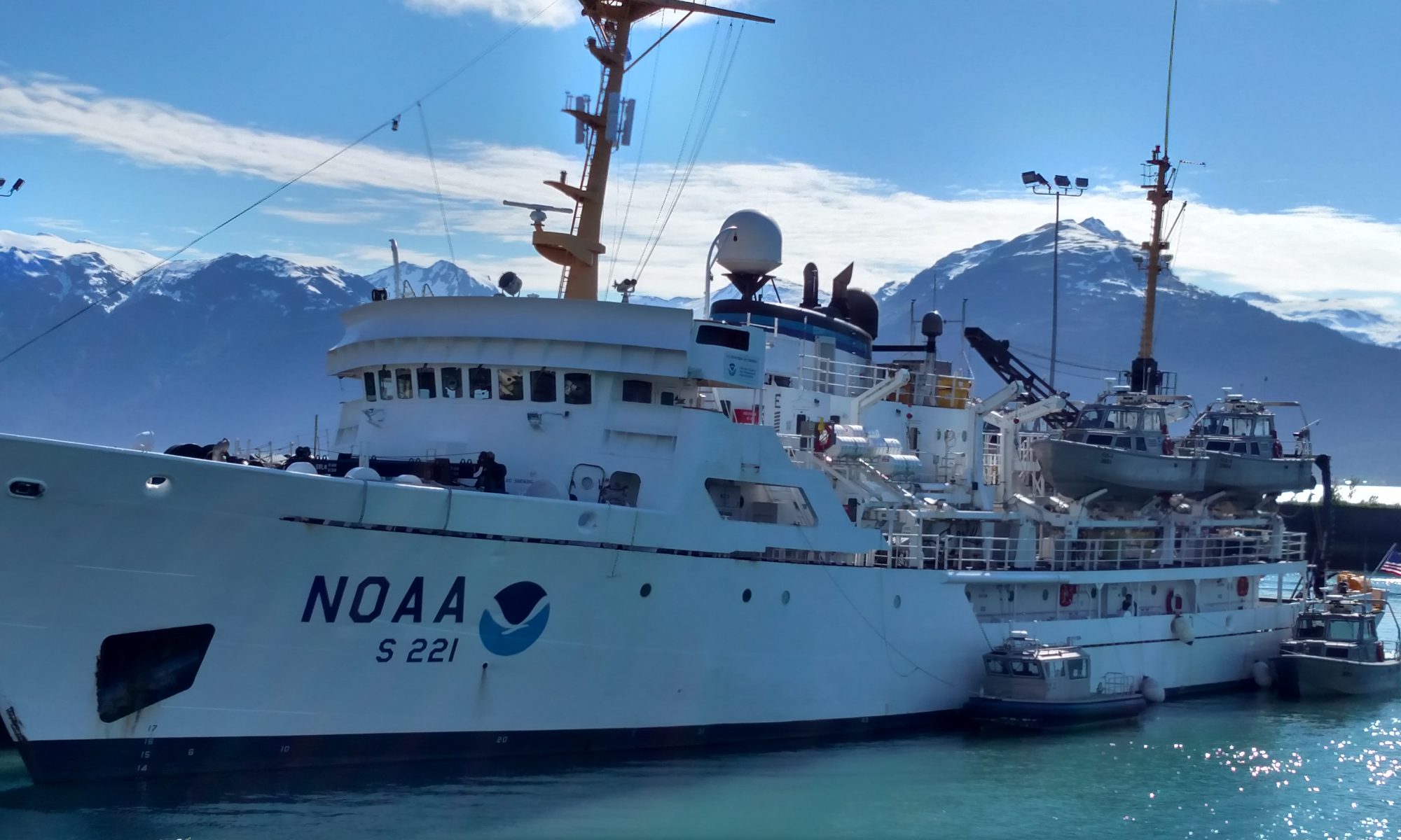
Margaret Stephens, May 25-27

NOAA Teacher at Sea: Margaret Stephens
NOAA Ship:
Pisces 
Mission: Fisheries, bathymetric data collection for habitat mapping
Geographical Area of Cruise: SE United States continental shelf waters from Cape Hatteras, NC to St. Lucie Inlet, FL
Dates: May 25-27, 2011

Weather Data from the Bridge 

View from the Pisces bridge: calm seas

As of 11:43 May 27, 2011
Latitude 29.94
Longitude 80.29
Wind Speed 0.60 knots; calm
Wind Direction 167.50 º
Surface Water Temperature 26.60 ºC
Air Temperature 25.70 ºC
Relative Humidity 81.00 %
Barometric Pressure 1013.70 millibars (mb)
Water Depth 54.59 m
Skies: clear to partly cloudy

Science and Technology Log 

I struggle to measure a squirmy black sea bass, Centropristis striata.

Previous logs describe in some detail the three principal components of this research work aboard Pisces: overnight mapping using acoustics (SONAR) technology; daytime fish trapping; and underwater videography. The nighttime mapping is used to identify the hardbottom habitats favored by red snapper and grouper species and helps the science team determine where to set traps the next day. The videography provides additional visual clues to the contours and composition of the sea floor, water clarity, and marine life in the area.

Scientific research at sea is far from neat, clean and predictable. Messy, hot, smelly, sometimes frustratingly unpredictable – and not for the weak-stomached– are better descriptors. The work goes on as long as it takes, well past the scheduled twelve hour shifts. The “wet” lab could just as well be called the “fishy” lab. For good reason, the seasoned researchers wear special waterproof bibs and boots and clothing they don’t mind getting dirty. A distinctly fish-infused aroma fills the air and embeds skin, hair and garb. The best laid plans go awry. Equipment and instruments are checked, double- and triple-checked; nevertheless, they don’t always function properly or yield the expected results. Despite using high-tech SONAR to locate what appear to be promising locations, and baiting traps with the most appetizing bait imaginable (dead menhaden), the fish move around and are not always lured into the traps we set so carefully. While this project has been graced so far with unusually calm seas, the currents, other boat traffic, threatening weather and other factors can cause the ship to deviate from its appointed path.

These scientists seem to thrive as they meet the challenges of the ever-changing seascape, solving problems and continuing the hard work day and night.

Todd Kellison (l) and Warren Mitchell (r) confer at sunrise as their long night’s acoustics lab work continues past dawn. Photo credit: David Berrane

After spending the first few days south of Cape Canaveral, mapping and trap sampling, calibrating and making adjustments to the instruments and deployment procedures, we headed north, because strong currents and turbid (cloudy) waters were limiting the team’s ability to deploy traps and capture useful underwater video images. When the currents are too strong (>2.5 – 3 knots, or nautical miles per hour), the moving water tends to drag the traps, making it very difficult to position them in the desired locations on the sea floor. In addition, the currents swirl sediments around, reducing visibility and yielding video images that are less than revealing. Since moving north of Cape Canaveral, the currents have been less of a problem, and the water clarity has improved.

The mapping, trapping, and video procedures all went more smoothly after the team made adjustments guided by the first days’ experiences. The acoustics team leaders, Warren Mitchell and Todd Kellison, have worked assiduously throughout the taxing, tiring overnight shifts to produce useful bathymetry maps with the ship’s state-of-the-art ME70 multibeam sonar unit. Investigator Jen Weaver has applied her expertise with GIS and mapping software to help Warren and Todd translate the sonar data into three dimensional maps most useful for Nate Bacheler, the Chief Scientist, to plan the trapping routes.

Sonar image shows ledges and outcrops. Photo credit: Christina Schobernd

By the second and third nights on the acoustics team, I was getting better at recognizing the features on the sonar screen displays, such as ledges and rocky outcroppings, that are indicative the hardbottom habitats we were seeking. Chief Scientist Nate has perfected the timing and communications with the deck crew so that the traps are released off the stern deck at just the right time, sinking to the bottom in the desired locations. Radio transmitter in hand, Nate studies an array of monitors displaying the sonar images of the sea bottom mapped the night before, the navigation system with the ship’s position and path, and a live video feed showing the crew awaiting instructions on the deck. The helmsman alerts Nate that the ship is approaching the next drop point and slows the ship.

Nate issues a series of commands to the deck crew by radio:

Crew deploys baited trap above guard rail on

“Ready the cameras. Ready the cameras.” – A few minutes before the ship approaches each trap point, a team member activates the two video cameras attached to the trap.

Crew deploys baited trap above guard rail on

“Go on standby; stand by to deploy trap.”- The deck crew positions the trap at the edge of the stern (back) deck and makes sure all the lines are clear.

“Deploy trap; deploy trap.” The deck crew pushes the trap over the edge of the stern and lets the line attaching it to the ship run free. Once the line goes slack, indicating the trap has reached the bottom, the crew releases the bright orange buoys to float on the surface, marking the trap locations to warn other ships to steer clear and facilitate retrieval.

The deck crew then positions the next trap, and the helmsman, Nate and crew repeat the choreographed sequence until all six traps in each set are in place. Soon after, the helmsman maneuvers the ship for the deck crew to retrieve the traps and their contents one by one using a pothauler, a special hoist.

Technical/Logistical Challenges 

We ran into some initial difficulties with the video cameras attached to the traps when they turned off and failed to record. As good scientists, the team observed the procedures closely and determined that the force of the cameras hitting the water upon release was probably causing them to shut off. At first, the traps with cameras attached were being pushed off the stern above a fixed guard rail, which sits about 1.5 meters above the deck, with three removable guard wires below the rail. A simple adjustment seems to have fixed that problem – instead of releasing the traps above the guard rail, the crew lowered the traps to the deck floor and pushed them off more gently from there. This modified procedure seems to have done the trick, as the cameras have not shut off since.

Science team adjusts camera-trap arrays on stern deck

We are constantly reminded of the ship’s mantra, “Safety first!”, as anyone working on deck while machinery is in operation is required to wear a hardhat and personal flotation device (PFD). He or she who forgets to do so is quickly alerted by others. Because the change in the trap release procedure necessitated removing the three safety wires below the stationary guard rail, leaving a gap large enough for a person to slip overboard, the crew members tied themselves to tethers attached to the deck. Falling off the stern of the ship is dangerous, not least because the propellers turn rapidly and create a backwash effect that could draw a person underwater, even one wearing a PFD.

After each set of six traps is collected, the crew and wet lab team prepare them for redeployment. They empty any fish caught from the traps into bins, separate them into species, then weigh, measure, and release or preserve them for further study. With the help of the deck crew, two or three members of the science team stay on the side deck, dressed in waterproof bibs, boots, life vests and helmets. They detach and dry the cameras and hand them to the dry lab video coordinator, Christina Schobernd, who immediately removes the memory cards, sets up the video to view, and readies the cameras for the next trapping sequence. Occasionally, a camera tilts out of alignment, possibly in the jolt of travel or by hitting something underwater or on the bottom. Each time that happens, Christina meticulously assesses the situation and adjusts the cameras’ attachments.

Under these conditions, working with expensive equipment, it is crucial to anticipate possible problems and build redundancy into the operations as much as possible. This year, the team added a second, high-definition camera to the video array, and each camera is attached to the trap frames with at least six heavy-duty plastic ties and a tether wire and clip. That tether has been a camera-saver, as in one instance the cameras somehow broke free and would have been lost without it.

Fish measuring “assembly line” in the wet lab

Thanks to good planning, enhanced by a measure of good luck, so far we have not lost any traps or equipment. It is not unheard of to have a trap break free from impact, from a boat propeller running over and cutting the line, or for some other reason. If a trap breaks loose in a place that’s too deep for human divers to search, or if the ship is not equipped with diving capability or a ROV (remote operating vehicle), the trap must be given up for lost.

Once the traps’ fishy contents are brought in and separated by species, three to four people in the wet lab process the fish in assembly-line fashion, as described in the previous log. With traps containing one hundred fifty (150) fish or more, we have to work fast and furiously to weigh, measure and release them before the next haul is aboard. The fish flop and squirm and squirt, and as I learned the first time I handled them, the black sea bass have some mighty sharp spines that can penetrate even the heavy, protective gloves we wear.

To ready the array for the next trap set, the team then

  •  “freshens” the bait by taking out any fully or partially eaten bait and replacing it with the same number of whole menhaden fish;
  •  reattaches the cameras;
  • lines up the numbered traps on deck, ready to go again.

Sometimes, the interim between trap sets coincides with the ship’s lunch time: 11 a.m. If so, the science team takes a short break to refuel with Steward Jesse Stiggens’ tasty culinary creations. If not, the stewards leave the lunch buffet available for whenever the team can get away for a few minutes. While the traps are “soaking” (sitting on the sea floor for the required ninety minute intervals), the science team keeps busy viewing video from the previous haul, processing fish specimens, tidying the deck and lab area, speculating about what the next trap might yield, and telling fish stories from past field work. As anyone who has spent time around fishers (the gender-neutral form of fishermen) knows, fishing stories always get better with time!

Processing and Collection of Biological Samples 

Otolith showing age rings Photo source: dnr.state.oh.us

To assess fish stock and population trends, scientists must do more than identify species and catch, weigh and measure fish. They also determine the sex, size and ages of fish and genetic diversity within the populations studied. Connecting size and age can help determine the fishes’ growth rates, where they are in their reproductive cycles, and how likely they are to spawn, or reproduce.

Why is it important to determine the age of fish? By knowing the age of fish, fisheries managers can better understand and monitor how fish populations change over time, and how they are affected by environmental stresses or disturbances, including environmental changes, storms, pollution, commercial and recreational fishing, natural mortality, predation, and changes in the availability of food. The age information helps inform policies promoting fishing practices that protect the fish resources for sustainable, long-term benefit.

David Berrane removes otoliths from red snapper, Lutjanus campechanus Photo credit: Christina Schobernd

To determine fish age most accurately, the scientists remove otoliths, two bones located on either side of fish’s skull that are analogous to the human ear bone. The otoliths show annual growth rings, so the technique used is similar to counting tree rings. You may clickhere to try aging a sample fish.

On board Pisces, the experienced scientists remove the otoliths from dead fish with a sharp knife and scalpel, then place the otoliths in small envelopes, labeled with the date and location caught, ready to be analyzed back in laboratories on land. At the same time, they preserve tissue samples used for DNA/genetic analysis. They may also remove the gonads, or egg sacs, of female fish, if they are needed for further study. They can approximate how close the fish are to spawning based on the condition of the egg sac. The closer they are to spawning, the fuller and larger the sacs become.

Removing egg sacs from female black sea bass, Centropristis striata

Through laboratory analysis using DNA from tissue samples, scientists can evaluate the genetic diversity within each species and other population dynamics. Genetic diversity among fish populations, as in other animal and plant species, is desired because more genetically diverse populations are generally more resilient, more resistant to disease and more able to withstand changes in environmental conditions, availability of food, and other stresses.

Personal Log 

We’ve been fortunate to have had a stretch of unusually fine weather and calm seas. Thank goodness, not a single person has shown a hint of sea sickness. It may be bad luck to say this while we are still out on the water, but I have never been seasick, and I certainly would not want this to be the first time. I’ve seen people who literally turned green and felt absolutely miserable while traveling on rough seas. Some of the crew members who served in the United States Navy or on commercial vessels told me that they had been violently sick every day for weeks when they first went to work at sea. Most eventually get over that. I cannot imagine how debilitating and horrible it must be to feel so wretched. There’s no place to go once you are on a ship — you cannot just jump overboard and swim home through long distances and possibly shark-infested waters, although if you are sick enough, that prospect might seem a welcome relief!

Significant events 

Late one afternoon, I noticed that we had changed direction. We had been heading south, and then turned back north. Since this was not the planned route, I thought perhaps I had missed or misunderstood something, so I went up to the bridge to investigate. Commander Jeremy Adams (the CO = Commanding Officer) informed me that he had turned the ship around in response to a radio call from the Coast Guard, the branch of the armed services of the United States in charge of monitoring the coasts for navigation, safety and law enforcement. The radio call was a Pan-pan alert, one step short of the emergency Mayday call that mandates immediate action. A Pan-pan is urgent but not imminent, and ships in the area are not required to respond. In this case, the Coast Guard announced that they had received a report of a partially submerged small boat with possible man overboard/missing. Since Pisces was the closest vessel to the reported location, CO Adams made the decision to deviate from the planned course and redirect her at nearly full speed, approximately fourteen knots (nautical miles per hour), to search and assist if necessary. As Captain Jerry put it, even though he was not obligated to respond, he would not have been able to rest knowing there was a possibility the ship under his command could have helped. While en route there, another radio relay from the Coast Guard canceled the Pan-pan, because the initial report was apparently a false alarm. The CO informed me that false alarms of this kind occur all too often. Sometimes disgruntled or troublemaking recreational boaters, perhaps annoyed with the Coast Guard’s vigilance or just pulling a prank, call in alarms. These are akin to and at least as dangerous as intentionally false bomb scares or fire alarms on land. Such maliciously false reports take emergency personnel and resources away from true emergencies, cause tremendous waste of public funds, and can put emergency responders and others at risk. At sea, if the perpetrators are caught, they can be fined heavily and held responsible for all the costs incurred.

Devastation in Joplin, Mississippi 

On Sunday, May 22, news of the catastrophic tornado in Joplin, Mississippi reached Pisces. One of the crew members watched the news feed in horror, as the images of an elementary school that had been completed flattened played over and over again on the large screen in the mess. His friend lived just two blocks from that same school and had probably been at home when the powerful twister hit. The crew member tried in vain to call her cell phone or reach anyone who might have heard from her.

In the next hours, we learned that this NOAA ship’s crew is like family. The CO authorized the crew member to take personal leave and arranged for Pisces to meet a Coast Guard vessel the next morning to transport the young man to shore, so he could catch a flight and drive to Mississippi to search for his friend. Since he is also a certified medic, he would be allowed in to the town, despite any official restrictions.

We all felt for him and waited anxiously for word from Joplin. Thankfully, a day later, the ship received a message that his friend was alive and physically intact, although her home and entire neighborhood were destroyed, and so many other residents were critically injured, missing or dead.

It would be terrible to be isolated at sea in such circumstances and feel utterly helpless. I was reminded of the sacrifices so many service members make. As other crew members who had served in the U.S. Navy and other military branches know all too well, home leave, even in emergencies, is not always possible. Many of them had missed key personal events and tragedies while they were away from home on active duty.

Links & Resources

Peggy Deichstetter, September 1, 2010

NOAA Teacher at Sea
Peggy Deichstetter
Aboard Oregon II
August 29 – September 10, 2012

Mission: Longline Shark and Red Snapper Survey
Geographical area of cruise: Gulf of Mexico
Date: September 1, 2010


Teacher at Sea Peggy Deichstetter in her hard hat
On the bridge
On the bridge

Day 4 Sept . 1

We are about an hour away from out first data collection area. This morning just before dawn I got a tour of the bridge. The CO showed my all the computers that keep track of where we are. I learned a lot, not only about the bridge but also about careers in NOAA.(National Oceanic and Atmospheric Administration).. NOAA is made up of several parts, the CO and I talked about the oceanic parts; the officers and crew who run the ship and the scientists. The officers follow the same rules as the military. If you are in the Navy you can transfer directly into this division.

The scientists do the actual research designed by NOAA to answer questions about the ocean. In this cruise we are counting, tagging and releasing shark. This will tell us about how many sharks are in this area at this time of year. NOAA has collected data for twenty year so they will be able to tell the health of the shark population.

To help collect information of the effect of the oil spill we are also doing water analysis and plankton tows.

After lunch we were taught how to do a plankton tow. I have done numerous plankton tows in my life but never on this scale. I used all the skills that I learned when I did research in the Arctic except on a much larger scale.

Annmarie Babicki, August 8, 2010

NOAA Teacher at Sea: Annmarie Babicki
NOAA Ship Name: Oregon II
Mission: Shark and Red Snapper Bottom Longline Survey
Geographical area of cruise:  Eastern Gulf of Mexico
Date: August 8, 2010

A cargo ship off the starboard side.

Weather Data from the Bridge

Time: 16:17 Military time, 4:17 P.M.
Latitude: 2636.96 degrees North
Longitude: 8510.18 degrees West
Clouds:  Mostly cloudy
Winds:  7.68 knots (kts.)
Air Temperature:  30.4 Celsius (C)
Sea Temperature: 30.2 Celsius (C)
Dry Bulb Temperature: n/a
Wet Bulb Temperature: n/a
Barometric Pressure: 1012.97 mB

Science and Technology:

Today the sea is very calm, so it was a great opportunity to have a diver’s drill. This was a very special event because they occur only once a month, so it was great to be able to watch the drill in action. Safety is of the utmost importance in everything both ship personnel and scientists do on this ship.  Prior to the dive, the Captain, Dave Nelson, called a meeting for all who were involved. Their  discussions included their mission, current and potential weather changes, possibility of sharks in the water, the role of each pair of divers and what the plan is in case of an emergency.  There is an in depth checklist to follow along with the recommendations of the Captain, Executive Office, Navigator, Junior Officer, Diver Master, Chief Boson, divers and skilled fisherman. Everyone on board has multiple roles and the key to everything going to plan is teamwork and safety.

The rescue boat, called a RHIB, was put into the water prior to divers going in. There were two people in the boat who monitored the divers and were there in case of an emergency.  This boat costs about $125,000 and needs to be cared for carefully so that it does not incur any damage. The divers jumped in the water, which was about 80 degrees and gave the OK (a pat on the head) that they were ready to begin their mission.  When they were about 12 feet down in the water,  I could clearly see them (No oil in these parts).

RHIB, the rescue boat used in the diver’s drill

They checked out the bow and propeller blades to make sure there was not a barnacle build up that could impact them functioning properly. The dive went off without a hitch and their diving gear was hauled out of the water prior to the divers coming aboard.  The Captain explained that this was done because the equipment is over 40 pound and would make it difficult for the divers to climb the floating ladder which is over the side of the ship. After the dive was completed, they had a debriefing session, where they discussed the status of the barnacles and concluded that at this time they were not having any impact the propeller or hull.

Personal Log

What an unbelievable 24 hours.  The crew and scientists have been so supportive and patient with me, as I asked them a thousand questions.  They are all willing to share their time, knowledge and experiences with me. I keep a small notebook with me at all times as there is so much I am learning every minute of the day.
We have been traveling to our first survey site, which is over 400 or so miles from the port in Pascaguola, Mississippi.  At a speed of about 12 knots, it will take us about 34 hours to reach our destination.  This has given me time to get my “sea legs”, which I’m still working on.  No sea sickness yet, and besides there’s too much I want to see and do to have time to get sick.

One thing I have been struck by is the color of the ocean.  It has change color many times since we left port.  It has been a muddy brown because the fresh water coming down from the Mississippi River is carrying sediment, which is then mixing with the salt water of the ocean. As we got farther away from shore, the color changed from a muddy brown, to a green and then to a very dark blue. We are currently in very deep waters  (approx. 10,750 feet) and the color of the ocean is a beautiful blue like I have never seen before. It almost took my breath away.

Blue waters

We will reach the survey site about 2 A.M. and get to work right away.  It is a 24 hour working ship, which means that surveying never stops.  I am part of a group of 5, who will work noon to midnight, therefore my work will start tomorrow.  I have lots to do and learn in the meantime and can’t wait to see my first shark.

“Question of the Day”: What is a fin clip?  Find out tomorrow after we begin the survey.

Obed Fulcar, July 22, 2010

NOAA Teacher at Sea Obed Fulcar
NOAA Ship Oscar Dyson
July 27, 2010 – August 8, 2010

Mission:Summer Pollock survey III
Geograpical Area:Bering Sea, Alaska
Date: July 22, 2010

Weather from the bridge:
Time: 0355 am
Latitude:58.22 N
Logitude:175.10 W
Wind speed:19.48 kts
Wind Direction:230 W/SW
Sea Temp:8.10 C (approx. 46.58 F)
Air Temp:8.72 C (approx. 47.70 F)
Barometric Pressure:1090.0 mb
Cloudy skies

Science and Technology Log:
Yesterday afternoon we had a Fire/Emergency drill, just like we do in school. Safety is definately big around here. Everywhere you look there is an orange sign for an EEBD (Emergency Escape Breathing Device), to be used in case of a fire,to avoid intoxication from breathing the smoke. Fire is the number one enemy in a ship, and it can have disastrous consequences at sea. For the fire drill we had to follow a path leading to a safe room where we had to be accounted for.

Me in my immersion suit

Fire stations are in every corner with Fire Hoses, and evenFire Axes. Next we had to do an Emergency drill where we had to practice abandoning ship. I had to grab my assigned Immersion suit, or “Mustang suit”, also known as a “Gumby suit”, which is an orange jumpsuit, made of neoprene (the material used in drysuits or diving suits). It is supposed to keep you warm and alive in the event you have to abandon ship and hit the icy waters of the Bering Sea. I had to practice putting on the cumbersome but necessary safety gear. Everyone is issued one that has to be kept in their staterooms. I had to pack it again and put it back in it’s original bag after I finished trying on. As part of the emergency drill we also had to gather around the ship’s Life Rafts, that where contained inside a set of 3 white canisters on both sides of the ship (Port (right), and Starboard (left)). I was surprised to see my name on the evacuation plan assinged to Life rafts 2-3.

Each life raft can hold up to 20 people inside, and many more, until rescue arrives. I noticed that aboard the ship chairs, tables, cabinets and pretty much anything that can get loose during bad weather are safely anchored to avoid falling off. There are safety signs everywhere you go reminding you to be ready at all times. Also safety is No 1 whenever working on the deck near the water, from the use of a PFD (personal Flotation Device), a hard hat, due to cranes and heavy duty cables, to a safety harness to be anchored to the boat. Eye wash emergency stations are everywhere, as well as signs telling you to use hand sanitizer at all times.

Personal Log:

Safety first: Just like in school, the possibility of a fire can lead to disaster and tragedy. It is a serious matter that we should all be prepared for. Fire drills in school, like in the Oscar Dyson, help us get familiar with our nearest exit starcase, and to know a safe place to gather up away from the fire, just like when we go across the street from our school during a drill. Also as a member of the Washington Heights, Manhattan North CB12 CERT (Community Emergency Response Team), it is my job to help educate the community at large about fire emergecy preparedness awareness. Fire is the #1 emergency affecting buildings in New York City and every resident is at risk of been affected. Since 9-11, NYC OEM has been promoting emrgency awareness by educating and getting the public involved in emergency awareness ranging from fire, heat waves, to hurricane emergencies. I encourage everyone to visit ReadyNY.org andReady.gov to learn more about protecting yourself, family and neighbors in case of an emergency.

Ayer tuvimos una practica deEvacuacion de emergencia y de Incendio. Practicamos siguiendo el Plan de Evacuacion en caso de fuego reuniendonos en un lugar designado (en este caso el salon de Conferencias). Tambien practicamos el abandonar la nave, donde teniamos que ponernos los Trajes de Supervivencia o de Inmersion, requeridos por ley. En caso de que al abandonar la nave nos protegerian de las gelidas aguas del Estrecho de Bering manteniendonos secos y abrigados si llegaramos a caer en el mar. Me sorprendi mucho de ver mi nombre en la lista de evacuacion ya asignado a una de las Balsas Salvavidas, de la nave. Hay dos juegos de 3 balsas en ambos lados de la nave(Babor o derecha, y Estribor o izquierda) con capacidad para 20 personas. La seguridad es No 1 abordo del Oscar Dyson, con letreros en todas partes indicando desde el uso de Chalecos Salvavidas, Trajes de Inmersion, hasta estaciones de emergencia, con mangueras y hachas de incendio. Asi como en la escuela y en los edificios todos debemos estar educados en que hacer en caso de incendio, que es la emergencia #1 en la Ciudad de Nueva York.

Elizabeth Warren, July 9, 2010

NOAA Teacher At Sea: Elizabeth Warren
Aboard NOAA Ship Pisces

Mission: Reef Fish Surveys
Geographical Area of Cruise: Gulf of Mexico
Date: July, 9 2010

Getting into it!

Sunset
Sunset

Weather Data from the Bridge:
Temperature: Water: 30.5℃ Air: 29.6 ℃
Wind: 2 knots
Swell: .3 meters
Location: 27. 51° N, 91.48° W
Weather: Sunny, Humidity 70%, light clouds

Science/Technology Log
Today we began the SEAMAP Reef Fish Survey.
A little background information: The surveying began in 1992 through now with a few years with no data in the middle where there wasn’t enough funding or boat time. The survey is conducted to show what types of species of fish live around the different types of topographical locations on the seafloor, specifically around the continental shelf (think about the sea floor as if it is a continent, there are mountain ranges, plains, banks, ledges, etc). The survey runs from Brownsville, TX to the Dry Tortuga’s, FL. Currently, I am on the second leg of the survey. The first leg was two and half weeks.

The areas that are surveyed are called blocks they are 10 by 10 nautical miles, these sites are selected randomly from previous bathymetric data, this is the mapping that we did yesterday. At each site an aluminum four stereo camera array and a Seabird 911 CTD is dropped, more information about this tomorrow. The camera pod, which NOAA actually makes in their lab, is composed of specially designed housing units that include two black and white still cameras that take pictures like you would blink your eyes, as well as a color mpeg camera that runs continuously.

Camera Array
Camera Array
Droping the Camera Array

Attached to the aluminum casing is a Temperature Depth Recorder (TDR), more about this later. At each site the pod is dropped over the side of the ship using a hydraulic side A-frame. The camera is left in the water for 45 minutes, once the camera is at the seafloor it begins to record. Throughout the day the cameras save their data to the 180 GB hard drive, all of the day’s drops are then downloaded onto an 2 TB external hard drive and burned to a blue ray disc during the night. This disc is briefly observed by the chief scientist and then later taken back to the onshore lab to identify and count all species of fish.

Chevron Trap
Chevron Trap

Also throughout the day, 4 sites are randomly chosen to drop either a bandit reel or a chevron fish trap. This random selection is done very scientifically. One scientist asks another to pull up a randomly created number table on the computer, the person at the computer wiggles the mouse and closes his eyes and then calls out one of the numbers that corresponds with the site numbers. A chevron fish trap which is a large wire cage is baited with squid, (Yes!) then left at the site to soak for an hour.

Dropping the Chevron Trap
A bandit reel is a vertical line with ten evenly spaced hooks baited with mackerel. The line is lowered to the sea floor and soaked in for ten minutes. When these fish are brought on board they are weighed, measured, cataloged, and some are frozen to preserve for further research. On this survey groupers, trigger fish, and snapper are frozen and taken back for baseline testing by National Seafood Inspection Laboratory.

Today we were sampling at Sweet Bank. All together we dropped the camera at 7 different sites throughout this block. Science out at sea is 10 minutes of a lot of excitement followed by an hour of waiting. For the first site I observed from inside the lab, watching as they dropped the camera and brought it back up. The first site was early in the day so when they pulled the camera’s up they found that they couldn’t see anything because the light had not yet penetrated to the ocean floor. At the second site I had my first job, I was to go out after they pulled the camera, turn it off, then turn the other knob to configure then turn the camera back on. I was so nervous that I turned the second knob to configure then back to record! Oops!

Cowboys Hardhat
Cowboys Hardhat
We also dropped the first chevron trap of the day. While the trap was soaking we moved to the third site and dropped the camera. We went back to the fish trap to pick it up. When you go out and there are hydraulic A-frames working you have to wear a hard hat and aPDF (Personal Floatation Device).
Personal Flotation Device
Bob Carter, the electronics technician lent me his helmet. When Captain Jerry was on deck he took issue with the design on the helmet. Anne-Marie and I got all ready and watched as they pulled up an empty fish trap, something had eaten the bait but they escaped capture. We were all dressed up with no fish to go! When we went back in the labs Kevin explained to us that one of the hardest things to learn as a scientist is that zero is a number. Even though it was disappointing that the trap came up empty it did mean something to the data.
We moved on to pick up the camera at the fourth site. At the fourth site we also did a bandit reel. I have no problem getting a little dirty so I helped bait the bandit reel. You have to put the hook through the bait then turn it and pull the hook through again. I got pretty fishy! We waited with baited breath to see if what we could pull up. The crew pulled up the bandit reel and there were two enormous fish caught on the reel. One was red snapper (Lutjanus campechanus) and the other was a red porgy (Pagruspagrus).
Me with a red snapper and a red porgy
We took the fish into the wet lab and measured them. There are three different ways to measure the fish. First you measure the total length which is to the end of the tail. Then you measure the forked length which is to the fork of the tail. Then you measure the standard length which is to the end of the hyplural plate at the end of the vertebrae. Then, the fish is weighed on a scale. All of this is done using the metric system. ( Ahh hah! There is a reason I teach the metric system of measurement! ) Lastly, Joey Salisbury, the watch leader for the scientist crew, checked to see what the sex of the two fish were. With the porgy he could cut him open and check the sex because he wasn’t being kept for Seafood Inspection, another way to tell the sex on some species that are dimorphic ordichromatic, is to look at the color of their lips . For the red snapper, since it had to be kept for inspection we were not able to tell what the sex was.
Dissecting fish in the wet lab
After some cajoling Joey also agreed to pull the otoliths (ear bones) of the porgy for me so I could bring them back to my class. You can tell the age of the fish from their ear bones, you stain them and count the rings just like you would for a tree.
Otolith
Otolith
 While all of this was happening on deck, in the lab the bathymetric mapping was noticing an odd mass, that was eating up everything and leaving behind blank space. Kevin decided to run an oil soaking rag down on the bandit reel to test if the mass was oil. Thankfully, when he pulled the rag back up it was oil free! We decided that the mass on the screen must have been a school of fish.
View of bathymetric mapping data
Dry lab
Dry lab
At each site we were able to do a little bit more of the science. I was able to weigh and measure the second set of fish from the last bandit reel. The fish were so heavy, and they move. I did squeal a little but I’m proud to say I did not scream! The spines on the snapper’s dorsal fin could poke holes in you, so I had to be careful when I picked her up. We could tell she was a female because when we pulled her up the change in pressure blew her air bladder and pushed her ovaries came out. (I know , I know, but remember this is in the realm of science so you all should be saying “how interesting” no ewws out there. )
Holding a Red Snapper
Measuring a red snapper
Personal Log:
Where to start! Yesterday really felt like three days in one. All of the science is so interesting. I keep asking a billion questions and everyone is a hundred percent willing to answer every one. Their patience is greatly appreciated since for every answer they give me I come up with 50 more questions  to clarify their answers. They were also extraordinary patient when I made a mistake. I was so embarrassed and worried that I had somehow messed up the video feed! They assured me that I hadn’t messed it up, but for the rest of the day Joey, the watch leader, gave me a hard time about knobs, hatches, and doors. The hatches and doors are incredibly heavy so I have to stop and really pull whenever I go into any hallway, and closing the hatches requires me to have nothing in my hands. At one point during the day I got confused as to which way to turn the hatch, and the crew kept telling me to pull the wrong way.
Heavy doors
Heavy doors
Everyone jokes constantly and you have to go with the flow and be a quick. Attempting to come up with comebacks is keeping me on my toes. As most of you know I’m willing to get dirty so any job that dealt with touching things I’m all over it. Baiting the bandit reel and the chevron fish trap were gooey and squishy and I was covered in fish guts and squid parts by the end of the day. I couldn’t have been more thrilled to be smelly and gross! It was pretty funny that they put me in the Cowboys helmet, you know cause you know I watch so much football. Captain Jerry threatened to throw it overboard because he is a Saints fan. The first two days we were conserving water while we were in possible oil impacted waters; today we were given the go ahead to take what the captain called “rock star showers”. Boy, was I in need of one today, at the end of the day I even had a streak of grease up my leg!
The crew is hilarious! They are constantly working everywhere you go. I go down one passageway and they are mopping, another they are vacuuming, down the ladder well and I run into someone sweeping. Think about how important it is to keep the ship clean. As we were standing waiting for the bandit reel to come up one of the crew started to fish with a line and a hook right off the side of the boat.
Fishing off the side of the boat
We caught a mackerel
When they threw the fish heads in from the cut up mackerel they caught a bunch of blue runners (Caranx crysos). I even managed to catch one! I was okay trying to kiss the fish..until he tried to kiss back!
Kissing a fish
Kissing a fish
At the end of the day, Anne Marie and I went out to the back deck to try and work on our logs but the crew was out their fishing. One of the crew, Ryan, caught a 55 lb greater amberjack (Seriola dumerili) and then turned around and caught another one that was just a little bit smaller! The big one was almost as long as I am tall! The Junior Officer Kurt caught a yellow-edge grouper, which Kevin pulled the otoliths out of for me and Anne-Marie. Every other minute another of the crew would catch another fish. I didn’t get much of my log done I was so distracted by the different fish they kept catching.
55 lb greater amberjack
Yellow-edge grouper
Yellow-edge grouper
I’m leaving so much out, but I’ll include more in my next log.