Laura Guertin: NOAA Fisheries Surveys, Highlighting Acoustic Trawling, June 16, 2023

pollock moving along belt

NOAA Teacher at Sea

Laura Guertin

Aboard NOAA Ship Oscar Dyson

June 10 – June 22, 2023


Mission: 2023 Summer Acoustic-Trawl Survey of Walleye Pollock in the Gulf of Alaska

Geographic Area of Cruise: Islands of Four Mountains area, Western Gulf of Alaska
Location (2PM (Alaska Time), June 15): 53o 38.9534′ N, 166o 10.9927′ W

Data from 2PM (Alaska Time), June 15, 2023
Air Temperature: 8.74 oC
Water Temperature (mid-hull): 6.2oC
Wind Speed: 3.55 knots
Wind Direction: 310.61 degrees
Course Over Ground (COG): 64.09 degrees
Speed Over Ground (SOG): 11.61 knots

Date: June 16, 2023

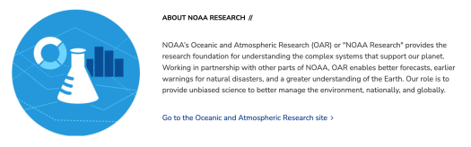
One of the nine key focus areas for NOAA is research (https://research.noaa.gov/). Additional summaries about NOAA’s research activities can be found at NOAA Ocean Today. There are also numerous articles that describe the impact of NOAA’s research activities, such as Five ways NOAA’s research improves hurricane forecasts and other articles listed under Latest News and Features.

A stylized graphic design representing NOAA Research, this is a blue circle containing icons of a chemistry beaker, a pie chart, and a bar graph. The adjacent text contains the description of NOAA Research found here: https://www.noaa.gov/research

And now, it’s time for some science and surveying! Before I dive into the specifics of the methods we are carrying out on Oscar Dyson, I’m sharing this incredibly helpful NOAA Fisheries page that summarizes their Research Surveys, where “Our scientists and partners collect data on the water, from aircrafts, and from shore to understand the abundance, distribution, and health of marine life and habitats. That data forms the scientific foundation for our management and conservation work.”

There is also an informative podcast episode, Learn About NOAA Fisheries Surveys (transcript available at link). This podcast covers the need for sustainable fisheries, the 2013-2016 North Pacific Blob, how surveys were done historically, how surveys are using new technology, the impact of the pandemic, and the concept of being in a “stationary” versus “non-stationary” world. Such a fascinating listen!

First episode of “Dive In with NOAA Fisheries,” titled Learn About NOAA Fisheries Surveys

There is another podcast episode from the same series that is an excellent follow-on from the episode available above. Surveying Alaska’s Waters (transcript available at link) shares how surveys are a tools that allow NOAA to reach its mission, whether those measurement techniques come from satellites, autonomous vehicles, buoys, ships, drones, etc. Although these tools assist NOAA scientists in collecting data, climate change is playing an even bigger role in making ecosystem management a moving target. Again – worth a listen!

Third episode of “Dive In with NOAA Fisheries,” titled Surveying Alaska’s Waters

Surveys in the Gulf of Alaska

Trawl surveys have been conducted by Alaska Fisheries Science Center (AFSC) beginning in 1984 to assess the abundance of groundfish in the Gulf of Alaska (2021 Stock Assessment Report, p. 9). Starting in 2001, the survey frequency was increased from once every three years to once every two years on odd-numbered years. This is a flyer that describes the biennial bottom trawl survey in the Gulf of Alaska 2023.

The website Alaska Fish Research Surveys includes field season research briefs going back to 2021. The 2023 field season includes a link to my current expedition, Summer Acoustic-Trawl Survey of Walleye Pollock in the Gulf of Alaska.

The strategy of combining trawl and acoustic surveys was developed by AFSC and the University of Washington. They published a paper in the Canadian Journal of Fisheries and Aquatic Sciences (Kotwicki et al., 2018) that discusses the need to perform acoustic-trawl (AT) and bottom-trawl (BT) surveys to accurately estimate the abundance of fish populations along with their spatial distribution. I’ve provided below part of a news release from the University of Washington describing the content of the publication:

Many species of fish spend some of the time on the ocean bottom, and some of their time far off the bottom, which makes them hard to survey. Acoustic surveys (that bounce sound off fish schools), can estimate the midwater component of so-called “semipelagic” fish, while trawl surveys can measure the portion on the bottom. Now a new method has been developed that combines data from both types of surveys into a single estimate using information about the environment (bottom light, temperature, sand type, and fish size). The new method has been used to assess the status of walleye pollock, which sustains the largest fishery in the United States.

This image from Kotwicki et al., 2018, does an excellent job of showing the two types of survey methods, acoustic and bottom trawling.

Illustration of conceptual model of walleye pollock sampling by an echo sounder and a bottom trawl. At the top right is an illustration of a fishing vessel sailing left. Two blue lines extend out the back of the vessel diagonally downward toward the seafloor and connect to two points on an illustration of a bottom trawl net. To the left of the net (in front of the opening) is drawn a school of fish; more fish are drawn directly below the ship. Two other blue lines extend diagonally down from the center of the ship's hull to form a triangle representing the acoustic swath. Blue boxes indicate the areas of the water column missed by either the bottom trawl net (that is, the entire pelagic zone) or the acoustic sampling (a narrow benthic zone right off the seafloor.)
Fig. 1. Illustration of conceptual model of walleye pollock sampling by an echo sounder and a bottom trawl. Note that acoustic data are collected directly under the survey vessel, while the bottom trawl catches walleye pollock some distance behind the vessel. Diving occurs in the time between the vessel passing over the school of walleye pollock and the trawl catching the same school. Source: Kotwicki et al. 2018.

What is different for my current expedition is that we are not doing any bottom trawling. We are doing the acoustic piece of the survey and trawling off the bottom. Separate surveys and ships are collecting the bottom data, and then will be combined with our data to provide a more accurate snapshot for the water column for the annual Stock Assessment Report for Walleye Pollock. AT and BT surveys get NOAA to their research objective: informing fish stock assessment models and catch allocation. NOAA publishes an annual 100+page Assessment of the Walleye Pollock Stock in the Gulf of Alaska from the surveys conducted each year (see reports from 2019, 2020, 2021).

Check out this website if you are curious to see images from Bottom Trawl Surveys in Alaska. NOAA’s Groundfish Assessment Program regularly conducts bottom trawl surveys to assess the condition of groundfish and shellfish stocks in Alaskan marine waters).

1883 International Fisheries Exhibition

To prepare to sail on Leg 1 of the Summer Acoustic-Trawl Survey of Walleye Pollock in the Gulf of Alaska, I did a lot of reading and preparation so I could better understand what I would be learning, and how I could then connect the material with my students and additional audiences I see post-expedition. These two books in the image below helped give me a much better picture of not only walleye pollock but the fisheries industry, policy, and practices over time and space.

Photo of two books - one titled Billion-Dollar Fish, by Kevin Bailey, and other titled World Without Fish, by Mark Kurlansky

Each of these books provides some fascinating insight into the history, thought, and even debates, about the nature of ocean resources.

The title of Chapter 4 in Kurlansky’s book gives a hint for how to respond to my questions: “Being The Myth of Nature’s Bounty And How Scientists Got It Wrong For Many Years.” Early in the chapter, Kurlansky states:

“In the 1800s, when the study of fish and oceans was a relatively new science, it was the fishermen who were afraid that fish populations could be destroyed by catching too many fish, especially small fish. Scientists at the time believed that it was impossible to catch too many fish because fish produced so many eggs.” — World Without Fish, p. 53

One of the causes of concern for fishermen was the new technology developing – specifically, engine power, that allowed for even more fish to be caught.

There was a great historical debate on fisheries, too! London was the site of the Great International Fisheries Exhibition of 1883, where a debate about the ocean took place between British scientists Thomas Huxley and Edwin “Ray” Lankester. Huxley gave the inaugural address of the exposition – you can read it in its entirety online. Here are excerpts:

“I believe that it may be affirmed with confidence that, in relation to our present modes of fishing, a number of the most important sea fisheries… are inexhaustible… and probably all the great sea-fisheries, are inexhaustible; that is to say that nothing we do seriously affects the number of fish. And any attempt to regulate these fisheries seems consequently… to be useless.” (*feel free to dive into Huxley’s speech to see his reasoning – the multitudes of fish available, and the destruction is minimal)

Then Lankester gave the final summary speech of the Exhibition – a rebuttal to Huxley. Lankester made the point that the fish in the sea are not unlimited, and captured fish are not readily replaced by others that exist further offshore from the fishing location. He raised the concern that the removal of the parents by fishing was going to impact the production of the young.

Although at the time many gave Huxley the victory in this debate, Huxley did not take into account the new development that I mentioned above – the modern trawl and the steam trawler to pull it, resulting in larger nets and catches. It’s interesting to note that eventually, Huxley studied the impact from engine-driven net draggers and changed his story. Huxley eventually agreed that overfishing was not only possible, but that it was happening.

Now to circle back to why we survey fisheries… it ultimately comes down to ecosystem management. As described in the two audio files at the top of this blog post and in my other posts, as well as the title to Chapter 8 in Kurlansky’s book, “The Best Solution To Overfishing: Sustainable Fishing.” And to engage in sustainable fishing, you need the data to make that happen – hence, fisheries surveys!

Laura Guertin: NOAA and NOAA Fisheries, June 12, 2023

NOAA Teacher at Sea

Laura Guertin

Aboard NOAA Ship Oscar Dyson

June 10 – June 22, 2023


Mission: 2023 Summer Acoustic-Trawl Survey of Walleye Pollock in the Gulf of Alaska

Geographic Area of Cruise: Islands of Four Mountains area, Western Gulf of Alaska
Location (site of calibration, June 11): 57o 32.6154′ N, 153o 55.8318′ W

Data from 2PM (Alaska Time), June 11, 2023
Air Temperature: 8.29 oC
Water Temperature (mid-hull): 6.3oC
Wind Speed: 10.35 knots
Wind Direction: 166.14 degrees
Course Over Ground (COG): 222.34 degrees
Speed Over Ground (SOG): 0.13 knots

COG = The direction the ship is heading relative to land. Over Ground means in relation to the Earth, so COG means the true direction free from the effects of sea currents.
SOG = Speed, real progress with respect to Earth. SOG means the true speed free from the effects of sea currents.

Date: June 12, 2023

I am pretty sure that, on a daily basis, I mention NOAA in my classroom, during public outreach events, and in conversations with colleagues and neighbors. But too often, individuals are not aware of this government agency and the critical role NOAA plays in our lives, even for those that are not scientists. So this blog post is for everyone not familiar with the services NOAA provides us all, along with a focus on NOAA’s National Marine Fisheries Service (aka “NOAA Fisheries”).


NOAA is an agency that enriches life through science. Our reach goes from the surface of the sun to the depths of the ocean floor as we work to keep the public informed of the changing environment around them. — from About our agency

The letters N-O-A-A stand for National Oceanic and Atmospheric Administration, an agency in the U.S. Department of Commerce. NOAA has a fascinating history, going back to 1807 and President Thomas Jefferson founding America’s first physical science agency, the Survey of the Coast. Fast-forward to 1870, when the Weather Bureau was establshed as the first agency dedicated to the atmospheric sciences. In 1871, the first conservation agency, the U.S. Commission of Fish and Fisheries, was in place. All three of these agencies were brought together in 1970 with the formation of NOAA. (*yes, NOAA recently celebrated its 50th anniversary! See this playlist of videos to learn even more about its history and the people of NOAA from over the years. There is an additional video that goes back to the original agency and mission of 1807.)

NOAA mission: To understand and predict changes in climate, weather, ocean, and coasts, to share that knowledge and information with others, and to conserve and manage coastal and marine ecosystems and resources. — from Our mission and vision

View this video for an overview of NOAA “meeting the moment.”

When I think of and hear “NOAA”, there are several terms/phrases that pop into my mind – science research, atmosphere, hydrosphere, weather and climate, health and safety, economy, conservation, sustainability, and so many more. The educational resources provided by NOAA are also valuable for additional background reading, citizen science opportunities, and multimedia materials (including podcasts!).

Quilt hanging on a wall with NOAA across the top and images that represent NOAA's areas of work

A STEAM Moment

I mentioned in my first blog post how I have a passion for and explore the integration of science and creative arts, specifically crafting via crocheting and quilting. To help others learn about the mission of NOAA and its key focus areas, I created a quilt to showcase NOAA’s work in research, weatherclimateocean & coastsfisherieschartingsatellitesmarine & aviationsanctuaries, and education. This quilt is just another tool in my education/outreach toolkit! To learn more about this quilt and to view a video, see this post.


NOAA Fisheries

NOAA Fisheries provides science-based conservation and management for sustainable fisheries and aquaculture, marine mammals, endangered species and their habitats. — from Fisheries

NOAA Fisheries, also known as the National Marine Fisheries Service, is a NOAA office composed of five regional offices, six science centers, and more than 20 laboratories around the United States and U.S. territories. Working with additional partners, NOAA Fisheries achieves its two core mandates: (1) to ensure the productivity and sustainability of fisheries and fishing communities through science-based decision-making and compliance with regulations; and (2) to recover and conserve protected resources including whales, turtles, and salmon.

There are several NOAA websites and videos that showcase the history and work of this office. I recommend the NOAA Fisheries About Us page, History page, YouTube playlist of NOAA Fisheries videos, and especially this overview video:

The main Fisheries page on NOAA’s website has fascinating facts you can scroll through. For example, I did not know that the total area NOAA Fisheries is responsible for monitoring and enforcing regulations for marine fisheries is 4.4 million square miles! This area is the largest Exclusive Economic Zone (EEZ) in the world! And the Fisheries News & Announcements page is a wealth of articles, press releases, multimedia material and more that will soon become required reading for students in my courses, adding to the materials I already tap into on NOAA’s Climate.gov and NOAA’s Ocean Facts!


#TheMoreYouNOAA

NOAA has an incredible range of resources and materials that are constantly being updated and expanded upon. There is something for everyone! (*including on Twitter, where you will find individuals and organizations highlighting NOAA’s work with the hashtag #TheMoreYouNOAA)

I’ll end this post with one of the fun audio narratives from the NOAA Ocean podcast series, which details phrases we use today that came from the Age of Sail (the period of time between the 16th and 19th centuries, transcript available).

NOAA Ocean Podcast: Episode 29 – The Nautical Origins of 10 Popular Phrases

The Challenger mission – so much more than fish

The mission of H.M.S. Challenger 150+ years ago was not as developed as the statements for NOAA and NOAA Fisheries – terms such as ‘conservation’, ‘management’, and ‘sustainability’ were not part of the expedition. Challenger was all about collecting samples, whether those samples be seafloor mud, manganese modules, corals, crabs, and plant and animal life from the islands they visited over their 3-year journey. The six Challenger scientists were not concerned about aquatic systems or human/environment interactions – this really was a journey of discovery and documenting what exists in these unexplored areas. It took 50 volumes of the Challenger Report to describe what was seen and collected – including roughly 4,700 new plant and animal species!

For the fish samples collected at that time, the “Challenger fishes” were incorporated into the British Museum (of Natural History) collection. There were 688 specimens of shallow water, shore and miscellaneous estuarine and freshwater fishes; 261 deep-sea fishes; and 125 pelagic fishes. Some of the fish were then sent over to the National Museum of Ireland in 1899, including type specimens of sixteen species (*data on the Challenger fishes from Wheeler and O’Riordan, 1969).

Sketch of a deep-sea eel, a figure from the Challenger publication
A deep-sea eel, one of the many sketches from samples collected on the H.M.S. Challenger (image in the public domain, part of the Freshwater and Marine Image Bank)

David Madden: Preparing for Pisces 2019, July 11, 2019

NOAA Teacher at Sea

David Madden

Preparing to Board NOAA Ship Pisces

July 15 – 29, 2019


Mission: South East Fisheries Independent Survey

Geographic Area of Cruise: Atlantic Ocean, SE US continental shelf ranging from Cape Hatteras, NC (35º30’ N, 75º19’W) to St. Lucie Inlet, FL (27º00’N, 75º59’W)

Date: July 11, 2019

NOAA Ship Pisces
NOAA Ship Pisces. Photo by National Oceanic and Atmospheric Administration.

Introductory Post

Personal Log:

Hello friends,

My name is David Madden. I am a high school science teacher at Maclay School in Tallahassee, FL, and I’m getting ready to go on my NOAA Teacher at Sea cruise! I recently completed my 21st year teaching – it’s been a super fun journey. I am as excited heading into year 22 as I was in years 1-5. I’ve been in love with nature since I can remember.

Madden Science logo
Madden Science logo

Over the course of my career I’ve taught: AP Biology, regular Biology, Physics, Integrated Science (bio, chem, phys combined), and Marine Biology. This upcoming year I will also be teaching AP Environmental Science. I’ve loved every minute of my job – teaching and learning with students, challenging myself and being challenged by my friends and colleagues, and exploring new adventures – like NOAA Teacher at Sea. Along the way I’ve also been a coach, helping kids learn the value of sports, including: volleyball, basketball, tennis, and track.

Over the last few years I’ve started making educational videos for my students – as a way for them to further develop their love of science and grow their scientific literacy: Madden Science on YouTube and www.maddenscience.com.

Madden family
The hardest part of the trip will be missing these two!

Starting on July 15th, 2019, I will be aboard NOAA Ship Pisces as part of the Southeast Fishery-Independent Survey (SEFIS). The mission of the cruise will be to conduct “applied fishery-independent sampling with chevron fish traps and attached underwater video cameras, and catch rates and biological data from SEFIS are critical for various stock assessments for economically important reef fishes along the southeast US Atlantic coast.” It’s an amazing opportunity for me to participate in important scientific research. I have the opportunity to work alongside and learn from some of the best scientists in the world.

Pisces Picture Wikipedia
NOAA Ship Pisces. Photo by National Oceanic and Atmospheric Administration.

There are so many things about NOAA Teacher at Sea that I’m looking forward to. Here’s a few:

  1. Spending time out on the ocean, experiencing the energy and power of the wild sea.
  2. Working with and learning from some of the world’s leading oceanic and atmospheric scientists.
  3. Learning about fish and marine biodiversity in the Atlantic.
  4. Asking tons of questions and hopefully learning more about the ocean and its central importance in our changing world.
  5. Sharing my experience with you; my family, friends, students, and the public.   I’ll share this adventure via this blog and also via videos I hope to create while on NOAA Ship Pisces. My goal is for these blog posts and videos to serve as a real-time record of the cruise, to be helpful and interesting right now, and also to help serve as resources for my classes and other classrooms around the world.

Neato Fact:

NOAA Ship Pisces is 209 feet (64 meters) long. To give you an idea, that’s basically 70% of a football field. That’s longer than two blue whales (~90 feet), the largest and longest animal to ever live! Usain Bolt can run that far in 6.13 seconds (assuming 9.58 s for 100 m). A starfish, traveling at 60 feet/hour, would take about 3.5 hours to travel the length of Pisces.

Madden Pisces diagram
NOAA Ship Pisces is 209 ft long.

I’d love it if you could join in with me on this adventure – please comment and ask questions. I’ll do my best to respond in a helpful and interesting way!

Stephen Kade: Oregon II Spotlight: Chelsea Parrish, August 2, 2018

Chelsea Parrish

NOAA Teacher at Sea

Stephen Kade

Aboard NOAA Ship Oregon II

July 23 – August 10, 2018

Mission: Long Line Shark/ Red Snapper survey Leg 1
Geographic Area: 30 54 760 N, 76 32 86.0 W, 40 nautical miles E of Cape Lookout, North Carolina
Date: August 2, 2018
Weather Data from the Bridge:
Wind speed 11 knots,
Air Temp: 25.c,
Visibility 10 nautical miles,
Wave height 3 foot


Spotlight: ENS Chelsea Parrish

During my NOAA Teacher at Sea experience, I have truly been inspired and impressed by how many important roles of our operation on the Oregon II are fulfilled by females. One of the most important crew members is Ensign (ENS) Chelsea Parrish who is one of our OOD’s. or Officers of the Deck. I think her story will inspire my daughter and female students to aim high for their future!

As a young child, Chelsea was inspired by her father who spent 20 years in the US Navy. She loved hearing stories about his role working aboard Navy submarines, and all of the interesting things one must do to work below the sea. After high school she attended the Savannah State University, in Georgia. She was able to train aboard the R/V Savannah where she learned about biological, chemical, physical, and geological oceanographic studies in estuaries and continental shelf waters in the southeastern US Atlantic and Gulf coasts. She earned her Bachelor degree in Biology, and received her Masters degree in Marine Science. While she didn’t need her Masters to get into her field, she knew that in the long run it would put herself above others in a highly competitive field and would be an advantage in the future.

A year into graduate school, she attended a conference, where she learned about the NOAA Corps. The NOAA Corps is one of the seven federally uniformed services of the United States, and is made up of scientifically and technically trained and commissioned officers. It was there that she met Lt. Commander Adler, whom she kept in contact with. Just a short time later, she was called for an open opportunity to join the NOAA Corps. She had 17 weeks of real world training at the Coast Guard Academy for Officer Candidate School (OCS). It was there that she learned how NOAA is different than the US Navy. The Navy focuses on various military actions, while NOAA Corps focus is on science and their motto is: “Science, Service, Stewardship”. It was then Chelsea knew she came to the right place to fulfill her professional goals.

After graduating from training, she earned her Officer of the Deck qualification aboard Oregon II in September, 2017. She will be aboard completing her assignment in January, 2019. Chelsea has many important duties to perform on the ship, including steering the ship. This entails following the chart that the CO (Commanding Officer, or Captain) has planned out to fulfill the mission of the ship. In our case the mission is long line fishing of Red Snapper and Sharks at many stations along the southeastern US and the Gulf of Mexico. While the CO is off duty, she must keep him informed of any changes that need to made to the Navigation trackline to ensure there is a safe navigational watch during her shift, which is normally 4 hours at a time.

The most common thing to happen that happens to create a change in course is foul weather, but there are many unforeseen events as well. Chelsea must study reports from the US Coast Guard which let her know various events happening in the region we are sailing. This can be other ships performing science missions, merchant navy ships of other countries in the area, oil drilling operations, or in our case yesterday, live ammunition firing exercises by the US Navy.

Chelsea Parrish
ENS Chelsea Parrish on the bridge of NOAA Ship Oregon II

Chelsea is also the environmental compliance officer aboard the ship, and she must follow specific rules set up by the EPA (Environmental Protection Agency) to ensure Oregon II is environmentally responsible while at sea. She must be sure there aren’t any issues with fuel, garbage, or any other foreign substance being put in the ocean while at port, or at sea. She also keeps a recycling log to track all activity and incidents that occur. Chelsea also runs the ship store and keeps track of all the items to be sold to the crew and volunteers aboard the ship.

Finally, Chelsea is the go- to rescue swimmer aboard Oregon II, and is the first to jump into the ocean if there is someone overboard to be retained from our ship, or another at sea near us. I saw her in action during our drills at the beginning of our trip and I was impressed at how quickly the crew launched our rescue boat, so Chelsea could rescue our life ring that acted as our “person overboard”. She also took a 3 week class to get certified as a NOAA working scuba diver. This certification allows her to be in the ocean to find, and/or fix any issues we have with the ship while at sea that can’t be fixed from the deck or rescue boat. She is certified to dive down to 130 feet below the surface.

It certainly is impressive how much Chelsea has accomplished in her 28 years. I hope this post inspires all my students, but especially the girls to go out into the world and do anything they can dream of, as that is exactly what Chelsea did. When her time aboard Oregon II is over, Chelsea plans to be a Cetacean Photogrammetry Specialist in La Jolla, California. She will be getting to get her FAA drone license to fly hexacopter drones from ships. Her duties will be to find, count and track marine mammals such as seals, dolphins, and whales. She said she loves helping NOAA fulfill their mission of helping marine animals and data collecting to further the study of these creatures and helping ensure their survival in the future.

Personal Log:
Now that I am almost a week into the survey, I am starting to fall into the rhythm  of working on the ship. The 12 hour work days are certainly long, but we do get breaks between stations to rest, converse, and prepare for the next run. If it’s a good station and we haul in a lot of catch, we often spend time talking about each of the things we caught and become like kids on Christmas if it’s something new and interesting. We also spend time logging all the data we collect into the computer for later research on land.
We have seen just about all the different weather scenarios you could imagine, and have endured bright, 93 degree cloudless days, and windy days with 6 foot waves and pouring rain. We’ve had to call off a few stations until our way back south down the coast due to  poor conditions, because on all NOAA ships, the motto is “Safety First”. The real trick is working during the big wave conditions and learning how to function as a human being while the boat is rocking and rolling all about for the entire day. I’m getting better at anticipating where my next step will land and compensating for the constant shifting gravity under my feet. It will make walking on earth again seem so easy!
Animals Seen Today: Sandbar sharks, Scalloped Hammerhead Shark, Blue Line Tile Fish, Grouper, Atlantic Spotted Dolphins, Squid


Denise Harrington: Big Sharks Bite, Itty Bitty Sharks Intrigue – May 11, 2016

NOAA Teacher at Sea
Denise Harrington
Aboard NOAA Ship Pisces (In Port)
May 04, 2016 – May 12, 2016


Date: Saturday, May 11, 2016

P1050542
Dr. Trey Driggers shares a great white shark jaw with me.  Photo courtesy of Kevin Rademacher

My children sometimes complain when they find a bird in the freezer next to their frozen waffles.  Yet in Pascagoula, Mississippi, relentless digging in the freezer is how discoveries are made.

P1050566
Mark Grace, in his office.

Mark Grace has been a biologist with NOAA for 30 years.  If he counted all his time at sea, excluding volunteer and international research, he spent “seven solid years floating.” Out of 200 surveys with NOAA, he was the field party chief for 41 of those projects.  In all of those years, he had never discovered a new species, almost no one ever does.   Yet, in 2013, he discovered an extremely rare, tiny species of pocket shark that had been identified only one other time, in 1979 off the coast of Peru.

pocket shark
This photo of the pocket shark shows its remarkable pocket, just behind the pectoral fin, and some skin damage in front of the eye that may have occurred from the pressure of being harvested from the depths.  Credit J. Wicker NOAA/NMFS/SEFSC

Scientists happened to find the 5 ½ inch shark while doing research on sperm whale feeding habits in the Gulf of Mexico in 2010.    The pocket, unnoticed at first, is what makes this shark so unique. Jesse Wicker took this photo in 2010, aboard NOAA Ship Pisces during the whale survey while processing mountains of sea creatures.  Scientists must pay meticulous attention to detail as they document and photograph specimens at sea.  You never know when your photo may prove crucial to scientific discovery.

The Discovery

The specimens collected in 2010 were identified and then placed in freezers to preserve them for further analysis.

freezer of fish
Photo courtesy of Mark Grace

Mark began to work through the specimens, but it took much longer than he had imagined.  He’d undo a bag, and there would be a hundred fish to process. Each bag seemed bottomless.  By the time Mark got to the last bags, the shark had been in the freezer for three years, eight months.  Brrr…..

Yet he knew the fish weren’t worth much if they stayed in the freezer. He was particularly interested in the cookie cutter shark named after the cookie shaped bites they leave in their prey.  He kept on.

cookie bite
NOAA photo The round mark left on the back of this toothed whale is a telltale sign of a cookie cutter shark, such as this one below.

cookie cutter shark

Cookie Cutter Shark, NOAA’s Fisheries Collection, Photo taken aboard NOAA Ship Pisces.

A shark caught his eye. The shark was identified as belonging to the Dalatiidae family (kitefin sharks), many of whom share luminescent features.

pocket shark bottom
Kitefin shark harvested in 2010 aboard Pisces. Credit: J. Wicker NOAA/NMFS/SEFSC 2010

Yet this shark did not look like the other cookie cutter sharks he had studied.  It had a remarkable fold of skin behind the pectoral fin that did not look like an injury or parasite.  Once Mark saw a matching feature behind the other fin, he realized this shark was like no other species he had ever seen.  Looking in his reference books, he could not find this shark, because it did not exist in any book on his shelf.

pocket
Photo credit: Mark Grace – The pockets behind the pectoral fin of the 2010 specimen.

pocket shark diagram

Over hundreds of millions of years, shark adaptations have helped them survive.  They have become smoother, faster, and better at sensing out their prey.  Many sharks have the hard, smooth, scales on their skin called denticles that increase their speed and reduce noise, just like my friend’s fast blue Sterling fiberglass kayak compared to my noisy, orange, plastic Avocet kayak.

Just below the snout, this shark had has a translucent denticle, or scale, at the center of surrounding denticles, giving the appearance of a flower.

pocket shark denticle
Magnified photo of modified denticle.

Mark hypothesized that this unique adaptation might be a pit organ, used to sense currents, or prey.  Scientists have many thoughts about the purposes for this organ.  Each unique feature of the shark inspired Mark to research further.

bioluminescent creatures
Composite of images of bio luminescent species collected with pocket shark by Mark Grace.

One adaption many creatures of deep ocean waters is they glow.  Small photophores, or organs on their body, emit light and signals to communicate with other animals.  In this picture, Mark created a composite of several of the other glowing animals that were pulled up in the trawl net with the pocket shark (middle).

In 30 years, he had never seen a species this rare.  A vitelline scar, like the belly button of a human, indicated that the five and a half inch fish was only a few days to no more than a few weeks old when it was born near the place it was harvested. It was a baby. There had to be at least one other fish like it somewhere in the world.

Connections to others

After a little research, Mark connected this pocket shark with the only other pocket shark ever recorded, in 1979 off the coast of Peru and Chile in the east Pacific Ocean.  His research was particularly challenging because Dolganov, the scientist who first identified the new species pocket shark, wrote up his findings in 1984, in Russian.  Mark had to find a Russian scientist to translate the document to English.


Sheiko pocket shark
The only other known pocket shark, harvested in 1974, is not in great condition.  Photo 2013, Boris Sheiko


pocket shark with ruler
Look at those unique photophore clusters on the shark’s underside.  Photo credit: J. Wicher NOAA/NMFS/SEFSC, 2010

The older pocket shark was a female, and probably an adult, at 20 inches long. Between the two sharks, there were many similarities, but also many differences.

P1060196
In second grade, we like to make Venn Diagrams in situations such as these.  So I drew this one, comparing the shark harvested in 1974 to the shark harvested in 2010.

Once again, I find myself swirling in a sea of questions.  Are these two pocket sharks, which lived far away from each other, of the same species?  Are their morphological (physical) differences enough to make them unable to reproduce with each other?  Scientists ask similar questions to determine if they have found a new species.

What makes a species unique?

Species identification is no easy task.  Mark reached out to experts, as we all do, with his questions.  At the Hollings Marine Laboratory, Gavin Naylor began to collaborate with Mark as part of his global effort to collect DNA of all living things.  He added the pocket shark to the portion of the tree of life he manages at Sharksrays.org.  John Denton, of the American Museum of Natural History, and Michael Doosey and Henry Bart from the Tulane University Biodiversity Research Institute became part of this group of five scientists who would be connected for life through this 5 ½ inch shark. Together they read many books, sliced and diced the shark digitally, and traveled around the world to meet with other biological explorers. They determined that the specimen collected in the Gulf of Mexico, like specimen in the east Pacific, was a pocket shark, Mollisquama.

pocket shark ct
This three dimensional image obtained by Gavin Naylor through a high resolution CT scan at the Hollings Marine Laboratory allows Mark and Gavin to share their research digitally, with scientists around the world, while keeping the baby pocket shark intact.


P1050570
The American Museum of Natural History in New York used a three dimension printer to obtain a model of the shark from the CT scan.

The most intriguing part of the scientists’ research lies in the title of their work, hidden in Latin: Mollisquama sp., the name for our Gulf of Mexico baby, and Mollisquama parini, its Russian relative. I notice that the second part of their name is different! Yet in order to establish our shark as a new species of Mollisquama, these scientists will have to write a paper that is “strong enough to withstand many layers of peer review,” says Mark. They will need to demonstrate that the physical differences (e.g. teeth and vertebrae) are significant enough to support a new species identification.

If they are successful in proving their pocket shark is different than its eastern Pacific Ocean relative, what should he name this species of shark?  Mark suggests an international competition, as it will take many minds “to be good enough for NOAA.”

Mark reminds us that when we learn about this shark, we realize that the one great interconnected ocean and its inhabitants are a still a place of mystery and discovery.  We have much more to learn about the ocean and its inhabitants than we know.

Personal Log

Often the greatest discoveries come when you least expect them, hiding in expectations dashed, problems, or the path less traveled. While the Pisces was scheduled to depart last week, the crew continues to work on long and short term projects on the ship and in the lab.

me on screen

Photo courtesy of William Osborn

I am being supervised by Engineering Department Chief “Chief” Brent Jones, on one of many cameras around the ship, as I “assist” the engineering crew get through their list of duties.  His words of wisdom? “Hands off!”

Here, Dana Reid, General Vessel Assistant, and I are opening up the aft valve, so that Travis Martin can switch out the strainers in the main water system.  Dirty strainers get hosed out at least every other day.  Today we caught a small eel in the strainer.

righty tighty

Photo Courtesy of William Osborn


cleaning the strainer

Travis Martin, TAS Denise Harrington, and Dana Reid are switching out the strainer, while Farron “Junior” Cornell, Fisherman, photo bombs us.

Acronyms abound at NOAA, and teachers are affectionately referred to, not by our names, but as “TAS,” for Teacher at Sea.  I’d like to name a new species of this family of adventuresome NOAA educators, “TIP” for those Teachers in Port who adapt by learning about all the amazing discoveries that take place on land following successful projects at sea.  I want to extend a big thank you to Mark Grace and the fishery biologists in the lab who did not know they’d be hosting a TIP.

While in port, I have been able to explore the various land based habitats which are much easier to study than their underwater counterparts. Standing on the water’s edge at David Bayou, I wondered how the area would look from a kayak.  I posted a message to the Mississippi Kayak Meetup Group. Both Eric and Keigm Richards and their friends responded, sharing their knowledge and boats, showing me parts of the watershed very few people see. Coincidentally, Eric was one of the talented NOAA Ship Pisces builders, and knows everything from the finest detail of an itty bitty kayak skeg, to the gigantic architecture and versatile features of the Pisces.

Here is a slideshow of the one of the most unspoiled, diverse and scenic estuaries I’ve paddled.

This slideshow requires JavaScript.

Most of the were taken by Eric.  Notice the changes in vegetation as we travel away from mouth of the Pascagoula River, up the estuary.  The decreasing salinity has a remarkable effect on the flora and fauna of the area.  Mississippians are proud of the Pascagoula, “the last unimpeded river system in the continental United States.” http://ltmcp.org/pascagoula-river-watershed.

DID YOU KNOW?

Most, around 80%, of the creatures in the water column are bio-luminescent, or emit light.  They can vomit out the glowing liquid, hold and release it from a pouch, and/or send it out through photophores (organs like eyes which emit light instead of collecting it).