

NOAA Teacher at Sea
Kate Schafer
Aboard NOAA Ship Oregon II
September 17 – 30, 2017
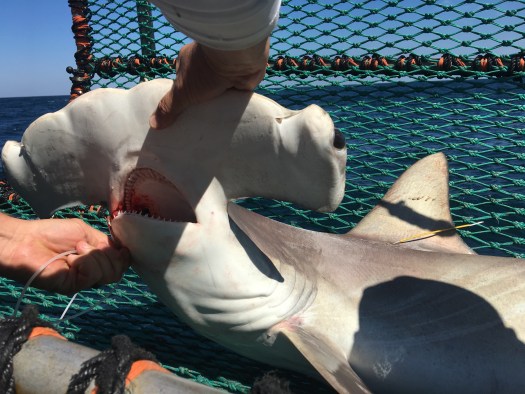
Mission: Shark/Red Snapper Longline Survey
Geographic Area of Cruise: Gulf of Mexico
Date: September 18, 2017
Weather Data from the Bridge:
Latitude: 27o 02.5’ N
Longitude: 94o 32.6’ W
Scattered clouds
Visibility 14 nautical miles
Wind speed 10 knots
Sea wave height 1 foot
Temperature Seawater 29.9 o Celsius
Personal log
Sunday afternoon, September 17
I arrived in Pascagoula, Mississippi in the late afternoon on Saturday after a long day of travel. Things were so quiet on the ship that evening as most of the crew had gone home during the break between legs of the survey. It was great to be met and shown around by a friendly face, the Officer on Duty (OOD) David Reymore. I definitely was feeling a bit like a fish out of water, even though we hadn’t even left the dock yet. As people start to arrive back on the ship, they all know their role and are busy getting ready for our departure later on today. It’s a good experience to feel like you’re out of your element every now and again and I guess a small part of why I decided to apply for a Teacher at Sea position in the first place.
NOAA
As I was preparing to depart on this adventure and was explaining that I was going to be a NOAA Teacher at Sea, I had a number of people ask me what NOAA stood for, so I thought I’d provide a bit of information about what they are and what they do. First, NOAA stands for the National Oceanic and Atmospheric Administration, and the name definitely suggests the broad mission that the agency has. Their mission involves striving to understand the oceans, atmosphere, climate, coastlines and weather and making predictions about how the interactions between these different entities might change over time.
That is a tall order, and the agency is divided up into different offices that focus on different aspects of their mission. The National Weather Service, for example, is focused on forecasting the weather and makes predictions about things like where hurricanes will travel and how intense they will be when they get there. The National Marine Fisheries Service is tasked with studying the ocean resources and habitats in U.S. waters and to use that understanding to create sustainable fisheries.
So far, I’ve met many people that I’ll be sharing the boat with over the next two weeks. They have all taken time to introduce themselves and talk for a bit, even though I know that they’ve got tons to do before we sail.
Sunday evening
Well, we’re underway towards our first sampling sites off the coast of Brownsville, Texas. The seas are really calm, and I’m sitting up on the deck enjoying the light breeze and digesting the delicious dinner of jambalaya, vegetables and blackberry cobbler. On our way out from Pascagoula, we saw a few dolphins, beautiful white sand barrier islands and mile after mile of moon jellies, but now we’re no longer in sight of land.

We’ve passed an occasional oil rig off in the distance but haven’t seen much else. The sun just set behind just enough clouds to make the colors spectacular and then as I was climbing down the stairs, I saw a handful of dolphins playing in the boat’s wake.

Monday, September 18
Today will be a full day of travel to reach our fishing grounds. Assuming we continue to make steady progress, we should arrive in the late afternoon or early evening on Tuesday to begin fishing. We will be baiting 100 hooks that, once deployed, will remain in the water for an hour before we pull them back in. We’ll be fishing in a variety of depths while working our way back towards Pascagoula. We practiced some drills this afternoon, including a “man overboard” simulation, using a couple of orange buoys. They deployed a rescue boat and had retrieved the buoys in a matter of minutes. I have to admit that watching them get out there with such speed and skill put me at ease.


