Anne Krauss: Once Upon a Maritime, August 4, 2018

NOAA Teacher at Sea

Anne Krauss

Aboard NOAA Ship Oregon II

August 12 – August 25, 2018

Mission: Shark/Red Snapper Longline Survey

Geographic Area of Cruise: Western North Atlantic Ocean/Gulf of Mexico

Date: August 4, 2018

Introductory Personal Log

I’m thrilled to be joining NOAA Ship Oregon II for the second leg of the Shark/Red Snapper Longline Survey. The adventure of a lifetime begins in Canaveral, Florida and concludes in Pascagoula, Mississippi. For two weeks, we’ll be studying sharks, red snapper, and other marine life in the Atlantic Ocean and Gulf of Mexico. Scientists will collect data on fish populations to find out more about their distribution, age, weight, length, reproduction, and other important information. Along the way, we’ll also sample water quality and collect other environmental data. Learning more about these creatures and their surroundings can help to keep their habitats safe and thriving.

This exciting opportunity is the next chapter in my lifelong appreciation for sharks and the sea. During a formative visit to the ocean at age three, I quickly acquired a taste for salt water, seafaring, and sharks. I saw my first shark, a hammerhead, in the New England Aquarium, and I was transfixed. I wanted to know everything about the water and what lived beneath the surface.

After discovering nonfiction in fourth grade, I could access the depths through reading. I was riveted to books about deep-sea creatures and pioneering undersea explorers. The more I learned, the more curious I became. As a younger student, I never indulged my aquatic interests in any formal academic sense beyond prerequisites because of my epic, giant-squid-versus-whale-like struggle with math. Because I was much stronger in humanities and social sciences, I pursued a predictable path into writing, literature, and education.

As a Literacy Specialist, I support developing readers and writers in grades K-5 by providing supplemental Language Arts instruction (Response to Intervention). To motivate and inspire my students, I share my zeal for the ocean, incorporating developmentally appropriate topics to teach requisite Language Arts skills and strategies.

In 2011, I initiated an ocean literacy collaboration with undersea explorer Michael Lombardi and Ocean Opportunity Inc. so that I could better answer my students’ questions about marine science careers and marine life. Our first meeting involved swimming with blue sharks offshore, and I knew I needed more experiences like that in my life. From chumming to helping with the equipment to observing pelagic sharks without a cage, I loved every aspect. This life-changing experience (both the collaboration and the shark encounter) transformed my instruction, reigniting my curiosity and ambition. Our educator-explorer partnership has inspired and motivated my students for the past seven years. After supporting and following my colleague’s field work with my students, I wanted a field experience of my own so that I can experience living, researching, and working at sea firsthand.

Although my fascination with all things maritime began at an early age, working closely with someone in the field transformed my life. Instead of tumbling, I feel like Alice plunging into a watery wonderland, chasing after a neoprene-clad rabbit to learn more. Finding someone who was willing to share their field experience and make it accessible gave me the confidence to revisit my childhood interests through any available, affordable means: online courses, documentaries, piles of nonfiction books, social media, workshops, symposiums, aquaria, snorkeling, and the occasional, cherished seaside visit.

We co-authored and published a case study about our collaboration in Current: The Journal of Marine Education, the peer-reviewed journal of the National Marine Educators Association (Fall/Winter 2016). We wrote about bringing the discovery of a new species of mesophotic clingfish to fourth and fifth grade struggling readers. Since a student-friendly text about the fish did not exist, I wrote one for my students at their instructional reading level, incorporating supportive nonfiction text features.

It’s reinvigorating to switch roles from teacher to student. Ultimately, this unconventional path has made me a more effective, empathetic educator. My students witness how I employ many of the same literacy skills and strategies that I teach. By challenging myself with material outside my area of expertise, I am better able to anticipate and accommodate my students’ challenges and misconceptions in Language Arts. When comprehension of a scientific research paper does not come to me easily on the first, second, or even third attempt, I can better understand my students’ occasional reluctance and frustration in Language Arts. At times, learning a different field reminds me of learning a second language. Because I’m such a word nerd, I savor learning the discourse and technical terminology for scientific phenomena. Acquiring new content area vocabulary is rewarding and delicious. It requires word roots and context clues (and sometimes, trial and error), and I model this process for my students.

Being selected for Teacher at Sea is an incredible opportunity that required determination, grit, and perseverance. Although my curiosity and excitement come very naturally, the command over marine science content has not. I’ve had to be an active reader and work hard in order to acquire and understand new concepts. Sometimes, the scientific content challenges me to retrain my language arts brain while simultaneously altering my perception of myself as a learner. Ultimately, that is what I want for my students: to see themselves as ever-curious, ever-improving readers, writers, critical thinkers, and hopefully, lifelong learners.

I am so grateful for the opportunities to learn and grow. I deeply appreciate the support, interest, and encouragement I’ve received from friends, family, and colleagues along the way. I will chronicle my experiences on NOAA Ship Oregon II while also capturing how the scientific research may translate to the elementary school classroom. Please share your questions and comments in the comments section below, and I will do my best to reply from sea. My students sent me off with many thoughtful questions to address, and I’ll share the answers in subsequent posts.

Did You Know?

Pelagic fish have bodies designed for long-distance swimming. With their long pectoral fins, the blue shark (Prionace glauca) is highly migratory, traveling great distances across oceans.

A blue shark swims near the surface.
Look carefully: This graceful blue shark was the first shark I saw in the open ocean. Swimming with them was exhilarating!

Recommended Reading

The cover of a children's nonfiction book shows a scientist diving near a shark and coral reef with an autonomous underwater vehicle in the background.
An engaging read-aloud for younger readers.

For a simplified introduction to how scientists study sharks, I recommend the picture book How to Spy on a Shark written by Lori Haskins Houran and illustrated by Francisca Marquez. This read-aloud science book portrays the process of catching, tagging, and releasing mako sharks. The book includes shark facts as well as an introduction to tagging and tracking technology. For more information on how scientists use underwater robots such as remotely operated vehicles (ROVs) and autonomous underwater vehicles (AUVs) to study sharks: https://oceanexplorer.noaa.gov/explorations/18whitesharkcafe/welcome.html

Angela Hung: Fortitude, July 23, 2018

NOAA Teacher at Sea

Angela Hung

Aboard NOAA Ship Oregon II

June 27-July 5, 2018


Mission: SEAMAP Summer Groundfish Survey

Geographic Area of Cruise: Gulf of Mexico

Date: July 23, 2018


Weather Data from Home

Conditions at 2101

Latitude: 41.54°N

Longitude: 87.53°W

Temperature: 21° C

Wind Speed: N 3 mph


Science and Technology Log

Back at home but there’s still so much to share! I’ll wrap up my amazing experience as a Teacher at Sea by introducing three more members of the NOAA Ship Oregon II family: Alonzo Hamilton, Executive Officer Andrew Ostapenko and Commanding Officer Captain Dave Nelson. At the start of my adventure, I wrote about flexibility. The Teacher at Sea Program also stresses that cruises “require high-intensity work that demands physical adeptness, endurance, and fortitude”. These three exemplify how fortitude, the ability to endure through life’s challenges and change, brings rewards throughout life.


Fishery Biologist Alonzo Hamilton

Alonzo Hamilton, left, and Taniya Wallace, right, enter species into FSCS.

Alonzo Hamilton has been a fishery biologist for 34 years! He likes to say that he stumbled into NOAA. He graduated from community college before enrolling at Jackson State University, a historically black university in Mississippi with a full scholarship. Actually, he was offered two scholarships, one for minority biomedical researchers to become a surgeon and the other for general studies. He arrived on campus to discuss his options in the science department. It turned out that the biomedical research scholarship was given to another recipient. On the bright side, it made the decision to accept the general studies funding much simpler. Now he had to make a choice of which field to pursue. As he explored the halls of the science building, he happened upon the office of the head of the marine science program and popped in to ask some questions. After learning about the program, he decided to apply his scholarship toward coursework in this field.

After college, he began working on a research project for the Navy which paid for a master’s degree. Soon after, President Reagan froze research funding for the Navy. Fortunately, Alonzo was tipped off that NOAA did very similar research with an active, albeit smaller budget. So began a 34 year career as a NOAA fishery biologist.

Being an African American scientist in the deep south came with challenges, but he reminded his supervisors and others around him that, “I won’t limit myself to your box”, which has carried him through a long and storied career. Today, he is happy that he gets “paid to play in the ocean”, which sounds like a pretty good deal to me.


Executive Officer (XO) Andrew Ostapenko

Andrew Ostapenko
Andrew Ostapenko

Most of the NOAA Corp officers you meet have a degree in science. I had the fortune of sailing with one of the few who doesn’t— the XO, LCDR Andrew Ostapenko. XO has a degree in political science from the University of St. Thomas in St. Paul, Minnesota. His goal was to become a lawyer, but after considering the job prospects and the lifestyle—”no one ever calls lawyers when they are happy”, and they never retire —he looked into some other options. In 2005 he applied for the NOAA Corps. Although he didn’t have a science degree, the general education requirements at the University of St. Paul, which included calculus, chemistry and physics, met the NOAA Corps requirements.

Since joining NOAA, LCDR Ostapenko has held a variety of assignments. In Maryland he managed budgets and projects for the National Centers for Environmental Prediction, a part of the National Weather Service that provides forecasts for the nation. He worked in small boat life cycle management as a Port engineer/small boat officer in Norfolk, Virginia, disseminating policies across the NOAA fleet.

His sailing experience began on NOAA Ship Thomas Jefferson which performs hydrographic surveys that map the oceans to continuously update and improve nautical charts. He was a member of the first crew on NOAA Ship Reuben Lasker, accompanying her from Wisconsin where she was built to her homeport of San Diego. Last but not least, XO has been an augmenting officer for three months on NOAA Ship Oscar Dyson, another fisheries survey vessel based in Alaska where high seas and storms are a part of a normal day’s work.

NOAA assignments are three years for shore tours and two years for sea tours. LCDR Ostapenko currently has about a year left with Oregon II. As XO shows, there is no danger of getting stuck in mundane office job as a NOAA Corps officer.


The Captain

Captain Dave Nelson of NOAA Ship Oregon II

“Lunch is on me!” invites the captain if you arrive to the galley after him. Captain Dave Nelson is the commanding officer (CO) of NOAA Ship Oregon II, and he’s gone a long way to realize that title. This is his 10th year as the captain of Oregon II, but he’s worked onboard since 1993. He refers to himself as a “hawsepiper”, urging me to look it up on the internet. Informally, it means to have started at the bottom as a deckhand and working up to becoming a captain. Captain Nelson is a Mississippi native and grew up shrimping and fishing with his dad. After high school he went to work on commercial boats that bring supplies to oil rigs. After over a decade, he felt that he needed a plan for the future– a stable pensioned job. He serendipitously stopped into the NOAA office as he was driving by on a day that someone had just quit and there was an opening to fill. The rest is Oregon II history.

The progression as a civilian begins with being a deckhand and progressing to Chief Boatswain. It takes 750 days at sea to qualify for the first license, the 3rd Mate license administered by the U.S. Coast Guard. It then takes 1100 more days to be eligible to test for the Masters license to become a captain. In 2008 the prospective captain lived in Seattle on a NOAA ship for 12 weeks for a prep course for the Masters exam. At this point, it’d be almost 30 years since he had been a student; not only did he have to learn the material for the test, he also had to learn how to study again.  Soon-to-be Captain Nelson committed seven days a week for the entire 12 weeks to study and reviewing material to pass. He knew he wanted it.

CO Nelson’s joking attitude belies the pressure of being the captain of a ship. It’s a tremendous responsibility because he is accountable for everything, particularly the safety of everyone onboard. Every decision is made or approved by the captain and he sends reports to his supervisors every day.

He is one of a few captains in the NOAA fleet who is a civilian; most NOAA Commissioned officers rotate between boats every two years. This means that he is always training the new officers joining Oregon II from ensigns like Andy Fullerton and Chelsea Parrish to XO’s like Andrew Ostapenko. It takes a lot of patience; everyone comes in with different strengths, weaknesses and of course, personalities. The key, he says, is to “treat people like people” no matter who they are.


Personal Log

I somehow made it through almost three weeks living on Oregon II without falling down any stairs or tripping and landing on my face over a bulkhead door. Sure enough, it was hard to fall asleep at home without the rocking of the boat, but I’m happy to have my own shower again.

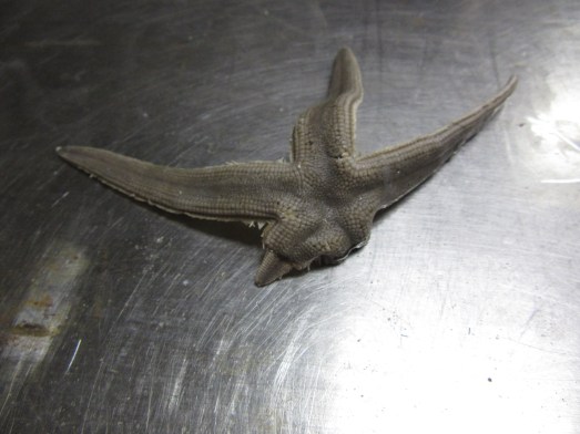
I’m so excited to show my students photos of so many of the things that I cover in class, or that they ask about, such as starfish regenerating lost arms and a video of wiggling tube feet on a severed arm (I accidently broke it off). I imagine they’ll also get to see critters they haven’t imagined-arrow and calico crabs, triggerfish, batfish…

A sea star that is regenerating its lower right arm.
A sea star that is regenerating its lower left arm.

I can’t believe how much I learned in such a short time about life and work at sea, careers, seafood, NOAA and its online resources. What I’ve shared in blogs is such a small fraction of everything I’ve experienced. I’m extremely grateful to everyone on Oregon II for being so welcoming and friendly, and for being so willing to speak with me. Although there were some setbacks, I got the chance to visit the lab and meet the wonderful scientists who showed me around. It’s hard work, but everyone agrees that it’s meaningful, rewarding and exciting.

Since coming home, my colleagues have commented that this is a once in a lifetime opportunity; that thought has crossed my mind as well. But watching everyone work, this is the everyday life of NOAA crew. I can’t help but think how few decisions it might have taken, maybe only 2-3 different choices, that might have made this my regular life too.


Did You Know?

NOAA Ship Oregon II earned the Gold Medal Award for rescuing three people off the coast of Cape Canaveral on Florida’s east coast. (This is where NASA’s Kennedy Space Center is located.) In 1998 when Captain Nelson was still a deckhand, he was woken from sleep between his watches. At about 2:30pm, a small overturned boat was spotted with a man, woman, and young girl on top. Captain Nelson was a small boat driver then; he launched a boat from Oregon II to rescue them and bring them to the Coast Guard.

NOAA Ship Oregon II earned the Gold Medal Award in 1998 for rescuing three people off of the coast of Florida.

Captain Dave surmises that they left port in Miami almost 200 miles south and got swept up in the Gulf Stream, a strong current of water that originates in the Gulf of Mexico and flows to Canada, affecting the climate even to Europe. It can create choppy conditions that capsized their boat.

The Gulf Stream is visible in red as it carries warm water from the south into the northern Atlantic. Photo from: https://en.wikipedia.org/wiki/Gulf_Stream#/media/File:Golfstrom.jpg

They were extraordinarily lucky; the ocean is vast so the chances of Oregon II coming by and being spotted were slim. Their boat was too small to be detected by radar; if it had been dark, they might have been run over. Those are three people who are alive today because of NOAA Ship Oregon II.

David Tourtellot: Draggin’ The Line, July 21st, 2018

NOAA Teacher at Sea

David Tourtellot

Aboard NOAA Ship Thomas Jefferson

July 9-26, 2018

Mission:  Hydrographic Survey – Approaches to Houston

Geographic Area of Cruise: Gulf of Mexico

Date: July 21st, 2018

Weather Data from the Bridge

Latitude: 29° 11.6357’ N

Longitude: 093° 55.9746’W

Visibility: 10+ Nautical Miles

Sky Condition: 6/8

Wind: Direction: 224°    Speed: 8.5 knots

Temperature:

Seawater: 30.4°C

Air: Dry bulb:31.5°C          Wet bulb: 28.5°C


Science and Technology Log

In my previous post, I discussed the ship’s sonar. This time, I’ll go into more detail about the tools the Thomas Jefferson is using to complete its mission. The sonar that the ship uses is multi-beam echosounder sonar, which sends the pings down to the seafloor and receives echoes in a fan shape, allowing the ship to survey a wide swath beneath the ship.

Multibeam Sonar
An illustration of a ship using multi-beam sonar. Image courtesy of NOAA

In addition to the multi-beam sonar, NOAA Ship Thomas Jefferson utilizes two towfish, or devices that are towed in the water behind the ship.

The first is the side scan sonar. Like the multi-beam, this device uses pings of soundwaves to create images of its surroundings. However unlike the multi-beam, the side scan doesn’t capture any data from the area underneath it. Instead, it collects data to its sides.  The side scan is connected to the ship via a cable, and is dragged through the water 6-15 meters above the seafloor. It is great for measuring the intensity of the return of the ping, which provides insights into the makeup of the seafloor.

The side scan towfish

The second towfish that the Thomas Jefferson is using is the MVP (like many things on the ship, MVP is an acronym, for Moving Vessel Profiler). The MVP truly gives the ship some of its most valuable data. As I discussed in my previous blog post, in order for us to accurately calculate the distance that the sonar’s pings are traveling, we need to know the amount of time it takes them to travel, as well as the velocity, or the speed, at which they’re moving. The singarounds I mentioned in my last post measure sound velocity, but only at the face of the sonar. Water conditions are not uniform – at the surface, water tends to be warmer, with less salinity. As you get deeper, however, the water tends to be colder and saltier. This means that the velocity of sound changes the deeper you get. Most of the time, the MVP rides just under the surface of the water, but periodically it will get cast down, to approximately 1 meter above the seafloor. It measures the water conditions of the entire water column from the surface to the seafloor, allowing us to calculate sound velocity all the way down.

MVP
The MVP towfish as it is being lowered into the water

The MVP measures the same water qualities as the CTD (a device I discussed in an earlier blog post), however, the MVP has a distinct advantage over the CTD. In order to use a CTD, the ship has to come to a stop while the CTD is lowered into the water. The MVP, however, can be used while the ship is in motion, which greatly increases productivity.

When surveying, many on the crew say it’s like mowing the lawn. The ship will capture a long stretch of data, called a line, and then turn around, and capture another stretch. 4% of these lines are cross lines, which run perpendicular, across a wide swath of lines of captured data. Cross lines allow the survey department to double check that the data they’ve captured is accurate.

Mowing the Lawn
A display of the lines of survey data the ship has captured. Cross lines can be seen running perpendicular to the majority.


Personal Log

TJ Bridge Daylight
The bridge of NOAA Ship Thomas Jefferson in the daylight

A couple of days ago, I went up to the bridge shortly after sunset, and I was surprised what I saw. All the lights were off, and the screens of the various instruments had been covered by red filters. I was told that this is for maintaining night vision when on watch. Red light interferes least with our night vision, so anything that gives off light is switched to red.

Bridge at night
The bridge of NOAA Ship Thomas Jefferson at night

While on the bridge, I had the opportunity to ask ENS Garrison Grant (who had recently been selected for a promotion to Lieutenant Junior Grade – congratulations Garrison!) a little about the NOAA Corps. I must admit that I was largely unfamiliar with them before joining the Thomas Jefferson.

The NOAA Corps as we know it today began in 1970, though its roots are much older. As president, Thomas Jefferson (for whom NOAA Ship Thomas Jefferson is named) created the United States Survey of the Coast, which would later evolve into the United States Coast & Geodetic Survey. Their early operations were not unlike the survey work that NOAA Ship Thomas Jefferson is doing today, though their tools were more primitive: surveyors wanting to determine the depths of America’s bodies of water didn’t have the benefit of sonar, and instead used lead lines – lead weights tied to the end of ropes. These surveyors would also play a vital role in our military history. They would often assist artillery, and survey battlefields. This is what led to the United States Coast & Geodetic Survey (and later, the National Oceanic and Atmospheric Administration) to gain a commissioned uniformed service. Due to the rules of war, captured uniformed service members could not be tried as spies.

To join the NOAA Corps today, you need to first have a bachelor’s degree. ENS Grant received his degree from Stockton University in Marine Sciences, but he says that it isn’t a requirement that the degree be in a maritime field. He says that some of his classmates had degrees in fields such as English or Communications. After getting a degree, you then apply to join the NOAA Corps (anyone interested should check out this website: https://www.omao.noaa.gov/learn/noaa-corps/join/applying). If selected, you would then complete the Basic Officer Training Class (BOTC), which generally takes about 6 months. After that, you’d be given your first assignment.


Did you know? Before NOAA Ship Thomas Jefferson was operated by the National Oceanic and Atmospheric Administration, it belonged to the U.S. Navy and was known as the U.S.N.S. Littlehales

Jeff Peterson: Learner at Sea: Day 1, July 9, 2018

NOAA Teacher at Sea

Jeff Peterson

Aboard Oregon II

July 9-July 20, 2018


Mission: SEAMAP Summer Groundfish Survey

Geographic Area of Cruise: Gulf of Mexico

Date: July 9, 2018


Weather Data from the Bridge

Date: 2018/07/12

Time: 16:16:53

Latitude: 28 48.11 N

Longitude: 092 47.94W

Barometric pressure: 1018.94

Relative humidity: 57

Air temperature: 32.4 C (90.3 F)

Calm seas


Science and Technology Log

photo 2seamap.jpg

This is the 3rd and final leg of the SEAMAP Summer Groundfish Survey for 2018, taking place between July 9 and July 20 in the Gulf of Mexico. “Groundfish” refers to fish that live on, in, or near the bottom of the ocean.  SEAMAP stands for “Southeast Area Monitoring and Assessment Program,” and as the Gulf States Marine Fisheries Commission defines it, it’s an interagency (State, Federal, and university) “program for collection, management and dissemination of fishery-independent data and information in the southeastern United States” (https://www.gsmfc.org/seamap.php).

download.jpg

What is “fishery-independent data,” you ask? The key is understanding its converse: “fishery-dependent data.” Fishery-dependent data is gathered directly from (and in that sense, depends on) commercial and recreational fisheries.  It’s furnished by “dockside monitors, at-sea observers, logbooks, electronic monitoring and reporting systems.” In other words, it’s all about what is caught for recreational or commercial purposes. By contrast, “fishery-independent data” are collected by “scientists from NOAA Fisheries science centers and partner agencies/institutes,” who seek to gather “information on fish stock abundance, biology and their ecosystem for inclusion in stock assessments.” Roughly speaking, then, the distinction is one between a particular target and that target’s larger biological context and ecological surround. Though I had an intuitive sense of this distinction, I wanted to hold myself to account and really learn what it meant. I’m a “Teacher at Sea,” yes, but I’m really a “Learner at Sea.”

I turned to a fellow member of the day watch, fisheries biologist Adam Pollack, and, after sketching the basic distinction for me, he directed me to the website for NOAA’s Office of Science and Technology, National Marine Fisheries Service, pointing me in particular to the webpage on Stock Assessment Basics, where, among other things, one can find terms like “fishery-dependent” and “fishery-independent data” neatly defined: https://www.st.nmfs.noaa.gov/stock-assessment/stock-assessment-101). Not sure what stock assessments are? Watch theNational Marine Fisheries Service video: “The ABCs of Stock Assessments.” As I was going online to check out the definition of “fishery-independent data,” Adam told me this: “This is the world I live in.”

The purpose of the Summer Groundfish Survey is three-fold: “to monitor size and distribution of penaeid shrimp during or prior to migration of brown shrimp from bays to the open Gulf; aid in evaluating the ‘Texas Closure’ management measure of the Gulf of Mexico Fishery Management Council’s Shrimp Fishery Management Plan; and provide information on shrimp and groundfish stocks across the Gulf of Mexico from inshore waters to 50 fm [fathoms]” (https://www.gsmfc.org/seamap-gomrs.php). (A quick note on the Texas Closure. In order to ­protect young brown shrimp and help ensure that the shrimp harvest is more mature and hence more commercially valuable, the Texas shrimp fishery is closed annually between May 15 and July 17.)

On the first leg (June 7 to 20) of the Survey, the Teacher at Sea aboard was Geoff Carlisle; on the second leg (June 27 to July 5, 2018), the Teacher at Sea aboard was Angela Hung. You can find the first two “chapters” of our collective TAS Summer Groundfish Survery story here: https://noaateacheratsea.blog/

At the time of writing we’re still on our way to the fish survey station; it’s a 30-hour steam out of Pascagoula. I look forward to reporting on our catches and the technology we’ll be using in a future post.

Personal Log

photo 1 - Oregon II at dock
NOAA Ship Oregon II at its homeport in Pascagoula, MS


I flew into Gulfport, MS, from San Francisco, on the afternoon of Sunday, July 8, and was met at the airport by friendly and informed Field Party Chief Christina Stepongzi. As we crossed the bridge over the Pascagoula River and NOAA Ship Oregon II came into view, Chrissy said proudly: “There’s home.” On arrival, I got a quick tour of the vessel I’ll have the privilege of calling home for the next 12 days, and Chrissy introduced me around. The folks I met that afternoon (and since) were all just great: gracious and good humored, warm and welcoming. That first jovial bunch consisted of Chief Marine Engineer Joe Howe, Chief Steward Lydell Reed, and Junior Unlicensed Engineer Jack Steadfast. I got settled into my stateroom, and, jet-lagged and short on sleep, I turned in early.

stateroom 2.jpg
Stateroom 103: That’s my gear on the top bunk


I woke rested Sunday morning and went out onto the dock to look around. I’d brought a sketchbook with me (intending to keep a sketch-journal as both a pastime and an aid to learning), and, since I had a couple of hours to myself before a meeting at 1230 hours, I decided to try sketching the ship. I found a comfortable spot in the shade, and got busy. I’d hoped to sketch the ship from stem to stern, realizing I wouldn’t be able to take it all in once aboard. I planned to divide the ship in half and draw the halves on facing pages in my sketchbook. Stores arrived at 1000 hours, and I watched various preparations taking place fore and aft. I also helped carry a few bags of groceries aboard.

NOAA ship Oregon II
NOAA ship Oregon II

Working briefly in pencil and mostly in ink, I committed myself to certain shapes and proportions early on, and it soon became clear that I’d have to omit the bow and stern, focusing on the middle of the ship and making the best of things. Many of the objects, devices, and structural forms I was drawing were unfamiliar, and I looked forward to having a crew member explain what I’d been drawing later on.


Sketch of NOAA ship Oregon II

It was an absorbing and thoroughly satisfying way of introducing myself to the ship, and I had the pleasure of meeting a few more members of the crew while I sketched. Skilled Fisherman Mike Conway introduced himself and very generously offered to grab me a fast-food lunch, since meals aboard weren’t being prepared yet. Arlene Beahm, the Second Cook, stopped by to say hello, as did First Assistant Engineer William Osborn. When the time came, I went aboard for the “Welcome Aboard” meeting, an orientation to the ship and shipboard courtesies by Operations Officer Ryan Belcher. Thereafter we had a little time to ourselves, so I meandered about the ship, meeting fisheries biologist Alonzo Hamilton in the galley. He kindly answered my questions about the version of the ship I’d sketched in the morning. (What were the white cylinders with domed tops amidships? Satellite antennas. What where the propeller-like forms forward of them, above the bridge? Radar.) We embarked at 1400 hours, and I up went to the flying bridge (i.e., the open deck above the bridge) to watch our passage down and out the mouth of the Pascagoula River and into the Gulf of Mexico.

view from flying deck.JPG
View from the flying bridge, minutes after embaraking

I got good looks at some Laughing Gulls and some Terns (that I’ll need to ID later), and watched a shrimp trawler working next to the channel behind Petit Bois and Horn Islands.

Laughing gull.JPG
Laughing Gull, Leucophaeus atricilla
Shrimper.JPG
The shrimp trawler Evening Star

Once we were in the Gulf proper, we were joined for a while by some Bottlenose Dolphins. An hour or two later, as I sat astern watching the sun set, I caught sight of a pair of Frigatebirds, high above the ship, their stunning forked tails trailing behind them. I’d never seen one, let alone two, and I didn’t sketch them or take a photograph of them. But you know I’ll remember them.

Sunset
Sunset

Did You Know?

Magnificent Frigatebirds don’t dive after fish. They skim themfrom the surface or chase after other birds, stealing their catches. To learn more about the Magnificent Frigatebird, visit Cornell Lab of Ornithology’s “All About Birds” website:  https://www.allaboutbirds.org/guide/Magnificent_Frigatebird/

Jeff Peterson: From the West Coast to the Gulf Coast, July 5, 2018

NOAA Teacher at Sea

Jeff Peterson

Aboard NOAA Ship Oregon II

July 9 – 20, 2018


Mission: SEAMAP Summer Groundfish Survey

Geographic Area of Cruise: Gulf of Mexico

Date: July 5, 2018


Introduction

In a few short days, I’ll be flying to the Gulf Coast and going aboard NOAA Ship Oregon II, a 170-foot fisheries research vessel which first launched in 1967. I turned seven that year, and in my Southern California boyhood loved nothing better than exploring the cliffsides and mudflats of the Newport Back Bay, collecting seashells and chasing lizards and Monarch butterflies. Fifty years later, I’m just as smitten with nature and the marine environment, maybe more so. I live in the San Francisco Bay Area now, and these days my passion for the ocean takes the form of getting out on the water whenever I can (and longing to do so whenever I can’t): kayak-fishing along the coast from Marin to Mendocino, tide-pooling at Half Moon Bay, and whale-watching with my family in Monterey.

Jeff Peterson family
Me & my kids, Miriam and Noah, just off the water. Van Damne State Park, Mendocino California.

Though my childhood reading consisted almost entirely of field guides for shells and insects—and those by Roger Tory Peterson (no relation) were my most-prized books—I didn’t become a biologist. No, I became a professor of English instead, one who was drawn, not too mysteriously, to writers who shared my fascination with the sea and its creatures, novelists like John Steinbeck and Herman Melville, poets like Walt Whitman and George Oppen. As a non-scientist with an incurable case of “sea fever,” I simply couldn’t be happier to sail this summer as a NOAA Teacher at Sea, and I look forward to experiencing first-hand the rigors of life and work aboard a NOAA research vessel.

The College Preparatory School
A glimpse of The College Preparatory School. Oakland, California

I have the great good fortune of teaching at a wonderful independent high school that has helped me to cultivate these interests within and beyond the classroom: Oakland’s College Preparatory School. I teach a year-long Freshman English course there as well as a handful of upper-level semester-long seminars, each focused on a special topic or theme. One of my favorite seminars is called “Deadliest Catches” (yes, a shameless allusion to those intrepid Bering Sea crabbers on Animal Planet), a course that offers a deep-dive into the encyclopedic wonders of Herman Melville’s Moby-Dick. Every fall members of this course visit the San Francisco Maritime National Historical Park to go aboard historic vessels and sing chanteys with a locally famous park ranger. We also team up with members of College Prep’s Oceanography class, taught by my colleague Bernie Shellem, for an afternoon of marine science aboard the R/V Brownlee, examining bottom-dwelling marine life, identifying fish and crustaceans, and studying water chemistry and plankton in the San Francisco Bay.


College Prep students
College Prep students, about to go aboard the R/V Brownlee. Richmond, California

Another of my sea-related courses, and one that might stand to benefit even more directly from my TAS experience, is “Fish & Ships”: a week-long intensive class on sustainable seafood and Bay Area maritime history.  Though the course is brief, it encourages students to reflect on big questions: how do their everyday choices affect the marine environment that surrounds them, and what does it mean to be an ethical consumer of seafood? We meet and eat with industry experts, and we take a road trip to Monterey, visiting its amazing Aquarium, kayaking on Elkhorn Slough (where its rescued sea otters are released), and feasting mindfully at restaurants that feature sustainable seafood.

In connection with this course and on a personal note, I’m especially interested in the shrimp species I’ll become well acquainted with on the upcoming cruise. I’m a big fan of shrimp tacos, and my favorite taqueria in Berkeley makes theirs from “wild-caught shrimp from the waters of Southeastern Louisiana.” An ad on the wall proclaims they’re a sustainable resource, informing customers that independent fisherman harvest the “Gulf Shrimp” using a method called “skim netting,” reducing by-catch (i.e., the unwanted capture of non-target species) and thereby doing less damage to the ecosystem. I’m fascinated by the ways supply-chain connections like these—between particular fishermen and the fish they fish for in a particular place and in a particular way—swirl out into so many different but interconnected orbits of human endeavor, binding them in one direction to the fisheries biologists who help determine whether their stocks are sustainable, and, in another, to fish taco aficionados and English teachers in far flung states who delight in their flavorful catches.

What am I bringing along to read, you may wonder. Well, for starters, it’s only fitting that my well-worn copy of Moby-Dick accompany me, and another old favorite belongs in my bags: Steinbeck’s Log of the Sea of Cortez. More powerfully than any of his fiction, that work—which records the marine-specimen collecting trip Steinbeck made to Baja California with his longtime friend, marine biologist Ed Ricketts—spoke to me as a young man and certainly helped inspire the voyage I’m about to take as a Teacher at Sea.


Did You Know?

Samuel Clemens’s pen name, Mark Twain, had a maritime source. In the parlance of riverboat pilots, the two words mean “two fathoms” (or 12 feet) of depth, “marked” (or measured) by the leadsman. The expression meant safe water for a steamboat, in other words.