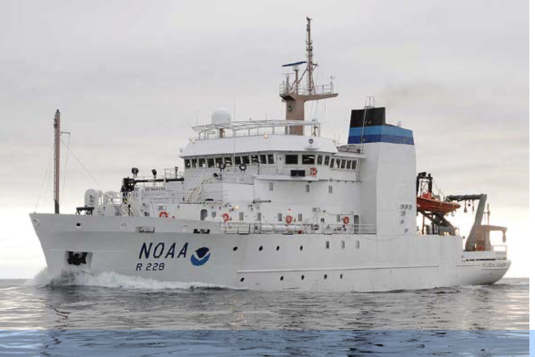
NOAA Teacher at Sea
Jacqueline Omania
Aboard NOAA Ship Reuben Lasker
July 14 – July 24, 2025
Mission: Oceanographic and Biological Monitoring of Davidson Seamount
Geographic Area: Davidson Seamount/Monterey Bay National Marine Sanctuary
Date: July 16, 2025
Weather Data from the Bridge
Latitude: 35° 42.48’ N
Longitude: 122° 22.29’ W
Wind Speed: 3.1 knots
Wave Height: 3-4 ft.
Air Temperature: 16.2°C/ 61°F
Sky: Overcast
Science and Technology Log:
After a day of transit, we reached our location in Monterey Bay National Marine Sanctuary, the Davidson Seamount, an undersea mountain habitat 80 miles southwest of Monterey. At 7,480 feet tall and with its summit still 4,101 feet below the ocean surface, Davidson Seamount is one of the largest known seamounts in U.S. waters. It hosts a large number of deep-sea species-like coral forests, sponge fields, crabs, shrimps and deep-sea fish-as well as a great diversity of marine mammals and sea birds. While the deep-sea habitat of the seamount has been well studied, the area above the top of the seamount has not. Thus, this environment is the focus of our research. We are working to observe marine mammal and bird life and to measure water conductivity (salinity), temperature, and depth (also known as CTD), and to collect environmental DNA (or eDNA, the genetic material shed by organisms in the water) data to give a more complete picture of the rich and interdependent food web above the seamount.
At the moment, we have completed our first day of observations and collections. The scientists work in two groups. One group is on the flying bridge (highest deck) and is observing and recording birds and mammals over a set distance with the ship traveling at the same speed (10 knots) each time.. The other group, in the wet lab, is managing the CTD data and eDNA collection. The chart below shows our CTD data collection stops on the transects over the seamount. We started at 24W and progressed to 24E on day one. Now as I write on day two, we are on 20M.

Image Credit: Chad King/MBNMS
What is a CTD?
A CTD rosette is an instrument used to measure conductivity, temperature and depth. Conductivity readings tell us how salty the water is because salinity affects how electricity moves through water. The device is a large cylindrical instrument, with a circle of 12 Niskin bottles, that is lifted by a very large winch and pulley system into the ocean. The caps to the bottles are open as the CTD rosette descends into the ocean. The device itself electronically collects CTD data along the round trip to 1000 meters and will do so at every location on the transect both in the day and in the night. For the water samples which capture the eDNA, the scientists close the caps on the bottles remotely to capture water at the depth of choice. For our eDNA samples at the yellow dots, we are collecting at 500 meters and the surface (0 meters) as the CTD rosette travels up. For the blue dots, we will collect eDNA at 0m, 500m and 1500-1700m. We are working hard to collect as much data as we can above the Davidson Seamount to better understand the relationship between oceanographic variables and the lives of marine organisms.


Science in the Wet Lab:
Once the CTD rosette returns, the scientists collect sterile samples in small vials. First (image 1), 500ml of water is slowly run through a tube that forces the water through a very fine filter (imagine something like a disk shaped coffee filter). The filter (image 2), captures the eDNA which is then put into a small 2 ml vial with a preservative. This vial (image 3) will be processed by MBARI (Monterey Bay Aquarium Research Institute) which is dedicated to the study of our ever-changing ocean. The eDNA samples will allow scientists to identify species which have been in the area, although we have not physically seen them, by analyzing the genetic materials the organisms have shed. Thus, when combined with the actual physical observations, we will have a more complete picture of the ecosystem at Davidson Seamount.


Science on the Flying Bridge:
The flying bridge, the highest deck on the ship (about 50 ft. above sea level), is where the mammal and bird scientists work. They divide the areas of observation into two 90 degree quadrants facing the direction of travel. Observations are recorded at specific time intervals from 7:30 am to 5 pm and only happen when the ship is traveling. As the observers call out, a recorder enters the data. There is a special order in which behaviors and details are entered. For birds the order of details recorded is: species, number, distance from ship (100m, 200m etc.), behavior (sitting on water, eating etc.) and direction of flight. For marine mammals, the order is: how first seen, what method (eye, binoculars), direction from ship, reticule (distance taken from binocular lines), animal’s activity, age/sex, species, number and any other comments. Since there are 4 observers calling out, taking turns is necessary. Also spotting a mammal takes precedence over birds- so mammal observers are allowed to interrupt and share their observations. All of this data is compiled daily. On our first day, we noted 331 sightings of which 284 were birds and 47 mammals. Today, Wednesday, we had 303 observations with 274 birds and 29 mammals. Most of the birds today were Red-necked Phalaropes and the mammals were fur seals. Red-necked Phalaropes, of which we saw 107 individuals, breed in the Arctic and then migrate to winter in South America.


All of this research is possible through excellent teamwork. Just as in our school, Oxford Elementary, we have a team of the principal, a secretary, teachers, instructional assistants, specialists, afterschool staff, maintenance and food service, our work on Rueben Lasker requires a team of the scientists, the ship crew and the NOAA Corps officers. I am part of the science team which is led by chief scientist Chad King from Monterey Bay National Marine Sanctuary and has four scientists from the sanctuary and four from Point Blue, a conservation organization that works both on land and sea. In future blogs, I will be spotlighting members of both the science team and the ship team to share their work.
Personal Log:
My first days on the ship have been wonderful. The entire community is so welcoming and are always checking in and willing to share their work. I have learned a great deal of new vocabulary that is important to get around the ship. My room is called “a stateroom,” the bathroom “a head,” and each floor is a “deck.” We eat in the dining room called the “ mess” and the food is made in the “galley” (kitchen). The front of the ship is “bow” and the back “stern,” while the right side is “starboard” and the left is “port.” I am learning my way around the ship- it is a bit of a maze of doors and levels. The first day, I spent an hour going up and down and around trying to find the acoustic lab to join the card games without luck. Now my orientation is better, and I know where the acoustic lab is; each day, though, I continue to notice more special doors or sections of the ship that I have never seen before.
I feel incredibly safe at sea due to the great teamwork. Chad, our chief scientist, meets with NOAA Corps and the crew twice a day- at sunrise and sunset- to discuss operations and gain feedback on the day. Our science team also meets at 8 pm daily to discuss both science and general well-being. On our second day at sea, the entire ship had both a fire drill and an abandon ship drill. For the fire drill, we had to go to our muster station- indicated on our bunk card – and wait for the ship crew to do their practice. This experience is much like fire drills at school where we make sure everyone is accounted for. For the abandoned ship drill, we had to put on the red survival suit. We were lucky we got to practice in the mess. It is a bit like struggling into the most awkward Elmo costume. Once you get your hands in, you lose dexterity and yet you still need to zip up your suit and pull up the head covering all on your own. With coaching by NOAA Corps officer, Lt. Mike Fuller, I made it! This suit will give you insulation and buoyancy to prevent hypothermia and drowning in case of the need to abandon ship.


Photo Credit: Holly Lohuis
Life aboard Rueben Lasker is quite comfortable. I share a stateroom with Amity Wood, who works with Monterey Bay National Marine Sanctuary in education and communication. She kindly let me have the bottom bunk. We have our own bathroom and shower and lockers to store our clothes in. Now, a few nights in, I am getting used to sleeping with the constant rocking. Overall, life aboard the ship is like being forever in a fun house. Everything moves- the hallways, the doors, the decks and the ladder like stairs. As you walk, you learn to keep your steadiness and constantly adjust despite it all. Metaphorically, this skill of always adjusting and adapting yourself to stay balanced no matter what happens is a great life skill.


The highlight of my experience so far is being able to spend my day 50 ft above sea level on the flying bridge surrounded by the deep blues to silver greys of the ever-changing Pacific Ocean. We began with amazing views of the Bay Bridge and the Golden Gate Bridge after we left our port of Alameda. Though I know the San Francisco Bay well, the chance to see it with the birds’ eye view was a special gift. I could see details I’d never seen before- such as the inside of a container loader’s cabin and the underside of both bridges.


Once we left the Bay, heading toward Monterey Bay National Marine Sanctuary, we sailed past several humpback whales, brown pelicans and cormorants. Each day, I learn more about scientific animal observation. I now know how to first spot an animal with your eye and then bring your binocular up to your face at the line of vision. You must not look down ever in the process or you will lose the animal you are focusing on. I am fairly new to birding- even though I started birding with my class this year. We gave ourselves the challenge to learn 6 local Berkeley birds and experienced birding at the Berkeley Marina, where most children saw their first ‘lifer’ – the Great Blue Heron. I’d love my students to see me now– as I am seeing ‘lifers’ every hour of the day! (A ‘lifer’ is the first time a bird species is seen by an observer.)

Animal observation takes time and patience and precision. At first, every time I spotted an animal, by the time I lifted the binoculars, it was gone. With practice, I’ve gotten better and each day is filled with wonder. I have a goal to personally see at least one new species a day. On Monday it was a Black-footed Albatross. On Tuesday, after missing out time after time…. I actually saw -– a Mola mola!
Did you know?
The Mola mola, also known as Ocean Sunfish, is the heaviest bony fish in the world. They can be up to 14 feet long and weigh 4,400 pounds. They average at 550-2200 pounds. Mola mola are silvery grey with a tiny mouth, big eyes, a flattened body and no tail. Because they spend much of their time near the surface, they are very sensitive to entanglement and plastic pollution. In my sighting, I saw the dorsal fin first and then the giant body through the water. You can see Mola mola at the Monterey Bay Aquarium.