Title: Kathy
Schroeder: Meet the NOAA Oregon
II, Sept 20, 2019
————————————————————————————————————————————–
NOAA Teacher
at Sea
Kathy
Schroeder
Aboard NOAA Ship
Oregon II
September
15-October 2, 2019
Mission: Shark/Red Snapper Longline
Survey
Geographic Area of Cruise: Gulf of Mexico
Date: 9/20/19
Weather Data from the Bridge
Latitude:
29.3088855
Longitude: -94.7948546
Temperature:
87°F
Wind Speeds:
SSW 17 mph
Science and Technology Log
Today I decided to share with you some information about the Oregon II that I found on her website and show you around the ship. I have attached pictures so you can see where I have been living and working for the last 5 days. (unfortunately each picture is taking forever to upload-so I hope to add more this week)
NOAA Ship Oregon II, photo credit: NOAA
“NOAA Ship Oregon II conducts a variety of fisheries, plankton and marine mammal surveys in the Gulf of Mexico, Atlantic Ocean and Caribbean Sea.
The 170-ft. ship’s mission includes supporting the National Marine Fisheries Service’s annual bottom longline red snapper/shark survey, during which researchers catch, measure, tag and release the fish to acquire the data used in stock assessment for many of the coastal species of sharks, as well as commercial snapper and grouper species. Using gear modeled after commercial shark fisheries, the survey has been running continuously since 1995.
During survey missions, observers stationed on the ship’s flying bridge watch for marine mammals or floating debris using high-powered “big eye” binoculars. When pods are encountered, the ship breaks from planned operations and investigates each sighting.
Oregon II is patterned after North Atlantic distant-water trawlers, designed for extended cruising range, versatility of operations, habitability and seaworthiness.
The ship uses trawls and benthic longlines to collect fish and crustacean specimens. The ship’s longline gear consists of one nautical mile of mainline with 100 hooks, which soak for a total of 1 hour. The ship uses plankton nets and surface and midwater larval nets to collect plankton.
Oregon II was originally built for the Bureau of Commercial Fisheries, Department of the Interior, as a replacement for the fishery research vessel Oregon, a converted 100-foot tuna clipper that carried out most of the federal fishery research work in the Gulf and southwest Atlantic beginning in 1952. The ship was commissioned in the NOAA fleet in 1975. Oregon II is homeported at NOAA’s Gulf Marine Support Facility in Pascagoula, Mississippi.”
Update: So we are still here in Galveston, TX. The engineers have been working so hard to get the parts in and fixed. We are ready to go, but need to wait on a part to arrive to have with us out in the Gulf. Hopefully we get out on the water today! The Tropical Storm Imelda brought lots of rain. About 14” of rain here. Some areas around us got 34”+. That means lots of flooding. Almost every restaurant and store here is closed. We made our way out last night to one place that was open and enjoyed some pizza. I’ll keep you posted as I know more!
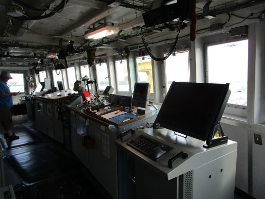
Oregon II The BridgeOregon II View from the Bridge
Shout Out: Today’s shout out goes to
my beautiful little Payton Clawson and her wonderful parents Andrea and
Tyler. Miss you!!
Geographic Area of Cruise: Gulf of Alaska (Kodiak – Aleutian Islands)
Date: September 12, 2019
Weather Data from the Bridge
Latitude: 57 35.35 N Longitude: 153 57.71 W Sea wave height: 1 ft Wind Speed: 14 knots Wind Direction: 208 degrees Visibility: 8 nautical miles Air Temperature: 15.4 C Barometric Pressure: 1002.58 mBar Sky: Overcast
Science and Technology Log
Well, we only have a few days left on this trip and it looks like mother nature is going to force us to head for Dutch Harbor a little early. I thought this might be a good time to spend some time sharing some information on some of the species we have been pulling out of the ocean. This is far from a complete list, but just the ones that made “the cut”.
Pollock Age 3
Pollock Age 0
At the top of the list has to be the Pollock. After all, this is the primary objective of this study. On the left is an adult three-year-old pollock and on the right is an age-0 pollock. The sampling of age-0 pollocks is a good indicator of the abundance of the future population.
Coho Salmon
Pink Salmon
There were several species of salmon caught on our trawls. On the left is a Coho Salmon and on the right is a Pink Salmon. These fish are very similar, but are classified as separately Coho Salmon are larger and have larger scales. Coho also has a richer, fuller flavor with darker red meat while the Pink Salmon has a milder flavor and a softer texture.
Another important part of this survey is the collection and measurement of zooplankton as this is a primary food source and the amount and health of the zooplankton will have a lasting impact on the ecology of the fish population in the area.
Capelin is another common fish caught in our trawls. This fish eats krill and other crustaceans and in turn is preyed upon by whales, seals, cod, squid, and seabirds.
The Pacific Saury was a fish that wasn’t expected to be found in our trawls. Also called the knifefish, this species always seemed to be found in substantial quantities when they were collected – as if the trawl net came across a school of them. They are found in the top one meter of the water column.
The Prowfish was another interesting find. This fish is very malleable and slimy. Adults tend to stay close to the ocean floor while young prowfish can be found higher up in the water column where they feed on jellyfish. As with the saury, the prowfish was not kept for future study. It was weighed, recorded, and returned to the water.
Jellyfish were abundant on our hauls. Here are the five most common species that we found.
The Bubble Jellyfish, Aequorea sp., is clear with a rim around it. This jellyfish is fragile and most of them are broken into pieces by the time we get them from the trawl net and onto the sorting table.
The Moon Jellyfish, Aurelia labiata, is translucent and when the sun or moon shines on them, they look like the moon all lit up.
The White Cross Jellyfish, Staurophora mertensi, was another mostly clear jelly that was very fragile. Very few made it to the sorting table in one piece. You have to look close it is so clear, but they can be identified by their clear bell with a distinctive X across the top of the bell.
The Lion’s Mane Jellyfish, Cyanea capillata, are the largest known species of jellyfish. These guys can become giants. They are typically a crimson red but could appear faded to a light brown.
The Sunrise Jellyfish, Chrysaora melanaster, was the most common jelly that we found. It is also arguably the least fragile. Almost all made it to the sorting table intact where they were counted, weighed, recorded, and returned to the water. It lives at depths of up to 100 meters, where it feeds on copepods, larvaceans, small fish, zooplankton, and other jellyfish.
Arrowtooth flounder are a relatively large, brownish colored flatfish with a large mouth. Just one look at its mouth and you can tell how it got its name. Their eyes migrate so that they are both on the right side and lie on the ocean floor on their left side.
Eulachons, sometimes called candlefish, were another common find on the sorting table. Throughout recent history, eulachons have been harvested for their rich oil. Their name, candlefish, was derived from it being so fat during spawning that if caught, dried, and strung on a wick, it can be burned as a candle. They are also an important food source for many ocean and shore predators.
The Vermilion Rockfish – This guy was the only non-larval rockfish that we caught. Most can be found between the Bering Sea and Washington State.
Smooth lumpsucker
Spiny lumpsucker
While the Smooth Lumpsucker is significantly larger than the Spiny Lumpsucker, both have unique faces. The Smooth Lumpsucker is also found in deeper water than the smaller Spiny Lumpsucker.
Squid
Squid
Most of the squid caught and recorded were larval. Here are a couple of the larger ones caught in a trawl.
Seabirds
Black-footed Albatross
There were a
variety of seabirds following us around looking for an easy meal. The Black-footed Albatross on the right was
one of several that joined the group one day.
And of course, I couldn’t leave out the great view we got of Pavlof Volcano! Standing snow capped above the clouds at 8,251 feet above sea level, it is flanked on the right by Pavlof’s Sister. Pavlof last erupted in March of 2016 and remains with a threat of future eruptions considered high. Pavlof’s Sister last erupted in 1786. This picture was taken from 50 miles away.
Personal Log
In keeping with the admiration I have for the scientists and
crew I am working with, I will continue here with my interview with Rob
Suryan.
Robert Suryan is a National Oceanic and Atmospheric Administration Scientist. He is currently a Research Ecologist and Auke Bay Laboratories, Science Coordinator, working on the Gulf Watch Alaska Long-term Ecosystem Monitoring Program.
How long have you been
working with NOAA? What did you do
before joining NOAA?
One and a half years.
Prior to that, I was a professor at Oregon State University
Where do you do most
of your work?
In the Gulf of Alaska
What do you enjoy
about your work?
I really enjoy giving presentations to the general public, where we have to describe why we are conducting studies and results to an audience with a non-science background. It teaches you a lot about messaging! I also like working with writers, reporters, and journalists in conducting press releases for our scientific publications. I also use Twitter for science communication.
Why is your work
important?
Having detailed knowledge about our
surroundings, especially the natural environment and the ocean. Finding
patterns in what sometimes seems like chaos in natural systems. Being able to
provide answers to questions about the marine environment.
How do you help wider
audiences understand and appreciate NOAA science?
I provide information and expertise to make
well informed resource management decisions, I inform the general public about
how our changing climate if affecting marine life, and I train (and hopefully
inspire) future generations of marine scientists
When did you know you
wanted to pursue a career in science an ocean career?
During middle school
What tool do you use
in your work that you could not live without?
Computer! So much of our instrumentation and sampling equipment
are controlled by software interfaces. Also, much of my research involves data
assimilation, analysis, creating graphs, and writing scientific papers.
Although, at the very beginning of my career, most of our data collection was
hand written, as were our scientific papers before typing the final version
with a typewriter. So glad those days are gone!
If you could invent
one tool to make your work easier, what would it be?
For in the office: a computer program that
would scan all of my emails, extract the important info that I need to know and
respond to, and populate my calendar with meetings/events. For the field: a
nano-power source that provided unlimited continuous power for instruments AND
global cell phone or wireless connectivity.
What part of your job
with NOAA did you least expect to be doing?
I joined NOAA later in my career and had
collaborated with NOAA scientists for many years, so everything was what I
expected for the most part.
What classes would you
recommend for a student interested in a career in Marine Science?
Biology, math, chemistry, and physics are good foundation
courses. If you have an opportunity to take a class in marine biology at your
school or during a summer program, that would be ideal. But keep in mind that
almost any field of study can be involved in marine science; including
engineering, economics, computer science, business, geology, microbiology,
genetics, literature, etc.
What’s at the top of
your recommended reading list for a student exploring ocean or science as a
career option?
I originally studied wildlife biology before marine science and one of my favorite books initially was A Sand County Almanac, by Aldo Leopold. For marine biology, I would recommend The Log from the Sea of Cortez, by John Steinbeck.
What do you think you
would be doing if you were not working for NOAA?
I would probably work at a university again –
I was a professor at Oregon State University before working for NOAA.
Do you have any
outside hobbies?
Pretty much any type of outdoor adventure, most frequently kayaking, mountain biking, hiking, camping, and beachcombing with my family and our dogs.
Mission: Northern Gulf of Alaska Long-Term Ecological Research project
Geographic Area of Cruise: Northern Gulf of Alaska – currently
sampling along the Seward line.
Date: September 16, 2019
Weather Data from the Bridge:
Time: 16:10 Latitude: 59º36.465’ Longitude: 149º14.346’ Wind: North 12 knots Air Temperature: 16ºC (61ºF) Air Pressure: 1001 millibars Clear skies
Science and Technology Log
The Long-Term Ecological Research (LTER) study focuses on ecosystem dynamics in the Northern Gulf of Alaska (NGA) and how the complex processes of abiotic factors, such as ocean salinity, temperature, currents, and trace metals influence primary productivity of phytoplankton. The project examines how efficiently this energy is transferred, in turn, to higher trophic levels, from zooplankton to vertebrates, such as fish, seabirds and marine mammals.
Over the past twenty years, seabird and marine mammal
observations have been an important component of the LTER study. Approximately
50 species of birds inhabit the NGA either year-round or seasonally, with a
variety of foraging behaviors and diets. Through the LTER, we can learn about how
physical and biological oceanographic processes influence the distribution and
abundance of higher trophic levels, such as seabirds.
Dr. Kathy Kuletz with the U.S. Fish and
Wildlife Service (USFWS) is the lead scientist for the seabird part of the research
program. Dan Cushing is the seabird and marine mammal observer aboard R/V Tiglax.
He holds a master’s degree in wildlife science and has a wealth of
experience in birding both on and offshore.
This fall cruise marks Dan’s eleventh cruise observing in the NGA. Whenever the R/V Tiglax is underway,
Dan can be found on the flying bridge collecting data.
The flying bridge (named for its bird’s eye view) is an open viewing area atop the wheel-house of R/V Tiglax accessed by a ladder.
Observations are made using a protocol established through the USFWS. Dan records survey data using a computer on the flying bridge that records both time and GPS coordinates of each bird or mammal sighting.
Dan actively observing on the flying bridge.
A chopstick with markings on it helps Dan estimate bird distance. Dan made this simple distance measuring tool using high-school trigonometry. When the top of the stick is placed on the horizon, the markings along the stick correspond to distances from the boat.
Dan is able to quickly document the species seen, abundance and any special notes using the computer program.
It is immediately clear that bird sightings
along the LTER follow a pattern.
Inshore, diving bird species are common, such as common murres, puffins
and cormorants. Pelagic bird species
inhabiting deeper waters are mostly surface-feeders, and rely on processes such
as fronts and upwellings at the shelf break to concentrate prey at the surface
where feeding occurs. Albatross, shearwaters
and storm-petrels are abundant as we head further out on our sampling lines.
Pelagic cormorants and black-legged kittiwakes sit on the dock in Seward prior to our departure.
A black-footed albatross. Photo credit: Dan Cushing
Dan’s experience on the LTER study is helpful
in that he can comment on both changes he sees from the spring, summer and fall
cruises but also over the past several years.
For example, in winter 2015-16, a large die-off event of common murres was
observed in Alaska following an extreme warming event called “the blob” in the
North Pacific. The murre die off was due
to starvation from lack of forage fish availability. A question of the LTER study is how is the
ocean chemistry, primary production, and zooplankton abundance tied to events
such as this. Today, the murre numbers have not completely rebounded in the NGA
and other species, such as the short-tailed shearwater are beginning to
experience die-offs in the Bristol Bay area. In addition to shifts in bird populations, fish
that frequent warmer waters, have been observed in the NGA, such as the ocean
sunfish. Dan spotted one on this trip
along our Middleton line swimming at the surface near a flock of
albatross.
The fall survey is occurring when birds are
preparing for harsh winter conditions or long migrations. We have spotted a few birds already changing
to a winter plumage, which can make identification that much more challenging. As the strong September storms hit us, it is
amazing to watch the birds handle the strong winds and driving rain. Last night as we worked on our nightly
plankton tow a gale blew up around us.
The winds picked up to 30 knots and the seas began to build to 10 feet,
and the aptly named storm-petrels kept us entertained. At one point, we turned around and one had
accidently gotten to close and seemingly stunned itself by hitting the back
deck. We watched as it shook off the
confusion and again took flight into the storm.
A fork-tailed storm petrel. Photo credit: Dan Cushing
One of the exciting things about Dan’s job and
my time observing with him was the sightings of rare and endangered
species. Just off of Cape Cleare, as I
sat on the flying bridge with Dan, I heard him exclaim, “no way!” as he grabbed
his camera for some shots. After a few quiet
moments, he shared that he had officially has his first sighting a Manx
shearwater. The Manx shearwater has a
primary range in the Atlantic Ocean, with rare but regular (1-2 per year)
sightings in the NGA. There currently
are no confirmed breeding locations identified in the Pacific Ocean. Every new
sighting adds to our limited understanding of this small and mysterious
population. Another exciting observation, although more frequent for Dan, was
the short-tailed albatross. This
beautiful bird, with its bubble-gum pink bill, is currently critically
endangered, with a global population of only about 4000. The good news is that the population is
currently rebounding from extremely low numbers.
A short-tailed albatross. Picture credit: Dan Cushing
Dan has not only done an amazing job as an
observer but also as a teacher. He has
helped me identify the birds as we see them and given me tips on how to hone in
on particular species. In addition to
this, he has supplied me with amazing facts about so many of the species, I am
in awe of his knowledge, patience and his skill as a seabird and mammal
observer.
I am getting better at identifying northern fulmars on a beautiful evening on the flying bridge.
Personal Log
One of the biggest questions I had (as well as
my students) prior to my trip, was how would I handle sea sickness. I must say for a person who used to get sea
sick snorkeling, I am thrilled to announce that I am sea sickness free. After riding through three strong gales with
12+ seas and 35-40 knot winds without any major problems, I think I’m in the
clear. I owe a lot of it to consistent
Bonine consumption!
Additionally, I would say I officially have my
sea legs on. I have gotten really good at working, walking, eating, typing, and
my brushing my teeth in high seas as the boat tosses about. One of my favorite phrases is when Captain
John says, “the seas are going to get a bit snappy.” I asked him what he meant
by this and he explained that snappy means the waves are sharp and about 8-12
feet in height in contrast to the swells.
They hit the ship with a snap that causes it to vibrate, rather than
just allowing it to slowly roll over them.
A last thing that has surprised me on this trip
so far is the warm weather. I am
typically always cold and was worried about how I would manage working outside
on the nightshift in the elements. The
weather, despite intermittent storms has remained surprisingly warm and with
our mustang suits and rain gear, we have remained mostly dry. Almost daily we have had the pleasure of a
beautiful ocean sunset, a full moon rising and stars over our heads. Now we are just crossing our fingers for some
northern lights to grace our presence.
Another sunset over the Northern Gulf of Alaska!
Animals Seen from the Flying Bridge
Mammals:
Fin whale Humpback whale Dall’s porpoise Harbor porpoise Stellar sea lion Harbor seal Sea otter
While we are waiting to get started with our research survey that collects fisheries-independent data about sharks, I’ll tell you a little about how other NOAA scientists collect information directly from the commercial shark fisheries in the Gulf of Mexico.
The Shark Bottom Longline
Observer Program works to gather reliable data on catch, bycatch, and discards
in the Shark Bottom Longline Fishery, as well as document interactions with
protected species. Administered by the Southeast Fishery Science Center’s Panama
City Laboratory, the data collected by observers helps inform management
decisions. NOAA hires one to six observer personnel under
contractual agreements to be placed on commercial fishing vessels targeting
shark species. Program coordinators maintain data storage and retrieval,
quality control, observer support services (training, observer gear,
documents, debriefing, data entry), and administrative support.
Fishery
This shark bottom longline fishery targets large coastal sharks (e.g., blacktip shark) and small coastal sharks (e.g., Atlantic sharpnose). Groupers, snappers, and tilefish are also taken. The shark bottom longline fishery is active on the southeast coast of the United States and throughout the Gulf of Mexico. Vessels in this fishery average 50 feet long, with longline gear consisting of 5 to 15 miles of mainline and 500 to 1500 hooks being set. Each trip has a catch limit ranging from 3 to 45 large coastal sharks, depending on the time of year and the region (Gulf of Mexico or south Atlantic). Shark directed trips can range from 3-5 days at sea.
In 2007, NOAA Fisheries created a shark research fishery to continue collection of life history data and catch data from sandbar sharks for future stock assessment. This was created as sandbar sharks are protected due to lower population numbers that allowed for some very limited commercial take of the animals and allows for collection of scientific data on life history etc. A limited number of commercial shark vessels are selected annually and may land sandbar sharks, which are otherwise prohibited. Observer coverage is mandatory within this research fishery (compared to coverage level of 4 percent to 6 percent for the regular shark bottom longline fishery).
Well, I guess you were hoping to hear from me sooner than this. I arrived in Galveston, TX on September 15th. I boarded NOAA Ship Oregon II and got settled in my room. The 170 foot ship was tugged into port early due to a broken part. Today is Wednesday September 18th , and we are still waiting to leave. Fingers crossed it will be tomorrow morning. During this time I was able to meet with the crew members and scientists and familiarize myself with the ship. I was able to walk around Galveston and learn about its history. We were able to go out to dinner where I have had amazing oysters and a new dish “Snapper Wings” at Katie’s Seafood Restaurant. It was delicious and so tender. I would definitely recommend it!
During our time in port we were also hit with Tropical Storm Imelda. We have had lots of rain and flooding in the area.
Snapper Wings at Katie’s Seafood Restaurant, Galveston, TX
Fresh Oysters at the Fisherman’s Wharf, Galveston, TX
Shout Out: Today’s shout out goes to my nephews Eastwood and Austin and my sister Karen and her husband Casey in Dallas, TX. I also want to say Hi to all of my marine students at PRHS. Hope I didn’t leave you all too much work to do 🙂 Keep up with your blog ws!
Mission: Northern Gulf of Alaska Long-Term Ecological Research project
Geographic Area of Cruise: Northern Gulf of Alaska – currently
sampling in Prince William Sound
Date: September 14, 2019
Weather Data from the Bridge:
Time: 16:10 Latitude: 59º19.670’ Longitude: 146º07.196’ Wind: East 5 knots Air Temperature: 14.5ºC (58ºF) Air Pressure: 1010 millibars Clear skies
Science
and Technology Log
A Methot net is not your typical plankton
net. This large net hooks to a
stainless-steel frame and has a mesh size of 3mm. Its purpose: large jellyfish collection! The Methot is unique not only for its size
but also in its method of deployment.
The net must be craned off the starboard (right side) of the ship and
submerged just under the water. It is
then towed for 20 minutes at the surface. Similar to the smaller plankton nets,
there is a “cod-end” bucket that helps collect the jellies as the water filters
out of the net.
Heidi working to tighten the shackles on one setup for the Methot net.
Emily helps place the flow meter on the net prior to deployment to measure water flow for quantifying the abundance of organisms caught.
The setup of the Methot is tricky. The frame that we are using was fabricated
locally for these nets so there isn’t a manual for setup and a lot if trial and
error is involved in the setup process.
This entails a lot of wrenching on shackles to connect the net to the
frame, trying out a setup and then trying again once it is in place and we can
watch the positioning and motion of the net in the water. Fortunately, we have an amazingly positive
team so we were able to meet each challenge and come up with a solution. Our fourth time in resetting the net seems to
be the charm.
The Methot being craned into the water.
The Methot looks like a giant wind sock when it is fully extended in tow next to the ship.
Heidi Islas is our onboard jellyfish guru. I have never met anyone who loves jellyfish more than Heidi, and this passion and enthusiasm translates directly toward her commitment to her research. She is currently working on her master’s degree at UAF with Russ Hopcroft as her advisor. Her specific research thesis is, “the abundance and distribution of gelatinous zooplankton in the Northern Gulf of Alaska (NGA).” Currently there is no baseline data on the type and biomass of the large jellies in the NGA so Heidi’s work is so important in helping identify not only what is present but how these jellies may be playing a role in this ecosystem particularly as predators on small fish.
Heidi is about to open the cod-end where the jellies are trapped at the end of the net. A few of our samples were so full the jellies were up into the net and we needed the assistance of the crane to lift it back onboard.
One of our first collections had only a few but a nice variety of jellies: 2 Lion’s Mane, 1 albino Lion’s Mane, 1 Sea Nettle and 1 Crystal jelly.
Our typical sampling includes running either a
Bongo net or Multinet off the stern (back) of the boat to collect zooplankton,
and then immediately following we lower the Methot net for its 20-minute
tow. One of the deckhands, either Dave
or Jen, run the crane for us, while the four of us help move and position the
net into and out of the water. At the
end of the tow, we hose down the net and then open the cod-end to see what we
have collected. Our first few tows had
only a few jellies but a little more variety.
Last night however, as we moved into deeper water south of Middleton
island, we had a large number of jellies to process. We assist Heidi in measuring the diameter of
bells of the jellies, as well as collecting volume and mass measurements. We then preserve any zooplankton and fish we
collect for analysis by fisheries scientists back in the lab.
Emily assists Heidi in measuring and massing the jellies.
Even though it is 3am, Heidi and I are pretty excited about our sample of Crystal jellies.
Many people might ask, why should we care about
the jellyfish? It all comes back to the
food web connectivity. For example, it
is known that jellies will feed on smaller zooplankton, such as copepods and
euphausiids (krill), but also on fish larvae, such as pollock. The commercial pollock fishery is very
interested in identifying any factor that may impact the adult pollock
numbers. Additionally, very little is
known about what else the jellies are eating, or in what quantity. So many questions arise about how these
jellies might be impacted food availability for other species as well as serving
as a food source themselves.
Russ examines a polychaete worm that was part of our sample.
Another very interesting piece of research for Heidi apart from her thesis focus is how are jellies responding to climate change. A current hypothesis was that jellies increase in number during warming events, suggesting that they may become more abundant as our climate changes with even greater impact other species. In her research on this topic, Heidi came across a paper published in 2013 that challenges this hypothesis. It demonstrated that jellyfish actually follow a natural cycle of growth and decline with a peak in abundance every 19 years. Heidi decided to analyze data that NOAA Fisheries had collected over a 38-year period from bottom trawls in the NGA. She too saw the same cycle emerge. Although this is exciting data, it leads to many more questions for her to explore. Such as what is driving this cyclic pattern?
Emily holds a giant Sea Nettle that actually got trapped in our Bongo net. We measured it before sending it back to sea.
In both the scientific and non-scientific world it is easy to see a correlation of cause and effect and jump to a conclusion. What I am realizing from the research going on aboard R/V Tiglax is that numerous variables must be considered before true causes can be determined from the data. This is why collaboration in research is so important. Physical, chemical and biological oceanographers along with fisheries biologists must work together to gain more holistic view of this NGA ecosystem to help unravel its secrets.
Personal Log
Fortitude is my word for the past few
days. I have learned so much on this
trip so far, including two important pieces of information about myself. One is that my body does not like to work
nights. The days are blurring together
for me as I adjust to my shift work. I
can say that it is definitely not an easy transition because the transition
requires more than just adjusting sleep times, but also eating patterns as
well. On Friday night, due to the nature
of our stations, we were not able to start our shift work until 1am. By 5:30 in the morning as we began our last
sample, I literally fell asleep on the rales of the ship waiting for our Bongo
net to surface. I think in another day
or two, I will have it figured out.
A second piece of information I learned about
myself, I am allergic to the scopolamine patch!
Early on Friday, I realized I was developing a rash, which soon
spread. The itching was becoming a
problem and so I immediately discontinued an antibiotic I was taking thinking
it was the culprit. After the rash
worsened, I then realized it was likely the patch. After speaking with Captain John, he
confirmed that this is a nasty side effect for some people. I removed the patch Saturday and transitioned
back to my usual medicine for motion sickness prevention: Bonine.
Unfortunately, 24 hours later, the rash and itching persists. Russ and John joke that they will be taping
my fingers soon, so I better behave.
After the first storm passed we were lucky
enough to have several days of beautiful and surprisingly warm weather as we
started along the Middleton line. I was
able to spend time on the fly bridge with Dan birding and mammal monitoring. I will definitely highlight more on this in a
later blog. From Friday to Saturday I
was fortunate enough to watch both amazing sunsets and sunrises as well as
enjoy the beauty of the full moon.
Sunset over the Northern Gulf of Alaska!
Another storm is forecast to be upon us by late
Sunday evening, so our plan is to finish the Middleton line tonight and be in
transit to GAK1 (just outside of Resurrection Bay) overnight. Currently it is calling for East 40 knot
winds and 11-13 foot seas. It should be
a fun ride.
Did You Know?
The jellies we are sampling all started out in the benthic (bottom) habitat in what is known as a polyp stage of their life cycle. These polyps are attached to the bottom and will asexually bud off into the water column. At this point, the jellies are only approximately a half of a centimeter in size. It is estimated that it takes approximately a year for the jellies to grow to the full adult medusa stage. The medusa is the bell-shaped, free floating stage that everyone recognizes as a jellyfish. This amount of growth requires a lot of energy input, and thus these jellies must feed continuously to reach the adult sizes. It is not known for sure, but it is estimated that the jellies will spend approximately a year in this phase in which they sexually reproduce. The larva will then settle back to the benthic environment and start the cycle all over again.