Kelly Dilliard: Sonobuoys and Gliders, June 4, 2015

NOAA Teacher at Sea
Kelly Dilliard
Onboard NOAA Ship Gordon Gunter

May 15 – June 5, 2015

Mission: Right Whale Survey
Geographical area of cruise: Northeast Atlantic Ocean
Date: June 4, 2015

Weather Data from the Bridge:

Air Pressure: 1025.1 mb
Air Temperature: 13.3 degrees C
Relative Humidity: 64%
Wind Speed: 13 knots
Wind Direction: 63 degrees

Science and Technology Log:

The sounds marine mammals make are often used to study them.  Dolphins make clicks and whistles whereas humpback whales mostly sing.  North Atlantic right whales also make sounds with their signature sound being described as an up-call, a rising whoop that lasts for about a second.  Sei whales, on the other hand make a down-call, a sinking whoop.  Right whales also make a variety of other sounds including: 1) eerie moans, 2) shrill screams which often occur when gathered in groups, and 3) a gunshot sound that sounds like a very loud pop and is thought to be an aggressive call towards males.  These sounds are not easily heard, but can be observed on a sound spectrogram.  A sound spectrogram is a graph of frequency (the number of cycles in a second, given as hertz) on the vertical axis and time on the horizontal axis.  Right whale up-calls range in the low hertz levels of 100-300 hertz, while dolphins are much higher in pitch.  The darker the call on the spectrogram, the louder the call is. To listen to a variety of right whale calls go to the Right Whale Listening Network for examples.

Right whale up-call on a spectrogram posted on the Northeast Fisheries Protected Species Branch website. Go to link to actually hear the call of a right whale and several other whale species.

Right whale up-call on a spectrogram posted on the Northeast Fisheries Protected Species Branch website. Go to link to actually hear the call of a right whale and several other whale species.

Close up of a right whale up-call on a spectrogram. Image from the Right Whale Listening Network.

Close up of a right whale up-call on a spectrogram. Image from the Right Whale Listening Network.

Sonabuoy
Sonobuoy tube.

Whale acoustics can be recorded by a variety of methods.  On this cruise we are using two methods: sonobuoys deployed from the ship and autonomous acoustic technology (aka “gliders”).  Let’s talk about sonobuoys first.  The sonobuoys used on this cruise were first designed for the military but have found a second use in scientific research.  They are housed in an aluminum tube about a meter in length and 10 centimeters in diameter.  When the tube hits salt water it starts a chain reaction starting with deployment of the bright orange float.  The sonobouy, with hydrophones, then bobs freely in the ocean and sends radio signals to an antenna high on the ship’s mast.  The signal is then captured by a computer and a spectrogram of the sound is displayed and recorded.  The sonobuoy has about an eight hour life span and a five mile range.

Sonobouy
Close up of the electronics panel of a sonobuoy.
sonobouy
Chris Tremblay, from the Northeast Fisheries Science Center, Passive Acoustic Group, deploying a sonobuoy to listen for sei whales off the stern of the Gordon Gunter.
sonobouy
A defunct sonobuoy out of the aluminum case. You can see the orange float, and the round hydrophone (in the upper left corner) attached to the purple netting.
sonobouy
Chris Tremblay analyzing the signal coming from the sonobuoy that was deployed.
sonobouy
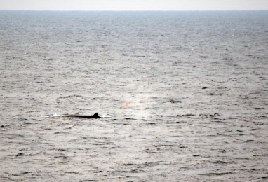
Two sei whales with orange float of the sonobuoy located to the left of the whales.

There are some limits to sonobuoys, namely the five mile (or more depending on model and antenna location) range.  Doctors Baumgartner and Fratantoni at the Woods Hole Oceanographic Institution (WHOI) have developed a means of retrieving real-time detection of whale acoustics from autonomous acoustic gliders.  The particular glider used in the Great South Channel is a Slocum glider.  It looks a bit like a torpedo.  It is programmed to follow a specific track and come to the surface every two hours to send data.  The two researchers also developed a computer program that detects, classifies and reports interesting marine mammal calls otherwise the amount of data coming in would be completely overwhelming.  The Slocum glider also measures fluorescence and other oceanographic conditions, similar to the CTD.


View of the Slocum glider underwater. Photo from NE Fisheries, Protected Species Branch (Dave Fratantoni, WHOI).

How the slocum glider travels and sends data. (Autonomous Real-time Marine Mammal Detections, WHOI)

How the slocum glider travels and sends data.  (Autonomous Real-time Marine Mammal Detections, WHOI)

For more information on acoustics check out the following links:

Personal Log:

Today is the last full day on the ship and it is bittersweet.  I have had a wonderful time and will be sad to go (but also glad to get home).  I have learned so much about whales and the ocean.  I have met some absolutely wonderful people, both scientists and crew.  I am very grateful to all for incorporating me into their family.  I would love to do this again next year.

IMG_2503
NOAA Corps on this cruise. Back row: Operations Officer Ensign David Wang, Junior Officer Ensign Pete Gleichauf, Executive Officer Lieutenant Commander Colin Little, Augmenting Officer Lieutenant Junior Grade P.J. Klavon. Front row: Navigation Officer Ensign Kristin Johns, Junior Officer Ensign Melissa Mathes, Commanding Officer Captain Donn Pratt.

Even though we did not see the as many of the right whales that we wanted to, we did see several species including: humpbacks, sei whales, fin whales, minke whales, and Pete saw a sperm whale.  Yesterday (June 4th) we were deploying plankton nets encircled by a few dozen feeding humpback whales.  It was a spectacular show.

humpbacks
Two humpbacks feeding. Images collected under MMPA research permit #17355
humpback
Humback whale feeding. Images collected under MMPA research permit #17355.
Two humpbacks.  Images collected under MMPA research permit #17355.
Two humpbacks. Images collected under MMPA research permit #17355.
Humpbacks.  Images collected under MMPA research permit #17355.
Humpback feeding. Images collected under MMPA research permit #17355.
Humpback.  Images collected under MMPA research permit #17355.
Humpback. Images collected under MMPA research permit #17355.

And I will end with a sunset photograph.

Sunset
Sunset off the stern.

Kelly Dilliard: Plankton Nets and a Right Whale Calf, June 2, 2015

NOAA Teacher at Sea
Kelly Dilliard
Onboard NOAA Ship Gordon Gunter

May 15 – June 5, 2015

Mission: Right Whale Survey
Geographical area of cruise: Northeast Atlantic Ocean
Date: June 2, 2015

Weather Data from the Bridge:

Air Pressure: 1017.02 mb
Air Temperature: 12.5 degrees C
Relative Humidity: 96%
Wind Speed: 7 knots
Wind Direction: 355 degrees

Science and Technology Log:

Sarah Fortune
Sarah Fortune with a full cod end.

Sarah Fortune, a graduate student at the University of British Columbia (UBC) was testing her plankton net a few days ago and I thought that it would be fun to describe the process.  A plankton net is hoisted overboard on a similar winch and winch cable as the CTD and is used to collect samples of plankton from the ocean.  A single plankton net has a large hoop at the opening, about 50 cm in diameter that then tapers down to a collection container, called a cod end, at the other end.  The plankton net is a little over 3 meters long.  Many plankton nets are actually paired side by side and commonly referred to as “bongo” nets for due to the two hoops looking like bongo drums.  The mesh of the net is made of nylon and can vary in mesh size.  This particular net has a mesh of 330 microns or a third of a millimeter.  This allows researchers to capture very small plankton (millimeter sized).

Plankton net fully extended after being down at about a depth of 150 meters.
trip mechanism
Trip mechanism used to open and close the plankton net.

The plankton net that Sarah will be using for her research on bowhead whales is designed to open and close at specific depths using a special clasp, called a double trip mechanism.  A rolled up net is lowered to the target depth, a weight is sent down the winch cable and opens the double trip mechansim and the net.  As the boat moves, ever so slightly, organisms are collected in the net.  The net is then brought back to the surface using the winch and then closed again with a weight at another target depth.  I gathered that the double trip mechanism was a bit finicky, so Sarah was practicing the technique.

Plankton net
Washing down the plankton net.

Once the net was out of the water, it was washed down with a hose to make sure that all of the organisms were in the cod end.  Further washing occurred on deck.  The cod end also contains mesh in spots, so the excess water flushes out and the organisms are left in the container (the cod end).  If there is a lot of excess water and organisms these are dumped into a bucket and then brought up to the wet lab to be processed.  A subset of the sample was poured into a test tube, via a funnel, and put in a freezer for further examination off the ship.  If there is excess water, the sample is poured through a mesh sieve to remove the excess water.  Other samples were also saved in beakers.

cod end
Cod end with lots of Calinus finmarchicus.
Sieve
Collection being sieved. The red coloring of the sample comes from Calinus finmarchicus.  There are also some clear jellyfish in there, but they are difficult to see.

Sarah also had a stereoscopic microscope along to examine the catch, though this is a somewhat difficult task as the specimens move around a lot with the ship’s motion.  The target specimen was Calanus finmarchicus, the primary food of the North Atlantic Right Whale.  These are incredibly tiny organisms, typically ranging in size from 2-4 millimeters.  At one point Dr. Baumgartner had one on his finger and even that was difficult to see except for the red pigment.  He also related to us onlookers an interesting analogy of how much an individual right whale would need to consume in one day.  Basically, every right whale needs to eat the weight of a Volkswagen Beetle of Calanus finmarchicus every day.  That is a lot of very small organisms.  Some other interesting organisms that were captured in the plankton net over the day included microscopic starfish, jellyfish, krill, and a fish (which was thrown back into the ocean).

Sample
View of sample using the light of the microscope.  The red organisms with out black eyes are Calinus finmarchicus.  The organisms with two black eyes are krill.

Personal Log:

In past few days we have encountered patches of thick fog that in some cases have lasted for hours.  This has hampered our whale observations, one because we cannot see them in the fog, and two we cannot stand up on the fly bridge (above the bridge) when the fog horn is on (very loud).  So, our sighting numbers are significantly down, with a whole day in which we did not see a single whale of any kind.  One evening, though, we had a really good show from a mother and calf North Atlantic right whale.  We have seen these two before on two occasions.  The mother is 1950.  Her calf was up near the surface for nearly an hour shaking its fluke and flippers, breaching, and rolling onto its back.  The calf also rolled all over the mom when she was at the surface.  This all occurred very close to the ship so everyone on the fly bridge and the bridge was able to watch and see the action pretty clearly.  I was able to capture several photographs and tried a few videos with my camera.  It is not very easy to shoot videos on a boat that is rocking up and down, but I think they turned out okay.

Right whale calf
Various images of right whale calf: “V” shaped blow, characteristics of right whales (upper left), fluke (upper right), calf swimming on its back with flippers flapping (middle row), and a head shot (bottom row). Images collected under MMPA research permit #17355. These photos are cropped images of photographs taken with a telephoto lens.
Breaching right whale
Right whale calf breaching. Images collected under MMPA research permit #17355. These photos are cropped images of photographs taken with a telephoto lens.
Right whale
Right whale calf rolling over the back of its mom, 1950. Notice the callosities pattern on the mom and the two blow holes. Images collected under MMPA research permit #17355. These photos are cropped images of photographs taken with a telephoto lens.

Only a few more days on the ship.  Unfortunately with the fog and the lack of right whale sightings the scientists have not necessarily accomplished all of their objectives, including testing out a new tag that could be used to track a whale for several days.  We come into port early Friday, June 5th.

Group shot
Group shot of the scientists on board (minus Eric Matzen who was only on for the first leg).  Back row from left to right: Mark Baumgartner, Lisa (Grace) Conger, Corey Accardo, Sarah Fortune, and Hansen Johnson.  Front row from left to right: Kelly Dilliard (me), Sabena Siddiqui, Jenn Gatzke, Suzanne Yin, Peter Duley (chief scientist), Divya Panicker, and Chris Tremblay.
Whale poop (strangely colored area) from a fin whale.   Images collected under MMPA research permit #17355. These photos are cropped images of photographs taken with a telephoto lens.
Whale poop (strangely colored area) from a fin whale. Images collected under MMPA research permit #17355. These photos are cropped images of photographs taken with a telephoto lens.

Kelly Dilliard: CTDs, May 26, 2015

NOAA Teacher at Sea
Kelly Dilliard
Onboard NOAA Ship Gordon Gunter

May 15 – June 5, 2015

Mission: Right Whale Survey
Geographical area of cruise: Northeast Atlantic Ocean
Date: May 26, 2015

Weather Data from the Bridge:
Air Pressure:  1021.52 mb
Air Temperature: 14 degrees C
Relative Humidity: 90 %
Wind Speed:   23.4 knots
Wind Direction:  208 degrees

Science and Technology Log:

While we are out in the Great South Channel looking for right whales, a group of scientists (under Dr. Mark Baumgartner) from Woods Hole Oceanographic Institute (WHOI) is collecting data about ocean characteristics using a CTD (Conductivity, Temperature, and Depth).  They have established a grid of drop sites spaced 5 miles apart along a transect, with the transects 12 miles apart from each other.  There are approximately 60 sites along five transects of varying length.

Map
Chart of transect lines and stations. In this chart, the ship is not yet to the transect lines.

What is a CTD?  Well, it is a standard tool used by oceanographers to measure changes in salinity and temperature with depth.  The instrument is lowered over the side of the ship with a vice winch and it is dropped through the water column at a steady rate, about 45 meters per minute, recording both conductivity and temperature.  The “CTD” that is being used on this cruise includes an array of instruments and two actual CTDs that are attached to a cage.  Other instruments on the cage include: two fluorometers, a video plankton recorder (VPR), and an optical plankton counter (OPC).

All three of these instruments are being used to study the food source (copepods) of the North Atlantic right whale. The fluorometer is used to determine the amount of phytoplankton (food source of the copepods) in the water, which fluoresces at specific wavelengths when light is shined on them.  The amount of light flashed back to the receiver is proportional to the amount of phytoplankton in the water.  The VPR is actually a camera with a strobe light on one end that takes images of the water column as the CTD passes through.  The VPR can be used to determine abundance and types of plankton, based on size, at different depths within the water column.  The OPC contains a narrow, rectangular-shaped, open-ended box with a red light shining in the center.  The water and plankton pass through the box and create shadows when they interfere with the light.  These shadows are then counted and an abundance of plankton can be determined.  The total package of instruments and weights weighs about 475 pounds.

CTD
Various views of the “CTD” cage and the instruments on it.
CTD
CTD coming out of the water. The orange blobs in the water are actually jellyfish.

What does the CTD tell us?  The CTD itself can show us how the ocean is stratified, or layered, based on different densities.  These layers change seasonally and daily depending upon the wind strength and tidal strength.  During the spring and summer months off Cape Cod, there tends to be a freshwater surface layer representing seasonal snowmelt that has made its way to the ocean via streams.  This layer sits on top because it contains less dissolved solids and therefore has a lower density.  This water also absorbs the sunlight, which makes it warm.  The surface water can mix due to the wind.  Phytoplankton and zooplankton are often found in the mixed layer.  Below this zone is a relatively thick layer of cold water that does not tend to mix.  This layer has been referred to as the “cold pool” and originates during the winter months.  The basal layer, or bottom water, tends to be warmer, but saltier, making it denser than the cold pool.  The bottom water originates out in the Atlantic Ocean proper.  So to recap from the surface down: 1) freshwater, 2) mixed water, 3) cold pool, and 4) bottom water.  These layers can be seen on the CTD profile as temperature and salinity change with depth.  Data from the fluorometer is also plotted with depth and one can determine where the phytoplankton is abundant, often in the mixed layer.

CTD profile.  The black line represents fluorescence, the green line is temperature, and the orange line is salinity.   All values increase to the right.  The duplication is due to the instrument recording measurements on the way down (the data used) and on the way up.
CTD profile. The black line represents fluorescence, the green line is temperature, and the orange line is salinity. All values increase to the right. The duplication is due to the instrument recording measurements on the way down (the data used) and on the way up.  You can see the warm, fresh layer at the top and the rapidly changing thermocline.  There is also a warmer, more salty bottom water in this profile.  The profile above was taken from the top track line and a eastern data site (SC115).

What is a copepod?  A copepod is a type of zooplankton.  Actually they are minute crustaceans that contain an exoskeleton.  There are thousands of species of copepods, but North Atlantic right whales are particular to Calanus finmarchicus.  These copepods are kind of interesting.  They feed on phytoplankton at the ocean surface during the night in hopes of avoiding being eaten themselves.  During the day, they sink to the bottom waters to avoid predators.  When they feed in the spring months, they store up energy in oil sacks.  This allows them to hibernate at a boundary layer near the bottom during the summer months when predators are most active.  Right whales are thought to dive down to this area and still feed on them.

Copepod
Calanus finmarchicus. Note the oil sacs (where the red color is in the copepod). Image from Centre of Ecotoxicology and Experimental Biology.
 Image of Calanus finmarchicus taken in-situ by the video plankton recorder (VPR). Image from Dr. Baumgartner's project website on Copepod Diel Vertical Migration.
Image of Calanus finmarchicus taken in-situ by the video plankton recorder (VPR). Image from Dr. Baumgartner’s project website on Copepod Diel Vertical Migration.

Several of the scientists that have been on these yearly North Atlantic right whale surveys will tell you that five or more years ago they would have seen lots of whales.  On this survey, we have only seen a handful of right whales.  There are many questions that remain unanswered, but most importantly, where are the right whales going once they leave areas like Cape Cod Bay.  They used to come to the Great South Channel, but that appears to be changing.  The CTD transects provide a method of studying oceanographic conditions and the location of right whale food sources on a yearly basis and provide a means of comparing ocean states from year to year.  Hopefully, with further research the question of why the right whales are not coming to this feeding ground anymore can be answered.

Please check out these project websites of Dr. Baumgartner for more information on using CTDs to study whales:

– North Atlantic Right Whale Diving and Foraging Behavior in the Western Gulf of Maine

From phytoplankton to whales: Ecological Interactions on Stellwagen Bank

Copepod Diel Vertical Migration

I would like to thank Dr. Mark Baumgartner for explaining much of what is written above and several students working under him (Hansen Johnson and Divya Panicker) for giving me a tour of the CTD instruments.

Personal Log:

We have been doing CTD transects for the past few days.  Half the group is on a CTD watch schedule and the other half, of which I am included, is continuing the watch on the fly bridge for whales.  It has been slow going, due to the frequent stops for CTD drops, with not many whale sightings.  Yesterday, (Tuesday) had especially low counts (only 6 observations).  This is also due to the weather conditions.  Strong winds blowing across the water created significant white-caps making it challenging to see blows off in the distance.  We did have a day off of sorts on Sunday when we were making our way to the first CTD transect line.  The ship strangely felt like a ghost ship as everyone caught up on sleep, laundry, and movies.

Since most of the watches that we are doing require sunlight, we are generally off from 7 pm to 6 am.  A few of us get together and play cards, specifically the game Peanut.  I had never heard of this, but am finding my life long playing of solitaire to be very helpful.  Thank you Nana!  Peanut is kind of like solitaire and can go by the name Nertz.  Each player has his or her own deck of cards.  You start with eleven cards in a pile and four single cards.  The object is to decrease your eleven card pile to zero, by either stacking the cards solitaire-style on the four single cards or by placing them on the various aces (from their own or others) out in the center.  The first person to end with zero wins and receives an extra ten points.

Want to end with a photo of some mammals.  Here is one of some white sided dolphins.

dolphins
White sided dolphins swimming off the boat.

Kelly Dilliard: Right Whale Genetics, May 24, 2015

NOAA Teacher at Sea
Kelly Dilliard
Onboard NOAA Ship Gordon Gunter

May 15 – June 5, 2015

Mission: Right Whale Survey
Geographical area of cruise: Northeast Atlantic Ocean
Date: May 24, 2015

Weather Data from the Bridge:
Air Pressure:  1025.57 mb
Air Temperature: 16.7 degrees C
Relative Humidity: 55%
Wind Speed:  23 knots
Wind Direction:  244 degrees

Science and Technology Log:

In the last blog post, I wrote about how right whales are photo-identified.  Today we will look into what researchers do with this information and other information that are gathered on right whales including lineages of specific individuals.  It really is amazing how much information has been gathered about the right whale population off the New England coast.  They have been collecting data on these whales for the past 25 years.  It goes to show that persistence pays off.

Right whales are also identified by genetics and can be used to develop right whale family trees.  Scientists use a dart shot from a crossbow to collect a small sample of skin, flesh, and blubber.  These are then sent to the Natural Resources DNA Profiling and Forensic Centre in Canada for DNA extraction.  The data is then stored in the North Atlantic Right Whale DNA Bank at Trent University and made available as an online database.  The database contains information on over 500 individuals and provides a means of studying the right whale population, keeping track of deceased individuals and paternity.  DNA provides the only means of determining a calf’s father.  The DNA database currently contains 105 paternity results (this link takes you to the list of father-mother-calf connections).

On our cruise we have been able to photo-identify a few right whales so far.  You can learn more about each of these whales by looking them up in the North Atlantic Right Whale Catalog, including callosity patterns, images and sightings. Two of the whales were with calves, Wolf and 1950, and two were not, Couplet and 3890.   As you can see, some whales have been named and some have not.  Wolf was born in 1987 to mom, Moon, and father, 1516.  She had a previous calf, Caterpillar, with Thorny in 2005.  1950 had a previous calf, Haley, in 1997 with Legs.  Couplet is an interesting one and warrants further examination.  3890 is not yet in the paternity database.  Females tend to breed every 3-4 years and they first give birth at age nine or ten.

Wolf
Image of Wolf taken by a NOAA aerial survey in 2010. Photo from the North Atlantic Right Whale Catalog.

Couplet was born in 1991 to Sonnet (mother) and Dingle (father).  Couplet has two other siblings, 3123 born in 2001 and 3423 born in 2004.   Couplet had a calf herself in 2003 with Velcro and another calf in 2001.  Couplet’s mom, Sonnet, was born in 1981 to Kleenex (mother) and 1050 (father).  Her grandmother, Kleenex, has had seven calves, with Sonnet being the second oldest.  Kleenex has been well studied and is thought to be the most productive female.  From Kleenex’s and Couplet’s family tree you can see that right whales interbreed.  Kleenex and Dingle had a calf, Echo, in 1996, an “aunt” of Couplet’s.  Couplet is a calf of Dingle as well.  You can read more about Kleenex in her biography.

Right whale 1950 spotted on Wednesday, May 20th with a calf.  Identified by Corey Accardo.
Right whale 1950 spotted on Wednesday, May 20th with a calf (the calf is not in this photo). Identified by Corey Accardo.  Images collected under MMPA research permit #17355.  Photo credit NOAA/NEFSC/KAD.

North Atlantic right whales travel up and down the eastern seaboard ranging from Florida to Canada.  Florida and the southeastern United States is the calving grounds for right whales.  The calving season is from December to March.  During this time there is no feeding going on.  This may be due to the lack of available food.  The right whales then migrate north for the summer and fall months to Cape Cod Bay (1 on the map), the Great South Channel (where we are currently, 2 on the map), the Bay of Fundy (3 on the map), and Roseway Basin/Browns Bank (4 on the map).  They move between the different areas for feeding and nursing, with the population distribution based almost solely on food availability.  Some individuals have been known to winter in Jordan Basin and Cashes Ledge in the central Gulf of Maine.  Jordan Basin, in particular, is a suspected breeding ground for the North Atlantic right whale.

  
Maps of the southeastern and northeastern seaboards with North Atlantic Right Whale habitats denoted.

Personal Log:

It has been a few days since I was able to write a blog partly due to weather and partly due to science activity.  On Friday the two small boats on the ship were deployed to tag and photo-identify a right whale that was spotted around 10 am from the fly bridge.  The boats are deployed via a crane that picks up the RHIBs (Rigid Hull Inflatable Boat) and puts it off the port side of the boat.  The scientists then crawl down a Jacobs ladder (rope ladder with steps) to get into the small boat.  While several of the scientists were out in the boat chasing the right whale, the rest of us were up on the fly bridge following the whale and directing the small boats to its location.  This was especially challenging because the right whale would only surface for a very short time period and then dive down for up to 20 minutes.  Through all of this there were hundreds of seals swimming off the bow, humpback whales feeding, and tons of birds.  Pete, the chief scientist, also saw yellow fin tuna within the “sea” of seals.   I was able to capture lots of images with my telephoto lens and with my GoPro.  I will post a few below.

Small boats looking for the elusive right whale.
Small boats looking for the elusive right whale.   Images collected under MMPA research permit #17355.  Photo credit NOAA/NEFSC/KAD.
The small boat from WHOI trying to tag our elusive right whale (tale).
The small boat from WHOI trying to tag our elusive right whale (tale).  Images collected under MMPA research permit #17355.  Photo credit NOAA/NEFSC/KAD.

On Saturday, we were in high seas due to sustained winds over 25 knots.  The choppy sea made it very difficult to spot whales due to all of the white water.  I especially was not on the Big Eyes do to the choppy seas.  Mark Baumgartner from WHOI (Woods Hole Oceanographic Institute) and his team were deploying the CTD at specific points along our track line.  The plan is to continue CTD work on Monday and Tuesday.  I also plan to write my next blog post about the CTD.  We are expected to have high seas and wind again.

Humpback whale feeding.  You can see the white baleen in her mouth.  This photo was taken with a telephoto lens and then cropped.
Humpback whale feeding. This photo was taken with a telephoto lens and then cropped.  Images collected under MMPA research permit #17355.  Photo credit NOAA/NEFSC/KAD.
Humpback whale feeding. You can see the white baleen in her mouth. This photo was taken with a telephoto lens and then cropped.
Humpback whale feeding. You can see the white baleen in her mouth. This photo was taken with a telephoto lens and then cropped.  Images collected under MMPA research permit #71355.  Photo credit NOAA/NEFSC/KAD.
Humpback
Humpback whale splash after breaching. I missed seeing (and photographing) the breach, but caught the large splash next to the ship.  Images collected under MMPA research permit #17355.  Photo credit NOAA/NEFSC/KAD.
"Sea" of seals off the starboard side.  Photo taken Friday the 21st.
“Sea of seals” off the starboard side. Photo taken Friday the 21st.  Images collected under MMPA research permit #17355.  Photo credit NOAA/NEFSC/KAD.
Seal off the port side of the ship.  Probably was once part of the above "sea of seals".
Seal off the port side of the ship. Probably was once part of the above “sea of seals”.  Images collected under MMPA research permit #17355.  Photo credit NOAA/NEFSC/KAD


Kelly Dilliard: Individual Right Whale Identification, May 19, 2105

NOAA Teacher at Sea
Kelly Dilliard
Onboard NOAA Ship 
Gordon Gunter
May 15 – June 5, 2015

Mission: Right Whale Survey
Geographical area of cruise: Northeast Atlantic Ocean
Date: May 19, 2015

Weather Data from the Bridge:

Air pressure: 1010.60 mb
Air Temperature: 11.3 degrees C
Relative Humidity: 96%
Wind Speed: 16 knots
Wind Direction: 182 degrees

Science and Technology Log:

Today will look at how to identify individual right whales.  Right whales, as many other whale species, have several physical characteristics that are specific to unique individuals.  Scientists use photo-identification to distinguish individuals, taking photographs of the unique characteristics and then comparing them to past photographs in a catalog.  This allows the scientist to know if the individual has been seen before and the where and when of those sightings.  Scientists can then monitor populations of whales through time and space.

Right whales are identified by their distinct pattern of callosities on the upper part of their heads.  Callosities consist of rough, calcified patches of skin, are grey in color, but often contain colonies of whale lice, barnacles, and parasitic worms that all give the callosities a white color.  Callosities form a unique pattern along the top of the rostrum, behind the blow holes, on the lips, along the jawline and above the eyes of every right whale making this pattern extremely useful to scientists trying to photo-identify specific whales.  Even newborn calves contain a unique callosity pattern.  Another interesting fact is that male right whales have a higher density than females.

Right whale callosities (image from WHOI).

How does this work?  Scientists out on a research ship or on aerial surveys take high-resolution photographs with large telescopic lenses.  These photographs are time stamped and the location is noted.  They then making drawings of the callosities pattern and determines a series of codes that describes the callosity pattern and other identifying marks.  They then try to match the pattern to known individuals within a computer database (The North Atlantic Right Whale Catalog – rwcatalog.neaq.org).

Right whales taken from an aerial survey. (Image from NE Aquarium).

Callosity patterns typically occur on the top of the head and can be characterized as “continuous” or “broken”.  A continuous pattern means that the callosities exist between the blowhole all the way to the tip of the head.  Broken callosities look patchy.  According to the New England Aquarium website on Right Whale Callosity Pattern Identification, 60 percent of right whales have a broken pattern.  Callosities can also occur around the lip, around the eye, and behind the blowhole.

Right whale callosities pattern, looks continuous with 2 symmetrical peninsulas. (photo of right whale in Florida from Flagerlive.com)

Categories of callosity patterns have been established and they are given codes, such as B6 – broken, two islands with the left island forward.  These categories describe the spatial relationships of the callosities, specifically the number of “islands” and their relationship to each other in whales with a “broken” pattern and the number and relative position of “peninsulas” or bulges on a “continuous” pattern.  Unfortunately, whale lice, or cyamid, can move around giving the appearance of callosity in places it does not exist and making these animals difficult to individually identify.

Sketch of callosities pattern
Sketch of callosities patterns from continuous with peninsulas to broken with islands.
Callosities pattern on a right whale with a composite code of C11 which indicates that there are four asymmetrical peninsulas.  (Image from NE Aquarium website, photo taken under NOAA permit 775-1600)

Other identifying marks are also used.  These can include: ridges along the lower lip, white patches on the belly and chin, a dip in the head seen in profile, erosion of the callosity at the front of the head or bonnet known as “tooth decay”, white blow holes, white fluke tips, and gray lines behind blow holes.  Other important identifying marks are scars.  These scars come from anthropogenic causes (entanglements in fishing gear, being hit by ships, etc…) and from other animals (bite marks from cookiecutter sharks or lamprey which leave behind a circular scar to attacks by killer whales).

Right whale fluke and if you look closely you can see a round mark made by a cookiecutter shark.
Right whale fluke and if you look closely you can see a round, light-colored mark made by a cookiecutter shark.

The New England Aquarium has a wonderful website about right whale photo-identification as well as pages on identification codes (see link NE Aquarium).  They also have a right whale photo-identification game (see link NE Aquarium Online Games).

Yesterday (Monday, May 18th) was the first day that we saw right whales up close and were able to photograph them from the ship.  Corey Accardo was behind the camera and captured many good photographs.  Four individual right whales were seen.

Corey taking photographs for photo-identification of right whales.
Corey taking more photographs and Hansen taking notes and helping her see.

Personal Log:

I was surprised with how easy it was to acclimate to life on the ship.  Of course the main reason it was pain free was that everyone, crew and scientists, are so friendly.  It has been wonderful getting to know the scientists and some of the crew that I have met so far.  I am intrigued with how everyone came to be on this ship, the Gordon Gunter.

I was a bit nervous about sea-sickness since I am prone to getting car sick.  Luckily I have fared pretty well.  I have taken to heart the suggestions for combating sea-sickness by drinking plenty of fluids and munching on dry foods.  I have occasionally taken BONiNE for motion sickness and they seem to help when I look through the binoculars.  The boat does rock and roll a bit and sometimes in bed you are being rocked side-to-side or back to forward.  It can be occasionally soothing, like a being a baby rocked to sleep.

One thing that will never happen on this ship is starving.  The food is amazing.  We have at least four or five entry choices at both lunch and dinner as well a full salad bar.  We have had lasagna, pizza, all sorts of fish, chicken parmigiana, Brazilian steak, chicken cordon bleu, vegetable curry, and vegetable lo mein to name a few.  As well as made to order hamburgers, gyros, and Philly cheese steaks.  There are always two different desserts from cookies, to pies, to banana fritters, to homemade custard.  I did not even mention the assorted condiments, including jellies from the Philippines.  There is a very large selection of hot teas, cereals, and breads.  I think I am going to gain weight.  Margaret, the head steward, is a wonder.

A portion of the mess.  you can see all of the selections of cereals in the background.
A portion of the mess. you can see all of the selections of cereals in the background.

Kelly Dilliard: Day 1 and 2, May 17, 2015

NOAA Teacher at Sea
Kelly Dilliard
Onboard NOAA Ship
 Gordon Gunter
May 15 – June 5, 2015

Mission: Right Whale Survey
Geographical area of cruise: Northeast Atlantic Ocean
Date: May 17, 2015

Weather Data from the Bridge:

Air Pressure:  1018.34 millibars
Air Temperature: 11.3 degrees C
Wet Bulb Temperature: 11.0 degrees C
Relative Humidity: 97%
Wind Speed: 10.4 knots
Wind Direction: 33. 69 degrees

Science and Technology Log

The Right Whale cruise that I am on has several objectives.  The main objective is to collect photo identification and biopsy samples of baleen whales, specifically Right Whales and Sei Whales, and apply dermal tags to the whales via small boats (RHIB = Rigid Hull Inflatable Boat) launched from the stern on the Gordon Gunter.

Once the targeted whales are tagged, a team from Woods Hole Oceanographic Institute (WHOI) will conduct oceanography sampling around the tagged whales using a CTD (which measures conductivity, temperature, and depth).  The CTD will be deployed every 20 minutes for as long as the tag stays on the whale and will collect vertical profile data including conductivity, temperature, depth, and information about zooplankton using a video plankton recorder (VPR) and an optical plankton counter (OPC).

Zooplankton will also be sampled via ring nets off the ship or the small boats.  Another objective is to do visual scans and report observations from the observation deck via large binoculars referred to as “big eyes”.  These observations will be tied into acoustical data being collected by two autonomous vehicles, referred to as gliders, which are surveying the Great South Channel, and sonabouys that can be deployed from the ship or small boats.  The gliders can detect and classify the calls of various baleen whales almost in real time.  Today let’s talk about identification of various marine mammals that we have seen and might see on this cruise.  In future blogs we will look into the acoustics of marine mammals and zoo plankton.

Every day there is a watch schedule with three scientists on watch at once, unless there is fog, and then there is only one monitoring the weather.  These scientists stand above the bridge with two big eyes, one on the port side (left) and one on the starboard side (right).  The third scientist is stationed at the computer inputting sightings.

Via the big eyes, you can record the bearing of the sighting, somewhere between 270 and 90 degrees, and the distance of the sighting, in reticles.  The binoculars are at 25 power, that is an object looks 25 times larger than seen with the naked eye.  The scientists are on the half hour rotation between the three stations, starting with the port side, then the computer, then starboard side.  Watch starts at 6 am and ends at 8 pm (or until it gets dark).  Data collected for a sighting includes the type of animal (right whale, sei whale, minke whale, unidentified dolphin, unidentified whale, etc…), number seen, number of calves, swim direction, certainty of identification, and what was the indicator (blow, breach, body…).  So in order to help out with watch, one needs to learn how to recognize the different species that one might see.

Me standing at the big eyes scope on watch.  (photo taken by Divya )
Me standing at the big eyes scope on watch. (photo taken by Divya Panicker)

The target species of the cruise are North Atlantic right whales (Eubalaena glacialis), which are an endangered species and are protected under both the U.S Endangered Species Act and the Marine Mammal Protection Act.  Right whales are identified by: their “V” shaped blow, a large head with an arched jaw, black and white patterns on the head (callosities are the white), and no dorsal fin or hump.

North Atlantic Right Whale drawing. Note the curved jaw and the white callosities. (image from Duke University – OBIS Seamap)

Another targeted species are sei whales (Balaenoptera borealis), which are another endangered species.  Sei whales are large whales reaching almost 19.5 meters (64 feet) long.  Sei whales are identified by: their pointed head with one ridge, a tall dorsal fin, and seeing the blow and the dorsal fin at the same time.

Sei whale drawing (from BBC news).

Other whales include humpback whales, fin whales, and minke whales.  Humpback whales (Megaptera novaeangliae) are identified by: knobs on their head, white or black undersides (ventral), a low dorsal fin with a broad base that can have distinct nicks or scarring, an S-shaped fluke with a distinct notch, and unique white or black coloring on the ventral side of their fluke.  Humpback whales also tend to breach (come up out of the water) and flap their tails and flippers.  Fin whales (Balaenoptera physalus) are commonly mistaken for Sei Whales and vice versa.

Luckily the data collected usually groups the two whales, fin/sei.  Fin whales have a dorsal fin that sits far back, like a sei whale.  They have a lower, white right jaw and a chevron pattern behind their blowhole.  Minke whales (Balaenoptera acutorostrata) have a pointed head with a ridge, they are small in size, and have a pointed fluke.  Their blow is not usually seen.  Other marine mammals that can be seen include dolphins (various species) and seals.

Humback whale
Drawing of a humpback whale courtesy of NOAA Fisheries: West Coast Region.
Fin whale drawing. (Image from University of California – San Diego)
Minke whale drawing. (image from NOAA PMEL Acoustics Program)

Personal Log

Today is day three on the ship.  We set sail from Newport, RI on Friday at 5 pm and headed towards the Great South Channel, which is located to the southeast of Cape Cod between the Nantucket Shoals and Georges Bank.  Both the Nantucket Shoals and Georges Bank are remnants of past glaciations and have been subsequently modified by marine transport.  The Great South Channel provides a link between the Gulf of Maine and the Northwest Atlantic Ocean and is funnel-shaped with a wider and deeper end toward the north and the Gulf of Maine.  Water flowing in the channel results in the upwelling of nutrients and zooplankton that whales, especially right whales, like to feed on.  The autonomous acoustic gliders picked up signals of whales in the area so we headed towards those waypoints.

Map of Great South Channel
Bathymetric map showing the location of the Great South Channel with reference to the Nantucket Shoals and Georges Bank. The ship path is shown in red (map is from Saturday, May 16th).

We had a beautiful day on Saturday, May 16th.  We woke up to glassy water and blue skies.  The watch started around lunchtime and we had an active day of spotting whales and other marine animals.  We saw humpback whales, minke whales, fin whales and sei whales.  We also saw lots of dolphins playing, a seal or two and some basking sharks.  Towards the later afternoon/early evening we came across a group of sei whales and we stopped the ship to observe.  A sonabouy was deployed in the midst of the whales.  It was a fun experience watching these whales swim around the sonabouy for hours (marked by a small orange blow-up float).  Last light, three of the scientists saw two right whales, recognized by their distinct V-shaped blow.

Sei whales
Sei whales swimming around the orange float of the deployed sonabuoy.  (Images taken under permit NEFSC MMPA number 17355.)

In the middle of the afternoon we performed the safety drills, including mustering on the correct deck with our life jacket and immersion suit, also known as the “gumby suit”.  We then went back to our rooms and had to put on our “gumby suit” in under a minute, without assistance.  This is not an easy feat and after doing it once with a large size (which was way to big for me), I had to do it again with a small size.

Gumby suit
Me in a “gumby suit”. (Photo taken by Suzanne Yin)

Sunday, May 17th, we woke to the ships’ foghorn.  We had fog for most of the morning and off and on during the day.  When fog occurs the person who would normally be on the computer (the center) is stationed up on the bridge observing the weather.  I was a bit intimidated about going on the bridge, but once there had some wonderful conversations with the Captain and several of the crew.  I ended up spending an hour and half up there (well past my shift).  Today was not as active with whales, but we saw several dolphins playing off the bow of the ship.

Whale #1
Whale #1  (Images taken under permit NEFSC MMPA number (17355)
Whale #2
Whale #2  (Images taken under permit NEFSC MMPA number (17355)
Whale #3
Whale #3 (Images taken under permit NEFSC MMPA number (17355)

Kelly Dilliard: Still Before the Cruise, May 15, 2015

NOAA Teacher at Sea
Kelly Dilliard
(Almost-Almost) Onboard NOAA Ship Gordon Gunter

May 15 – June 5, 2015

Mission: Right Whale Survey
Geographical area of cruise: Northeast Atlantic Ocean
Date: May 15, 2015

Personal Log

Well, as you can see we are not quite on the ship yet. Today is the day, though. We are heading from Woods Hole, MA to Newport, RI to get on the Gordon Gunter and we are to set sail at 5 pm or 17:00. On Wednesday, I traveled to Newport and the Gordon Gunter with one of the scientists, a marine mammal specialist named Suzanne Yin (she goes by Yin). She was extremely helpful in making the shuttle to Newport and the Taxi to get onto the Navy base where the Gordon Gunter is docked.

Once there we met up with many of the other scientists and helped to unload all of the scientific equipment and two small boats that will be deployed off the stern. Antennas were installed for acoustic work and the science labs were organized. I got to meet many of the scientists who will be on board and some that are not travelling. The project involves personnel from NOAA Fisheries and from Woods Hole Oceanographic Institute (WHOI). There are full time workers, contractors, and student interns. All of them are extremely nice and welcoming.

Equipment loading
Loading equipment onto the Gordon Gunter (photo taken by Yin)
Gordon Gunter
Standing alongside the Gordon Gunter in port. (Photo taken by Yin)

After loading the ship and getting a bit organized it was determined that the ship would not make a good place to stay until Friday. One of the scientists, Chris Tremblay offered up a guest room and I headed back with them to Woods Hole. Yesterday (Thursday, May 14th) while everyone continued getting ready, I headed on the ferry to Martha’s Vineyard where I rented a car and drove around the island.

Martha’s Vineyard is actually composed of two islands to the south of Cape Cod. The island, similar to Cape Cod is the remnant of glaciers. The island marks the location of a terminal moraine and consists of sediment that was pushed there by glaciers and then left behind as the glaciers receded. It is an island now as sea level increased and separated this part of the moraine from other parts. The island is covered in glacial erratics, large rocks left behind by the receding glaciers. Many of these smaller rocks have been turned into rock walls all over the island.

Martha's Vineyard
Map of Martha’s Vineyard

An interesting geologic feature of the island is Gays Head Cliffs. The cliffs are also referred to as the Aquinnah Cliffs and they are located on the western most edge of the island. The Gay Head Cliffs are composed of series of white, grey, red, and black clays that are Cretaceous in age (about 75 million years old). These beds once formed the coastal plain of North America but were pushed upwards by the moving glaciers to form part of the moraine. The top of the cliffs are composed of glacial deposits, including boulders, some of which have tumbled down to the beach. A viewpoint above and a walk on the beach provided a really nice view of the cliffs.

Gay Head Cliffs
The Gay Head Cliffs, located on the western edge of the island.

I continued my tour around Martha’s Vineyard by heading east to Edgartown and the Katama Beach. I walked for a while on the beach trying to see the spit, but had to give up in the interest of time. Still, the beach was very spectacular especially since I seemed to have it all to myself. I found all sorts of seashells and dead crabs along my walk. The beach itself is bordered by vegetated sand dunes.

Katama Beach
Katama Beach, located to the south of Edgartown on the eastern side of the island. The beach is bordered by vegetated sand dunes.

From Edgartown, I headed north to Oak Bluffs to see some unique architecture including The Gingerbread Cottages, a colony of more than 300 small, unique decorated homes around a central park. This area started out as a Methodist meeting place with families setting up tents around a central park in the late 1800’s. Over the years, the tents were built on platforms and then the platforms had porches, and then they became these small, elaborate cottages. They are very cute, but I am not sure I would want to take on the task of repainting one.

Cottage
One of the Gingerbread Cottages in Oak Bluffs.

From Oak Bluffs I returned to Vineyard Haven to return my rental car and to board the ferry for Woods Hole. I had a wonderful day touring Martha’s Vineyard.

Reference: Cape Cod, Martha’s Vineyard, and Nantucket: The Geologic Story, by Robert N. Oldale, 2001 (revised), published by On Cape Publications.  (you can download the book from the author’s website: http://woodshole.er.usgs.gov/staffpages/boldale/Default.htm)

Kelly Dilliard: Before the Cruise, May 12, 2015

NOAA Teacher at Sea
Kelly Dilliard
(Almost) Onboard NOAA Ship Gordon Gunter

May 14 – June 5, 2015

Mission: Right Whale Survey
Geographical area of cruise: Northeast Atlantic Ocean
Date: May 12, 2015

Personal Log

I got into Providence, Rhode Island from Sioux Falls, South Dakota on Sunday, May 10th. The ship, the Gordon Gunter was not in port yet, so I decided to take a bit of a tour around the area. I rented a car on Monday and headed for the New Bedford Whaling Museum located in New Bedford, Massachusetts. The museum is located in the New Bedford Whaling National Historical Park and includes exhibits, several whale skeletons, a model whaling ship, and lots of artwork. There are three whale skeletons, a right whale, a blue whale and a humpback whale hanging from the initial gallery. The right whale was accidentally killed while 10 months pregnant by a boat propeller cutting off her left fluke. The other two whales were also killed accidentally.

Right whale skeleton
Right whale skeleton including baby.

One thing I found interesting was how international the whaling industry was. Many people immigrated from Portugal and territories that belonged to Portugal, like the Azores and Cape Verde. Many whaling boats from New Bedford traveled all the way to the South Pacific and the Arctic. The main reason for whaling was for whale oil that was used to light houses and businesses. But other parts of the whale were also used including the baleen, which was used in corset stays. New Bedford is known as the “City that lit the world.” Whaling started in the area around the 1700s. New Bedford is also known for Herman Melville, a whaler and an author.

Another thing that was interesting was how small the boats were that went out to hunt the right whales. They were basically rowboats. Once a whale was killed by a harpoon, the whalers would either tow the whales back to shore or to larger ships. Whalers would then cut off the blubber and boil it in large cauldrons called try-pots. Try-pots could be used on ships and held 140 to 220 gallons of oil.

Try-pots
Try-pots used to boil whale blubber.

After going to the Whaling Museum, I then headed to Newport, Rhode Island to see The Newport Mansions. I took a walk on the Cliff Walk, a 3.5 mile trail that walks below many of Newport’s mansions and along the rocky eastern shoreline. Mansions on the route include The Breakers and Rough Point; both were built by Vanderbilts and represent architecture of the gilded age. The houses were magnificent, but so was the geology. The trail traverses over metamorphosed sedimentary rocks and granite, the Newport granite. There are locations on the trail that were destroyed by Super Storm Sandy.

Cliff Walk
Google map of the Cliff Walk. The Breakers and Rough Point are marked.
Rough Point
Rough Point, from the Cliff Walk, Newport, RI.

Today, Tuesday, May 12, I decided to head further east traveling to Woods Hole and to Cape Cod National Seashore. I drove down to Woods Hole to see the Woods Hole Oceanographic Institute for myself. I have heard of WHOI since I was in elementary school and Robert Ballard was looking for the RMS Titanic. My elementary school principal was a Titanic buff and he involved us in the Jason Project. I toured the aquarium and even meet up with the Chief Scientist on my cruise, Peter Duley or NOAA.

I then traveled to the Cape Cod National Seashore. I had no idea that Cape Cod is considered a large barrier island, actually the largest in the world. A canal to west separates Cape Cod from the mainland. Cape cod was originally created by glacier that pushed sediment along as they flowed south and left that sediment when they retreated. One interesting feature I saw today was Doane rock, a large glacial erratic. This sediment left by the glaciers is constantly reworked by wind and waves. At Coast Guard Beach there are some spectacular beach cliffs. The last place I stopped was to view the Nauset Marsh, a spectacular salt marsh and tidal channels.

Coast Guard Beach
Coast Guard Beach, Cape Cod National Seashore
Nauset Marsh
Nauset Marsh, Cape Cod National Seashore

Tomorrow I head back to Newport and onto the Gordon Gunter. We are scheduled to depart on Friday.

Kelly Dilliard: Introduction, May 3, 2015

NOAA Teacher at Sea
Kelly Dilliard
(Almost) Onboard NOAA Ship Gordon Gunter

May 14 – June 5, 2015

Mission: Right Whale Survey
Geographical area of cruise: Northeast Atlantic Ocean
Date: May 3, 2015

Personal Log

Hello from South Dakota! My name is Kelly Dilliard and I am a college professor at Wayne State College (WSC) in Wayne, NE. Wayne State College is one of three schools with the Nebraska State College System and it is located in northeast Nebraska. I actually live in Vermillion, South Dakota, due north of Wayne and commute to school every day. My husband, Mark Sweeney, is an Earth Science Professor at the University of South Dakota in Vermillion. We are located about 45 minutes northwest from Sioux City, Iowa and about an hour south of South Falls, South Dakota.

Map of locations.
Map of eastern Nebraska and parts of Iowa and South Dakota showing locations of where I am coming from.
Photo of me at Malibu Beach.
Me at a cove beach near Malibu, California in July of 2014. Taking lots of photographs and videos to use in my teaching.

I teach all sorts of Earth Science courses at WSC including Introduction to Geology, Environmental Geology, Historical Geology, Rocks and Minerals, Oceanography, and Introduction to Meteorology. I try to create a hands-on experience for my students, but teaching in Nebraska has its drawbacks. We are far from some of the best geology sites and from the ocean, so instead of taking my students to the rocks or the ocean, I try to bring the rocks to my students in the form of specimens, photographs, and videos.  I believe that my students benefit from exposure to these samples and from the experiences that I bring into the classroom.  I hope this experience out at sea will help me bring more of the ocean to them.  As I teach mostly to future science teachers, I also hope this experience will open them up to taking similar opportunities to gain useful experiences to use in their own classroom.

Family at Black Canyon of the Gunnison.
My husband, Mark, myself, and our puggle, Penny Lane, at Black Canyon of the Gunnison National Park, Colorado, July of 2014.

As a youngster I had an interest in two sciences… geology and oceanography. I spent time in Hawaii when I was in fourth grade and fell in love with volcanoes and humpback whales. When it came to deciding on a major in college, I decided on geology and I have been actively engaged in researching and teaching about the Earth for the past 20 years. I am originally from eastern Pennsylvania, but through my graduate and professional career have lived in various states across the United States. I have three degrees in Geology, including a PhD from Washington State University.

Me and my brother in front of sign
My brother and I in April of 1986 standing by the map of the “Save the Whales” walk we took part in.

While I have an interest in oceanography and teach an oceanography class, I have never actually taken a formal oceanography course. I applied to the NOAA (National Oceanic and Atmospheric Administration) Teacher at Sea (TAS) program to gain some ocean research experience and to bring that experience back into my classroom. The Teacher at Sea program is celebrating it’s 25th Anniversary this year and is, as I am finding out, a wonderful program (link to TAS program)! I was selected to take part in a Right Whale Survey off the Northeast Coast on board the NOAA ship the Gordon Gunter (see the ship’s website for information and photographs). I never dreamed that I would also be getting exposed to a “what could have been” experience, that is, if I had decided to study oceanography and whales 20 years ago as an undergraduate.

So let me tell you a little about what I have learned so far about the North Atlantic Right Whale.  The North Atlantic Right Whale (Eubalaena glacialis) is an endangered species and is protected under both the U.S Endangered Species Act and the Marine Mammal Protection Act. Right whales were heavily targeted by whale hunters, being prized for their high blubber content, the fact that they float when killed, and their relative sluggishness. They were the “right” whale to hunt. Right whales are baleen whales like the humpback whale, but feed mainly by skimming through prey at or near the surface of the ocean. Right whales are recognized by their callosities, or rough skin (white in color due to whale lice!), on their heads. For more information on Right Whales check out the NOAA Fisheries article on them.

Right Whales
North Atlantic Right Whales. You can see their callosities. Photo credit: NOAA Fisheries

Next week I will be flying to Boston, Massachusetts and meeting up with the Gordon Gunter at the Woods Hole Oceanographic Institute. But before then, I have to finish off the semester, participate at the WSC graduation, put in my garden (hopefully), and pack for my trip. The next time you should hear from me, I should be aboard the Gordon Gunter.

Map of home and WHOI
Map indicating where I live/work and where I will be leaving from for the Right Whale Survey.