Carol Glor: Lights, Camera, Action, July 7, 2014

NOAA Teacher at Sea

Carol Glor

Aboard R/V Hugh R. Sharp

July 5 – 14, 2014

Mission: Sea Scallop Survey (Third leg)

Geographical Area: Northwest Atlantic Ocean

Date: July 7, 2014

Weather Data from the bridge: Wind SW 18-20 knots, Seas 4-7 ft,  Visibility – good

Science and Technology Log: Starring the HabCam

The HabCam is a computerized video camera system. It is a non-invasive method of observing and recording underwater stereo images, and collecting oceanographic data,such as temperature,salinity, and conductivity.  The vehicle is towed at  1.5 – 2 meters from the floor of the ocean. The main objective of this mission is to survey the population of scallops as well as noting the substrate (ocean floor make-up) changes. Most substrate is made up of sand, gravel, shell hash and epifauna. We also note the presence of roundfish (eel, sea snakes, monkfish, ocean pout, and hake), flatfish (flounders and fluke), whelk, crab, and skates. Although sea stars (starfish) are a major predator of scallops, they are not included in our annotations.

HabCam
The HabCam awaiting deployment.

The crew and science staff work on alternate shifts (called watches) to ensure the seamless collection of data. The scallop survey is a 24-hour operation. The science component of the ship consists of 11 members. Six people are part of the night watch from 12am-12pm and the remaining members (myself included) are assigned to the day watch which is from 12pm until 12am. During the HabCam part of the survey all science staff members rotate job tasks during their 12-hour shift. These include:

A. Piloting the HabCam – using a joystick to operate the winch that controls the raising and lowering of the HabCam along the ocean floor. This task is challenging for several reasons. There are six computer monitors that are continually reviewed by the pilot so they can assess the winch direction and speed, monitor the video quality of the sea floor, and ensure that the HabCam remains a constant 1.5 – 2 meters from the ocean floor. The ocean floor is not flat – it consists of sand waves, drop-offs, and valleys. Quick action is necessary to avoid crashing the HabCam into the ocean floor.

HabCam pilot
Carol piloting the HabCam.

B. The co-pilot is in charge of ensuring the quality of digital images that are being recorded by the HabCam. Using a computer, they tag specific marine life and check to see if the computers are recording the data properly. They also assist the pilot as needed.

HabCam image
One of the images from the HabCam

C. Annotating is another important task on this stage of the survey. Using a computer, each image that is recorded by the HabCam is analyzed in order to highlight the specific species that are found in that image. Live scallops are measured using a line tool and fish, crabs, whelk and skates are highlighted using a boxing tool so they can be reviewed by NOAA personnel at the end of the cruise season.

Personal Log:

When not on watch there is time to sleep, enjoy beautiful ocean views, spot whales and dolphins from the bridge (captain’s control center), socialize with fellow science staff and crew members, and of course take lots of pictures. The accommodations are cozy. My cabin is a four-person room consisting of two sets of bunk beds, a sink, and desk area. The room is not meant to be used for more than sleeping or stowing gear. When the ship is moving, it is important to move slowly and purposely throughout the ship. When going up and down the stairs you need to hold onto the railing with one hand and guide the other hand along the wall for stability. This is especially important during choppy seas. The constant motion of the ship is soothing as you sleep but makes for challenging mobility when awake.

Top bunk
My home away from home.
Captain Jimmy
Captain Jimmy runs a tight ship.


Before heading out to sea it is important to practice safety drills. Each person is made aware of their muster station (where to go in the event of an emergency), and is familiarized with specific distress signals. We also practiced donning our immersion suits. These enable a person to be in the water for up to 72 hours (depending upon the temperature of the water). There is a specific way to get into the suit in order to do so in under a minute. We were reminded to put our shoes inside our suit in a real life emergency for when we are rescued. Good advice indeed.

immersion suit
Carol dons her immersion suit.
life jacket
Life jacket selfie.


Did you know?

The ship makes it’s own drinking water. While saltwater is used on deck for cleaning purposes, and in the toilets for waste removal, it is not so good for cooking, showers, or drinking. The ship makes between 600 and 1,000 gallons per day. It is triple-filtered through a reverse-osmosis process to make it safe for drinking. The downside is that the filtration system removes some important minerals that are required for the human body. It also tends to dry out the skin; so using moisturizer is a good idea when out at sea.

Photo Gallery:

Sharp
Waiting to board the RV Hugh R. Sharp
WG flag
West Genesee colors; flying high on the Sharp
Floating Frogs
Floating Frogs at the Woods Hole Biological Museum.
Seal at aquarium
Seal at the Woods Hole Aquarium – Oldest Aquarium in the US.


Carol Glor: The Adventure Continues, June 25, 2014

NOAA Teacher at Sea

Carol Glor

(Soon to be aboard) R/V Hugh R. Sharp

July 5 – 14 2014

Mission: Sea Scallop Survey, Third Leg

Geographical area of cruise: North Atlantic Ocean

Date: June 25, 2014

Personal Log:

commander
Last summer I served as the Commander for our simulated mission during my week-long adventure at Space Camp.

Hello, my name is Carol Glor and I live in Liverpool, New York (a suburb of Syracuse). I teach Home & Career Skills at Camillus Middle School and West Genesee Middle School in Camillus, New York. Last summer, I was selected to participate in Honeywell’s Educators at Space Academy at the US Space and Rocket Center in Huntsville, Alabama. It was a week-long camp full of activities that use space to become more effective educators within science, technology, engineering and math. When one of my space camp teammates told me about her experiences as a Teacher at Sea, I knew that I had to apply.

I am so excited to have been chosen by NOAA (National Oceanic and Atmospheric Administration) to be part of the 2014 Teacher at Sea field season. As a Home & Career Skills teacher, I have the opportunity to educate students about the connections between real-life skills in math, science, technology and engineering while learning about important topics such as conservation, career exploration and current events. The best way that I can learn to teach these skills is by practicing them myself. During my upcoming cruise, I will become a real scientist and learn more about the scientific research that is involved in keeping our oceans alive for generations to come.

Onondaga Lake
View from Onondaga Lake West Shore Trail Expansion.
Girls Varsity Crew
Liverpool High School Crew on Onondaga Lake

Sustainability is an important topic of concern for our oceans as well as our lakes and streams. I currently live less than a mile from Onondaga Lake. For many years it has been considered one of the most polluted bodies of water in the US. Since 2007, the Honeywell Corporation has implemented the Onondaga Lake Remediation Plan (slated for completion in 2015) to result in an eventual recovery of the lake’s habitat for fish and wildlife as well as recreational activities on and around the lake. Most recently, the West Shore Trail Extension was opened for the public to enjoy. Onondaga Lake Park has always been one of my favorite places to go to experience nature while walking, running, biking or watching my daughters’ crew races. Now I can enjoy it even more.

Science and Technology:

I will be sailing from Woods Hole, Massachusetts aboard the R/V Hugh R. Sharp to participate in an Atlantic sea scallop survey. The R/V Hugh R. Sharp is a coastal research vessel, built in 2006, is 146 feet long, and is part of the University of Delaware’s College of Earth, Ocean, and Environment fleet.

R/V Hugh R Sharp
R/V Hugh R Sharp out at sea

The purpose of a sea scallop survey is to determine the scallop population on the east coast. This survey is important to protect the sea scallop from being over-harvested. By collecting digital video data and sea scallop samples, the science crew is able to advise which areas of the east coast are open for scallop fishing.

The Atlantic Sea Scallop

What I hope to learn:

Recently, I had the pleasure of visiting Martha’s Vineyard, Massachusetts. While there, I experienced the beauty of the coastal island as well as savoring the bounty from the sea. As a casual observer, I noticed a few lobster boats, trawling vessels and pleasure cruisers. Each has a stake in the future abundance of sea life in the Northwest Atlantic Ocean. I would like to learn first-hand the impact of over-harvesting on sea scallops and be able to observe them in their natural habitat. My work as a scientist will give my students a taste for the vast amount of research careers that are available to them.

Edgartown Lighthouse
Edgartown Lighthouse on Martha’s Vineyard
Lobsterman
A Lobsterman hauling in his catch in Nantucket Sound.

Virginia Warren: The Beginning of Life at Sea, July 11, 2013

NOAA Teacher at Sea
Virginia Warren
Aboard the R/V Hugh R. Sharp
July 9 – 17, 2013

Mission: Leg 3 of the Sea Scallop Survey
Geographical Area of Cruise: Great South Channel, near Nantucket
Date: July 11, 2013

Weather Data from the Bridge: SW winds 10 to 20 knots, seas 3 to 6 feet, widespread rain and scattered thunderstorms

Science and Technology Log:

The first part of the mission has been to tow the HabCam down the Great South Channel, around Nantucket, and then up part of Georges Bank. If you remember from my previous post, the HabCam stands for Habitat Camera Mapping System, which allows scientists to study the animals’ natural habitat. There are only two HabCams that have been built; the V2 which is an early prototype, and the V4 which is what we are using for this survey. This piece of equipment cost over 1.5 million dollars to design, develop, and build. One of the people on our science crew is the engineer that helped to design the frame built around the equipment to keep it safe. The HabCam has four strobe lights that enable the two cameras to be able to take 6 images per second. Not only does the HabCam have the capability of taking quality underwater images, but it also has sonar and several other data collectors that are capable of testing the water’s salinity, conductivity, pH, and more.

HabCam on the Hugh R. Sharp

The scientists call the HabCam a vehicle. While the HabCam is deployed in the water, there are two people from the science crew that are always ‘flying’ the HabCam. They are called the pilot and co-pilot. The vehicle is tethered to the ship with a thick, fiber optic cable that also sends data information to the ship’s lab. The pilot uses a joy stick to fly the vehicle. Flying the HabCam vehicle can be a very tricky job because to fly it, the pilot walks a very fine line between having the vehicle close enough to the bottom of the ocean to get clear images and keeping the vehicle from crashing into huge boulders and underwater sand dunes. Pushing the joystick up allows the winch to let more cable out, which sends the vehicle closer to the bottom of the ocean. Pulling the joystick down, shortens the cable and brings the vehicle closer to the ship.

HabCam and Sonar View
The HabCam screen is on the bottom. The screen on top that looks like a desert is the sonar.

My job for the first half of the trip has been to take turns with the other day shift science crew members piloting and co-piloting the HabCam vehicle. The pilot keeps the vehicle at the correct depth, usually around 1.8 to 2.5 meters from the bottom of the ocean. The co-pilot annotates the images as they come from the HabCam. Annotating HabCam images entails quickly identifying objects in the image, such as a fish, crab, or scallop. This sounds easy enough, except that new images are flashing on the screen every second. Eventually the images will be color corrected on shore and annotated in greater detail.

Example of HabCam images strung together to make a larger view of the bottom of the ocean.

The HabCam vehicle is also equipped with side scan sonar. In the pictures below (the ones that look like a picture of the desert) you can see the sand waves on the ocean floor and previous dredging marks.

Dredge Marks on Left Screen
Dredge Marks on Right Screen

Personal Log:

I began my journey by flying from Pensacola, Florida at 6 a.m. Sunday morning into Atlanta, Georgia’s airport. From Georgia I flew into Boston, Massachusetts and landed by about 12:30p.m. (That is 11:30 in Mobile time because Boston is an hour ahead of Mobile.) I was very excited to fly into Boston because as all of my students should know, Boston is a very important city for the American Revolutionary War as it is where the war started. I was able to tour the Old State House, which is where the Boston Massacre occurred, as well as explore the beautiful architecture that Boston has to offer! On my return trip home, I hope to be able to learn more about the history behind the city of Boston!

I stayed Sunday night in a hotel so that I would be able to catch a bus from Boston to Woods Hole bright and early Monday morning. Woods Hole is where I would meet up with the R/V Hugh R. Sharp. Woods Hole is an amazing little research community that is part of Cape Cod and has only one main street with a charming high bridge for the sail boats to enter or exit Eel Pond. I spent most of the day walking around and taking in the beautiful scenery of Wood’s Hole. That afternoon I was able to meet up with some the scientists that participate or have participated in scallop surveys. I slept on the ship that night and was able to get to know the ship’s crew and explore the ship.

My first day at sea was really nice. The ship crew made several comments about the water “looking like glass” because it was so calm. The Hugh R. Sharp has a really awesome ship crew. They were very welcoming and were open to any questions that I asked. As we left woods hole, the ship crew went over the safety procedures to follow should an emergency happen while we are at sea. My students should be happy to know that we even participated in a fire drill. I haven’t had any seasickness to speak of so far, knock on wood. The rocking of the ship actually made for some very sound sleeping!

The science crew shifts are broken into 12 hours. The night shift works from 12 midnight till 12 noon. The day shift works the opposite, 12 noon till 12 midnight. I am on the day shift working with the chief scientist.

Question of the Day:

Angela Greene: “I found a Science Town… with great coffee!” April 29, 2013

NOAA Teacher at Sea
Angela Greene
Aboard NOAA Ship Gordon Gunter
April 29-May 11, 2013

Mission: Northern Right Whale Survey
Geographical Area of Cruise: Atlantic Ocean out of Woods Hole, MA
Date: April 29, 2013

Weather Data from the Bridge: Air Temperature: 12° C or 53.6° F, Sea Temperature: 11° C or 51.8° F, Winds out of the south at 10 knots, Partly Cloudy

Woods Hole
“A day of exploring the land before the ocean.”

Science and Technology Log: Flexibility is definitely the key to success on a NOAA research cruise. I am in Woods Hole, Massachusetts. Our ship, the Gordon Gunter, is having minor technical difficulties, so we are not leaving port until tomorrow morning at 8:00 am, one day later than planned. This delay gave me the opportunity to explore a town known as “Little Village, Big Science”!

Little village
“The phrase says it all!”

Woods Hole is a world center for marine, biomedical, and environmental science. Within this tiny village are two large private science organizations, the Marine Biological Laboratory (MLB), and the Woods Hole Oceanographic Institution (WHOI). Also in the village are two large federal government science facilities, the National Marine Fisheries Service (NMFS) operated by the National Oceanic and Atmospheric Administration (NOAA), and the U.S. Geological Survey (USGS). In short, a science town with, not one, but two great coffee houses!

Museum alvin
“Alvin, a ship built for three!” Photo Credit: Peter Partridge, museum staff

I was able  to visit the WHOI Ocean Science Exhibit Center. This is small museum that features the work done by the “Alvin Submarine” including the exploration of hydrothermal vents, and the discovery of the Titanic. I was not familiar with Alvin, so I spent quite a bit of time at this exhibit. Alvin is a submarine that probes the depths of the oceans (all the way to the bottom!) with three scientists in a small titanium sphere. The museum has a simulation model that I was able to board.

New Alvin
“The Alvin Submarine”

Curiosity killed the cat. After leaving the museum, I set out on a quest to find the real Alvin. It seems all I have to do in this town is tell people I am the NOAA Teacher at Sea aboard the Gordon Gunter, and I am permitted to go where no other man has gone before! I. FOUND. ALVIN. Not the old Alvin, but the brand new, not even fully assembled yet, scheduled to deploy this weekend, Alvin! That’s right, folks, I was standing right in front of a scientific vehicle that will propel itself along the floor of the dark, cold ocean with three humans on board in a tiny compartment for a nine hour dive! No standing, no walking, no sunlight, and no bathroom…

Bruce
“Alvin Pilot, Bruce and a fellow diver discussing the addition of fog lights!”

I met Bruce, one of the Alvin pilots, who has served on over three hundred dives. He was frantically working on the submarine actually owned by the Navy, to meet his weekend deadline. I was amazed that he not only pilots this underwater ship, but he also works on assembling it. I asked him, “What is the worst part about doing a nine hour dive in Alvin?” I was coming up with answers to my question in my own head such as, “leg cramps, claustrophobia, an unexpected need for a bathroom…” He thought a moment and said, “Nothing. There is no worst part of a dive.” He has never turned down the opportunity to dive. I knew then, that I had to figure out a way to become a “Teacher in Alvin”…

Deborah
“My new Scallop Scientist Friend, Deborah, Operations Research Analyst for NOAA!” Photo Credit: Anthony L. VanCampen, Electronics Technician onboard the Gordon Gunter

Personal Log: Even though our ship hasn’t left the dock, I am already having a great time learning about so many things I never knew existed. I saw a lady walking out of a NOAA building, obviously on her way home after a long day at work. I introduced myself, once again dropping my new powerful title, and I learned that she is a “scallop scientist”! A NOAA PhD! Even though the NOAA aquarium was closed for the day, she took the time to give me a private tour. She showed me her office, shared a Powerpoint about scallop survey research with me, and gave me a scallop shell. I have collected a new scientist friend.

All aboard
“All aboard!”

Today I have learned that so many more things are possible for my students than even I had imagined. In the past I have had a few students say to me that they wanted to be marine biologists. I have made the mistake of telling them to consider limnology, the study of inland waters, because we live in a state bordered by Lake Erie. While limnology would be an amazing field of study for any Tecumseh scientist, marine biology is NOT out of our reach. I see that now. We set sail in the morning.

Janet Nelson: Steaming for Home, June 25, 2012

NOAA Teacher at Sea
Janet Nelson Huewe
Aboard R/V Hugh R. Sharp
June 13 – 25, 2012

Mission: Sea Scallop Survey
Geographic Area: North Atlantic
Monday, June 25, 2012

Weather Data from the Bridge:
Latitude: 41 24.21 North
Longitude: 069 54.98 West
Wind Speed: 13.7 kt
Air Temperature: 17 C                    

Final Log:

We are steaming for home. Woods Hole, MA that is. In the past ten days we have conducted 71 scallop dredge tows and processed 15, 979 scallops. We also took over 4 million images with the HabCam in 691 nautical miles of this leg. We have been a little busy.

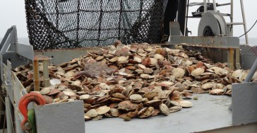
A tow of scallops

This morning (0600 hrs.) we mustered in the dry lab and began our assignments, ranging from swabbing the decks to vacuuming our state rooms. Tonight I will be in Boston and then on my way back to Minnesota. I am ready to go home, but I know I will think back fondly on a few things. The rocking of the boat when I’m going to sleep.  Meals prepared for me. The sound of waves and water. The hum of the engines. Seeing what comes up in the scallop dredge. Being on deck and on the bridge. A hap chance at seeing whales or dolphins. New friends and fun banter. Even though this journey began with an unpleasant introduction, it is ending with fond feelings.

Me and a barndoor skate!
Me and a barn door skate!

Being on this boat has been interesting for several reasons. I have learned new things about ocean life that I can take back to my classroom as well as a few souvenirs. I can honestly say I have never seen more scallops in my life, not to mention sand dollars and sea stars! I am looking forward to sharing this experience with my family, students, and friends. As I write this last blog, I am thinking of what a privilege it has been to be a member of this team of researchers. I am honored to learn from them. To my team: Jon, Nicole, Mike, Jess, Alexis, Ted, Nick (TG), and TR, thank you!! This experience would not have been the same without you! I will remember you fondly for many, many days to come.

Cheers!

L to R, TR, Ted, Mike, Jess, Jon, Nicole…my crew

Jessie Soder: Steamin’ and Swimmin’, August 10, 2011

NOAA Teacher at Sea
Jessie Soder
Aboard NOAA Ship Delaware II
August 8 – 19, 2011 

Mission: Atlantic Surfclam and Ocean Quahog Survey
Geographical Area of Cruise:  Northern Atlantic
Date: Wednesday, August 10, 2011 

Weather Data
Time:  16:00
Location:  40°41.716N, 67°36.233W
Air temp: 20.6° C (69° F)
Water temp: 17° C (63° F)
Wind direction: West
Wind speed: 11 knots
Sea wave height: 3 feet
Sea swell:  5-6 feet 

Science and Technology Log

View from the flying bridge departing Woods Hole

Our departure from Woods Hole has been delayed a number of times due to several factors.  We were scheduled to leave the dock on Monday at 2pm, but due to rough seas (8ft on Georges Bank—which was where we were planning to go first) and a crane that needed to be fixed our departure was rescheduled for Tuesday at 10am.  On Tuesday, the crane was fixed, but then it was discovered that the ship’s engineering alarm system was not working properly, so our departure was delayed again for a few hours.  The crew worked hard to get the ship off the dock and we departed at 1:15 on Tuesday.  Yay!  We were on our way to Georges Bank, which was about a 15 hour “steam,” or, trip.

The purpose of the NOAA Fisheries Atlantic surfclam and ocean quahog survey is to determine and keep track of the population of both species.  This particular survey is done every three years.  NOAA Fisheries surveys other species too, such as ground fish (cod, haddock, pollock, fluke), sea scallops, and northern shrimp.  These species are surveyed more often—usually a couple of times each year.  Atlantic surfclams and ocean quahogs are surveyed less often than other fished species because they do not grow as fast as other species.  In fact, the ocean quahog can live for more than 150 years, but it only reaches about 6  inches across!  In comparison, the sea scallop lives for only 10 to 15 years and reaches a size of 8 inches.

There are 27 people on board this cruise.  Each person is assigned a watch, or shift, so that there are people working 24 hours a day. The work never stops!  Seventeen people on board are members of the crew that are responsible for the operation and navigation of the ship, machinery operation and upkeep (crane, dredge, etc.), food preparation, general maintenance, and electronics operations and repair.  There are a lot of things that need to happen to make things on a research ship run smoothly in order for the scientific work to happen!

NOAA Ship Delaware II docked in Woods Hole

Twelve people on board are part of the science team, including me, who collect the samples and record the data.  We are split into two watches, the noon-midnight watch and the midnight-noon watch.  We sort through the material in the dredge for the clams and the quahogs.  We measure and weigh them as well as document the location where they are collected.  Several members of the science team are volunteers.

Personal Log

A swimming beach near Nobska Lighthouse

Our delayed departure has given me a lot of time to talk to crew and to explore Woods Hole—which I have really enjoyed.  I have learned a lot about the responsibilities of the different members of the crew and about the maritime industry, which is something that has always interested me.  I was also able to visit the Woods Hole aquarium (twice!) and attend a talk given by crew from the R/V Knorr. The Woods Hole Oceanographic Institute operates the R/V Knorr and it was on this ship that the location of the wreck of the Titanic was located for the first time in 1985.  Additionally,  in 1977 scientists aboard this ship discovered  hydrothermal vents  on the ocean floor.  And, lastly, I had time to go swimming in the Atlantic Ocean!  The water was a bit warmer off the coast of Massachusetts than it is off the coast of Alaska…

Questions to Ponder

What is the difference between an ocean quahog and an Atlantic surfclam?

Kathleen Brown: First Days at Sea, June 8-9, 2011

NOAA Teacher at Sea
Kathleen Brown
Aboard R/V Hugh R. Sharp
June 7 – 18, 2011

Mission: Sea Scallop Survey
Geographical area of cruise: North Atlantic
Dates: June 8-9, 2011

June 9, 2011

Weather Data from the Bridge
Time: 10:00 am
Winds 10 to 20 knots
Seas 3 to 4 feet 

Science and Technology Log

R/V Hugh R. Sharp
R/V Hugh R. Sharp

This morning is the first day that I have awoken on board the ship. It will be my first twelve-hour shift. The scientists work either from noon until midnight or from midnight to noon. Kevin, the chief scientist, has assigned me to the day shift. I am very happy about this! We suit up in our foul weather gear. Those who have done this before explain to me that it is easiest to slip on the black rubber boots and rain pants like a firefighter who just got a call might do. We eagerly wait for the winch to pull the catch out of the water. The net drops everything out on the table. When we receive word from the engineer that all is clear, I don a hardhat, and hop up on the table with a white board that lists the station, strata and tow. My shipmate, La Shaun, snaps a photo record of the catch. We stand around the table and begin the inventory. We are looking for sea scallops and any we find go into a big orange basket. Other species that we separate out include: red hake, monkfish, haddock, skate, and ocean pout. We measure the length of the fish that we have separated. I imagine how the data might be used by scientists back on land to indicate the health of that portion of the ocean. As soon as we finish the haul and clean up, it is time to do it all over again. Every third catch we count the number of starfish and cancer crabs. I am excited to hold sponges, sea urchins, and hermit crabs. I am surprised to learn that the sand dollars are red.

Scallops!
Scallops!

Once all the sea life on the table has been sorted, it is time to head to the wet lab. There, the buckets of animals are counted and measured. Two persons work at each table measuring the fish. The fish is laid flat against the scale and one scientist uses a magnetic tool to capture the length electronically. During one catch, Aaron and I measured the length of 37 skate. I am impressed by the knowledge of the scientists who can easily tell the difference between a winter skate and a little skate. I hope by the end of the trip, I will be able to do so as quickly as they can.

Personal Log

I hardly notice the rocking of the ship while we are working. I think I may be starting to get my sea legs. On this first day there is very little time in between stations, and there is no real down time. I have learned how to shuck a sea scallop and seen the anatomy of the animal for the first time. I had been promised that I would get to work hard out on the open ocean and I am not disappointed.

Question of the Day Do you know the shape of the sea scallop shell? If you open the shell of a sea scallop you can immediately tell if it is a male or a female. How?

June 8, 2011

Personal Log

I reported to the Woods Hole dock at 7:30 in the morning. The day was bright and sunny, with temperatures in the 70s. The sight of the ship docked next to the NOAA building was so exciting. I climbed on board and introduced myself to Captain Jimmy who showed me right to the galley and offered me a cup of coffee. He was so welcoming! The ship had arrived in port at about 5:00 am and the crew and scientists were working to get everything ready to go by noon. I was shown my room, which is meant for four persons and has two sets of bunk beds. The room is so much bigger than it appeared in the photographs I saw! I chose a lower bunk and stowed my duffel bag underneath the bed in a cubby that was designed just for that. As more of those traveling on the journey arrived, I was interested to find that five of us have ties to Maine. We gathered to hear a briefing on the research that we will be supporting while on board the ship. Did you know that the American Sea Scallop is the most valuable fishery in the United States? Then we went off to lunch in the galley. The cook, Paul, served us an amazing lentil soup and sandwiches. The galley is full of snacks, a fridge with ice cream, and milk juice, coffee and tea, all of which are available day and night. As we were eating, I felt the ship start to move. We were told our first station is about eight hours away. (A station is a place where we collect a sample of the sea life.) Away we go!

Question of the Day What is the reason that Woods Hole became the location on Cape Cod for ocean research?

Jill Carpenter, September 14, 2006

NOAA Teacher at Sea
Jill Carpenter
Onboard NOAA Ship Delaware II
September 5 – 15, 2006

Mission: Herring Hydroacoustic Survey
Geographical Area: North Atlantic
Date: September 14, 2006

Weather Data from Bridge 
Visibility: 10 nautical miles
Wind direction: 180
Wind speed: 14 kts
Sea wave height: 2ft.
Swell wave height: 7 ft./9 sec. from 90o
Seawater temperature: 16.8oC
Sea level pressure: 1018.7mb
Cloud cover: PC

Teacher at Sea Jill Carpenter on board the DELAWARE II.

Science and Technology Log 

The trip is winding down and we will be in port in a few hours. I am writing this final log in the early hours of the morning of my last night shift.  We will soon be approaching Cape Cod Canal, and our time of arrival into Woods Hole is scheduled for 9:30 this morning. On last night’s shift, we passed the time taking CTD measurements and logging the events. Unfortunately, no trawls were completed since we didn’t come upon a location with an abundance of fish. Tonight we began with a trawl. As with the last trawl, the majority of our catch was redfish.  We also caught Atlantic herring, northern shrimp, anchovies, pearlsides, silver hake and red hake, short fin squid, several dogfish and a goosefish. The catch from the trawl was sorted by species, just as before.  The individual species were weighed and measured.  Again, we took a subsample of redfish which means that we took a portion of the total catch and measured each individual length. Additional information was again gathered on the herring including sex, maturity stage, and stomach contents, and then a subsample was frozen for age analysis back at the lab.  The Fisheries Scientific Computer System (FSCS) system was used for entry of the biological data.

I was also able to interview a few more of the crewmembers on the ship. Commanding Officer Richard Wingrove (otherwise known as Captain) has worked his way up to his Commander position during his 17 years experience with NOAA.  Richard has a degree in Marine Biology and has loved the ocean from the time he was a child.  His extensive background experiences include being a satellite oceanographer for the NOAA Hurricane Center, working for the National Marine Sanctuary on oil spill cleanups, and serving the Peace Corps as a fisheries officer in Antigua.  As commanding officer of the NOAA ship DELAWARE II, his job involves overseeing the entire ship, supervising officers, and safely completing missions.  He claims the best part of his job is working with the crew, which he thinks of as his family at sea, although he admits it is still tough being away from his real family.  As one can imagine, the job of commanding officer comes with a great amount of responsibility.  Richard is in charge of a $12 1/2 million ship and a crew of 34 people.  Pretty intimidating!

Jill Carpenter in her survival suit

He has a great deal of fond memories and stories of rough seas, though he recalls one humorous incident in particular.  He was once on board a ship off the coast of Alaska when the seas were 25-30 ft. It was so rough that all the crew could do was ride out the seas; the cooks weren’t even able to make a meal!  On a dare from the other crew members, Richard tried jumping up to touch his back to the ceiling, but mistimed his jump and ended up being slammed to the floor when the ship descended quickly and the ceiling pushed him down.  He was stunned, but otherwise okay.  This legendary stunt is still spoken of amongst Richard’s seafaring friends.  Richard recommends taking many classes in science and math if one is interested in commanding a ship.

Lead fisherman Pete Langlois has experienced a lot of rough weather during his six years at sea aboard NOAA ships. He has many responsibilities aboard the DELAWARE II.  A lead fisherman splits a 24 hour shift with the boatswain, and their duties are to operate the machinery on deck, such as the nets, winches and crane.  Pete is responsible for the fishermen’s and scientists’ safety on deck while machinery is operating.  He also oversees the deployments and recoveries of scientific instruments such as the CTD sensor. Additional duties of a lead fisherman include general maintenance of the ship, such as loading and unloading stores and equipment.  Mr. Langlois also serves as third mate of the ship.  A third mate is in charge of the track lines of the ship and acts as a representative of the captain.

One of the first things that Pete recommends for future sailors is to try spending time aboard a ship to see if you like it.  It is also necessary to get your Able Seaman Certificate which is issued by the U.S Coast Guard. One path to pursuing your career is through a maritime academy, such as the Massachusetts Maritime Academy.  He claims there is a high demand for all positions aboard ships, and it is important to get experience at sea in order to get an Able Seamen or Captain’s license.

TAS Jill Carpenter in front of the NOAA ship DELAWARE II.
TAS Jill Carpenter in front of the NOAA ship DELAWARE II

Personal Log

Although I am sad for the trip to be over, I am looking forward to returning home to my family, friends, and classroom and sharing my experience with them.  This trip has been invaluable to me in so many ways.  I have met many amazing people, I have participated in recording ocean data, and I have seen how much thought, effort and talent goes into a fisheries research vessel.  I am fortunate to have completed 3 mid-water trawls while on board. Being able to see and touch the fish that we are studying was amazing.  I gained hands-on knowledge and experience, and I began to see the species not as slimy and gross fish, but as a necessary tool for progressing our understanding of ocean species.

The crew of the DELAWARE II has been nothing but welcoming and accommodating to me.  I appreciated all of their care, time and patience with me as I learned about life on board a scientific research ship. Their sincere good natures and the humorous spirits will always be remembered by me.  I can now better understand the wisdom shared by our Chief Scientist, Bill Michaels, about how people and teamwork are to be greatly appreciated. People are such a large part of what make a job enjoyable.  It is easy to see that the entire crew of the DELAWARE II enjoy their jobs and each other’s company. They make an unbelievably great team. Thanks to all of the crewmembers of the DELAWARE II. I will never forget you or my experiences on board.  My students will surely benefit from my gained knowledge for years to come.  Thanks again for sharing a slice of your lives with me.  I’ve been inspired by all of you.

Jill Carpenter, September 12, 2006

NOAA Teacher at Sea
Jill Carpenter
Onboard NOAA Ship Delaware II
September 5 – 15, 2006

Mission: Herring Hydroacoustic Survey
Geographical Area: North Atlantic
Date: September 12, 2006

Weather Data from Bridge 
Visibility: 10 nautical miles
Wind direction:  60 degrees
Wind speed: 17 knots
Sea wave height: 5 feet
Swell wave height: ~ 1f
Seawater temperature: 17.3oC
Sea level pressure: 1029.1 mb
Cloud cover: PC (partly cloudy)

TAS Jill Carpenter with a lumpfish caught with a mid-water trawl

Science and Technology Log

On Sunday, the DELAWARE II steamed out of the Great Harbor.  Our first stop was Cape Cod Bay, and then we continued to the Gulf on Maine. It’s great to be at sea! My first night on the night shift felt very productive to me.  I worked with fisheries biologists Dr. Jech and Karen to rig up the monofilament (fishing line) so we could attach the copper spheres beneath the hull in order to complete calibrations of the acoustic system.  As explained in an earlier log, calibrations are required for each survey to ensure data quality and to verify that the equipment is working properly. We were mostly successful, but a few events slowed our progress, such as having to reposition the ship because of fixed gear (lobster traps) in the water near us.  Once we located the copper spheres in each of the remote-controlled downriggers in order to move the copper sphere in all directions within the beam.  After we worked out all the bugs during the first calibration, the system worked smoothly for the two remaining frequency calibrations.  When we finished, we disassembled the downriggers and put away the gear.

We finished our first shift by deploying a Conductivity-Temperature-Depth (CTD) sensor and keeping track of it in the Event Log book and computer program.  A CTD is an instrument that is equipped with devices which measure the salinity and temperature of the water and the depth of the instrument.  Connected to a cable and winch system, it is lowered into the water within meters of the ocean floor, all the while taking measurements and sending data to computers on deck.  A profile of salinity and temperature is taken at the end of each transect, or path, that the ship makes and also before a trawl is completed.

TAS Jill Carpenter with two redfish caught with a mid-water trawl

Deploying a CTD is a joint effort on the part of the officers on the bridge, the fishermen and the scientists. Communication takes place via walkie-talkies to synchronize the deployment time.  While the officers on the bridge maintain the location of the ship and watch out for traffic, the fishermen are deploying the CTD instrument and the scientists are logging the event, recording information such as time of deployment and the latitude and longitude of the deployment. My second night on the night shift was also very eventful.  We had begun a series of transects, which basically means that the ship zigzags back and forth across the ocean in order to take CTD measurements and locate large schools of fish for the purpose of trawling, or catching fish for biological sampling. Twice during the night, in the middle of parallel transects, we completed trawls.  The High Speed Midwater Rope Trawl (HSMRT) is a funnel-shaped net attached to wires, also known as trawl warps, which are spooled onto winches located on the aft deck of the ship. The HSMRT is used to collect biological samples.  The decision on where to trawl rests with the scientists as they interpret acoustic data, so if the acoustic system shows that there is a large collection of objects (hopefully fish) below the surface, a trawl may be completed.  Trawling is also a group effort between the officers, the fishermen, and the scientists.  The net is set out and retrieved by the fishermen who control the depth of the net and monitor its performance.  The officers on the bridge work with the fishermen during the trawl to ensure its success.

The catch from the trawls is sorted by species. Then the individual species are weighed and measured.  The catch from our first trawl included redfish, Atlantic herring, lumpfish, and northern shrimp.  We then took a subsample of redfish which means that we took a portion of the total catch and measured each individual length.  Because herring is the primary focus of this survey, additional information was also gathered on this species including sex, maturity stage, and stomach contents, and then a subsample was frozen for age analysis back at the lab.  The Fisheries Scientific Computer System (FSCS) system was used for entry of the biological data. This is done by using a stylus to press the buttons on the computer screen to enter the catch information.  The scales used for weighing the fish and the measuring boards automatically send their information into the computer system.  The data is saved and later will be analyzed by the National Marine Fisheries Service.

TAS Jill Carpenter with a basket of redfish caught with a mid-water trawl for the Atlantic Herring Hydroacoustic Survey
TAS Jill Carpenter with a basket of redfish caught for the Herring Hydroacoustic Survey

Personal Log

I apologize for not writing in a few days. As I predicted, the shift work is taking a bit of a toll on me, and I haven’t been sleeping well during the day due to slight seasickness.  It is such a strange feeling to be lying in bed and rocking back and forth. Sometimes the boat pitched so much that my stomach got butterflies, just like when you ride a roller coaster and go down a steep hill. I had to keep getting up and sitting on one of the decks so I could see the horizon and get some fresh air.  Our stateroom has no windows, so there is no way of telling what the conditions are outside.  I had to laugh at myself when I went up to the bridge, expecting to see a ferocious storm and high sea swells, only to find blue skies and slightly choppy waters. A combination of Dramamine, ginger root tablets, and Saltine crackers also helped to calm my stomach.

This past night of sleeping (rather, day of sleeping) went much better.  I seemed to be used to the motion of the ship, and I fell asleep right away.  It helped to wedge myself in between the wall and my bag to keep from rocking back and forth so much.  I feel rested and much more confident to handle the seas.  It was forecasted that Hurricane Florence would make our ride a bit rough, though she is passing several hundred miles from our location and seas have been much calmer than expected, which is fine with me!  Even so, I can now see why we had to spend time tying down equipment so it wouldn’t slide or roll. When the ship was docked, it was hard to imagine it moving so much to necessitate securing items so well, but the need was evident to me after this shift.  Several times during the night, the ship rolled side to side so much that even heavy items fell over and off tables.  The chairs we were sitting in kept sliding back and forth, and we had to hang on to the tables to keep from moving around! It was wild. I loved it! I tried to get a picture, but I had to hang on instead!

Removing otoliths (ear bones) from a redfish. Otoliths are used by scientists to age a fish.

I was proud of myself when we completed our trawls and I had to handle the fish. It was rather disturbing to see the eyes and stomachs of the fish bulge out because of the change in pressure. We had to be careful when picking up the redfish because of the prickly spines sticking out of their fins. I was a little apprehensive to feel the fish through my gloves, and I was very grossed out at the thought of picking up a slimy, dead fish, but I tried to put that aside so that I could be of some help, at least.  The biologists I was working with jumped right in and weren’t squeamish at all.  After all, this is part of their job and the focus of their research. I tried to be brave and handle the fish confidently and without shrieking just as they did, but I still looked a bit wimpy.  The important thing, though, is that I tried something new and walked away with an invaluable learning experience. Cutting apart a herring to examine its insides was a little over my limit, but I tried it anyway and now I am glad that I did. I figured that it’s not every day that I have the chance to dissect a fish in the name of research.

I spoke with Mrs. Nelson the other day, and she said I have a bright group of fifth graders awaiting my return.  I can’t wait to show all of you my pictures and share this incredible learning experience with you.

Question of the Day

When weighing fish on board the ship, it is necessary to “tare” the scale.  This means that if a fish is being weighed in a bucket, we must first put the empty bucket on the scale, and then we need to reset the scale so it measures to zero kilograms.  After that, we place the fish in the bucket and put it back on the scale.

Why do you think it is important for scientists to tare a scale when weighing objects that are in containers?

Jill Carpenter, September 9, 2006

NOAA Teacher at Sea
Jill Carpenter
Onboard NOAA Ship Delaware II
September 5 – 15, 2006

Mission: Herring Hydroacoustic Survey
Geographical Area: North Atlantic
Date: September 9, 2006

Weather Data from Bridge 
Visibility: 3 nautical miles
Wind direction: 240 degrees
Wind speed: 15 knots
Sea wave height: 1-2 feet
Swell wave height: no swell
Seawater temperature: 19.4 degrees Celsius
Sea level pressure: 1016.2 millibars
Cloud cover: hazy skies 1/8

Chief Scientist Bill Michaels on the aft deck of the DELAWARE II.
Chief Scientist Bill Michaels on the aft deck

Science and Technology Log

Today, the DELAWARE II left the port and steamed out into the waters of Vineyard Sound for the day. It was exciting to finally get underway.  While out at sea, the AFTV underwent additional testing and troubleshooting. I was able to work the joystick which controls the video camera on the front of the AFTV and enter information into the Event Log program to document the beginning and end of the AFTV deployment.  We steamed back to Woods Hole for the evening, and our scheduled time of departure is tomorrow at noon. Once we leave tomorrow, we should be out to sea for the remainder of the cruise. Additionally, I was able to interview two other members of the crew. The Chief Scientist aboard this mission is Fisheries Research Biologist Bill Michaels.  He has worked for NOAA and been a chief scientist for 27 years. He started as a co-op student at the Northeast Fisheries Science Center.  Bill’s parents knew he would grow up to be a scientist when they saw him spending his time collecting feathers and examining flowers as a six-year old. He has extensive training in marine and fisheries biology and has been in charge of the National Marine Fisheries acoustic program working on advanced sampling techniques for almost 10 years.  Bill has logged over 2000 days at sea and has been a part of many different research boats in many different countries! Bill believes that by incorporating advanced technologies into cruise operations, we will be able to provide more accurate, cost-effective and timely scientific information in order to meet NOAA’s goals. 

Mr. Michaels says the best parts about his job are the diversity associated with the work and the teamwork involved.  Because of these, he has enjoyed every day of his career.  Although he loves working with new technologies such as his new Advanced Fisheries Towed Vehicle, he has come to enjoy working with people more and more, especially with scientists from other countries. Bill shared with me that he once went overboard during winter temperatures, though he wouldn’t say if it was by accident or on purpose!  Some of his more challenging voyage experiences include being out to sea with 25 ft waves, having to sleep in a fish bin, and being on a foreign boat that was infested with cockroaches.  Bill’s advice to someone who would like to become a scientist is to focus on all subjects, not just biology and math.  He says that you can’t be a good biologist by studying only biology.  He advises future biologists to understand people, value teamwork, appreciate different cultures, learn new technologies, and study from a variety of disciplines, ranging from geology to English and foreign languages.

TAS Jill Carpenter (far right) with NOAA Program and Management specialist Jeannine Cody, Chief Scientist Bill Michaels, and Fisheries Biologist Karen Bolles on board

I also spoke with my roommate and NOAA Program and Management Analyst, Jeannine Cody. She works in the National Marine Fisheries Service (NMFS) Office of Management and Budget in the Program Planning and Budget Formulation Division.  She serves a liaison to NMFS’ Office of Science and Technology, the Ecosystem Observations Program, and the Climate and Ecosystems Productivity Program.  She also tracks all of NMFS’ research and development activities at their six Science Centers. Each year, the President of the United States submits a budget request asking Congress for money to support NOAA activities. It’s kind of like asking for an allowance and then telling your parents the reason why you need the money.  In Jeannine’s line of work, telling the reasons why money is needed is called a budget justification. Each fiscal year (Oct 1 through Sept 30) she works on budget justifications for NOAA’s fisheries research programs.  This involves talking to a scientist to understand his/her plans for research in the upcoming year and writing a summary about the need for the activity, the cost of the activity, and the benefits to the country. She says that although her job description changes day to day, she spends much of her time responding to questions from the Department of Commerce, the Office of Management and Budget and from Congressional staff. 

I found it interesting that Jeannine first became interested in working in marine biology while watching Jacques Cousteau’s TV show as child.  Later, she volunteered to work with National Museum of Natural History curator Dr. Clyde Roper after watching a Discovery Channel program on giant squid.  She’s proud to say that one of her reference letters for graduate school had a giant squid at the top of the letterhead!  Ten years later, Jeannine’s back where she started as a research collaborator in the Museum’s Division of Fishes.

Sunset from Cape Cod Bay

She says the best part of her job is when her efforts are successful in getting funding for NMFS’ programs. “It’s nice to know that you’re a part of a larger effort to understand the oceans and marine life,” says Jeannine.  To prepare for a NMFS career in program planning and budget formulation, Jeannine recommends a biological degree, such as one in fisheries science, marine biology, environmental biology, or environmental policy.  You should be comfortable working with numbers and asking a lot of tough questions. Jeannine spends a lot of time writing, creating slideshow presentations, designing websites and talking to different groups, therefore good communication skills will help as well. Internships, fellowships and volunteering on NMFS cruises are also great ways to know how NMFS works.

Personal Log

What a beautiful day! It was a wonderful experience to be steaming on board the ship.  It was a warm, sunny day, although it was considerably cooler when we got away from land. Today was the first day that I was able to get weather and sea measurements from the bridge. I am hoping to become independent in reading the instruments that take these measurements by the time we return.

On the return trip, I was able to sit up on the flying deck (which is the top level deck) and watch as we pulled back in to the harbor at Woods Hole. The view was incredible and made me feel so far away from Virginia!  Don’t worry, I am still planning on returning to school on the 18th! I am sure once we begin with the more intense work load that comes with trawling and completing biological sampling, paired with the overnight (6 PM to 6 AM) watch that I have been assigned to, I will be looking forward to returning to my own bed soon enough!

Question of the Day

A seafaring riddle for you: What is alive without breath, As cold as death, Never thirsty, never drinking, All in mail but never clinking?