Kristin Joivell, June 30, 2009

NOAA Teacher at Sea
Kristin Joivell
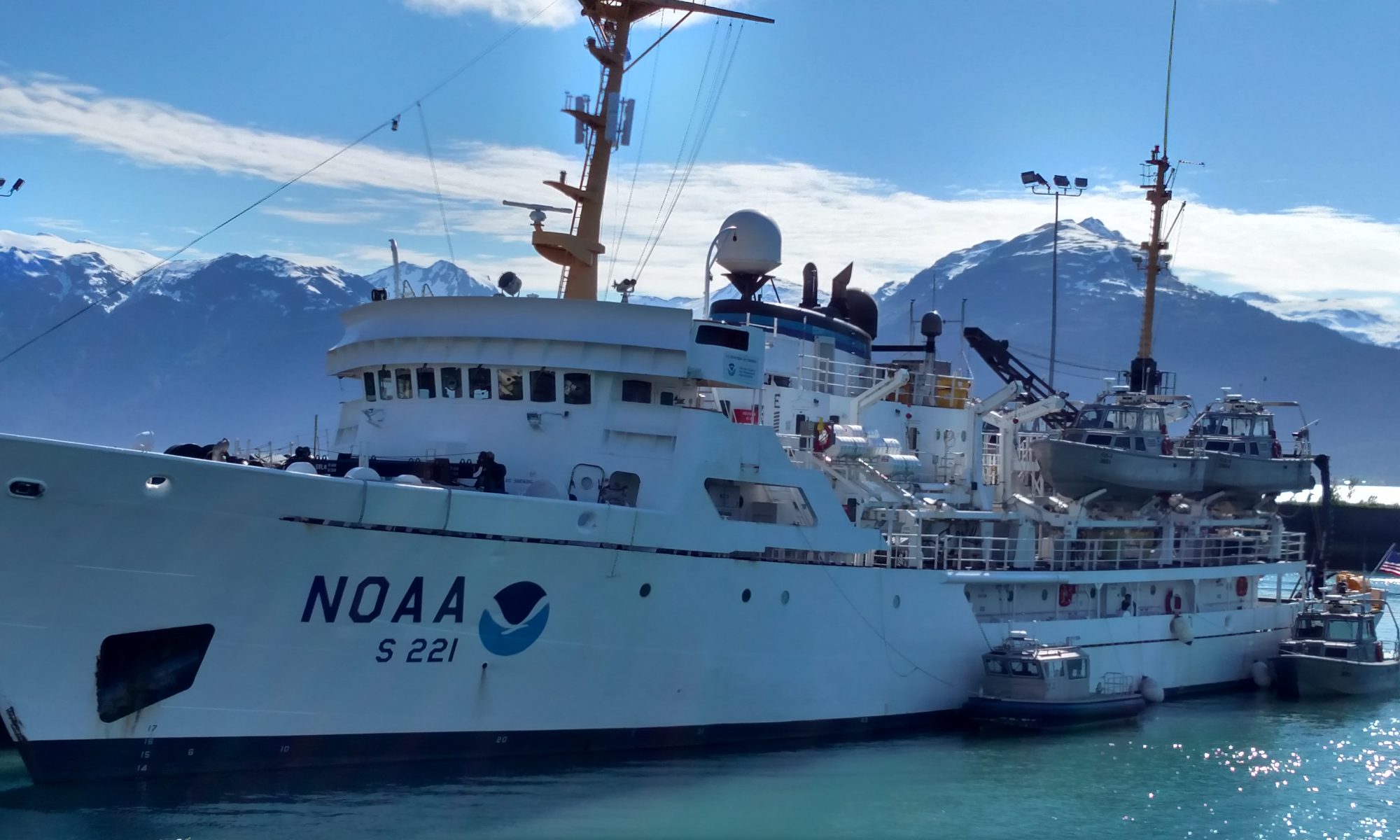
Onboard NOAA Ship Fairweather
June 15 – July 1, 2009 

Mission: Hydrographic Survey
Geographical area of cruise: Shumagin Islands, Alaska
Date: June 29-30, 2009

This sea star was brought to the surface in a bottom sample.

Weather Data From the Bridge:   
Position: North of Big Koniuji Island
Clouds: mostly clear
Visibility: 10+ miles
Wind: calm Waves: 0 feet
Temperature: 12.0 dry bulb
Temperature: 10.0 wet bulb
Barometer: 1023.2

Science and Technology Log 

Since the ship is operating in waters that there is not much information about, verifying current charted information is important.  Before launches are sent into a new area to collect data, shoreline verification is an operation that must be completed.  First, existing charts and new pictures of the coastline taken from a plane are used to determine a rough estimate of the shoreline.  Then, the shoreline verification team is sent into the area in a small boat.  The boat’s course is determined based on a buffer zone of the mean high water line on shore so that it can avoid any known, previously charted hazards. The boat travels a set path just outside of this buffer zone while logging information about bottom depths and looking for dangers to navigation.

Taking a compass bearing for a previously uncharted danger to navigation.  The rock found is only visible at low tide which makes it all the more hazardous.
Taking a compass bearing for a previously uncharted danger to navigation. The rock found is only visible at low tide which makes it all the more hazardous.

Sometimes hazards are found that are not charted on existing maps.  So, the team must identify these hazards and log their specific locations. An advanced GPS device is used along with a compass to determine the location of the hazard from the boat. The hazards are logged on a computer to record their positions.  Then, that information is used to both warn the other survey boats from the Fairweather working in the area, and to update new editions of the charts. Sometimes hazards that are currently charted are found in a different location. Once in a while, charted hazards are not even there at all!  All of this new information about hazards is also added to the new editions of charts. It’s somewhat terrifying to think that current charts sometimes have mistakes on them that could affect travelers so negatively. Checking what is on the bottom of the ocean is also important information.  To anchor a ship, some materials are more desirable than others. For example, hard rock is not as desirable as mud or sand because the anchor will just drag along hard rock and not catch as well. So, bottom sampling is another important operation that must be completed so that ships can anchor safely and properly.

Retrieving the bottom sampler.  It’s interesting to open it up and see what’s inside.  Depending on material found, ships can determine more desirable and less desirable anchoring locations.
Retrieving the bottom sampler. It’s interesting to open it up and see what’s inside. Depending on material found, ships can determine more desirable and less desirable anchoring locations.

To take a bottom sample, a scoop is deployed from a small boat or the ship.  The scoop has an automatic trigger that closes it when it hits the bottom of the ocean.  Then, you pull the bottom sampling device back up to the boat or ship and open the scoop. Observations about gathered materials are made on the computer.  There are all kinds of designations to specify the nature of the materials gathered.  Many of the samples we gathered were fine sand, but some included medium gravel, soft coral, and broken shells.  A few samples even included sea stars and a sponge!

The most difficult part about bottom sampling is that you have to pull the line up from the ocean floor with the bottom sampler attached.  The bottom sampler is a heavy, metal object so, pulling up all the line and the sampler from over 100 feet below gives you a workout.  Rotating positions on the boat helped especially since there were four of us on board.  That way, everyone’s arms had a chance to rest through three turns until it was your next turn to haul up the line and bottom sampler. I liked bottom sampling a lot because it was a surprise every time the sample was brought back up the boat. Also, it gave me a chance to look at some of the creatures that live in the ocean in Alaska. Seeing the sea stars and the sponge were the highlights of the day.

Personal Log 

This is a small halibut caught by one of the crew. It was quite small, but they can grow to be over 400 pounds.

Free time is a priceless commodity on the ship.  Everyone works to complete many tasks each day. Sometimes unexpected events occur that interfere with regular schedules. The Plan of the Day even has a disclaimer on it that states: “Tasks are subject to change at any time.  And they will.” So, when a person has free time and isn’t catching up on sleep, choosing an activity is difficult. Movies are shown each night and the computers are internet capable, but sometimes it’s good to get out on deck or off the ship instead of sitting in a room on board.

One of the things you can do on the ship in your free time is go fishing. You need an Alaska fishing license to do this, so I like to watch the licensed fishermen on board and examine their fish before they are released back into the ocean.  It’s interesting to see how many different kinds of fish are caught on the ship. In just the past few days, people have caught halibut, flounder, and cod.  Someone even recently caught a red octopus eating a baby crab!  Unfortunately, I missed that catch by about 10 minutes.  Comparing the freshwater fish that I know to these saltwater fish is a great free time activity.

Panning for gold on Herendeen Island.  The mica in the water is deceptively similar to gold flake.
Panning for gold on Herendeen Island. The mica in the water is deceptively similar to gold flake.

Another free time activity that is popular is going ashore to hike and explore. We sometimes even have the opportunity to build a fire on the shoreline. There is a lot of driftwood available, but the lack of garbage on the beaches never stops surprising me.  There are none of the common waste materials that you find commonly on the beaches in the Northeastern United States. However, there are some plastic materials like bottles and bags.  One plastic bottle found even had Korean fishermen use plastic fishing floats, but the glass ones are much older and looked for to use for decorations. The crew suggested that I look for them, but I didn’t find any at all.

Panning for gold is also something that can be done while ashore.  I assisted a fellow crew member on the quest for gold, but we were unsuccessful.  The rocks in the area have mica in them, so the streams are full of glittery chips.  These looked to me like gold, and I thought we had struck it rich, but I was wrong.  Standing in the cold stream and searching for gold nuggets is something that I will definitely remember for a long time.

Create Your Own NOAA Experiment at Home 

You can explore the types of water organisms in your area like a NOAA crew member.  If you are planning on fishing, make sure you have the correct fishing license for your area.  Rivers are great places to start because you don’t need a boat to fish on them; you can just fish from the riverbank. Also, if you don’t want to fish, you can examine the macroinvertebrates that live under rocks. In the rivers and streams in Central Pennsylvania where I’m from, you can find mayfly and stonefly nymphs, caddisfly larvae, and water pennies in abundance.  The Pennsylvania Fish Commission has lots of great materials available to help with identification of organisms.  Looking at water from lakes, rivers, streams, and ponds under a microscope is also an interesting experience. You can learn a lot about the health of your area’s watershed by examining the organisms in the water.

Kristin Joivell, June 27, 2009

NOAA Teacher at Sea
Kristin Joivell
Onboard NOAA Ship Fairweather
June 15 – July 1, 2009 

Mission: Hydrographic Survey
Geographical area of cruise: Shumagin Islands, Alaska
Date: June 27-28, 2009

The engine room is a busy, confusing, and crowded place, but the engineers know how to maintain every one of the machines.

Weather Data from the Bridge  
Position: East of Big Koniuji Island
Clouds: clear
Visibility: 10+ miles
Wind: variable and light
Waves: less than 1 foot
Temperature: 11.2 dry bulb
Temperature: 9.0 wet bulb
Barometer: 1019.2

Science and Technology Log 

The engine room of the ship is a very important place.  If the machines located there aren’t working, the ship isn’t going to be going very far. I took a tour of engineering and explored the area with one of the engineers. The first impression that I got about the engine room is that you really need to be good with your hands and mechanically minded to work in this area. There are so many different machines that must be maintained, repaired, and monitored that it seems pretty overwhelming when you first walk in.  Even though much information about the machines is displayed on a master control board overlooking the engine room, it’s difficult to figure out where each of the machines is located. It’s almost like a whole other world under the floor where the majority of the crew works and lives.

Here I am climbing out of the engineering department using an escape trunk.  This pathway is centrally located for easy escapes.
Here I am climbing out of the engineering department using an escape trunk. This pathway is centrally located for easy escapes.

If there is a problem in engineering like a fire or water leak, there are self sealing doors to isolate and contain the problem.  The situation is contained to the lower levels of the ship and spread is limited and slow. The engineers can escape from the area using hatches. Crew members are very careful not to place anything on the escape hatches just in case an accident occurs.  Safety plays a big part in the engineering department and in the entire ship.  It is very important to follow certain procedures for everyone’s safety. The ship has two engines and two generators. Each of these pieces of machinery is large and extensive.  Much of the control panel is dedicated to information about their state. Interestingly enough, the two engines are actually train engines and the generators are from General Motors.  Both of these, especially the generators, seem to be larger versions of the same land based machines.  The engines have seven oil filters apiece. These, naturally, must be changed similar to your personal vehicle. Each of the oil filters is almost two feet long!  Many are kept in supply for maintenance purposes.

This is one of the unused oil filters for the main engines of the ship.  You can see other filters in the storage room as well.
This is one of the unused oil filters for the main engines of the ship. You can see other filters in the storage room as well.

But, the engineers are not just in charge of the engines, generators, and the other machines that make the ship move through the water.  They also must maintain, repair, and monitor the refrigeration, air conditioning, heating, electricity, and plumbing on the ship.  Additionally, they are in charge of keeping the five small boats on the ship operating correctly. The ship has two launches, two smaller boats, and one skiff. Each of these presents its own specific problems to maintain.  Each of the boats has an engine system that must be maintained.  They must be fueled and checked after each day’s work. Anything that breaks must be repaired immediately so that the work on the ship can continue on schedule.

I helped repair one of the smaller boats that was not starting correctly.  First, the problem must be diagnosed.  So, we used a multimeter to get readings from electrical connections.  Salt water corrodes wires quickly. Even though engineer decided to try to clean the components with a wire brush and a knife to create better connections. We cleaned the existing corrosion, but the boat still did not start properly.  Next, the engineer predicted that the starter could be the problem since much of the connections to it were very rusty and dirty. We took out the starter and replaced it with a new one; the boat started!  It was a relief to be able to use the boat the next day.  Without the work of the engineers, the ship would have been short one boat for a period of time.  This would prevent work from being completed and put the ship behind schedule; a lot of money would be wasted on operations being incomplete.

I’m lending a hand to repair a boat engine.  The batteriesmust be disconnected for safety when working with the starter and other electrical equipment.
I’m lending a hand to repair a boat engine. The batteriesmust be disconnected for safety when working with the starter and other electrical equipment.

Personal Log 

Safety on the ship is something that is not taken lightly in engineering or anywhere else.  Drills are conducted periodically to ensure that crew members know what to do when an emergency occurs.  There are drills for fire, man overboard, and abandon ship.  For each drill, each person on board is assigned a meeting spot, called a muster, and function.  There are also alternate musters for each emergency in case the first muster is compromised in some way.

Fire drills are important to practice.  It’s interesting to note that even though the ship is surrounded by water, fire is one of the most difficult problems to deal with onboard.  The ship basically has mini fire stations set up throughout the ship to deal with the emergency.  Standard firefighting gear is located at these stations. Certain crew members are assigned to wear the turnout gear and operate the hoses or extinguishers during the drills.  Recently, a burned bag of microwave popcorn set off the fire alarm, so these alarms are sensitive!

Practicing the proper technique with a fire hose.  These hose stations are located in a variety of spaces all around the ship.
Practicing the proper technique with a fire hose. These hose stations are located in a variety of spaces all around the ship.

Another situation that can occur is when someone falls overboard.  Quick retrieval is very important especially here in Alaska due to the cold temperatures.  Different crew members are assigned to be lookouts during a man overboard drill to help with the location of the man overboard.  If you see someone when you are a lookout, you must point and alert the bridge to the person’s location to ensure a speedy retrieval. Life preservers are on hand at a variety of locations to throw to the person in the water. The ship also has a line launching device that you can use to shoot a line a lot further than humanly possible.  This device is powered by compressed air and shoots the line quite far from the ship.

The last resort in an emergency is to abandon the ship. Since the waters here are so cold, we must be ready to don our emergency suits.  I had the chance to practice putting on my suit during a drill.  The suit is made of special material that can protect you even in the coldest water.  Some of the material seemed similar to a thick wetsuit.  You must be able to don the suit quickly and efficiently. The feet are part of the suit, but the arms have tight seals and then you put on mittens separately.  There is even a cover for your face that only lets your eyes peek out. As I practiced putting mine on, I got very sweaty, so it seemed to be doing its job already.

Practicing using the line launching device.  This tool is helpful in getting help to a man overboard quickly and efficiently.
Practicing using the line launching device. This tool is helpful in getting help to a man overboard quickly and efficiently.

Create Your Own NOAA Experiment at Home 
The crew of a NOAA ship practices emergency drills and you can do these at home, too.  In the unlikely event of an emergency, your family can be well prepared and organized. It is always good to be prepared for an emergency; you think more clearly when well prepared.

Did you ever stop and wonder what you should do if your house is on fire?  How will you get out of the house?  You should have more than one way to get out just in case the first path is compromised.  Do you have a meeting place, or muster, for your family?  Where is it?  Who will bring the pets outside with the family?  Where will you call 911 from?  Remember, you shouldn’t call from your house if it is on fire; call from a neighbor’s house or cell phone outside your house. You can create an emergency plan for your family and have fire drills periodically.

What about if there is a homeland security emergency?  Who is going to pick you up from school?  Where will you go to wait for the emergency to be over? Do you have supplies like food and water ready?  Who will get the pets and bring them with you?  You can create a plan and have drills for this type of emergency as well.  That way, if something happens, nobody gets left behind and your family will be comfortable and secure.

Here I am in my emergency suit.  This suit can protect you even in the coldest waters.  Along with life preservers, hats, and coats, suits must be brought to life raft musters during abandon ship drills.
Here I am in my emergency suit. This suit can protect you even in the coldest waters. Along with life preservers, hats, and coats, suits must be brought to life raft musters during abandon ship drills.


Kristin Joivell, June 26, 2009

NOAA Teacher at Sea
Kristin Joivell
Onboard NOAA Ship Fairweather
June 15 – July 1, 2009 

Mission: Hydrographic Survey
Geographical area of cruise: Shumagin Islands, Alaska
Date: June 24-26, 2009

I found lots of seagull nests on Herendeen Island.  Every nest that I saw contained three eggs.
I found lots of seagull nests on Herendeen Island. Every nest that I saw contained three eggs.

Weather Data from the Bridge   
Position: Northwest Harbor
Clouds: Mostly Clear
Visibility: 10+ miles
Wind: variable and light
Waves: less than 1 foot
Temperature: 11.5 dry bulb
Temperature: 10.0 wet bulb
Barometer: 1011.5

Science and Technology Log 

Keeping time on the ship isn’t the same as keeping time at home.  First of all, all of the day to day operations on the ship take place based on the 24 hour time system.  The day is divided into 24 hours, numbered from 0 for 12:00am to 23 for 11:00pm.  The diagram below helps to visualize the 24 hour clock; it can be found on this website.  This website also has some really great conversion charts and problems to solve using the 24 hour clock.

Fairweather ship operations are based on the 24 hour clock.  Diagram courtesy of the Math Is Fun website.
Fairweather ship operations are based on the 24 hour clock. Diagram courtesy of the Math Is Fun website.

The change from am and pm to the 24 hour clock seems difficult enough, but there is another type of time you need to know when traveling on the Fairweather. Data collection takes place using UTC, or Coordinated Universal Time.  This is also a 24 hour clock, but the problems encountered with traveling through different time zones are cancelled out by using UTC.  If you want to figure out what your UTC is at the current moment, you either add or subtract a certain amount of hours from your time based on your location.  So, since I live in Pennsylvania, our local time zone is Eastern Standard Time (EST).  To get the UTC for my time zone, I just need to add five hours to my local time.  All of the data collection done on the ship takes place in UTC. That way, there is no problem knowing what time the data was taken, especially since the ship travels through different time zones sometimes while in the process of acquiring data.

TAS Joivell relaxes on Little Koniuji Island at about 11:00pm.  As you can see, it is still daylight out.  I called this area “Dinosaur Egg Beach” because of the shapes, textures, and colors of the rocks.
TAS Joivell relaxes on Little Koniuji Island at about 11:00pm. As you can see, it is still daylight out. I called this area “Dinosaur Egg Beach” because of the shapes, textures, and colors of the rocks.

Of course, all of this time conversion is even crazier at our location in the Shumagain Islands because sunrise is at about 6:00am and sunset is at about 11:30pm.  This makes going to sleep at a reasonable time confusing because your body wants to stay awake since it’s daylight. If that’s not confusing enough, another type of time that is used on the Fairweather is the Julian Calendar. In this calendar, each day of the year is assigned a number; months are not used at all.  So, since today is June 25, 2009 that converts to day number 176 on the calendar used for Julian time.  This is important again for data acquisition because it prevents misunderstandings based on time zones and is easier to save and input data using three numbers instead of a month, day, and year. With all the data processing taking place on board, anything that can help with the organization of the system is welcome. All of this time takes some getting used to, but by now I am already thinking in the 24 hour clock. When I got up today, I didn’t know what day of the month it was, but I knew that all the data acquisition would be labeled with the number 176.  I guess I’m beginning to think like a scientist!

Personal Log 

TAS Joivell takes a break at the summit of Herendeen Island. Note the matted vegetation on the ground. It looks flat, but it is not so easy to hike through.

Time to go for a hike is always welcome on the ship.  Sometimes the monotony of rocking from side to side gets tiring and it’s nice to put your feet on solid ground.  Even after a day of hard work, you somehow always still have energy left for a trip ashore. A group of us hiked to the summit of Herendeen Island.  As the island got closer and closer, I could see that it wasn’t going to be easy.  At first, the terrain looked smooth, but when I began to travel up the slope, it was pretty rough going. First of all, the ground is covered with long grasses and tangled brush. All of this vegetation weaves together to make a mat on the ground.  However, there are little holes under the grassy mat that you sink into as you go.  It’s kind of like walking through deep snowdrifts.

Herendeen Island is approximately 750 feet tall, but it seems much taller.  The views from the top really show how alone we are out here. No ships are in the water as far as I could see except the Fairweather. You can’t see any houses, power lines, roads, billboards, or any other signs of human life either.  I thought that Kodiak was remote, but the Shumagins are even more isolated. 

Create Your Own NOAA Experiment at Home 

You can tell time like the scientists on the NOAA ship.  Find some clock and date conversion websites. Can you determine what time it is on the 24 hour clock?  How about the UTC for your location?  What Julian Day is it?  Try to figure out times for your school schedule based on the 24 hour clock. You can even convert your birthday into a Julian Date.  Mine is day number 350!  

Kristin Joivell, June 23, 2009

NOAA Teacher at Sea
Kristin Joivell
Onboard NOAA Ship Fairweather
June 15 – July 1, 2009 

Mission: Hydrographic Survey
Geographical area of cruise: Shumagin Islands, Alaska
Date: June 23, 2009

The mess hall is a place where people tend to gather.

Weather Data from the Bridge  
Position: Northwest Harbor
Clouds: overcast
Visibility: 10 miles
Wind: 10 knots
Waves: less than 1 foot
Temperature: 8.5 dry bulb
Temperature: 7.2 wet bulb
Barometer: 1008.0

Science and Technology Log 

Disposing of all the trash made by people from eating, working, and other day to day tasks was something I was wondering about.  So, I asked crew members on the deck department how all this waste was disposed of. They showed me the incinerator.  The incinerator is the main device for dealing with waste management at sea, but if the amount of trash builds up too much, it is dealt with when the ship arrives back in port.

Here, I’m readying cardboard to be placed in the ship’s incinerator.  As you can see in the bottom right corner, trash tends to build up rather quickly. This picture was taken in the morning and the line up of trash to be incinerated was already building.
Here, I’m readying cardboard to be placed in the ship’s incinerator. As you can see in the bottom right corner, trash tends to build up rather quickly. This picture was taken in the morning and the line up of trash to be incinerated was already building.

The incinerator burns waste at very high temperatures of 850 degrees Celsius to 1150 degrees Celsius. If you’re not familiar with the Celsius scale (like me), you won’t realize that that equals 1562 degrees Fahrenheit to 2102 degrees Fahrenheit! The high temperatures are created using diesel as fuel with air vents helping to ventilate the fire as it burns.  The ash that is left when the waste is done burning takes up much less volume than the waste did and it is disposed of when the ship arrives back in port. There is a central location on deck near the incinerator for trash collection. Personal trash from state rooms can be placed there in bags for disposal.  The trash from the kitchen, deck, bridge, and survey departments are also place there. Workers from the deck department burn the trash in the incinerator periodically throughout the day. If the ship didn’t have an incinerator, the trash on board would build up very high and very quickly!  Each day since I came on board, there is a pile of waste to be incinerated. From cardboard boxes, to printer paper and food waste, to used rags from cleaning, most materials are disposed of in the incinerator.

The ship also has a collection area for recycling. There are collection bins for glass, metal, aerosol cans, and batteries in a central location near the mess hall. However, plastics are incinerated.  The temperatures in the incinerator are so high it seems that the plastic is basically vaporized. Naturally, there is also a filter on the exhaust pipe of the incinerator so that toxins do not enter the atmosphere. Additionally, the ship is going to begin recycling plastics in the near future.

Here I am examining the ship’s food stores.  This is the fresh fruit and vegetable section of the cooler, but there are many other sections as well.
Here I am examining the ship’s food stores. This is the fresh fruit and vegetable section of the cooler, but there are many other sections as well.

Personal Log 

People may be wondering how it is possible to feed almost 50 people everyday without stopping at the grocery store. I found that the Fairweather is well equipped to deal with everyone’s food needs and more!  I took a tour of the storage facilities and found them equivalent to a small grocery store.  There are stockpiles of dairy, meats, fresh fruit and vegetables, breads, freezer storage, and dry storage. According to the Chief Cook, the ship could theoretically sail for up to 60 days without going to a port if necessary.

Every day, there are three main meals and two between meal snack times offered. Fresh fruits and vegetables are in large supply; most foods are not prepackaged, but are created on the ship.  Vegetarian choices are available at every meal.  Coffee, tea, milk, water, and a variety of fruit drinks are always available any time of day or night.  Condiments in abundance are located on every table, too, and not just ketchup and mustard.  Different kinds of salad dressing are also available in the mess refrigerator at every meal.

The first meal of the day is breakfast.  Breakfast is served from 7 to 8 in the morning.  Each day at breakfast, there are a large variety of foods offered.  Today’s breakfast choices were as follows: fresh fruit, grits, bacon and ham, vegetarian sausage, French toast, hash browns, made to order eggs, breakfast sandwiches, and omelets, and hot and cold cereal.  I always get the fresh fruit because I love the blueberries and pineapple! Then, there is a midmorning snack offered sometime between breakfast and lunch.  These snacks are usually coffee cakes or breads. Today’s snack was apple bread with nuts.  It was made from scratch with fresh ingredients!

I chose a lemon blueberry jelly roll for dessert!  Yum!
I chose a lemon blueberry jelly roll for dessert! Yum!

Next, lunch occurs from 12 to 12:30pm.  Each day at lunch, there are usually salads, soup, a choice of two main courses with a vegetarian alternative, side dishes of pastas, potatoes, or rice, and a side dish of vegetables. Today’s lunch menu included the following:  kielbasa and kale soup, grilled reuben, grilled pastrami and Swiss sandwich, grilled cheese, and tater tots.  I love it that there is a vegetarian choice; even though I am not a vegetarian, I try to limit my meat intake. After that, an afternoon snack is offered sometime between lunch and dinner.  These snacks are usually cookies. Today’s snack was chocolate chip and peanut butter cookies. They were still warm when they were offered.

Finally, dinner is from 5 to 5:30.  Dinner choices include a main dish and a vegetarian alternative, a variety of side dishes, and a dessert prepared on the ship. As with all of the other meals and snacks, there is a focus on freshly prepared food instead of prepackaged items.  Today’s dinner menu included the following: mustard crusted rack of lamb, paella de marisco, herb cheese stuffed eggplant, creamy orzotto, sautéed bok choy, and lemon blueberry jelly roll for dessert. It’s hard to resist dessert because it’s so freshly made and delicious, so I usually have dessert at dinner, but avoid the two snack times during the day.

Additionally, the mess hall has facilities that are available for snacking at any time of the day or night. Salad ingredients, ice cream, frozen burritos and hot pockets, cold cereals, and fresh fruit are always ready to be eaten. If you’re not careful, you can be overwhelmed with all of the food choices on board and gain a lot of weight while at sea! Speaking to the crew about food is interesting.  Many of the crew has not so fond memories about “other” ocean ships that they have been on that did not offer such wonderful food choices.  Some crew members expressed the feelings that the morale of the crew basically depends on the food. I can see how a long trip at sea can be made more comfortable with the knowledge that the food will be great!

Create Your Own NOAA Experiment at Home 

NOAA ships use the Celsius scale to measure temperatures, but many people in the United States use the Fahrenheit scale.  You probably think of a day that is 100 degrees Fahrenheit outside as a hot, summer day, but did you know that this equals 37.8 degrees Celsius?  A cold, winter day is usually about 35 degrees Fahrenheit, but that is equal to 1.8 degrees Celsius. You can use a website from NOAA to easily convert Fahrenheit to Celsius and vice versa.  Just go to http://www.wbuf.noaa.gov/tempfc.htm and type a number into either the Fahrenheit or Celsius box. Then, click off the box and the temperature is automatically converted for you.  Try typing in temperature that you are familiar with like your body temperature (about 99 degrees Fahrenheit), the temperature that water freezes (32 degrees Fahrenheit), and the temperature that water boils (100 degrees Celsius).

You can also use a formula to convert temperatures.  This is helpful if you don’t have the internet.

For Fahrenheit to Celsius, use this formula
For Celsius to Fahrenheit, use this formula

Many thermometers also are scaled for both Fahrenheit and Celsius, so that you can read both temperatures on the thermometer itself.

Kristin Joivell, June 22, 2009

NOAA Teacher at Sea
Kristin Joivell
Onboard NOAA Ship Fairweather
June 15 – July 1, 2009 

Mission: Hydrographic Survey
Geographical area of cruise: Shumagin Islands, Alaska
Date: June 21-22, 2009

The Fairweatherrests at anchor in Northwest Harbor.

Weather Data from the Bridge   
Position: Northwest Harbor
Clouds: Mostly Clear
Visibility: 10+ miles
Wind: 13 knots
Waves: less than 1 foot
Temperature: 8.2 dry bulb
Temperature: 7.2 wet bulb
Barometer: 1007.0

Science and Technology Log 

Launches are excellent for collecting data near the shoreline, but the Fairweather is better at open water data collection. The polygons are larger, but the ship must still be traveling at approximately 6 knots for optimum results.  The ship also uses the multibeam to sweep the ocean floor, just like the launches.  Of course, multiple computer screens are again necessary to monitor data collection on the ship. Also similar to the launches and their CTD’s, the ship uses a device called a Moving Vessel Profile (MVP) that collects information about sound velocity as it is dropped through the water. It is commonly called the “fish” since it is dropped into the water and manipulated to “swim” at different depths for data collection.

Here I am dislplaying the MVP or “fish” that will be deployed periodically throughout data collection to measure sound velocity, temperature, and pressure of the water.

A definite advantage of the MVP is that the fish can be deployed while the ship is moving; however, the launch must be stopped to use the CTD.  Additionally, the MVP measures sound velocity directly where as the CTD collects data that must be plugged into a formula to calculate the measurement for sound velocity. Data collected from both the launches and the ship must be processed and converted.  Much of the data processing involves moving data uploaded from launches into networked folders.  At times while I watched data processing, there were too many folders open on multiple computer screens for me to personally keep track of.  Also, I noticed certain data sets being converted from one form to another.  Sometimes, the data conversion takes a long time so computers must be marked so nobody interrupts the conversion process.  Patience, computer literacy, and organization skills are a must for working on data processing!

In this picture I’m attempting to clean “dirty” data.  The screen on the left shows a 3D image of the ocean floor.  The screen on the right shows a 2D image of the ocean floor that is color coded based on depth. As you can see, dirty dishes also tend to collect when cleaning dirty data!
In this picture I’m attempting to clean “dirty” data. The screen on the left shows a 3D image of the ocean floor. The screen on the right shows a 2D image of the ocean floor that is color coded based on depth. As you can see, dirty dishes also tend to collect when cleaning dirty data!

Another part of working with data collected from the launches and the ship involves cleaning “dirty” data.  Even through the best efforts to collect data, pings are sometimes lost or interference occurs. Perhaps the speed of the vessel exceeded 6 knots or maybe there was a section of the water with an unusual density. So, a software program called Caris is used to work with the data on a dual screen computer. The ocean floor that is color coded by depth can be viewed on one screen. Then, the person working with the data selects small segments of the ocean floor to view on the other screen.  The plane of the ocean floor and all of the pings are shown in a variety of color scales. Data that is very accurate at a high confidence level can be shown in violet, but the lower the confidence level gets, the further up the spectrum the colors are shown.  Many people choose to show different lines of pings in different colors to make it easier to see how many times the same section of the ocean floor was swept.

The person working on the computer can choose to delete certain pings, especially if they were located at the far end of the multibeam.  These pings are more likely to be lost or misrepresent the depth. Additionally, a measurement can be taken on the screen with a ruler tool to determine if a group of pings are within specification limits.  If they are not, a segment of data can be designated for further investigation.  The person working on this must make many decisions, so it is important to be able to infer information from data as you work.

Personal Log 

Paddling my kayak in the ocean through Northwest Harbor in the Shumagin Islands

I went sea kayaking a few years ago in Mexico, but sea kayaking in Alaska is by far more dangerous. Even though the kayaks are paddled the same way and I could keep the boat balanced relatively easily, the danger of flipping over and freezing to death in the sea water is a constant thought. The beauty of the islands as I paddled near them was mesmerizing.  The Shumagin Islands look like something out of a prehistoric world.  I keep expecting to see a dinosaur walking up one of the rocky hillsides. I didn’t see any prehistoric creatures on the kayak, but I did see some puffins, a seal, and a wide variety of other seabirds too far away for identification.  Kelp was also floating around in abundance. I should mention that I was sea kayaking from about 8:30 to 11:00pm, but it was still daylight the whole time.  It is near the summer solstice, so daylight lasts for about 18 hours or so each day. Right now, the sun is rising at about 6:00am each morning and setting at about 11:30 each night. It is really unusual to be out on a sea kayak in bright daylight in the middle of the night!

Create Your Own NOAA Experiment at Home 
You can use simple items from your kitchen to see how cold the water in Alaska feels. You will need some ice water, a thermometer, and a bowl. First, put the ice in the bowl and pour the water over it. Next, place the thermometer in the bowl with the ice water.  Wait until the temperature goes down to about 45 degrees Fahrenheit.  Now, place your bare hand in the ice water. How does it feel? Try it with a glove on.  Do you feel a difference?  Remember, your body temperature is about 98 degrees Fahrenheit, so you are putting your hand into water that is about half your body temperature. Can you imagine how it would feel to fall into this water?