John Schneider, July 9, 2009

NOAA Teacher at Sea
John Schneider
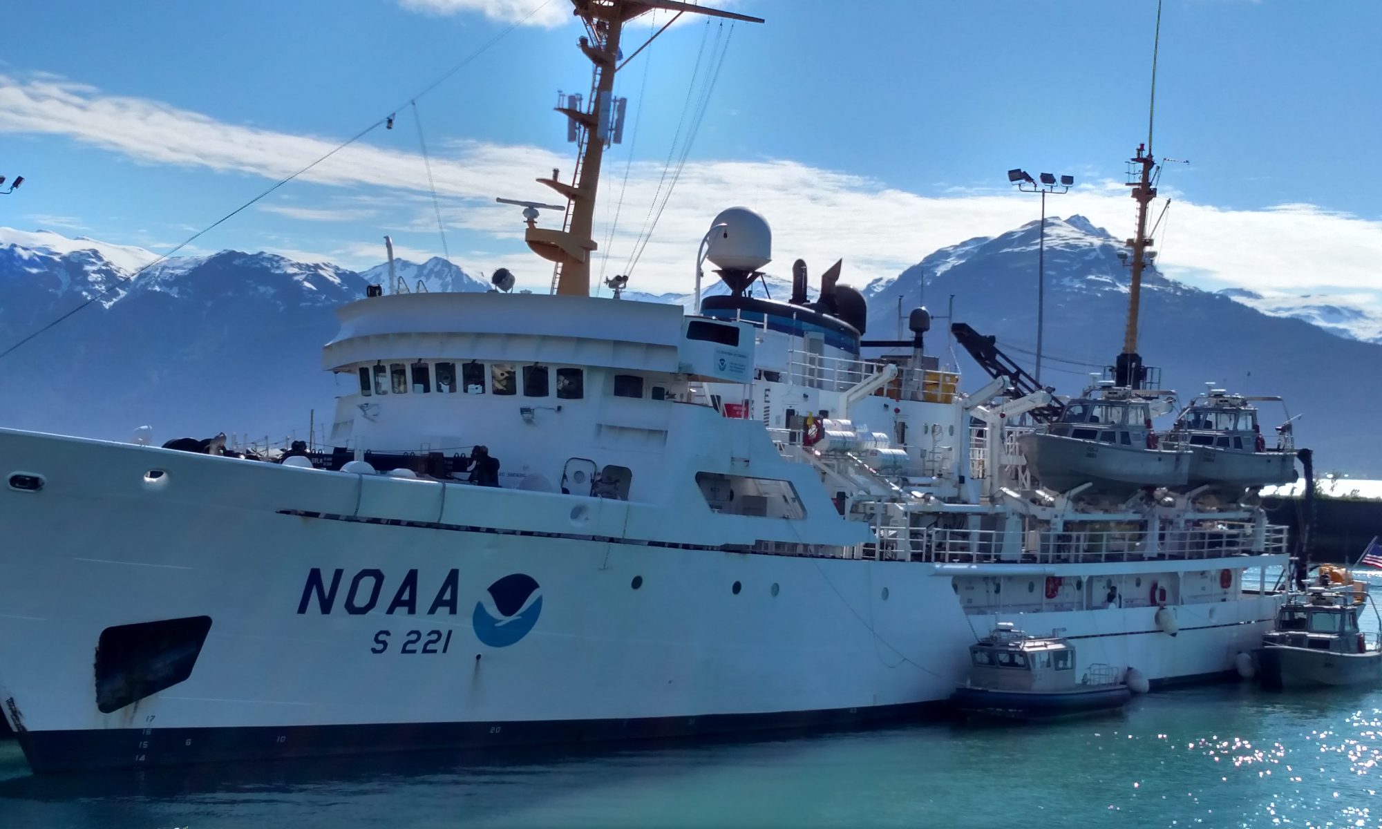
Onboard NOAA Ship Fairweather 
July 7 – August 8, 2009 

Mission: Hydrographic Survey
Geographical Area: Kodiak, AK to Dutch Harbor, AK
Date: July 9, 2009

Position 
Shumagin Islands

Weather Data from the Bridge 
Barometer: 1022.3
Wind: light & variable
Temperature: 12.1ºC
Sea State: <1 foot

This top of this picture shows the area that has been surveyed, and the bottom half has not been surveyed yet.

Science and Technology Log 

While part of the survey crew was doing more bottom sampling, launches 1010 and 1018 were deployed to acquire other data from areas ranging between 5 and 15 miles away.  The launch deployments today were for 8 hours and the chefs prepare to-go lunches for the crews. The Fairweather is well-suited to its task here in the Shumagins.  The crew is experienced at this and it shows. While the launches are away gathering data close to shorelines, the ship sails backand-forth across wide swaths of open ocean using the multi-beam sonar to document depth.  Some members of the crew call this “mowing the lawn” which is a perfect analogy (I like to think of it more like a Zamboni cutting the ice in a hockey rink!)

The swath covered by the multi-beam sonar can extend to 75º up from vertical on each side of the ship. As you can see in the picture, the top half of the screen is green. This is an area that has been surveyed with Multi-Beam Echo Sounders (MBES).  The white at the bottom is bottom that has not been surveyed. Fairweather is sailing a course from East to West on the screen and the MBES is sweeping a path indicated on the screen in orange. The colors are significant – they represent different depths. (If you look closely you can see a color bar on the left of the screen. Red=shallow, blue=deep.) the number on the right is the depth in meters.  Fairweather does all its bathymetry (<Greek bottom/depth + measure) in meters as they are the units of scientific analysis. Hopefully in the next few days I’ll get to have a better understanding.  Right now it kind of glazes over  . . . too much input! 

Deck Maintenance

Look Carefully - Blue writing!
Look Carefully – Blue writing!

A ship the size of the Fairweather (230 feet, 7 decks) has an enormous amount of maintenance required just to keep it ship-shape. The permanent crew of AB’s (Able Bodied Seaman,) engineers, stewards and officers keep the Fairweather spotless and running flawlessly. This morning there was need for a modification to a pulley used to deploy the bottom sampler.  It was constructed in a short amount of time. The marine environment is merciless on steel and the ship is constantly being stripped of old paint, primed and repainted.  Doing this requires that the old finish be removed with a “needle gun” which is a compressed air powered tool consisting of a 1.5cm diameter head of about 25 “needles.” The “needles” are more like 1 mm flathead finishing nails that bounce on the surface like mini-jackhammers.

By impacting the surface thousands of times a minute, old paint is loosened from the underlying steel and chips off. The really cool aspect of this is that the underlying steel isn’t even dented!  When I started on this piece of steel it was painted with one layer of primer and two layers of white paint.  Now it’s down to bare metal and the markings from the original construction of the davit are clearly legible! After being stripped, a coat of anti-oxidation paint is applied, then primer, then one or more coats of paint. The crew never stops and the condition of the Fairweather is a testament to their diligence.

Personal Log 

The weather is absolutely perfect. It is sunny, warm, calm seas.  I’m sure it can be (and probably will be) worse at some time during the trip, but for now everyone is soaking it all in!  The Fairweather has a ship’s store with some snacks, necessities, T-shirts and other items.  It’s open periodically (announced on the PA) and I’ll be sure to hit it up before leaving Dutch Harbor (but I’ve got to get to an ATM – they don’t take American Express.)  😉

Animals (or other cool stuff!) Observed Today 

Whales about a mile off the bow – not close enough to see well – brittle stars, tube worms, more coral(!) and the daily dose of sea birds. This morning there was a bit of time when some fog was rolling over a mountain island about 10 miles away and it looked like the fog was just cascading over the top from the other side.  Gorgeous!

John Schneider, July 8, 2009

NOAA Teacher at Sea
John Schneider
Onboard NOAA Ship Fairweather 
July 7 – August 8, 2009 

Mission: Hydrographic Survey
Geographical Area: Kodiak, AK to Dutch Harbor, AK
Date: July 8, 2009

Position 
Small boat/launch operations vicinity; Herendeen Island (Shumagin Islands Group)

Weather Data from the Bridge 
Wind: light & variable
Temperature: 12.7ºC
Sea State: 1 foot

National Ocean Service Benchmark

Science and Technology Log 

Today I’ll be heading out on the Ambar (an aluminum hulled inflatable) to check on a tide gauge off Herendeen Island.  It might get chilly being off the Fairweather, but the weather has been fantastic since we left. Waves <1 foot, winds below 5 or 6 knots.  Weather actually got better as we went to the tide station.  (I’ll try to get a good shot of each of the launches.) The tide station is a remarkably simple in concept, yet a terribly complex operation to execute. A month ago, Fairweather personnel installed a tide station on Herendeen Island. This involved sending a launch to the island where personnel did the following setup work:

The tide gauge interface being downloaded to a weather/shockproof laptop computer
  1.  Drill a 1/2 inch hole 3” deep into a solid piece of granite and set a bronze bench mark into it.
  2. Drill 3 more holes into a huge granite boulder at the water’s edge. Construct, on that boulder, a vertical tide gauge with markings every centimeter, ensuring that the bottom of the gauge is both lower and higher than the tide should go.
  3. Precisely and accurately determine the height of the benchmark in relationship to the heights on the tide gauge.
  4. Send a diver down below the lowest tide levels and install a nitrogen-fed orifice connected to a hose and secure it to the sea floor.
  5. Connect the hose to a pressurized tank of nitrogen on shore.
  6. Install a solar power panel near the station with a southern exposure.
  7. Install the data acquisition interface. This piece of equipment forces a single nitrogen bubble out of the orifice every six minutes (one-tenth of an hour) and measures the pressure it takes to release the bubble which is then used to calculate the depth of the water (as a function of pressure.)

Collected data are automatically sent by satellite to NOAA. A month later, the survey team re-visits the site and performs a series of 10 visual observations coordinated with the automated sequences of the nitrogen bubble data recorder.  These visual observations are then compared to the automated data acquired.  If their statistical differences are within accepted parameters, the data are considered valid and will be used further.  If not, the data are discarded and collection is re-started. 

It's a little weird to see the Ambar leave after dropping us off on an island that has seen very few footprints!
It’s a little weird to see the Ambar leave after dropping us off on an island that has seen very few footprints!

Not only is the process painstaking, but the technology and Research & Development needed to design the equipment must have been extremely difficult. However, given the amount of our nation’s dependence on marine commerce and movement of goods, it is time and effort more than well spent. Once we returned to the ship, I was able to lend a hand on the fantail (that’s the aft area of the deck where a LOT of work gets done) where the survey team was collecting samples of the ocean bottom.  Bottom sapling is done at specific locations proscribed by NOAA guidelines for coastal waters.  It is important for mariners to know the type of bottom in an area in case they need to anchor or engage in commercial fishing. 

Bottom samples are collected using a Shipek Grab.  This 130-pound tool captures a 3-liter sample of the bottom. The scoop is spring loaded on the surface and when it strikes the bottom a very heavy weight triggers the scoop to close, picking up about 1/25 of a square meter of bottom. Bottom characteristics are then recorded with the position and will eventually be placed on nautical charts.  Sometimes even small animals get caught in the grab. Today we saw brittle stars, tube worms and a couple of little crabs.  However, the biggest surprise to me was finding numerous small pieces of CORAL in the samples!  I certainly did not expect to see coral in ALASKAN waters!

Personal Log 

A piece of coral on a pebble.  (It's on a 3x5 file card for scale.)
A piece of coral on a pebble. (It’s on a 3×5 file card for scale.)

Lest you think that it’s all work and no play, we anchored tonight after a 12 hour+ work day.  With sunset at around 2330 hrs (11:30) there was still time for some fishing (nothing was kept but we caught a couple small halibut) and movies in the conference room.  There are movies aboard almost every night as well as closed circuit images from 4 areas of the ship.  I’ve also started taking pictures of the menu board every night but won’t post all of them because of space limits on my file size – besides, you all simply wouldn’t believe how well we are fed on the Fairweather. Just as an example: how does blackened salmon wraps sound for lunch??? Oh yeah!!! (You have permission to be jealous!)

Coming back, the Fairweather, after being out of sight from the Ambar, is a welcome sight!

Animals (or other cool stuff!) Observed Today 

Saw a whale in the distance, quite far off, just before lunch. Two seals a couple hundred meters aft of the port quarter. While at the tide station we saw two whales’ spouts near the shoreline, one seal poked his big ol’ head up from the kelp bed and checked us out a couple of times, saw a bunch of loons, cormorants and puffins, and while at the tide station, Dave Francksen (a very helpful member of the survey team) caught sight of an octopus. 

This octopus was about 2 feet across from tentacle-tip to tentacle-tip and changed color when it got over the spotted light-colored rocks.

Questions for Your Investigation 

What phylum and class are octopi?  Are Brittle Stars?

What “day shape” does the Fairweather display when anchored?  When conducting survey operations?

What do you call the kitchen on board a vessel?

John Schneider, July 7, 2009

NOAA Teacher at Sea
John Schneider
Onboard NOAA Ship Fairweather 
July 7 – August 8, 2009 

Mission: Hydrographic Survey
Geographical Area: Kodiak, AK to Dutch Harbor, AK
Date: July 7, 2009

Position 
58º01.18’ N, 153° 29.56’ W  (en route to the Shumagin Islands)

Weather Data from the Bridge 
Weather System: Fog
Barometer: 1019.5
Temperature: 11.8º C
Sea State: 1-2 feet but to increase through the night

Ships in the distance as seen from the Fairweather

Personal Log 

It’s 0610 and at almost exactly 0600 the generator started. The generators (there are 2) on board the Fairweather each put out about 300 kilowatts of electrical power. It’s the electrical power plant that will provide us with electricity for the next 2••• weeks. We’re going to sea in just 4 or 5 hours! I was fortunate to have breakfast with Captain Baird. Focused, professional, likeable, gregarious. He demonstrates characteristics of a fine leader.

Forty-five minutes prior to sailing, the ship’s alarm, fire alarm, watertight doors and PA were all tested. The professionalism of the crew is repeatedly demonstrated and I am in excellent hands. Every crew member has specific duty stations for specific duties.  For docking and undocking the ship, my station is forward on the bow for assisting with line handling.  The dock lines are really big and they are so long that they require several people to manage.  Once again, teamwork, clear communication and coordination were displayed.

You can see how big the lines are when compared to my hand.

Well, my hands are still trembling from the exertion; in the comfort of my cabin I tried on my cold water immersion abandon ship suit (“Gumby suit”.) I wanted to see what was involved before we have an abandon ship drill later on. I sure hope we never need it.  Being somewhat claustrophobic, the notion of being fully enveloped in a neoprene rubber suit with only half of my face showing is not exciting. To make it worse, I had a heck of a time escaping from the suit.  It literally took about 7 or 8 minutes without assistance.  I’ve got to ask if that’s normal or if there are any bigger suits!

Well, it’s 4 hours later and I just finished my safety briefing with Mr. Rice.  Putting the suit on and taking it off are MUCH MUCH easier with assistance and instructions!  I’m now comfortable and capable of donning it easily – but in no means don’t I want to need to! We’ve been under way for about 5 hours now and just completed a fire drill simulating smoke in a cabin aft on C-deck. Once again, well done. Shortly later, that was followed by the Abandon Ship drill. The entire crew had to don their Gumby suits and I was as ready as anyone. The two previous donnings saved me from looking foolish!

Here I am in my immersion suit, also called a “Gumby” suit.

Almost 1800 hours.  Dinner was: fried chicken, barbequed pork chops with chipotle/sundried tomato glaze, fresh snow peas, cheesy potatoes, salad, and rice pudding with fresh whipped cream and raspberries!!! OMG I don’t want to go home!  The BBQ is on the port side and the smell of dinner cooking just permeated the air.  What a joy!

Animals (or other cool stuff!) Observed Today 

While I was in the safety briefing the bridge spotted a couple whales /   but there will be others! And as I get ready to turn in for the day, brilliant sunlight at 2200 hours!

Questions for You to Investigate 

Without the immersion suit, in 45ºF water, how long would a normal person survive before hypothermia set in?

The mooring lines are a synthetic material less dense than water.  Why is that an advantage?

What do “RADAR,” “SONAR” and “GPS” stand for?

Which animals are whales more closely related to, people or tuna?

Lots of fog on the sea…

John Schneider, July 6, 2009

NOAA Teacher at Sea
John Schneider
Onboard NOAA Ship Fairweather 
July 7 – August 8, 2009 

Mission: Hydrographic Survey
Geographical Area: Kodiak, AK to Dutch Harbor, AK
Date: July 6, 2009

Position 
57° 43.766’ N, 152° 30.946’ W (Pier at USCG base – Kodiak)

Weather Data from the Bridge 
Barometer: 1022mB (30.15”) This is a nominally high pressure air mass characterized by cool temperatures and clear skies.
Wind: 4-6 kts (gusts to 12) 30º off the port bow (ship is facing ~60º at the pier)
Temperature: low 60’s Sea state: calm

The FAIRWEATHER alongside the USCG Pier, Kodiak

Science and Technology Log 

Our mission on this cruise is to conduct small-boat hydrographic research and documentation of the sea floor in the Shumagin Islands region.  This is an area about 250 miles Southwest of Kodiak. It’ll take about a full day of steaming just to get there.  I took a rough estimate of an area of approximately 900 square miles in the Shumagins and found a total of about 100 depths recorded! I realize that the numbers may be hard to read, but the picture to the left is just South of Nagai Island in the Shumagins and includes about 900 square miles.  As you can see, there are very few markings in the area.  Compare this with the picture to the right of an area of the same size more thoroughly surveyed.

A nautical chart of the area the Fairweather will be surveying, called the Shumagin Islands.

The 1953 Coast Pilot says of the Shumagins “…comprising 15 sizable islands and many islets and rocks, extend for a distance of 60 miles from the coast of the Alaska Peninsula from which the group is separated by Unga Strait.”  The newest edition (2008) is worded identically!  It’s obvious that there is a need for research in the area and newer charts available to mariners will benefit from the data we collect in the next leg of the Fairweather’s tasking. Regarding data collection and storage, yesterday I was shown the compartment (room) where the on board computer servers are kept.  It is one of the significant responsibilities of the duty officers to regularly check the temperature of that compartment as the entirety of the data collected is stored on those servers.  If the entire mission runs flawlessly and the data are allowed to be compromised, the mission is ultimately a failure.

Barnacles
Barnacles

Historically, soundings were taken by lowering a weighted line—called a “lead line” because the weight was often made of lead—to the bottom and seeing how deep the water is at that location.  Positions were estimated by manually triangulating “fixes” using visual bearings to known landmarks.  Later (from the 1950’s through the 1970’s) positions were established using LORAN (Long Range Radio Navigation) and Radar and depths were determined using depth sounders which bounce an electronic “ping” off the bottom. All of these earlier methods were very prone to human error and imprecision.

Bald eagle
Bald eagle

Current technologies integrate multi-beam sonar interfaced with computers and satellites to determine position (within just a couple of feet) and not only the depth of the water straight down, but off to the sides. When the data are uploaded to the Fairweather, the computers on board coordinate the exact time, GPS position, tide level, temperature, salinity and clarity of the water at the position of the data acquisition allowing the computers to correct for the different rates of transmission of the sonar signal through differing densities of water to determine the most accurate sea floor information ever possible. So now, as a navigation term, “by the Mark, Twain” (meaning 2 fathoms of depth) is obsolete…but the literary contributions of Samuel Langhorne Clemens remain a tribute to America’s heritage!

Personal Log 

All the dark spots are Bison!

Today at the 1400 pre-cruise briefing I was fortunate to be present when two of the officers on the Fairweather were acknowledged as having been promoted.  The response of the crew demonstrated the respect these officers had earned. If lunch today was any indication of how the meals will be on board, I can’t wait for dinner and don’t want to go home!  Fajitas with about 15 different toppings available, corn on the cob, salad and soup!

Animals (or other cool stuff!) Observed Today 

Fox along the road!
Fox along the road!

While gazing down into the water alongside the ship, I noticed what appear to be 2 different species of jellies – one looking similar to the East Coast’s Aurelia aurelia about 10” in diameter and the other being unknown to me.  The unknown was radially symmetrical (as are all jellies) but all of them had 8 distinct lobes on the bell and measured about half the size of the other species.

I also noticed barnacles, mussels and sea anemones living on the pilings that hold up the pier.  The anemones at left must have been three inches in diameter at the body tube and the tentacles extended in a halo about 10-12 inches in diameter. On a 2.5 hour drive this afternoon I also saw 2 bald eagles, a herd of bison, a red fox and a kingfisher. (The fox picture is a bit blurred, it was a bit skittish and I took it through the windshield.) 

Questions for You to Investigate 

What animal did Benjamin Franklin want to use as a National Symbol? When were the Shumagin Islands named?  For whom are they named? What is scurvy and how is it prevented?

Bison?  Is this Wyoming?!
Bison? Is this Wyoming?!

Kristin Joivell, July 1, 2009

NOAA Teacher at Sea
Kristin Joivell
Onboard NOAA Ship Fairweather
June 15 – July 1, 2009 

Mission: Hydrographic Survey
Geographical area of cruise: Shumagin Islands, Alaska
Date: July 1, 2009

To me, the beach on Big Koniuji Island looks very similar to the beaches at the Outer Banks, North Carolina.

Weather Data from the Bridge  
Position: In transit to Kodiak, Alaska
Clouds: mostly cloudy
Visibility: 10+ miles
Wind: 7 knots
Waves: less than 1 foot
Temperature: 10.5 dry bulb
Temperature: 8.7 wet bulb
Barometer: 1026.5

Science and Technology Log 

The NOAA training materials define hydrography as “the science of measuring and describing the physical features of the navigable portion of the Earth’s surface adjoining coastal areas, with special reference to their uses for the purpose of navigation.” The definition describes the project that I’ve been helping with on the Fairweather, but it doesn’t mention everything that is involved in the journey or all the components that must come together to have a successful project.

TAS Joivell displays some of the kelp found on the beach at Big Koniuji Island.  The tube like part is full of air and the leaves feel like plastic.
TAS Joivell displays some of the kelp found on the beach at Big Koniuji Island. The tube like part is full of air and the leaves feel like plastic.

Different departments on the ship all contribute to the project.  Though each department has its own focus, they are all essential to the ship’s well being. The officers all work together to navigate the ship and decide how to gather the data without putting anyone at risk.  The survey team gathers, processes, and analyzes data. The deck department contributes to the upkeep of the ship.  Engineers make sure the ship’s engines keep it moving through the water.  The electronics technician makes sure that the many computer systems are working correctly.  The stewards make sure that everyone’s food needs are met.  It’s up to everyone on board to contribute in their own way to make the journey significant and meaningful.

A great movie from NOAA that describes the history of surveying in the United States is called “The Surveyors:  Charting America’s Course” and can be watched online here. The first scene shows the ocean waves and a quote from John F. Kennedy that states, “Knowledge of the ocean is more than a matter of curiosity.  Our very survival may hinge upon it.”  I was encouraged to watch this movie on one of my first days onboard and it really set the stage for the work I was to help with.  The work that I assisted with on the Fairweather is going to be used to help ships travel safely through previously uncharted or incompletely charted waters.  I gained a respect for the crew’s mission from the first day on and am proud that I play my small part in it.

You can see the lake on Big Koniuji Island on the right.  I am calling it “Muck Lake” because of the large amounts of sediment on the bottom.  You can see a small part of the sandy beach off to the left.
You can see the lake on Big Koniuji Island on the right. I am calling it “Muck Lake” because of the large amounts of sediment on the bottom. You can see a small part of the sandy beach off to the left.

Personal Log: 

One of the best things about being on this ship is the opportunity to explore new places. But, I wasn’t expecting to be able to see a beach and swim in a lake in Alaska!  Before leaving the Shumagin Islands for Kodiak, we had the opportunity to visit Big Koniuji Island one final time. To me, the beach at Big Koniuji Island looks similar to the beaches at the Outer Banks, North Carolina because it has white sand, dunes, and driftwood. I went beach combing and found sand dollars and kelp all over the beach. I collected some sand to add to my collection at home.  Some brave crew members even went swimming in the ocean near the island!

One of the crew knew about a lake on the island and organized a hiking trip to visit it. We hiked over a ridge through some thick brush and weeds to get to the lake, but it was worth it.  The lake water was so clear you could see the bottom from almost everywhere.  The water was also much warmer than the ocean which encouraged more people to swim in it.  I tried out the swimming conditions and soon found that the entire bottom of the lake was covered with at least 2 feet of muck.  Every time you tried to move your arms through the shallow waters of the lake, you hit a pile of cold, gooey muck.  Even though it was kind of disgusting, the swim was still worth it.  I most likely will never be back to the Shumagin Islands to try it again, so this was my one chance to swim in a lake on an island in Alaska. This lake is unnamed, so I am naming it Muck Lake in honor of the piles of muck at the bottom.

Create Your Own NOAA Experiment at Home 
NOAA ships travel to many different places in their journeys.  There are countless opportunities listed on the internet where you can apply to travel to different countries for volunteer work.  One organization that I have noticed is the World Society for the Protection of Animals.  Their website has a section about volunteering abroad where you can do work with animals in many different countries.  The Peace Corps is another organization where there are opportunities to do worldwide work, but you need to be able to dedicate at least 27 months to the experience.  Working with AmeriCorps is similar to the Peace Corps, but the work is conducted in the United States for variable amounts of time.  Habitat for Humanity has sites both in the United States and internationally. Earthwatch Worldwide works with scientists to solve international problems.  Some of these programs cost money and some are free, but all do important work around the world. If you have the time to dedicate to any of these opportunities, you should investigate further.