Evening of August 17 – North East of Point Barrow, Alaska
Air temp 27F, sea depth 60m , surface sea water temp 30.6F
Viewing Sea Ice on an Icebreaker
USCGC Healy breaking through sea ice
The USCGS Healy was designed to break through ice and it has had that opportunity to do so on this trip. Breaking into the ice is a first time experience for myself and for many of the science crew and USCG crew who are pictured above. It’s an amazing experience.
We are now entering the edge of the polar ice cap in the Beaufort Sea. The polar ice cap is an area of the world around the North Pole where the sea surface stays mostly frozen year round. The sun angle here is low in the summer with endless nights in the winter. This spring and summer, the ice off the shore of Barrow, Alaska was thicker than normal. Thicker ice is multi-year ice where the freezing has exceeded the melting over successive years causing the ice to progressively thicken. This thicker ice was not formed here; it drifted from farther north where it broke off the pack ice and traveled south to where we are now.
Drift Ice
Pack ice is primarily a continuous piece of ice with little open water. Pictured here and above with the Healy is drift ice. The drift ice is broken up into large pieces due to warming seasonal temperatures and rough seas. The drift ice in the second image has reconnected with a thin clear layer of ice made possible by the calm seas and cold temperatures that we experienced on August 17th.
Ridge Ice
The ice is not normally flat. Wind and internal forces cause the ice to collide and create ridges both above and below the water line. In the winter, the snow that falls can also drift into piles. The image below shows where two pieces of ice once collided on a small scale. When pack ice builds over time these processes create a variable landscape with protruding ice ridges. When ice breaks off from the pack ice the thickest ice will take the longest to melt and will eventually float alone. These pieces of ice are called “growlers”.
These have been amazing to observe popping up along the seascape. The first one I saw had birds flying overhead in the distance. The birds were using the using the growler as a place to land. To me it looked like a big white whale. Another piece looked like a sea dragon. See these growlers in the images below.
This growler looks like a whale…
…and this growler looks like a dragon!
Today’s Wildlife Sightings
Bearded Seal
Above is an image of a bearded seal seen on the morning of August 17. The water was very calm and the seal popped up right in the front of the bow of the ship. Later in the evening I saw one sitting on a piece of drift ice. Bearded seals like to eat clams and fish and are a favorite prey of the polar bear. Polar bears also live in the area we are sailing through now. Both walrus and seals use ice for resting places. In the spring, the bearded seal will use drift ice as a place to give birth to their young (called pups). Polar bears will then hunt on the ice for its prey.
Now and Looking forward
As Healy sails in this area with a daily satellite image showing ice coverage, it’s easy to forget what a dangerous place the Arctic can be for ships. When ice first appeared during this trip, we were north of Wainwright, Alaska–a location not far from a historic whaling disaster in 1871. During August of 1871, the wind changed direction and blew pack ice towards the shore trapping 33 whaling ships. All of the ships had to be abandoned and most were eventually crushed by the ice. On the morning of August 17, 2018, we were also sailing between ice and land. There was an eerie calm sea with both fog and some larger pieces of ice. At times the sun, ice, and fog created an illusion that appeared as if we could sail off the end of the world. Below are some pictures that I thought captured the eerie calm Arctic of August 17th.
Picture below: Clouds on a calm sea off Healy‘s bow as we travel north. I call this picture “going off the edge of the world”.
“Going off the Edge of the World”
Picture below: Glaucous gull on the edge of a fog bow. A rainbow formed from a thin fog layer of suspended water droplets at the surface. The calm Arctic Ocean feels like a mystical place.
I woke up about 6:40 am and heard a thump on my wall. My room is on the lowest level of the ship. I worked on the computer for a while then headed upstairs for what I thought would be our first station around 8. There was nothing but white ice all around us.
More Ice
I was so excited you would have thought it was Christmas morning. I spent the next two hours on the bridge watching as we slowly made a pass through the ice to get to our next destination-St. Paul Island. Most of the ice is broken up into large pieces, so when the waves move through you can see them rolling. Staring at ice chunks is like looking up at the clouds. You start seeing all kinds of shapes: swans, hippos, Lockness monster. It’s amazing how calm the waters get when there is ice to slow the wind. We finally made it to our first station around 5:30pm. During the Bongo tow it pulled up a piece of ice from the surface. It was small, but I got to hold sea ice!
NOAA Teacher at Sea
Christine Hedge
Onboard USCGC Healy
August 7 – September 16, 2009
Mission: U.S.-Canada 2009 Arctic Seafloor Continental Shelf Survey Location: Chukchi Sea, north of the arctic circle Date: September 13, 2009
Weather Data from the Bridge
Latitude: 720 44’N
Longitude: 1560 59’W
Temperature: 350F
A Seasonal Ice buoy with a thermistor chain is deployed from the Healy. This buoy starts in open water and later may freeze into the ice. This instrument collects ocean and air temperature data, barometric pressure data, and location data.
Science and Technology Log
Buoys and Moorings And Gliders, Oh My!!!
Exploring the oceans has a lot in common with exploring space. NASA can send manned or unmanned missions into space. Sending manned vehicles into space is more complicated than launching a probe or a telescope. The same is true for exploring the Arctic Ocean. We can collect data on an icebreaker, manned with Coast Guard and science personnel or use instruments that can send back data remotely. On this mission, many instruments have been deployed to send back data about the conditions in the Arctic. These instruments continue to do their work after the crew and scientists from the Healy have moved on. Ice buoys, which float or freeze into ice floes, are one example. The HARP instruments (High-frequency Acoustic Recording Package), which sit on the sea floor, are another.
A United States Navy team, under the supervision of Navy Commander William Sommer, has launched a very interesting instrument from the Healy called the Seaglider. We have been tracking its movements since it was launched on August 8th. The Seaglider collects information about the salinity, temperature, and optical clarity of the ocean. The Navy is interested in how sound travels through the oceans and this glider is an important tool for doing just that.
CDR Bill Sommer, AG1 Richard Lehmkuhl, and MST3 Marshal Chaidez deploy a Seaglider from the Healy in the Chukchi Sea. Data from the Seaglider will improve the performance, and aid in the evaluation, of the effectiveness of the ocean models in the Arctic. Photo courtesy of PA3 Patrick Kelley, USCG.
What makes the Seaglider unique is that instead of just drifting, it can be driven. In fact, this instrument is directed via satellite from a computer lab in Mississippi! The glider moves up and down in the water column and like an air glider it uses this up and down motion to move forward. It has a GPS and a radio so that it can communicate its location. The Seaglider deployed from the Healy in August was picked up today.
Final check of the Seaglider before it was launched.The green dots indicate the path of the Navy Seaglider as it collected data in the Chukchi Sea.Coast Guard and Navy personnel work together to retrieve the Seaglider on September 13.
NOAA Teacher at Sea
Christine Hedge
Onboard USCGC Healy
August 7 – September 16, 2009
Mission: U.S.-Canada 2009 Arctic Seafloor Continental Shelf Survey Location: Chukchi Sea, north of the arctic circle Date: September 9-11, 2009
Positions
From Latitude: 790 6’N/ Longitude: 1550 47’W
To Latitude: 780 3’N/ Longitude: 1590 41’W
Alex Andronikov labels and bags rock samples for further study.
Science and Technology Log
Exploring the Unknown
Geologically speaking, parts of the Arctic Ocean are some of the least explored areas on earth because they are often covered with thick ice. Geologists know there is an ultra-slow spreading center (where seafloor pulls apart) called the Gakkel Ridge. They know where major features such as abyssal plains, plateaus, and ridges are, but the story of how this area formed is still the subject of much discussion. Where exactly are the plate boundaries in the Arctic? Which direction are they moving? Which forces formed the Arctic Basin? These are great questions that geologists continue to investigate. In 7th grade we study plate tectonics. Our textbooks contain maps showing where the plates are pulling apart (divergent boundaries), pushing together (convergent boundaries), and sliding past one another (transform boundaries). I had never noticed before this trip that clear plate boundaries are not shown under the Arctic Ocean.
FOR MY STUDENTS: There are some great animations showing plate movements at this site.
Looking Back in Time with Rock Samples
Kelley Brumley and Alex Andronikov are geologists on board the Healy. They have been analyzing the data collected by the echosounding instruments to better understand the forces at work here. But what they have really been looking forward to is seeing what type of rock the seamounts, ridges, and plateaus below the Arctic Ocean are made of, and how these features were created.
Our first 2 dredge sites brought up muddy sediment and lots of:
Ice rafted debris: These are rocks that are frozen into ice that breaks from shore and carried out to sea. They can come from glaciers, or river deltas or any shoreline. Some show glacial striations (scratches left behind by glaciers).
Coated sediments: These are crumbly, compressed mounds of sediment coated with a dark precipitate.
Dredge #2 was a muddy affair. Using the hose, I helped separate the sediment from the rocks. That’s me in the turquoise gloves!
The next 3 dredges broke off rock samples from the steep slopes over which they were dragged. This was what the geologists were hoping for – samples of bedrock. The rock samples that were dredged up show us that the geological history of the region is very complex. Analyzing the chemistry and mineral composition of these rocks will help to answer some of the questions Kelley, Alex, and other Arctic geologists have about this part of the Arctic Ocean. The rocks are cleaned, carefully labeled, and shipped to Stanford University, the University of Michigan, and the USGS (United States Geological Survey) for further study. Who knows, maybe the rocks that were collected today will help to clarify models for the geologic history of this part of the Arctic Ocean.
Personal Log
On September 11, I was able to call my students in Indiana. Jon Pazol, (ARMADA teacher at sea) has an Iridium satellite phone that he graciously allowed me to borrow. How fun to stand on the helicopter pad of the Healy and field questions from Carmel, Indiana.
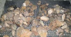
Rock samples from a successful dredge operationDredges sometimes bring up more than rocks and sediment. This arthropod came up with one of the dredge samples.Calling my students. You can see in the background that there is much more ice than a few days ago.
NOAA Teacher at Sea
Christine Hedge
Onboard USCGC Healy
August 7 – September 16, 2009
Mission: U.S.-Canada 2009 Arctic Seafloor Continental Shelf Survey Location: Beaufort Sea, north of the arctic circle Date: September 7, 2009
The empty dredge being lowered into the ocean.
Weather Data from the Bridge
Latitude: 790 ’24N
Longitude: 1540 27’W
Temperature: 290F
Science and Technology Log
Today we deployed our first dredge in hopes of collecting some samples of bedrock from the Arctic Ocean. A dredge is a basket made of metal chain link with a sharp edged bottomless tray on top. A wire cable connects this dredge to the Healy. Our echosounding instruments show us what the sea floor looks like. Maps reveal ridges, seamounts, flat abyssal plains, and raised continental shelves. But, how did all these features form? How old are they? What type of rock are they made from? What kinds of forces created this ocean surrounded by continents? Where are the plate boundaries? Collecting rock samples will help us to answer some of these questions.
Sifting through the muddy sediment in search of rocks
FOR MY STUDENTS: Can you predict what type of rock we might find by sampling oceanic crust? Continental crust?
Here is how dredging works:
The dredge is deployed over a seafloor feature with a steep slope. Lowering the dredge takes a long time as the huge spool of cable unwinds. The top speed for the cable is 50 meters/minute. Today, the cable with the dredge attached rolled out 3850 meters before it stopped. The Healy then moves slowly up the slope dragging the dredge behind. The metal plates at the top of the dredge catch on rock outcrops as it is dragged up the side of the slope. Pieces of rock and sediment fall into the basket. The dredge is pulled up by the cable and lowered back on to the deck of the Healy. The dredge is dumped and scientists pick through all the mud and find the rocks.
Full dredge is safely landed on the deck of the Healy.
This first dredge brought back 400 pounds of mud and rock. Unfortunately, most was mud and only 10% was rock. Dredging is tricky business. Sometimes the dredge gets stuck and needs to be cut free. Sometimes it collects only mud and no bedrock. We will be dredging at different sites for the next few days in the hope that good examples of bedrock will be collected. The rocks we find will be catalogued and the chemistry of the rocks will be analyzed. Hopefully, the rocks will help to answer some of the questions we have about the geologic history of the Arctic Ocean.
Personal Log
Examples of rocks that were collected from our first dredge site.
When you work at a school, you get used to drills. Fire, severe weather, and intruder drills help to ensure that students and teachers will know what to do in the event of a real emergency. The Coast Guard has drills each Friday to ensure the Healy will be ready to handle any emergency. I have observed the crew practicing what to do in the event of fire, flooding, collision with another ship and various other scenarios. Last Friday, I was lucky enough to watch the crew in action.
The crew is suiting up for a Friday drill. Each member of the crew is trained to do many different jobs in case of an emergency.Emergency medical situations are often a part of the training. Friday’s drill included this mock-amputation of a crewmembers hand. (Note the fake rubber hand)If a compartment is flooded; the crew needs to do their best to contain the water. This hatch is braced with wood and mechanical shoring.
NOAA Teacher at Sea
Christine Hedge
Onboard USCGC Healy
August 7 – September 16, 2009
Mission: U.S.-Canada 2009 Arctic Seafloor Continental Shelf Survey Location: Beaufort Sea, north of the arctic circle Date: September 6, 2009
Weather Data from the Bridge
Latitude: 760 51’N
Longitude: 1380 54’W
Temperature: 300F
Rachel is showing me how the data we collect is processed.
Science Party Profile—Rachel Soraruf: Working For NOAA
Are you the kind of kid who buys rocks when you visit a museum gift shop? When you walk down the beach – is your head down searching for shells and stones? If so, maybe you should consider studying geology in college. Rachel Soraruf was one of those kids and now she works for NOAA. This year, NOAA sent her to the Center for Coastal and Ocean Mapping/Joint Hydrographic Center (CCOM/JHC) at the University of New Hampshire. (That’s a mouthful!!) At CCOM, she is a graduate student learning about the latest technologies in ocean mapping.
Rachel decided to major in Geology during her sophomore year at Mt. Holyoke College. According to Rachel, geology is a fun major because you get to “Do What You Learn”. In addition, there are lots of field trips that complement your lab and classroom work. Her next educational move was to earn a Masters Degree in Geosciences from the University of Massachusetts. By studying the geochemistry of a stalagmite for her thesis (final project) – Rachel was able to look back 5,000 years and determine climate changes that occurred over the centuries.
FOR MY STUDENTS: Have you ever gone caving? Did you know stalagmites could reveal climate history?
Ten-foot swells caused the ice floes to roll and bump. September 6th was the roughest ride of this trip.
Rachel has always liked the idea of “science with a purpose” – and NOAA offers her just that. Her job is to plan the field seasons for NOAA vessels as they update the Hydrographic Charts of the waters around the United States. People’s lives depend on these charts. In order to safely navigate an oil tanker, cruise ship or fishing vessel – up to date charts are essential. The work she does makes a difference. It truly is science with a purpose.
Personal Log
Today we are in an area with thin ice and 10-12 foot swells. It is an amazing sight to see the ice on the surface of the Arctic Ocean rolling with the swells. The Captain reminded us to tie down our possessions so that cameras and laptops wouldn’t go flying off our desks. It was good advice! I had not closed my file cabinet drawers completely and they were opening and closing as the ship rolled with the swells. I brought seasickness patches and pressure point wristbands to help me in case of seasickness and used them both today.
NOAA Teacher at Sea
Christine Hedge
Onboard USCGC Healy
August 7 – September 16, 2009
Mission: U.S.-Canada 2009 Arctic Seafloor Continental Shelf Survey Location: Beaufort Sea, north of the arctic circle Date: September 5, 2009
Weather Data from the Bridge
Latitude: 770 13’N
Longitude: 1370 41’W
Temperature: 290F
Science and Technology Log
The two icebreakers are tying up side-by-side so that we can visit each other.
More Ways to Use Sound to See Beneath the Sea Floor
Today we “rafted” with the Louis (the ships tied together side by side). I have been eager to see the science instruments that the Canadian ship is carrying. Once the ships were securely tied together we could just walk back and forth between them and tour the Canadian vessel.
The Healy has been breaking ice so that the Louis can have an easier time collecting data using seismic reflection profiling. The goal is for the Canadian scientists to determine how deep the sediments are in this part of the Arctic Basin. The sound waves their instrument sends out can penetrate about 1500 meters below the seafloor. Using sound they can “see” inside the earth – amazing!
FOR MY STUDENTS: Remember your Latin/Greek word parts? Look up “seism”.
Seismic sled being hauled out of the water on the Louis. (Photo courtesy of Ethan Roth)
Here is how it works. The Louis steams forward at a low speed following in the path that the Healy has created through the ice. The Louis tows behind a weighted sled with 3 airguns suspended from the bottom. This sinks about 10 meters below the water. Attached to the sled is a long tube filled with hydrophones (underwater microphones) called a streamer. This streamer is about 400 meters long and stretches out behind the ship. It is best for the ship to move continuously so that the streamer will not sink or float to the surface.
FOR MY STUDENTS: Try to picture a 400-meter long “tail” on a ship. That is longer than 4 football fields.
The airguns create a huge air bubble in the water. When it collapses, it creates a sound pulse. Two of the guns use a low frequency, which will penetrate deep into the sea floor but will create a low-resolution image. The other gun uses a high frequency, which does not penetrate as deep but gives a high-resolution image. The 16 sound recorders in the streamer record the echo created by these sounds reflecting from the sediment layers below the sea floor. The final product this instrument creates is an image of a cross section through the Earth. Scientists can look at these by observing this geologic history, the scientists are looking back in time. You can imagine that ice can cause lots of problems when a ship is towing a 400-meter long streamer behind it. This is why we are working on collecting this data together. One ship breaks, the other collects the seismic reflection data.
Steamer on deck of Louis. The blue steamer is out of the water and lying on deck when we visit the Louis.
Personal Log
The crew has been looking forward to the two ships tying up together for the entire cruise. Everyone is curious about the other ship. What are the staterooms like? What is the food like? How is their bridge different from our bridge? And of course there is shopping!! Both of the ship stores had their best Louis and Healy gear ready for the eager shoppers.
After learning about the science instruments aboard the Louis, it was nice to finally see the seismic sled, streamers, and the computer nerve center where the seismic images are received. The ships are pretty different in their appearance. The Louis is an older vessel and has wooden handrails, panels cover the wires in the ceiling, and there are some larger windows with actual curtains. The Healy was built to be a science research icebreaker and so has many large spaces for science and looks generally more industrial. The Louis was an icebreaker first and some of their science spaces have been added later and are less spacious.
The bubble created by the airguns on the Louis. (Photo Courtesy Pat Kelley USCG)
Shopping and tours were fun but the most anticipated events of the day were the evening meal, contests and games. The ship’s officers exchanged gifts in a formal presentation and then we had an amazing buffet together. Personnel from both ships enjoyed scallops, halibut, salmon, shrimp, lobster, pork, beef, cheese, salads, and desserts. This was an exceptional meal and a great social event. The idea of having Teachers at Sea (TAS) was a new one for most Canadians I spoke with and as we talked they seemed to think this TAS would be a great idea to stimulate interest in young Canadians about maritime careers. The evening concluded with some friendly competitions between the crews and the science parties. This entire event was a lot of work for the Coast Guard crews. The science party really appreciates all the hours they put into planning this event!
Behind the wheel on the bridge of the Louis S. St. Laurent.
NOAA Teacher at Sea
Christine Hedge
Onboard USCGC Healy
August 7 – September 16, 2009
Mission: U.S.-Canada 2009 Arctic Seafloor Continental Shelf Survey Location: Beaufort Sea, north of the arctic circle Date: September 4, 2009
Sometimes kittiwakes follow the ship. I caught this one as it passed by the Healy.
Weather Data from the Bridge
Latitude: 780 12’N
Longitude: 1360 33’W
Temperature: 290F
Science and Technology Log
Part of NOAA’s mission is to conserve and manage marine resources. To this end, the Healy has a Marine Mammal Observer (MMO) on board. Our MMO is Justin Pudenz. He collects data on any interactions we might have with marine mammals during our voyage. Both the Louis and the Healy have observers on board.
Using a field guide to identify the Yellow Wagtail
Justin spends his time on the bridge of the Healy, binoculars in hand, notebook near by, always on the lookout for life on the ice or in the air. He lives in southern Minnesota when he is not on a ship. Justin tries to spend 6 months at sea and 6 months at home. He has been a fisheries or marine mammal observer since 2001. The company he works for is MRAG Americas. NOAA hires observers from this company when they are needed. While on board the Healy, Justin spends hours each day watching for marine mammals and recording his observations. The data he collects goes back to NOAA.
Justin has traveled to many bodies of water as an observer including the Pacific near Hawaii and the Bering Sea for fisheries observation. His next mission will be on a crabbing vessel in mid-October. If you can picture the television show “DEADLIEST CATCH” – that is the type of vessel he will sail on. On a fisheries trip Justin will collect data on the species of fish caught, their sex, weight, length and other information NOAA needs, to understand the health of ocean ecosystems. Justin grew up enjoying the outdoors and always knew a desk job was not for him. He has a degree in Wildlife and Fisheries Science and has been lucky enough to find a job that gets him outdoors and is ever changing.
A yellow wagtail has been seen from the ship in the past few days. I wonder what this bird is doing so far out to sea – ideas?
FOR MY STUDENTS: How are your observation skills? Would a job at sea be a good match for you?
I asked Justin what he has seen from the Healy. Our “trip list” follows. The farther away from land we get, the fewer species of birds we see. Most of these bird species were spotted before we hit the heavy ice.
The Marine Mammal Observer has seen these birds since we departed Barrow, AK: Pacific loon, Northern fulmar, red phalarope, long-tailed jaeger, Ross’ gull, Arctic tern, spectacled eider, pelagic cormorant, parasitic jaeger, glaucous gull, black-legged kittiwake, yellow wagtail.
The Marine Mammal Observer has seen these mammals since we departed Barrow, AK: bearded seal, ringed seal, Arctic fox, polar bear.
Personal Log
Many people have asked about the living spaces inside this ship. It is an amazing vessel when you think about all that happens here. The Healy is truly a floating city with 120 people on board. Any function that your town does – this ship needs to do. A city needs to clean water, sewage treatment, trash pick up, recycling, electrical power, food, shelter, and recreation. All of these are provided for on the Healy. I have attached a few pictures of life on the Healy below.
Our bunk beds have curtains to keep out the 24-We each have our own desk and filing cabinet and hour sun. Note the stuffed polar bear. This was most important a porthole window! Notice the color a gift from Mrs. Campbell and Mrs. Taylor. outside – we are getting a few hours of twilight in the early morning hours.This is the place where the science party relaxes, plays cards, and watches movies.We each have our own desk and filing cabinet and most important a porthole window! Notice the color outside – we are getting a few hours of twilight in the early morning hours.The main library has computers for the crew to email friends and family and plenty of reading material.
NOAA Teacher at Sea
Christine Hedge
Onboard USCGC Healy
August 7 – September 16, 2009
Mission: U.S.-Canada 2009 Arctic Seafloor Continental Shelf Survey Location: Beaufort Sea, north of the arctic circle Date: September 3, 2009
Weather Data from the Bridge
Latitude: 780 34’N
Longitude: 1360 59’W
Temperature: 290F
Science and Technology Log
Ethan Roth shows me the inner workings of a sonobuoy.
Low-Impact Exploring
Some of my previous logs have talked about sound in the Arctic Ocean. Sounds made by seals, whales, ice cracking and ridges forming, bubbles popping, wind, waves – these are the normal or ambient noises that have always occurred. As governments, scientists, and corporations explore the Arctic their presence will have an impact. Ships breaking ice and the seismic instruments they use to explore, add noise to the environment. We call this man-made noise, anthropogenic noise. Will these additional sounds impact the organisms that live here? Can we explore in a way that minimizes our impact on the environment? The marine wildlife of the Arctic has evolved in an ocean covered by ice. But the ice is changing and the human presence is increasing.
Studies of other oceans have shown that more ship traffic means more background noise. In most regions of the Pacific Ocean the background noise has increased 3 decibels every 10 years since the 1960’s. The scientists on the Healy and the Louis are interested in minimizing their impact as they explore the Arctic Ocean.
Do No Harm – Step 1 Collect Data
I am tossing the sonobuoy off the fantail of the Healy.
One of the ways we are listening to the noise that our own instruments make is with sonobuoys. These are devices that help us listen to how sound propagates through the ocean. While the Louis is using airguns to collect seismic data – scientists on the Healy are throwing sonobuoys into the ocean to listen to the sound waves created by the airguns. Knowing how the sound waves from airguns travel through the water will help us to understand their impact on the environment. Sonobuoys are self-contained floating units. They consist of a salt-water battery that activates when it hits the water, a bag that inflates with CO2 on impact, a 400-foot cable with an amplifier and hydrophone (underwater microphone).
The data acquired through the sonobuoy are relayed to the ship via radio link. A receiving antenna had to be placed high up on the Louis in order to collect this data. Like many of the devices we are using to collect information, the sonobuoys are single use instruments and we do not pick them up after their batteries run out. After 8 hours of data collection, the float bag burns and the instrument sinks to the bottom. They are known as self-scuttling (self-destructing) instruments. The more we know about the sounds we make and how these sounds are interacting with the animals that call the Arctic home, the better we will be at low impact exploring.
Personal Log
The float inflates as the sonobuoy floats away.
I’ve had lots of questions from students about the weather. For most of our trip, the air temperature has been around 270F and the visibility has been poor. A log fog has prevented us from seeing the horizon. We have also had quite a few days with snow and freezing rain. Some of our snow flurries have coated the decks with enough snow to make a few snowballs and prompted the crew to get out the salt to melt the slippery spots.
This past week we had some seriously cold days. On September 1st, the air temperature was 160F with a wind chill of -250F. These cold days brought blue skies, sparkling snow, and beautiful crystals forming on the handrails, ropes and many other surfaces on the deck.
Ice crystals on a valve
FOR MY STUDENTS: Why do you think it is foggier on warmer days?
As we travel south we are starting to get some sunsets and sunrises. There are a few hours of twilight between the times that the sun dips below the horizon – but no true night sky. One of the things I miss the most is seeing stars. I look forward to seeing the Indiana night sky in a few weeks. But until then, the gorgeous sun over the Arctic will have to do.
As the seasons change and we travel south, the sun gets lower in the sky
NOAA Teacher at Sea
Christine Hedge
Onboard USCGC Healy
August 7 – September 16, 2009
Mission: U.S.-Canada 2009 Arctic Seafloor Continental Shelf Survey Location: Beaufort Sea, north of the arctic circle Date: September 1, 2009
The path of the Healy through the ice with the Louis S. St. Laurent from Canada following (See it way in the distance?)
Weather Data from the Bridge
Latitude: 800 26’N
Longitude: 1370 16’W
Temperature: 200
Science and Technology Log
Why Are Two Icebreakers Traveling Together?
All of the countries that have a coastline on the Arctic Ocean are trying to collect data to determine where their extended continental shelf (ECS) ends. One of the types of data needed is called seismic data. Collecting this information involves towing a long (a kilometer or more) streamer behind the ship. It is difficult to do this well in ice-covered water. So, the Canadians and the Americans are collecting data together. One icebreaker leads and breaks a path for the second following with the seismic streamer being towed behind. For most of our trip together, the Healy has broken ice for the Louis S. St. Laurent. We are both collecting data – just different types with different instruments.
FOR MY STUDENTS: Can you name all the countries that have coastlines on the Arctic Ocean? Of which country is Greenland part?
Why Do We Care Where Our Extended Continental Shelf Is?
Close-up of the Louis S. St. Laurent collecting data behind the Healy
The oceans and ocean floors are rich with natural resources. Some countries obtain much of their wealth from mining the oceans, drilling for oil or gas in the oceans, or from fish or shellfish obtained from the oceans. Currently, a nation has the right to explore for and harvest all resources in the water and everything on or below the seafloor for 200 nautical miles beyond its shoreline. One nation can allow other nations to use its waters or charge oil companies for the right to drill in its seafloor and thus make money. But what if we could use resources beyond that 200-mile limit? That would add to a country’s wealth. If a country can show with scientific data that the continental shelf extends beyond those 200 miles they can extend their rights over:
1) The non-living resources of the seabed and subsoil (minerals, oil, gas)
2) The living resources that are attached to the seabed (clams, corals, scallops ) An extended continental shelf means a nation has rights to more natural resources.
FOR MY STUDENTS: Look at a map of the oceans. Can you find the continental shelf marked on the Atlantic coast of the United States? What types of resources can you think of that we get from the ocean and the seafloor?
Where Exactly Is the Healy Going?
The red line shows where the Healy has been. The yellow waypoints show where we might be after September 1, 2009.
Our trail looks random to the untrained eye but it does have a purpose. We have been helping the Louis get good measurements of the thickness of the sediments on the seafloor. You see there are certain features of the seafloor that help a nation identify its ECS. One is related to depth. Another is related to the thickness of the underlying sediments. Another is related to the place where the continental slope ends (the foot of the slope). We have been following a path that takes us to the 2500-meter contour (where the ocean is 2500 meters deep) and following a path to measure the thickness of the sediment in the Canada Basin. I was surprised to think that there was thick sediment on the seafloor in this area. But, the Arctic is a unique ocean because continents surround it. It is more like a bowl surrounded by land. As rivers have flowed into the Arctic over millions of years – layers and layers of sediment have covered the Canadian Basin.
Erin Clark, Canadian Ice Services Specialist has been working with us on the Healy.
The U.S and Canada have been sharing personnel as well as sharing a science mission. Coast Guard personnel and science party personnel have been traveling between the two ships via helicopter to share their expertise. As the Canadian visitors come through our science lab and eat meals with us – we have had plenty of time to discuss science and everyday life. There has also been a longer-term exchange of personnel. A scientist from the United States Geological Survey (USGS) has been sailing on the Louis since they left Kugluktuk, Northwest Territories. Dr. Deborah Hutchinson is on the Louis to provide USGS input to scientific decisions made during the cruise.
My roommate, Erin Clark, is a Canadian Ice Services Specialist. Erin hails from Toronto, Ontario and is staying on the Healy to exchange expertise with the American ice analysts. It has been interesting getting to know Erin and hearing the story of her career path. She was one of those kids in school who just couldn’t sit still in a structured classroom environment. Erin is a visual learner – and often had a hard time proving to her professors that she understood the material as she worked on her degree in Geography. Where other students used multi-step equations, Erin used diagrams and often didn’t “show her work”. NOTE TO STUDENTS: Do you know how you learn best? What is your learning style?
Matthew Vaughan a Canadian geology student from Dalhousie University shows us pictures of the seismic gear on the Louis
Erin was lucky enough to have instructors that worked with her and now she is one of about 20 Marine Services Field Ice Observers in Canada. Luckily, she has found a career that offers lots of opportunities to move around. Some of her time is spent analyzing satellite photos of ice on a computer screen, some ice observing from a ship, and some ice observing on helicopter reconnaissance trips. She communicates what she observes about ice conditions to ships; helping them to navigate safely in ice-covered waters.
FOR MY STUDENTS: What kind of skills do you think an Ice Specialist would need to succeed in their career?
NOAA Teacher at Sea
Christine Hedge
Onboard USCGC Healy
August 7 – September 16, 2009
Mission: U.S.-Canada 2009 Arctic Seafloor Continental Shelf Survey Location: Beaufort Sea, north of the arctic circle Date: August 29, 2009
Science Party Profile – George Neakok
George Neakok (left) and Justin Pudenz watch for marine mammals from the bridge of the Healy.
George Neakok is on board the Healy as our Community Observer from the North Slope Borough. A borough is like a county government. Except, since Alaska is so huge, the North Slope Borough is roughly the size of the state of Minnesota. George acts as the eyes of the Inupiat (native people of the North Slope) community while on board the Healy. The Inupiat people are subsistence hunters. They live off the animals and plants of the Arctic and have a real stake in how other people are using the same lands and waters they depend on for survival. George spends hours on the bridge each day looking for life outside the Healy and noting any encounters the ship has with wildlife in general and marine mammals in particular. He is a resident of Barrow, Alaska (one of the 7 villages in the Borough) and has acted as an observer for 2 years traveling on 5 different expeditions. George says he was selected for the Community Observer job because he is a good hunter and has good eyes. He is too humble. His life experience has endowed him with fascinating knowledge about the ice, animals, and the Arctic world in general. George can see a polar bear a kilometer away and know how old it is, how healthy, and what sex.
I asked George to share a little about his life and the kinds of changes he has observed in the Arctic. He has always lived in Barrow except for 2 years when he went away to Kenai Peninsula College to study Petroleum Technology. His dad died while he was away and so he returned home to help his mother. He has worked in the natural gas fields near Barrow and expects to work in the new field southwest of Barrow in the future. George has 7 children ranging in age from 20 years to 9 months. His youngest daughter is adopted, which he says is very common in his culture. There are no orphans. If a child needs a home, another family will take that child in. Although his children are being raised in a world with cell phones and snowmobiles – they are still learning to live the way their ancestors have always lived.
Erosion on the coast of Barrow, Alaska is an ever increasing problem.
George and his community are a part of both an ancient and a modern world. With each season comes another type of food to hunt or collect. The Neakok family hunts caribou, bowhead whale, seals, walrus, beluga, and geese each in its’ own season. They fish in fresh water and in the Chukchi Sea. They collect berries, roots, greens and eggs, storing them in seal oil to preserve them until they are needed. Food is stored in ice cellars. These are underground rooms that can keep food frozen all year round. The animals that are hunted are used for more than just food. The Inupiat make boats from seal or walrus skin. In Inupiat culture, the blubber, oil, tusks, baleen and meat are all useful in some way. If one community has a very successful hunt, they share with their neighbors. If a community has a bad hunt, they know that other villages will help them out. Villages come together to meet, celebrate, trade and share what they have caught. George says this is just the way it is. People take care of their neighbors.
FOR MY STUDENTS: What can we learn from the people of the North Slope about community?
A polar bear travels over thin ice by spreading out his body weight. (Photo courtesy of Pat Kelley)
George has witnessed much change in his life. He notes that the seasons are coming earlier and staying later. The shore ice used to start forming in late August but lately it has been forming in late September or early October. When there is less ice close to land, there are fewer animals to hunt. Whaling off the ice is getting more and more dangerous. The ice is more “rotten” and camping on the ice during the hunt can be treacherous. In recent years, more and more hunters have lost their equipment when the ice gave way.
Erosion of the coastline is another recent problem. Without ice to protect the shoreline the wave action eats away at the permafrost causing coastlines to collapse. George has seen a coastal hillside where he used to sled – crumble into the ocean. Entire villages have been moved farther inland as the coastal erosion eats away at the land. George is hopeful that although the Arctic is changing fast, the Inupiat people and culture will handle these changes and continue to live and thrive on the North Slope of Alaska.
NOAA Teacher at Sea
Christine Hedge
Onboard USCGC Healy
August 7 – September 16, 2009
Mission: U.S.-Canada 2009 Arctic Seafloor Continental Shelf Survey Location: Beaufort Sea, north of the arctic circle Date: August 28, 2009
Weather Data from the Bridge
Latitude: 840 10’N
Longitude: 1210 30’W
Temperature: 290F
Science and Technology Log
Sick Bay on the Healy
What Happens If You Get Sick?
The Sick Bay (medical clinic) on the Healy is the largest and best equipped in the Coast Guard. It has to be, since we are so far from land for such long periods of time. We have a digital x-ray unit and a cardiac unit for diagnosis, defibrillation, and pacing an irregular heartbeat plus everything needed to keep a patient stabilized and pain free until they can get to a hospital. The Healy is also the only cutter with a permanent Physician’s Assistant (PA) on staff. The most serious medical issues our current PA has had to deal with on the Healy are broken bones and deep gashes. If a patient did have a life threatening injury, they would be kept comfortable until an aircraft could get them to shore. I spoke with Lt. Jason Appleberry (Physician’s Assistant) and HS2 (Health Services Technician) John Wendelschaefer who staff this important part of the ship and asked them about their jobs and their training for working in healthcare on an icebreaker.
Prevention Is the Best Medicine
HS2 Wendelschaefer shows me Mr. Bones in Sick Bay
The busiest times in Sick Bay are when new people come on board with new germs. When the crew has time on shore or new crew or science parties join the Healy – colds and other minor inconveniences crop up. The Coast Guard has strict rules about vaccinations for anyone spending time at sea and a very visible strategy to help prevent the spread of germs. There are hand sanitizer dispensers in the mess (cafeteria) and elsewhere. Anti-bacterial wipes are available in the gym to wipe down sweaty equipment. The medical staff inspects the cooks and the galley like a Health Inspector would at a restaurant. Sick Bay also has an incubator used to test the drinking water for contamination. And last but not least, every Saturday, everyone cleans! Heads (bathrooms), staterooms (bedrooms), and the rest of the ship are disinfected and made ready for inspection. So kids, you have to make your bed and clean your room – even on an icebreaker!!
Profile of the Medical Staff
I asked Lt. Appleberry how he ended up in this job. As a young man his career interests included, doctor, paramedic, firefighter and other jobs that combined adventure with a curiosity about science and medicine. In his words, he wanted to be – “that guy who shows up during a disaster to help.” After a few years of college he spoke to the Coast Guard and thought Coast Guard search and rescue would offer adventure and medicine all in one career. He enlisted in 1991, and since then has traveled all over the country learning and serving. Lt. Appleberry earned a Masters degree through the Coast Guard and has been able to use his training in clinics in Kodiak, Alaska and Hawaii and on various ships.
FOR MY STUDENTS: Have you thought about what kind of career you would like to have? What do you enjoy doing? What activities drain you? What activities invigorate you?
Part of the mission of the Coast Guard is search and rescue. If someone is hurt on a fishing boat or a pleasure boat is lost at sea, the Coast Guard is there to help. HS2 (kind of like an EMT for civilians) Wendelschaefer has also received his medical training through the Coast Guard. His experience has been that the Coast Guard is a great place to be a lifelong learner. There are lots of choices for career paths, tuition assistance, and constant on the job training. For both men, the Coast Guard has been a positive experience. They have traveled to and lived in exotic locations, and should they decide to leave the military – they have very marketable skills for the civilian world.
Personal Log
This is a screen shot of our path as we hit our northern most point. The red line indicates the 840 parallel.
Today we hit our northern most point of the trip. We were north of 840 and as they say, it’s all down hill from here! This is the closest I will ever get to the North Pole. Next week we will have a ceremony for all the folks on the ship who have crossed the Arctic Circle for the first time. This summer I crossed the Tropic of Cancer (look that one up) when I went to Baja, Mexico and the Arctic Circle. It was easy for me because I had air transportation. Some animals make migrations like this every year!!! The gray whale will swim from the Tropic of Cancer to the Chukchi Sea every year without the benefit of an airplane – AMAZING!
FOR MY STUDENTS: Look at a map. Follow 840 North and see where it goes. Think of all the places you have traveled. How far north have you been? Figure out your latitude.
NOAA Teacher at Sea
Christine Hedge
Onboard USCGC Healy
August 7 – September 16, 2009
Mission: U.S.-Canada 2009 Arctic Seafloor Continental Shelf Survey Location: Beaufort Sea, north of the arctic circle Date: August 26, 2009
Science and Technology Log
This is what we see in the Science Lab of the Healy before the data is processed. It is like a cross-section through the top 50-100 meters of the sea floor. Here you can see it was flat and then climbed uphill. The numbers represent round trip travel time in seconds.
Is There a Bird in My Room?
When I first got on the Healy, I thought there was a bird in my room. Then I realized the chirp that I kept hearing every 9 seconds or so was not just in my room. It got louder as I went down the ladders to the deepest part of the ship near the laundry. I found out that this chirp is the sound transmitted by the subbottom profiling system. This instrument is being used on the Healy to collect data about the depth of the water and the nature of the sea floor. These subbottom profiler transducers are mounted on the hull of the ship. The “chirp” sound reflects (echos) off the bottom of the ocean and also reveals the sediment layers below the bottom. This is one of the systems I watch on a computer screen when I am working.
Using Sound as a Tool to See Inside the Earth
Sound is an amazing tool in the hands of a geophysicist, who is a person who studies the physics of the earth. The subbottom profiler uses a low frequency sound. Low frequency will penetrate further into the earth than the higher frequencies used by echosounders. This helps scientists to “see” about 50 meters below the surface, depending on the type of sediment (clay, sand, etc). By looking at how the sound waves are reflected back to the ship, scientists can see layering of sediments, infer sediment type (REMEMBER SAND, SILT, CLAY???), and sometimes see evidence of channels under the sea floor.
The subbottom profiler data is processed and an image is generated for scientists to analyze. This is an image from the 2005 Healy trip to the Arctic. You can see the types of features the sound waves can “see” for us.
FOR MY STUDENTS: DO YOU REMEMBER STUDYING SOUND IN 6TH GRADE? WHAT DOES FREQUENCY REFER TO?
These pictures appear on many doors of the Healy
Why Is This Important?
Geologically speaking, the Arctic Basin is poorly understood. We are not sure how some of the major features formed or even where the plate boundaries are. When you look at maps of the tectonic plates, you might notice that they are not clearly marked in the Arctic. Understanding how the sea floor is shaped and what lies beneath will give us clues to understand the history of the Arctic Basin. From a practical standpoint, geology can tell us where important natural resources might occur. When companies are searching for natural gas or petroleum, they are using clues from the geology of the sea floor to decide where to look.
As far as I can tell there is no place on a ship where it is completely silent. There are fans, air compressors, engines, doors opening and closing and of course on this ship ice breaking and chirping. There are some places on the ship where we are warned to use ear protection because the machine noise could, over long periods, cause hearing loss. Many doors on the ship have pictures reminding us to wear ear protection in certain areas to protect our hearing. The crew spends time working in areas with high intensity noise – so they are often seen wearing protective headsets.
In addition, all over the ship, there are boxes of earplugs. These are available for people to use whenever they need them. My first week, I slept with earplugs every night. The constant chirping, the sound of the engines and the doors opening and closing were more than I could handle. I thought I would need to use earplugs for the entire journey. Now, I am sleeping like a baby even with the additional sound of us plowing through ice. I guess the human body can get used to just about anything.
Earplugs are found near every doorway that leads into an area with dangerous noise levels.
NOAA Teacher at Sea
Christine Hedge
Onboard USCGC Healy
August 7 – September 16, 2009
Mission: U.S.-Canada 2009 Arctic Seafloor Continental Shelf Survey Location: Beaufort Sea, north of the arctic circle Date: August 25, 2009
Weather Data from the Bridge
Temperature: 30.150F
Latitude: 81.310 N
Longitude: 134.280W
Science and Technology Log
This multibeam image of the new seamount is what I saw in the Science Lab.
A Day of Discovery…
Today, our planned route took us near an unmapped feature on the sea floor. A 2002 Russian contour map showed a single contour (a bump in the middle of a flat plain) at 3600 meters. This single contour line also appeared on the IBCAO (International Bathymetric Chart of the Arctic Ocean) map. We were so close that we decided to take a slight detour and see if there really was a bump on this flat, featureless stretch of sea floor.
The contour was labeled 3600 meters and the sea floor in the area averaged about 3800 meters so a 200 meter bump was what the map suggested. As the Healy traveled over the area we found much more than a bump! The feature slowly unfolded before our eyes on the computer screen. It got taller and taller and excitement grew as people realized this might be over 1000 meters tall. If a feature is 1000 meters or more, it is considered a seamount (underwater mountain) and can be named. Finally, the picture was complete, the data was processed, and a new seamount was discovered. The height is approximately 1,100 meters and the location is 81.31.57N and 134.28.80W.
The colors on this 3-D image of the newly discovered seamount indicate depth.
Why Isn’t the Arctic Mapped?
Some areas of the sea floor have been mapped and charted over and over again with each improvement in our bathymetric technology. Areas with lots of ship traffic such as San Francisco Bay or Chesapeake Bay need to have excellent bathymetric charts, which show depth of the water, and any features on the sea floor that might cause damage to a ship. But in the Arctic Ocean, there isn’t much ship traffic and it is a difficult place to collect bathymetric data because of all the ice. Therefore, in some areas the maps are based on very sparse soundings from lots of different sources. Remember, older maps are often based on data that was collected before multibeam echosounders and GPS navigation – new technology means more precise data!
Personal Log
This is the IBCAO. (International Bathymetric chart of the Arctic Ocean) It is a great resource for ships exploring the Arctic Basin.
It is still very foggy. We are about 625 miles north of Alaska and plowing through ice that is 1-2 meters thick. This time of year it is the melt season. Increased evaporation means more water in the atmosphere and more fog. Even though we are usually in water that is 90% covered by ice (REMEMBER 9/10 ice cover?) we rarely have to back and ram to get through. It is noisier lately and the chunks of ice that pop up beside the ship are more interesting to look at. There are blue stripes, brown patches of algae and usually a thin layer of snow on top.
I cannot send a current sound file because of our limited bandwidth on the Healy. When we are this far north it is difficult to get Internet access. But, if you would like to hear what it sounds like when the Healy is breaking ice, click on this link from a past trip through Arctic sea ice.
NOAA Teacher at Sea
Christine Hedge
Onboard USCGC Healy
August 7 – September 16, 2009
Mission: U.S.-Canada 2009 Arctic Seafloor Continental Shelf Survey Location: Beaufort Sea, north of the arctic circle Date: August 20, 2009
Weather Data from the Bridge
Lat: 80.570 N
Long: 151.320 W
Air Temp: 29.210 F
Science and Technology Log
The science computer lab is where the data is observed. Processors clean the data of all the extraneous noise and spikes. Not every beam is returned and some take a bad bounce off a fish, chunk of ice or a bubble.
The Healy is collecting bathymetric data on this trip. Bathymetric data will tell us how deep the ocean is and what the terrain of the ocean floor is like. Less than 6% of the floor of the Arctic Ocean has been mapped. So, this data will help us to learn about some places for the very first time. The word bathymetry comes from the Greek – bathy= deep and metry = to measure.
NOTE TO STUDENTS: If you learn Latin/Greek word parts you can understand almost any word!
How Do We Collect This Data?
There are two main devices the Healy is using to measure the depth to the seafloor. One is called the multibeam echosounder. It sends a beam of sound, which reflects off the bottom and sends back up to 121 beams to a receiver. By measuring the time it takes for the sound to return the multibeam can accurately map the surface of the sea floor. This allows the multibeam to “see” a wide swath of seafloor – kilometers wide. The other device is bouncing a single beam off the bottom and “seeing” a profile of that spot. This one is called a single beam echosounder or sub-bottom profiler. The single beam actually penetrates the sea floor to show a cross-section of the layers of sediment. Both are mounted on the hull of the ship and send their data and images to computers in the science lab.
What Does Mrs. Hedge Do?
This screen shows the multibeam bathymetry data. Depth is measured over a swath about 8 kilometers wide on this particular screen. Purple is the deepest (3850 m) and orange is the most shallow (3000 m). You can see that for most of this trip we were on flat abyssal plain and then we hit a little bump on the sea floor about 450 meters tall.
The science crew takes turns “standing watch”. We have 3 teams; each watches the computers that display the bathymetry data for an 8-hour shift. My watch is from 8 am until 4 pm. We need to look at how many beams are being received and sometimes make adjustments. Traveling through heavy ice makes data collection challenging. We also need to “log” or record anything that might impact the data collection such the ship turning, stopping, heavy ice, or a change in speed. When we are going over an interesting feature on the seafloor, our job is engaging. When the seafloor is flat, the 8-hour shift can seem pretty long!
How Did People Do This Before Computers?
Until the 1930’s, the depth of the ocean was taken by lowering a lead weight on a heavy rope over the side of a boat and measuring how much rope it took until the weight hit the bottom. This was called a lead line. Then the boat would move and do this again, over and over.
Another bear was spotted from the Healy. Photo Pat Kelley.
This method was very time consuming because it only measured depth at one point in time. Between soundings, people would just infer what the depth was. Using sound to measure depth is a huge improvement compared to soundings with a weighted rope. For example, in 100 meters of water, with a lead line 10 soundings per hour could be obtained. With multibeam at the same depth, 1,500,000 soundings can be obtained per hour. Mapping the ocean floor has become much more accurate and precise.
FOR MY STUDENTS: Can you think of other areas of science where improvements in technology lead to huge improvements and new discoveries?
Personal Log
When a polar bear is spotted, the deck fills with hopeful observers.
Last night, there was an announcement right after I went to bed that polar bears had been spotted. I threw on some clothes and ran outside. There was a female and cub 2 kilometers away. With binoculars, I could see them pretty well. The adult kept turning around and looking at the cub over her shoulder. I suspect, the cub was being told to hurry up! When a bear is spotted, the deck of the ship fills up with hopeful observers no matter what time of day it is.
FOR MY STUDENTS: I heard that the old polar bear at the Indianapolis Zoo died recently. Will there still be a polar bear exhibit at the zoo? What are the plans for the future?
NOAA Teacher at Sea
Christine Hedge
Onboard USCGC Healy
August 7 – September 16, 2009
Mission: U.S.-Canada 2009 Arctic Seafloor Continental Shelf Survey Location: Chukchi Sea, north of the arctic circle Date: August 19, 2009
Weather Data from the Bridge
Brittle star
LAT: 810 23’N
LONG: 1560 31’W
Air Temp: 28.27 0F
Science and Technology Log
My fellow teacher at sea, Jon Pazol, and I wonder, “What kind of brittle star is this?” We think it is a Gorgonocephalus cf arcticus.
There isn’t much biology to be done on this cruise. Our mapping mission is the main focus. But, living things find a way of working their way into the picture. We have a marine mammal and a community observer on board looking for whales, seals, polar bears, sea birds and other Arctic animals. Yesterday, a small Arctic Cod found its way into the seawater pipe in the science lab. And a few days ago, when the HARP instrument was pulled up, there was a brittle star attached to it. Jon Pazol (the ARMADA Teacher at Sea) and I are both biology types and we got excited about the opportunity to identify this creature from the Arctic Ocean.
Personal log
Yoann, a student from France, enjoys his first corndog
I did not grow up in Indiana and have avoided eating a corndog until now. Yoann Ladroit (from France) and I (from Connecticut) had our very first corndogs for lunch yesterday. We have enjoyed many different types of food on the Healy. Imagine stocking a ship with enough food for 120-130 people for months in the Arctic. When the Healy left Seattle they had a food inventory valued at $300,000. Ideally, this ship leaves port with enough food for a year. This is more than most Coast Guard cutters carry – but the Arctic is a unique place. In other oceans, cutters can pull in to port and purchase fresh supplies. In the Arctic there are few ports and where there are ports – the food is VERY expensive. The Healy needs to be prepared to feed the crew, just in case they get beset (stuck in ice). So, they have staple foods ready for an emergency situation.
A forklift carries food supplies to the Healy
In Barrow, the Healy picked up many forklifts full of fresh produce and eggs. This will be the last fresh produce we get until September 16th when we return to shore. The Healy is one of the newest ships in the Coast Guard and has spacious facilities in the galley (kitchen) and the mess decks (dining room). There are huge refrigerators, storage rooms and freezers for food. The gleaming stainless steel galley has computerized ovens with probes that sense when the food has reached the correct temperature and a huge and speedy dishwasher. As a newcomer to the ship we were warned about the powerful microwave oven, which heats anything in 10 seconds and garbage disposal (affectionately called the Red Goat) which grinds up all food waste instantly.
This area, called the mess, is where we eat our meals.
We eat in the mess decks. Our mess decks are twice the size of those on other Coast Guard cutters. Meals are served 4 times each day. Breakfast, lunch, and dinner are served at the regular times. Since people work 24/7, a fourth meal called Mid-rats (midnight rations) is served each night at 11pm. One of the interesting features in the mess decks is the operating room set up over one of the tables. Although the Healy has a state of the art sick bay, what if the sick bay was unusable because of a fire or some other crisis? It seems that in a mass casualty situation, the mess decks doubles as a medical space, which would be used to tend to wounded personnel.
NOAA Teacher at Sea
Christine Hedge
Onboard USCGC Healy
August 7 – September 16, 2009
Mission: U.S.-Canada 2009 Arctic Seafloor Continental Shelf Survey Location: Chukchi Sea, north of the arctic circle Date: August 18, 2009
Weather Data from the Bridge
Lat: 800 32’N
Long: 1540 04’ W
Temp: 28.720 F
Science and Technology Log
Mrs. Hedge fills the weather balloon
Twice each day, AG1 (Aerographers mate 1st class) Richard Lemkuhl launches a weather balloon. Today, at 6 AM I assisted with the launch. The balloon is filled with helium and attached to a device powered by a 9-volt battery. The weather balloon sends back temperature, pressure, and humidity data along with GPS derived winds to a radio receiver on the bridge of the Healy. This profile of the atmospheric conditions can be injected into global weather models to help predict the weather. On the Healy we use this information for flight operations (the helicopter). Helicopters, ships, and planes all need current weather conditions to navigate safely. Data from weather balloons can help determine if there might be icing, turbulence, wind driven ice or the possibility of thunderstorms.
FOR MY STUDENTS: All kinds of scientists use models to help explain, predict, and understand the world around them. Can you think of a model you have used in science?
Radio Receiver on the bridge of the Healy
AG1 Lemkuhl works for the Naval Maritime Forecast Center in Norfolk, Virginia. He is part of a group of U. S. Navy personnel on board the Healy to better understand how to operate Navy vessels in the Arctic. The dynamic weather patterns he experienced as a child in Oklahoma sparked his interest in meteorology. His very first weather balloon was launched in 8th grade under the watchful eyes of Mrs. Stevens, his science teacher in Clarksville, Tennessee. AG1 enjoyed learning about Earth Science as a middle school student, which lead to studying geography and climatology in college. The Navy has added to his education and after a year of school he is currently an Assistant Operational Meteorologist.
FOR MY STUDENTS: What have you studied in school that has sparked your interest?
Personal Log
AG1 Lemkuhl holding the weather balloon instrument
Yesterday the sun came out and the sky was blue. What a difference that blue sky made! There isn’t much color in the Arctic – especially when it is foggy. The inside of the ship is tan. The ice and sky are white. Blue sky brought more people out on deck just to enjoy the color change. We also saw more seals out on the ice. Could it be that they like to bask in the sun as well?
Today, as we backed and rammed through 2.5 meters of ice, I saw my first fish! They were small, about the size of my palm. Could these be the Arctic Cod I have read about??
FOR MY STUDENTS: Look at my current latitude. What day will the sun finally set at this latitude???
AG1 Lemkuhl shows Mrs. Hedge how to launch a weather balloon.Blue Sky in the Arctic! This is the CCGS Louis S. St. Laurent. The Healy is breaking ice for her.
NOAA Teacher at Sea
Christine Hedge
Onboard USCGC Healy
August 7 – September 16, 2009
Mission: U.S.-Canada 2009 Arctic Seafloor Continental Shelf Survey Location: Beaufort Sea, north of the arctic circle Date: August 16, 2009
Weather Data from the Bridge
800 6.28’N 1400 33.69’W
Temp: 32.40F
Conditions: low visibility
Science and Technology Log
Blue sea ice with red reflected from the Healy
FRAZIL, NILAS, GREASE ICE, PANCAKE ICE, BRASH, AND SHUGA – These are just a few of the sea ice vocabulary words I have been learning. Ice observers and ice analysts are important people to have around while operating a ship in the Arctic. Depending on the situation and the ship, observations can be made by looking at the ice from the ship, from satellite imagery, from the air in a helicopter, or from actually walking out onto the ice and measuring the thickness. On the Healy, we are using ship-based and satellite imagery observations.
HOW THICK IS IT?
The ice we are plowing through today is about 0.7 – 1.2 meters thick. In general, flat first-year ice is between 0.3 – 2.0 m thick, although it can get much thicker with ridging. Flat second-year ice can be up to 2.5 m thick. Multi-year ice is at least 3 m thick but can be more than 15 m thick.
WHY IS SOME OF THE ICE BLUE?
Seawater is about 3.5% salt, but first-year ice has an average salinity of only about 0.5%. As the sea ice grows it rejects most of the salt in the seawater from which it forms. The ice with less salt reflects more light and air bubbles form as the ice ages. This causes more light to scatter, producing a deeper blue color over time.
HOW IS ICE CLASSIFIED?
Experienced ice observers look at 3 basic parameters:
1) Concentration – how tightly the ice is packed
This is reported in tenths. Less than 1/10th ice is basically open water. The higher the number, the more tightly packed the sea ice. At 10/10ths the ice is considered “compact”.
2) Form – the horizontal shape and dimension of the pieces of ice
These have specialized names and ranges of size. For example, a brash is about the size of a bicycle. Pancake ice is circular pieces of ice, with raised edges that look like giant lily pads or pancakes.
3) Stage of Development – direct observation of the age and structural characteristics
The three major classifications are first-year ice, second-year ice, and multi-year ice. Structural characteristics can include things like thickness, color, ponds or melt water on top, ridges or hummocks.
WHY DOES ICE CHANGE AND GROW?
Sea ice with ponding
Classifying ice by stage of development is really interesting. What sets the different classifications apart (first-year, second-year, multi-year) is the growth and aging of the sea ice. Ice grows in the fall and winter during the freezing cycle. Ice decays during the spring and summer during the thawing cycle. The amount of thawing that happens in the summer determines how much first-year ice survives to become second-year ice and how much second-year ice survives to become multi-year ice.
HOW IS CLIMATE CHANGE IMPACTING SEA ICE?
Drastic changes in the condition and amount of Arctic sea ice have been observed over the past few decades. The least ice extent ever was observed in 2007. This can mean more dangerous conditions for ships to sail in a region where variable and hazardous ice conditions still exist year round.
Personal Log
Bundling up for the Saturday night movie
Different movies play every day in the lounge spaces of the ship. When the crew and scientists have time off they can kick back and relax with their friends. On Saturday night, there are two special social events for morale boosters. There is bingo, and a movie on the big screen projected in the helicopter hanger. Everyone dresses in their warmest gear, camp chairs are set up, and popcorn, candy, and soda are provided. It is a kind of Arctic Drive-in experience. Last night, we watched Star Trek. Of course, when the movie was over we walked out into bright daylight even though it was 10pm.
NOAA Teacher at Sea
Christine Hedge
Onboard USCGC Healy
August 7 – September 16, 2009
Mission: U.S.-Canada 2009 Arctic Seafloor Continental Shelf Survey Location: Beaufort Sea, north of the arctic circle Date: August 14, 2009
Weather Data from the Bridge
800 3’N 1450 42’W
Temp: 310 F Light, fine snow
Science and Technology Log
The coastline of Barrow (8/4/09)
Some of you have asked what the ice looks like up here. Pull out your maps and I’ll tell you about the changing ice conditions. When I got to Barrow on 8/4/09 there was no ice visible from shore. But this changes with the winds and currents. Just one day earlier, the coastline was lined with chunks of sea ice but it had blown out to sea by the time I flew in.
As we started sailing north from Barrow into the Chukchi Sea we saw some chunks of ice but mostly dark water. Our track line (the path we follow) took us back and forth, north and south as we tested our equipment and waited to meet up with our partner ship from Canada. As we went south, there were more patches of open water. Traveling north brought us into more ice.
What looks like dirt is really a layer of algae
Sometimes there were large patches of open water and sometimes it looked like ice all the way to the horizon. The ice that appears blue has frozen and thawed over a period of time. When it freezes, the salt is squeezed out leaving behind fresher, bluer water. The dark lines on the ice are patches of algae that grow at the interface between the ocean water and the sea ice. The sea ice of the Chukchi and Beaufort Seas has retreated as far north as it will go generally by September. We are traveling during the best open water time for this part of the world.
The Healy breaking through the ice
Now that we are traveling north, breaking a path for the CCGS Louis S. St. Laurent we are seeing less and less open water. Yesterday, (8/13/09) the view from the deck looked like a white jigsaw puzzle spread out on a black table. Each day there is more and more ice.
Today, (8/14/09) when I look out over the ice it looks like a white landscape with black lakes or rivers meandering through. We passed 800N today and there are more ridges and large expanses of ice. On board ship there are people who are experts in sea ice. Using direct observation and satellite imagery they help the crew know what the ice conditions are going to be. In fact, there is a whole field of study concerning ice. Who knew! If you would like to learn more, visit the website of the National Ice Center (http://natice.noaa.gov). I’ll go into this topic in more detail after I learn more.
Personal Log
More sea ice!
My goal for next this week is to learn more about how ice is classified. I found a little book “The Observers Guide to Sea Ice” which will be a good place to start. The many ice experts on board will also be a great resource. We are hearing the sound of ice against the hull of the ship more often now and that is a pretty powerful sound. I can’t imagine what it will be like when we hit thicker ice.
The list of Inupiaq words for snow and ice is long – which makes sense. To someone from Indiana, (like me) there might appear to be 5 or 6 different consistencies and colors of ice. There are 76 Inupiaq words to describe ice! Some refer to its age, composition, position to land and a host of other factors. For example, the word for thin ice that is too dangerous to walk on is sikuaq. Slushy ice piled up on the beach is called qaapaaq.
For my students: Do you have any questions about Ice?
NOAA Teacher at Sea
Christine Hedge
Onboard USCGC Healy
August 7 – September 16, 2009
Mission: U.S.-Canada 2009 Arctic Seafloor Continental Shelf Survey Geographical area of cruise: Barrow, AK, 71°18N 156°47W Date: August 7, 2009
Weather Data
Cloud cover: Overcast
Temperature: 450F
Winds: E, 17 mph
Science and Technology Log
Bringing the HARP aboardBringing the HARP aboard
Although the primary mission of this trip is to map the ocean floor, there are also other scientists on board doing other research. Ethan Roth is doing just such research. He is from the Scripps Institution of Oceanography in San Diego, California. Ethan’s specialty is ocean acoustics. He planted two acoustic sensors on the seafloor in September of 2008 and today he retrieved both instruments. This device is known as a HARP (High-frequency Acoustic Recording Package). Basically, this instrument has been “listening” to the sounds of the ocean north of Barrow for almost a year. The HARP sat at a depth of about 300 meters for all this time and today it saw daylight for the first time! The seafloor frame sits on a steel plate, which act as ballast to keep it under the water and moored to the seafloor. When Ethan wants it to surface, he sends it an acoustic signal to release the ballast and the HARP floats up to the surface. A small rigid hull inflatable boat (RHIB) is used to retrieve the instrument and tow it back to the ship where it is lifted aboard.
An inside look at the HARP
You might be wondering why anyone would care what kinds of sounds are happening underwater in the Arctic Ocean. When the surface is frozen with sea ice, it is a very quiet place. The ice/water interface acts differently than the ice/air interface. The acoustic environment of the Arctic Ocean may be changing due to the disappearance of much of the multiyear sea ice. In addition to losing the insulating quality the ice has for sound the amount of human activity is likely to change, as there is less ice. As the ice begins to disappear, shipping and exploration will likely increase, adding more sounds to the ocean. Less ice means more noise in the ocean environment AND less ice will mean more human activity and even MORE NOISE. It is unknown what effect this might have on marine mammals, such as whales that depend on sound for survival. Organisms in the Arctic have evolved in a certain acoustic environment. They use sound as a tool to obtain food, migrate and communicate. If the Arctic becomes a much noisier place, how will this impact their lives?
The landing craft that took us to the Healy
In any science endeavor it is important to collect “baseline data”. In other words, what were things like before one of the variables changed? It is important data that these HARPs collect. Knowing the acoustical environment today can help us to interpret changes in the future.
Personal Log
Here I am in my mustang suit
The trip from Barrow, Alaska out to the USCGC Healy is usually accomplished by helicopter. But Mother Nature was not cooperating with us. Our fresh food (delivered by plane) and the helicopter were both delayed because of weather conditions. There was heavy smoke around Fairbanks due to forest fires and fog elsewhere making flying just too risky. Being a group of problem solvers, the leaders of the science team started asking around and found a landing craft that would fit our luggage, the food cargo, and us. The Healy evaluated the plan and agreed. In a wonderful act of generosity, the Bowhead Transportation Company (a subsidiary of Ukpeagvik Inupiat Corporation) offered to take our science party and cargo to the Healy and bring the “old” science party back to shore. If we had traveled by helicopter, we would have transported a few at a time and had to make many repeat trips. But, using the landing craft we didn’t have to worry about weight and the entire science party and cargo were able to travel at once. Thanks to the crew of the Greta and the Bowhead Transportation Company for getting us to our destination.
I had learned from Dr. Michael Cameron, that we were about to pass through the most concentrated seal soup of the entire mission around 9:30 yesterday evening. He said that there were so many seals in that region, that the helo opps (helicopter observations) had to take turns recording their seals, waiting for one to finish until the other could sight verbally.
So what do YOU see? There are two walrus here.
So I rambled up the three ladders to the bridge, and as I have for so many days this cruise, screwed the binocular eye cradles into my eye sockets and swooped back and forth across the magnified ice vista.
I LOVED to go up to the bridge and observe.
What did I see? Lots and lots of seals! There were spotted seals, and ribbon seals, and even a bearded seal pup or two. The Coast Guard crew assigned to watch those few hours were taking the ‘Seal Avoidance Mission’ seriously, much to my relief.
And then what?
There it was, the edge of the ice.It was obvious on the horizon.The ice was changing too.
Not so much large ice cakes anymore. There were smaller pieces honeycombed with holes and meltpools.
The concentration of small pieces jumbled together became thicker, and thicker.
I’ve been feeling a little sad these past few days because the Healy 0701 mission is coming to a close. There’s been so much data taken, so many measurements done, and more than a few hypotheses tested. So WHAT has been learned?
The CTD was lowered and fired over 200 times in rough water
This research here, this Bering Sea Ecosystem Study, has been some of the first research done with SEASONAL ice during this time of the year. SEASONAL ice is ice that melts and then reforms each year. The algae blooms occur because the seasonal ice melts, creating a stable freshwater layer, a place for the algae to grow. The algae take up nutrients, which act as a fertilizer, and explode in numbers. The nutrients are quickly used up. The bloom for that year is over.
Rob tested the water for iron, getting baseline data to see if it is a limiting factor in Bering Sea productivity.
In areas of the Bering Sea that we visited that were really shallow, like around Nunivak Island, the ice has melted and the nutrients have been used. The bloom is over.
Nancy Kachel collected many samples from the CTD during this research mission.
What has been a surprise to some of the scientists is that the very productive algae blooms occur at the ice edge, not so much under the ice.
When phytoplankton reproduce very quickly they can actually turn the color of the seawater green.
The algae need sunlight, and the sunlight just doesn’t seem to penetrate ice. Algae explode in large numbers when the ice, under which they have been growing, melts away.
Although this seems to be a small observation, it is actually HUGE! Or at least it was for me. Look at areas of the Arctic that do not have the seasonal ice. The flow of energy in that ecosystem is different. The energy transfer from sunlight through the high Arctic permanent ice to the algae that populate the Arctic Ocean is different. Same thing with the Antarctic permanent ice.
This is one of the deepest drops that the CTD made. Over 3000 meters!
If the Arctic or Antarctic holds more seasonal ice, i.e. starts melting, the model of how energy is transferred in the polar region will change. Knowing how seasonal ice acts as a medium to facilitate algal blooms will be very important. Right now is a critical time to research this key component.
TAS Maggie observing the sea ice
I learned a huge amount about ice. I made ice observations many, many times. The scientists on this mission to help them interpret their data will use that information.
The science community has named this an International Polar Year (IPY). What I am doing, in trailing along with scientists, is acting to translate and understand the Bering Sea Ecosystem Study, and to act to educate others about cutting edge scientific research of climactic change. I think I can begin to start telling you the story.
Monday, April 30: The ice is here so ice observations take place every two hours. I had a feeling today was going to be a wildlife bonanza and it was. We saw lots of ribbon and spotted seals and birds. As always the time up in the bridge turned into hours.
I learned how to filter seawater and replace filter papers in Dr. Ray Sambrotto’s Lab. He is measuring the productivity of the Bering Sea.
After lunch I concentrated on getting my presentation to Dr. Ray to edit for the webinar on Thursday. Robyn and I worked out the times for the last webinar and got some images together for the Thursday show. David Hyrenbach as always came through with a good baseline Powerpoint for others to work off.
The ship is tracing a path we have gone before. It is tracing the path through the most productive areas we’ve been to. Much of that area is not under ice. Needless to say, I noticed that there was very little ice algae growth on the ice. The researches say the productivity is in the water, not on the ice. I am sure there will be some new conclusions brought forward.
Tuesday, May 1: Learn to Burn. First it was ‘learn to return,’ our survival safety class. Now it is ‘learn to burn?’
Well, the Healy works hard to be ‘green.’ There are only certain amount of resources available for a big 422 foot ship going out to sea for a whole month. Conservation of resources is a necessity.
We have been told how to conserve water when we take showers and wash and brush our teeth. We sort our trash into burnable, recyclable, and food compost. We only wash full loads of laundry.
The majority of the trash we are able to burn. However, not EVERYONE can burn. One has to be trained to burn. The two scientists that burned on the first leg of this trip, left on Saturday. The large pile of burnables present in the science conference room spurred Robyn and I to volunteer for a job that nobody wanted to do.
Steven Elliot, our coast guard science liason, took time out to teach us the specifics of burning. Lucky for us, two Coasties came in while we were being trained and put a bag of trash in the incinerator that was WAY too big. One of the ship engineers came down to the incinerator room and scolded them. We watched with eyes large, and vowed never to make the engineers angry at our burning ways.
Robyn and I were very happy to finish burning the bags of trash.
It took the bulk of the afternoon to burn the many bags of burnable trash the science conference room had to offer. We collected bags from the science lab too. When we left the incinerator room it was 90 some degrees. Robyn named us the ‘Fire and Ice’ team. We observe the ice and we burn the trash.
Wednesday, May 2: The cups that the students from St. Paul decorated have been sent down to the deep and back up. They will be so excited to see the results. I will be sending them from Dutch when I get there next Monday.
St. Paul students will be happy to get their teeny weeny cups back.
The scientists have been named as chefs for the Morale Night Dinner on Saturday. It was decided we would cook with a Mexican theme, since it was the fifth of May. I wanted to make a piñata. After all who doesn’t like a piñata? We used paper mache and bright green gloves to try and make a hard ball. No go. It collapsed. So I talked with some guys who have made piñatas in the past and tried to follow their guidelines.
Our first attempt at making a piñata failed.
The trick was NOT to use paper mache, but duct tape and cardboard to fashion a hollow container. I chose to make a diatom using cardboard and discarded egg dividers. At 7 pm, Janet Scannell, our dinner coordinator, told me the piñata was out. I was disappointed. After all that work, no piñata. I cleaned up my mess and focused on Thursdays IPY webinar.
The ice is back. As a loose loose pack. Still lots of open water amid the flows. Skimming the waves between the flows were Laysan and Short-tailed Albatross, my Hawaiian friends!
Thursday, May 3: An IPY webinar at an early hour on ship. 9:00! We had two very important guests so we wanted to do our best. Somehow, between all the planning e-mail, a time reminder went out with the incorrect time. Now a half hour of time is a precious thing to busy people. We told our guests to hang tight, we would let them know when time had come. Thirty minutes of time has never passed more slowly.
But pass it did, and a very informative hour followed. Between Dr. Ray Sambrotto, the cruise Principal Investigator, and Captain Tedric Lindstrom, the Healy captain, the internet audience was wowed.
Immediately after the webinar, the Arcus folk had arranged for me to talk directly to my students. This was a huge special treat for me. I teach very active seventh graders, and their attention span and the schools technical equipment did not lend itself to easy listening. For a whole half hour I was connected to my Green Honus (fourth period students) who asked me any and all kinds of questions. Oh my, how I missed my students.The rest of the day was spent catching up with journal writing, editing pictures, and ice observing.
Friday, May 4: Today, we decided to try and work with our mp3 voice recorders. Robyn had recorded Carleton Ray discuss walrus ecology and I wanted to work with a Frank DeLima presentation from my school. Ice observations, writing, answering questions from the webpages, cleaning our rooms, the day was done, and we weren’t any closer to our mastering the mp3 podcast platform.
To the Coast Guard, it’s all about safety.
There were many last-minute dinner problems that came and went. And the ice was always present and changing, we made sure of that.
Saturday, May 5:
Between cooking a Mexican banquet for 130, I ran up to the bridge to take ice observations.
Started like any ordinary day, but soon morphed into a remarkable one. Check out my journal entry for May 5 to fill in the blanks between. OH, by the way, we also took in a tour of the ships engine, and cooked a Mexican banquet for 130. It was fun and delicious. And so ended our next to the last week on the icebreaker Healy.
Saturday May 5, started off ordinary, as ordinary as a Saturday on an icebreaker in the middle of the Bering Sea can be. I was lingering over lunch with Gavin Brady and Dr. Michael Cameron, two members of the NOAA National Marine Mammal Laboratory ice seal team. They were telling leopard seal stories and fun factoids about other seals. Unfortunately, I had to excuse myself, as it was time for me to make an ice observation up on the bridge.
In that very short period of time that it took me to lumber up the five flights to the bridge of the Healy, something happened. We were stopped at a station, a ribbon seal had been recorded close to the ship, and the ice seal team was going to try and tag it.
Much of the ice we encountered last week was soft and honeycombed. You wouldn’t want to go ice hopping on this.
I stopped right smack dab in the middle of my observations and flew down three flights to the hanger, where the seal team was hastily putting on their zodiac safety gear. Our last week on the Healy had us in rotting ice, or fog, or no ice at all with few opportunities to tag ice seals. This was a golden opportunity, as the boat was stopped and on station. Zodiacs away!
Jay Ver Hoef, the newest member of the ice seal team, geared up in a MS 900, bunny boots, white stocking cap, helmet, and ice camoflage overshirt.
Permission was granted and the seal team was good to go.
Dr. Mike talks netting strategy to the ice seal team.
They met together, refreshed their netting strategy, and waited.
The purpose of a strategy meeting is to review boat approaches and answer any questions that might arise.
The Coast Guard worked as quickly as it was able to.
Lee Harris stands next to Captain Lindstrom. The Healy supports scientific research by facilitating technology and equipment dispersal.
This was only the second time these zodiacs were launched; the crew was working out protocol and safety procedures.
The ice seal team rolled the zodiacs onto the deck so that they could be lifted into the icy Bering Sea.
Time ticked, ticked, ticked away.
The ice seal team tracked the ribbon seal as they waited patiently for the Coast Guard to get the three zodiacs into the water below.
Each zodiac had to be lifted by crane up and over the helo deck fencing.Zodiac one contained Dr. Mike and his driver Dave Withrow.Sean Dahle and Lee Harris scooted off in zodiac two.This was Jay’s first decent down the Healy Jacobs Ladder.
Gavin Brady with driver Jay Ver Hoef descended the Jacobs ladder into the zodiacs below. They chugged off into the frosty fog, and were gone.
The zodiacs slipped into the fog and out of sight.
They had radios, GPS and other contact equipment. We knew they would be safe.
Steven Elliot, Tom Bolmer, and Captain Lindstrom help the zodiacs find the seal in the ice-maze.
The rest of the seal tagging was done within a quiet and serene ice flowscape.
Dave Withrow, one of the ice seal team, took pictures of the Healy from the zodiac.
The three boats split up and surrounded the ice piece upon which the ribbon seal reclined. Sean Dahle and Gavin Brady quickly took control of the animal, it was a juvenile male.
The ice team wasted no time in getting measurements and data from the juvenile male ribbon seal.
The rest of the team measured its weight, some blood, it’s length, sex and attached the flipper tag.
The team attached the tag on the right rear flipper.
Ribbon seals are willing subjects. They are true ice seals; they never touch land and rarely encounter humans. Because of their naivety of humans, they can often be approached more easily than other arctic species.
Ribbon seals can often be approached more easily than other arctic seal species.
This young male waited patiently for the ice seal team to finish taking data.
This young male was true to its breed.
The ribbon seal slipped off the ice and into the Bering Sea. The tag will send out valuable information for a year.
So tagging number two can go down in the ice seal journal and in the event log of the 0701 Healy Science cruise as uber successful. Ordinary days? There are none, when you are on an icebreaker somewhere the middle of the Bering Sea!
I have watched a lot of science happen these past three weeks. I have asked a lot of questions and taken a lot of pictures. See I needed to understand what was happening here in the middle of the Bering Sea. And I need to know it so well that I can go back home and tell my students all about it.
The producers in the Bering Sea ecosystem are diatoms and other phytoplankton. They are productive because there are lots of nutrients in the water.
I have been trying to synthesize ecosystem science and understand. Gradually, oh so slowly, I can see. And it hasn’t been easy. Scientists often do research with a very specific topic or organism. They work in small teams. They need to gather accurate data during the mission and/or store samples to continue research back in their labs.
The scientists on-board Healy work in small teams, with one scientist named again and again as contributing essential data to the Bering Sea Ecosystem STudy. This scientist works alone but is a huge team player. Meet Dr. Calvin Mordy.
Dr. Cal Mordy figures out what nutrients are in the water samples pulled from the Bering Sea.
Cal figures out what nutrients are in the water samples pulled up from the varying depths in the Bering Sea. These nutrients are like fertilizer for the tiny phytoplankton producers that cling to the bottom of the ice that covers the Bering Sea. Understanding why, how and when these tiny green food factories grow and multiply is another researchers problem. Yet another researcher is cataloging what zooplankton consumers are present and in what quantity. Cal? He’s all about the nutrients in the water of the Bering Sea.
Cal tirelessly and exactingly tests hundreds of samples of Bering Sea water.
Remember that the zooplankton (consumers) depend on the phytoplankton (producers) for food. Nutrients are key in this research. Cal tirelessly and exactingly tests hundreds of samples of Bering Sea water, at different depths in the water column, and returns information back to the BEST (Bering Sea Ecosystem Study) scientists so they may integrate that information in their research. Lots of people depend on him for their data. They make calculations of different solutions from his cue.
Many researchers on the Healy depend on Dr. Mordy for his data.
With so many people depending on him for data, does he ever make a mistake? ‘Never,’ he says, and I believe him. Mistakes advertise themselves, he explains. Any data that is out of sort is flagged. Those samples are run again, to verify the data in question. Often those samples are the result of a leaky bottle or a misfired bottle. That data is pulled. That’s that.
Somehow it is so comforting to know that Cal has such a strong grasp of this key piece of the Bering Sea Ecosystem Study. Deep in the lab onboard the USCG Cutter Healy, there is a scientist at work. Cal systematically finds out what nutrients are in this icy cold water and in what concentration. In the BEST cruise, it all starts here.
We did an experiment a few weeks back. Our students decorated Styrofoam balls, bowls and cups. We asked them to predict what they thought would happen to the object if we sent it down to the bottom of the deep Bering Sea.
Some thought it would expand and become huge, others thought it might be crushed. Still others thought nothing would happen.
So one late Saturday night and super early Sunday morning we strapped the materials to the CTD rosette and let it drop down down down.
Something happened all right.
The opportunity came to us from the St. Paul students to do the experiment again.
So when the opportunity came to us from the St. Paul students to do the experiment again using cups that they decorated, we were ready. I gathered them up from teacher Tonia Kushin, tucked them into my backpack and counted the days until I would send them to the deep deep deep.
The cups have been sent to the deep deep deep.
Today is the day. We have gathered them together and stuffed each one with two paper towels so that the cups won’t piggy back into each other. I have deposited them in a mesh laundry bag with Scott Hiller, oceanographer supreme-o, and rest assured they will be strapped to the next CTD down.
And now we wait.
At 60 meters per minute, why not calculate how many minutes it will take to go down 3000 feet and then back up. That’s your assignment for today.
You’ll have to wait for tomorrow’s log to find out what happens.
Species Profile: Dall’s Porpoise and Northern Fur Seal
The place to be on the ship is up in the bridge. That is the place to see all the animals. We have two different groups of scientists up there from sunrise to about nine at night. We have scientists looking for different kinds of birds and we have scientists looking for ice seals. Sometimes they see other animals. Like today. They saw another kind of cetacean, a porpoise. If you’d like to learn more about them, read on.
Dall’s Porpoise: Phocoenoides dalli
Where do Dall’s porpoises live? Dall’s porpoises only live in the North Pacific Ocean from Japan to Southern California and as far north as Bering Sea.
How many Dall’s porpoises are there? We don’t know. Although population numbers are unknown, Dall’s porpoises appear abundant through their range. Dall’s porpoises are not considered endangered.
How can I identify a Dall’s porpoise? Dall’s porpoises are beautiful! Though individual animal coloring varies slightly, Dall’s porpoises are easy to identify as they are mostly black with white along their sides, on the top half of their dorsal fins and on the trailing edge of their flukes. Dall’s porpoises mature to around 7 feet (2.1 meters) long and have 19-23 spade-shaped teeth. When swimming, Dall’s porpoises leave a characteristic splash called a ‘rooster tail.’
How well can a Dall’s porpoise see or hear? Scientists don’t really know. Captive Dall’s porpoises emit low frequency clicks that are presumably used for echolocation.
What do Dall’s porpoises eat? Dall’s porpoises are thought to have a rather varied diet consisting of hake, squid, lanternfish, anchovy, sardines and small schooling fish.
How do Dall’s porpoises have babies? Female Dall’s porpoises reproduce at approximately six years of age while male Dall’s porpoises mature at 8 years of age. Dall’s porpoise calves are born in mid-summer after a 12 month gestation period. They are about 3 feet (0.9 meters) long. Calves and their mothers live separate from main porpoise herds for a time. Dall’s porpoise mothers usually have calves every 3 years.
How long do Dall’s porpoises live? How do they die? Dall’s porpoises usually live about 16-17 years. Very little is known about their mortality however many believe that Dall’s porpoises are very susceptible to “incidental” capture by certain types of fishing gear. These porpoises become so intense upon the pursuit of their food that they fail to anticipate or see gill nets set for fish. Porpoises that get entangled in nets usually drown.
The Healy made a stop at St. George and St. Paul Island this past week. Collectively, they are called the Pribilof Islands. The history of these two islands is very interesting. There is a deep Russian influence as well as Native Alaskan Aleut. The animal that the islands based their economy on was the Northern Fur Seal. Read on if you’d like to learn more!
Northern fur seals range extends from Southern California, up the North American coast, west along the Alaskan coastline, across the sub Arctic sea to the Russian coast and down to waters of northern Japan.
How many Northern fur seals are there? The estimate of the world’s population of Northern fur seals is 1,130,000. There are about 880,000 northern fur seals in U.S. waters and most breed on the Pribilof Islands. A smaller population of Northern fur seals are found on San Miguel Island off the California coast. But in 1909, there were only 200,000 to 300,000 left to breed on the Pribilof Islands because of commercial seal harvests. The seal hunters harvested the Northern fur seals for their fur.
How can I identify a Northern fur seal? Males are gray to black, and females are light gray on the back and reddish-brown on the chest with a light patch. Both have extremely dense fur, so dense that it keeps the cool ocean water from the skin, thereby preserving body heat; but it is not waterproof. Because of this dense fur they have large, hairless flippers to keep them cool. The females weigh 90 to 110 pounds on average, and the males between 300 and 615 pounds. Like all fur seals and sea lions, the Northern fur seal has ears that stick out from its head. By rotating their flippers forward, they can walk, run and climb out of the water.
What do Northern fur seals eat? Northern fur seals feed mainly at night and may dive to depths of 600 feet (180 m) in search of small schooling fish and squid and prey are typically eaten underwater. Larger fish are brought to the surface and eaten there.
How do Northern fur seals have their young? After giving birth on one of the rookeries, the mother nurses her pup for 8-10 days. She then begins a pattern of leaving to feed at sea for 4 to 10 days, and returning for 1 or 2 to nurse her pup. During this time she usually makes short shallow dives at night to feed. The pups are weaned after 4 months.
How long do Northern fur seals live? How do they die? The Northern fur seal can live for 25 years, but most females live to be 18-20 years old and the males to their low teens.
Natural predators of the fur seals include sharks, foxes, killer whales and Steller sea lions. El Ñino and entanglement also are hazardous to the Northern fur seal.
Do you know what is really cool about Northern fur seals? A Northern fur seal bull, that has territory, will defend it against any intruding bulls, and even humans!!
The Northern fur seal can spend extremely long periods in the open ocean. Before returning to the breeding colonies many pups will remain at sea for up to 22 months!
A Northern fur seal mother find her pup by moving through the breeding colony and listening for the pup’s distinctive voice!
Northern fur seals mainly feed at night, when prey species are closer to the ocean surface!
Northern fur seals have huge flippers, proportionally bigger than a Steller sea lions. They help keep them cool.
Northern fur seals are famous for the dense fur that covers all but their flippers. That fur consists of approximately 46,500 hairs per square centimeter.
Monday, April 23: The ice is back so we have resumed our ice observation. Every two hours we haul ourselves up to the Bridge and write down our observations in a form. It averages about 7 times a day, and Robyn and I split up the observations so we have equal numbers. We are contributing ?
Weather was really icky. The morning helicopter observations were canceled because of poor visibility and wind. The wind has calmed down a bit, but the fog is still present. It will make for difficult observations in some areas. The rest of the research team is working steadily in the labs. They are all looking forward to the sampling of the ice algae for tomorrow. Robyn and I are trying to prepare for the webinar for Thursday. The scientists who will be on the show have been super helpful in providing us with materials for the webinar.
Tuesday, April 24: Scientists on ice. We hit very thick ice last night. The scientists are ready to go out for an ice sample. The ship just tucked up, into the ice. It let down a metal ramp, and down we went. All of the scientists were very excited to get off the boat. They have been stuck in a lab since the cruise started.
Most of the scientists are doing experiments associated or needing seawater. The stop on the ice was the first for all of them, to drill ice cores, collect ice and melt it down. When they return to the ship, they test it to see what secrets it may tell. The visit to the ice had almost a party-like atmosphere. Remember the reason they were collecting ice samples, was because of the puzzling results they were getting. I believe every single scientist and assistant were on the ice except the marine mammal and bird folks, who are doing a different kind of sampling. The scientists were on the ice from 8:30 am through 11 am. That is the time when oxygen release and chlorophyll is dramatically observed and measured. They will be returning to the ice in the future to continue to take the ice samples.
Seal Tagging: Oh, but my day was not over yet. I was about to get a hands-on experience in tagging ice seals. Instead of re-explaining it all here, I thought I could ask you to go into my journals and check the entry ‘Seal Tagging Adventure.’ You can get very good details and photos of the event. We got back to the ship around four pm. My tail was dragging from leaping over snow banks and falling over ice chunks. Tagging seals is a very rigorous science occupation.
Wednesday, April 25: Getting ready for the webcast. This was the last full day we had to deal with all the background of materials that needed to come to us for the webinar. Both of the scientists Alex DiRobertis, and Jeff Napp, provided us with a nice powerpoint presentation for our audience to see while we talked.
It was also time for me to start preparing for the classroom visits to St. George and St. Paul Islands. There were activities to write, brochures to track activities, and materials to hunt down. That took a lot of time for me, because I decided to take the students K-8. Robyn took the 4 high schoolers. All of my students would rotate through two different classes. In each class there were three different stations. I wanted to engage the students in some kind of active learning.
It was also time to write and reflect on the seal tagging.
I took almost 150 pictures of the seal tagging adventure. I needed to select the best for the Journal Article on tagging seals. I also needed to write an article and highlight those images in the Journal. I completed it by the end of the day, and turned it back to the Polartrec website along with the 18 pictures I selected to illustrate the activity.
Thursday, April 26 Webcast day. A zillion details to wade through. To make matters a bit more complicated, the place where we normally have our webinar was going to be used by the science team, so we had to seek out an alternative spot to broadcast.
At first we chose the chief scientists room. But the static and noises from the phone made us try yet another room. Down on the third floor to try two other rooms. Time was tight, it was 12:30 time to broadcast! So we decided to start it going in the regular spot and then move out into the hallway as the scientists meeting continued.
However, as soon as we moved, the feedback from the speakers overwhelmed us. For every word we spoke there was an echo. We were just about to hang up early when someone got the bright idea to go into my room and continue the webinar. All 7 of us picked up one piece of the telephone system and moved as one into my small stateroom.
We were good to broadcast for another 10 minutes, before the iridum phone broke connection. We tried and tried to call back. On the last try, Robyn got through. After 60 minutes of technological torture, we were done! Yahoo! And now back to the St. George presentations we were developing for the next day. I stayed up until 1:30 making pollack, krill, and phytoplankton puppets. I also needed to put all my Hawaii products out for the kids to try. Dried pineapple, mango, ginger, candy postcards, and pencils. I hoped the students would enjoy learning about my students on Maui. I checked and double checked my duffle bag to make sure I had all the materials and then some more!
Friday, April 27, 2007: The zodiac to St. George. Right after breakfast, the team of scientists and others (us teacher kine) were directed to the helo area (where the helicopter is stored) to put on our survival suits. The MS 900. Since I was going to have my students try on the suit I was wearing, I was able to keep it on, and change into my street clothes at the school.
The zodiac ride over was so much FUN! Splash, splash, kersplash, the person at the front of the bow got very wet. The rest of us hid behind him and let him take the salty spray. Once on the island, we were transported to the school via a little white bus.
THAT’S when the fun really began!
We did an icebreaking activity (person bingo) that was a real hit! Each person had a piece of paper with 20 questions. Each person had to find someone in the general meeting area who could answer that question right. Then, they put their name on the sheet. The first one with a complete blackout wins.
Then we rolled into our next activity, ‘Which creature do you identify with best?’ There were loads of people who stood by the polar bear, humpback whale, and walrus. The phytoplankton and pollack were ignored by everyone. Hopefully by the end of the day, they might warm up to this microscopic creature and learn that it controls the entire ecosystem.
The elementary students and middle schools funneled through my stations. Of course their favorite was the station about Hawaii, mostly because of the treats I offered, perhaps? I do believe they have learned a little more about my island home and the students I teach. I hope we can continue or friendship via a blog spot I recently set up. They were incredibly respectful and curious students!
We brought the four high schoolers and some teachers and community members back o the ship with us. They were given a nice tour of the boat and supper. Back to the zodiacs they went. We waved Aloha to our new friends.
Saturday, April 28: St Paul. The other Pribilof Island. Stormy seas were forecasted. To the Coast Guard it was all about safety. To Robyn and me it was all about getting there and back. We had a presentation scheduled for the school from 11-12:30. We wanted to connect with the community.
St. Paul is larger than St. George. The helicopter was an efficient way to transport people off the boat (those who were going home) and pick up people coming to the boat (those scientists who were joining our adventure). Robyn, David Doucet (air safety manager) and I were the first flight out. Robyn and I were very excited and nervous at the same time.
Up and off we flew, 6 miles from the ship to the airport over the freezing cold Bering Sea. One minute on the ship, blink twice, we were landing safely at the airport in St. Paul. Tonia Kushin, teacher from St. Paul and I had been in contact with each other since late March. We wanted to bring her students culture to my students culture and make a meaningful connection. She took us on a tour of St. Paul, and then took us to her school. Both Robyn and I took in her tour like a sponge.
It was a wonderful time! We were set up in the library, a most fantastic place to learn. Surrounded by student made kayaks, a seal skeleton, and many antique photos from the olden time, we began our introductions.
Our education activity stations were a hit. I think the one the students enjoyed most was getting into and out of the MS 900 suit and bunny boots.
We talked to the audience about marine mammals, then broke into activity stations, then were treated to a celebration of dance. Their costumes were gorgeous!
Their dance lively!
Their song rang clear and sweet.
It brought tears to my eyes.
I went back to the Aleut classroom to see their costumes up close and was rewarded with the students coming up to me and answering all my questions. Their wonderful teacher too!
She told me that the dancing group is getting smaller and younger with each passing year. Seems many teenagers are no longer interested in learning the Aleut ways. I understood what she said. It is difficult to compete with videogames and the internet. I see some of my students in Hawaii making those same choices.
Before we knew it, it was time to go. The wind had picked up considerably and we needed to leave the school, WIKI WIKI!
We said a hurried good-bye, and left St. Paul behind. I left the island with a treasure trove of memories, and a stack of Styrofoam cups for the St. Paul students experiment “Down to the Deep.”
That kinda says it all for me. This experience is all about science and making cultural connections. It is all one ocean, one voice, one earth.
We took the zodiac to St. George Island today, an island that is part of the Pribilof Islands, north of the Aleutian chain. Right after breakfast, the team of scientists and others (us teacher kine) were directed to the helo area (where the helicopter is stored) to put on our survival suits. The MS 900.
Emily Davenport and I were very happy to ride in a zodiac!
Since I was going to have my students try on the suit I was wearing, I was able to keep it on, and change into my street clothes at the school.
The zodiac ride over was so much FUN! Splash, splash, kersplash, the person at the front of the bow got very wet.
The ride over to St. George was so much fun!
The rest of us hid behind him and let him take the salty spray. Once on the island, we were transported to the school via a little white bus.
THAT’S when the fun really began!
Although St. George School is very small, it has a BIG heart.
We did an icebreaking activity (person bingo) that was a real hit! Each person had a piece of paper with 20 questions. Each person had to find someone in the general meeting area who could answer that question right. Then, they put their name on the sheet. The first one with a complete blackout wins.
Everyone had to ask everyone their name and a few questions. It’s an icebreaker that takes the edge off of meeting new people.
Then we rolled into our next activity, ‘Which creature do you identify with best?’ There were loads of people who stood by the polar bear, humpback whale, and walrus. The phytoplankton and pollock were ignored by everyone. Hopefully by the end of the day, they might warm up to this microscopic creature and learn that it controls the entire ecosystem.
The phytoplankton puppet was a little strange looking. After I explained it to a few students, one decided that he wanted to rule the ocean with me.
The elementary students and middle schools funneled through my stations. Of course their favorite was the station about Hawaii, mostly because of the treats I offered, perhaps? I do believe they have learned a little more about my island home and the students I teach. I hope we can continue or friendship via a blog spot I recently set up. They were incredibly respectful and curious students!
We brought the four high schoolers and some teachers and community members back to the ship with us. They were given a nice tour of the boat and supper. Back to the zodiacs they went. We waved aloha to our new friends.
So there I was just working on my journal entry when a phone call came through into the science conference room. Dr. Michael Cameron, Ice Seal Team leader, was on the line. “We are going to try to tag a seal on the ice,” he said, ”meet us in the helo hanger.” I dropped the phone and exited the conference room as fast as my rubber boots would allow. What a great opportunity this was. I was going to see what it would be like getting a tagging event together!
Imagine my surprise when Dr. Mike came thumping down the ladder from helo headquarters, “Get dressed, you’re coming with.” My heart was beating in my throat.
Me? Coming with! I MUST be dreaming!
The rest of the seal team was casually slipping on their ice gear suits and white overcoat. I wriggled into an extra large survival suit, my bunny boots, and the white lab coat, which acted as camouflage. All I needed was a red safety helmet and off we went.
I needed to gear up in a MS 900 in order to participate in the seal tagging event. I might not look fashionable, but I certainly am prepared for the unexpected.
We were transported to the ice via the ‘Man Basket.’ The ‘Man Basket’ is a steel cage suspended from a long cable and driven by a crane. The crane operator lifts the basket, steers it, and then lowers it down to a stable section of the ice. Once the basket has stopped moving, you slip out of the basket, and there you go.
The seal team and bear watch designee were the first group taken down to the ice. As soon as they landed, they were scrambling over the rounded pack ice berms and bumps towards the seal threesome. I knew the importance of them getting out there quickly in order to catch either of the adult spotted seals.
The seal team quickly goes to work to try and catch the spotted seals.
Before too long, the basket returned, lifted us up into the air, and down onto the frozen Bering Sea. Gavin Brady, the last of the seal team, was off like a shot. I urged him forward to do the job he was here to do. My clumsiness held him back like an anchor. I tried hard to hurdle the icy ridges and rafts, but the MS 900 worked as an efficient brake to dull my progress.
I’m OK! Just GO!
The short sprint to the seal location took my breath away. The seal team worked lightening fast to net the two adult spotted seals. They used a huge net, that looked like a huge butterfly net, to trap them, and then transferred the animal quickly into a hoop net. My job was to watch the baby and make sure she wouldn’t separate from her mama and get lost in the open water.
I wasn’t the only one seal sitting. Dr. Mike restrains the spotted seal while seal team takes valuable data.
But I wasn’t the only one seal sitting. In order to restrain it safely, one of the researchers straddles the seal, sits on it’s back, and controls its head and front flippers. Spotted seals have sharp, sharp teeth and they can telescope their neck to inflict quite a nasty bite. One researcher volunteers to act as a restrainer, which allows the scientists to collect their data quickly and effectively
The team concentrated on the two adults, one female and one male. I watched the baby. Of all the tasks that were available at the seal tag site, I think that was the best.
Of all the jobs available at the tag site, I think mine was the best.
Taking advantage of my close but respectable distance I took many pictures of the furry bundle with very sharp teeth.
A baby spotted seal, aka furry bundle with very sharp teeth.
I was totally impressed with the speed and agility of the seal team. One of their major goals is to gather the data, and tag the seal as quickly and painlessly as possible. Their teamwork and communication was exemplary and allowed the mother seal to return to her offspring in a surprisingly short period of time.
Happy reunion between mother and pup.
Because I was preoccupied with the baby seal watch, I had missed out on what samples the scientists were collecting. Remember they are gathering data, some of it baseline for ice seals. The tagging will produce information that is original and first of its kind. So if you were to gather information on ice seals, what kind of information would YOU collect?
The male spotted seal and I were soon to find out.
Sexing is first on the agenda. Male or female? One hole or two?
Next is tagging the seal. The seal tags are marvels of technology. They contain computer chips and batteries that will permit the researchers to discover how deep the seals dive and when, where, and how often do they haul out. Two small holes are pierced through webbing between its toes, and the tag is securely attached. As soon as the seal returns to the sea, the salt water activates the tag. It will continue satellite transmission for up to a year.
Shawn Dahle and Josh London prepare to attach the tag to the back flipper of the spotted seal.
Then the tissue from the flipper is placed in a small vial for DNA testing. Scientists can map the DNA and discover information about the different individuals and populations. Following tissue sampling, blood is taken to learn of the seal’s health. The researchers use a syringe and insert it into a special cavity (dorsal sinus) of the spotted seal, an easy target for them to tap. After the tagging event, the team will take the blood back to the boat and separate the solid red blood cells from the light colored serum. It is the serum that contains the antibodies and information.
Dr. London puts the blood into a ‘tiger tube,’ a special test tube that has a layer of wax to separate the high density red blood cells from the serum.
The serum is suctioned from the tiger tube and placed into a smaller sample tube.
This serum will be frozen, along with the tissue, for another scientist who specializes in blood work to decipher its content. Lastly, measurements are made. We didn’t have enough time to weigh the animal. The researchers use numbers recorded from tape measurements at the hip, belly, front flipper, and neck. They put the numbers in a special equation that use a special ratio to determine a good estimate of the weight of the animal.
Measuring the length and width of a seal is a quick way to get a fairly accurate measure of weight.
The seal team does a quick check and double check to make sure all the numbers have been recorded. But there is an additional sample that the male spotted seal has left for the science party.
You know poop? Doo doo? Number two?
I was told that all wildlife biologists start out as scat collectors. Scat or vomit is commonly used to figure out what, how, and how much animals eat. The seal team was very happy to delegate scat collection in a whirl bag (special sample bag) to me.
The seal team was very happy to delegate scat collection to me.
They even had a special little shovel to transfer the scat to the bag.
The trek back to the ship was more relaxed than the sprint out. We needed to wait for the helicopter to take two members of the ice algae productivity sample group back to the sampling site we were at in the early morning. We got Andy, our Bear-Watcher-Outer, to take pictures of us all. Dr. Mike and the rest of the ice seal team were incredibly happy.
So there you go. From start to finish, a whirlwind of valuable data gathering, done in an efficient and non-invasive way. Yeah, this is science.
We hit very thick ice last night. That is exactly what the scientists were waiting for. So the ship just tucked up into the ice, let down a metal ramp, and down we went.
The scientists were able to walk off the boat by way of this metal ramp. They had to grasp the handrails and walk backwards down the ramp. It was like climbing down a ladder.
All of the scientists were very excited to get off the boat. They have been researching in a lab since the cruise started. Most of the scientists are doing experiments associated with or needing seawater.
Most of the scientists are working with sea water. The collection of sea water directly from these holes was a new protocol.
The stop on the ice was the first for all of them, to drill ice cores, to collect ice and water directly from the hole.
Dr. Ned Cokelet drills an ice core using a gas powered engine. It allows the scientists to take samples quickly and efficiently.
When they return to the ship, they test it to see what secrets it may tell. Remember the reason they were collecting ice samples, was because of the puzzling results they were getting.
Ice samples were brought back onboard the Healy by attaching a rope and dragging them up the ramp.
I believe every single scientist and assistant were on the ice except the marine mammal and bird folks, who are doing a different kind of sampling. The scientists were on the ice from 8:30 am through 11 am. That is the time when oxygen release and chlorophyll is dramatically observed and measured. They will be returning to the ice three more times to take the ice samples.
Seal Tagging: Oh, but my day was not over yet. I was about to get a hands-on experience in tagging ice seals. Instead of re-explaining it all here, I thought I could ask you to go into my journals and check the entry ‘Seal Tagging Adventure.’ You can get very good details and photos of the event. We got back to the ship around four pm. My tail was dragging from leaping over snow banks and falling over ice chunks. Tagging seals is a very rigorous science occupation.
Before I started this adventure onboard the Healy, we were told about the opportunity to run a deep-sea pressure experiment with our students. All that was needed was a Styrofoam object decorated with Sharpie pens. I got some Styrofoam balls and bowls, a package of Sharpies and the students went to work decorating the objects.
They were a bit difficult to pack. The goal was to get them here in one piece. The TSA at most airports did all they could to protect my fragile cargo (NOT!) When I got on the ship, I put them on my desk and waited for the opportunity.
This little mesh bag held the Styrofoam balls.
It just so happened that on Saturday night, April 21, we were going to have a deep, deep, station collection. The CTD (rosette water sampling machinery) was to be dropped down to 2500 METERS. So we gathered our travel mesh bags together, stuck the Styrofoam in the bags, and went in search of the CTD operator, Scott Hiller, from Scripts Oceanography Institute. He said no problemo! He’d make sure the Styrofoam balls, bowls and cups got down there and back.
Scott Hiller from Scripps Oceanography Institute said he would make sure the balls, bowls and cups would be taken down and up again.
So in the interest of science, I stayed up late, determined to see the experiment through from start to finish. The hours ticked away. 8 o’clock, 9 o’clock, 10 o’clock. The rosette sunk deeper and deeper. 11 o’clock, 12 o’clock, 1 o’clock, 1:30 it hit the bottom.
These Styrofoam objects were tucked in a mesh bag and tied to the side of the CTD rosette.
That’s 2500 METERS. So how many feet is that?
It had to sit on the bottom for 45 minutes, and then get hauled back up to the surface. 2:00, 3:00. Wow, I was up, witnessing a science experiment at 6 hours past my regular bedtime. Now this is science!
Scientists regularly stay up to do their research at all hours of the night. I never expected to be up this late.
When the rosette hit the surface, attached were the Styrofoam forms, but what did they look like? Your assignment is to write a hypothesis as to what you think happened to the balls and bowls that were lowered into the deep deep Bering Sea.
I am sure that you know that there are many different scientists on board, all researching pieces of the Bering Sea ecosystem puzzle. Recently, some of the scientists started talking with each other because some of the results have not been what they expected. They asked, why is this happening and what is causing this to happen?
There were some puzzling results that couldn’t be explained from the samples.
Their conclusion?
No dirty snow here. This ice is covered with ice algae. Ice algae is the producer of the Bering Sea.
What the heck, you might say. How come this piece of the puzzle has gone unchecked? Might I remind you that many of these scientists are doing baseline studies? They are collecting data from one or more of the factors in the ecosystem. Never been done, at this time, in this place before.
The information that is being collected is fed into a computer and displayed as a graph.
So a meeting was called. At that meeting were the researchers who were discovering that there was something missing. These researchers told the group of scientists that they believed their missing data had to do with the ice algae. That they needed access to algae samples that were not sent into shock from the collision of the icebreaker and the ice.
Scientists often have to make their own data sampling equipment. It is a mixture of science, engineering, and creativity.
Now here is the interesting part. Everyone agreed. EVERYONE agreed. This aspect of the BEST (Bering Sea Ecosystem Study) cruise had not been included in the research plans. Time to develop another protocol and possibly another piece of equipment that would permit the researchers to gather untouched pieces of the algae.
Researchers need to get samples of the water and sea algae. In order to get it, they need to pump the stuff up out of a teeny tiny hole they will punch through the ice.
So it became a true collaboration. Everyone worked together to create the protocol, make the sampler, to decide time of day to collect and for how long and for how many. The nutrient scientists worked with the zooplankton folks worked with the mud researchers worked with fish acoustics. Now there is a plan, and a protocol, and scientists who will be sampling ice algae from undisturbed areas in the ice. The plan was created in just two short days, in addition to their crazy research schedule. This group of scientists is pumped to find out the role of ice algae in the ecosystem of the Bering Sea.
This is a new ice filter that was created especially for this machine.
Stay tuned to this website as I am sure there will be more interesting data that will come out of all this.
It’s hard to believe another week has passed. There have been so many exciting projects, and unexpected problems. I am in awe of the creativity and the toughness of the scientists on board!
Monday April 16: We started the rotation last week Thursday. It’s time to rotate into our next scientist group. For me that is the ‘mud guys.’ David Schull and Al Devol. These scientists get samples of the bottom sediment (mud) and are able to figure out what’s going on by measuring the amount and type of gas produced. There is a lot happening in terms of Nitrogen fixing and natural radon gas presence. These are serious scientists that like to play in the mud. Robyn and my ice observations continue to take place every two hours. That’s about 7 or more a day.
Tuesday April 17: Our first live event from somewhere in the Bering Sea. The topic of the event was ‘Scientific Research -Life Onboard Ship” We invited Dr. David Hyrenbach and Mr. Steven Elliot to field questions from the virtual audience. Considering we ARE in the middle of nowhere, surrounded by ice, we thought the connection and the whole project went very well! Robyn and my ice observations continue to take place every two hours. That’s about 7 or more a day. Our next Live Event will be THURSDAY April 26. We hope to hear you there ?
Wednesday April 18: We are trying to keep up with the research schedule. It’s time for the next rotation into the fishes. Dr. Alex De Roberis does some amazing things using acoustics to measure the population and tracking of fishes. Fishing is one of the most important industries in the Bering Sea. Understanding how fish populations might be influenced by climate change is a timely issue. I learned about Euphausids (krill) and other teeny tiny copepods. I also learned about fishes like Pollack; fishing Pollack is a major, MAJOR industry in the Bering Sea. Robyn and my ice observations continue to take place every two hours. That’s about 7 or more a day.
Thursday April 19: Onto Rotation 3 and the Marine Mammal group. This group, headed by Dr. Michael Cameron from the National Marine Mammal Lab in Seattle, WA is doing baseline studies with ice seals to document their population and distribution. About twice a day, two or three of the ice seal team wiggle into survivor suits and bunny boots. They follow a transect in the helicopter and count the animals.
They see much more than ice seals. They have seen belugas, polar bears, walrus, and orcas from their 400-foot observatory in the sky. Other members of the team include Dr. Josh London, Gavin Brady, Dave Withrow, Shawn Dahle and Lee Harris. This stuff is very cool. Robyn and my ice observations continue to take place every two hours. That’s about 7 or more a day.
Friday April 20: Flight in a helicopter! So I was working with David Hyrenbach and Robyn Staup to coordinate our outreach program on the Pribilof Islands next week when Dr. Mike gave me the signal that it was my turn to fly.
Me Fly?!
So I jumped into a survivor suit MS 900, got fitted with a flight helmet, slipped on my bunny boots and there I was ready to go. The scariest part of all this was giving the helicopter facilitator my true weight. Women out there can easily identify with this. Giving out your age and weight to a male not related to you, is something that you don’t do until you are married. I mumbled the tonnage and closed my eyes, expecting it to go on the Coast Guard ‘pipes’ (in ship speaker announcement system.) I lucked out.
The flight was just totally amazing. Sitting in the front seat of the helo and watching the boat slide away from underneath your big white feet is a bit un-nerving But soon you adjust to the fact that you are at 400 feet altitude, zipping along at 80-90 miles per hour. Suddenly, little dark shapes turn into seals but they are not. And other dark colored seal bodies, turn into ice, which they are. It takes someone with way more experience than me to count seals.
This I learned many times as we flew over the solid white sea. At this point in the cruise we were very close to Russia. I saw a few seals and some walrus. Trying to spot the ice seals was as tough as trying to see those white-tailed deer that my Dad pointed out to us during trips up to Gramma’s house as a child. ‘Look a deer!’ And six children’s’ heads swiveled and eyes strained to see that beast. I never could see that deer, and I never did see too many ice seals.
Saturday April 21: Out of the ice and into open water. Tons of wildlife including a huge pod (20+) of Beluga whales as viewed from the helicopter. With the help of the evening science team, I stayed up way late, running the Styrofoam experiment. We attached the Styrofoam cups, bowls and balls to the rosette, CTD sampler as it descended to 2700 meters. It was time I modeled scientists round the clock behavior. I never expected the CTD sampling to run past midnight. But 3 o’clock in the morning? I hope my students realize that science is not for sissies. Because we left the ice behind us, our ice observations were cancelled until we return to the ice sometime tomorrow. It was a banner day for animals and we discovered that birds, ribbon seals, spotted seals, and orcas all enjoy life in the loose pack as it cycles into the southern Bering Sea.
When I walked around the back of the hotel in Dutch, I surprised a big ‘ol bald eagle dumpster diving with three of
Bald eagle (Photo by TAS Michele Brustolon)
his raven friends. Later I found out the ravens were not really his friends. They tricked him into surrendering his meal! Bald Eagles play an important role in this ecosystem. They are scavengers, not only in Nature, but out of garbage dumps too.
The eagle is called ‘bald’ because of white feathers on their heads. Its yellow eyes and beak stand in contrast to its dark brown body. Eagles can reach flight speeds between 35 and 44 miles per hour.
How big are bald eagles?
The bald eagle is 32 to 40 inches long with a wingspan of 6 to 8 feet. Males are smaller than females.
How many Bald Eagles are alive today?
80,000 to 110,000 eagles exist in the wild. There are 4,500 breeding pairs in the lower 48 states.
How long do they live?
Over 30 years in the wild. They live longer in captivity because they have a better diet and are protected.
Where do they live?
Bald Eagles live in Canada, Alaska and lower 48 states. They like to hang out in forests, valleys, mountain regions, lakes, rivers and along waters’ edge.
They build nests in the limbs of tall trees. Their nests are used year after year with new additions of mosses and sticks. Nests can reach 5 feet across, 2 feet high and weigh 4,000 pounds!
What do they eat?
Bald eagles eat fish, waterfowl, and small to medium mammals. They kill their prey with their talons (feet and claws) and use their beaks for tearing flesh. They are scavengers that will eat anything from dead fish, to road kill, and dumpster food.
How do they reproduce?
Bald Eagles often mate for life. Once paired, the female lays two eggs in the spring. After 35 days, one or two chicks hatch. If two are hatched, usually only the chick that is more aggressive, and takes most of the food, survives. At 15 weeks of age, the young permanently leaves the nest.
What threats do they have?
Bald Eagles have lost their homes to humans in many coastal areas. Since they scavenge (eat dead or decaying food) heavy metals and other poisons can concentrate in their body and kill them.
Did you know?
Bald eagles can swim! They use an overhand movement of the wings that is very much like the butterfly stroke.
Most all of the information for this creature feature was taken directly from:
http://www.kidsplanet.org/factsheets/bald_eagle.html Word for word, just copied and pasted. I’d like to credit them for writing and researching it. You can find lots more information there too! Make sure you give them credit if you are using this information for reference!
Since I am going to be learning a lot more about ice seals, I thought that I’d do a creature feature on the Hawaiian Monk Seal so when the time comes, you will be able to compare and contrast them.
The Hawaiian monk seal has a streamlined body to aid in swimming. Their front and back limbs are flipper-like. The front flippers are smaller than the back flippers. The front flippers have five fingers. The hind flippers cannot be turned forward, so they must wiggle when on land. In the water, they propel themselves by moving the hind flippers and use their front flippers as rudders. They are dark gray on their backside and silvery gray on their stomachs.
How big are monk seals?
Males are approximately seven feet long and weigh about 400 pounds. Female Hawaiian monk seals are larger than males, up to 7.5 feet long and weigh up to 600 pounds.
How many monk seals are alive today?
The population is estimated around 1300.
How old do they get?
Hawaiian monk seals can live for up to 30 years.
Where does it live?
Once found all over the Hawaiian Islands, the Hawaiian monk seal is now found only in the remote Northwestern Hawaiian Islands. It likes to hang out in reefs, shallow lagoons, open ocean and beaches.
What do they eat?
Fish, eels and crustaceans.
Monk seal and baby
Do they have any special adaptations that allow them to survive in the very warm water of the Pacific Ocean?
These seals do not have special physical adaptations to deal with the warm climate in which they live. Instead, they remain inactive during the heat of the day, finding a resting spot with shade or wet sand. They are solitary animals. The Hawaiian monk seal evolved in an area without people or other land predators. Therefore, it did not learn to fear people and is easily approachable and disturbed.
How often do they reproduce?
A pregnant female gives birth to a single pup from mid-March to late May. Pups are about three feet long and weigh about 37 pounds when they are born. Pups stay with their mothers for 35 to 40 days while they nurse. During this time the mother gives the pup swimming lessons each day. While the pup is nursing, the mother fasts and may lose up to 200 pounds during this time. When the pup has been weaned, the mother returns to the sea and the pup must fend for itself.
What are the threats to the Monk Seal?
Humans; commercial hunting for skins, entanglement in fishing nets and long lines. They also die from disease.
Did you know?
A close relative of the Hawaiian Monk Seal, the Caribbean Monk seal, went extinct 10 years ago.
Most all of the information for this creature feature was taken directly from:
Word for word, just copied and pasted. I’d like to credit them for writing and researching it. You can find lots more information there too! Make sure you give them credit if you are using this information for reference!
For the past few days, we have been seeing bearded seals. Bearded seals are extremely important to the Alaskan Native population that live along the Bering Sea. They use their skins for watertight boats, and their meat for food. They are solitary, love to hang out by themselves and are bottom feeders. Many times their heads appear reddish brown, stained from the benthic muck.
Alaskan Natives carve beautiful animals from walrus ivory. This carving is located on the second floor of the Anchorage Airport.
Where do bearded seals live?
Bearded seals live in areas of the Atlantic, Pacific, and Arctic Oceans that freeze and form ice during the winter.
How many bearded seals are there?
There is no accurate population count at this time, but it is estimated that there are probably over 500,000 bearded seals worldwide.
Bearded seals often have reddish heads from grubbing for their food in the bottom sediment.
How can I identify bearded seals?
A bearded seals most distinguishing feature is the beard of white whiskers they use to find food on the sea floor. Adult bearded seals are gray to brown, pups silver-gray, and do not have spots or other identifying markings. They do have small heads and flippers for the size of their bodies. The average length of adult bearded seals is 6.5 to 7 feet. They can weigh as much as 700 pounds, but the average weight is 400 to 500 pounds.
What do bearded seals eat?
Bearded seals are mainly bottom feeders that eat shrimps, crabs, clams and whelks. They will prey on fish such as cod and sculpin when they get a chance.
How do bearded seals have their young?
The bearded seal pups are born on the ice from the middle of March to the early May. Pups are weaned in approximately 3 weeks, and during those three weeks they gain a lot of weight. Their mothers then leave them to fend for themselves. The bearded seal pups learn to swim and dive within the first week of life. The pups then live a solitary life-like the rest of the bearded seals.
How long do bearded seals live? How do they die?
The life span of bearded seals is believed to be up to 31 years. The main predator of the bearded seal are the polar bear. Sharks, and walrus have been known to feed on pups, and humans also hunt bearded seals for subsistence.
Bearded seal pups usually stay on the ice. The mother seal will dive into the water but hangs around the pup.
Do you know what is really cool about bearded seals?
Bearded seals will ram their heads through thin ice to produce breathing holes!
Bearded seals lay on the edge of the ice looking downward into the water. They can then get away if a predator approaches!
The bearded seal gets its name from the white whiskers on its face! The whiskers are very sensitive and are used to find food on the ocean bottom!
Within a week of birth pups are capable of diving to a depth of 200 feet!
The bearded seals can be easily recognized because the body looks too big for the size of its head and front flippers!
Orca: The Killer Whale
The pilot from the helicopter gave us a heads up. Two killer whales headed our way. The announcement resounded through the ship via the pipes (announcement system). For some people on board ship, this was their first glimpse of the orca. Keep on reading if you are interested in learning more about the whale called Killer.
We saw a pod of killer whales all eating heartily. What was on their menu for dinner? Take a guess.
Killer whales are social animals that live in stable family-related groups. Killer whales display a high level of care for their offspring. In addition to the mothers, various pod members (mainly adolescent females) perform most of the care for the calves. As with most mammals, killer whales are very protective of their young.
Different killer whale pods “sound” different. Each pod has their own dialect of sounds. They can easily recognize their own pod from several miles away based on the differences in calls.
Killer whales are often compared to wolves because both species are top predators, maintain complex social relationships, and hunt cooperatively.
To some, killer whales look exactly alike however they can be distinguished from one another by the shape and size of their dorsal fins, the distinctive grayish-white saddle patches behind their dorsal fins, as well as distinctive scars, nicks and marks on their dorsal fins.
What are killer whales like?
Though killer whales, also called orcas, are considered whales by most people, they are actually members of the Delphinidae (dolphin) family. Killer whales are excellent hunters that a wide range of prey, including fish, seals, and big whales such as blue whales. Despite their hunting of other animals, free-ranging killer whales have never been reported killing a human being.
Where do killer whales live?
Killer whales can be found in all oceans but they seem to prefer coastal waters and cooler regions. Killer whales occur in family groups called pods. Three types of pods have been described:
* Resident pods: remain stable over time * Transient pods: dynamic in structure (are constantly changing) * Offshore pods: Are seen only in outer coast waters and not much else is known of them.
Killer whale pods are based on the lineage of the mother (mothers, daughters, and sons form groups); the whales live and travel with their mothers even after they are full-grown, forming strongly matriarchal whale societies.
How many killer whales are there?
There are no official killer whale worldwide population estimates. There are minimum counts in local areas. For example, approximately 1000 whales have been individually identified in Alaskan waters through photographs. Killer whales are at the top of the food chain and are not considered endangered.
How can I identify a killer whale?
Killer whales are extremely distinctive with jet-black bodies and white patches usually over the eyes, under the jaw, on the belly, and extending onto their sides. Female killer whales can grow up to 26 feet (7.9 meters) with a 3 foot dorsal fin while males are larger than the females growing up to 28 feet (8.5 meters) with a 6 foot (1.3 meters) dorsal fin. Killer whales have 48 to 52 teeth that are large and conical shaped as well as slightly curved back and inward.
How well do killer whales see or hear?
Killer whales have well-developed, acute senses. They can hear a vast range of sounds and possess skin that is sensitive to touch. Killer whales have excellent vision in and out of water. It is not known whether or not they may have some sort of sense of taste.
What do killer whales eat?
The killer whale diet consists of fish, squid, seals, sea lions, penguins, dolphins, porpoises and large whales like the blue whale. Some killer whales have been known to slide on to beaches in order to capture a good meal. Resident pods (pods that primarily reside in one area) prefer fish whereas transient pods (pods that travel over a relatively wide area) appear to target other marine mammals as prey.
Killer whales are very successful hunters due to their cooperative hunting, where all animals within the pod participate. This coordination is apparently developed and learned within pods.
How do killer whales have their young?
Killer whale males reach breeding age when they are around 22 feet (6.7 meters) long while females can breed when they are about 16 feet (4.9 meters) long. Killer whales breed all year around and calves are born about 8 feet (2.4 meters) long after a 17 month gestation period. Female killer whales usually give birth every 3 to 10 years.
How long do killer whales live? How do they die?
Killer whales have no natural predators (they are the top predators of the oceans) and can live to about 50-80 years old. Killer whales have been hunted by humans but not with enthusiasm as it takes 21 killer whales to produce the same amount of oil as 1 sperm whale.
Ribbon Seals: Phoca fasciata
I saw my first ribbon seal today! These beautiful creature are the most highly vulnerable critter that live up in the Arctic. Why? They never touch land. They spend their entire lives on ice flows, even give birth there. What will happen to them if there is less and less ice? Think about it.
Where do ribbon seals live?
Ribbon seals range northward from Bristol Bay in the Bering Sea into the Chukchi, Okhotsk and western Beaufort Seas.
This walrus tusk caving is a perfect miniature of the beautiful animals know as ribbon seals.
How many ribbon seals are there? In the mid-70s, the estimate of the world’s population of ribbon seals was thought to be 240,000, but there is no accurate estimate at this time.
How can I identify a ribbon seal? Ribbon seals are very distinctive. Males are dark brown to black with four ribbons of white. Females are lighter with less distinctive stripes. The stripes are located around the front shoulders, the neck and the rear section. Young seals are gray and will acquire the distinctive ribbons by the age of four. Ribbon seals have large eyes and small teeth.
Ribbon seals are generally easy to catch because they do not fear humans.
What do ribbon seals eat? Ribbon seals feed mainly on groundfish and shrimp, along with some crustaceans.
How do ribbon seals have their young? Ribbon seal pups are born on the ice in the spring. They are white at birth and become silver gray in 3 to 6 weeks. They are weaned in about at month and then spend time learning to move on ice and to dive.
How long do ribbon seals live? How do they die? The life span of ribbon seals is believed to be up to 25 years.
The main predators of the ribbon seal are the killer whale, sharks and humans. There seems to be little interaction between commercial fishing and the ribbon seal.
Do you know what is really cool about ribbon seals? Ribbon seals have an internal air sack, over their ribs on the right side of their body. They are the only seals with this air sack! We do not know what it is used for!!
Ribbon seals move on the ice differently than other Arctic seals, they move one fore flipper at a time at a time, while other seals pull with both their front flippers to move forward! For short distances, they can move on the ice as fast as a man can run!!
Ribbon seals hang out where humans are not. They love to spend time out in the Bering Sea. The ice flow is their home.
Why do we know so little about ribbon seals? Ribbon seals are hard to study because of the amount of time they spend floating on pack ice and in open water, away from land. Luckily, this also makes it harder for predators to prey on them. At birth the pups are pure white. We know that ribbon seals stay close to the pack ice, but after most of the pack ice has melted, the ribbon seals are believed to be in the open sea.
I ate breakfast this morning with Lee Harris, a member of the National Marine Mammal Lab, NOAA’s ice seal team. Lee is also an Inupiat Eskimo. I enjoy listening to and learning about what he says. It is obvious in the harsh Arctic environment, that Native people have the edge in making observations and finding the ice seal. After all, they have been living in the Arctic and sharing their environment with ice seals their entire lives.
Lee’s village is Kotzebue, Alaska, a small town about 30 miles north from the Arctic Circle. Many of the people there rely on the native animals for their food, boats and some clothing. It didn’t occur to me until I talked with him this morning, that he had to make some major changes to his lifestyle in joining this scientific expedition.
These French pastries are not a regular part of Lee’s diet
Take eating and diet. I piled the fresh pineapple, melon and strawberries high in my bowl, and spooned strawberry yogurt over the fruit. Two warm hard-boiled eggs gave me a little protein boost, to keep me going until lunch.
Lee is quite good at driving the zodiac.
But the food on the ship is not ordinary for Lee. He told me dried caribou, seal meat, and walrus are what he enjoys. The Native Alaskan diet needs to be high in protein and energy in order to sustain their active lifestyle and brutal cold weather. High in cholesterol, unhealthy? No way! Lee has been told he is as healthy as can be by the doctor in the local clinic. By far, more healthy than some youngsters that stray from the traditional diet and consume fast foods and white sugar.
Lee can spot seals really well. He knows where they hang out from experience.
I have lots to learn from Lee. His quiet way of talking and humble nature are as natural and true as the ice seals presence here in the Bering Sea.
Yesterday the helicopter crew flew over some walrus. Walrus are touchy feely kinda animals. They love to get together in great big piles and just sprawl all over each other. It’s also a way they keep warm. You can read more about the walrus below.
Scientific name: Odobenus rosmarus
This healthy walrus is hanging out in its favorite place, the ice!
Everyone knows what a walrus looks like! Its long ivory tusks are used for many things, including protection from attack by polar bears, killer whales and local hunters in kayaks.
Walrus are very slow on land because they are so big and clumsy, but in the water they are very fast and strong. They can dive down 300 feet to retrieve their favorite food, clams, from the sea bottom. A walrus can eat 4,000 clams in one feeding!
Air sacs in the walrus’ neck allow it to sleep with its head held up in the water. Nursing females use this standing position as they nurse. The pups, born approximately every two years, nurse upside down.
Walrus will dive into the water at the faintest scent of a human. Walrus numbers were very reduced by commercial hunters until 1972 when the Marine Mammal Act started protecting them. Now only native people in the Arctic may hunt them and the populations have grown in size. Native peoples in the Arctic hunt the walrus for food and put every part of its body to good use. They use the tusks for the delicate art of carving called “scrimshaw.”
Uglat is walrus poop. Scientists can tell where walruses have been by these dark brown patches. They can also tell what they’ve been eating.
DESCRIPTION: Walruses are large animals with a rounded head, short muzzle, short neck and small eyes. They are able to turn their hind flippers forward to aid in movement on land. Their front flippers are large and each has five digits. Males have special air sacs that are used to make a bell-like sound. Both males and females have large tusks that are used for defense, cutting through ice and to aid in getting out of the water. The tusks can be more than three feet long in males and about two and a half feet long in females. Walruses are cinnamon brown in color.
SIZE: Females are smaller than male walruses. Male walruses stand up to five feet tall, are nine to 11 feet long and weigh 1,700 to 3,700 pounds. Females weigh 880 to 2,700 pounds and are seven to ten feet long.
POPULATION: 250,000
LIFESPAN: Walruses can live for 40 years.
RANGE: Coastal regions of the Arctic Ocean and adjacent seas.
HABITAT: Moving pack ice in the shallow waters found near land, coastal beaches. They spend the majority of their time in the water.
FOOD: Clams, mussels and other bottom dwelling organisms that are located by their sensitive whiskers.
BEHAVIOR: Most groups of walruses migrate north in the summer and south in the winter. During the nonbreeding season, males and females tend to stay in groups segregated from one another. Many interactions between walruses are agonistic and may end in fighting.
OFFSPRING: Walruses breed in January or February. Following a 15 to 16 month gestation, a single calf is born. Females are very protective of their young. Female walruses help one another in raising calves. Babies are weaned from their mother at about two years of age.
THREATS: Historically, walruses were hunted commercially for their ivory tusks, oil and hides.
19th Century Naturalist Edward Nelson Recounts:
“To many of the Eskimo, especially on the Arctic shores, this animal is of almost vital importance and upon Saint Lawrence Island, just south of Bering Straits, over eight hundred Eskimo died in one winter, owing to their missing the fall Walrus hunt.
To these northern people this animal furnishes material for many uses. Its flesh is food for men and dogs; its oil is also used for food and for light in oil lamps and heating the houses. Its skin when tanned and oiled makes a durable cover for their large skin boats; its intestines make waterproof clothing, window-covers, and floats. Its tusks make lance or spear points or are carved into a great variety of useful and ornamental objects, and its bones are used to make heads for spears and other purposes.”
This material taken directly from the following URLs, just copied and pasted. Make sure you give them credit should you use it in a report!
I realized that I was doing you all a great disservice by not featuring the most important creatures of all, the producers. Producers are organisms that take the radiant energy from the sun and transform it into food (chemical) energy. These little bitties form the first link in a food web or chain. They are the link between the physical and the biological. They are the photosynthesizers.
It’s easy to feature the cute seal pup, or majestic bald eagle, but phytoplankton? Sea algae? Where’s the glamour in that? Come closer and have a look at the backbone of the ecosystem, come meet the microscopic creatures of the most productive marine ecosystem on Earth, the Bering Sea!
It actually starts with the rich nutrients that are circulated in complex cycles through the icy sea.
The first indicator that something is going on is the ICE. This isn’t dirt on this monster ice cube. It’s ice algae, one of the main producers in the Bering Sea. There are many different kinds of Diatoms that live here, use the rich nutrients dissolved in the sea and transform the energy of the sun into food.
This ice isn’t dirty. It’s colonized by ice algae, one of the backbones for the Bering Sea Ecosystem.
Enter the copepods, krill, bigger zooplankton that chow down on these little ‘plants of the sea’ and in doing so transfer energy from the phytoplankton into them. Next it’s a free for all with something eating something else, a living luau that bubbles and brews and transforms and transfers. From creature to creature to creature and then one more. Nothing is wasted, everything is a part of and needed.
Enter the copepods.
And suddenly, it’s over, but not really, it’s just reformed and recycled. The body decomposes, enters the nutrient cycles, and becomes part of the growing phytoplankton bloom ready to explode as soon as the ice melts.
What’s the ground floor of this uber productive sea? Say, ‘Hello Sunshine’
Today a beluga whale was spotted from the helicopter. The whale was swimming in a small open area in the middle of an ice flow. This open water is called a ‘polynya.’ Read on to learn more about these beautiful whales. In the next few days, I will have the chance to add photos from Belugas we see.
What is really cool about beluga whales?
Beluga whales (also called white whales) are known to strand on mud flats without apparent harm. They are able to wait for the next high tide to swim away.
Adult beluga whales have been observed carrying odd objects such as planks, buoys, and even caribou skeletons during calving seasons. It is believed that if a female beluga loses her newborn, she might interact with these objects as a calf surrogate.
Beluga whales have a flexible neck due to cervical vertebrae (backbone) that are not fused, as in other cetaceans. This allows them to move their head up, down, and to the side. Their bulbous forehead, called a melon, is also very flexible allowing them to make many different facial expressions. Movement of the melon is associated with the production of sounds.
Beluga whales are known as the “canaries of the sea” because they produce a vast repertoire of sounds including whistles, squeals, moos, chirps, and clicks. These sounds are used for communication within their social groups and also use to locate prey through echolocation.
What are beluga whales like?
The name beluga comes from the Russian word “bielo” meaning white. Beluga whales live, hunt, and migrate together in pods of a few, to hundreds of whales. Beluga whales are extremely social. In the summer, they are often found near river mouths, and sometimes even venture up river (as far as 621.4 miles (1000 kilometers) in the Yukon River). However, recent satellite tagging research has shown that beluga whales also spend time offshore, diving to depths of at least 1,148 feet (350 meters) where they are likely feeding on deepwater prey.
Where do beluga whales live?
Beluga whales inhabit the Arctic and subarctic regions of Russia, Greenland, and North America. Some populations are strongly migratory, moving north in the spring and south in the fall as the ice forms in the Arctic. As the ice breaks up in the spring, the whales move north again feeding near river mouths and offshore. There are a few isolated populations that do not migrate in the spring, including those in the Cook Inlet, Alaska and the St. Lawrence estuary in Canada.
How many beluga whales are there?
Beluga whales are not considered an endangered species however some stocks are faring better than others. NMML has done extensive work with some stocks of beluga whales including the Beaufort Sea, Eastern Chukchi Sea, Eastern Bering Sea, Bristol Bay and Cook Inlet stocks. You can read more about these stocks in the NMFS Alaska and Atlantic stock assessment reports.
How can I identify a beluga whale?
Belugas are born dark gray. They turn white as they mature sometimes taking 3-8 years to reach their adult coloration. Adult beluga whales can grow up to 16 feet (4.9 meters) long. Females are generally smaller than males. Belugas have large melons and very short snouts. Interestingly enough, unlike other cetaceans, beluga whales also have the ability to move their head independent of their body.
Beluga whales do not have dorsal fins. Dorsal fins would be a major hindrance during the winter when they live in the loose pack ice of the Arctic. A dorsal fin would cause extra heat loss when Arctic animals, such as belugas, need to conserve heat. They do have a tough dorsal ridge which, along with their head, can be used to break ice for breathing holes.
How well can a beluga whale see or hear?
Beluga whales have well-developed, acute senses. They can hear a vast range of sounds and have excellent vision in and out of water. Belugas may have some sense of taste, but they do not have the brain receptors or olfactory structures for the sense of smell.
Belugas often hang in pods. This huge pod was seen on Saturday April 21 by the Ice Seal team as they were recording a transect.
What do beluga whales eat?
Beluga whales are diverse eaters, with more than 100 prey species identified including salmon, capelin, herring, shrimp, Arctic cod, flounder, and even crab. They feed in both open water (pelagic) or on the bottom (benthic) and in shallow and deepwater habitats.
How do beluga whales have their young?
Female beluga whales are old enough to reproduce at 4-7 years of age and males at 7-9 years. Beluga whales mate in the spring, the exact time varying geographically. The following year, after a 14-15 month gestation period, females give birth to single calves (and on a rare occasion twins) that are about 5 feet (1.5 meters) long. Calves nurse for at least 12-18 months, but may continue to nurse for another year after beginning to eat solid food.
How long do beluga whales live? How do they die?
Beluga whales are thought to live for 35-50 years. Beluga whales are prey to killer whales and polar bears. They can also die when entrapped by ice.
Some beluga whale populations have been greatly reduced as a result of hunting practices. Historically, large numbers of beluga whales were hunted commercially. Today only subsistence hunting is allowed in U.S. waters. Beluga whales’ affinity for shallow coastal waters puts them at risk as humans alter coastlines and estuaries with pollution, dams, and off-shore petroleum exploration and extraction. Canada’s St. Lawrence Estuary is an example where industrial pollution has caused high beluga whale mortality.
This material was taken word for word from the following website. Please give them all the credit in the world should you wish to use this information in a report.
On the hunt
Polar Bear: Ursus maritimus
On board the Healy, there is one helicopter that is being used by the folks from the National Marine Mammal Laboratory to do population studies. Today they went out for two runs. In the first run, the team saw a Polar Bear eating walrus. The photos for polar bear will be added as soon as they become available. If you’d like to learn more about them, read on.
Polar bears live year round near arctic waters hunting seal and other animals, rarely coming on land except on islands and rocky points. In winter they hunt along the Arctic shelves looking for tasty seals, fish, and even humans! Their white coats provide camouflage in the ice and snow which make them almost invisible as they stalk their prey.
In winter, when they are far from land they search for breathing holes made by seals. When the seal comes up for air, the polar bear will kill it and flip it out of the water with a single blow of its great clawed paw! Polar bears are very dangerous, and grow to a huge size and weigh as much as small automobile (1000 pounds). They have longer legs than other bears and large furry feet. These big feet help to distribute their weight as they walk on thin ice in the arctic waters. Polar bears are strong swimmers and can stay submerged for two minutes at a time. Their fur is made of hollow hairs which trap air and help to insulate them in the frigid waters.
After the kill
In November polar bears retire to dens dug out of the snow or permafrost. The females remain until the spring when they emerge with one or two cubs who stay with them for the next year and a half. The males spend a shorter time in the dens and may be seen out and about at any time of the year.
19th Century Naturalist Edward Nelson Recounts:
“The Eskimo of Saint Lawrence Island and the American coast are well supplied with firearms which they use when bear-hunting. In winter, north of the straits, the bears often become thin and very savage from lack of food.
A number of Eskimo on the Alaskan coast show frightful scars obtained in contests with them in winter. One man, who came on board the Corwin, had the entire skin and flesh torn from one side of his head and face including the eye and ear, yet had escaped and recovered. One incident was related to me which occurred near Point Hope during the winter of 1880-’81. Men went out from Point Hope during one of the long winter nights to attend to their seal nets, which were set through holes in the ice. While at work near each other, one of the men heard a bear approaching over the frosty snow, and having no weapon but a small knife, and the bear being between him and the shore, he threw himself upon his back on the ice and waited. The bear came up and for a few moments smelled about the man from head to foot, and finally pressed his cold nose against the man’s lips and nose and sniffed several times; each time the terrified Eskimo held his breath until, as he afterwards said, his lungs nearly burst. The bear suddenly heard the other man at work, and listening for a moment he started towards him at a gallop, while the man he left sprang to his feet and ran for his life for the village and reached it safely. At midday, when the sun had risen a little above the horizon, a large party went out to the spot and found the bear finishing his feast upon the other hunter and soon dispatched him. Cases similar to this occur occasionally all along the coast where the bear is found in winter.”
This material was copied and pasted from the following website. Please give them all the credit in the world should you use it in a report or in other ways. http://www.mnh.si.edu/arctic/html/polar_bear.html
So what’s on board a scientific research vessel and Coast Guard Icebreaker? Come take a tour with Kolehe, my naughty monkey friend.
Walk the gang plank
That’s how you get on the ship. You are looking at the PORT side of the ship. It faces the port. The other side, starboard, doesn’t. The gangplank enters at the 01 level. My stateroom (where I sleep) is located one floor above. You need to take very steep steps to get from one level to the next. Going up is easier than going down.
Water Fountain
You get REALLY thirsty walking up and down steps, so there are lots of water fountains and the water is nice and cold.
My State Room: I share a nice room with a nice scientist, Ana Ajuilar-Islas. Scientists have to work for 12 hour shifts, sometimes even more. They sleep when they can. That means I need to be respectful of her. Look I’ve made myself right at home. My desk looks just like my teacher desk on Maui!
My Desk
Science Conference Room: Just down the hall from me is the science conference room. That’s where many of the scientist go to use the public computers and talk story. Attached to it is the TV video entertainment area. There is a huge TV screen where everyone gathers to watch movies.
Opening up Doors: I have the hardest time opening up the water tight doors that lead to and from different areas of the ship. You have to crank them all the way open and then all the way closed. I am developing my arm muscles for sure!
Good Morale: The crew has a group of people who work on keeping the attitude of the ship very positive. They play bingo on some nights, have fun food entrees and on Saturday nights…
Movie Night
A movie in the helicopter hanger with free popcorn and soda! This past week it was a James Bond Movie, ‘Casino Royale.’
More Movies
The Bridge I love to spend time on the bridge. That’s where you go if you want to see any wildlife. I spend as much time as I can up there because it is so interesting for me. I also get to take ice observations for the scientists, valuable data that they will use to help analyze the data they are getting right now.
The captain hangs out on the bridge.
I have to keep Kolohe close to me. He is always getting into trouble!
This is Tim Sullivan. He’s the ship’s navigator which is a really important job. The ship doesn’t go anywhere with his knowing about it.
All this touring has made Kolohe hungry. He’s stopping by the galley to enjoy some snacks to renew his energy.
The galley is five ladders down from the bridge.
Do you think he will burn off all those candy calories walking back up to the bridge?
Time for Bed… After a long hard day of experiments and data generation, we are ready for sleep. Did you know the sun sets at around 10:30 at night here? That’s right, it stays light very late. But that doesn’t stop us from getting a good night’s sleep! Hope you enjoyed this brief tour of the boat. Make sure you email any questions you might have to me!
On Monday, April 9: we loaded the ship with many bags and boxes of gear. Everyone moved into their rooms, unpacked and then headed for the science lab. In order to do science experiments, the scientists had to set up their labs.
The food is yummy onboard the Healy. There are always many fresh fruits, vegetables, beverages and snacks in the galley. Some of the food I have eaten includes fresh mixed fruit, creamy vegetable soup, and lo mein with vegetables. The salsa is to die for. There are fresh baked pies, coconut macaroons, brownies and ice cream.
Tuesday, April 10: we shipped out of Dutch Harbor and steered north. The water has been amazingly calm. We have seen many gulls and some smaller waterfowl. One of the research groups is counting and identifying our fine-feathered friends. Since they don’t have very much equipment besides binoculars, they were busy from the first day out, collecting data.
Wednesday, April 11: was the first big push for samples from the rosette. Because so many teams need seawater in order to do their experiments, there are many sampling stops. The water is below freezing, but it is still liquid because salt is dissolved. Many of the scientists are using the water samples to test for the concentration of various nutrients and plankton.
Why nutrients? They are one very important limiting factor in the growth of the producers. Yes, without sunshine there’s no life, but algae and other phytoplankton need fertilizers to grow like crazy. Measuring the concentration of these nutrients allow the scientists to check on the health of the ecosystem and make predictions about what might happen to the delicate balance in the Bering Sea.
Thursday, April 12: was a very interesting day because the Ice Seal Team, from the National Marine Mammal Laboratory in Seattle, did some practice runs using the zodiacs. The Healy had never launched zodiacs of this size before so it was practice for the Coast Guard as well. The scientists in the lab were in full experiment mode, working on perfecting their technique or tweaking their new setup.
Friday, April 13: started our rotations through the science labs. We arranged our rotations around the theme of ‘Energy and Nutrient Transfer Through the Ecosystem.’ Dr. Cal Mordy was my first scientist mentor. He is looking at concentration of nutrients and oxygen in seawater. Robyn Staup, the other onboard teacher, was connected with the physical oceanographers, Drs. Nancy and David Kachel and Dr. Ned Cokelet. She fired tubes and learned many different techniques they are using to test the water of the Bering Sea.
The helicopter did a launch from the flight deck on Friday afternoon. The NMML (NOAA) is doing population counts for ice seals in the sea. Much work has to go into creating a flight plan. Time is made to communicate concerns. It was all done right, thanks to the careful attention of Ice Seal Team Leader Mike Cameron.
Today we saw our first ice.
Saturday, April 14: was a trial day for both Robyn and I as we are training for being the Ice Observers for the cruise. We had training in ice observation yesterday, but today we were on our own. Every two hours we look at the ice and interpret what kind and how much. We get help from the Coast Guard as they tell us the visibility in nautical miles and track our latitude and longitude too. We take ice observations as long as the sun is shining in daylight. After the scientists have completed their investigations in May, our ice observations will provide information about how much ice was there when they collected our data. The helicopter did another transect and observed ice seals and walrus.
Sunday, April 15: a great day to submit ice observations and look for walrus and ice seals. The animals are becoming more common and the birds are becoming scarce. Why? There is hardly any open water anymore, we are surrounded by ice.
The Ice Seals had another transect using the helicopter.
Robyn and I are working on the pictures we need for our first Live from IPY event. Our theme will be life on board a scientific research vessel that is also a Coast Guard Icebreaker.We believe it will be at 10:30 Hawaii time, 12:30 Alaska time, 1:30 Seattle time, 2:30 Mountain time, 3:30 Central time, 4:30 Eastern time. We expect to have representatives from both the Coast Guard and our scientists present.
Yes! I am an official ice observer, a real member of the scientific team. My job is to tag team with Robyn Staup, my fellow PolarTREC teacher, to record the conditions of the ice every two hours.
The Healy breaks a path through the ice. But what KIND of ice?
It’s not as easy as it sounds. So every two hours one of us takes flights of steps up to the bridge. We are set-up in a corner. Our station is made up of a computer, camera, pencil, piece of paper and the guide for Official Ice Observers.
I get help and advise from my friends up on the bridge.
I try to time my observations to be at the same time that the ship has stopped to take some samples. I need to take three pictures there, all in certain places, upload them to a website form, and interpret certain environmental conditions.
This satellite image of ice on the Bering Sea is very accurate.
How much ice? What kind of ice? How cloudy is the sky? How cold is it? Is there ice algae? How much? What is the visibility?
Is this cake ice or pancake ice?
After that’s all recorded in the form, I have to stop the observation so that the observation has a start and end time. I reread what I wrote, check the links to the photos and upload the form. Then I double check it again by going out of the website and back into it and rechecking the data and photos. At first it took us over an hour. Now we have it down to about 15 minutes.
Kolohe gives me advise sometimes. But he gets into so much trouble I have to keep him close to me when I am on the bridge.
The hardest part is getting outside to take a picture of the ice horizon. On one side of the boat, there is a big gust of wind that takes your breath away, it’s that cold. I don’t stand around, I just take the picture and get back into the bridge.
Spotted seals are found by ridges and waffles on the ice. They are often hiding. Can you spot the spotted seal?
Why are we doing this? All the scientists need to see how abiotic factors influence their sample. Ice is an ever-present factor here in the Bering Sea. When scientists get off the ship and go back to their research labs, they will want to know what the weather was like and what the ice was like on the days and times they took samples.
Jeff Napp, a senior scientist onboard Healy, puts fine nets in the water to trap phytoplankton and zooplankton. He will use the ice observation data.
We were told it’s the first time anyone has been so regular in reporting this data. And what we are doing is very valuable to them.
Today was our first close encounter with a spotted seal. Spotted seals are the most common ice seals in this area. They are known for their spicy personality.
Where do spotted seals live?
Spotted seals live along the continental shelf of the Beaufort, Chukchi, Bering, and Okhotsk Seas, south to the northern Yellow Sea and west to the Sea of Japan.
How many spotted seals are there?
There is no accurate population count at this time, but it is estimated that there are under 300,000. They are the most common ice seal up in the Bering Sea.
How can I identify a spotted seal?
Pups are white and weigh 18 to 26 pounds. This one was a bit heavier.
Spotted seals are wary and hard to get close to. Adult spotted seals are silvery-gray with dark grey on the back and covered with brown to black irregular spots. Pups are born with a white coat but molt to the adult colors after 3 or 4 months. It is believed they winter in the Bering sea. Following the ice front, they travel north in the spring and summer. They reverse the process and follow the developing ice south in the fall. Spotted seals may get to be 270 pounds, but males and females average 180 to 240 pounds. Length of grown seals is between 4.5 and 5.5 feet. Newborn pups weigh 18 to 26 pounds (8 to 12 kg) and average about 33 inches (84 cm) long.
What do spotted seals eat?
Spotted seals eat many things, depending on the season and their location, including Arctic cod, sand lance, sculpins, flatfishes, cephalopods, and a variety of shrimps.
During the first few weeks after weaning, pups seem to spend most of their time on the ice, but they do not enter the water.
How do spotted seals have their young?
Spotted sea pups are born anytime from early February to the first part of May, depending on their location. Pups are white and weigh 18 to 26 pounds. They are nursed for three to six weeks, during which time they more than double in weight. During the first few weeks after weaning, pups seem to spend most of their time on the ice, but they do not enter the water. Spotted seal pups take longer than other ice seals to learn to swim and dive! In the spring, spotted seals will form small groups of a male, female and her pup.
How long do spotted seals live? How do they die?
The life span of spotted seals is believed to be up to 35 years.
The predators of the spotted seal include the polar bear, sharks, Steller sea lions, brown bears, humans and walrus. Wolves, foxes and large birds have been known to feed on pups.
Did You Know? Spotted seal are the only seal that breeds in China!
One thing you can say about the BEST mission is that it’s full of adventure! Take today for example.
April 13 was the launch test date for the helicopter that the National Marine Mammal Lab (NOAA) uses for transects of seal populations. There was an air of excitement about the boat. The helicopter, pilot, and three-person crew were going to test out the machine and the instruments they needed. And they did.
This beautiful machine will carry up to three seal scientists to study ice seal populations.
The helicopter was a thing of beauty. It carries 600 pounds of cargo including human passengers. It is equipped with a camera that can take a picture of what is directly below the machine every two seconds. Seals missed in a count can be seen in the photos. It lifted straight up from the flight deck. No glitches. So fast. It circled over us and was gone. Zoom, zoom, and zoom.
After more than an hour, the helicopter returned to the ship. It approached from the starboard (right side) of the flight deck, slowly, slowly, and then landed as soft as a snowflake on the rough textured cement.
They waited for the blades to stop, then jumped out of the helicopter from doors in the passenger and navigator positions. They were covered from head to foot in safety gear, bundled against a potential problem. No problems surfaced.
Climbing down
They saw the ice boundary just 14 miles away. They saw a seal.
Being a scientist requires you to have top-level problem solving and analyzing skills. The scientific team from the National Marine Mammal Laboratory (NMML) is a great example of this skill in practice.
Michael Cameron led a team of six skilled seal experts through a practice run of a seal launch. It may sound easy, but the Healy had never launched a zodiac of the 17-foot or 14 foot variety before. A joint dry run was held to test the abilities of the Seal Team to change into survival gear and the abilities of the Coast Guard to get the zodiacs into the water. Right after breakfast, the teams made a beeline to the heliport, where the three zodiacs patiently rested. While the Coast Guard gathered together and assigned duties to the staff, the Seal Team pulled and tugged on their safety gear.
Setting up
Next, the entire team got together and the Coast Guard brought up potential problem areas. The seal team regrouped for a few reminders. And the dry run began. The Coast Guard scrambled into position, using ropes, cables, and a ‘headache ball’ (a modified hook attached to a pulley). Soon the ball and hook were attached to the zodiacs’ rope harness.
The headache ball is a modified hook and pulley that is used to haul heavy objects.
A crane operator plucked the first zodiac away from its trailer cradle and gently, so gently lowered it to the icy 31-degree water.
The first two scientists, Mike Cameron the seal catcher and David Withrow the skilled driver, descended the Jacob’s Ladder. I have always known Jacob’s Ladders to be toys that you can flip over and over again by twisting your wrist. That was not this. This was not a toy. This is science!
Strong hands held the three zodiacs together.
The scientists had to descend to the zodiac along a suspended ladder. The ladder was a twisty moving thing. They were wearing bunny boots the size of watermelons on their feet. It must have been hard hanging and balancing. But they made it. Yay, they made it! But, you can count on something going wrong on a dry run. And it did.
The first zodiac had a very nice outboard motor, that wouldn’t start. David and Mike took turns pulling. And pulling. And pulling. And pulling.
David told me later in the day, that even though the motor was a bit temperamental, it was still better than some of the motors he had to work with in the past. It was David who finally started the motor. By the set of his jaw, and the strength of the pull, I could tell that pull was the one. And it was.
Off they went waiting for the other two zodiacs. Each launch of the zodiac proved faster and smoother than the previous. Soon the flotilla circled and took off flying across the water. Two short miles later, the zodiacs slid into position on the starboard side of the Healy. They reversed the process of boarding into the process of deboarding. First they stopped the motor. Then they connected the ‘headache ball’ to the rope harness.
One at a time, the driver and seal catcher climbed the ladder. After they were safe on the Healy, the skilled Coast Guard crane operator and rope tethers eased the zodiac back into her trailer cradle. Each time they pulled in a zodiac, it was smoother. At the end of the exercise, I don’t know which group had the wider smile, the six seal scientists or the Coast Guard Zodiac Crew.
Ray Sambrotto is the PI (principal investigator) for this expedition. His job, besides doing investigations in the lab, is to coordinate the entire BEST mission. He has to meet daily with the Coast Guard Officers, check accountability and coordinate sampling, but there is a lot more. He is constantly on watch to fix potential problems that might arise. And they do arise.
Dr. Sambrotto works with two scientists, Drs. Cal Mordy and Nancy Kachel to coordinate sampling.
So we needed a point of contact, to run communication and requests between the very busy scientists and us. David Hyrenbach, from the University of Washington, is acting as our liason with the scientists on the BEST cruise. There are so many scientists and so many projects, we needed organization to help us learn who is who doing what and when and maybe why.
David Hyrenbach is our education liason.
He steered us in the direction of creating a table of rotation visits to the various scientific teams on board. We used the theme of ‘Energy and Matter Transfer Through the Ecosystem.’ We divided all the teams into where they fit in the ecosystem.
Easy enough?
But in reality, it doesn’t work that way. Some scientists might have equipment malfunction. Some might have sample contamination or lack of a sample. There are many ways things can go wrong. And they do. When that happens, they go to a holding pattern and regroup. All scientists suffer setbacks. It matters not that you have had extensive meetings, done problem solving, and communicated with everyone that needs to know. This is science. And anything that might happen will happen.
Working to prep equipment
In science, you need to have a backup plan, and then another backup plan. If something happens to Plan A, continue the experiment with Plan B. If Plan B goes down, take up Plan C.
Dr. Cal Mordy was my first rotation scientist. He is testing the water for certain nutrients.
Making observations from the bridge is an enjoyable task.
Albatross often mate for life. Photo by Maura Naughton
Species Profile: Laysan albatross: Diomedea immutabilis
One bird that we expect to find up here in the western part of the Bering Sea is the Laysan Albatross. This is one beautiful bird, large creamy white, and so elegant! It breeds in the Hawaiian Islands, mostly in the isolated Northwestern Hawaiian Islands (NWHI). My students have a great connection to the Bering Sea with this animal as it flies from those small Hawaiian islands all the way up here to find food. They will have the chance to study its diet when they dissect boluses from the chicks bred on Tern Island in the French Frigate Shoals of the NWHI archipelago later on this quarter.
Where can you find the Laysan Albatross?
The Laysan Albatross breeds on isolated islands in the central Pacific Ocean, but is found throughout the northern oceans during all times of the year. They are most commonly seen in the Bering Sea and Aleutian Islands flying low over the waves searching for food.
How large are they?
Laysan Albatrosses are among the largest of all flying birds, having a wingspread greater than 2m (6 ft), but weighing only 10 kg (22 lbs).
What do they eat?
Laysan Albatrosses are specialized feeders on schooling fish and snatch unwary victims from just under the surface. They also eat squid, flying fish eggs, and most unfortunately, lots of plastic marine debris.
What’s pelagic mean?
Birds and other animals that spend most of their lives at sea, and use land only to breed are called pelagic. Once hatched, albatrosses will return to land only to breed, the rest of their life is spent at sea.
How do they sleep?
They sometimes are seen asleep on the water but this makes them easy targets for killer whales and hunters. Most albatrosses apparently sleep while gliding in the air.
This information was copied and slightly modified from this website:
I learned that many hands make light work. Ned Cokelet, one of the NOAA oceanographers, volunteered to haul us to the boat. The gear of six scientists and two teachers is voluminous. It filled up the pick-up box of a good-sized truck. We topped it off with two scientists who couldn’t fit into the inside of the cab and off we bumped. We bounced pass the airport and didn’t have to wait for airplanes crossing the road (the only stoplight in Dutch). The ride was short and we didn’t get lost.
Unloading the gear was light work. Eight people grabbing bags and shuffling up the gangplank drained the back of the pickup in short time. We learned the names of a few of the crew, essential to the upload process and began the transfer of our gear to our sleeping quarters or berths. Although the stairways were steep, to conserve space on ship, they were easy enough to navigate. Bag by bag I filled the space that would be mine for the next 33 days.
I can do this.
Much of the afternoon and evening centered in the science lab area. I sensed urgency in the scientists securing their equipment and setting up their lab gear. They used bungee cords, duct tape, rope and these little screw wires with eyehooks to secure their areas. We learned that the boat can pitch and sway in the spring seas. Anything unsecured soon becomes a flying projectile. Safety is the top priority. Unsecured gear can hurt you and others. Tie it down, tape it up, or put it away.
We watched and tried to volunteer for jobs that would make their lives easier. After a while we realized that we were taking up space and busied ourselves with our assignment, observing, taking mental notes, and writing about the expedition. We familiarized ourselves with the ships internal computer system and science public log-ins.
We posted and massaged our journals. Soon it was bedtime, but the ships scientists worked on into the night.
The scientists on board are playing in rhythm to their own music. It is a musical symphony! Sometimes one section of the orchestra will break away and so a solo, but for the most part, they play together, in melodies that support and enhance the whole. That’s what this expedition is all about. Doing research to supports the understanding of the whole ecosystem. One instrument cannot play the entire symphony. One scientist cannot do it all. It’s going to take many hands working together, insightful minds interpreting data, all listening to each other.
We can do this.
And after we learn how, I’m going to teach you. And you can tell others and show them how. So what exactly are we are trying to learn?