I’ve been home from my voyage for almost two weeks, and I have been avoiding this last blog post because I don’t want the adventure to truly be over. (I have avoided unpacking my suitcase for the same reason!) But alas, all good things must come to an end. After cruising beneath the Golden Gate Bridge and making our way to port in San Francisco on June 26th, I immediately hopped on a flight back to Atlanta and was in my own bed by 2:00 a.m. the next morning.
Photo taken from NOAA Ship Bell M. Shimada as we passed beneath the Golden Gate Bridge into San Francisco.
Saying goodbye to everyone aboard NOAA ship Bell M. Shimada was bittersweet, because I honestly don’t know if I’ll ever see those people ever again. (Thank goodness for modern technology, though, which will keep us connected.) Being at sea is an experience unlike anything I have ever done, and I am filled with so much gratitude for everyone who made this trip happen.
Classroom Connections
So, what’s next for me? Well, teachers in my area return to school on July 21st, and so my summer is slowly slipping away. That means that very soon, I will have six new classes of oceanography students walking into my classroom, ready to learn about the ocean. But first, as with any classroom, we will spend some time getting to know each other before we dive into the curriculum. I plan on introducing myself with a slideshow of pictures and stories from my time at sea, because I want my students to see that an average teacher from a landlocked city without any special college degree can still explore the ocean. I went to school in this same district and was raised in this same town; I want my students to see themselves in me. I want my students to see that it is okay to be scared of something new and to try it anyway. I want my students to see that science is messy and can be unpredictable at times, but it’s all part of the process. I want my students to see science as a verb; as something that is experienced, not only something that is studied in school.
In addition, as part of my agreement with the NOAA Teacher at Sea program, I will be creating lesson plans for my classroom that incorporate some of the research conducted during my time at sea. I will also be creating curriculum content around oceanography careers for my students to explore. I also want to include social-emotional learning about skills such as collaboration, communication, and self-awareness.
I want my students to learn that it’s not always about what you know, but what you can accomplish alongside others. Learning in the classroom does not take place in isolation, and neither does working in the field. I want my students to leave high school and enter adult society as functional humans who can work with a team to achieve a common goal, even if they feel uncomfortable at first. I want my students to understand concepts such as comradery and morale, and to understand how their actions can affect others. And I want my students to feel confident in their ability to problem-solve and communicate with others in times of uncertainty. These are all skills that I witnessed firsthand aboard the ship, and I feel that these lessons are just as important as the science content that I teach every day.
This is goodbye for now, but as part of the NOAA Teacher at Sea alumni association, I hope there will be more opportunities for me to partner with NOAA to explore the big blue world. And in the meantime, I’ll do what the character Dory from Finding Nemo does – just keep swimming.
NOAA Ship Bell M. Shimada, docked in San Francisco.
Mission: Fisheries: Pacific Hake Survey (More info here)
GeographicRegion: Pacific Ocean, off the coast of California
Date: July 13, 2023
– – ⚓ – –
Weather Data from the bridge:
July11 (1200 PT, 1500 EST) Location: 37° 46.7’ N, 123° 26.6’ W 43nm (50mi) West of San Francisco, CA
Visibility: 2 nautical miles Sky condition: Overcast, fog Wind: 20 knots from N 250° Barometer: 1015.2 mbar Sea wave height: 2-3 feet Swell: 6-7 ft from NW 320° Sea temperature: 12.2°C (57.2°F) Air temperature: 12.7°C (57.9°F) Course Over Ground: (COG): 270° Speed Over Ground (SOG): 10 knots
July 12 (1200 PT, 1500 EST) Location: 38° 06.8’ N, 123° 01.6’ W 7nm (8mi) North of Point Reyes Lighthouse, Inverness, CA
Visibility: 2 nautical miles Sky condition: Overcast, fog Wind: 12 knots from N 350° Barometer: 1016.0 mbar Sea wave height: 1-2 feet Swell: 3-4 ft from W 280° Sea temperature: 11.0°C (57.2°F) Air temperature: 11.5°C (57.9°F) Course Over Ground: (COG): 270° Speed Over Ground (SOG): 10 knots
July 13 (1200 PT, 1500 EST) Location: 38° 17.3’ N, 123° 06.1’ W 2.5nm (4mi) Southwest of Bodega Bay, CA
Visibility: 3 nautical miles Sky condition: Few clouds, fog Wind: 13 knots from NW 300° Barometer: 1015.9 mbar Sea wave height: 1-2 feet 1-2 Swell: 3-4 ft from NW 300° Sea temperature: 10.7°C (51.3°F) Air temperature: 13.7°C (56.6°F) Course Over Ground: (COG): 340° Speed Over Ground (SOG): 10 knots
– – ⚓ – –
In my July 6 post, I explained how NOAA Ship Bell M. Shimada is equipped to collect acoustic data in the form of echo grams and therefore find fish to trawl for. In my July 10 post, I explained how we get the fish onboard, and what we do with the sample once it is collected from the net. These entries described what work is done in the Acoustics Lab and the Wet Lab, but there is one more Lab onboard to explore and explain: the Chemistry Lab.
NOAA Ship Bell M. Shimada leaving Pier 30/32 in San Francisco, CA on July 5, 2023. (Just a nice photo taken by me that I wanted to include)
Science and Technology Log
Each morning after breakfast, we usually gather in the Acoustics Lab, determine what transect we are on, if we are inshore or offshore, and in some ways: hurry up and wait. Once certain patterns and blips show up on the echo grams, the Acoustics team talks with the bridge and may request to turn around and attempt a trawl. After all marine mammal observations are completed, the net is retrieved, and the samples are brought to the Wet Lab, we sort and collect data on the samples. These operations usually take place between 0800 and 2000. (8am to 8pm)
So what happens at night? In the Chemistry Lab, scientists work with the Deck and Surveys Departments to deploy a collection of electronic instruments and 12 Niskin bottles (open bottles used to collect and hold water samples, about one meter long) secured to a cylindrical frame called a rosette. It is deployed from the side sampling station instead of the stern. Scientists onboard NOAA Ship Bell M. Shimada use the instruments and collection of water samples in two ways: measuring Conductivity, Temperature, and Depth (CTD) within a water column to study oceanography, and collecting environmental DNA (eDNA).
CTD Niskin bottles arranged on a circular rosette frame.
“Nighttime operations primarily consists of deploying the Conductivity-Temperature [-Depth] (CTD) rosette which gathers oceanographic data such as conductivity, temperature, dissolved oxygen, and chlorophyll fluorescence. The CTD can also be triggered to collect water at specific depths.”
CTD stands for conductivity (ability to pass an electrical current), temperature, and depth. Scientists use the rosette frame, which is attached to the ship by cables, and has the CTD and 12 Niskin bottles attached, to collect electronic data and multiple water samples.
“A CTD device’s primary function is to detect how the conductivity and temperature of the water column changes relative to depth. Conductivity is a measure of how well a solution conducts electricity and it is directly related to salinity. By measuring the conductivity of seawater, the salinity can be derived from the temperature and pressure of the same water. The depth is then derived from the pressure measurement by calculating the density of water from the temperature and the salinity.”
Senior Survey Technician Elysha Agne gives commands to the Deck Department running the winch and cable to the rosette, and ensures quality data is being collected at each sampling depth.
“For more detailed analyses back in the lab, each of the large gray bottles captures a water sample at a different depth. The data provide scientists important information about the local aquatic environment.”
Depending on the depth at which the vessel is currently operating, the rosette will descend to one to five predetermined depths (50m-500m) for sampling. For example, if the vessel depth reads 400m, water samples will occur at 50m, 150m, 200m, and 300m (more information in Table 1 below). A water sample is also taken just below the ocean surface using a through hull fitting, which allows seawater to be collected via a hole in the hull that feeds directly to the Chem Lab.
Table 1 in Protocol manual, written by Chem Lab member and eDNA scientist Abi Wells.
While the rosette descends, data is recorded from multiple sensors and are later used by scientists to compare with Acoustic and Wet Lab data and compile and categorize new information from the survey. Pressure, depth, temperature, conductivity, salinity, oxygen, fluorescence, and turbidity were all being recorded during this leg of the survey mission.
Program displaying data collected from the CTD rosette in real time.
Environmental DNA: eDNA
During the day, Hake stay in deeper waters, averaging around 200-350m, but at night the nocturnal feeders start their daily migration through the water column to shallower depths. They feed primarily on zooplankton, shrimp, myctophids (Lanternfish), and even young Hake at this depth. As Hake move throughout the water column, they leave behind DNA in the water that can be collected later as sort of a signature of their presence in that location. The collection, filtering, and preservation of sampled water in the ocean environment is categorized as collecting eDNA. This environmental DNA can be in the form of gametes (reproductive cells), fish scales, feces, etc.
Collecting water samples at different depths in the same vertical column can show what marine life was present at that location, and what depth they were at. I relate it to reviewing school security cameras or talking to other teachers at the end of the school day, to determine where a student was at a certain time and why.
Chem Lab member and eDNA scientist Abi Wells collecting a 2.5L water sample from a Niskin bottle after a successful CTD deployment.
When the rosette is back on deck, scientists use gloves and new collection bags called Whirlpacks, to collect approximately 2.5L of water from each 10L Niskin bottle. This process is conducted with a great emphasis on sterility, including wiping the bottle spigot with DNAway to remove any contaminants, using new materials, and not allowing fingers or the spigot to touch the collection bag.
Sterile work site being set up to pour water samples into the cups and strain through the filters.Chem Lab member and eDNA scientist Abi Wells pouring a 2.5L water sample into the corresponding cup to strain through the filter.
Once the collection bags are filled and brought to the Chem Lab, filtration occurs using 1.0 micron filters. Although this size of filter, compared to smaller filters, allows some cells to pass through and not be collected, it is faster and results in less breakage of cells and loss of DNA. After 2.5L of the water sample is poured through individual filters for each depth sample, they are placed in pre-labeled (location and depth information) tubes with 2mL of preservative buffer. The tubes are stored at room temperature and away from UV light until NOAA Ship Bell M. Shimada is back in port and the samples can be further researched in on-land laboratories. Results from additional studies help to compile lists of marine life that was present in the water column and can be compared to acoustic data and species caught and logged in the Wet Lab.
– – ⚓ – –
Personal Log
So, there you have it. Three Labs onboard that conduct very different research, but fit together in the puzzle of Hake development, migration, diet, niches, ecosystem, biomass, and supporting sustainable commercial fisheries. Each additional piece of data; whether it be echo sounds, physical samples, eDNA, or CTD information, strengthens the others and helps to create a cohesive summary of the data.
This was a lot to learn in the first few days, but as I’ve said before, all of the crew has been welcoming, supportive, and educational. Having a strong team that works together is priceless, and thoroughly noticed and appreciated.
A few days into the mission my Mom asked me what the best part of my day was. I had three answers and haven’t had a day yet with only one answer. I replied that it was the great salmon dinner, clean clothes, and seeing Risso’s Dolphins for the first time.
Video taken by me of Risso’s Dolphins surfacing for air. (Plays on loop)
We are now a little more than halfway through the mission and it has truly flown by. We’ve shared riddles and daily Final Jeopardy questions. We’ve laughed over daily experiences and the faces Hake fish make. We’ve played music and watched baseball during dinner. We enjoy watching marine life and breathe in the salt air while strengthening our sea legs. Sometimes we just drink coffee and snack and enjoy this opportunity with each other, and that makes every part of the day the best part.
– – ⚓ – –
Did You Know?
Although Hake are occasionally cannibalistic, they are not at the top of their food chain. Humboldt Squid (Remember those 15 foot long tentacles in my Wet Lab post?), Dogfish Sharks, and marine mammals are all predators, as well as commercial fishing. Today well over 100 Spiny Dogfish Sharks were inadvertently caught in the trawl, in the same location as the baskets of Hake we sampled from. Maybe there were baby Hake fish in the sharks’ stomachs… we didn’t attempt to find out.
Basket one of Spiny DogfishBasket two of Spiny Dogfish
– – ⚓ – –
New Terms/Phrases
Although I had learned the terms a few days earlier, I got to help Wet Lab Lead Ethan Beyer collect otolith and stomach samples for the first time from a sub-sample of Hake the other day.
I watched and learned, then helped scan barcodes of otolith sample bottles, add 95% ethanol that is diluted 50/50 with water, and delicately pick up the ear bones with tweezers and place them in the bottle.
Additionally, each Hake in the sub-sample has its weight recorded, along with length, sex, and developmental stage. From that sub-sample, five stomachs are removed for later analysis, and five have their stomachs opened and their diet is recorded. We often find Lanternfish (Myctophids), Krill (Euphausiidae) and small Hake.
Wet Lab Lead Ethan Beyer weighing a Hake sample. Otolith tubes are in the foreground, those with lids have samples inside them and have been scanned into the database with other measurements and samples data from the Hake.
Mission: Fisheries: Pacific Hake Survey (More info here)
Geographic Region: Pacific Ocean, off the coast of California
Date: July 10, 2023
– – ⚓ – –
Weather Data from the bridge:
July 7 (1200 PT, 1500 EST) Location: 36° 00.4’ N, 122° 05.9’ W 16nm (21mi) West of Big Sur, CA
Visibility: 10 nautical miles Sky condition: Overcast Wind: 20 knots from NW 330° Barometer: 1013.1 mbar Sea wave height: 3-4 feet Swell: 6-7 ft from NW 320° Sea temperature: 14.0°C (57.2°F) Air temperature: 14.4°C (57.9°F) Course Over Ground: (COG): 323° Speed Over Ground (SOG): 10 knots
July 8 (1200 PT, 1500 EST) Location: 36° 34.5’ N, 122° 05.3’ W 17nm (20mi) Southwest of Monterey, CA
Visibility: 10 nautical miles Sky condition: Few clouds Wind: 19 knots from NW 330° Barometer: 1013.8 mbar Sea wave height: 5-6 feet Swell: 6-7 ft from NW 330° Sea temperature: 14.0°C (57.2°F) 13.7 Air temperature: 14.4°C (57.9°F) 14.3 Course Over Ground: (COG): 089° Speed Over Ground (SOG): 10 knots
July 9 (1200 PT, 1500 EST) Location: 37° 06.8’ N, 123° 00.5’ W 30nm (35mi) West of Pigeon Point Light Station, Pescadero, CA
Visibility: 10 nautical miles Sky condition: Overcast Wind: 13 knots from NW 332° Barometer: 1016.0 mbar Sea wave height: 2-3 feet Swell: 4-5 ft from NW 310° 4-5 Sea temperature: 14.3°C (57.7°F) Air temperature: 15.2°C (59.4°F) Course Over Ground: (COG): 093° Speed Over Ground (SOG): 10 knots
July 10 (1200 PT, 1500 EST) Location: 37° 26.7’ N, 123° 06.4’ W 32nm (37mi) West of Pescadero, CA
Visibility: 8 nautical miles Sky condition: Overcast, fog in vicinity Wind: 20 knots from NW 330° Barometer: 1015.9 mbar Sea wave height: 2-3 feet Swell: 3-4 ft from NW 320° Sea temperature: 14.5°C (58.1°F) Air temperature: 13.6°C (56.5°F) Course Over Ground: (COG): 314° Speed Over Ground (SOG): 3 knots
– – ⚓ – –
Science and Technology Log
Me holding a Hake before sorting. After observation, we determined this was a developmentally mature female, measuring 50cm (20in) long!
In my July 6 blog post, I explained how NOAA Ship Bell M. Shimada is equipped to collect acoustic data in the form of echo grams. The acoustics team uses the data to determine if there are enough return signals to suggest fish are present and attempt a trawl. In this blog post, I will explain how we get the fish onboard, and what we do with the sample of marine life once it is collected from the net.
One question I had after learning about the acoustics and environmental DNA (eDNA) pieces of the survey mission was, “How does physically collecting and researching Hake samples fit into the puzzle of understanding their ecosystem and supporting sustainable fisheries?” (NOAA Fisheries quick facts and video here)
“While echosounders are useful, they do not provide certain quantitative data that researchers need to understand the ecology of these organisms and the midwater zone. To collect quantitative data, such as biomass, length and weight, and age class distributions, researchers must gather representational samples and take direct measurements of them. The best way to do this is by employing trawls.”
So, although acoustics and eDNA research is important to the overall survey, they are only pieces of the puzzle, and the puzzle is not complete without conducting trawls and physically researching samples. NOAA Ship Bell M. Shimada uses a midwater trawl net that is deployed from the stern over the transom, and towed behind the vessel. As the name suggests, midwater trawls occur in the middle section of the water column, versus surface and bottom trawls. The net is conical in shape and uses two metal Fishbuster Trawl Doors, and two sets of heavy chain links called Tom weights, in order to keep the trawl in the middle of the water column.
“The midwater region is especially important because the creatures that inhabit it constitute the majority of the world’s seafood. Understanding the ecology of midwater organisms and their vast environment can provide us with better information to manage these important natural resources and prevent their overexploitation.”
Deck department assisting in recovering the trawl net after a successful deployment.
Once the net is onboard, the net is emptied one of two ways depending on the size of the sample. For large samples, marine life is deposited into a hopper and subsequent conveyor belt. For smaller samples, the Hake will be put into a large basket then divided into smaller baskets of approximately 100 Hake each. Any other marine life like Salps, Myctophids, Pyrosomes, Rockfish, King of the Salmon, and small bony fish, etc. are recorded in the database and returned to the ocean.
“The ship’s wet lab allows scientists to sort, weigh, measure and examine fish. The data is entered directly into the ship’s scientific computer network.”
NOAA Office of Marine and Aviation Operations (OMAO): “Bell M. Shimada”
Large basket containing a sample of Hake with a few (red) Splitnose Rockfish.
NOAA Ship Bell M. Shimada’s Wet Lab with multiple scales, Ichtystick electronic measuring boards, trawl camera, vials for otolith (ear) bones, disposal chute, and tools including scalpels, tweezers, and knives.Wet Lab team member Maddie Reifsteck holding a Hake sample.Hake coming down the hopper ramp and onto the conveyor belt. Also in photo: Pinkish-brown Sea Pickle (Pyrosome) and translucent Salp.Basket of freshly caught Hake waiting to be sexed, sorted and have their length measured.Chemistry Lab team member Abi Wells using a scalpel to remove an organ sample from a Hake for further research of RNA.
With our boots and bright orange rubber pants and gloves on, our first task is to distribute the sample of Hake into baskets of about 100 each. Based on how many baskets we fill, a random selection of baskets will be kept, and the others will be returned to the ocean. With the remaining groups of Hake, we determine their sex and length.
In order to do this, we use a scalpel to make an incision on the underside/belly of the Hake. Once open, we are able to examine their organs, including the gonads to determine if the fish is male or female, and if they are developmentally immature or mature. Young Hake are difficult to sex, and it takes practice to get over any initial fears of cutting into an animal; let alone being able to locate and identify the gonads. Hake usually spawn in early winter, so many of the smaller Hake we sample from during the summer are age one or younger.
Our largest Hake thus far was a developmentally mature female, measuring 50cm (20in). In order to accurately and consistently measure the length of the sample, we use a waterproof, magnetic plastic board with metric (centimeter and millimeter) markings called an Ichthystick (think: high-tech meter stick). The fish is placed on the board with its mouth touching the black board at 0cm, then a magnetic stylus is placed at the fork of the fish’s tail. Once the magnetic stylus is placed on the board, the length to the nearest millimeter is displayed on the LCD screen and automatically entered into the database program. The length data is grouped with the date, time, and identified sex for later observation and comparison.
Additional information, abstracts and outline about Ichthystick here
Ichthystick’s LCD display, motherboard, magnetic board, and magnetic stylus. Digital scale in background.
An even smaller subgroup is then selected and examined to record weights of individual Hake, collect ear bones called Otoliths for aging, stomach samples for diet, liver for RNA, and ovaries for maturity development. Otolith bones help determine the age of the Hake because they grow a new “layer” of bone each year, similar to coral structures and annual tree rings. Organs and bones removed from the Hake are sent to NOAA Fisheries centers for analysis and included in databases with the date, identified sex, length, weight, and location in which they were collected.
This data is used to build more of the puzzle, along with acoustical information, water samples, and eDNA data in order to further understand the ecosystem, biomass, diet, and
“support sustainable populations of Pacific hake on the West Coast.” (…) “It provides vital data to help manage the migratory coastal stock of Pacific hake. The hake survey, officially called the Joint U.S.-Canada Integrated Ecosystem and Pacific Hake Acoustic Trawl Survey, occurs every odd-numbered year.”
Although this subtopic of explaining the Integrated Ecosystem and Pacific Hake Acoustic Trawl Survey is a bit easier to understand than my July 6 Acoustics Lab post, it certainly does not mean it’s an easy task!
When I had a tour on July 4, I remarked how clean and organized the Wet Lab is. I hadn’t see it in action yet, but noticed how everything had its place and use. On July 6 we conducted our first trawl and collected a sample of 11 baskets of Hake (approximately 1,100 Hake since we group about 100 Hake together in each basket.) From that sample, we kept four baskets and counted, sexed, and measured 541 Hake.
Five of us were working together in the Wet Lab for that haul. I’ll admit I probably didn’t sex 100+ Hake. It took a few minutes of watching the others carefully and swiftly cut into the underside of a fish, open the two sides, and know what to look for to determine the sex of very young Hake. Eventually I found the courage to slice in and take a look. By the fourth or fifth Hake, the uneasiness had subsided and I found the process very interesting and educational. Although young samples are hard to sex as they are often undeveloped, the others encouraged me and answered my questions and guesses with enthusiasm and support.
While working on measuring the lengths of our samples, one Science Team member paused and remarked how beautiful he found the fish. Although they do not have vibrant, bold colors, shimmering scales, or anything else particularly remarkable, he found the beauty in them. He digressed into a conversation of their role in the ecosystem, how they are living and breathing creatures, and how they probably all have their own personalities and slight physical differences. I noticed some of their eyes were shiny and sparkling, and how their faces and expressions were noticeably unique the more you looked. That “down to earth”, heartfelt discussion was very special and demonstrated how the crew respects the process of catching and sampling Hake, while keeping each other and marine mammals safe.
From the NOAA Corps Officers, to the deck department, to the engineers, electronics, science team, survey team, galley crew, volunteers, and everyone in between; the crew on NOAA Ship Bell M. Shimada is special. They take pride in their vessel and job, and always seem to have a smile and kind greeting. Being away from land and loved ones for weeks and months at a time will certainly take a toll on the body and mind, but this team is there for each other. To all of the crew, thank you for making me feel so welcomed and appreciated. We’re almost halfway through the mission, and as tired as I may get after (sometimes) 12+ hour days, I sleep well knowing the crew trusts their vessel and each other; and look forward to learning and becoming more and more acquainted each day with the people that make this mission possible. Thank you!
– – ⚓ – –
Did You Know? (FAQs)
1. Are you finding schools of them?
We’ve had seven successful trawls out of nine attempts for Pacific Hake fish. They often come with pyrosomes (Sea Pickle) myctophids (Lanternfish), and salps in the net too. Some trawl attempts are successful without a hitch, but more often than not we have to restart our Marine Mammal watches a few times before deploying in order to keep our ocean life safe and not get tangled in the net. Two trawl attempts have been abandoned because of the amount of persistent marine mammal life and playfulness near the ship. (I think they know we’re watching and show off for our cameras.)
2. What’s your average depth?
The transects (Set and numbered longitudinal east-west lines NOAA Ship Bell M. Shimada navigates on while collecting acoustic data) usually range from 50m – 1,500m (164ft – 4,921ft) in depth.
However, right now one of the displays in the Acoustics Lab, the depth reading is 3,240m which is about 10,630ft or just over two miles deep!
This depth is only 1,870ft shallower than the wreck of the RMS Titanic!
(We were on a long transect, we do not often see depths this great.)
3. Have you gotten seasick? Seasickness should subside after about 3 days.
I’ve never gotten seasick thankfully! Knock on wood and all the other premonitions, please.
4. What is the Hake role in the ecosystem?
More info on this coming in later posts after explaining our Chemistry lab and technology aboard!
However, as predators, they can be cannibalistic towards their own kind.
As far as their role in human consumption: They are often used as a substitute for Cod and Haddock, and in fish sticks and imitation crab meat.
Mission: Fisheries: Pacific Hake Survey (More info here)
Geographic Region: Pacific Ocean, off the coast of California
Date: July 6, 2023
Weather Data from the Bridge:
— July 5 Departure (1800 PT, 2100 EST) Location: 37° 44.9’N, 122° 39.2’W Docked at Pier 30/32 San Francisco, CA
Visibility: 10 nautical miles Sky condition: Overcast Wind: 17 knots from NW 300° Barometer: 1012.8 mbar Sea wave height: 1-2 feet Swell: 2-4 ft from W 270° Sea temperature: 14.2°C (57.6°F) Air temperature: 14.7°C (58.5°F) Course Over Ground: (COG): N/A Speed Over Ground (SOG): N/A
— July 6 (1200 PT, 1500 EST) Location: 35° 38.2’ N, 121° 18.9’ W 16nm (18mi) West of San Simeon, CA
Visibility: 10nm Wind: 6 knots from 330° Barometer: 1013.9 Sea wave height: 1-2ft Swell: 2-4ft from 280° Sea wave temperature: 14.4°C (57.9°F) Air temperature: 14.9°C (58.8°F) Course Over Ground: (COG): W 270° Speed Over Ground (SOG): 10 knots
– – ⚓ – –
Science and Technology Log
On July 6, our first full day at sea, we gathered in the acoustics lab to observe and keep watch on data from various screens. Data includes our current course plotted on a digital chart, a camera showing current sea state, measurements of the wind speed and direction, and displays of the multiple frequencies at which the Simrad EK80 transmitter emits sound. The EK80 is used while traveling on numbered longitudinal east-west lines called transects. NOAA Ship Bell M. Shimada navigates on these lines while collecting acoustic data along the west coast of the U.S. and into Canada, in hopes of finding schools of Hake to collect for surveying.
Map showing transects 1-45 off the coast of California. Transect 1 is south of Morro Bay, CA and transect 45 is near Crescent City, CA. (We hope to survey transects 8-35 by Cape Mendocino, CA before traveling north to dock in Newport, OR.)
“For acoustic surveys, the ship uses a multibeam echo sounder (MBES) that projects a fan-shaped beam of sound that bounces back to the ship. The ship’s MBES—one of only three systems of its type worldwide—acquires data from both the water column and the sea floor.”
NOAA Office of Marine and Aviation Operations (OMAO): “Bell M. Shimada”
The Simrad EK80 emits sound waves from the hull of the vessel down to the sea floor. The process is very similar to a dolphin or bat using echolocation to find prey. Any object the signal hits that has a different density and reflectivity than the surrounding water will cause the waves to bounce back to the ship. An image, called an echo gram, is pieced together each time this occurs and the acoustics team is able to use this information to determine if there are enough return signals that suggest fish are present to attempt a trawl.
EK80 displaying returned sound waves at two different wave frequencies.Display from sonar camera showing the outer edge of the net (between ring 2 and 3)Image demonstrating the use of a MBES “The sound pulses travel down into the water column, illustrated by the white cones here, and bounce back when encountering resistance.” NOAA Fisheries: “Acoustic Hake Survey Methods on the West Coast”
Fish that have swim bladders, like bony fish, reflect or echo the sound wave back to the vessel very strongly. Other marine life such as myctophids and zooplankton also have a different density than the sea water, and reflect sound, although not as strongly as fish with air-filled swim bladders. The sea floor itself also reflects sound very strongly, because of the density difference between water and rocks, sand, and mud.
Marine life that have swim bladders (represented in blue) reflect or echo the sound wave back to the vessel. Examples of such marine life include bony fish, myctophids, and zooplankton, as well as the sea floor itself, which has a different density than the sea water.
Image: Cross section example of a Black Sea Bass to show a swim bladder.
If the acoustics team determines there is enough marine life (that they are interested in surveying) to attempt a haul, they will notify the bridge deck and officers that they would like to have the fishing net deployed.
Before an attempted haul, the science team conducts a marine mammal watch for ten minutes. In this time window, several pairs of eyes are observing from the bridge deck and stern for any signs of dolphins, whales, sea lions, seals, and any other marine mammals that are within 500 meters of the vessel. If any marine mammals are spotted within the ten minute observation, we will stand down and wait ten minutes before restarting the marine mammal watch. Net deployment cannot occur until the full observation window has completed.
First haul July 6: 1422-1432 Mammal watch, no marine mammals spotted. The net deployment started, at which time the vessel continues forward at two knots. Vessel speed increases to three knots when the net is fully deployed with doors and weights in the water, which assist in opening the conical shaped net outwards linearly and laterally. During this time the science team watches displays of the EK80 frequencies and observe the linear width and depth of the net. Scientists can compare these displays to determine if the net is in the correct position to have the best chance of collecting fish.
Chief Scientist Steve de Blois monitoring EK80 frequencies and net information.Deck department deploying fishing net.Wet Lab team takes over sorting Hake and other marine life.
Hauling back the net occurs after several minutes, at which time the vessel returns to a speed of two knots, and we estimate how many fish were collected. The amount of time in which the net is submerged depends on the depth of the water and acoustic information about the size of the school of fish the net is (hopefully) sampling. After recovery, the haul is deposited into a hopper which feeds onto a conveyor belt in the wet lab, then into large baskets and the wet lab team takes over.
During the first attempt, two sea lions were spotted which required the haul attempt to be paused. We restarted the ten minute marine mammal watch from 1500-1510, the deck department retrieved and reset the net, and the vessel was turned around to return to the start of the noted longitudinal transect. With no marine mammals spotted during the observation period, the second attempt was successful and resulted in:
– 1604-1634: 30 minute haul at 350m depth.
– 11 baskets of Hake collected.
– 4 sample baskets kept at random.
– 541 Hake counted and studied in the wet lab.
Photo: Two deck department members about to open the net to allow the sample to drop into a large collection basket.
– – ⚓ – –
Personal Log
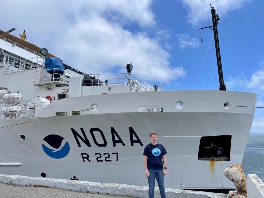
On July 4 I arrived to pier 30/32 in San Francisco, CA to board NOAA Ship Bell M. Shimada. Although I grew up volunteering on the 441’ WWII Liberty Ship SS John W. Brown in Baltimore, MD, seeing a new ship still resulted in a mix of emotions, nervousness, adrenaline, excitement, and everything in between. After five and a half years, finally seeing the 208’ vessel that would become my home for the next two weeks was a core memory and feeling I will always remember.
NOAA Ship Bell M. Shimada docked at Pier 30/32 in San Francisco, CA on July 4
Once onboard, I met Chief Scientist Steve de Blois and Wet Lab Lead Ethan Beyer. I was given a tour of the acoustic, chem, and wet labs and shown to my cabin. After dinner ashore, I joined some of the crew on the flying bridge to watch the July 4th fireworks. I met additional science team members and enjoyed a long night’s rest.
In the morning on July 5, we had a welcome aboard meeting, various trainings, a safety meeting and orientation, fire and abandon ship drills, and a science team meeting. We introduced ourselves, took an official team photo, and soon departed pier 30/32 for our 14 day mission. After passing under the Golden Gate Bridge and heading to the Pacific Ocean, our cold hands were warmed by a wonderful hot dinner of chicken, steak, fresh veggies, salad, and desserts from our galley crew. After dinner, we settled in for our first night at sea, waiting with anticipation for our first trawl on July 6.
Last morning on land: July 5 at Pier 30/32 in San Francisco, CA!Just after taking in lines and leaving Pier 30/32 on July 5Science Team! Back: Maddie, Ethan, Toby, Jamie, Beth Front: Myself, Steve, AbiSan Francisco, CA SkylineHeading out to the open sea of the Pacific Ocean
– – ⚓ – –
Did You Know?
– Hake can be cannibalistic! – Some larger Hake we have collected have had a smaller Hake in their mouth, throat, or stomach! – Their very sharp teeth often stick to our thick rubber gloves.
– – ⚓ – –
New Terms/Phrases:
“Salp: Barrel-shaped, planktonic tunicate in the family Salpidae. It moves by contracting, thereby pumping water through its gelatinous body.”
“Myctophid: Lanternfish (or myctophids, from the Greek μυκτήρ myktḗr, “nose” and ophis, “serpent”) are small mesopelagic fish (…) Lanternfishes are aptly named after their conspicuous use of bioluminescence.”
Simrad EK80: Multibeam Echo Sounder (MBES) transducer that emits sound waves from the hull of the vessel down to the sea floor. It allows scientists to observe and study returned sound wave signals that may suggest marine life is present.
Transect: Set and numbered longitudinal east-west lines NOAA Ship Bell M. Shimada navigates on while collecting acoustic data.
Mission: Fisheries: Pacific Hake Survey (More info here)
Geographic Region: Pacific Ocean, off the coast of California
Date: July 3, 2023
Introduction and Background
Hello! My name is Lisa Carlson and I am an elementary school teacher in Virginia Beach, Virginia. I have taught third, fourth, and fifth grade general education with Special Education and English as a Second Language (ESL) inclusion. This coming fall I will be a second grade teacher, continuing with ESL inclusion! Although I was surprised to move down from fourth grade, I try to maintain the belief that everything happens for a reason, and the only constant in life is change.
For example, if I not missed out on previous opportunities to join NOAA as a Teacher at Sea due to the pandemic, a short career change, and other extenuating circumstances; I wouldn’t be writing this blog from a hotel room in San Francisco, California, anticipating boarding and seeing July 4th fireworks from the deck tomorrow.
– – ⚓ – –
My introduction to NOAA’s Teacher at Sea program began in the fall of 2017. After student teaching in the fall/winter of 2016 in a third grade class, and permanent subbing in a fifth grade in the winter/spring of 2017, I accepted a position for my own third grade classroom.
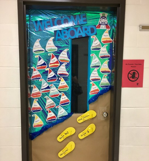
My classroom came together with a nautical theme, shades of blues and calm colors, nautical paintings by my Mom, lots of cleaning and moving by my Dad, sailboat name tags on the door, and our own 3D sailboat in my class library. It soon got around that my room was one to go see!
Door decorations for my first third grade classroom!
Classroom decor: life ring painting, handmade pilings, fish and life ring pillows, sea creature lights, and 3D sailboat
Our Technology Integration Specialist, a NOAA Teacher at Sea Alumnus, visited my room and explained the program to me. The application was due on my birthday, less than a month from when I learned about the opportunity.
– – ⚓ – –
So, I applied in November 2017, 2018, and 2019. One year I just wasn’t selected, one year administrative input was not turned in on time, and other hiccups along the way. Then, my 2019 application was accepted, and I was over the moon in January 2020 to learn that I was a finalist. Of course, we all know what happened that March; and the 2020 and subsequent 2021 sailing seasons were canceled. Slowly, a few teachers were able to sail in the summer of 2022, and I was able to read their blogs from afar with the belief of everything happening for a reason.
“For three decades, the Teacher at Sea program has helped teachers participate in annual NOAA research surveys conducted by our scientists. Teachers from around the country embark on a two to three week expedition at sea. They gain invaluable on-the-job experience and communicate their journey through a series of blogs and lesson plans.”
I am so excited for this opportunity and experience after five and a half years of anticipation. So follow along, wish us fair winds and following seas, and as many schools of Pacific Hake as possible to sample from and research!
– From my king sized bed hotel room, and last night ashore:
Temporarily reassigned teacher, and sailor at heart.