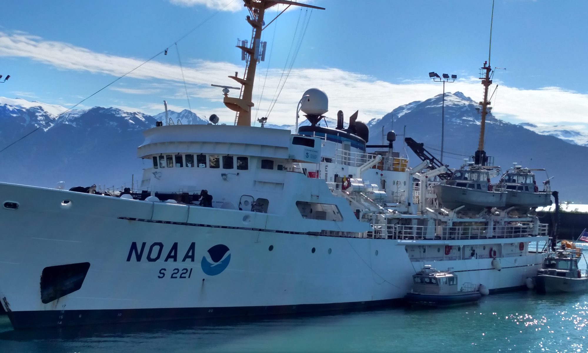
Anne Marie Wotkyns, July 8, 2010

NOAA Teacher at Sea
Anne Marie Wotkyns
Onboard NOAA Ship Pisces
July 7-13, 2010

NOAA Teacher at Sea: Anne Marie Wotkyns
NOAA Ship Pisces
Mission: Reef Fish Survey
Geographic Area: Gulf of Mexico
Date: Thursday, July 8, 2010

Weather Data from the Bridge

Wind: 7-9 mph
Other Weather Features:
Sunny, scattered light clouds
Waves 1’; Swells 3-4’
Location: 28.37.2 N
089.33 W

Science and Technology Log

Hello, my name is Anne Marie Wotkyns and I am participating in the NOAA Teacher at Sea program. I teach 4th grade at J.B. Monlux Magnet School in North Hollywood, California. I joined the NOAA ship Pisces on the evening of July 6 to begin a 6 day cruise in the Gulf of Mexico. I will be posting logs to share the information I learn and the experience of working aboard a scientific research vessel. We will be working on the SEAMAP Reef Fish Survey of Offshore Banks, a project which provides information about the relative abundance of fish species associated with geographic features such as banks and ledges on the continental shelf of the Gulf of Mexico. I’ll be explaining this project more in my next log entry.

Me in front of the Pisces

After meeting the other Teacher at Sea, Liz Warren and bird expert Scott Mills, at the Gulfport Mississippi Airport, we were driven to the NOAA docks in Pascagoula, Mississippi. It was quite late when we boarded the Pisces, so we found the cabin Liz and I would share, explored the ship a bit, and turned in for the night.

Wednesday, July 7 found us eager to get started on our TAS adventure. We started the day at the NOAA office and lab building, adjacent to the ship docks. There we met Kevin Rademacher, Chief Scientist for the SEAMAP (Southeast Area Monitoring and Assessment Program) offshore reef fish survey which we will be participating in on our cruise. He showed us around the NOAA facilities, which house the Southeast Marine Fisheries Offices, Seafood Inspection, and Documentation Approval and Supply Services. The fisheries division deals with resources surveys, harvesting, and engineering related to commercial fishing. The seafood inspection division deals with issues related to seafood safety and chemical and microbiological analysis of seafood. These labs can help determine if the “red snapper” your favorite restaurant serves is really red snapper or a different type of fish! This division will also be testing some of the fish we collect on our cruise for baseline data on fish from areas outside the oil spill for possible later comparison to fish collected within the spill zone.

Me in Front of the Southwest Fisheries Building

Now a little more about the Pisces, my home away from home for the next 6 days. The Pisces was commissioned in 2009 and is one of NOAA’s newest ships. She is 63.8 meters (209 feet) long, 15 meters (49.2 feet) wide, and has a draft of 6 meters (19.4 feet.) Her cruising speed is 14.5 knots and she can stay out to sea for 40 days if necessary. On this cruise there are 22 crew comprised of a commanding officer, deck officers, engineering officers, deck hands, engineers, stewards, and survey and electronic technicians. There are 6 on our science team and 2 bird observers conducting surveys of pelagic seabirds possibly affected by the oil spill.

NOAA Ship Pisces
NOAA Ship Pisces

After we set sail on Tuesday afternoon, we spent much of the late afternoon up on the flying bridge, the highest deck on the ship. We observed a wide variety of boats and ships in the channels around Pascagoula Bay. Scott and Ron, the bird observers, helped us identify the bird species we saw, including Brown Pelicans, Laughing Gulls, and Sandwich Terns. We also saw several Atlantic Bottlenose Dolphin swimming near the ship. Soon the seas grew rougher and after dinner and a short welcome meeting, we retired to our cabins for the night.

Wednesday morning brought calmer seas, and the start of “science “ on board the Pisces. Before we reached the areas selected for the SEAMAP fish surveys, Chief Scientist Kevin Rademacher wanted to conduct bathymetric mapping of an area called Sackett Bank, off the coast of Lousiana. This involves sailing the ship in a series of overlapping transects 1.6 miles long, .05 miles apart, similar to “mowing your lawn” at home. The ME70 multibeam acoustic system covers a swath of 120 degrees using 27 beams which can detect and map features on the sea floor down to .5 meters in size. This will allow NOAA to produce highly accurate nautical charts of the region. The charts will eventually be available to commercial and sport fishermen, sailors, shipping companies, and anyone else who is interested.

Mapping Sackett Bank

When a ship is conducting activities like this bathymetric mapping or other “Restricted Mobility and Manuevers” work, they hoist a nylon “Ball-Diamond-Ball” to notify other ships in the area that it is restricted in its movement so the other ships can change their course. This message is also sent electronically by VHF radio signal. I happened to be on the bridge while they prepared to start the first transect, so Commanding Officer (CO) Jeremy Adams let me hoist the ball-diamond-ball.

Hoisting the ball-diamond-ball
Ball-diamond-ball

    Hoisting the ball-diamond-ball
Hoisting the ball-diamond-ball

Transect Lines
Transect Lines

In this photo, the green boat indicates the position of the Pisces as we conduct the mapping transects.

Tomorrow the plans are to begin the SEAMAP reef fish surveys, “one hour after sunrise” – looks like we’ll be working from about 7 am to 7 pm with the fish! Bring it on!!

Personal Log

After submitting Teacher at Sea applications for 3 years (the first 2 years I was not selected) I am thrilled to be here! The opportunity to participate in a cruise like this on such an amazing ship is truly a once in a lifetime experience!

Here are a few more pictures of life aboard the Pisces.

Stateroom
Stateroom

Desk
Desk

Galley
Galley

Our cabin is a little small, but very clean and functional. Liz volunteered to take the top bunk, so I have the bottom. I love the little curtains that can enclose the bunk – makes a dark little “cave” for me! And the reading lamp lets me read late at night! We have a flatscreen TV, but so far we have only been able to watch the USA network – one channel only. But we don’t spend much time in the cabin anyway. The bathroom is very similar to a cruise ship bathroom, and the shower has great water pressure – however the ship is under water conservation so showers need to be quick. Notice we’re eating on paper plates with plastic utensils. No dishwashing either! After the ship moves farther from the oil spill they will able to use their salt water to fresh water conversion process and we’ll be able to use water more freely.

Pascy chooses his dinner in the “mess” – sorry – no fish!

In Pascagoula I purchased a small stuffed penguin and named him “Pascy” (for Pasacagoula.) Pascy has been exploring the Pisces so here are some shots of him around the ship!

Pascy helps check off each transect in the acoustics lab.
A little coffee is always good in the morning.
The cookies here are great!

Another big event today was the fire drill and abandon ship drill. We were assigned “muster stations”, places we would go to in event of an emergency. Part of the drill was to practice donning our “survival suits” – one piece insulated buoyant suits that would keep us afloat and warm if we ever had to abandon ship. The hardest part of the drill was getting the awkward suit on and off – they seem to be one-size-fits all and I seem to be smaller than most sailors!

Even Pascy got to participate in the drill! I don’t think he need to worry about staying afloat or warm in the water! Good thing, because that lifejacket looks a little big!

Immersion suit
Immersion suit

Me in my Gumby Suit
Me in my Gumby Suit

Elizabeth Warren, July 7-8, 2010

NOAA Teacher At Sea: Elizabeth Warren
Aboard NOAA Ship Pisces

Mission: Reef Fish Surveys
Geographical Area of Cruise: Gulf of Mexico
Date: July, 15 2010

Here we goooo……

Weather Data from the Bridge:
Temperature: Dry Bulb 30̊℃, Wet Bulb 26.2 ℃
Wind: 7-9 mph
Swell: 3-4 feet
Location: 28 37.12° N, 89.33° W
Weather: Sunny, Humid, Scattered clouds

Science/Technology Log

Me in Front of the Southwest Fisheries Building
Yesterday, Anne-Marie and I were given a tour of the NOAA facilities in Pascagoula. In the new building they house several different divisions; Southeast Marine Fisheries Unit, Seafood Inspection and Documentation and Approval Center. Kevin Rademacher our Chief Scientist showed us around. The labs in the Marine Fisheries unit take what is being done on the vessels and use it for research. They run many different types of research on the ships. Beside the Pisces, there are two other ships that are run out of Pascagoula; Oregon II,  and The Gordan Gunter.
Seafood Inspection Lab

On one of the floors were the Seafood Inspection labs. They bring in fish from different areas and test it. In one lab they had a set of partitions up which were the tasting areas. An example of what they have done in the past that Kevin gave us was a restaurant bought some red snapper. They brought it to the lab where they cooked in clear Pyrex containers then they smelled, checked the consistency, and tasted the fish. They discovered that the fish was not really snapper! Right now due to the oil spill they are mainly focusing on the fish that we bring in on our survey. We are required to save 10 fish out of every trap we bring up so that they can have a baseline testing of fish from an area before being it has been impacted by the oil spill.

Another floor of the building is the science labs. We walked through the plankton lab, where each person had their own station with a computer and a high powered microscope. They had several different samples out that were labeled. Just like our trip in the 6th grade they used  nets with different size holes to catch different types of plankton. Another lab was called the Age and Growth lab. Here is a picture of shark vertebrae they were preparing for aging.

Plankton lab
Plankton lab

Today we are not working on the Reef Fish survey. Our Chief Scientist Kevin Radechamer wanted to do some mapping of an area called Sackett Bank which is south of Louisiana. The mapping they had done before did not give them an accurate depiction of the sea floor and now they have new technology. They are using an acoustic system called ME70. This system has 27 beams that run in a 120 degree swath. With the technology they had before they were only able to see 1 meter “bumps” on the surface now they can see to within a ½ meter. The white line that you can barely see shows the surface of the seafloor. The red is sand or mud that is on the bottom, as the red gets thinner and darker it is showing the harder rock that is below. As the sound waves go down they bounce back and we are able to see any see critters that are down there. Most of what you can see in the picture is plankton but occasionally you can see fish as well. This is a before and after shot of the two types of mapping. In one the map technology was guessing what was in between the bands. This information will give scientists new information about the seafloor.

Mapping Sacket Bank
Mapping Sackett Bank
    Mapping Sackett Bank
Mapping Sackett Bank

Personal Log:

Sailing Board
Sailing Board

I’m finally here! The last two days were very exciting. When we got to the ship it was 7:00ish and most of the ship’s crew were out and about, so we had the ship to ourselves. We wandered around taking pictures and investigating. I only went on an “adventure” (lost my way) twice. Everywhere you turn there is a doorway, hatch or stairwell. I was awed by the amount of technology that they have on board. There are computer labs on almost every floor. I am envious of the color printer! Ann Marie and I are sharing a state room. It’s fantastic! The crew takes pride in what they do and it is very obvious, our beds even had mints on them. We have a T.V. and an internet connection in our room. I don’t plan on spending a lot of time in there but it is pretty fabulous!

My Stateroom
My Stateroom

We left port yesterday and headed south. The scientists and teachers stayed on the fly deck as we moved closer to the Gulf. As we were leaving you could see what impact the oil spill has had on the Mississippi Coast and on the Barrier Islands.

Impact of Deepwater Horizon

As a result of the tropical storm over the weekend there were some pretty high swells. We had waves from 6 to 8 ft. The ship was rocking pretty badly. After our Safety Meeting where we were told about all of the safety precautions and the rules. No matter where you go there are rules. Including.. No wearing tank tops to the galley and NO sitting in the captains chair.  After the safety meeting the rolling was beginning to get to us so Anne Marie and I took to our bunks. I didn’t get sick! I did however go to sleep at 7:30.

Today we have spent most of the day wandering around the ship and talking to the many different crew members on board. Oh.. and we had a fire drill. The fire drill was a lot like having one at school, the bell rang we walked to our area and then we sat for awhile. The next drill was much more exciting. We had an Abandon Ship Drill! We had to grab a long sleeve t-shirt, a hat, pants, our Gumby suit, and a life jacket. It was a lot of stuff to carry with us! Everyone met out on the deck and I was introduced to Chief Marine Engineer Garrett who would be in charge of getting me where I needed to be in an emergency. As a first timer I was required to get into my Gumby suit. Yes, for those of you old enough to remember they are named after Gumby and Pokey. This would definitely not be my choice of a fashionable outfit. To get into it you have to lay the suit down on the ground and climb in like a sleeping bag. Then you zip it up!

In my gumby suit
In my gumby suit

Everywhere you look in the Gulf you see oil rigs or tankers moving away or to an oil rig. We passed the disaster site this morning but we were 9 miles away so we did not see any oil or much of anything. In fact I haven’t seen oil yet, which is a good thing. The interesting thing that has come about for our trip as a result of the spill is the two bird experts, Scott and Ron. The birders were hired to look for pelagic birds, those that spend most of their lives at sea. Fish and Wildlife hired one, and the other is here for BP. They are looking to see if any pelagic birds have oil on them or if they find any dead birds. So far, in the four hour s they watched this morning they saw 11 birds. Listening to them talk has been fascinating!

Sunset
Sunset

This was the sunset tonight. I’m heading in with tea in hand to try and upload the rest of my pictures. I’m ready for tomorrow! Kevin said we will start a half hour after sunrise so I’ll be up bright and early! Let’s do it! Bring on the giant fish and things for me to get dirty with!

Laura Rodriguez, May 24th, 2010

NOAA Teacher at Sea
Laura Rodriguez
Aboard NOAA Ship Oscar Dyson
May 24 – June 2, 2012

Mission: Fisheries Surveys
Geographical Area: Eastern Bering Sea
Date: May 24, 2010

Pollock Survey Begins

Robert and Kerri deploy the CTD
Deploying the Bongo nets
The bongo nets are almost in
Retrieving the bongo nets, full of algae and hopefully full of Pollock Larvae

On Saturday, my watch began at 10:00 AM. Two of the scientists, Annette Dougherty and Kevin Bailey have watch from 4 AM until 4 PM. The other two scientists, Tiffany Vance and Steve Porter, have watch from 4 PM until 4 AM. I guess being the teacher they took pity on me and gave me half and half. Before getting to one of the stations, the scientists make sure that everything is ready. They lay out the bongo nets on the deck where they will be used. The bongo nets are two nets that from the top look like bongo drums. (See picture) There is an instrument attached to the bongo nets called a SEACAT that takes conductivity, temperature and salinity measurements during the tow. Inside the lab, buckets, bowls and tweezers are all laid out ready to be used.

As we approach each station, the bridge informs the scientists and survey technicians. The bongo nets have already been readied and are set to be deployed (put into the ocean) from the hero platform. When the OK is given, the nets are lifted by the hydrowinch to a point where they can be maneuvered over the rail and then they are lowered into the water. The nets are lowered until they are at 100 meters or 10 meters off the bottom. As they are lowered, the pilot of the boat keeps the wire at a 45° angle by moving the boat slowly forward. Once the nets reach their maximum depth, they are slowly brought back up again.  ( I tried to upload a video showing the deployment and retrieval of the bongo, but it won’t work so I’ll show you the video when I get back.

Pollock larvae under the microscope

When the nets clear the water, they are hosed down to get any organisms into the bottle on the end of the net (called the cod end.) The cod end is then removed and the contents of one net are poured into a bucket for sorting. The contents of the other net are preserved and sent to a lab in Poland where they use instruments to get a very accurate count of the Pollock.

Annette Dougherty and Kevin Bailey in the chem Lab

Inside the chem lab, the contents of the bucket are scooped out and poured little by little into a mixing bowl. We then perform a rough count by removing the very small Pollock larvae and any other fish larvae and put them into a petri dish with cold water (the petri dish is placed on top of ice.) They are only a few mm long (averaging between 6-10mm.) Once we have gone through the entire contents, the Pollock larvae are counted, photographed and the length measured. They are then placed into a labeled vial with 95% ethanol. The other fish larvae are placed in a separate vial in 100% ethanol. They are kept in case another scientific team needs the data. The Pollock larvae will be sent to the scientists’ lab back in Seattle where they will perform further analysis on them. I’ll tell you more about that in the next blog.


Answers to your questions:

Annalise – The ship travels at 12 knots when we are going between stations.

Abandon Ship drill – You need to know how to put on your survival suit

Matt T– The ship is very safe. Drills are conducted every week. My first day on the ship, we had a fire drill and abandon ship drill. (See photo of me in my survival suit.)

Dan – The Oscar Dyson observes and records a number of environmental conditions. The bridge takes weather readings every hour and keeps them in a weather log. These include wind direction, wind speed, seawater temperature, air temperature, air pressure, cloud cover, sea swell height and direction. Conditions in the water are also constantly monitored such as temperature, conductivity, salinity, and amount of oxygen.

Olivia – The bongo tow is one way to get fish eggs. The mesh used on the bongo nets is very fine). It is able to filter out these very small larval fish and fish eggs, too.

Brittany – There is no specific number of fish that need to be caught for this experiment. Part of the experiment is to see how many larval fish there are. For our rough count, the scientists measure 20 larvae to get an estimate of their size. They will then look at the otoliths (small inner ear bones) to estimate their age.

Euphausid – Krill
Copepod

Amy – Aside from the Pollock larvae in the nets, we have caught cod larvae, larval squid, fish eggs, amphipods, terapods, jellies, Euphausids or krill, copepods and the larvae of other fish. The nets are small enough that we don’t catch any large fish or other animals.

Josh W. and Jon – Joel Kellogg has the night shift, so I haven’t met him yet. Stephen Macri is not on this cruise so I can’t ask him your questions.


Questions for today

In your answers to the last blog, many of you researched the large animals that live here in the Gulf of Alaska. The most abundant organisms, however, are much smaller. Two organisms that are very important to the survival of the large animals here are copepods and Euphausids. The larval Pollock feed on the larval copepods that are called copepodites.

Find out what other animals feed on copepods and euphausids. Then, describe at least one food chain that includes copepods and one that includes krill. In your food chain start with a producer or autotroph Ex. Algae) and end with the highest level of consumer or predator (Ex. blue Whale)


Again, Please be sure to include the link to the website where you got your information.  Answer the questions in your own words writing complete sentences with as much detail as you can.

David Altizio, May 17-18, 2010

NOAA Teacher at Sea
David Altizio
Onboard NOAA Ship Fairweather
May 17 – May 27, 2010

NOAA ship Fairweather
Mission: Hydrographic survey

Geographical Area of Cruise: SE Alaska, from Petersburg, AK to Seattle, WA
Dates: Monday, May 17 and Tuesday, May 18

Weather Data from the Bridge

Position: Petersburg to Ketchikan
Time: 0800 on 5/18
Latitude: 550 18.4’ N
Longitude: 1310 29.1’ W
Clouds: Overcast
Visibility: 10 miles
Winds: 10 knots from the NE Waves: Less than one foot
Dry Bulb Temperature: 13.50C
Wet Bulb Temperature: 13.00C
Barometric Pressure: 1004.0 mb
Tides (in feet):
High @ 0358 of 15.8
Low @ 1038 of ‐1.5
High @ 1711 of 13.6
Low @ 2246 of 3.9

View out the window of the plane to Petersburg of a meandering river
View out the window of the plane to Petersburg
View out the window of the plane to Petersburg of a
meandering river

Science and Technology Log

The main purpose of the Fairweather is to conduct hydrographic surveys which measure the depth and bottom configuration along SE Alaska. This work assists in the production of nautical charts and ensures safe navigation in the U.S. The surveys also identify sea‐floor materials, dredging areas, cables, pipelines, wrecks and obstructions. The Fairweather supports a variety of activities such as port and harbor maintenance (dredging), coastal engineering (beach erosion and replenishment studies), coastal zone management, and offshore resource development. Hydrographic surveys are conducted primarily by using side scan and multibeam sonar. SONAR (Sound Navigation and Ranging) uses sound waves to find and identify objects in the water and determine water depth.
Side scan sonar is most useful to locate sea‐floor features and possible obstructions, but does not provide depth information. While multi‐beam sonar systems emit sound waves directly beneath the ship’s hull to produce fan‐shaped coverage of the sea floor. These systems measure and record the time elapsed between the emission of the signal to the sea floor or object and back again. Multi‐beam sonar produces a “swath” of soundings (i.e., depths) to ensure full coverage of an area.
Safety is hugely important while out at sea. Today we performed two safety drills, a fire/emergency situation, and an abandon ship drill. During the first drill I reported to the mess hall (dining area), and a fire was supposedly going in the paint room. When more help was needed I and one of the engineers scurried to the bow (front) of the ship and climbed down a hatch to help determine if the “fire” was spreading. Moments after that we tested two of the ship’s fire hoses, which definitely work. A little while later another alarm sounded signaling an abandon ship drill. For this I needed to go to my room and get my survival suit, and life vest, and then reported to my life raft. Practicing these drills is vital to life at sea. The officers of the Fairweather also become firefighters and we all need to communicate and work together to ensure everyone’s safety.

Here I am operating one of the ship’s fire hoses

Personal Log

Let me start off by saying that I feel like I have won a science teacher lottery. I feel so lucky and privileged to be able to represent New Rochelle High School, and be part of a science research cruise. My first two days in SE Alaska have been absolutely amazing. I flew from New York to Seattle, and then on to Anchorage, AK. I spent one night there and then in the morning flew to Petersburg, with a brief stop at the Juneau airport. Once on the ground in Petersburg I was met and picked up by the Executive Officer (XO) and a Junior Officer (JO). Within two minutes of being on the ground I was asked if I would like to play softball. I told him I could be considered “a ringer”.

Me in my survival (Gumby) suit

The setting was truly surreal. There were snow capped mountains in all directions, and I spotted my first bald eagle of my trip. We played 7 innings on a gravel ballfield; with members of both the Fairweather and its sister ship The Rainier, which is being serviced currently. I smacked the ball around pretty good and almost made a sliding catch in the outfield. Once the game was over (we lost), I went to dinner with some of the ships officers. After a long night in town, I finally made it to the Fairweather. We spent most of Monday at the dock, waiting for the tide to come up. The first stretch of the journey is a place called Wrangell Narrows. As the name implies it is a very narrow stretch of water and it is best for a ship the size of the Fairweather to pass at high tide. The first few hours of the trip were absolutely beautiful. From the time on the ship until now I must have seen over a dozen bald eagles, almost too many to count. From there we entered Sumner Strait, and then went through Snow Pass and into Clarence Strait. Next, after dark (the sun does not set until 9 p.m., and it is not dark until an hour or so after that), we cruised through Nicholls Passage and in the morning through Tongass Narrows and into the port of Ketchikan.

Dinner the first night was delicious; I had roasted eggplant ragout over polenta, with roasted broccoli on the side. Yum. I have heard people onboard say that the Fairweather has the best food in the NOAA fleet and I already agree. After a long nights sleep, our first day of work started. At 0800 there was a safety briefing on the stern (back) of the ship. The two survey teams were launched from the ship. Those who stayed onboard went into Ketchikan to get almost 30,000 gallons of marine diesel fuel. For dinner the second night I had Halibut with a curried corn sauce, mushroom risotto, and snap peas. Again it was great. In my next log I will show you some of the ships facilities.

Here I am hitting a double to right centerfield, in a losing effort

Animals Seen Today

Bald Eagles – so many I lost count, at least a dozen
A few people said that bald eagles in Alaska are as common as pigeons in New York. A few seals while in Petersburg
Many other birds while out at sea

Karen Matsumoto, April 27, 2010

NOAA Teacher at Sea: Karen Matsumoto
Onboard NOAA Ship Oscar Elton Sette
April 19 – May 4, 2010

NOAA Ship: Oscar Elton Sette
Mission: Transit/Acoustic Cetacean Survey
Geographical Area: North Pacific Ocean; transit from Guam to Oahu, Hawaii, including Wake Is.
Date: Friday, April 27, 2010

Science and Technology Log

In addition to the deployment of the acoustic sonobouys and monitoring of the towed hydrophone array, we also do “XBT” drops three times a day, at sunrise, noon, and sunset. The Expendable Bathythermograph (XBT) has been used by oceanographers for many years to obtain information on the temperature structure of the ocean. The XBTs deployed by the Sette research team measures temperature to a depth of 1000 meters.

The XBT is a probe which is dropped from a moving ship and measures the temperature as it falls through the water. Two thin copper wires transmit the temperature data to the ship where it is recorded for later analysis. The probe is designed to fall at a known rate, so that the depth of the probe can be inferred from the time since it was launched. By plotting temperature as a function of depth, the scientists can get a picture of the temperature profile of the water. It is amazing to think that over 1000 meters of thin copper wire is packed into that small tube! When I first launched an XBT, I was expecting to shoot it off like a rifle, but it actually just falls out of the unit by gravity. I was relieved that I didn’t experience “kick-back” from the probe unit when I pulled the lynch pin!

Chief Scientist Marie Hill preparing to launch the XBT unit.
XBT deployed and falling to a depth of 1000 feet.
Marie cutting the copper wire ending the connection to the probe and computer.

Bellow: Temperature and depth information is sent to the computer from the probe attached to the XBT unit by thin copper wires. The wires are cut when the unit reaches a depth of 1,000 meters, and the unit falls to the ocean floor. The researchers on the Sette use XBTs to obtain information on the temperature structure of the ocean, as seen on the computer screen at bellow.

We are continuing to conduct visual observations on the “Flying Bridge.” I had a chance to take a shift on the “Big Eyes” which are 25 x 150 magnification binoculars. The person at each of the Big Eye stations does a slow 90 degree sweep toward the bow and then back again, searching the ocean from horizon to ship to spot whales. I have a renewed appreciation for the skill it takes to use binoculars, especially one that weighs over 40 pounds! I had to use stacked rubber mats to be able to reach the Big Eyes at its lowest height setting, and even then it was a struggle to keep them steady every time we hit a wave! I think the Big Eyes were designed by the same people that made the huge Norwegian survival suits!

Karen on the “Big Eyes.”

Personal Log

The more I learn about sperm whales, the more I want to see one! I heard sperm whale clicks this morning, which was super exciting. John Henderson, a member of our science team sent me a cool website that shows an MRI of a juvenile sperm whale. I’ve included it below. Sperm whales are still on my wish list for whale sightings on this trip!

QuickTime™ and a decompressorare needed to see this picture.

MRI Image of a juvenile sperm whale. © 1999 Ted W. Cranford.
See website at: http://www.spermwhale.org/SpermWhale/spermwhaleorgV1.html

Question of the Day: How do sperm whales make their vocalizations? Sperm whale clicks are produced when air is passed between chambers in the animals’ nasal passages, making a sound that is reflected off the front of the skull and focused through the oil-filled nose. It has been suggested that powerful echolocation clicks made by sperm whales may stun their prey. Recent studies have shown that these sounds are among the loudest sounds made under water by animals (they can travel up to six miles despite being fairly high frequency).

Sperm whale clicks are heard most frequently when the animals are diving and foraging. These sounds may be echolocation (“sonar”) sounds used to find their prey, calls to coordinate movement between individuals, or both. Clicks are heard most frequently when the animals are in groups, while individual sperm whales are generally silent when alone. Most of the sounds that sperm whales make are clicks ranging from less than 100 Hz to 30 kHz

New Term/Phrase/Word of the Day: Expendable Bathythermograph or the XBT was developed in the 1960s by former The Sippican Corporation, today Lockheed Martin Sippican. Over 5 million XBT’s have been manufactured since its invention. The XBT is used by the Navy and oceanographic scientists to provide an ocean temperature versus depth profile. Some XBTs can be launched from aircraft or submarines, and have been used for anti-submarine warfare. How many XBTs do you think are on the bottom of the ocean?

Something to Think About:

“Thar she blows!” was the cry of the whaler!

Whale researchers can identify many whales by their “blows,” when the whale comes to the surface to breathe. Observers look for the direction and shape of the blow. For example, sperm whale blows are almost always directed at a low angle to the left, as their single nostril is located on the left side.

Grey whales, on the other hand, have two blowholes on the top of their head, and have very low heart-shaped or V-shaped blows, with the spray falling inwards. What do you think are you seeing when you see whale blows?

Animals Seen Today:

• Flying fish

Did you know?

Cetaceans evolved from land mammals in the even-toed ungulates group. The hippopotamus is most likely their closest living relative!

Picture of the Day

Abandon ship drill on the Sette!