Cathrine Prenot: How a Fool Bird Regained its Footing. August 11, 2016

NOAA Teacher at Sea
Cathrine Prenot
Aboard Bell M. Shimada
July 17-July 30, 2016

Mission: 2016 California Current Ecosystem: Investigations of hake survey methods, life history, and associated ecosystem

Geographical area of cruise: Pacific Coast from Newport, OR to Seattle, WA

Date: August 11, 2016

Weather Data from the Bridge: N/A

Science and Technology Log

Marine Mammal Excluder Net on the Bell M. Shimada.

Unreeling the nets behind the ship and trawling is the equivalent of ringing a dinner bell at sea. We may not even be in sight of land, but as soon as the fishermen begin to unroll the huge nets, birds begin descending from the skies, appearing in the distance, and gliding on their wings over the waves.

Black Footed Albatross. Photo By Kathryn Willingham

The birds are arriving in hopes of getting a part of the catch or the bycatch. They will patiently wait until fish that have been measured and weighed are tossed overboard, and were particularly fond of Walleye Pollock liver from the Oscar Dyson. Sometimes marine mammals like Pacific White Sided Dolphins will also show up, but all fishing operations stop when they are in the waters around the ship—we don’t want to encourage them to associate nets with dinner.

White Sided Pacific Dolphins. Photo By Kathryn Willingham
Pacific White Sided Dolphins. Photo By Kathryn Willingham

Some of my favorite birds to watch are the albatross. They are enormous, with a six foot wingspan and feet wide enough to surf in the wake of the ship before splashing down. All of the albatross I saw were Black Footed, but one of the scientists on the ship, Ryan Shama from the West Coast Groundfish Observer Program, told me to keep an eye out for birds that looked like a black footed albatross but with a bright bubble gum pink bill. These were the “vulnerable” Short Tailed Albatross, and there were only about 4,750 in the world—up from 25 individuals in 1954.

Black Footed Albatross. Photo By Kathryn Willingham

I got pretty excited a few times, but evidently their bills are REALLY pink, not just pink-ish.

Short tailed albatross populations are rebounding after a pretty devastating 200 years. They were collected for food, but their numbers really declined through feather hunting, which was fueled by a ladies’ fashion craze.

Photo from here.
Photo from here.
Photo from here.

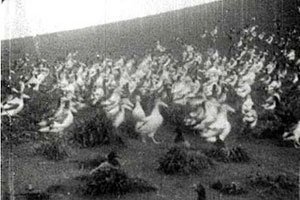
To give you an idea of the scale of this craze, below is the full bird count from two afternoon walks in 1886 through the streets of NYC by Frank Chapman, an Ornithologist at the American Museum of Natural History:

“Robin, four. Brown thrush, one. Bluebird, three. Blackburnion warbler, one. Blackpoll warbler, three. Wilson’s black-capped flycatcher, three. Scarlet tanager, three. White-bellied swallow, one. Bohemian waxwing, one. Waxwing, twenty-three. Great northern shrike, one. Pine grosbeak, one. Snow bunting, fifteen. Tree sparrow, two. White-throated sparrow, one. Bobolink, one. Meadow lurk, two. Baltimore oriole, nine. Purple grackle, five. Bluejay, five. Swallow-tailed flycatcher, one. Kingbird, one. Kingfisher, one. Pileated woodpecker, one. Red-headed woodpecker, two. Golden-winged woodpecker, twenty-one. Acadian owl, one. Carolina dove, one. Pinnated grouse, one. Ruffed grouse, two. victorian hatQuail, sixteen. Helmet quail, two. Sanderling, five Big yellowlegs, one. Green heron, one. Virginia rail one. Laughing gull, one. Common tern, twenty-one. Black tern. one. Grebe, seven.” (from here )

All of these birds were on women’s hats. Of the 700 hats he counted, 543 were decorated with feathers.

And then let’s start looking at the specifics of the decimation of the albatross population:

“From the mid-19th to the early 20th century it was highly fashionable to wear extravagant hats decorated with feathers, wings and even whole birds. In 1875, the magazine Harper’s Bazaar described one such hat: “The entire bird is used, and is mounted on wires and springs that permit the head and wings to be moved about in the most natural manner.” The demand for feathered headwear was enormous. By 1886 more than five million birds were harvested annually for the millinery trade in North America. Large albatross feathers were popular, and hunters harvested hundreds of tons of feathers annually—first from Japanese islands and then from Northwestern Hawaiian islands where albatrosses breed. In 1904 Japanese hunters killed 285,000 albatrosses on Lisianski Island in six months, then another 70,000 albatrosses on Laysan Island that same year—just for feathers. All over the world many species of birds were hunted for their plumage, to near extinction.”  (from here)

The Short Tailed Albatross nested almost exclusively on one island in Japan, and “feather hunters” killed an estimated 5 million birds over many years. The birds wouldn’t move as the feather hunters moved among them, clubbing them to death, giving them the name “Ahodori” in Japanese, which means “fool bird.”

From here. The site is also a good read.
From here.

But you can read all about it in Adventures in a Blue World: “The Fool Regains its Footing.”

Adventures in a Blue World: The Fool Regains its Footing. CNP

Personal Log

The scenery on the last day at sea was pretty wonderful. The Strait of Juan de Fuca is absolutely gorgeous, and although we traveled a lot of it under the cover of darkness, I went up on the flying bridge at dusk and loved watching huge container ships in the channel next to us. After being on the largest ship for two weeks—with smaller fishing vessels keeping about a mile or more radius and having the ocean be the whole world around you, it was somewhat comforting to see land on either side and ships many times more massive than us cruising calmly by. Once day broke, we got to see constant ferry traffic between the islands around Seattle, and tons of small boats scurrying around us like ants.

As you might note from the dates, I am no longer out at sea. We pulled into the port of Seattle on August 30, and I made a beeline to the airport thanks to some of the scientists, and got home in time to start work the next day.   I am SO very thankful for the crew, Corps, and scientists from the Shimada for making me feel so welcome and including me in all of their work. I have a few more cartoons to go, so will continue to blog, but I won’t be able to report to you in as much detail all of the “freedom of the seas” that I was granted on the Shimada.

It's a tough life, being a Teacher at Sea!
It’s a tough life, being a Teacher at Sea!

 Did You Know?

Pacific White Sided Dolphins are extremely acrobatic and live and travel together in groups of up to 100 individuals!

Resources:

Interesting articles on the bird hat craze. This one, and this one, and oh yeah, one more.

Elaine Bechler: A Survey on the R/V Fulmar! July 21, 2011

NOAA Teacher at Sea
Elaine Bechler
Aboard R/V Fulmar
July 21- 26, 2011 

Mission: Survey of Cordell Bank and Gulf of the Farallones NMS
Geographical Area of Cruise:  Pacific Ocean, Off the California Coast
Date: July 21, 2011 

Science and Technology Log

Welcome to the July 2011 Applied California Current Ecosystem Studies  six-day survey of the Gulf of the Farallones National Marine Sanctuary and the  Cordell Bank National Marine Sanctuary.  The purpose of this survey was  to find out if there were any biotic or abiotic changes happening in the sanctuaries. Prior to the trip, transect lines

transect lines along study area
This map shows transect lines in the areas we are studying in the sanctuaries.

were drawn on a map.  The science team onboard the R/V Fulmar planned to survey as many of the lines as was possible.  While following the transect lines, all animal sightings were recorded.  Once the data is collected, the scientists can compare the 2011 survey results to other years of data. What questions do you think a marine biologist might have while surveying the organisms in the marine sanctuary?  What might motivate an organization to send scientist on a survey such as this?


R/V Fulmar
R/V Fulmar

The vessel we boarded was the R/V Fulmar .  If you check the website you will see it is a survey machine!  For this cruise there were seven of us on the science team and two crew – the captain and the mate.   What features make this vessel a good one for ocean surveys?

Prior to disembarking, the crew and scientists frequently checked the conditions of the ocean in order to determine if the survey could be safely conducted. They used a computer on board to check the conditions from NOAA websites.  Another website was  real time buoy data . The computer indicated that the ocean was going to be very active on our first two days with 10-foot swells. It felt like we were in a washing machine.  Needless to say a few of us were feeling sea sick!  It was quite a humbling experience yet it bonded us too.  What remedies are there for sea sickness?  What would you do to prepare yourself for a trip on the R/V Fulmar?

abiotic: nonliving

The science team was divided into two groups: those working on the flying bridge at the bow or front of the vessel and those working on the back deck with nets.  On the flying bridge there were three observers, two on either

observers on the flying bridge
Observers on the flying bridge

end, the port (left) and the starboard (right),  who would spot all marine mammals (Carol Keiper and Jan Roletto).  An ornithologist on board would identify birds (Sophie Webb).  The other member (Jaime Jahncke) recorded what the animal was, where it was, how many there were and what the organisms were doing.  Sometimes there was a lot going on at one time and they would use a second recorder (Kaitlin Graiff) temporarily to document all the animals. The data is always gathered in this way.  Those who were not observers were allowed to watch but not to assist the observers.  Can you think of a reason why?

They spotted 50 whales: 10 blues and 40 humpbacks; some breaching, some tail lobbing.  We documented 16 different species of birds including the Tufted Puffin, Cassin’s Auklet, Northern Fulmar, Pink-footed Shearwater, Sooty Shearwater,  Western Gull, Heermann’s Gull, Fork-tailed Storm-Petrel, Ashy Storm-Petrel, Brown Pelican, Brandt’s Cormorant, Common MurreElegant Tern, Pigeon Guillemot, Red-necked Phalarope and Black-footed Albatross. (Sophie Webb, the ornithologist on board took these shots). Each of these animals are predators and some of them were found in the thousands out in the sanctuaries.  What would be possible prey for all of these animals? 

male Common Murre and chick
Male Common Murre and chick
Black-footed Albatross

Having many different species living in an area is called biological diversity.  Diversity is a measure of health in an ecosystem, the more different species that are supported, the better the ecosystem can deal with environmental change.  What would be some possible environmental changes that the organisms in this ecosystem might be experiencing?  

Many of these animals are pelagic, which means they live their entire life without visiting a mainland.  Many of them are predatory on the fish and zooplankton living in the ocean.   Where does the energy to support such large numbers of predatory animals come from?   What organisms are at the bottom of the food chains that support these animals?  

Check out the other posts from this cruise to learn more!

Tufted Puffin
Tufted Puffin

Elaine Bechler: Phenomenal Feeding Frenzy, July 25, 2011

NOAA Teacher at Sea
Elaine Bechler
Aboard R/V Fulmar
July 21 – 26, 2011 

Mission: Survey of Cordell Bank and Gulf of the Farallones NMS
Geographical Area of Cruise:  Pacific Ocean, Off the California Coast
Date: July 25, 2011 

Science and Technology Log

Humpbacks performing vertical lunge feeding

Cool stuff today.  While transiting between one transect and another, the R/V Fulmar happened upon a major feeding event.  While approaching, hundreds of birds could be seen flying and diving along with evidence of many humpback whale spouts.  It turned out to be a furious feeding frenzy of myriads of birds, dolphins, pinipeds and whales.  Very dramatic was the vertical lunge feeding of the humpback whales.  We could see their huge mouths open and pointed upward as they gobbled silvery fish.  The whales would release huge loud exhales over and over.  A pod of 20 Pacific white-sided dolphins would lunge and dive down randomly seeking the swift swimmers.  Entering from the north side came a pod of Northern-right whale dolphins so sleek and moving in a group as if choreographed.  Thousands of seabirds including Sooty and Pink footed Shearwaters, Northern Fulmars, Black-footed Albatrosses, Western Gulls, Fork-tailed Storm Petrels and Common Murres were diving and competing for the fish.  We could hear the feet, wings, beaks and calls from their interactions on the surface.   It was remarkable to see the shearwaters swimming after the prey.  The feeding group would move and change as the school of fish darted about from below.  It was a tumultuous feast.

Bird feeding frenzy
shearwater feeding under water
Shearwater feeding under water

What we witnessed was the food web in action!  Each of these animals was supported by the fish they were eating.  Those fish were supported by a smaller food source such as smaller fish and zooplankton.  Those small organisms rely on the phytoplankton to capture the solar radiation from the sun and to use the deep water nutrients which were upwelled to the surface waters.   Create 5 food chains 5 organisms long that could have been in place in the ocean that day.

Dall's Porpoise
Dall's Porpoise

Earlier I noted a Western Gull spy a white object in the water and attempt to land on it for feeding only to find it was a piece of paper.  I had never observed the interaction of a marine animal with marine debris until now.  It was obvious that the debris caught the gull’s attention from a good distance away and had attracted it to the surface of the water.  How could this action affect the food web?

I feel fortunate to have been chosen to experience this cruise and all that went along with it.  I’d do it again in a heartbeat (with sufficient amounts of  seasickness medication!).  Thank you R/V Fulmar crew, ACCESS team, PRBO Conservation Science , TAS team and NOAA for this opportunity.  Thank you Sophie Webb for all of the photos of the frenzy on this page.

Pacific White-sided dolphins and Kaitlin

Jason Moeller: June 19-20, 2011

NOAA TEACHER AT SEA
JASON MOELLER
ONBOARD NOAA SHIP OSCAR DYSON
JUNE 11 – JUNE 30, 2011

NOAA Teacher at Sea: Jason Moeller
Ship: Oscar Dyson
Mission: Walleye Pollock Survey
Geographic Location: Gulf of Alaska
Dates: June 19-20, 2011

Ship Data
Latitude: 54.29 N
Longitude: -165.13 W
Wind: 12.31 knots
Surface Water Temperature: 5.5 degrees Celsius
Air Temperature: 6.1 degrees Celsius
Humidity: 97%
Depth: 140.99 meters

Personal Log

Welcome aboard, explorers!

To be honest, there is not a great deal to write about for the personal log. My daily schedule has settled in quite nicely! I get off work at 4 in the morning, shower, sleep until 2:30 in the afternoon, and then head down to the acoustics room where we track the fish. When we are processing a catch (see the science and technology section of this blog), I am in the fish lab wearing bright orange waterproof clothes that make me resemble a traffic cone.

fishing gear
Jason in fishing gear.

The rest of the time is down time, which is spent reading, working on the blog, learning about the ship, and dreaming up lesson plans that I can use to torment my students. I hope they are interested in a summer fishing trip, as that is the one I am currently planning.

Most of the blog work involves running around and taking photographs. My wife’s camera was soaked beyond repair during the prank that was pulled (see the previous post) as Sarah was holding the camera when the wave came over the railing. Fortunately, there was another camera on board.

Our survey is keeping us very close to the coast and islands of Alaska. As a result, I’ve gotten some gorgeous photos. This place is just beautiful.

An island shrouded by clouds.
waterfall
A waterfall falls off into the ocean.
Wind
Jason in front of an island. It was a bit windy, but at least it was sunny!
view
Mountaintops visible just above the island coast. Jake took this photo while I was in the fish lab.
sunset
Sunset over Alaskan waters.

Science and Technology Log

Pollock
Walleye Pollock waiting to be processed

We finally started fishing! As I mentioned in my very first blog, the Oscar Dyson is surveying walleye pollock, which is an important fish species here in Alaska. Walleye pollock make up 56.3% of the groundfish catch in Alaska, and is eaten in fast food restaurants around the world such as Wendy’s, McDonalds, and Burger King. It is also used to make imitation crabmeat.

Our first catch had a little over 300 walleye pollock, and we processed all of them. Three hundred is an ideal sample size for this species. If, for example, we had caught 2,000 pollock, we would only have processed 300 of the fish, and we would have released the rest of them back into the ocean.

The photo captions below will provide a tour of the fish lab as well as introduce blog readers to the data we wish to collect and how scientists aboard the Oscar Dyson collect it.

Conveyer belt
This is the conveyor belt. After the catch is pulled on board, it is loaded onto this conveyor belt and moved down the belt and into the lab. At this point, the scientists separate the pollock from the rest of the sea life that was accidentally in the net. Today, the majority of the "extra" sea life were brittle stars, sponges, and a few squid.
Gender Box
Once the pollock and other sea life are separated, they are moved to this box to be sexed. In order to do this, we would have to cut the fish open and look at the internal organs of the fish. Once this was done, females would go over the yellow sign on the right and into the box that was hidden behind it. The males went into the box on the left.
Length Station
Once we had determined the pollock's gender, we moved to the measuring station, which was on the other side of the last station. We laid each individual fish on the table on top of the ruler, and then measured the fish from the head to the fork of its tail. We recorded the length by tapping the table at the fork of the fish's tail with a sensor that we carried in our hand. A sensor in the table recorded the data and sent it to the computer monitor seen above the table.
measuring pollock
Jason measures a pollock on the board!

From this catch (we will do this for any following catch as well) we also took and preserved twenty stomachs from random fish. This was done in order to later analyze what the pollock had eaten before they died. We also took forty otoliths from random pollock as well. An otolith is the ear bone of the pollock, and it is incredibly important to researchers as they will tell the pollock’s age in a similar manner to the way a tree’s rings will.

This is a pollock otolith!
Stored Otoliths
After removing the otolith from the fish, they were put into these vials. Each pair of otoliths received their own vial.

While looking at pollock is the main focus of the survey, we did run into some other neat critters in this haul as well!

Atka Makerel
This is an Atka Mackerel. We also caught a salmon, but I didn't get a good look at it. Our kitchen grabbed it!
Basket Star
This is a basket starfish. We were trawling close to the bottom and pulled it up in the nets.
Lumpsucker
This is a lumpsucker! They spend their lives on the bottom where they eat slow-moving animals such as worms and mollusks.
Arrowtooth Flounder
This is an arrowtooth flounder. These are not very good eating fish, and are not the flounder found in the supermarket. Check out the nasty teeth in the photo below this one!
Flounder teeth
I wouldn't want to be bitten by this fish!
Rockfish
Finally, this is a rockfish! The red snapper that we see in the marketplace is often this fish instead.

Species Seen

Albatross
Northern Fulmar
Gulls
Rockfish
Walleye Pollock
Lumpsucker
Arrowtooth Flounder
Atka Mackerel
Salmon
Pacific Grenadier
Squid
Shrimp
Basket Starfish

Reader Question(s) of the Day!

Today’s question is actually a request. It comes from Tish Neilson, one of our homeschool parents.

Hey Jason –
I had a super favor to ask of you. There is a little girl from Jackson’s school that is a 5th grader and she was recently diagnosed with leukemia. There have been some bracelets created for her that say “Going Bananas for Anna” to show support and several moms and I have gotten together and are putting together a scrapbook for her and trying to get as many people as possible wearing her bracelets in really cool places. Then we are having them take pictures to send to us to put in her scrapbook so she can she how far her bracelets have traveled and how many people are pulling for her. If it’s possible to do so and you would be willing to do it I would LOVE to try and get you a bracelet to take some pictures and send to me from Alaska. Her nickname is Anna Banana and she is always asking for pictures and such so that is why we came up with this idea.
Tish Neilson

Unfortunately, I had left for Alaska before I received the email, and as a result I do not have a bracelet. Hopefully, a sign will work just as well.

For Anna
Hi Anna! This is Unimak Island! It is one of the Aleutian Islands off the coast of Alaska! Hang in there, we are rooting for you!

Jason Moeller: June 17-18, 2011

NOAA TEACHER AT SEA
JASON MOELLER
ONBOARD NOAA SHIP OSCAR DYSON
JUNE 11 – JUNE 30, 2011

NOAA Teacher at Sea: Jason Moeller
Ship: Oscar Dyson
Mission: Walleye Pollock Survey
Geographic Location: Gulf of Alaska
Dates: June 17-18, 2011

Ship Data
Latitude: 52.34 N
Longitude: -167.51 W
Wind Speed: 7.25 knots
Surface Water Temperature: 6.6 Degrees C
Air Temperature: 7.1 Degrees C
Relative Humidity: 101%
Depth:  63.53 meters

All of the above information was found on http://shiptracker.noaa.gov. Readers can use this site to track exactly where I am at all times!

Personal Log

Welcome back, explorers!

It has been a very eventful 24 hours! We have started fishing, but have done so little that I will wait to talk about that in the next log. Tammy, the other Teacher at Sea, has not begun fishing yet, and as we will be writing the science and technology log together, I will save the fishing stories until she has had a chance to fish.

After turning in last night’s log, we managed to spot eight or nine humpback whales on our starboard side that appeared to be feeding at the surface. They were too far away to get any decent photos, but it was a lot of fun to watch the spouts from their blowholes tower up into the air.

Whale Spouts
Ten whale spouts rise in the distance.

This afternoon started off by dropping an expendable bathythermograph (from here on out this will be referred to as an XBT). The XBT measures the temperature and depth of the water column where it is dropped (there will be more on this in the Science and Technology section). I was told that I would be dropping the XBT this time, and was led off by Sarah and Abby (two of the scientists on board) to get ready.

Ready to launch!
The first thing I had to do was to get dressed. I was told the XBT would feel and sound like firing a shotgun, so I had to put on eye, ear and head protection. I was also put in a fireman suit to protect my body from the kickback, since I am so small. The XBT launcher is the tube in my hands.
Pranked!
This is me launching the XBT. Why no smoke? All we actually needed to do was drop the device over the side. The whole shotgun experience was a prank pulled off by the scientists on all of the new guys. Their acting was great! When I turned towards Sarah at one point with the launcher, she ducked out of the way as if afraid I would accidentally fire it. I fell for it hook, line, and sinker.

However, the prank backfired somewhat. As the scientists were all laughing, a huge wave came up over the side of the ship and drenched us. I got nailed, but since I was in all of the gear, I stayed dry with the hem of my jeans being the only casualty. Sarah didn’t get so lucky. Fun times!

Sarah
Sarah looking a bit wet.
Science and Technology Log
Today, we will be looking at the XBT (the expendable bathythermograph). Bathy refers to the depth, and thermo refers to the temperature. This probe measures the depth and temperature of the water column when it is dropped over the starboard side of the ship.
“Dropping” isn’t exactly the right phrase to use. We use a launcher that resembles a gun. See the photo below to get an idea of what the launcher looks like.
XBT Launcher
This is the XBT Launcher.
Pin
The silver loop is the pin for the launcher. To launch the probe, we pulled the pin and flung out our arm. The momentum pushed the probe out of the tube and into the water below.
The probe
The probe.

The probe is connected to a length of copper wire, which runs continuously as the probe sinks through the water column. It is important to launch the probe as far away from the ship as possible, as the copper wire should never touch the ship. If the wire were to touch the ship, the data feed back to the ship would be disrupted and we would have to launch another probe, which is a waste of money and equipment. The survey technician decides to cut the wire when he/she has determined that sufficient data has been acquired. This normally occurs when the probe hits the ocean floor.

This is a quick and convenient way to collect data on the depth and temperature of the water column. While the ship has other methods of collecting this data (such as a Conductivity, Temperature, and Depth (CTD) probe), the XBT is a simpler system that does not need to be recovered (as opposed to the CTD).

CTD
A CTD
Data collected from the most recent XBT.
Latitude: 53.20 degrees N
Longitude: 167.46 degrees W
Temperature at surface: 6.7 degrees C
Temperature at bottom: 5.1 degrees C
Thermocline: 0 meters to 25 meters.
The thermocline is the area where the most rapid temperature change occurs. Beneath the thermocline, the temperature remains relatively constant.
Thermocline
This is a graph showing a thermocline in a body of water. Source: http://www.windows2universe.org

Species Seen

Humpback Whales

Northern Fulmar

Albatross

Northern Smoothtongue

Walleye Pollock

Mackerel

Lumpsucker

Squid

Pacific Sleeper Shark

Reader Question(s) of the Day!

Today’s reader questions come from James and David Segrest, who are two of my students in Knoxville Zoo’s homeschool Tuesday classes!

1. Did pirates ever travel the path you are on now? Are there any out there now?

A. As far as I know, there are no pirates currently operating in Alaska, and according to the scientists, there were not any on the specific route that we are now traveling. However, Alaska does have a history of piracy! In 1910, a man named James Robert Heckem invented a floating fish trap that was designed to catch salmon. The trap was able to divert migrating salmon away from their normal route and into a funnel, which dumped the fish off into a circular wire net. There, the fish would swim around until they were taken from the trap.

Salmon and trap
Workers remove salmon from a fish trap in 1938. Historic Photo Courtesy of the U.S. Fish & Wildlife - Fisheries Collection - Photographer: Archival photograph by Mr. Sean Linehan, NOS, NGS.

For people who liked eating fish, this was a great thing! The salmon could be caught quickly with less work, and it was fresh, as the salmon would still be alive when taken from the trap. For the traditional fisherman, however, this was terrible news. The fishermen could not compete with the traps and found that they could not make a living. The result was that the fishermen began raiding the floating traps, using any means possible.

Salmon barge
A barge of salmon going to a cannery. Fishermen could not compete with traps that could catch more fish. Historic Photo Courtesy of the U.S. Fish & Wildlife - Fisheries Collection -Photographer: Archival photograph by Mr. Sean Linehan, NOS, NGS

The most common method used was bribery. The canneries that operated the traps would hire individuals to watch the traps. Fishermen would bribe the watchers, steal the fish, and then leave the area. The practice became so common that the canneries began to hire people to watch the trap-watchers.

2. Have you seen any sharks? Are there any sharks that roam the waters where you are traveling?

shark
Hi James and David! Here is your shark! It's a Pacific Sleeper Shark.
shark in net
The shark in the net
Shark
Another image of the shark on the conveyor belt.

This is a Pacific Sleeper Shark. It is called a sleeper shark as it does not appear to move a great deal, choosing instead to glide with very little movement of its fins. As a result, it does not make any noise underwater, making it the owl of the shark world. It hunts much faster fish (pollock, flounders, rockfish) by being stealthy. They are also known to eat crabs, octopus, and even snails! It is one of two animals known to eat giant squid, with the other one being sperm whales, although it is believed that these sharks probably scavenge the bodies of the much larger squid.

The other shark commonly seen is the salmon shark. Hopefully, we will catch one of these and I will have photos later in the trip.

Jason Moeller: June 14-16, 2011

NOAA TEACHER AT SEA
JASON MOELLER
ONBOARD NOAA SHIP OSCAR DYSON
JUNE 11 – JUNE 30, 2011

NOAA Teacher at Sea: Jason Moeller
Ship: Oscar Dyson
Mission: Walleye Pollock Survey
Geographic Location: Gulf of Alaska
Dates: June 14-16, 2011

Personal Log

Welcome back, explorers!

June 14

I think I posted my last log too soon, because as soon as I hit the send button interesting things began to happen. First, I was called up to see some Mountain Goats feeding in the wild! I was able to take a picture of them as well! (Well, kind of…)

goats
The mountain goats were so far away I had to use binoculars just to spot them. If you can spot the two tiny white dots to the right of the snow, that is them! There is also one that is on the left hand side in the middle of the photograph. You will have to take my word for it.

While this was going on, the professional members of the science team were still calibrating the sonar that we are going to use to catch the fish! I have explained the process in the captions of the following photographs.

sonar balls
Calibrating starts with these little balls. The one used to calibrate our sonar was made of Tungsten (like the black ball at the top)
Pole
The ball was suspended underneath the water on three poles, placed in a triangular shape, around the ship. This is a photo of one of the poles.
Screen.
Once the ball was placed underneath the boat, the scientist swept sound waves off of the ball and used the above screen to see where the sound waves were striking the ball and reflecting. This allowed them to adjust the sound waves to hit the ball (or out in the ocean, the fish) exactly where they wanted it. This optimizes the amount of sound coming back to the boat and paints a better picture of what is under the water.

The process took several hours, but once we finished, we headed back out to sea to start the two-day journey towards our first fishing spot!

June 15-16

The most common sight off of the boat for the past two days has been this one.

Water
Water, water, everywhere

We are currently in Unimak Pass, which will lead us to the Bering Sea! Unimak Pass is the fastest sea route from the United States into Asia, and as a result is a common merchant route between Seattle and Japan. It is also the best way to avoid rough seas and bad weather when travelling between the Gulf of Alaska and the Bering Sea, as it receives some cover from the landmass.

The Bering Sea likely needs no introduction, as it is arguably the best crab fishing waters on the planet and is well-known from the television show The Deadliest Catch. Aside from crab, the Bering Sea is teeming with life such as pollock, flounder, salmon, and halibut. As a result of this diverse and tasty biomass, the Bering Sea is an incredibly important area to the world’s fisheries.

Steaming towards our destination has kept us away from any land, but there are still things to do and to see! We did a second dry cast of the net, but this time two different pieces of equipment were tested.

The net
The first piece of equipment was a special net for taking samples. The net has three sections, called codends, which can be opened and closed individually. You can see two of the codends in this photo. On top of the green net, you should see black netting that is lined with white rope. These are the codends.
net 2
This is a better view of the codends. The codends are opened and closed using a series of six bars. When the first bar is dropped, the first codend is able to take in fish. When the second bar is dropped, the codend is unable to take in fish. The bar system has not worked incredibly well, and there is talk of removing one of the codends to make the net easier to use.
camera
The second piece of equipment was this camera, which was attached to the net. It allowed us to see what was coming in the net. Even though this was a dry run and we were not catching anything, I still saw a few Pollock in the camera!

Even though this was a test run and we did not catch any fish, the birds saw the net moving and came to investigate. The remaining photographs for the personal log are of the several species of birds that flew by the boat.

Bird 1
A Northern Fulmar flies alongside the Oscar Dyson
Bird 2
An albatross (by the thin wire just below the spot the water meets the horizon) flies away from the Oscar Dyson
Bird 3
Fulmar's and Gulls wheel about the Oscar Dyson, looking for fish.

Science and Technology Log

This section of the blog will be written after we start fishing for Pollock in the next day or so!

New Species

Mountain Goats

Northern Fulmar

Albatross

Gulls

Reader Question(s) of the Day!

First, I owe a belated shout out to Dr. John, Knoxville Zoo’s IT technician. He lent me the computer that I am currently using to post these logs, and I forgot to mention him in the last post. Thanks Dr. John!

The two questions of the day also come from Kaci, a future Teacher at Sea with NOAA.

1. What is it like sleeping on the boat?

A. Honestly, I am being jostled around quite a bit. Part of this is due to the way the beds are set up. The beds go from port to starboard (or right to left for the landlubbers out there) instead of fore to aft (front to back). This means that when the boat rolls, my feet will often be higher than my head, which causes all of blood to rush to my head. I still haven’t gotten used to the feeling yet.

Part of the jostling, though, is my fault. I had heard that most individuals took the bottom bunks given the option, and since I was one of the first individuals on board, I decided to be polite and give my roommate, who outranked me by some 10-15 years at sea, the bottom bunk. It turns out that the reason people pick the bottom bunk is that the top bunk moves around more since it is higher off the floor. I’ve heard stories about people being thrown from the top bunk in heavy seas as well.

The most comfortable place to sleep has turned out to be the beanbag chair in the common room. It is considered rude to go into your room if your shift ends early, as your roommate may still be sleeping. My shift ended two hours early the other night, so I sat down on the beanbag chair to catch some zs. The ship’s rocking was greatly reduced by the bean bag chair, and I slept very well for the next couple of hours.

2. Is it stressful so far?

A. The only stressful part of the trip so far has been the seasickness, which I have not yet been able to shake. The rest of it has been a lot of fun!

Rebecca Kimport, JUNE 29, 2010 part2

NOAA Teacher at Sea Rebecca Kimport
NOAA Ship Oscar Dyson
June 30, 2010 – July 19, 2010

Mission: Summer Pollock survey
Geograpical Area:Bering Sea, Alaska
Date: June 29,  2010

Time with Birds and Mammals

On our way out of Dutch Harbor and Captain’s Bay, I spent some time on the bow with Katie, Michele and birder Nate Jones. As I know very little about birds, I quizzed him on every flying specimen we encountered and used his binoculars to observe the birds up close. After a few sightings, I was able to identify the Fulmar by its unique wing movement (quick quick quick soar). We also saw tufted puffins and a black-footed albatross. There are two birders (Nate and Marty from US Fish and Wildlife Service) on this leg who are responsible for scanning the horizon and counting and identifying the seabirds they observe from the bridge.Here is bird observer Nate Jones scanning the horizon for seabirds:

Nate Jones observing
We were distracted from our bird watching by a call of orcas. We hustled up to the “flying bridge” to join the marine mammal observers. There are three “mammals” (Paula, Yin and Ernesto from the National Marine Mammal Laboratory) on this leg and they are constantly scanning the horizon with their “big eyes” to observe and identify cetaceans. I was able to observe two separate groups of orcas and heard that porpoises were also spotted.Here is marine mammalian observer Ernesto Vazquez looking through the big eyes on the flying bridge:

Ernesto observing mammals

Although I am technically on the fish shift, I hope to check in with the “birds” and “mammals” later in the cruise. After spotting birds and mammals, it’s time for the first installment of the “animals seen” list:Animals Seen in Dutch Harbor
Bald eagles
Ground Squirrel
Sea Urchin
Sea Stars
Sea Cucumber
Pigeon Guillemot
Oyster Catchers
Mussels
Chiton
Limpets
Hermit Crabs
Snails
(but no horses…)Animals Seen in Transit
Orcas
Fulmars
Black Footed Albatross
Tufted Puffin

UPDATE
As many of you know, I am a horrible speller. When I went to check the spelling for the birds I had seen, I spotted a Thick-billed Murre from the bridge. Okay, in reality, the observation and identification went more like this:

Me: “Hey that’s a bird”
Nate: “Yes, it was a Thick-billed Murre”

I am impressed by the seabird and marine mammal observers’ abilities to spot and identify birds and mammals from such far distances. Like any recall-related skill, I recognize that animal identification takes both an innate talent and years of practice. But the animal observers also need to have extreme patience to maintain a clear focus, a methodologically-sound routine and a sense of possibility (as the weather is not always in their favor). We’re lucky to have such talented scientists counting species in the Bering Sea.

As we say goodbye to land, we know the real adventure is about to begin

Goodbye Land
Goodbye Land

More soon!

Justin Czarka, August 14, 2009

NOAA Teacher at Sea
Justin Czarka
Onboard NOAA Ship McArthur II (tracker)
August 10 – 19, 2009 

Mission: Hydrographic and Plankton Survey
Geographical area of cruise: North Pacific Ocean from San Francisco, CA to Seattle, WA
Date: August 14, 2009

Weather Data from the Bridge 

Sunrise: 6:29 a.m.
Sunset: 2033 (8:33 p.m.)
Weather: patchy mist
Sky: partly to mostly cloudy
Wind direction and speed: Northwest 10-15 knots (kt)
Visibility: unrestricted, reduced to 1-3 nautical miles (nm) in mist
Waves: northwest 3-6 feet
Air Temperature: 17.50°C
Water Temperature: 17.63°C

Science and Technology Log 

Today I rotated to a new job assignment. I have been working with the CTD water samples, storing nutrient samples, and preparing chlorophyll samples.  Now I work with Jay Peterson, researcher from Oregon State University, Hatfield Marine Science Center, Newport, Oregon, deploying, retrieving, and preparing live samples from the vertical net and bongo net on a cable.

The vertical net gets rinsed off after the tow.

The nets collect all types of plankton, both plants and animals.  As with all the sample collections occurring aboard the McArthur II, communication is the backbone of the operations, or “ops.” For the vertical net and bongo net, two people manually place the nets over the ship’s starboard side, while a winch operator deploys and retrieves the nets from the ocean, and the bridge navigates the ship. For vertical nets, the goal is to take the net to 100 meters (m) depth and then hauled up vertically. The purpose is to catch organisms from the entire water column up to the surface.  It is the same depth for the bongo net, but the goal is to have the cable at a 45° angle with the ship moving at a steady 2 knots (kt). Both nets have flowmeters to determine the volume of water that goes through the net. Once back on the deck, the nets are rinsed from the top to the bottom so that everything in the net can be analyzed. The samples are placed in jars or buckets to observe under microscope.  We find euphausiids (krill), copepods, Tomopteris, Chaetognatha (arrow worms), fish larvae, Phronima, and even bird feathers!  You have to check out these animals online, as they all have fascinating features. More importantly, while small in size, they are an essential part of the food web. Without them, many species would struggle to find food.

Personal Log 

Today we a day of plenty in terms of sighting marine mammals and other species as well!  The day started out near shore at Newport, Oregon and the Yaquina Head Lighthouse.  The McArthur II travels roughly in a zigzag approach near shore to off shore and back for this mission.  Getting ready for the day watch, I saw some whales off the port (left side facing forward on a ship). That was just the beginning. As we headed due west on the Newport transect line (44 39.1′ N latitude) we spotted brownish and reddish jelly fish, albatross following along the starboard side during bongo tows, sea lions skirting by the stern, and a shark fiddling with driftwood presumably looking for small fish that were utilizing the log as a habitat. Later in the day, we navigated near breaching humpback whales on the starboard side. Towards evening, a group of 5-6 pacific white-sided dolphins followed along for 10 minutes or so.

A Doliolid, which feeds on plankton, was caught in the vertical net before being released into the ocean.  Note the pinkish lines, the muscle bands, and blimp-like shape.
A Doliolid, which feeds on plankton, was caught in the vertical net before being released into the ocean. Note the pinkish lines, the muscle bands, and blimp-like shape.

Being out here witnessing the wildlife in their environment is fascinating.  You start to internalize the ocean planet as more than a vast emptiness.  There exists a tremendous amount of species diversity living above and below the surface. Yet sadly, since few of us spend regular time away from our land habitats, we tend to neglect the essential nature of the ocean.  The ocean truly sustains us, whether providing the majority of our freshwater (through evaporation and, consequently, rain), supporting our nutritional diets, and driving the weather we experience daily.  Teacher at Sea really reinforces this revelation since I get to spend an extended amount of time away from my terrestrial existence learning to appreciate the ocean’s influence on our lives.  May we gain enough understanding to ensure the sustainability of the ocean ecosystem.

Animals Seen 

Humpback whales
Shark
Jellyfish
Doliolid
Albatross
Albacore tuna
Sea lion
Pacific white-sided dolphin

Bryan Hirschman, August 6, 2009

NOAA Teacher at Sea
Bryan Hirschman
Onboard NOAA Ship Miller Freeman (tracker)
August 1 – 17, 2009 

Mission: 2009 United States/Canada Pacific Hake Acoustic Survey
Geographical area: North Pacific Ocean; Newport, OR to Port Angeles, WA
Date: August 6, 2009

Weather Data from Bridge (0800) 
Visibility: 6 nautical miles
Wind: light
Wave Height: <1
Wave Swell: 2-3 ft
Ocean temperature: 15.90C
Air Temperature: 15.50C

Science and Technology Log 

John and Melanie sexing and measuring the fish
Melanie sexing and measuring the fish

Today the day started with a fish tow at 8:00 am. The acoustic scientists, Steve, Larry, and Chu, predicted the fish would be mostly myctophids, and wanted to be certain. The fisherman sent the net out and about an hour later the net was brought back. As predicted the net was filled with mostly myctophids. This is an important step in being able to determine the fish type and numbers using acoustic data only. Scientists will then be able to acoustically count fish populations for most schooling fish (Pollock, Pacific Hake, anchovies, and mackerel to name a few), with out using nets. After the nets are brought in the fish biologists (and me) get to work. We separate all the organisms into their own piles. We then count and weigh them, and log this into a computer using their scientific names. It’s amazing how Melanie and John (the fish biologists) can identify and recall the Latin names of these organisms.

Question: Do we just fish in random locations?

Answer: No, the acoustic scientists choose to fish in locations that appear to be different from previous fishing locations. The parameters which make them different are depth, color intensity, or pattern of the markings on their computer screens. The scientists get real-time acoustic pictures as the boat travels along on a pre-determined path (called a transect).  The more they can relate the graphs on the computer screens to the actual catch in the nets the less fishing which needs to be done.

Here is an acoustic image (2 frequencies) as seen on the scientist’s screen. The bottom wavy line is the seafloor, and the colored sections above are organisms located in the water column.
Here is the second tow consisting of Pacific Hake and Humboldt Squid.

The second fish tow of the day produced Pacific Hake and Humboldt Squid. We weighed all the squid first (then quickly returned to the ocean), and 10 were randomly selected for a stomach dissection. The stomachs contained pieces of squid, Pacific Hake, and other unidentifiable fish. Another purpose of this cruise is to determine the effects of the squid on the Hake, and by looking at the stomachs the scientists will be able to determine the relationship between the squid and hake.  The third tow of the day involved an open net with a camera. The camera could record for an hour. The scientists then view the footage to estimate the size and quantity of the hake passing through the net. This is another method the scientists are using to verify their acoustic data.

Here I am holding the delightful meal of tuna.

I also had the chance to launch an XBT (Expendable Bathythermograph). This device is launched at the back of the boat. The sensor is released into the water and is attached by a tiny copper wire. As the sensor travels down the water column it sends the depth and temperature data to the bridge. This data is saved and used by physical oceanographers to better understand temperature profiles found in the ocean.

Personal Log 

Today was a great day. The seas were calm, I slept well last night, and the food was great. I even got to exercise for 1.5 hours. The exercise room has a television hooked up to watch movies, and it made using the elliptical trainer and stationary bike much more enjoyable. I also had a great time working with the fish biologists. We were throwing and catching squid like the professionals who work at Pike Place Market in Seattle.  Best of all was dinner, freshly caught tuna, which I got to filet.

Animals Seen Today 
Dolphin, Mola-mola, Albatross, Sheerwaters, Slender Barracudia, Ribbon Barracudina, Blackbelly Dragonfish, Pacific Hake, Lanternfish (myctophids), Salps, Sunrise Jellyfish, Purple Cone Jellyfish, Wheel Jellyfish, Humboldt Squid, Black-eyed Squid, Pacific Hatchetfish, and Spiny Dogfish shark.

Question of the Day : Can you identify the animals in the photo?

Answer to the last question: Lancetfish

Jennifer Fry, July 16, 2009

NOAA Teacher at Sea
Jennifer Fry
Onboard NOAA Ship Miller Freeman (tracker)
July 14 – 29, 2009 

Mission: 2009 United States/Canada Pacific Hake Acoustic Survey
Geographical area of cruise: North Pacific Ocean from Monterey, CA to British Columbia, CA.
Date: July 16, 2009

Here is Dr. Chu using a sonar readout to determine where the hake are located.

Weather Data from the Bridge 
Wind speed: 20 knots
Wind direction: 358°from the north
Visibility: foggy
Temperature: 15.2°C (dry bulb); 13.4°C (wet bulb)

Science and Technology Log 

We conducted several sea trawls for hake and other various fish species.   First, the scientists conduct an acoustic survey using 4 different frequencies. Then the nets are lowered and drug at depth. The fun begins when we don our rubber overalls, gloves, and galoshes and count, identify and, weigh the fish. The most numerous fish in the trawls were myctophids (see photo), bioluminescent fish with some species having 2 headlights in front of their eyes to help attract prey.

Here we are sorting the catch.

HAB/ Harmful Algal Blooms Test:  Throughout the day we took HAB samples, “harmful algae blooms”, which measures the toxins, domoic acid, and chlorophyll levels in the water (which correspond to the amount of plankton present). The HAB sample entails collecting sea water and putting it through a filtering process. Julia Clemons, a NOAA Oceanographer, and I conducted the HAB survey (pictured below).  Fifty milliliters of sea water is measured into a graduated cylinder then filtered.

This is a type of fish called a myctophid. They are bioluminescent.

Sea water is collected at specific times during each transect or line of study.  The sea water goes through a filtering process testing domoic acid and chlorophyll levels.  These results will be evaluated later in the lab. One thing that strikes me is the importance of careful and accurate measurement in the lab setting. The harmful algal bloom samples are conducted 5-6 times daily and accuracy is essential for precise and definitive results.  Later scientists will review and evaluate the data that was collected in the field.  It is very important that the scientists use the same measurements and tools so that each experiment is done the same way. Making accurate data collection makes for accurate scientific results.

Animals Seen Today 
Numerous albatross circling the stern of the ship, Viper fish, Octopi (approx. 6 inches in length), Squid (approx. 3 inches in length), and Myctophidae (see photo).

Zooplankton
Zooplankton
Here I am observing Julia as she filters a HAB sample.

Taylor Parker, April 21, 2009

NOAA Teacher at Sea
Taylor Parker
Onboard NOAA Ship Oscar Elton Sette
April 19-29, 2009 

Mission: Hawaii Bottom fish Survey
Geographical Area: South side of Oahu
Date: April 21, 2009

The crew does an incredible job of lowering these SAFE boats into the water with Kona coast in the background.

Weather Data 
Winds: 7-16 knots variable.
3-5 ft swells.
Water temp: 24 C.
Air temp: 70 F.

Science and Technology Log 

Oh man, I am so happy that we’re underway! The swells found us today and we’re finally rocking around – it is great! Today, the game-plan is that at 6am the 15ft SAFE boat runs out into the sapphire blue Hawaiian waters to study the slicks (areas of converging down-welling currents- the glassy parts in the ocean) while the 19ft boat tries to find juvenile bottom-fish. Good luck!

Retrieving the trawl

I, however, am helping three other scientists with trawling for billfish. We’re working with the Isaacs-Kidd trawl (I/K). This is a 10 meter long net with 5mm mesh that is connected to a detachable cod-end which collects the plankton. The I/K was named after the researchers from Scripps in La Jolla who developed the technology in the 60’s. We dropped the net bearing their names into the water by an A-Frame winch maintaining just below the surface for an hour. At this time the net is retrieved and the cod end is removed for study. It is replaced with a fresh end and the net is thrown back into the water for another hour.

The codend is replaced

The cod-end is brought into the hydro-lab and the contents are splayed out into a tray and analyzed. The marine organisms are then sorted, organized and labeled for any rare or special fish – my personal favorite is the long, skinny Lizardfish in the middle of the tray. The different fish in this photo are really interesting. The small one in the top left is a Slender Mola which as an adult lives in the open water, the longer Lizardfish lives on the bottom, the Blenny lives near shore in shallow water while the Lantern-fish grows up, lives in mid-water and develops light organs. As adults they grow into different sizes, scatter into different waters in the ocean and adapt accordingly. But as larvae they are all found together—in the slicks.

The contents of the cod-end are readied for analysis

The target specimens for this trawl are Marlin, Swordfish and other billfish larvae. And you know what? We caught a couple; the one pictured is a baby Swordfish. From this photo it is hard to believe this creature grows up to be the extremely muscular fish in the same sub-Order as the one Hemingway writes about, but it is true. Not much is known about the life histories of these fish, that is why we’re here, but it is believed that it takes many years to reach adult. The specimen were photographed and then placed in a 32oz plastic jar with ethyl alcohol for further analyzing later. We repeated this process 6 times throughout the day.

Personal Log 

My personal favorite, the lizardfish

The I/K collects a lot of very small marine organisms. It looks like gumbo. Luckily, this isn’t our dinner; we’re fed a lot better looking— and definitely tasting— food on this cruise. We collected numerous jellies, shrimp, fish larvae, debris, eggs, nudibranchs and crabs. All of it is relatively transparent so you don’t notice it while in the ocean. The I/K concentrates the gelatinous biota and truly illustrates what is in the water. And considering the warmer waters of the tropics are less productive than colder waters, this isn’t everything that could be there. Just don’t think about this when you open your mouth underwater!

A baby swordfish
A baby swordfish

The trawl was fun and definitely a new experience. It is truly incredible the amount of life that is in the water. Until you see you it pulled out, you don’t believe it. This is one of the paradigm-shifting results from being on this ship that I am only now beginning to realize. This entire vessel is designed to study the ocean; every facet of this boat is geared toward understanding the marine world. The researchers and crew on the Sette are actively embracing NOAA’s mission of stewardship.

Question of the Day 

"Gumbo" from the trawl
“Gumbo” from the trawl

Why are the fish we catch the colors they are—orange, yellow, red, etc? This was one of the questions I asked some of the expert marine biologists over dinner the other day and I was told that one of the reasons is that the colors makes the fish invisible. Red absorbs the spectrum of light that gets down around 100 fathoms and makes the fish look grey.

New Term/ Phrase/ Word 
New words: Vog –volcanic fog. Here the marine layer is normal condensation coupled with volcanic particulates. Kai – Hawaiian for the sea; Nalu – Hawaiian for waves; Kuliana— Hawaiian for responsibility. This can be responsibility for anything: your job, your family, etc. But as Ensign Norris says, it is also responsibility for the environment and it reminds us to protect what we have.

Animals Seen Today 
We saw a Laysan Albatross (Phoebastria immutabilis) today zooming the boat. It is a beautiful bird that I’ve never seen before and its wings were truly massive. We also caught a few billfish and fish larvae so tiny they look like they are just heads!

Elizabeth Eubanks, July 31, 2007

NOAA Teacher at Sea
Elizabeth Eubanks
Onboard NOAA Ship David Starr Jordan
July 22 – August 3, 2007

Mission: Relative Shark Abundance Survey and J vs. Circle Hook Comparison
Geographical Area: Pacific Ocean, West of San Diego
Date: July 31, 2007

Weather Data from the Bridge 
Visibility: 10 miles
Air temperature: 16.0 degrees C
Sea Temperature at 700m: 5 degrees C
Sea Temperature at surface: 19.2 degrees C
Wind Direction: 300 W
Wind Speed:  15 kts
Cloud cover: Clear –stratus
Sea Level Pressure: 1013.9 MB
Sea Wave Height: 4-5 ft
Swell Wave Height: 2 ft

Science and Technology Log 

Salt, Sodium, NaCl, Salinity. How much salt is in the ocean? How much salt is in me and you? Is there a difference between the amount of salt in from the Pacific to the Atlantic ocean? How much salt is in a fish or shark? Lots of questions about salt. I spent some time again with Dr. Jeff Graham and he showed me some nice diagrams to help me understand.

Percent of average salt content – salinity. ***The top of the box marks only 10%   scale subject to revision (due to lack of resources on board ship)
Percent of average salt content – salinity. The top of the box marks only 10% scale subject to revision (due to lack of resources on board ship)

Personal Log 

Yeah I added a new species to my list and yesterday I was able to get a photo of the Black Footed Albatross. While we were hauling our line he kept circling. He seemed to be very interested in the line. Some of the scientists were tossing bait to him from the hooks they were debating, but he didn’t seem that interested our old Mackerel.  Albatross are beautiful birds. They are the largest of seabirds and spend most of their time on the water. They have long, narrow wings as you can see from the photo below. One of the scientists on board was telling me that she read studies, indicating that they can travel 3,000 miles across the ocean, before they need to touch land.  Rarely does a person have the opportunity to view them from shore unless you are on some remote island when they are breading and nesting.

Black-footed albatross, tagged.

Look at the photo I took. You will notice a yellow band on left leg and a white one oh his right. I am told that to band these birds, you go to a remote island and just band them. They aren’t really afraid of people. – I would love to do that…. When is that cruise?  Nobody likes it when this happens, especially the sea lions. This is the only we caught this trip. They put up a huge fight and this one actually got off of the line. Hopefully, he will be fine. It is such a treat to see them out here. During this set we had a lot of half eaten bait, so we believe he was having a feast!

Steller sea lion hooked in the mouth

Question of the Day 

Salt is essential for all life. However too much salt can be toxic. Animals have special ways of regulating the salt in their bodies. How does the shark regulate its salt? Define these terms associated with salinity and adaptations an animal makes to an environment: Isosmotic,  Hypoosmotic, and  Hyperosmotic.

Question of the trip: Which hook, the J or Circle, will catch more sharks?

Please make a hypothesis. Utilize resources to justify your hypothesis. ———Yes, you get extra credit for this.  

Chris Monsour, July 7, 2007

NOAA Teacher at Sea
Chris Monsour
Onboard NOAA Ship Oscar Elton Sette
June 12 – July 12, 2007

Mission: Lobster Survey
Geographical Area: Northwestern Hawaiian Islands
Date: July 7, 2007

NOAA Teacher at Sea Chris Monsour demonstrates the proper technique for holding and releasing on of the many Grey Tipped Reef Sharks that were brought aboard OSCAR ELTON SETTE during the July 7th lobster trapping.
Chris Monsour demonstrates the proper technique for holding and releasing Grey Tipped Reef Sharks

Science and Technology Log

Today we finally got to get back to what brought us here, the lobster trapping. As mentioned several times before, the lobster population at Necker Island  seems to be smaller than Maro Reef.  Today this was evident when at one point we had pulled up more Grey Tipped Reef Sharks than lobsters. It was neck and neck with 20 apiece. I think at the end of the day we had more sharks. (As I am writing this the lab is finishing up the data). Some of the area where we were sampling is a sand bottom which is not the best habitat for the lobsters, so we pulled mostly hermit crabs and sharks out of the traps. That is not to say we did not catch any lobster. We caught a few Chinese slipper and a few spiny. The spiny that we did catch were large adults, with no juveniles.  There were several times that we would have an entire string of traps without any lobsters.

The number of sharks did surprise me and at first I was hesitant to handle the sharks, but the other cracker, Matt, showed me the proper way to get a shark out of the trap. I had to first grab the shark behind the head, near the gills and then grab near the tail. One has to grab the head first because a shark does not like to be grabbed as one could imagine and if the head is not grabbed first, it will bite you.  After I fumbled the first two, I had enough courage and the ability to take sharks out of the traps on my own.  At one point when I was taking a shark out I was called the “Shark Whisperer”.  By my estimate, I pulled 12 sharks out of the traps and tossed them overboard.  There were a few times when we would have 2 very large sharks in a trap. I have to wonder what would drive such a large animal into such a small space, for so little food.  Is the natural drive for food so strong in sharks that they would squeeze themselves into such a small space?  

Many grey tipped sharks were brought aboard during the lobster trapping.

There were also a few eels, Conger eels to be exact and these eels do not have the teeth or the mean disposition of the moray eels.  I did not know this at first, so the first time Matt tried to pick up a Conger eel and it slid out of his hands and ended up coming right at me! I was standing on the table in about 2 seconds, I didn’t know it wasn’t going to bite me.  The crew got a good laugh at me standing on the table. Eventually, I had the nerve to pick up the eels and was able to remove the last  eel of the day and toss it over the side of the ship safely.

We have only 5 days left, 3 of these will be trapping.  I am glad to be back to work.  The six days we were down were fun at first, but by Thursday I was getting cabin fever or boat fever. I am looking forward to the 3 days of work.  I will be a cracker again tomorrow, runner, and my last day I will be a stacker.

Aloha… Chris

Chris Monsour, July 3, 2007

NOAA Teacher at Sea
Chris Monsour
Onboard NOAA Ship Oscar Elton Sette
June 12 – July 12, 2007

Mission: Lobster Survey
Geographical Area: Northwestern Hawaiian Islands
Date: July 3, 2007

The reflection of NOAA Teacher at Sea Chris Monsour can be seen in one of the monuments to The Battle of Midway.

Science and Technology Log 

I have decided to just combine the logs because we have not had a chance to do any lobster trapping in the past seven days and really have not done a lot of science.  I have seen a lot science and ecology in action, but I have not participated in doing any research, so no science log today.  Last night at about 1:00 a.m., I watched as the air ambulance took off from Midway. I had the chance to ride in the ambulance to the airstrip and help with the final transport of the injured researcher.  Watching the plane take off was the culmination of my unexpected visit to Midway Atoll.  I must say, that I feel very fortunate to have had the opportunity to visit Midway and take in some of the history and nature of the island.  I spent the two days here relaxing on the beach, observing several thousand Laysan albatross, and just exploring a remarkable island. So this log will focus on Midway.  Most the information comes from the Northwestern Hawaiian Islands Multi-Agency Education project.

Midway Atoll is a circular-shaped atoll with three small islets (Sand, Eastern, and Spit) on the southern end of the lagoon. Midway is probably the best known location within the Northwestern Hawaiian Islands.  While the land area only covers about 1535 acres, the atoll has approximately 85,929 acres of reef.

NOAA Teacher at Sea Chris Monsour captured a Fairy Tern displaying its wings during his trip to Midway Atoll.

During World War II, Midway served as an important naval air station and submarine refit base. The atoll was attacked twice, first on December 7th 1941, and again during the pivotal Battle of Midway, June 4th-6th 1942. A successful American intelligence operation tipped the U.S. forces to the planned attack, and a small U.S. task force was able to surprise and defeat the Japanese invasion fleet bound for the atoll.  Many interpret this battle as the watershed moment in the tide of the Pacific War.  Though the major carrier-based actions took place to the north, a fierce air battle was waged above and on Sand and Eastern Islands. The atoll was designated as the National Memorial to the Battle of Midway in 2000.  Nearly two million birds of 19 species nest at Midway. The atoll has the largest Laysan albatross (also called goonie birds) colony in the world. Other birds include black-footed albatross, red-tailed tropicbirds, white terns, black and brown noddies, shearwaters, and Bonin petrels. The waters abound with dolphins, monk seals, and green sea turtles. More than 250 species of fish live in its waters, including hapu`upu`u, ulua (jack), kumu (goatfish), and sharks. Beyond the reefs are pelagic fishes such as tuna and marlin.

Teacher at Sea Chris Monsour captured this photo ofseveral Laysan Albatross resting in one of the fields onSand Island at Midway Atoll.
Chris Monsour captured this photo of several Laysan Albatross resting on Sand Island at Midway Atoll.

In 1996 the once strategic naval base was turned over to the U.S. Fish and Wildlife Service to be managed as Midway Atoll National Wildlife Refuge. A massive U.S. Navy clean up prior to their departure removed tons of debris, leaky fuel tanks, and lead paint, as well as rats. Today a fulltime Refuge staff administers a small visitor program, cares for its wildlife, restores native plant life, and protects historic resources.

It would be hard to not mention the Laysan Albatross when not mentioning Midway. Over seventy percent of the world’s population nests at Midway. In 1996, about 387,854 breeding pairs of Laysan Albatross nested on all three Albatross currently on the island, he stated around 400,000 breeding pairs.  We just happened to be at Midway when the chicks were beginning to fledge.  To get around on the island was at times difficult because the birds would not move when approached.  At times the streets were full of adults and chicks and one had to zigzag through the sea of birds. As one passes by an albatross and gets to close, it will snap. It was nothing for me to be walking to the North Beach and have a hundred of these birds snapping at me.  I have never seen the Alfred Hitchcock movie “The Birds”, but it was referenced several times as we made our way through the island.  It was especially eerie at night because it gets very dark on Midway and I forgot to bring a flashlight with me on the second night.  I walked along the beach back to the ship because I knew if I followed the roads back, I might step on an albatross.

Overall, I enjoyed the time at Midway Atoll.  We are currently on course back to Necker Island. We’ll have four more days of trapping, and then we’ll depart for Pearl Harbor.

Aloha… Chris

NOAA Ship OSCAR ELTON SETTE seems to be dwarfed by one of the huge fuel tanks on Sand Island at Midway Atoll.
NOAA Ship OSCAR ELTON SETTE is dwarfed by one of the huge fuel tanks on Sand Island at Midway Atoll.

Chris Monsour, July 1, 2007

NOAA Teacher at Sea
Chris Monsour
Onboard NOAA Ship Oscar Elton Sette
June 12 – July 12, 2007

Mission: Lobster Survey
Geographical Area: Northwestern Hawaiian Islands
Date: July 1, 2007

Science and Technology Log

Third week at sea and the course of the rest of the trip is still up in the air.  We are currently on our way to Midway. As you may know, Midway was an important sea battle during WWII and an important victory for the Allies in the Pacific Theater (I know this is supposed to be a science log, but history is just as important).  Yesterday we picked up two researchers from the island of Lisianski (see below).  We traveled from Necker Island to Lisianski, then off to Midway.  The Northwest Hawaiian Islands Education Project had some good information about Lasianski Island. Lisianski Island is 1.5 square kilometers (381 acres), about the size of Honolulu. Its highest point is a sand dune about 40 feet above sea level. Though the island is small, the reef area to the southeast, called Neva Shoals, is huge, covering 979 square kilometers (241,916 acres), an area nearly the size of O`ahu.

This map was part on an article found in the June 14th, 2006 edition of the New York Times.

A ship picking up survivors of a shipwreck introduced mice to the island in 1844. Rabbits were introduced later, and along with mice, they devastated the island’s ecology and are believed to have caused the demise of the Laysan rail. Feather collecting began on Lisianski about 1904. In response to public outcry about the feather trade, Theodore Roosevelt established the Hawaiian Island Bird Reservation, which included Lisianski, in 1909. An armed party landed on the island in 1910.

NOAA Teacher at Sea Chris Monsour takes in the sand and sun
Chris Monsour takes in the sand and sun

They arrested feather poachers and confiscated and destroyed about 1.4 tons of feathers, representing 140,400 birds. Today, Hawaiian monk seals and green sea turtles are common visitors to Lisianski’s sandy white beaches. Migratory shorebirds seen on the island include the kolea (golden plover), ulili (wandering tattler), and kioea (bristle-thighed curlew). Nearly three-fourths of the Bonin petrels nesting in Hawai`i make this island their home. In some years, more than a million sooty terns visit Lisianski.

An Albatross preens its young. Lisianski Island is an important nesting area for the Albatross as well as other seabirds.

The Hawaiian Monk Seal is an endangered marine mammal that is endemic to the warm, clear waters of the Hawaiian Islands. `Ilioholo-i-ka-uaua is how it is known to the indigenous people of Hawaii. The Monk Seal gets its common name from its round head covered with short hairs, giving it the appearance of a medieval friar. The name may also reflect the fact that the Hawaiian Monk Seal lives a more solitary existence, in comparison with other seals that in places collect in large colonies.

This photo of a mother Monk Seal with her cub was taken by NOAA Teacher at Sea Chris Monsour during a visit to Lisianski Island.
Chris Monsour captures this mother Monk Seal with her cub during a visit to Lisianski Island.

Maggie Prevenas, April 10, 2007

NOAA Teacher at Sea
Maggie Prevenas
Onboard US Coast Guard Ship Healy
April 20 – May 15, 2007

Mission: Bering Sea Ecosystem Survey
Geographic Region: Alaska
Date: April 10, 2007

Albatross often mate for life. Photo by Maura Naughton

Species Profile: Laysan albatross: Diomedea immutabilis

One bird that we expect to find up here in the western part of the Bering Sea is the Laysan Albatross. This is one beautiful bird, large creamy white, and so elegant! It breeds in the Hawaiian Islands, mostly in the isolated Northwestern Hawaiian Islands (NWHI). My students have a great connection to the Bering Sea with this animal as it flies from those small Hawaiian islands all the way up here to find food. They will have the chance to study its diet when they dissect boluses from the chicks bred on Tern Island in the French Frigate Shoals of the NWHI archipelago later on this quarter.

Where can you find the Laysan Albatross?

The Laysan Albatross breeds on isolated islands in the central Pacific Ocean, but is found throughout the northern oceans during all times of the year. They are most commonly seen in the Bering Sea and Aleutian Islands flying low over the waves searching for food.

How large are they?

Laysan Albatrosses are among the largest of all flying birds, having a wingspread greater than 2m (6 ft), but weighing only 10 kg (22 lbs).

What do they eat?

Laysan Albatrosses are specialized feeders on schooling fish and snatch unwary victims from just under the surface. They also eat squid, flying fish eggs, and most unfortunately, lots of plastic marine debris.

What’s pelagic mean?

Birds and other animals that spend most of their lives at sea, and use land only to breed are called pelagic. Once hatched, albatrosses will return to land only to breed, the rest of their life is spent at sea.

How do they sleep?

They sometimes are seen asleep on the water but this makes them easy targets for killer whales and hunters. Most albatrosses apparently sleep while gliding in the air.

This information was copied and slightly modified from this website:

http://www.mnh.si.edu/arctic/html/albatross.html

Please visit the website and credit them correctly if you use this information.

Patricia Greene, July 16, 2006

NOAA Teacher at Sea
Patricia Greene
Onboard NOAA Ship Hi’ialakai
June 26 – July 30, 2006

Mission: Ecosystem Survey
Geographical Area: Central Pacific Ocean, Hawaii
Date: July 16, 2006

The ornate butterflyfish (Chaetodon ornatissimus) is one type of butterflyfish that is also a coral predator.

Science and Technology Log

When you think of the Northwestern Hawaiian Islands and predators, the first thing that comes to mind may be the apex predators; tiger sharks, Galapagos sharks and species of huge fish such as the jacks. Corallivores (an animal that feeds on corals) may include fish, sea stars or mollusks.  Generally, two types are recognized; obligate corallivores; those that feed only on corals and facultative corallivores; which feed on corals, algae, sponges, and mollusks.However, while snorkeling the Kure Atoll, I was reminded that there is another group of predators here; the corallivores. I observed a crown of thorns that appeared to be feeding on the coral and upon further research I discovered and recognized a variety of Northwestern Hawaiian Islands creatures that I have seen that also specialize in feeding on corals.

The crown of thorns feeds by inverting its stomach through its mouth, and then digests the corals externally. Human attempts at controlling populations of crown of thorns have been relatively unsuccessful and causes of these population spikes or outbreaks have been a topic of debate. Some believe they are natural occurrences and occur in cycles while other scientists believe they are due to human causes such as increased sedimentation and pollution.The crown of thorns (Acanthaster planci) has cryptic coloration and toxin-filled spines.  It prefers to feed on rice corals (Montipora), lace corals (Pocillopora), and cauliflower corals (Acropora). Ironically, the crown of thorn eggs and larvae are often fed on by the stony corals. Other natural enemies of the crown of thorns is the harlequin shrimp and the fireworm. This little shrimp does not kill the crown of thorns, but merely creates a small, open wound. This is known as “facilitated predation.” The larvae of the fireworm then enter the cavity, reproduce, and the offspring eat the crown of thorns from the inside out; eventually causing death.

The crown of thorns (Acanthaster planci) is a major predator of coral reefs.

We have also observed a variety of butterflyfish on the reefs; all that are also coral predators. The ornate butterflyfish (Chaetodon ornatissimus), the oval butterflyfish (Chaetodon lunulatus), the fourspot butterflyfish (Chaetodon quadrimaculatus), and the multiband butterflyfish (Chaetodon multicinctus), are all obligate corallivores. Other butterflyfish that eat both corals and invertebrates include; the threadfin butterflyfish (Chaetodon auriga) and the teardrop butterflyfish (Chaetodon unimaculatus).

We have also identified the spotted pufferfish (Arothron meleagris) hiding in the corals of Kure Atoll’s lagoon. This unique creature has a beak-like mouth with sharp frontal teeth for removing pieces of substrate and flat teeth in the back for grinding. They feed on a variety of organisms, including the stony corals and calcareous algae. They have a unique adaptation that allows them to lodge their bodies into a crevice or hole and then puff up so it is impossible for a predator to dislodge them. Their tissue is relatively toxic to humans.The shortbodied blenny (Exallias brevis) is an obligate corallivore. It prefers the lobe (Porites lobata) and finger coral (Porites compressa). The spotted color of these fish blends nicely with the colonies of coral. Removing tiny bites these fish have little impact on the health of the corals. The coral colony is able to regenerate new polyps and fill in he bite marks.

The shortbodied blenny (Exallias brevis) is an obligate corallivore, which feeds on coral.
The shortbodied blenny is an obligate corallivore, which feeds on coral.

The blue-eye damselfish (Plectroglyphidodon johnstonianus) inhabits the Northwestern Hawaiian Islands coral reefs. It feeds only on coral, preferring the lace, antler, cauliflower, finger and lobe corals. These small fish are very territorial and will defend their nests, hiding in the corals that also serve as food. Most of the coral predators do not pose any major threats to the coral reefs. They are natural inhabitants of the reefs and do little damage. The crown of thorns can cause mass devastation; during major outbreaks at other Pacific Ocean locations the coral cover was reduced from 78% to 2%. In 1970, approximately 26,000 crown of thorns were destroyed off the southern coast of Moloka`i. However, during all of dives in the Northwestern Hawaiian Islands we only observed two crown of thorns, which is good news for this remote region.

Patricia Greene, July 13, 2006

NOAA Teacher at Sea
Patricia Greene
Onboard NOAA Ship Hi’ialakai
June 26 – July 30, 2006

Mission: Ecosystem Survey
Geographical Area: Central Pacific Ocean, Hawaii
Date: July 13, 2006

Old fishing nets get piled up on the pier on Green Island at Kure Atoll waiting for the marine debris crew to pick up

Science and Technology Log

One reason the Northwestern Hawaiian Islands (NWHI) are so unique is that they contain some of the most isolated, pristine, and genetically pure coral reefs in the world.  Kure Atoll is approximately 1,200 miles from the main Hawaiian Islands. It represents one of the last intact, predator-dominated reef ecosystems. It is a critically important habitat to a wide range of species including seabirds, sea turtles, monk seals, and sharks.  The earliest creatures arrived on these islands by swimming, flying, or floating for thousands of miles and then with the passage of time, evolved into genetically different species. These species are referred to as ‘endemic’ meaning they are unique to that area.

Historically, man’s greatest impact on the ecosystems of NWHI has taken two major venues; importation of terrestrial alien or exotic species and mass slaughter or over-harvesting of existing endemic species.  Understanding the past can help us protect the future of the NWHI.Hawai`i has a very high incidence of marine endemism due to the age of the islands (Kure Atoll is approximately 28 million years old) and the relative isolation from other coral reefs. The prevailing currents generally run from east to west; keeping larvae from other reefs from reaching Hawai`i. Also, the waters here tend to be cooler and the wave action intense, deterring foreign species from colonizing. The marine ecosystems have been far less impacted by man than the terrestrial ecosystems. Only 11 aquatic invasive marine invertebrate, fish, and algal specifies have been identified in the NWHI.  The magnitude of the problem of aquatic invasive species is far greater in main Hawaiian Islands than in NWHI. Endemism and diversity in the NWHI has reportedly been higher than the main Hawaiian Islands for some corals and other reef species. However, the Northwestern Hawaiian Islands have not been free from human influence.

Early influence of man can be traced back approximately 1,000 years ago when Polynesians were the first to change the natural ecosystems of the islands. They brought to the main Hawaiian Islands animals such as boars, dogs and rats. However, the first documented evidence of mammals being introduced to the NWHI occurred in 1894 when entrepreneurs from a rabbit canning industry released rabbits that literally devoured all the vegetation on some islands; Laysan, Lisianski, and Southeast Island at Pearl and Hermes Atoll. Other alien or exotic plant and insect species (those that have been brought from other areas) drastically changed the existing ecosystems by destroying or out-competing many of the native endemic species. Until very recently the exotic Polynesian rats were major predators on Kure Atoll; eating the bird eggs and killing chicks. Today all the NWHI are completely rat free.

An old Coast Guard anchor sits deep within the Verbesina, a bright yellow flowering plant in the sunflower family that is an exotic, invasive plant on many of the atolls.

The Verbesina encelioides that we viewed on Kure Atoll; a bright yellow flowering plant in the sunflower family, is an excellent example of an exotic, invasive plant. This weed has literally suffocated and killed native plants as well as engulfed open space used as  nesting sites. Without weeding efforts by researchers, scientists and volunteers the birds would no longer have “runways” to allow the fledgings to run, take-off, and try their wings. Approximately 312 plant species have been identified on the NWHI. Thirty-seven species are indigenous, 12 endemic, the other remaining 267 are alien or exotic species.

Of the 485 species of insects and spiders found in the Northwestern Hawaiian Islands over 300 of them have been introduced by accident. Only 100 out of 485 are indigenous and another 80 are endemic. It is estimated over 20 new species of insects are introduced accidentally to mainland Hawai`i every year. This is just one reason why strict regulations are in place to minimize the introduction of new species to the NWHI. Exotic insects have devastating effects on the natural ecosystems. Ants on Kure Atoll have plagued the seabird chicks, who are relatively immobile during their early years and stay in the same nest area. Ants also displace native insects and can have such a major influence on ecosystems that they invade, or are introduced to, that they are called “ecosystem busters.”

In addition to the biological invasions, man has also brought other contaminants to the Northwestern Hawaiian Islands. Even though the area is thousands of miles from human inhabitation the islands remain impacted by man’s past military occupation. Kure Atoll is still recuperating from the remains of a Coast Guard station, LORAN tower and unlined dump site on the island. Contaminants may include elevated levels of copper, nickel, lead and polychlorinated biphenyls (PCB’s). Midway contamination from military operations include; petroleum, DDT, PCB’s, and heavy metals such as cadmium, lead and mercury. Over 75 million dollars were allocated by the Department of Defense for extensive clean up efforts on Midway Atoll just prior to the Naval Air Facility’s transfer to the U.S. Fish and Wildlife Service.

The remoteness of the area does not protect the islands from the prevailing ocean currents and man's trash.
The remoteness of the area does not protect the islands from the prevailing ocean currents and man’s trash.

During the Navy’s tenure at Midway,  in an effort to protect their pilots and aircraft, they would permit the deaths of thousands of albatrosses which are large enough to cause a danger to aircraft during landing or takeoff. In the short period 1957-58, over 36,000 birds were slaughtered and unknown thousands in subsequent years in an attempt to keep a major runway clear of albatross on Sand Island. When dead albatrosses began piling up on Midway, the commanding officer ordered them dumped at sea. However, with poetic justice, the prevailing currents carried an entire barge’s contents of rotting bird carcasses back to the beach at Midway and sailors had to pick them up and bury them.In the late 1800’s and early 1900’s the Northwestern Hawaiian Islands were exploited and ravished by seal hunters, whalers, feather hunters, pearl divers and guano miners. Seals, sea turtles, seabirds, sharks and whales were slaughtered en mass. In 1824 the ship Gambiamay have taken as many as 1,500 seals. The ship’s log of the Ada (1882) reported taking 103 sea turtles in just three days. Japanese feather hunters slaughtered thousands of seabirds. In the period from 1904 to 1915 counts of 284,000, 64,000, 119,000 and 200,000 dead birds and literally tons of feathers, were confiscated from Japanese poachers. These numbers represent only a fraction of the slaughter; only those who were caught poaching; many hundreds of thousands of bird deaths went undocumented and undetected.

The black-lipped pearl oyster (Pinctada margarifera) is one of the most obvious examples of the devastation man’s exploitation may cause. Masses of oyster beds were discovered at Pearl and Hermes in 1927. Within only three years of discovery estimates of over 200,000 oysters or 150,000 tons had been harvested and the oysters almost eliminated. An act was passed in 1929 making it illegal to take pearl oysters in Hawaiian waters. Later, in 1930, an expedition was sent to determine the extent of the damage to the oyster beds; only 480 oysters were found. By 1950 only six oysters were observed, and in 1969 only one oyster was found. More recent surveys in 1969, 1996, and 2000 found only a few oysters while a comprehensive 2003 NOAA study documented sightings of over 1,000 individual oysters. However, while the latter study suggests the oyster population may be starting to recover, almost 80 years have passed and the numbers do not begin to compare to the pre-exploitation levels. The pearl oyster clearly demonstrates the damage a coral reef can sustain from over-harvesting and the inordinate length of time it may take to recover even under full protection.

Fortunately, the entire reef is partially protected from many human influences by location and strict State and Federal restrictions. Existing in such a remote location the atolls and islands do not have the typical issues of coastal pollution and eutrophication from human inhabitation, tourism, development or agriculture like the main Hawaiian Islands. For the most part, the only humans to visit this isolated wilderness are researchers and scientists and they must sign and adhere to strict government permits and quarantines. All clothing or soft goods must be frozen for 48 hours to help prevent alien insects or seeds from going ashore. All dive gear must be soaked in a bleach solution after each use. Many varieties of fresh fruits and vegetables are forbidden on the islands.

However, the remoteness of the area does not protect the islands from the prevailing ocean currents and man’s trash. Currents in the North Pacific carry plastics and marine discards to the island shores. A portion of this debris may be terrestrial in origin while much of it obviously originates from fishing ships. As we walked along the shores of Kure Atoll we observed thousands of articles of domestic or household origin and items that were clearly from marine origins such as floats, nets, and other equipment connected with the industry. Based on past and current marine removal operations it is estimated that over 1,000 tons of debris has accumulated in the NWHI. Yearly accumulation rates are estimated at 40-80 tons. These amounts will continue indefinitely unless we educate and reduce the sources.

Legally, acts have been passed since the early 1900’s in attempts to protect the fragile creatures of the NWHI. Earliest efforts by Teddy Roosevelt (1909) attempted to protect the seabirds from the feather hunters by establishing the Hawaiian Islands Reservation. This reservation granted protections from Nihoa to Kure Atoll (minus Midway Atoll which at the time was owned by the U.S. military).  Since sea turtles travel from the NWHI to feeding grounds throughout the main Hawaiian Islands full protection did not occur until 1973 with the Endangered Species Act. Wild dolphins are protected under the Marine Mammal Protection Act, while the Hawaiian Monk Seals are protected under both the Endangered Species Act and the Marine Mammal Protection Act. The NWHI are of critical importance to monk seals and the sea turtles. The majority of the monk seals in existence live in the NWHI. Over 90% of green sea turtles depend upon the French Frigate Shores for their breeding grounds.  Researchers take surveys and collect information on the life cycles of the animals in an attempt to aid recovery of the populations and ensure that any of these species will not become extinct. Data is collected on monk seals, spinner dolphins, seabirds, and turtles by researchers in the NWHI.

Most recently, President Bush changed the designation of the marine area from a coral reef ecosystem reserve to include the islands as a Marine National Monument to effect more immediate change. By doing this the eight fishing permits that currently exist for the area will be phased out in five years and the entire Northwestern Hawaiian Islands will fall under more stringent long term protection.

However, legislation and presidential actions will not stop the debris that is carried from thousands of miles by ocean currents and deposited on the shores of these islands or correct some of the more subtle impacts of man that remain. We need to look deeply into the past, reflect upon our trespasses, and learn from our mistakes. Only education, protection and careful scrutiny of our environment and natural resources will accomplish this and provide future protection. Prevention is a better solution than attempts to clean-up. History tells us we must be better care-takers of our fragile coral ecosystems.

Patricia Greene, July 6, 2006

NOAA Teacher at Sea
Patricia Greene
Onboard NOAA Ship Hi’ialakai
June 26 – July 30, 2006

Mission: Ecosystem Survey
Geographical Area: Central Pacific Ocean, Hawaii
Date: July 6, 2006

Science and Technology Log

We arrived on Green Island at Kure Atoll and observed thousands of Laysan Albatross, (Phoebastria immutabilis),chicks and fledglings.  As we walked the island we noted dead birds among the living.  To some extent this may be a natural occurrence.  Only one egg is laid and both parents nurture the chick.  In the early stages the parents return often with frequent feedings.  As the chick matures and becomes older the feedings become less frequent; at this age perhaps just once a week.  The parents may travel hundreds, even thousands of miles across the Pacific Ocean far as the Aleutian Islands to forage.  Meanwhile, the chicks wait close to their hatching spot for a parent to return.

In a perfect world untainted by man, our chick’s diet would consist of fish and fish eggs, squid, and octopus.  Yet in our world and the “age of plastics” the chick will likely be fed some amazing indigestible, synthetic products. The parent albatross has a perilous journey.  On the way one or both of parents may fall victim to long line fishing or nets, power lines, planes, sharks or other predators.  If one parent is killed, the other parent will probably not be able to provide enough food to sustain the chick; the chick will sit and wait for the parents; eventually starve to death, or if it is old enough and ready, it may try its wings and fledge.

Although a chick may be fed plastics, once they reach fledgling age they are usually able to regurgitate the indigestible material and cleanse their bodies of the plastic.  However, if the pieces are too large or in this case, large, sharp and piercing, the bird may die an agonizing death; totally impacted and/or the lining punctured.  As we walked the paths of Green Island we observed many young dead albatross.  After viewing this incredible necropsy we contemplate how many of these young birds may have met a similar fate to the one we necropsied.  Our specimen was chosen at random, selected only because we realized it had died within the last few hours.On July 1, 2006, Cynthia Vanderlip conducted a necropsy of a chick that had expired a few hours previous.  The “chick” had a wing spread of 5 to 6 feet and weighed approximately 5 lbs.  The contents of the bird’s stomach amazed and shocked the teachers and scientists.  The dead chick was severely impacted and literally full of plastics.  Some pieces were approximately 6 inches long and several were sharp and jagged.  We could conclusively state this bird was killed by the plastic debris because of the observed puncture in the lining of the proventriculus.  We removed the plastic from our bird and counted an excess of 306 pieces of plastic!

Typically, Laysan Albatrosses have a larger volume of ingested plastic than any other seabird because their favored food, flying fish eggs, are attached to floating debris, and in our modern world most of this debris is plastics, where it used to be wood or pumice.  Floating is one of the properties of plastics.  The most recent research that we had available to us on the island regarding plastics and albatross chicks was published in 1995.  According to this research by Auman, Ludwig, Geis, and Colburn: “ingested plastic probably does not cause a significant direct mortality in Laysan Albatross chicks, but likely causes physiological stress as a result of satiation and mechanical blockage.  Resulting problems may include; starvation, suppressed appetite, reduced growth rate, lower fledgling masses, obstruction of the gut, and decreased fat deposition.”

Interestingly, much of the plastic found in the Northwestern Hawaiian Islands is of Japanese origin.  As we walked the beach we observed many plastic articles with Japanese writing on them.  In the boli from chicks we observed Japanese cigarette lighters and in our specimen there was a piece of plastic with Japanese writing on it.  Some of the debris may be from Japanese fishing boats or perhaps from the warm Kuroshiro current that flows from Japan.Research suggests there is an upward trend in the volume and mass of plastics found in the Laysan Albatross chicks.  In 1966, 74% of 91 chicks contained some plastic, with 8 pieces being the greatest number found and the average mass only 1.87 grams.  In the 1994/1995 study 18.1 grams and 23.8 grams respectively.  From our recent experience, we could only imagine what the numbers look like now in 2006.

In a few days, our bird will be gone; devoured by the decomposers and scavengers.  At night the ghost crabs will come out of their burrows and feast on him; beetles and fly larvae will clean up the remains.  Soon the bird will be reduced to just a pile of feathers but the plastics we found will remain for years.Another concern is when the albatross eats burned or melted plastic parts.  These are especially toxic because of release of organochlorines; polychlorinated biphenyls (PCB’s) and phospholipid foams, which can be absorbed and harmful to both the adult birds and their chicks.  Many pieces of burnt plastics were observed on the island and in the chick Cynthia conducted a necropsy on.

Dena Deck, July 2, 2006

NOAA Teacher at Sea
Dena Deck
Onboard NOAA Ship Hi’ialakai
June 26 – July 30, 2006

Mission: Seabird Survey
Geographical Area: Central Pacific Ocean, Hawaii
Date: July 2, 2006

A Laysan Albatross fledgling practices how to take flight

Science and Technology Log

Early the sun arose, with our group preparing to band Laysan Albatross on Green Island in the ring of Kure Atoll.  Cynthia Vanderlip, Dept. of Land and Natural Resources Field Camp Leader along with Jacob Eijzenga a Fish and Wildlife Service biologist, and his wife Heather a volunteer, instructed our group in the proper protocol for banding fledgling albatross.

The chicks were hatched in January. Their parents are diligent caregivers, with both doting parents providing endless warmth to their single egg.  The caregivers balance the egg on the tops of their feet and tucked in the brood patch to keep it warm. As we walked in single file to the banding area, our path was alive with young albatross fledglings holding wings out that would soon find their way to the sky.  The young chicks accepted our group into their flight training area.  They seemed to be interested in objects as we set up to band. I set my wide brimmed hat on the ground and set to capture a bird for banding. When I went to recover my hat, one of the inquisitive chicks was playfully pulling at the brightly colored band around my hat.

One of the many "hair-dos" of the Laysan Albatross chicks. We call this one the Abe Lincoln.
One of the many “hair-dos” of the Laysan Albatross chicks. We call this one the Abe Lincoln.

After he lost interest I donned my gloves and began to team up to accomplish the morning’s task. The chick hatchling arrives, and the parents start the long and tedious job of feeding their down covered chick.  Both parents contribute countless hours of flight time to collecting meals for their young.  Unknowing they will likely return with a gullet full of misplaced plastics that may cause a slow and painful death, providing little nutrients to the young chick.  Albatross mortality is higher when the chicks are younger.  There are various reasons, one being that they may have lost a parent and aren’t getting enough nutrition or their nest cup is too deep in a shrub that the parent has a hard time relocating them to feed. Albatross chicks also succumb to heat, dehydration or a failure to digest food due to the ingestion of plastics.  Parents looking for their chicks in the dense, alien verbesina plants  may succumb to the heat, leaving the chick with just one parent to care for it to fledging. Generally, the parents locate their chick by the high-pitched squawking sounds and whining whistles.  The chicks do some bill clacking and foot stomping while waiting up to two weeks for food delivery.

The bands are now made of stainless steel, identified by number, and logged with a facility in Maryland.  The stainless steel is expected to last at least 40 years, which should provide some good data over a long period of time.  In conversation, Cynthia commented to us that maybe the longline fishermen would believe that these birds were of a greater value if someone had taken the time to band them.Each albatross personality is augmented by the down wear off, almost a haircut of sorts.  The Abe Lincoln look or the Mohawk cut is fashionable.  We laughed as we walked down the old paved airstrip of the island.  Cameras were clicking continuously for over two hours of our evening stroll.

Claire practices her technique of bird banding on Green Island

Laysan Albatross are very tame, seemingly heedless.  To band you must quickly take your left hand to the bird’s head, while your right hand frames the wings.  A gentle hold will keep the bird docile for another team member to band the right leg.  The birds need to be held with great care as to not damage the primary and secondary under wing feathers.  In some instances, their feathers get a little ruffled, but nothing they can’t shake out easily.

The importance of banding birds helps us understand migration patterns and the longevity of the species.  Cynthia believes that the albatross, the largest of the seabirds, live between 40-50 years and possibly even to 60 years old.  From previous banding efforts we also now know that Laysan Albatross are a species that mate for life.On this particular day, we successfully banded 93 Laysan albatross.  Each bird having its own attitude when the banding was complete.  Some walking away unfazed, others lounging aggressively, clapping their beak.  The Kure Atoll team plans to band nearly 300 Laysan Albatross this season on this particular area of the island.  That way they have a small plot they can track the return of the albatross over time.  Before our arrival, they had banded over 2,000 Black-footed Albatross before they fledged.  Apparently the Black-footed Albatross are more feisty and put up a bigger fight when getting banded.  We weren’t nearly as challenged with the somewhat docile Laysan Albatross.

It is truly an open ocean bird with a mastery of gliding flight.  They rarely approach land, only to breed on isolated, remote islands, such as Green Island in Kure Atoll. The fledglings will return in 4 years to the same location or within meters of their original nest cup, which is where they were born.  At four years of age albatross are able to mate, but have little success.  However, by the age of seven, the success rate increases with viable eggs.

After our banding activity, we pulled out some of the invasive verbesina weeds to clear a “runway” for the fledglings.  The greatest joy of this activity was seeing my banded bird attempt to take flight.  Somehow it seems right to have a full runway left on Green Island by the Coast Guard in 1992.  It serves as “real” flight training site for the albatross.

Dena Deck, June 27, 2006

NOAA Teacher at Sea
Dena Deck
Onboard NOAA Ship Hi’ialakai
June 26 – July 30, 2006

Mission: Seabird Survey
Geographical Area: Central Pacific Ocean, Hawaii
Date: June 27, 2006

Science and Technology Log

In maritime archaeology, as well as in real estate, it’s all about location, location, location. Whereas in the towns and cities we use roads to locate a house, when studying a shipwreck, maritime archeologists use a method called “trilateration.” Dr. Hans Van Tilburg, Pacific Islands Region Maritime Heritage Program Coordinator, explains “trilateration is the technique we use to record the precise position of artifacts and their distribution on a wreck site. It’s a hands-on, relatively simple method for divers to map out these artifacts on the bottom.”

A shipwreck, much like a car accident, is often the product of a violent event. And once a ship is on the ocean’s bottom, wood decomposes and metals rust. The remains of a ship are scattered by currents and inhabited by animals. It often takes many years, hundreds of years sometimes, before these remains are seen again. A shipwreck no longer resembles its original shape, and its many parts are found far from the original structure, and some are never found again. How would you locate all these remnants?

For objects within 3 meters (approx. 10 feet) of this baseline, a single transect line is used, placed at right angles to the baseline. For objects which are farther away, two transect lines are placed, each beginning at different points on the baseline, forming a triangle. This triangle can be relocated on graph paper, plotting each artifact’s position with accuracy. For small objects, only one reference point is required (one triangle). For larger objects, such as an anchor, two reference points are used to have an idea of the size and orientation of the artifact, each point requiring two transect lines and yielding two triangles. For each transect line, the distance from the baseline is measured and drawn, underwater, on water-proof paper. At the end of a dive, all measures and drawings are combined into a single diagram of the wreck. What can you find at a shipwreck? Cannons, anchors, boiler pieces, fasteners, and rigging.First, start with a baseline. A baseline is a temporary line, a reference for the position of all artifacts in its vicinity. It consists of a measuring tape placed temperately at the bottom of the sea floor near the wreck. Once this baseline is set, transect tapes are used to measure the distance to every artifact.

Because the amount of artifacts related to a wreck are large, and bottom time is limited, marine archaeology teams often cannot fully catalog an entire site on a single cruise, and often have to come back to it several times. When dedicated teams of scientists return to the neighborhood to continue work, they grow more familiar with the area and artifact, a site of past human history and tragedy under the waves. It’s all about location, location, location.Find, locate, measure, draw. It might sound simple enough, but when you are working with a team of people underwater, communication is limited. Everyone on the team has done this before, but not together. Dr. Van Tilburg mentions the importance of team practice by noting that “Some of [the] team is from Florida, some from the West coast, but it’s good for us to practice this because we all have our tricks and gimmicks and we want to make sure we are on the same page of who’s doing what underwater, because you do this these things on dry land, it all seems very simple, but as you well know, when you get on the water, everything gets twice as difficult.

Chris Harvey, June 23, 2006

NOAA Teacher at Sea
Chris Harvey
Onboard NOAA Ship Oscar Elton Sette
June 5 – July 4, 2006

Mission: Lobster Survey
Geographical Area: Central Pacific Ocean, Hawaii
Date: June 23, 2006

Science and Technology Log 

“When both feet are planted firmly, you are stuck”

I can only think of one thing to write about today- or yesterday, or the day before, for that matter. That is, what day is today? Piglet would tell me that today is the day after yesterday, which does not help since I do not know what day yesterday is. And Pooh would tell me that today is the day before tomorrow, which makes more sense, but not enough. Eeyore would tell me that today is a bad day, while Rabbit would tell me that today is however many days past the first of the year it so happens to be (as he calculates how many days have passed since then!). Owl would tell me that today is just a state of pondering what today really means. And Christopher Robin would tell me that today is today, of course! I was thinking that today must be close to July. Days just seem to pass out here. And it seems we are much closer to being back in port than to being out to sea. And yet a container of milk said June 14 for the expiration date. So I think to myself, are we in some kind of time warp, or am I drinking milk that is two weeks past expiration? Pooh says expiration dates don’t matter anyway, as long as you put some honey in the milk. (Is it the sun, or salty air, or both that are getting to me?)

But low and behold, as I poured the crunchy ice-milk into my cup I realized that my rationality, what the sun and sea have not taken from me, had been undermined by a piece of modern technology called a freezer! God bless the freezer! We have been eating “fresh” fruit and vegetables for over twenty days now, and I have had no complaint on the freshness of the food. Scurvy has stayed clear of the Oscar Elton Sette!

Presently we are anchored off of Maro Reef, far enough out not to do damage to the reef, yet close enough that- with my mega ultra 17 X super zoom lens (it’s not really that great!)- I can see waves breaking on the reef. Our friendly albatross has multiplied during the day, and all but disappeared during the evening. Have I mentioned how amazing these creatures are?

In terms of work, yesterday we averaged nearly six lobsters per trap, which was a substantial increase over past days in the NWHI. However today was back to normal. We are in our last rotation of jobs this week, which is bittersweet in that by the end of the week we get another break. Only this time the break is for good. I can tell you that without a shadow of a doubt, I will not miss hauling and setting lobster traps.

However, having just observed the Pacific sunset (behind a big nasty storm, beautiful nonetheless) I am reminded of my joys while being here. And yes I still coo like a schoolgirl over her first crush when I see the stars at night. I’ve made it a point to spend several hours a night lying underneath them. I have come up with my own constellations, since the other ones seem to be rather old and archaic. There is the Hippopotamus, the Wishbone, the Giraffe, the Arrow, the Sun to name a few (Yes, I know the Sun already exists. But I have found another one, much brighter than our own, but further away…Have I told you of the sun and salty air and what it does to the mind?)

As for the quote of the day. When both feet are planted firmly, one would think they would be on stable ground. This is good for some, and bad for others. I am of the kind that likes to think that two feet planted implies immobility. Although it does not quite rule out two feet firmly planted while running in some direction. Still, I always think of my life- the few times I think of my life in terms of footsteps- as having one foot on the ground, and one foot in the clouds. But that might also be because the more I think about planting myself anywhere, the more I want to get up and go somewhere else. In fact, I think that at this very moment I shall quit my teaching job and find a job as a deckhand in Honolulu! (That is the foot in the clouds speaking!) Of course this is not sensible, but can you imagine the stories I would be able to tell you then!

My friends Pooh, Eeyore, Piglet, Rabbit, Owl, and Christopher Robin want me to mention that, if you get the chance, you should read The Tao of Pooh. For those of you who know me, you will find that the cover of the book somewhat resembles a piece of artwork tattooed to my right leg (or rather, the artwork on my right leg somewhat resembles the cover of the book). Either way, the book is wonderful in that it brings about a simpler perspective of life. I have been reading it in the time I have been out here, savoring the pages for the perspective that I gain from them.

Other than that, life goes on like Groundhog Day. Did I mention the effect of the sun and the salty air on the mind? Oh, thanks Pooh, I see that I have. Well it makes one love the sea and all of the Beautiful experiences that one experiences out here. Absolutely amazing!

Kazu Kauinana, May 13, 2006

NOAA Teacher at Sea
Kazu Kauinana
Onboard NOAA Ship Oscar Elton Sette
May 9 – 23, 2006

Mission: Fisheries Survey
Geographical Area: Hawaiian Islands
Date: May 13, 2006

Weather Data from Bridge 
Latitude:  25, 33.1N
Longitude: 121:28.9W
Visibility:  10nm
Wind direction:  090
Wind speed:  19Kts
Sea wave height: 2-3
Sea swells height: 4-6
Sea water temperature: 24.8
Sea level temperature: 24.8
Sea level pressure: 1021.4
Cloud cover: 4/8, altocumulus, cumulostratus, cumulonimbus, cumulus

Science and Technology Log 

I left the OSCAR SETTE at 8:30 this morning on a Zodiac with cargo and a crew of five for Laysan Island. This island was not a military landing strip so it still looks like what you might imagine a desert island would look like.  It is really beautiful—nice sandy beaches, clear water with coral reefs, low shrubs and grasses, a patch of coconut trees and even a lake.

Sarah Luecke took us on a tour from the beach where we had landed to the hyper-saline lake in the northern, middle of the island.  As with all of the islands, you cannot explore without a guide. Shearwater noddys, Tristan’s petrels, and bonin petrels burrow into the ground to make their nests, and if you do not follow your guide carefully, there is a good chance that you could cave in their nests. We managed to cave in only two, and we had to re-dig the tunnels to make sure the birds could continue using them.  Birds are everywhere and they have no fear of humans. They behave like barnyard birds, so when you are walking you have to go around them, because they will not move.  When they get  irritated with you being too close they clack their beaks like plastic toy wind-up dentures.  The two breeds that are the most oblivious to human space are the large Laysan Albatross and the black-footed Albatross. The chicks are almost as large as the adults, covered with patches of downy molting fuzz, and are really goofy looking.  They plant themselves everywhere, especially on the paths, in front of tent doorways and chairs, and next to your belongings.

It was great to see so many birds, because at about the turn of the century the bird population had been decimated by the Japanese feather industry.  An American Guano contractor had subleased the right to taking wings, breasts, skins, and tons of feathers to the Japanese company.  This went on for at least a couple of years before it was stopped but, by then, the damage was done.  At least a million birds were killed and three out of the five endemic species became extinct.  Fortunately, most of the sea birds came back.

The bird population here had at one time been so dense that you could see the cloud of birds way before you ever saw the island. It was so thick that a guano industry was established here in the late 1800’s into the early 20th century.  The Japanese immigrant workers who worked for Haole American businessmen based on Oahu, had to use picks and axes to break up the caked up thick layers of it.

There had also been an attempt at rabbit farming by a family, but that didn’t work.  It did, however, destroy almost all of the vegetation on the island.  Through a lot of work and expense, the rabbits were eradicated and an intensive replanting program was established and is still active. In spite of all of these man-made disasters, the island today, looks like paradise.  So it did give me a lot of hope that we may still be able to maintain some of the few precious resources that we have left.

Personal Log 

We walked along the beach and saw monk seals in the water and on the beach.  We found a spot where it looked like it would be terrific snorkeling and it was.  After that, it was time to go back to the OSCAR SETTE.

Kimberly Pratt, July 20, 2005

NOAA Teacher at Sea
Kimberly Pratt
Onboard NOAA Ship McArthur II
July 2 – 24, 2005

Elegant Tern
Elegant Tern. Photo credit: Sophie Webb.

Mission: Ecosystem Wildlife Survey
Geographical Area: Pacific Northwest
Date: July 20, 2005

Weather Data from Bridge

Latitude: 3602.734 N
Longitude: 12153.520 W
Visibility: 8 miles
Wind Direction: Variable
Wind Speed: light
Sea Wave Height: <1  ft
Swell Wave Height: 2-3  ft.
Sea Level Pressure 1014.0
Cloud Cover: Cloudy
Temperature: 16.0

Heerman’s Gull
Heerman’s Gull. Photo credit: Sophie Webb.


Scientific Log

Our days continue to be hazy and cloudy. We are getting more track lines done and are staying “on effort” more frequently, yesterday, we had around 70 sightings of marine mammals.  We are still seeing humpbacks, killer whales, Risso’s dolphins, harbor porpoises, pacific-white sided dolphins, minke whales, beaked whales, Dall’s porpoise, as well as California sea lions, northern fur seals, and elephant seals. The California current is one of the most productive in the world.

Yesterday, afternoon, about 3 miles from Big Sur, a Blue Whale surfaced right on the bow of the ship. It was beautiful to see the whale with the Big Sur coastline in the background.

Northern Fulmar
Northern Fulmar. Photo credit: Sophie Webb

Ornithologists are observing many birds including the resident breeders – Common Murre, Ashy Storm Petrels, Cassin’s Auklets, and Western Gulls.  Additionally, they’ve observed Black-footed Albatross – (Hawaiian Island breeder), Sooty Shearwaters (New Zealand breeders), Pink footed Shearwaters (breed in Chile), South Polar Skua’s (Antarctic breeder), Red Necked Phalaropes, Sabine’s Gulls (Artic breeders), Heerman’s comes up the California current from Mexico, also 95% breed on the same island as the Heerman’s Gull, the Terns winter in Northern Chile, and Southern Peru.

Personal Log

The days are getting busy with sightings as we continue to work track lines in the southern marine sanctuaries.  Although hazy and foggy, the weather has been quite pleasant.  The ocean has been relatively flat, with little waves and small swells.  This makes it easier to sight blows and marine mammals.

Today I’ll be editing video, and hopefully will have some good footage to share with you. We are trying a new way to get my logs off the ship.  I will still answer e-mail to scientist7.mcarthur@noaa.gov until Sunday afternoon.

Pinkfooted Shearwater
Pinkfooted Shearwater. Photo credit: Sophie Webb
Sooty Shearwater
Sooty Shearwater. Photo credit: Sophie Webb

Photos by: Sophie Webb

Kimberly Pratt, July 7, 2005

NOAA Teacher at Sea
Kimberly Pratt
Onboard NOAA Ship McArthur II
July 2 – 24, 2005

Mission: Ecosystem Wildlife Survey
Geographical Area: Pacific Northwest
Date: July 7, 2005

White-sided dolphins

Weather Data from Bridge

Latitude:  44, 20, 7 N
Longitude: -126, 27, 7 W
Visibility:  10
Wind direction: 220
Wind Speed: 220
Sea Wave Height:  12
Swell Wave Height:  3-5
Sea Level pressure: 16.1
Cloud Cover: 7/8, AC, AS, CU
Temperature:  17.1

Scientific Log

Yesterday, we had the good fortune to see a school of Pacific White Sided dolphin, which swam at our bow for about 1/2 hr. A biopsy was taken of two of the animals, by Scientists, Tim O’Toole and Juan Carlos who used a crossbow with a special “grabber” attached to the arrow. A piece of skin and a piece of blubber will be analyzed.  Also swimming with the school were 2-3 baby dolphins.  Also spotted was a Humpback whale. A very busy day…

Today, we’ve spotted 2-3 Fin whales, along with a pod of Killer Whales.  The small boat was launched and tissue samples were taken from one of the Fin whales.  The Fin whale seemed rather curious as it approached the small boat at a close range.  The Killer Whales, however, were more cunning and a tissue sample could not be taken because their swimming pattern was very erratic.

As far as birds go, we spotted several Puffins, with beautiful markings on their heads; Black footed Albatrosses, Sooty Shearwaters, Leach’s Storm Petrels and lots of Seagulls.  Peter Pyle and Sophie Webb have trained me in the data entry part of their observations, so I am now helping them on the bridge when possible.  Tonight, I’ll be learning more about the CDT cast and also the Bongo Tow.

Personal Log

Yesterday was our first day out to sea, and my first experience with ocean swells.  I will admit I did develop sea sickness – or getting my sea legs as it’s called.  Chief Scientist Karen Forney, joked that may my sea legs grow quickly.  Ha! I’m now recovered, with no worse for wear. I guess it’s a rite of passage that all sea goers must experience.  So now I’m seasoned.  I’m very grateful to Chief Scientist Forney who in the middle of my sickness, came to my room and let me know about the dolphins outside.  She knew I wouldn’t want to miss it and she was right!  Another wonderful sight is the different tones of blue that can be seen when looking out over the water.  The weather has been nice, and we are now in the waters off of central Oregon.  We hope to be in central California by this weekend, depending on how things go.  The crew and scientists are extremely supportive and patient with all of my questions, and I’m learning a lot. I’ll post another log in a day or two.

Melissa Fye, April 8, 2005

NOAA Teacher at Sea
Melissa Fye
Onboard NOAA Ship Hi’ialakai
April 4 – 25, 2005

Mission: Coral Reef Ecosystem Survey
Geographical Area: Northwest Hawaiian Island
Date: April 8, 2005

Seabirds on Tern Island

Location: Latitude: 28.5 N, Longitude: 49.3 W

Weather Data from the Bridge
Visibility: 10 nautical miles
Wind Direction: 42
Wind Speed: 16 kts
Sea Wave Height: 3 feet
Swell Wave Height: 3-4 feet
Sea Water Temperature: N/A
Sea Level Pressure: 1021 mb
Cloud Cover: 3/8 SC, AS, Ci

Science and Technology Log

The HI’IALAKAI continued running survey lines laid out by scientists across the Pacific Ocean to add to data for the creation of benthic habitat maps. Approximately 10 AM this morning several scientists deployed the AHI research boat with 2 computer engineers aboard from our ship. The engineers were on board to get the new sonar system up and running and correct any glitches as they occurred.  Their services did not require them to be on board for the whole cruise, so they went on the AHI this morning to Tern Island to rendezvous with a small plane to fly them back to Honolulu. I began interviewing Scientist Kyle Hogrefe in the dry lab and he showed me a slide show regarding the GhostNet project and the subtropical convergent zone.  The projects concern the studies of winds and currents converging in the Pacific Ocean, sometimes coming together near the Hawaiian Islands, which entangles and clumps debris from humans (fishing nets, Bic liters, toothbrushes-things littered into the sea) and damages coral reefs and kills marine life, choking or strangling them.

Visiting the seabird sanctuary

Many dead sea animals have been found, the cause of death due to their bodies being full of garbage like lighters and plastics, which ends up getting entangled in their organs or choking them. Mr. Hogrefe works as a Marine Debris Specialist and often goes on diving trips which reclaim some of the pollution that endangers ocean ecosystems. An hour later I boarded a shuttle boat with the Commanding Officer (CO), a deck hand, and chief boatswain to also go to Tern Island and take a tour of the bird, monk seal, and turtle refuge, run by the Fisheries Dep’t (Dep’t of Interior)on the island.  Jennifer, the manager of the sanctuary, led the CO and me on a tour of the half mile long island, which is nothing more than a few research barracks, a landing strip, and thousands of birds. The studies they are conducting for Hawaii’s bird population proved to be very interesting.

At this time, a manager and 3 volunteers are stationed on the island for a minimum of 4 months at a time to count bird eggs, tag chicks, and count the adult species.  Tern Island bird sanctuary has the largest collection of data in the world on the species of birds which spend their lives flying over the ocean and which are indigenous to the Hawaiian Island Chain. The data has been collected for over 30 years, the reproductive rates of the birds are improving, and the work there will lead to the Albatross bird being put on the endangered species list. More than 90 percent of Hawaii’s bird population uses the island as a mating area.  The birds which reproduce on Tern, once adult, may spend up to 4 years flying over the ocean without ever stopping and their bodies have a way for the bird to rest or sleep while in flight. We learned about adaptations, like a waterproofing gland at the base of the bird’s body to protect them from ocean water, and we also saw a monk seal, and 5 huge sea turtles. A binder was also given to me about a unit of lessons called “Navigating Change”, involving the Northwestern Hawaiian Island Chain that can be used to teach respect and understanding of the ocean and environment to 4th and 5th graders. It was an invaluable gift! We then boarded the shuttle back to ship for the 15 minute ride across the ocean. Returned to the HI’IALAKAI at approximately 4:30 PM. A CTD cast was made (Conductivity, Temperature, Depth measurement in the ocean) at approximately 6 pm.  Deck hand/Surveyor Jeremy Taylor lead a group of new surveyors through the steps to conducting a cast and retrieving the data sent up through the cable. Survey lines continued to be performed by the ship at 7 knots.

Bird action!
Bird action!

Personal Log

I was very busy today and it was the most exciting day of the trip so far. I arose to eat breakfast and send out my computer logs, answer emails, and send pictures to my class via the internet.  I soon interviewed scientist Kyle Hogrefe aboard the ship and learned a lot about marine debris, as mentioned in the science log above. I then boarded the shuttle boat to Tern Island, watched the computer engineers take off in their small Cessna plane and took a fantastic tour of the place. The bird sanctuary teemed with thousands of birds!  As soon as you stepped foot on the island, you saw thousands of birds flying and roosting below. Literally thousands of birds blanketed the entire island except for the landing strip in the middle.  The entire place is covered with bird feces and I was rightfully inducted as a visitor when a bird pooped on my leg!  Ha Ha!

There are many interesting species of birds living on the island and the 4 people living there are tracking the reproductive rates of the birds. The sounds the birds make are actually the same sound bites used in the movie, “The Birds!” After a great tour of the place, I saw my first monk seals and gigantic sea turtles and took many pictures.  After returning to the island I spent the afternoon learning how to edit data on the survey computers, so I could help the survey scientists, and I told many members of the crew about the trip to Tern Island since only 4 of us had permits to go.  It was quite an informative and exciting day.  It was energizing to ride across the ocean on a raft type engine boat and see the coral reef beneath!

QUESTION OF THE DAY for my fourth grade students:  If a small plastic bag was found floating in the ocean, and a bird or shark went to eat it, what do you think that small bag looks like to the sea animal (what ocean animal)? After reading the information above, why is it important for humans to recycle?

Susan Carty, March 17, 2001

NOAA Teacher at Sea
Susan Carty
Onboard NOAA Ship Ronald H. Brown
March 14 – April 20, 2001

Mission: Asian-Pacific Regional Aerosol Characterization Experiment (ACE-ASIA)
Geographical Area: Western Pacific
Date: March 17, 2001

Today is officially day 3 at sea. We just finished our 8:00 am organization meeting. Each day we post the actual location of the ship. Yesterday we were 26N,161W. Today we will be 34N nd 164 W. Time zone change will occur at around 23:00 hrs. Then we will be 6 hours earlier than the east coast time. We change from zone #10 to zone #11 at 160 W. You can see how just this information alone would be good for an interdisciplinary study with social studies or geography.

We have left the Tradewinds and are now in the Westerlies. Ocean is rougher and
air temp. is much cooler. They expect a period of sun this afternoon and then we could be heading into a rainy front. Last night the rocking of the ship was much more pronounced. I could feel myself rolling around in the bunk. I will try to tape record the sounds at night. They would be perfect for a horror movie. Lots of clanking, groaning, crashing of metal on metal and then water sloshing around. Cool!!!

Today, I had a tour of the bridge. WOW what an awesome sight that is! The technology involved with running this ship is amazing. That will be a place to visit when seas become higher.

The albatross are still following (remember the Rhyme of the Ancient Mariner?)
We had better treat them well.

Today’s testing off the stern was similar to yesterdays. Only today the measurements were not just practice. I learned that the phytoplankton are considered to be “particles” in the sea since they too have influence on the behavior of light in the waters and above the waters. They would definitely be considered to be some of the larger particles. Non the less, they have an impact.

Questions for today: What is a fetch? Why are they different in the Pacific compared to the Atlantic? When sailing, which sea would you prefer to experience and why?

Talk to you tomorrow,
Susan

Susan Carty, March 16, 2001

NOAA Teacher at Sea
Susan Carty
Onboard NOAA Ship Ronald H. Brown
March 14 – April 20, 2001

Mission: Asian-Pacific Regional Aerosol Characterization Experiment (ACE-ASIA)
Geographical Area: Western Pacific
Date: March 16, 2001

First day at sea was terrific! Blue waters like I have never seen. Almost a Royal Blue. We had company off the stern today. Two young albatross having a great time soaring on the air wake behind us.

Questions of the Day: What is so unusual about the albatross? How long can these birds keep flying? Where do they sleep?

A number of practice runs on scientific equipment were performed today. Weather balloon was released (photo to follow) to measure the temperature, pressure, wind speed, humidity, etc.. Later a CTD was lowered into the waters to measure water temperature and conductivity at various depths. (photo to follow)

Two different satellites pass over the ship twice/day. The SeaWifs and the N16. It would be an interesting assignment for students to investigate these satellites in terms of: How they actually work, Who owns and operates them, and What types of images do they produce?

Other scientific was tested as well today. Tomorrow should be the “real thing” with a number of these devices. I will report on them later.

One final exciting happening! A beautiful Mahi Mahi was reeled in off the stern. Actually – no reel was involved, just a thick rope with a lure on the end. Now that’s “Fishin”!

Susan