Geographic Area of Cruise: Northwest Pacific Ocean, off the coast of Washington
Date: August 26, 2017
Weather from the Bridge…or Backyard
At home in Decatur, GA we are celebrating a weekend break in the humidity. The sun is shining and the sky is filling with a variety of imagination provoking Cumulus clouds.
Latitude: 33.767782
Longitude: -84.299283
Wind Speed: 6mph
Wind Direction: E
On Monday I will travel 2,759 miles to Port Angeles, WA where I will board the Bell M. Shimada. I look forward to cooler temperatures and the invigorating salty air.
Science and Technology Log:
I have yet to meet the scientists and crew of the Shimada so I have no first hand info to share. However this is a great opportunity to introduce the main focus of this survey… Merluccius productus, Pacific Hake.
Pacific Hake is an important species to both humans and many species in the marine ecosystem off of the Pacific Northwest coast of both the United States and Canada. There is a cooperative effort to manage these fish that involves the governments of both the U.S. and Canada, fisheries scientists and fisherman. Such a collaboration and intentional effort amongst so many groups is a great model and example for other issues at large. Here is some background reading related to the Pacific Hake Survey.
Personal Log:
I have taught middle school science at Renfroe Middle School (RMS) in the City Schools of Decatur for 10 years. Renfroe is full of wonderfully intelligent, thoughtful and supportive people – students and staff. Currently, I work with 7th grade students as we explore ecology, evolution, genetics, cells and anatomy. I am thrilled to have this adventure at sea to share with my students and friends. I look forward to bringing back real-world research and developing curriculum that we can ALL benefit from.
As an inquisitive and adrenaline hungry person I love the combination of adventure and challenging work, so I am thinking that my time on the Bell M. Shimada may be about as ideal of a learning opportunity as I could imagine. In addition to being a classroom teacher at RMS, I also work as a Mentor in The Nature Conservancy’s Leaders in Environmental Action for the Future (LEAF) program. LEAF provides an opportunity for Mentors and Interns to spend an intensive month focused on all aspects of conservation. This program encourages all involved towards hands-on environmental stewardship experiences and to broaden the boundaries of our comfort zone. For both my RMS students and LEAF mentees I take this Teacher At Sea opportunity to put into action the message that I often share with them…learning is a life long goal and risk-taking is a way to enhance the connection that you feel with the world.
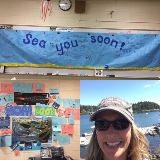
I want to thank my colleagues and students for a heart warming send-off and I promise all plenty of awesome photos and updates to come.
A lovely RMS bon voyage complete with oodles of creative & pun filled cards.
Did you know?
According to Atlas Obscura, in 1914 the town of Port Angeles had such an issue with sewage flooding that they opted to raise one of the town’s main streets by 10-14 feet. This engineering challenge was accomplished by moving soil from a neighboring hill completely by hand…no mechanical interventions. To this day you can tour the underground areas and see store fronts frozen in time. This lovely seaside town is where I will embark on my voyage.
Current Location: Impatiently waiting to sail in Centennial, Colorado
Date: June 20
Weather Data from the “Bridge” (AKA My Sun Porch):
Here’s the weather data from the “Bridge” in Centennial. (In Station Model format, of course. How else would we practice?)
Personal Log – An Introduction
Hello! My name is Staci DeSchryver and I will be traveling this upcoming July on the Oscar Elton Sette as part of the HICEAS program!
I am an Oceanography, Meteorology, and Earth Science teacher at Cherokee Trail High School in Aurora, CO. This August will kick off my 14th (yikes!) year teaching. I know you might be thinking, “Why Oceanography in a landlocked state?” Well, the reason why I can and do teach Oceanography is because of Teacher At Sea. I am an alumna, so this is my second official voyage through the Teacher At Sea program. It was all of the wonderful people I met, lessons I learned, and science that I participated in on the
This is my husband, Stephen, and I, at the game that sent the Broncos to the Superbowl!
Oscar Dyson in 2011 that led me to encourage my school to put an Oceanography course in place for seniors as a capstone course. This past year was the first year for the Oceanography and Meteorology courses, and they were very well received! I have three sections of each class next year, as well! (Shout out to all my recent senior grads reading this post! You were awesome!) We study our World’s Ocean from the top of the water column all the way to the deepest parts of the Marianas Trench, and from the tiniest atom all the way up to the largest whale. I believe it is one of the most comprehensive courses offered to our students – incorporating geology, chemistry, physics, and biology, but then again, I’m a bit biased.
Apart from being a teacher, I am a wife to my husband of 8 years, Stephen. We don’t have children, but we do have two hedgehogs, Tank and Willa, who keep us reasonably busy. Willa only has one eye, and Tank is named Tank because he’s abnormally large for a hedgie. They are the best lil’ hedgies we know. We enjoy camping, rock climbing, and hiking – the typical Coloradans, though we are both originally from Michigan. When we aren’t spending time together, I like to dance ballet, read, write, and I recently picked up a new weightlifting habit, which has led me to an entire new lifestyle of health and wellness with an occasional interjection of things like Ice Cream topped with caramel and Nachos when in the “off” season (hey, nobody’s perfect).
I will be leaving for Honolulu, Hawaii on July 4th to meet up with the fine scientists that make up the HICEAS team. What is HICEAS? Read below to find out more about HICEAS and the research we will be doing onboard!
Science Log
The HICEAS (Hawaiian Islands Cetacean and Ecosystem Assessment Survey) is a study of Cetaceans (Whales, Dolphins, and Porpoises) and their habitats. Cetaceans live in the ocean, and are characterized by being carnivorous (we will get along just fine at the dinner table) and having fins (since I am a poor swimmer, I will humbly yield to what I can only assume is their instinctive expertise). This means that the study will cover all manners of these majestic creatures – from whales that are definitely easily identifiable as whales to whales that look like dolphins but are actually whales to porpoises that really look like whales but are actually dolphins and dolphins that look like dolphins that are dolphins and… are you exhausted yet? Here’s some good news – porpoises aren’t very common in Hawaiian waters, so that takes some of the stress out of identifying one of those groups, though we will still be on the lookout. Here’s where it gets tricky – it won’t be enough to just sight a whale, for example and say, “Hey! We have a whale!” The observers will be identifying the actual species of the whale (or dolphin or possible-porpoise). The observers who tackle this task are sharp and quick at what is truly a difficult and impressive skill. I’m sure this will be immediately confirmed when they spot, identify, and carry on before I say, “Wait! Where do you see it?”
There are 25 cetacean species native to Hawaiian waters, so that’s a big order to fill for the observers. And we will be out on the water until we locate every last one. Just kidding. But we will be looking to spot all of these species, and once found, we will do our best to estimate how many there are overall as a stock estimate. Ideally, these cetacean species will be classified into three categories – delphinids (dolphins and a few dolphin-like whales), deep diving whales (whales with teeth), and baleen whales (of the “swim away!” variety). Once identified in this broad sense, they will then be identified by species. However, I do have a feeling these two categorizations happen all at once.
Once the data is collected, there is an equation that is used to project stock estimates for the whole of the Pacific. More on this later, but I will just start by saying for all you math folk out there, it’s some seriously sophisticated data extrapolation. It involves maths that I have yet to master, but I have a month to figure it out, so it’s not looking too bleak for me just yet. In the meantime, I’m spending my time trying to figure out which cetaceans that look like dolphins are actually possible-porpoises, and which dolphins that look like dolphins are actually whales.
Goals and Objectives of the HICEAS
The HICEAS study operates as a part of the Pacific Islands Fisheries Science Center (PIFSC) and the Southwest Fisheries Science Center (SFSC), both under the NOAA umbrella. Our chief scientist is Dr. Erin Oleson, who will be the lead on this leg of the cruise. HICEAS last collected data in 2010, and is now ready for the next round of stock assessments. HICEAS is a 187-day study, of which we will be participating in approximately 30 of those days for this particular leg. Our research area is 2.5 million square kilometers, and covers the whole of the Hawaiian Archipelago and it’s Exclusive Economic Zone, or EEZ! The HICEAS study has three primary goals:
Estimate the number of cetaceans in Hawaii.
Examine their population structure.
Understand their habitat.
Studies like the HICEAS are pretty rare (2002, 2010, and now 2017), so the scientists are doing their best to work together to collect as much information as they possibly can during the study. From what I can gather in lead-up chats with on board scientist Kym Yano, we will be traveling along lines called “transects” in the Pacific Ocean, looking for all the popular Cetacean hangouts. When a cetacean is sighted, we move toward the lil’ guy (or gal) and all his friends to take an estimate, and if it permits, a biopsy. There is a second team of scientists working below deck listening for Cetacean gossip (whale calls) as well. Acoustic scientists will record the whale or dolphin calls for later review and confirmation of identification of species, and, of course, general awesomeness.
But that’s not all!
We will also be dropping CTD’s twice per day, which is pretty standard ocean scientific practice. Recall that the CTD will give us an idea of temperature, salinity, and pressure variations with depth, alerting us to the presence and locations of any of the “clines” – thermocline, halocline, and pycnocline. Recall that in areas near the equator, rapid changes of temperature, salinity, and density with depth are pretty common year-round, but at the middle latitudes, these form and dissipate through the course of the solar year. These density changes with depth can block nutrients from moving to the surface, which can act as a cutoff to primary production. Further, the CTD readings will help the acoustic scientists to do their work, as salinity and temperature variations will change the speed of sound in water.
There will also be a team working to sight sea birds and other marine life that doesn’t fall under the cetacean study (think sea turtles and other fun marine life). This study is enormous in scope. And I’m so excited to be a part of it!
Pop Quiz:
What is the difference between a porpoise and a dolphin?
It has to do with 3 identifiers: Faces, Fins, and Figures.
Bradford, A. L., Forney, K. A., Oleson, E. M., & Barlow, J. (2017). Abundance estimates of cetaceans from a line-transect survey within the U.S. Hawaiian Islands Exclusive Economic Zone. Fishery Bulletin,115(2), 129-142. doi:10.7755/fb.115.2.1