NOAA Teacher at Sea
Mary Cook
Onboard R/V Norseman II
March 18-30, 2016
Mission: Deepwater Ecosystems of Glacier Bay National Park Geographical Area of Cruise: Glacier Bay, Alaska Date: Monday, March 28, 2016 Time: 7:48 am
Data from the Bridge
Temperature: 39.4°F Pressure: 1022 millibars Speed: 5.6 knots Location: N 58°56.540’, W 136°54.153’
Science and Food Log
Blustery conditions in Glacier Bay
This morning at the science meeting, Chief Scientist Rhian Waller expressed that, even though we’ve had blustery weather conditions the last few days, most of the scuba dive and sample collection goals have been met making this scientific cruise a huge success! It’s nice to be able to take a deep breath and realize the science objectives are going to be met before deadline! Everyone’s hard work has paid off. We are all glad for the exceptionally clear skies and good weather during the first half of the cruise. Rain, snow, fog and wind have been the environmental setting for R/V Norseman II in Glacier Bay this weekend.
I am hoping to get to go back out on the little dive boat today or tomorrow one last time, even though it’s a bit choppy out there.
Yesterday, the scuba divers brought up some more fascinating samples from their dives!
Mary holds a beautiful sea star
Jellyfish
Sea star, one-armed sea star (alive and moving!), and yellow nudibranch
Amongst the curious creatures were beautiful sea stars, a jellyfish that reminds me of a jam-drop cookie, a big yellow nudibranch, a fat-looking brown sea cucumber and a one-armed sea star! The one-armed sea star was alive and moving. Did you know that sea stars have the ability to regenerate missing body parts? So this one-armed guy will grow another body!
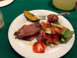
Hard working scientists, divers, and crew members need good food to sustain their abilities to concentrate and do the physical labor.
Thanks to our ship’s cooks, Harry and Darrin, we have an abundance of delicious and healthful food choices prepared daily onboard the R/V Norseman II. As each mealtime approaches I look forward to finding out what these two guys have whipped up to serve everyone onboard.
Head Cook Harry
Harry works in the galley
According to Head Cook Harry, who is a retired Navy cook with over 26 years of cooking experience, the biggest difference in meal preparation on a ship is the scale. They are preparing four full meals a day for 23 people in a small kitchen!
Breakfast is served!
Mess Hall at meal time
Their shifts are from 7 to 7. Harry works the day shift preparing lunch and supper. Darrin, the assistant cook, works the night shift preparing midnight meal and breakfast. You may recognize names of some of the famous chefs that Darrin has worked for during his off-season: Emeril and Chappy.
Assistant Cook Darrin works the night shift
The biggest challenge is planning the meals for 14 days without being able to go to the grocery store if something was forgotten. One thing Harry never, ever forgets is coffee. There must be plenty of coffee onboard.
Improvisation becomes an important skill for the ship’s cook–to make do with what you have. Rotating foods and re-purposing leftovers into something tasty are essential. I must say these guys do a wonderful job of putting on a sumptuous, nutritious meal four times a day every day!
In addition to the great meals, Darrin is a pastry chef whose baking fills the ship with the delightful scents of cakes and cookies. Darrin shares that when baking on a ship you must rotate what’s in the oven often or it’ll come out lop-sided!
Yummy lemon cake
Blueberry muffins
I’m also impressed that we are still having fresh green salads at this point in the voyage.
Fresh fruit
Pizza for lunch!
Harry relates that he buys lettuce in whole heads and keeps them cold. This enables him to get at least two weeks of good out of the fresh produce. A cool, dry place for storage of potatoes, carrots, beets and squash is in the fore peek hold located in the ship’s bow. Every nook and cranny of the ship is used for something! No wasted spaces here.
Good quality food and skilled meal preparation is very important on a lengthy voyage—for the health and overall morale of the hard working people on board the R/V Norseman II.
Hmmm….. I wonder what’s for lunch?
Personal Log
I really can’t express the wonder and awe that I feel when getting to view the creatures from the deep. Seeing pictures is just not as good as seeing them in person and getting to hold them in my hands. They move and creep along exploring their new environs while Dann and Kasey and I take photos. With each new batch I get another wonderful science lesson from one of the scientists explaining the life cycles, behaviors and importance of these animals! Many of you will be happy to know that after their “glamour shots” most of the animals are returned to the ocean.
So, I just found out that I get to go out on the next dive boat! Yay!
NOAA Teacher at Sea
Mary Cook
Onboard R/V Norseman II
March 18-30, 2016
Mission: Deepwater Ecosystems of Glacier Bay National Park Geographical Area of Cruise: Glacier Bay, Alaska Date: Sunday, March 27, 2016 (Easter) Time: 9:56 am
Data from the Bridge
Temperature: 37.0°F Pressure: 1012 millibars Speed: 1.2 knots Location: N 58°49.516’, W 136°32.367’
Science and History Log
I have found the National Park Service’s brochure to be very interesting and would like to share some of this information with you.
Glacier Bay National Park and Preserve is located in Southeast Alaska about 65 miles west of the state’s capitol city of Juneau. It is comprised of 3.3 million acres of mountains, glaciers, forests and waterways. The highest mountain is Mount Fairweather at 15,300 feet. Accessible only by plane or boat, Glacier Bay serves as a home for a multitude of wildlife including grizzlies and black bear, moose, birds, mountain goats, sea lions, otters, orca, and humpback whales. Glacier Bay is a highlight of the Inside Passage and a destination for kayakers, hikers, campers, as well as cruise ship passengers.
This slideshow requires JavaScript.
Just 250 years ago, Glacier Bay was all glacier and no bay. A massive river of ice, roughly 100 miles long and thousands of feet deep, occupied the entire bay. Today that glacier is gone. There are hundreds of smaller glaciers dotting the landscape, tucked into mountain valleys, including about a dozen tidewater glaciers situated at the heads of their inlets.
An example of a tidewater glacierTlingit Totem
Contrary to what you might think, Glacier Bay is a land of rapid change. In the 1600’s-1700’s, the Huna Tlingit lived in the valley in front the big glacier. By 1750, the glacier had reached its maximum and dislocated the people from their homes. Captain George Vancouver sailed there in 1795 finding the glacier melted back five miles into the Bay. In 1879, conservationist John Muir traveled there and the glacier had retreated 40 more miles up the bay. Today you must travel 65 miles up the bay to view tidewater glaciers. You might it interesting that some glaciers are retreating here, and others are advancing.
Personal Log
What a blessing it is to explore Glacier Bay with a group of scientists who want to better understand the climate and interconnectedness of life on Earth. It seems there are glaciers at every turn! And surprisingly, it’s not as cold as I expected. Most days the temperature has been above freezing. Yesterday was the first day I’d seen it snow in the Bay. The snowflakes were big and wet plopping into the blue-green waters– very beautiful sight to see.
Snowfall in Glacier Bay
Wildlife viewing has also been great fun. We’ve seen lots of bald eagles, seabirds and mountain goats. I spent about an hour watching a group of goats maneuver their way up and down steep slopes one morning. Amazing animals in their own right. A few humpback whales were spotted near the mouth of the Bay as they are just beginning their return migration. More elusive have been the smaller Orca whales. The divers have gotten to see even more amazing wildlife below the surface. I’m so glad they take cameras with them so they can share it with those of us confined to the ship.
Glacier Bay National Park–truly a treasure to protect for future generations.
NOAA Teacher at Sea
Mary Cook
Onboard R/V Norseman II
March 18-30, 2016
Mission: Deepwater Ecosystems of Glacier Bay National Park Geographical Area of Cruise: Glacier Bay, Alaska Date: Friday, March 25, 2016 Time: 6:49 pm
Data from the Bridge
Temperature: 35.1°F Pressure: 1012 millibars Speed: 0.2 knots Location: N 58°52.509’, W 137°04.299’
Science Log
Last night we headed out to open-sea and the waters got a bit rougher. I felt queasy so I took seasick meds and went to sleep. We steamed ahead to open sea and arrived to the site for our ROV dive. But the ROV dive didn’t occur due to a mechanical problem with the ship’s engine, so we headed back into the Bay on toward Johns Hopkins glacier for another round of sampling. Today was a very good day for many of the scientists to get a much-needed rest. The ship’s labs were quiet as we traveled back to the glacier. The ship’s crew on the other hand did not get a break. The ship must still be piloted. The galley work continued with meal preparation. The engine room and all of the ship’s operations were still in working mode.
Once we arrived at Johns Hopkins glacier, the ROV proceedings for the night began. It didn’t take long to find Primnoa pacifica! Samples were being carefully taken and put into quivers until resurfacing in the morning.
ROV samples stored in quivers overnight
There are all sorts of other important work that’s occurring in addition to coral collection. One of those is water sampling.
Amanda filters water samples
Scientist/Diver Amanda Kelley helps with filtering seawater collected in a Niskin bottle attached to the ROV Kraken. The Niskin bottle has plugs at both ends that are propped open to allow it to fill with water. When the plugs are tripped, the water at a certain depth is collected and sealed so that no other water will enter that sample.
Dann Blackwood demonstrates Niskin bottle mechanics
Filtering the water sample will help determine the concentration of particulate organic matter in a given amount of seawater at the same location of the Primnoa pacifica being collected. Scientists are trying to determine if the corals derive their food from the particulate organic matter or chemosynthetic sources. The filtered matter will be used to assess for the presence of nitrogen and carbon isotopes helping the scientists better understand the nutritional pathways of the coral ecosystem within Glacier Bay.
The scientists are measuring as many environmental variables as possible and hoping to link these to the health of the coral in Glacier Bay.
Accurate record keeping is of the utmost importance!
Oh my goodness! There are backups to the backups!
Kathy records data and checks the logbooks
Geologist Kathy Scanlon shares that she is putting geographic position data into a Geographic Information System (GIS), a digital mapping system, along with the other data collected such as diver comments and coral samples.
Kathy records data in the Geographic Information System (GIS)
In a nutshell, it’s a way to organize data based on geographic location. In the process of gleaning this information, she says it’s also a great way of double-checking the record keeping for any inconsistencies. Another backup to the backups!
Some of the data points being recorded and re-recorded are date, time, site, depth, species, several reference numbers, and diver’s comments.
In addition to samples of Primnoa pacifica being collected, the divers are gathering samples of other organisms for documentation. These scientist divers are looking for something new—something they don’t recognize—possibly a new species or an extension of a known species location. When they surface with something unusual to them, the excitement is palpable! Everyone on the ship wants to see what’s new!
This slideshow requires JavaScript.
Personal Blog
Today I’ve been a bit groggy because seasick meds make me sleepy, but I was glad to avoid the “5-star barfing” as one person described their seasick experience.
I’m so impressed with the enthusiasm for education amongst the people involved with this scientific cruise. Yesterday, I met several people at Bartlett Cove who were reading my blog and keeping up with this research cruise. All the scientists and crew onboard the Norseman II are willing and eager to answer any of my questions.
I got an email from a co-worker, Holly, one of Scammon Bay’s English teachers! She told me that she shared my blog with two of her classes and used it as a journaling prompt. Also, our principal Melissa Rivers, is sharing photos and facts with the entire school on a monitor in the Commons. I so appreciate the enthusiasm from my co-workers and their willingness to help our students learn about this cutting-edge research being done in Alaska. What a wonderful opportunity to learn and expand our horizons together!
Thanks again for your support and interest!
NOAA Teacher at Sea
Mary Cook
Onboard R/V Norseman II
March 18-30, 2016
Mission: Deepwater Ecosystems of Glacier Bay National Park Geographical Area of Cruise: Glacier Bay, Alaska Date: Wednesday, March 23 – Thursday, March 24, 2016
Data from the Bridge
Temperature: 46.6°F Pressure: 1012 millibars Speed: 11.3 knots Location: N 58°22.470’, W 135°59.779’
Science Log
Before I left Scammon Bay, all of our students K-12 signed and decorated a Styrofoam cup. I carefully packed these cups and brought them onboard the Norseman II in order to send them to the bottom of the Bay with the ROV Kraken on one of its nighttime dives. So, last night was the night for the deepest dive! I stuffed paper towels into each cup and dropped them into a mesh bag. The ROV crew tied the bag of cups to the frame and down, down, down they went!
The styrofoam cups are tied to the ROV Kraken2
The crew prepares for deployment
The Kraken descends!
About 6:30 the next morning, I hurriedly went up to check on our cups. Wow! All the cups were miniatures! The water pressure had compressed the air from the Styrofoam as the ROV had descended and the cups shrank!
Now all the students of Scammon Bay have a souvenir from the bottom of Glacier Bay! What a neat object lesson these little cups will be for all the kids at school. I hope it will be something they’ll never forget.
In addition to my excitement about my student’s cups, the scientists were excited about the samples brought up from the dive. A big Red Tree Coral sample was lying on deck. By its name you would think the coral is red. But it’s not. It’s kind of pinkish orange sherbet colored. It does look like a tree, though. The bottom of it looks like a young tree trunk. And it has rings like tree rings! According to Chief Scientist Rhian Waller, unlike tree growth rings, the rings aren’t indicative of yearly growth, but of growth due to abundance of food and living conditions.
Mary, Qanuk, and red tree coral
Red Tree Coral cross section shows its “tree rings”
Today, we steamed back toward Bartlett Cove. Bartlett Cove is the headquarters for the Glacier Bay National Park Rangers and the little town nearby is Gustavus. Gustavus has a population of 350 and the school has about 70 students. When we arrived in port, a sea otter greeted us, just hanging out. Eating while he floated on his back. He was noisily, crunching and smacking. Sea otters typically eat urchins, clams, and mussels. At one point he crawled out onto the dock to sun himself.
While in port, we had “open-ship” tours for the community of Gustavus. Scientists and ship’s crew took groups of ten through the Norseman II showing equipment, samples and answered questions. We were thrilled that about 65 people, including children with parents and grandparents, turned out and enjoyed learning about scientific research conducted in their Bay!
Mary in Bartlett Cove, with the Norseman II in the background
Scientist Amanda leads a tour of the Norseman II
Drysuit (right) and yellow underwater scooter
I rode into the little town of Gustavus with Ranger Sarah to drop Scientist Bob Stone off at the airstrip. Sarah drove us around on a tour. Gustavus is a beautiful little town with a gorgeous view of the Fairweather Mountain Range. One super cool thing that you can see in the Gustavus Public Library: an Orca skeleton hanging from the ceiling! Orca whales stay in Glacier Bay year round.
An orca skeleton hangs in the Gustavus Public Library
After the ship tours, the Park Rangers took us on a short walking tour around the visitor’s center. The National Park Service is partnering with the local Tlingit tribes in making this location once again a gathering place for them. They are building totem poles and a tribal meetinghouse designed by the tribal elders.
We learned that the Tlingit tribe lived in the area before the Bay was formed. It wasn’t yet a Bay because it was still covered in a giant glacier. The Tlingit still have songs and stories that tell of the glacier moving as fast as a dog running! So they hurriedly got in their canoes and fled to safety. As the glacier surged it destroyed their homes and scoured the land. They re-settled into places like nearby Hoonah, a native village across the way.
Before we left Bartlett Cove, everyone gathered with Qanuk and I on the dock sign for a photo with the winning banner designed by Scammon Bay 4th graders!
Mary and Qanuk hold up the winning banner from Scammon Bay School
Now we’re all back on the ship and heading out to open waters. The glassy waters of the Bay are gone and it’s looking like a rough ride.
I already feel a bit queasy……
Personal Log
Since the ship’s work is ongoing 24-7, it seems that one day runs into the next because someone is always up and at work. And someone is always asleep in the stateroom. I’m amazed at how smoothly things work. Everyone pulls together to help each other and get the work done. If you think about it, there are LOTS of things going on. For example, the meals must be prepared and dishes washed. The science work must be done—scuba diving and processing during the day and ROV diving at night. The ship must be piloted and navigation is critical at all times. General housekeeping is always going on. It’s all an impressive operation and I’m happy to be here and hopefully a productive part of the team!
NOAA Teacher at Sea Virginia Warren
Mission: Acoustic and Trawl Survey of Walleye Pollock
Geographical Area of Cruise: Shelikof Strait
on NOAA ship Oscar Dyson
Date: 3/25/2016
Science and Technology Log:
The fish are dumped from the cod end of the net onto this table. The guys working to get the net ready to dump onto the table to be start processing. Cod End of the NetThe guys working to get the net ready to dump onto the table to be start processing.
I created the video below to document some of my activities aboard the Oscar Dyson during my 2016 Teacher at Sea research trip.
In this video, Virginia opens with exciting footage from the front of the Oscar Dyson’s bow as they transit through Alaska’s Shelikof Strait. Interspersed, she shares various steps involved in processing the fish caught in the survey: sorting the catch by species (0:34), collecting the pollock into bins (1:00), making an incision to determine the sex of the pollock (1:07), measuring the pollocks’ lengths and taking biological samples (1:33), removing the otoliths (2:23 and 3:29), preserving the otoliths for analyzing on shore (3:12), and measuring and recording other fish using the Ichthystick and the CLAMS computer program (3:57). Virginia also takes the opportunity to show off some interesting species—lumpsucker fish (2:18), starry flounder (2:53), and salmon (3:53). Finally, Virginia gives a brief tour of the deck (4:38) and finishes with a photo of her wearing a survival (or “Gumby”) suit (5:02.)
My students know a good bit about my previous Teacher at Sea experience out of Woods Hole, Massachusetts where we used the HabCam to look at the ocean floor. With that knowledge in mind a couple of my students asked me if there was a way that we were able to look at the fish while they were still in the water. The simple answer to that question is yes. While my previous TAS experience used the HabCam, the Oscar Dyson uses a CamTrawl. The CamTrawl is attached to the net and it records pictures as fish enter the cod end of the net.
Image from the CamTrawl
CamTrawlNick and Ryan Attaching the CamTrawl to the Net
After each trawl we would use custom software written in MATLAB to measure lengths of pollock while they were in the water. This program uses the pictures taken from the CamTrawl during the trawl to measure the length of the fish. The CamTrawl takes two pictures at different angles so that most of the time we can see the same fish from two different angles. Fish length irregularities occur in the MATLAB program when it selects nets or two fish at one time to length, so therefore a person has to go back and check to make sure that the program has selected valid fish to length. As the fish pictures come up on the MATLAB screen the person rating the fish selects the fish when the yellow box around the fish covers most of the fish from both angle camera shots of the CamTrawl.
A Screen in MATLAB that Shows Valid Fish Lengths
The above picture shows three different fish that were valid choices for length measurement. The pictures on the left show one camera angle and the pictures on the right show the other camera angle. When both angles have a valid fish with the correct placement of the yellow box, the person selecting the fish will click the fish to tell the program to use that fish in the measurement data.
Interview With a NOAA Survey Technician: Alyssa Pourmonir
Alyssa Pourmonir inside the Wet Lab
How did you come to be in NOAA Corps? (or what made you decide to join NOAA Corps and not another military branch.
I am not in the NOAA Corps, instead I am a civilian government employee under the title of Survey Technician. I was in the US Coast Guard for 3 years where I took many courses related to navigation, leadership, and ship life. I feel my background in the Coast Guard has allowed me to excel in this demanding environment.
What is your educational/working background?
I have been lucky to have the opportunity to be in the Coast Guard which taught me many professional skills and built me up to be stronger and more independent. I also spent an entire summer forecasting for the weather in Pennsylvania. Here I gained an abundance of practice presenting the weather on the green screen and performing on live television for WNEP TV. Before coming to Alaska for this job, I worked as a consultant at NASA Stennis Space Center performing remote sensing analysis of forests using data from the MODIS and VIIRS data.
Academically, I have a BS in Marine Environmental Science from SUNY Maritime College, although most of my college experience took place at the US Coast Guard Academy.
How long have you been in NOAA Corps?
I’m not in the NOAA Corps, but I have worked for NOAA for almost 2 years as a Survey Technician. May 2014 to present.
How long have you been on the Dyson?
June 2014 to present.
How long do you usually stay onboard the ship before going home?
In the past 2 years I have visited my family one time. Partly because I wish to send money home so my family can struggle a little less and hopefully enjoy a life with less debt; especially as my father passes retirement age. He has worked several full time jobs at a time for many years just to support my mom and sisters. Potentially, his work ethic and care giving nature is what I try to embody each day.
Have you worked on any other NOAA ships? If so, which one and how long did you work on it?
Nope
What is your job description on the Dyson?
On the NOAA Oscar Dyson, I am a crew member who acts as a liaison to the scientific personnel on board. I work up to 12 hours each day, 7 days per week maintaining the scientific data, equipment, and lab spaces on board. I also work alongside the scientists, deck department, and bridge watch standers to collect data by completing many different oceanographic or fishing operations.
How is your science job on the Dyson different from the NOAA Scientists that you work with?
As a crew member, I facilitate a positive environment with the needed resources for the scientists to fulfill their data analysis and data collection. I also work alongside the scientists to process the fishing catch in our lab. So you can imagine me suited up with the scientists analyzing the fish’s reproduction development stages and extracting otoliths.
What is the best part of your job?
I get to explore and work in the infamous Bering Sea Alaska, Gulf of Alaska, and Aleutian Island chain which most people can’t even imagine doing. Here in Alaska, I do not have the luxuries found in Continental US, so I believe out here there is a great opportunity for character building. It takes someone pretty amazing to live out here and do what we do.
What is the most difficult part of your job?
Being in remote places and not seeing family or friends, but also being so far away that it is super expensive to try to see them.
Do you have any career highlights or something that stands out in your mind that is exceptionally interesting?
I began my BS absolutely hating biology. I dislike and do not eat seafood. I was skittish and would let my partners do all of the dissections during classes, and I felt that I knew nothing about biology. As a Marine Environmental Science major I decided to take as many biology electives as I could. I went from the lowest grade in my classes to someone who received one of the highest grades in each class. I graduated just one class shy of a minor in Marine Biology and now toss around fish on the NOAA Ship Oscar Dyson, a fisheries research vessel. While my first day I would jump when the fish would move unexpectedly, now I can analyze characteristics of the fish with little alarm and much confidence. It is amazing how I enjoy biology now. I hope to encourage others to confidently try new things, for with a little practice and hard work you may accomplish anything or overcome fears you may not have realized you had.
Do you have any advice for students who want to pursue a career with NOAA?
If you wish to pursue a career with NOAA, be sure to work hard to learn as much as you can, but also come out of your comfort zone to pursue as many volunteer or paid jobs that will give you work experience that correlates with your interests. Time management and resilience is often my secret to success.
Personal Log:
I had a fabulous time aboard NOAA Ship Oscar Dyson and I’m very thankful to NOAA giving me the opportunity to travel to Alaska and learn from their scientists!!!
Kim and Virginia with a Chinook SalmonVirginia Holding a Walleye PollockGood friends made on this trip!
My flight home started on a small plane from Kodiak to Anchorage.
Ravn Alaska’s Bombardier DHC-8-100
After the plane got into the air and was flying away from Kodiak, we were treated to a flyby of the Kodak Harbor and even got to see the Dyson outside of the harbor as we flew away.
Aerial view of the Kodiak Harbor
We flew into Anchorage, Alaska and I was amazed at the beauty of the mountains in Alaska!
Mountains Outside the Anchorage, Alaska Airport
A little while before sunset I caught a plane from Anchorage to the Chicago, O’Hare airport. The scenery and sunset leaving Alaska was beautiful!!!! I hope this won’t be the last time I get to come to Alaska, because it is a beautiful, adventure-filled part of the United States.
It was good to be back on land again when we got back to Kodiak, but I do miss being on the ocean!!
Bow of the Oscar DysonNOAA Ship Oscar Dyson
Finally back on land in front of the NOAA Ship Oscar Dyson!
This experience was wonderful for me, however for my students this experience was invaluable. I was able to communicate and share my experiences with them through email almost daily and they were also able to read my TAS blogs as they were posted. If they don’t learn anything else from my experiences in Alaska, which I know that they will, I hope they will learn that the world is theirs to explore, study, and learn about no matter how small the town is that they come from!!