Rebecca Loy, Sad to Say Goodbye, September 24, 2015

NOAA Teacher at Sea
Rebecca Loy
Aboard NOAA Ship Rainier
September 8 – 24 , 2015

Mission: Hydrographic Survey
Geographical area of Research: Kodiak Island, Alaska
Date: September 24, 2015

Current Location: Kodiak, Alaska

Noaa corps banner depicting work done by noaa corps officer and the logo's of NOAA Corps and DOC

While NOAA is a larger organization, I thought it might be nice for people to learn about the group that took such excellent care of me while I was at sea.  I am talking about the NOAA Corps.  These are the officers that get the ship where it needs to go safely.  NOAA Corps is one of the seven uniformed services in the United States.  It has a long history starting as Survey of the Coast which was established by Thomas Jefferson in 1807.  The 321 officers in NOAA Corps not only work on and operate ships, but they also fly airplanes, facilitate research projects, conduct dive operations and work as staff throughout NOAA.

Press the link to learn more about NOAA Corps.  This could lead to an amazing career for someone!

Path to Rainier:

I thought it would be appropriate for me to highlight one of the NOAA officers.  They have all been wonderful to me and have taught me so much, it is hard for me to pick just one person.  I wish I could highlight them all.   One person that I could go to for anything, gave me my tour of Rainier and worked with me on the ship and on the shore is ENS Shelley Devereaux.

ENS Shelley Devereaux and I on the bridge.

The NOAA Corps officers do so much.  I enjoyed sitting with ENS Devereaux and learning more about what she does and how she got to Rainier.   ENS Devereaux told me she does a little bit of everything, which is very true.  She works on navigation, standing watch, logistics of planning details for when the ship is inport including mail delivery and organizing the “liberty van” that takes crew into town.  ENS Devereaux does survey work and is the tide assistant (she was with me when we installed the tide gauge earlier).  I have only listed a few things here, all of the officers work very hard and are pretty amazing people!

ENS Devereaux started as a math major in college.  She also did some work as a bicycle mechanic, a pastry chef, worked as a research assistant for a bio lab and was a data manager for an educational non-profit.  She realized she missed science and went back to school to get her Master’s Degree in Geographic Information Systems.  She studied mapping applied to many areas of study including data visualization.

She learned about NOAA Corps when her uncle told her and her cousin about it.  ENS Devereaux’s cousin applied first and then she followed.  Her cousin in on Rainier’s sister ship, Fairweather.  Interestingly, the two cousins had a chance to meet up this past summer in the Arctic.

ENS Devereaux inputting data at the tide gauge installation.

ENS Devereaux told me more about the NOAA Corps.  She had to undergo training for 6 months with the Coast Guard Academy (the two services work together for training).  There she learned ship navigation, firefighting, First Aid, driving the rescue boats and how to be an officer plus much more.  After her initial training, she had further training with NOAA for safety, teamwork, communication, leadership skills and problem solving.  ENS Devereaux truly enjoys the hands on work, being part of a team, serving and creating charts for safe navigation.

When I asked ENS Devereaux where she has been in the world, she told me she traveled to parts of Europe and Costa Rica, but the most interesting part is she backpacked by herself through Mongolia, China and Taiwan.  I was not surprised that this dynamic woman would take on this challenge.

Tide install with Rainier in the background.

Like all of the officers on Rainier, ENS Devereaux is a pretty spectacular person.  Knowing that people like her, including her NOAA Corps colleagues, are serving and taking care of our oceans is very reassuring.   Thank you for everything you have done for me and our planet.


Personal Log:

Sunrise from Shelikoff Strait.
Hello there!
Hello there!

My time here on Rainier is drawing to a close.  When I first arrived, it was all so new and exciting and I must admit it was a bit overwhelming.  Now, almost 3 weeks later, I feel like an integral part of this crew.  While this ship is incredible, it is the people who make it their work and home that make it truly special.

This hard working crew has included me in everything!  I was given every opportunity possible so I could bring this experience back to my community – and I have some wonderful ideas thanks to them!!!

Kizhuyak Bay
Kizhuyak Bay

I learned more than just how this ship runs or what hydrographic surveys are.   More importantly, I watched this group of people be problem solvers.  We often teach our students how to resolve a situation.  Being on Rainier showed me that this is a skill that needs to continually be exercised!

I thought this was an interesting beach photo.

I appreciated how a situation would present itself and the crew would move into action!  This could be something less intense like planning our route from bay to bay around Kodiak Island to more involved problem solving such as repairs/maintenance to the MVP on the back of the ship.  A group of people would start thinking, brainstorming, testing, reviewing and thinking some more.  They came together from different departments and areas of expertise to solve an issue.  It was incredible to be a part of this process and something I plan to facilitate more in my teaching.

Watching the shore go by
Tide install with sunrise

I have the greatest respect for this unique group of people.  I am going to miss a lot here… the easy comradery they have with each other, sharing our wish for better internet among the mountains, looking for wildlife or the aurora borealis together, eating PB&J sandwiches with the most incredible views, having dessert with lunch AND dinner, 18:00 movie time (6:00 PM for those of you on shore), watching the beautiful Alaskan coast go by, whales…whales and more whales, the unique names that are used throughout the ship (the Holodeck, Princess Suite, engineer Hollywood just to name a few), line handling and all kinds of deck work, learning how to use a crane and not getting the Bo’sun wet, watching the launches come out of and into their cradles, hanging on to EVERYTHING as the ship rolls and pitches (yes, even this), looking at ENS Kosten and ENS Devereaux’s beautiful photos, hearing about everyone’s incredible experiences- especially in the Arctic, bumping my head in engineering, and most importantly, being my nerdy self with people who understand!

I am very thankful to NOAA ship Rainier Commanding Officer EJ Van Den Ameele for being so kind and allowing me this opportunity, to Rainier’s officers and crew for being so helpful and supportive as I learned my way around asking a million and one questions (no joke, I should have kept track of how many I asked) and to the NOAA Teacher at Sea program.

I hope to make you all proud as I head back home and share this incredible experience!

Rainier from a launch in Kizhuyak Bay


Rebecca Loy, Full STEAM ahead! September 21, 2015

NOAA Teacher at Sea
Rebecca Loy
Aboard NOAA Ship Rainier
September 8 – 24 , 2015

Mission: Hydrographic Survey
Geographical area of Research: Kodiak Island, Alaska
Date: September 21, 2015

Current Location: Viecoda Bay, North Kodiak, Alaska

After learning how areas to be studied are decided, organized and surveyed, I wanted to see what happens after the data is collected.  I spent some time in the Plotting room with NOAA visiting physical scientist Adam Argento.  Adam instructed me on hydrographic research and what is involved with completing their work.  Needless to say, using the term “blowing my mind” is very appropriate here.

Sitting with Adam and discussing the work that is accomplished was great.  He even made me think of space – and you know how much I love a space tie-in!!  While we were talking about the data that would be collected we began speaking of how do researchers know where the ship is?  You might automatically think of GPS (Global Positioning Systems).  We have them on our phones, in our cars and other forms of technology to help us find our way home, but the GPS systems we use are not as accurate as NOAA needs.

On Rainier they need to know exactly where they are!!  Just like when we give you rules you need to follow in doing your work, the researchers here have very limited parameters for creating/updating their charts for safety.  While collecting data they want to make sure that the charts are as accurate as they can make them.  If the data collected is off just a bit, there could be a dangerous situation.  The people updating the charts work very hard to create high quality and safe charts.

A satellite GPS receiver on one of the launches.

Adam showed me some of the satellite receivers on the ship and launches.  We couldn’t reach the Rainier receivers, but see the picture of a receiver on a launch, they are much smaller than I imagined.  Each launch has two receivers at least six feet apart.  They are needed for the satellites to know which direction the launch is going in. The satellites use the smallest of time measurements sent down and received back between the two, but it works!

Adam asked me some questions – now it’s your turn to think about this…How would Rainier know exactly where it is?  You might say it uses a GPS because I just mentioned it and simply put, yes it does.  Except, one, two even three satellites will not give Rainier the accurate positioning they need.  Four satellites can give Rainier a specific point.  Just take a moment and think about this.  In short, four satellites will give you a good position, but Rainier uses up to seven to be much more accurate.  For more information on satellites check out this website: http://www.gma.org/surfing/sats.html#nav

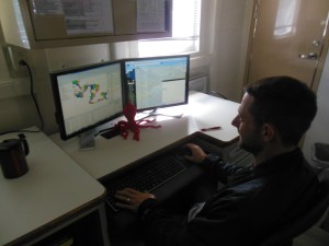
Adam Argento at his computer in the Plot room.

Another question… how do the satellites know where they are?  We can’t use a marker on the Earth reliably, or to the level that NOAA needs, because our planet is constantly moving (think tectonic plates and earthquakes).   Are you ready?  Adam told me satellites use pulsing QUASARS that are far out in space to know exactly where they are!!! (In case you were wondering, this is the part where my mind was blown, I thought they used land based markers).

Like I mentioned earlier, the CARIS program takes all of the data, including changes in the Earth’s Ionosphere and differences in the ocean water due to CDT (conductivity, depth and temperature) and puts it together to create a working document or chart.  This is a lot of information that needs to be controlled.  Adam works for NOAA in Seattle so he will be part of the team taking the data and putting it into more accurate charts once he gets back on land.  A pretty cool job if you ask me!!

Path to Rainier

To continue sharing some of the fascinating people on Rainier, I sat down with Rainier General Vessel Assistant (GVA) Carl Stedman to learn how he came to work here.  Carl started his career in the Army and retired after 20 yrs.  Incredibly, after proudly serving our country for so long, he then went to college and earned a bachelor’s degree in finance from San Francisco State.

With GVA Carl Stedman. Photo Credit: Bob Steele

About half way through earning his MBA (Masters of Business Administration) he decided to take some time off.  He rode his motorcycle around the US for three months.  Realizing wearing a suit or working in a cubicle would not make him happy, he moved to Virginia and opened his own coffee shop for three years where he met his wife.  He then worked as a patient service manager in Norfolk hospital.  With more introspection he thought back to his time in the Army.  After having lived in Germany and serving in other areas of the world for a long time, he remembered his time on an Army ship for the last 7 years of  his Army career and how much he enjoyed it.  He then applied to work for NOAA and was put on Rainier.

On Rainier, Carl has some very interesting jobs!!  Along with the very busy job as a GVA, Carl is also an Advanced Firefighter and is on the first response team (he was also in his firefighter outfit when we had drills, but I did not get a picture of him).  He is an MPIC (Medical Person In Charge) which is like an EMT that we have on land.  Another job he has (and one that makes me nervous just thinking about it) is as a Confined Space Rescuer.  Yikes… he clearly does not have claustrophobia!!  Another exciting job he has is the driver for the fast rescue boat that is on Rainier.  Carl is another unique person on this incredible ship and I feel very safe knowing he is around.  Thank you, Carl, for taking the time to chat with me and show me so much!!!

Personal Log

Moving my bucket filled with water. See Jason near it. Photo credit: Bob Steele

This wonderful crew has been teaching me a great deal about this ship.  One day, acting Boatswain (pronounced Bo-son) Jason Kinyon took time to teach me how to work the two smaller cranes on the bow of the ship.  He had me move a filled bucket of water to different areas on the bow WITHOUT SPILLING ANY OF IT!!

I really liked it!!!  The most challenging part was when he sat down right next to where I had to place my bucket of water.  I did not want to get the deck boss wet and I didn’t!  I did spill a little bit on one of the hatches though.  Jason was very patient showing me all the tricks to moving the crane!  Bring on the big aft crane next!!!!

When we went to the fuel pier in Kodiak I was able to throw the “heave line” that goes up to the dock and is then knotted around the bigger mooring lines so they can be pulled up to the pier.

Getting ready to throw the heave line! Photo Credit: ENS Chris Wood

I feel the need to add that three big, strong deck crew who were back in the fantail of the ship with me missed where they had to throw their lines.  GVA Carl Stedman was very reassuring to me and I got the line where it had to go.  Everyone on the ship was talking about how I made it on the first try when the seasoned crew did not.  In case you are wondering, yes, that is a cruise ship in the distance at the Kodiak public dock.

Pulling slack on the line. Photo Credit: ENS Chris Wood

To name just a few more things, I have been shown lots about navigation, I have also driven the launch, worked the davits that raise and lower the launches, learned about the anchor and basically anything else I can learn about and what people are able to teach me.  Thank you, again, to everyone for teaching the teacher so I can share this amazing experience with others!!

Learning to lower the launches.
Learning to lower the launches.  Here, I already put the launch in the water.

Rebecca Loy, Days of Data Aquisition! September 18, 2015

NOAA Teacher at Sea
Rebecca Loy
Aboard NOAA Ship Rainier
September 8 – 24 , 2015

Mission: Hydrographic Survey
Geographical area of Research: Kodiak Island, Alaska
Date: September 18, 2015

Current Location: Uganik, Viecoda and Terror Bays, Northern Kodiak Island, Alaska

After our tide gauge installation we were ready for data acquisition.  Back in the Plot Room with the NOAA officers and surveyors, we were using Rainier to get information for Sheet H12692 and later for sheet H12691.

The MVP before it was sent off the back of Rainier

The first thing we had to do was drop the MVP off the back of the ship.  On Rainier, the MVP is a Moving Vessel Profiler.  This small, but very important piece of equipment needs to be placed in the water before we begin scanning the ocean floor.  On Rainier, they use the MVP.  On the launches, they do the same thing, but they call it a CTD.

Information from the MVP during scanning
Information from the MVP during scanning Photo Credit: Chris Palmer

This important part of data acquisition is needed to check the conductivity of the water, the depth of where this is happening and the temperature.  To be more specific, sound travels differently when water has more salinity (conductivity), more pressure (depth) and fluctuating temperatures.  This information varies greatly from place to place.  Simple changes to this information could come from a variety of places.  There could be glacial runoff or streams coming into the bays that would change salinity and temperature.  Further down from the surface, water has more pressure from above.  Something as simple as the time of year – warmer water temperatures in the summer, cooler in the spring or fall can make a difference to the data collected.  This is all important information so Rainier and the launches check levels a great deal.  Here is some Rainier specific information on MVP/CTD.  For additional information, check out this great link about sound in the sea.  I  also found an interesting website about the difference between salt water and fresh water – why salt water and fresh water don’t always mix.  What else can you think of that might change the conductivity in ocean water?

Again, all of this information, including tidal readings and depth of the boat where the sonar is, will be put into the CARIS program for a great deal of work after we initially scan the ocean floor.

ENS Bissell and ENS Deveraux were here along with many surveyors as we scanned over their sheet with Rainier’s MBES.  Do you remember, this is the Multi Beam Echolocation Sounder that comes out of the bottom of the ship.

I initially thought we would be going back and forth over the area – sort of like when you mow the lawn.  You want to cover everything without repeating a space and wasting time, but also you don’t want to miss an area either (they call this missed area a “holiday” – kind of quirky,  but I couldn’t find anyone who knew why).  Today, Rainier was going in a zig-zag crossover pattern.

Looking at the radar where Rainier has been.
Looking at the ECDIS, an electronic chart, where Rainier has been.

I learned that they do this initially in an area for Quality Control.  Here, they just call it QC.  They scan an initial zig zag pattern so when they do the back and forth lawn mower type of scanning they will be able to match up the scans with the previous zig zag.  Again, they take their work very seriously and this a great way to make sure they are getting quality scans.

HAST Mike Bloom keeping an eye on all of the information coming in.

At first, I was able to experience collecting data on Rainier.  Then, one of the days I was assigned to survey launch RA6.  The launches are miniature versions of Rainier but they can go into areas that are more difficult for Rainier.  Every morning, after the American flag is raised, LT Pfundt holds a saftey briefing

RA6 being lowered alongside Rainier

After a bit of training for new crew and myself, the large davits brought the 16,000 pound survey launches out of their cradles and into the water, we loaded them up and off we went.  On the day I was out surveying, we had two launches working.  One was further inside Viecoda Bay while RA6 was out in the bay closer to the opening.  We went to our assigned polygon to begin work.  Eli Smith, the scientist in charge of this particular sheet named all of his polygons with tree names (I was told a story how a few years ago someone used silly names such as Fluffy Bunny to name their polygons).  We went to Eucalyptus first and began scanning the ocean floor.  About halfway through our initial scan we needed to stop and get a CTD reading.  We would do this a total of 3 times today.

LT Pfundt and ENS Bissell preparing the CDT to be lowered.
LT Pfundt and ENS Bissell preparing the CTD to be lowered.

Unlike the MVP on Rainier that gets dragged behind the ship for a specific time period, the CTD on the launches gets lowered to the ocean floor while the launch is not moving.  In the photo you can see LT Pfundt and ENS Bissell working with the CTD.  HAST Chris Palmer was also with us and he then checked to see if we received quality data and later would put all the information together in the Plot Room.

Our day continued for many (many… many…)  hours out scanning the ocean floor in polygons.  We had AB Anthony Wright at the helm driving us throughout the day.  He was kind enough to let ENS Bissell and I drive the boat for a while and he was an excellent teacher.

Some rough seas coming over the bow of RA6

Eventually, the weather changed and we had some rough seas to work in.  Since we are looking for quality scans, we had to leave an area and go closer to shore to get away from big waves (when scans are not good they get “noise” and “blow-outs” that need to be re-scanned).  We also had to lower our speed from about 6 knots to 4 knots so our scans were clear.  A knot is a unit of speed that is equal to 1.151 miles per hour.  As you can see, we didn’t go very fast.

Remember, we are sending sound waves down to the bottom of the ocean and back.  The more we moved around the more difficulty the sound had coming back to us.  Keep in mind all this movement on top of the ocean, plus checking the quality of the water equals the computers needing to do a great deal of work.  The launches not only have multiple computer screens to use, but behind the person manning them was a stack of computer servers to process the data… and this was only the beginning of the work!

Hydrographic Assistant Survey Tech Chris Palmer keeping track of data.
The computer servers on RA6

While we were out in the launch, we got a chance to see lots of whales and sea otters up close.  It was pretty exciting being out on the launch surrounded by nature and some amazing STEAM work!

I got to steer RA6 and call in to Rainier that we were 5 minutes from pick-up

Path to Rainier:

We chose to do a selfie! With Chief Engineer Garrett Urban
We chose to do a selfie! With Chief Engineer Garret Urban

For this entire trip I have been fascinated by the engineers running this ship.  They would pop up out of this door with a skull and cross bones on it having worked hard to keep this 46 year old ship running smoothly.   I chose to sit down with Chief Engineer Garret Urban.  We discussed his job as a Maritime Engineer.  As Chief, he is the boss of the engineering department and keeps a constant eye on things, hopefully they will be able to spot a situation that they can repair before it becomes a bigger problem.  Garret is on call 24 hours a day, but the engine department has 2 people on duty at all times.  Garret needs to maintain all the equipment, do repairs and do some administrative items such as scheduling and juggling what needs to be taken care of within a certain budget.  Like everything else on this ship, Garret made sure to point out that safety is paramount to everything they do in the engine room.  He told me he makes a plan for every day, but always needs to improvise and adapt!

Garret chose to go into the Navy right out of high school.  He mentioned he was not a fan of going to school and suggests the Navy for someone who is interested in this job and might not like traditional schools as much.  The Navy trained him very well.  He did say there are Maritime Engineering schools around the country and this is a very high need career!  Garret was actually on Rainier as a 1st engineer earlier on in his post-Navy career before he worked on NOAA ship Pisces.  After some time taking care of family business, working on luxury yachts and in the oil industry, Garret came back to NOAA this year.  He became Chief Engineer on Rainier this past summer.  Everyone here is very glad to have this hard working man around!

I was pretty excited when Garret offered me a tour of the engine room – while the ship was under way.  He set me up with ear plugs AND headphones to protect me from all the noise in the engine room.  Wow! Was I thankful for that!  This fascinating place in the lowest level of the ship is a maze of moving parts… I loved it!!

Double protection for me!
NOAA TAS engine room 025
Notice the pistons on this sign
One small area of the engine room looking down on one of the diesel engines. Same type they use for trains, but Rainier has 2.
A small area of the engine room looking down on one of the diesel engines. Same type they use for trains, but Rainier has 2.
Down in the noisy engine room - a fascinating place for me!!
Down in the noisy engine room – a fascinating place for me!!

Personal Log:

Underwater photo of two types of jellyfish. Look closely for the very small baby jellyfish.
Holding a large starfish in Uginak Bay. Photo Credit: Shelley Deveraux
Holding a large starfish in Uganik Bay. Photo Credit: Shelley Deveraux

I have been truly enjoying the wildlife here in Alaska.  I wasn’t sure what I would see being later in the year.  Much to my surprise I have seen a great deal.  I have seen many bald eagles, porpoises, otters, whales and even lots of underwater photos of jellyfish, starfish and sea anemone.   One odd creature was a hooded nudibranch!!

A unique hooded nudibranch, a sea slug that comes in a variety of shapes and colors.
One whale was just 20 feet from the launch!

I was very impressed by how the crew respects wild life.

An otter that watched us go by.

One day, we had some whales nearby while we were scanning the ocean.  Usually the whales give us lots of room, but today a few were right in front of us.  Rainier actually stopped and backed up to give the whales room.  We then had to circle around to get back to our survey area.  I am still hopeful that I will safely see a Kodiak Bear… but not yet!

Rebecca Loy, Does Rainier Run on Diesel or STEAM?  September 14, 2015

NOAA Teacher at Sea
Rebecca Loy
Aboard NOAA Ship Rainier
September 8 – 24 , 2015

Mission: Hydrographic Survey
Geographical area of Research: Kodiak Island, Alaska
Date: September 14, 2015

Current Location: South Arm of Uganik Bay, Kodiak Island, Alaska

To answer this question, Rainier runs on both diesel and STEAM.  The diesel keeps this ship running where it needs to go and the engineers are masterful at keeping this ship maintained.  The STEAM is everywhere, and I am not just talking about water steam in a pipe or in the galley.  This ship has serious Science, Technology, Engineering, Arts and Math!!

I met with acting (Executive Officer) XO LT Adam Pfundt and acting (Field Ops Officer) FOO LT Steve Loy (even though Loy is a unique name, we are not related – but it is pretty cool that another Loy is here).  They were discussing who was going to lead certain jobs.  I learned a great deal about the process needed.  During research, an area in review is called a “sheet”.  Why do you think they call the areas sheets and not something else?  Do you think there could be some historical mariner significance?

Map with NOAA sheet areas listed

Like most tasks on Rainier, research begins with a geographical area being assigned to a manager, assistant plus a mentor.  They will work together as a team on their sheet until the hydrographic branch of NOAA accepts the data.  Like I mentioned in my second blog entry, this could take weeks or months after the initial data collection to complete.

I have decided to use sheet number H12692, which was just assigned to the team of  ENS Matt Bissell, manager, ENS Shelley Deveraux as assistant, and LT Steve Loy as mentor this past week.  Can you find H12692 on the photo above?

ENS Bissell and I discussing his polygon grid
ENS Bissell and I discussing his polygon grid. Photo Credit: Chris Palmer

All team members are responsible for maintaining work logs so they can report on them.  Even here writing & communication is very important – remember this when I help you with YOUR writing!  Here is a brief overview of the duties:

Sheet Manager – this is the biggest of the jobs given.  The sheet manager is responsible for organizing the team.  This person needs to prepare the area to be studied by separating it into more manageable areas called polygon plans.

Sheet H12962 in polygon planning.

They decide which area gets studied by the large Rainier or if a smaller launch is needed.  The smaller launches are good for areas closer to the shore or shallow areas.

The manager has to know if Rainier should use its multibeam echolocation sounder (MBES) in large runs or drag its Side Scan Sonar (SSS) behind it in the area to be studied.  Another option the manager has to decide is do they need to use the MBES or Side Scan Sonars that are mounted on the smaller launches and where should this be.

The MBES on one of the launches. The SSS is currently removed.
The MBES on one of the launches. The SSS is currently removed. Photo Credit: ENS Matt Bissell

ENS Bissell has a many choices to make to get the best information possible.  Looking at the polygon grid ENS Bissell organized can you pick out which areas Rainier will cover?

Managers need to attend meetings and review data that was processed the night before.  They do this to see if any problems were encountered and if an area needs to be scanned again.  The manager uses the immense CARIS HIPS and SIPS marine data processing program, prepares dive teams if needed, does more reviewing of data and organizes the pilots that take the launches closer to shore.  This is truly just a brief overview.  Sheet Manager is a very important job.

Sheet Assistant – The assistant works very hard right alongside the Sheet Manager.  This person is in training as well and will someday be a Sheet Manager.  It is important for the Sheet Manager to give the assistant guidance to learn.   The assistant needs to ask questions so they can be an effective manager in the future.  They need to set up the launches, help with polygon plans, maintain the bottom sample notebook, load charts, assist with data acquisition and follow what the manager needs them to do.

ENS Deveraux showing me how she is plotting a course to our research area.
ENS Deveraux showing me how she is plotting a course to our research area. Photo credit: Anthony Wright

Sheet Mentor – The mentor’s role is an advisor to the manager, especially if this is the first time someone is managing.  They also train the sheet assistant and work between the FOO and the management team (in this case the FOO is also the mentor).  The more the mentor can teach the assistant the easier their transition will be from assistant to manager in the future.

Once all of the extensive planning is taken care of, this team begins to collect data.  This is the actual field work that Rainier does!  I know all of you at school were most excited to hear about this!


Drilling for tide marker "Echo" while HAST Mike Bloom looks on.
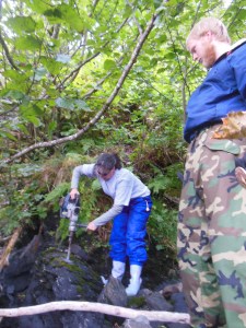
Drilling for tide benchmark “Echo” while HAST Mike Bloom looks on. Photo credit: Chris Palmer

To begin, we went ashore in the South Arm of Uganik Bay, northern Kodiak Island and had to place a tide gauge station.  To begin the scuba divers had to place part of the equipment called the orifice under water.  This orifice holds air bubbles.  When the tide is higher and the water level is high, more bubbles will be pushed out of the orifice letting the system know that the water level is up.  The more water pressure on the orifice, the higher the tide level and the opposite is also true.  This information is sent to the satellite links where solar panels and batteries keep everything powered so people on the ship can read the data.  We also had to place tide benchmarks in five different areas near the tide station.  I helped with tide benchmark 7588 E or “Echo” which was the fifth benchmark to go in.  Due to movement in the Earth, we need to have tide benchmarks throughout the areas we are studying so when the ship returns in 30 days they will have accurate information.

Tide gauge 1788 E
Tide benchmark 7588 E


I worked very hard drilling into just the right rock to cement it down (I actually drilled in 4 areas before this one, but the shale kept breaking apart, LT Pfundt found this great spot with a more stable rock).  Hydrographic Assistant Survey Tech (HAST) Michael Bloom and I made a great team working together.  It took 1 1/2 days to place everything, survey and link the systems plus take 3 hours of observations for the tides.  During this 3 hour period the observer checks the water level on the staff every 6 minutes.  This is a lot of close observation to make sure everything is running properly!

Surveying all the tide gauges!
Surveying all the tide benchmarks!

Do you know why we would need to know when the sea rises and falls?  Sometimes it can change over 6 feet in depth – two times per day here in the Pacific!!  We need to know the levels for the charts that are being made.  The researchers are looking at updating water depths on a chart.  They will use the tide level that is lowest to be safest.  This will give boats traveling above the best depth for clearance below them.  The opposite is true if there is bridge on a chart.  The researchers will use the highest tide depth so ships can know if they can make it under a bridge.  Knowing tides is very important to chart development!  Here is some more information on Vertical Control-Tides.

Our finished tide gauge installation from the water.
Our finished tide gauge installation from the water.  See the tall stick where water measurements were taken every 6 minutes.  In the back, are the satellite up-links with the GOES and Iridium data retrieval boxes under the blue tarp.


Path to Rainier

Hydrographic Survey Tech Eli Smith and I. Photo Credit: Tracey Davis

Another fascinating person on board is Hydrographic Survey Technician Eli Smith.  Eli has been on Rainier for 1 1/2 years now.  He started as a Hydrographic Assistant Survey Tech  in May of 2014.  Originally, he graduated from Western Washington University with a BA in Geology.  I was curious how he went from being a geologist in the oil fields of Denver to working on the ocean.  While he was in Denver, Eli would take soil samples.  So many samples that he was called a “Mud Logger” which is a pretty interesting term even though Eli didn’t enjoy it very much.  He did a lot of “soul searching” and realized he needed to do something else.  Between remembering an ocean based field experience in college off the coast of Hawaii and contacting a career counselor, Eli was led to NOAA.  He was pleased when he was placed on Rainier.

On Rainier, Eli works a great deal up in the Plotting room or in another room called the “Hologram Room” where survey techs also work.  Currently, he is a sheet manager for sheet H12691.  This sheet includes Viekoda Bay and Terror Bay.  You can see his area in the photo above.  Eli has been  hard at work doing his own polygon plot and preparing plans for his sheet.  He is also part of the Tides Team placing tidal gauges in areas that are being studied.

When Eli is not working, he has his bike on board and likes to ride that when he can.  He is also a hiker and snowboarder.  I appreciate Eli spending some time with me telling me about himself and all your help on shore.  Thank you!


Personal Log

Being on this ship is like being part of a hard working family.  People are all over this ship.  I have come to appreciate the true gift that this crew gave me with my own stateroom, head and starboard side porthole.

I even have my own head!
Looking into my stateroom from the hallway.

I found out the room they gave me is called the “Princess Suite.”  I  learned this name comes from using the initials PS for the visiting Physical Scientists who often come aboard.  I extend an apology to visiting NOAA physical scientist Adam Argento.  You will learn about Adam in a future blog.  He did not get to sleep in the wonderful “Princess Suite” on this trip.

Rebecca Loy, DC means Damage Control! September 13, 2015

NOAA Teacher at Sea
Rebecca Loy
Aboard NOAA Ship Rainier
September 8 – 24 , 2015

Mission: Hydrographic Survey
Geographical area of Research: Kodiak Island, Alaska
Date: September 13, 2015

Current Location: transitioning between Shelikoff Strait and Uganik Bay, North Kodiak Island, Alaska

As I mentioned earlier, safety is top priority here on Rainier.  The crew is required to have safety drills within 24 hours of leaving port.  This includes drills such as Fire and Emergency drills, Man Over Board (MOB) drills and Abandon Ship drills.

When I arrived I was quickly told how to find 2 ways out of my cabin.  My cabin also has a device called an EEBD – Emergency Escape Breathing Device that will allow me to breathe for 10 minutes in a smoky corridor if needed.  Each and every cabin has these and they are also in various places around the ship.

All new crew and visitors are given a thorough safety briefing before we leave port.  We started by doing some paperwork and discussing what everything means.  Then, ENS Danial Palance took us around the ship and showed us the important areas.  He made sure I could find my safe places to report to since I am so new to the ship.

My Rainier safety card

Every person, including me, has a job during an emergency.  Each person is given a “bunk card” that is held near your sleeping bunk.  It lists the three main emergencies we practice and where each person reports to.

Fire and Emergency Drills – the ship’s whistle will blow for a long 10 second blast when there is a fire or other emergency.  Go ahead and slowly count to 10 to see how long it is – 1 Mississippi, 2 Mississippi, 3…

This will definitely get your attention!   If it is a drill it will be announced.  If not, it will say this is an emergency.  My job is to get to the “BRAVO station” which is on the Fantail or back of the ship near the boat shop.  My primary duty is to “assist as directed” if help is needed.   All over the ship are stations for the firefighters. What I find most interesting is these are not people they bring on board specifically… it is the crew you see around you who have also trained to be Firefighters and Advanced Firefighters!  ENS Palance is one of them!

The fire station in the mess hall.

Also throughout the ship you can see Fire Stations and fire extinguishers, fire alarm boxes, radios for communication.  Some of the areas with more dangerous items (like paint or the machine shop) are labeled “CO2 PROTECTED SPACE”.  I was most curious about this.  What do you think CO2 and fires have in common?  If you answered that fires need oxygen to burn and CO2 will put a fire out then you are correct.  In one area of the ship there are many large canisters with CO2 in them.  If there is a bad fire in one of the CO2 protected spaces, someone can send the CO2 to that area and put the fire out.  It will remove all the oxygen from the space.

Man Over Board drills – On a ship if someone falls into the water you will hear the whistle blow for 3 long blasts.

Along with many other orange safety rings, this one has smoke attached to it.

If you are the person who saw this, you will need to keep your eye on the person and let others know.  Everyone has a station for this as well.  My job is to report to the “Flying bridge” on top of the ship and be a lookout and help as needed.  The ship has many orange safety rings that can be throw overboard to someone.  There are also two rings with smoke signals attached that can be released from both port (left side) and starboard (right side) of the ship.  We learned how to release those as well.  Rainier has to do monthly drills for MOB.  They don’t actually put someone in the water for this, it is usually a buoy or it could be “Oscar” the medical mannequin (He must be Rainier’s version of “Buster” from the show Mythbusters).

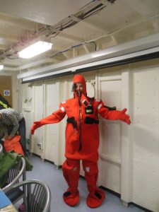
In my survival suit!

Abandon Ship drills – Being out on the cold waters of Alaska and leaving this ship is a scary thought, but it needs to be practiced.  Everyone has their own Survival Suits to wear for these drills.  Check me out with mine!!  We also need to bring long sleeved shirts, warm hats and flotation devices with us.  I will be reporting to Liferaft #4 on the port side of the ship with Liferaft #3 on the starboard side as back up.  My indoor meeting place is in the Wardroom and, again, I assist as directed.  If we have to leave the ship, people have jobs to go get the EPIRB which is an Emergency Position Indicating Radio Beacon, the SART is a Search and Rescue Transponder and the GMDSS which are Global Maritime Distress Safety Signal.  All of these will help the Coast Guard rescue us!!

I have had my training, and you know what needs to be done.  Now, time for the real drills at sea!!!

Suddenly, we hear a long 10 second whistle… it was the drill for fire and emergency.  Everyone quickly went to their assigned areas.  There was a fire near the mess hall and the fire team was on the job!!  ENS McKay and AB Wright worked on putting the fire out.  Below are some pictures of them in their fire gear!

ENS McKay practicing with the fire hoses.
AB Wright and ENS McKay practicing fighting the fire with all their gear on.


The fire drill turned into an Abandoned Ship drill.  Calmly and quickly, everyone gathered their survival suits, a warm hat, long sleeved shirt and their PFD (personal floatation device) and went to their station.  Everyone had to put their survival suits on.  ENS McKay was my group leader and he had to help me with mine.  He was incredibly fast putting his on and gave me some great pointers on being quicker in a real emergency.

Abandon ship drills when everyone puts on their survival suits!
Abandon ship drills when everyone puts on their survival suits! Photo Credit: Eli Smith
ENS McKay had his suit on and off very quickly, he then helped me with mine.
ENS McKay had his suit on and off very quickly, he then helped me with mine. Photo Credit: Eli Smith


While safety drills are important.  I hope we will never have to do this for real!

Path to Rainier

This crew is truly an incredible bunch.  I thought it would be interesting for others to see how people ended up working here.   While I would like to highlight everyone, I could only pick a few.

The first person I want everyone to meet is Able Seaman (AB) Lindsey Houska.  Lindsey is one of the deck hands on Rainier.   I wanted to know what path led her to this unique work place.

With AB Lindsey Houska. Photo credit: Bob Steele

Lindsey started with a degree in Economics from South Dakota State University and worked in Montana for the USDA (U.S Department of Agriculture) for 4 1/2 years.  She realized she wanted to get a bit more out of life than working at a desk.  She sold her house and car, stored her belongings with her parents and went to Indonesia to volunteer instructing farmers on better growing practices.  This was the beginning of her life adventures!  After 3 months living in Indonesia and 5 months traveling other areas of Southeast Asia, she headed out to Australia.  This incredibly hard working woman did a few jobs but ended up working on a commercial fishing vessel catching prawns on the West Coast of Australia.  Later, she got a job in Seattle and South East Alaska as a deck hand on a luxury yacht.  Realizing she had a love of positive environmental practices she wanted to do more for the world in general.  This is when Lindsey applied to work for NOAA.  NOAA are true stewards of the ocean!

On Rainier, Lindsey has been a very busy deck hand for nearly 2 years.  She loves working with all the other deck hands and they have an amazing camaraderie with each other.   I learned so much more about her job when we sat down together.  Lindsey is a trained fire fighter, has been to radar school and even has her captain’s license for smaller vessels.  She works hard with boat deployment, maintenance on the weather deck, inport bridge watch for security and anchor watch so the ship stays in place when it is at anchor.  She also works the cranes, does lookout on the flying bridge and can be a helmsman steering the ship.

In her free time, Lindsey can be found reading, working out in the gym on board, meditating for some quiet time and she also has a bicycle on board that she likes to ride when the ship is in port.  When I asked Lindsey what she did to reduce stress on the job, she said having a good sense of humor with colleagues goes a long way.  They also enjoy time in port together and having meals together.  This amazing woman has traveled all over the world including most of Southeast Asia, all over Australia and New Zealand.  She has been to Europe, Mexico, British Columbia and Manitoba, Canada.  Incredibly, but not surprising as I get to know her, many of the areas Lindsey backpacked to on her own!

I am truly impressed by this lady; how hard she works and how kind she has been to me.  Thank you, Lindsey, for letting me get to know you better!

Personal Log

So true!
So true!

TEAMWORK SAFETY FIRST   Three words that I have discovered run Rainier.  I am incredibly impressed by the teamwork, communication, hard work and commitment to our oceans that is evident here.  The umbrella over all of this is an even bigger obligation to safety.  Above I have highlighted just a bit of what makes this ship work in regard to safety.  In future blogs you will read more about this topic when you learn about the people here.   Needless to say, even though we will be out in very big, deep waters and in narrow bays with tall mountains, I feel incredibly safe in the hands of this reliable crew.

Even getting fuel, this team is safe. Here a fuel boom went around the ship.

Rebecca Loy, Land, Sea and Flexibility! September 9, 2015

NOAA Teacher at Sea
Rebecca Loy
Aboard NOAA Ship Rainier
September 8 – 24 , 2015

Mission: Hydrographic Survey
Geographical area of Research: Kodiak Island, Alaska
Date: September 9, 2015

Current Location: Women’s Harbor, U.S. Coast Guard Base, Kodiak, Alaska

Science Log

Kodiak, Alaska is amazing and NOAA Ship Rainier is even more so.  When I arrived I learned that we were going to be in port for a few days.  Instead of leaving on Tuesday, September 08, 2015 we are scheduled to leave on Saturday.  Early in my planning and training I learned that FLEXIBILITY is very important and it has proven to be true.

NOAA TAS 2015 005
Rainier with the rising sun behind it at Women’s Bay

During this time at port, the entire crew is very busy with ship activities.  I thought this would be the perfect time to give some background on this amazing ship!  Here is a link to more detailed information Rainier information flyer.  An even more detailed, “let the geek out” link is   Rainier special details.

Rainier is named after Mount Rainier in Washington State and was put to work in 1968.  Do the math, how old is Rainier this year?  Rainier is a long 231 foot ship.  The breadth (width) is 42 feet and the draft, or how far down it sits in the water is 14 feet.  One of the most interesting facts about this vessel is the ice strengthened hull.  Rainier is one tough ship!!

To keep this unique ship running so well it has an incredible crew.  I have learned that there are 7 main areas of work.  I am only going to give a general overview so everyone can understand a little bit more about what happens here.  I will go into more detail with future blogs.

Wardroom – This is what the NOAA uniformed officers are called.  They can be seen wearing their blue uniforms.  The hydrographic officers have a more interesting job than the officers on other NOAA vessels because they act not only as officers getting the ship where it needs to go safely, but they also work right alongside the survey scientists making tidal observations and coastal maps.

The Rainier Officers working in the Plotting Room
Rainier Officers working in the Plotting Room

It makes a lot of sense for the people who are researching and creating the very important coastal maps to understand them.  There is no one better than the men and women who work with them every day!

Survey – These are the scientists who work with the officers to collect the data.  Collecting the data is just the beginning.  Once the data is collected they begin analyzing data and putting it to work.  Similar to students who have classwork, they get assignments that need to be met and deadlines to get the work done.  It can take weeks and months for the data to be put together to make the charts.

Engineering – The engineers are the inner working of the ship.  They are the men and women who keep Rainier going strong!  While here, there is a constant hum of mechanical parts (later the engines will be going and we will hear and feel those).

Just one of many areas the engineers work. This is an organized machine shop for repairs/fabricating.

Everywhere you look inside the ship you can see something that the engineers are responsible for maintaining.  On my tour, I was amazed from top to bottom of the fans, gears, plumbing, wires, generators, motors, hydraulics, engines, heating/cooling, launch maintenance, refrigeration, distillers for water plus so much more that needs to be kept going.  As you can see, this is also a very busy department!

Deck – While the engineers maintain the inside of the ship, the deck crew maintains the outside or what is called the “weather deck”.   Here you will see the massive crane on the back of the ship and two smaller cranes at the front.

The large crane at the stern (back) of the ship.

They work the two large anchors and the “windlass” or winch to pull them up along with the smaller launches (boats) that are attached to the ship and the davits (hoists) to put them in and out of the water.  The deck crew also make sure the ship is moored (tied up) properly plus so much more.

EET and ET – These are the two smallest departments, but they are needed to keep everyone working.  The EET is the electronics engineering technician.  He is an electrician that takes care of all the wiring throughout the ship.  The Rainier EET has been here for over 20 years.  The ET is the electronics technician and he builds, maintains and programs the computers and servers that are needed to run Rainier.

Steward – Have you heard the term “laughter is the best medicine?”  Here on Rainier the food is the best medicine and what keeps this crew connected and happy!

The incredibly clean and efficient galley on the Rainier
The incredibly clean and efficient galley on Rainier

The galley (kitchen) is incredibly clean, organized and delicious!  The selection of food has been healthy, varied and with just the right amount of sweet treats.  They are up very early and work later to keep this crew fed.  Every department has to come through here so they are the true backbone of the ship!

As I get to know the ship and crew more, I am continually amazed at the people here, how they communicate and work together and it all runs so smoothly.  I am looking forward to our upcoming adventures doing research around Kodiak Island.

Personal Log

Being chosen for this experience is a great honor for me.  I was here for only 24 hours and I had already seen so much of this beautiful area.  I was fortunate enough to get here the night before Labor Day so the crew and I had the day off.

One of the harbors in Kodiak, AK

I walked around the harbor town of Kodiak and then went hiking to Abercrombie State Park.  This now incredibly beautiful area of moss draped trees, cliffs and black rock/sand beaches was once a World War II gun site.  I saw the massive guns, the lookout that was half buried in the rock and the searchlight shelter.  Due to the northern site, there are times that the sun is not out for long so they had big searchlights that were rolled out of the structure to search for planes and ships out in the Pacific Ocean.  While there I got to see the resident Bald Eagles and other wildlife (no Kodiak bears yet but I keep looking).

Later, I was able to head to the southern shore of Kodiak Island to see where people surf on Surfer Beach.  Again, the sand is very dark and the waves were incredible.  I didn’t think Alaska was an area for surfing, but it is very popular.

The incredible Surfer Beach!

After looking at Surfer Beach I was taken over to the Pacific Spaceport Complex Alaska.  I was able to let my Space Geek out.  Too bad I didn’t have my Blue Flight Suit, I could have had my picture taken there.  This is an active launch pad for launches over the Arctic.  They had an explosion here in November, 2014 (no one was hurt thankfully) so it is being repaired before more launches can take place.

An interesting sign at the Pacific Spaceport Alaska.

On the ship, the crew is incredibly welcoming and helpful.  I am gradually learning my way around and how things work.  Off the ship, I used the time to connect with the local Kodiak High School and their award winning robotics team.  They are doing some pretty amazing things here with STEAM in this small coastal town.

More adventures to follow as we head out and I become a true Teacher At Sea, not just a Teacher In Port!

Rebecca Loy, Hello from land! August 12, 2015

NOAA Teacher at Sea
Rebecca Loy
Soon to be aboard NOAA Ship Rainier
September 8 – 24 , 2015

Mission: Hydrographic Survey
Geographical area of Research: Kodiak Island, Alaska
Date: August 12, 2015

Introduction

Personal Log:  Hello to everyone from Cicero, New York. Cicero is just outside of Syracuse in the middle of New York State surrounded by some very beautiful areas. My name is Becky Loy and I have been teaching special education for 24 years.

You might wonder, why is a special education teacher going to sea…? Well, I sort of joke that I am a special education teacher by day, STEAM (Science, Technology, Engineering, Arts and Math) enthusiast by night.

Caught by surprise having a laugh with some volunteers with our high powered rockets.

I love my job teaching at Minoa Elementary in the East Syracuse-Minoa School District. My district is extremely supportive of me, and I look for any way to incorporate STEAM activities into my day, but it is usually after school. From space education, launching large five foot high powered rockets, Lego robotics, NASA moon rocks, writing NASA curriculum to taking large groups to Washington, D.C. or Space Camp, Canada, I try to inspire students many ways! I am very excited about going to sea in Alaska on NOAA Ship Rainier!  This will give me many more experiences to bring back to my school and community. My dream is for kids to be inspired by me to follow their own STEAM paths and careers.

This slideshow requires JavaScript.

Some of my best adventures have been around water.  To begin, I grew up on the large St. Lawrence River in northern New York State and could practically swim before I walked.  A true passion of mine for over 10 years is sailing on the Maine-based, National Heritage schooner Isaac H. Evans.  While sailing, the wind takes you where it pleases and the chef cooks on a wood stove in a wooden galley.  This is where I learned that you sleep in a “berth”, go the to the bathroom in a “head” and you wash your hands in a “basin” (Think about it – you don’t want to use the word “sink” on a boat!).   Another water-based, but thrilling experience is when I went cage diving with Great White sharks off the coast of Africa!  Little did I know that the shark was going to grab the chum right in front of me – yikes!!

This slideshow requires JavaScript.

Being on water is natural for me and I love it! Having the experience of being on a hydrographic research vessel is very unique. Hydrographic research is the study of our coastal waters – updating charts, maybe checking tides or the bottom of a bay/strait or going on smaller boats to look closer at the shoreline. I look forward to learning all I can about it!

This is all very exciting for me, but I must admit I am a bit nervous. Who would think that someone who swam with sharks would be more nervous about this, but I am. Since my dream is to inspire more children and adults, I want to do a great job!

Blue Flight Suit fun with fellow Honeywell teachers Jacqui and Maria and astronaut Clay Anderson

Some of my adventures that are not based on water are attending Honeywell’s Space and Advanced Space Academies for educators, getting VIP tours of various NASA facilities, sleeping in a car to see Space Shuttle Atlantis lift off (oooohh my back and neck hurt after that experience!), star gazing in Death Valley, CA, paragliding off a mountain in Africa and traveling in Europe.  Another passion (and something I get the strangest looks for) is showing off my Space Academy Blue Flight Suit at any appropriate occasion with other space enthusiasts!  We are like our own little family.


My son and I with Mythbuster Adam Savage! STEAM Awesomeness!

In my free time, I enjoy special time with my loving family. I have an incredibly supportive husband, an 18 year old son and 2 pugs! I enjoy reading, painting, gardening and a variety of

At the TACNY Outstanding Teacher awards with my husband and son, 2013

do-it-yourself projects. I take a great deal of pride in seeking new adventures to inspire both adults and children!

Thank you for following me on this latest adventure!