Geographic Area of Cruise: North Pacific: Greater Farallones National Marine Sanctuary, Cordell Bank National Marine Sanctuary
Pam Schaffer, NOAA Teacher at Sea
All I can say about my NOAA Teacher at Sea experience is WOW- what an incredible experience. Thank you to everyone at the NOAA Teacher at Sea program, the crew of the NOAA Ship Bell M. Shimada, the ACCESS research scientists on-board and the staff of the Greater Farallones and Cordell Bank National Marine Sanctuaries. I’d particularly like to thank Dr. Jaime Jahncke for teaching me how to collect and process zooplanton samples using the Tucker Trawler and enabling me to become a trusted member of his research team.
During the cruise, I learned so much about the work of oceanographers, marine biologists and ecologists. I’ve sailed in these waters in my own sail boat many times but I’ve never seen the sanctuaries through the lens of a researcher. The care and attention to detail taken during marine wildlife observations and the collection of zooplankton and phytoplankton samples throughout the water column reveals an incredibly rich and abundant ecosystem. The data collected will be shared with scientists around the world and helps us better understand and manage the health of our oceans.
The experience has given me lots of great ideas for lessons that I think will engage students and get them excited about knowing more about the ocean. I can hardly wait for the next school year to start so that I can share this amazing experience with students and facilitate learning experiences to inspire future scientists.
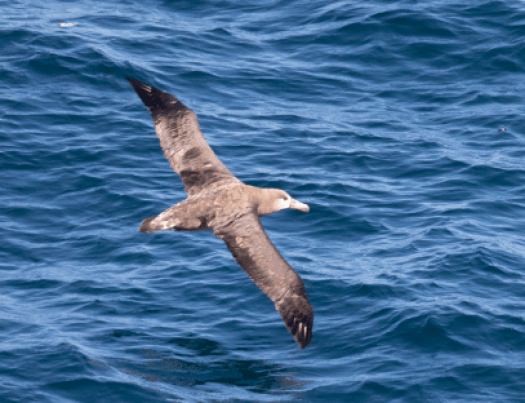
Here are some great wildlife pictures that I wanted to share earlier but the connectivity on the vessel was really limited and I wasn’t able to post them.
Geographic Area of Cruise: North Pacific: Greater Farallones National Marine Sanctuary, Cordell Bank National Marine Sanctuary
Weather Data from the Bridge
Date
July 7 2018
Time
1200 (noon)
Latitude
37° 58.3’ N
Longitude
123° 06.4’ W
Present Weather/ Sky
Cloudy
Visibility (nm)
10
Wind Direction (true)
341°
Wind Speed (kts)
18
Atmospheric Pressure (mb)
1018
Sea Wave Height (ft)
3-5
Swell Waves Direction (true)
330°
Swell Waves Height (ft)
3-5
Temperature Sea Water (C)
13.2°
Temperature Dry Bulb (C)
Air Temperature
13.1°
Temp Wet Bulb (C )
12.1°
Science and Technology Log
Marine life is not evenly distributed throughout the World’s oceans. Some areas contain abundant and diverse life forms and support complex food webs whereas other areas are considered a desert. This variation is due to environmental factors like temperature, salinity, nutrients, amount of light, underlying currents, oxygen levels and pH. Some of these variables, such as temperature, oxygen levels, and pH, are experiencing more variability as a result of climate change. In order to understand the health of marine environments, scientists explore the chemical and physical properties of seawater using a set of electronic instruments on a device called a CTD. CTD stands for conductivity, temperature and depth and is the standard set of instruments used to measure variables in the water column.
The CTD is the bread and butter of oceanography research. It is primarily used to profile and assess salinity and temperature differences at varying depths in a water column. But the device can also carry instruments used to calculate turbidity, fluorescence (a way to measure the amount of phytoplankton in the water), oxygen levels, and pH. Conductivity is a way of determining the salinity of water. It measures how easily an electric current passes through a liquid. Electric currents pass much more easily through seawater than fresh water. A small electrical current is passed between two electrodes and the resulting measurement is interpreted to measure the amount of salt and other inorganic compounds in a water sample. Dissolved salt increases the density of water, and the density of water also increases as temperature decreases. Deeper water is colder and denser. Density is also affected by water pressure. Since water pressure increases with increasing depth, the density of seawater also increases as depth increases.
Optical sensors are used to measure the amount of turbidity, fluorescence, and dissolved oxygen at various depths in the water column. Dissolved oxygen levels fluctuate with temperature, salinity and pressure changes and is a key indicator of water quality. Dissolved oxygen is essential for the survival of fish and other marine organisms. Oxygen gets into the water as gas exchange with the atmosphere and as a by-product of plant photosynthesis (algae, kelp etc.).
Photo Credit: Julie Chase/ACCESS/NOAA/Point Blue
Typically, CTD instruments are attached to a large circular metal frame called a Rosette, which contains water-sampling bottles that are remotely opened and closed at different depths to collect water samples for later analysis. Using the information and samples collected, scientists can make inferences about the occurrence of certain chemical properties to better understand the distribution and abundance of life in particular areas of the ocean.
Scientist Carina Fish collects samples from CTD
On our mission, scientists deploy the CTD to a depth of 500 meters at most stations. On the shelf break, the researchers deployed the CTD to 1200 meters (more than 3/4 of a mile below the surface) to collect samples. The pressure is so great at this depth that a 1 foot by 1 foot square of Styrofoam is crushed to a quarter of its size(3″x 3″).
Retrieving the CTD Rosette
Personal Log
Around 01:30 last night we lost our Tucker Trawl net as it was being re-positioned. The winds had picked up to around 20 knots and the sea height was around 5-8 feet according to the bridge log. The sea state complicated the retrieval and as best we can conclude the wind and seas pushed the net bridle into a prop blade which swiftly and effortlessly cut the 1/3” thick metal wire cable and separated the net from its tether. Mishaps at sea are part and parcel of working in a harsh and variable environments. Even the very best and most experienced captain and crew encounter unforeseen issues from time to time. Dr. Jaime Jahncke quickly stepped into action and made contact with onshore colleagues to arrange for another net for the next research cruise. In the meantime, we plan to use the hoop net to collect krill samples, weather permitting.
Did You Know?
According to NOAA scientists, only about 5% of the Earth’s oceans have been explored.
Geographic Area of Cruise: North Pacific: Greater Farallones National Marine Sanctuary, Cordell Bank National Marine Sanctuary
Weather Data from the Bridge
Date
July 5 2018
Time
1100
Latitude
37 30.1’N
Longitude
123 08.5’W
Present Weather/ Sky
Cloudy
Visibility (nm)
12
Wind Direction (tree)
Light
Wind Speed (kts)
Variable
Atmospheric Pressure (mb)
1021.3
Sea Wave Height (ft)
<1
Swell Waves Direction (true)
270°
Swell Waves Height (ft)
1-2
Temperature Sea Water (C)
13.0°
Temperature Dry bulb (C)
Air Temperature
16.7°
Temperature Wet Bulb (C )
13.7°
Science and Technology Log
Krill are small crustaceans (think shrimp-like) that inhabit the world’s oceans. They are an essential component of marine ecosystems, residing near the bottom of the food chain. Krill are a staple in the diet of whales, squid, octopuses and fish. Understanding the variability of krill populations is an important way of monitoring ocean health. In order to track the krill population, scientists do two things; they use acoustics to estimate the biomass and use nets to verify the results from the acoustics.
Deploying the Tucker Trawl
Scientists use a large net mechanism called a “Tucker Trawl” to collect samples of krill and other zooplankton at various depths in the water column. A Tucker Trawl is a set of opening and closing cone shaped nets made of fine mesh (holes that are 333 microns in diameter). The unit we are using has three sections, each with a mouth diameter of 1 meter by 1.5 meters and a sample collector container on the bottom. Krill is collected by dropping the net in a specific location to a specified depth while the ship is slowly moving at a rate of approximately two knots per hour (2.3 mph). An onboard crane deploys and retrieves the mechanism using a heavy cable. On this cruise we’ve sampled to depths as much as 200 meters deep. The Tucker Trawl depth and when the nets are opened can be adjusted in order to sample several vertical positions in the water column during a single trawl.
Processing Samples
Once the samples are back onboard the nets are sprayed down and the collectors are carefully emptied into storage containers for later analysis onshore. The content analysis will count and identify the various species collected in the sample, as determining sex, size, lifecycle which vary by species. We’ve observed two different species in our samples; Euphasia pacifica (smallest and most abundant) and Thysanoessa spinifera (larger with a spiny back). Data collected via these Tucker Trawl sessions is used to construct models for assessing krill biomass using acoustic measuring technology.
Thysanoessa spinifera upcloseLoads of Krill
Personal Log
Tucker Trawling is wet business but really interesting. It’s a great learning experience working with Dr. Jaime Jahncke to deploy the nets and process the samples. We’re doing several trawls each day throughout the cruise- one session around noon and another set around midnight. I’ve adjusted my sleeping schedule to get a few hours of rest before we start the midnight shift and then I sleep a few hours after we finish working around 4:30 am. I’m tired but really happy to be here.
Did You Know?
The name “krill” is Norwegian for “small fry of fish”.
Geographic Area of Cruise: North Pacific: Greater Farallones Nation Marine Sanctuary, Cordell Bank National Marine Sanctuary
Weather Data from the Bridge.
Date
July 3 2018
Time
1200 (noon)
Latitude
37° 49.5’ N
Longitude
122° 48.1’ W
Present Weather/ Sky
Cloudy
Visibility (nm)
10
Wind Direction (tree)
172°
Wind Speed (kts)
12
Atmospheric Pressure (mb)
1027
Sea Wave Height (ft)
N/A
Swell Waves Direction (true)
290°
Swell Waves Height (ft)
3-5
Temperature Sea Water (C)
13.6°
Temp Dry bulb (C)
Air Temperature
14.2°
Temp Wet Bulb (C )
11.9°
Science and Technology Log
After leaving San Francisco Bay, yesterday we headed west and spent the day getting our “sea legs” and collecting observations of marine mammals and birds in the Greater Farallones National Marine Sanctuary waters. We began collecting data around 1300 hrs from 37° 47′ 52.4“ N 122° 53’ 31.2” W and headed west towards the continental shelf break approximately 30 miles off shore.
ACCESS Research Team Departing San Francisco Bay
Throughout the day we followed a series of predetermined tracks (referred to as transects) and collected counts of the abundant life thriving in the sanctuary. We saw numerous Blue Whales, Fin Whales, Humpbacks and dolphins. We also had a sighting of a strange prehistoric looking fish called a Mola mola (common name: Ocean Sunfish). Mola Mola are the largest bony fish in the world and are playfully described small dinner plates and can grow to as large as a smart car. They tend to live in deep water so seeing one at the surface is a real treat. Their distinctive dorsal and ventral fins are quite long and their pectoral fins (the ones on the sides) are quite short and stubby. They dine on jelly fish and need to eat a lot in order to develop and sustain their substantial bulk. Members of the ACCESS survey team have observed Mola slurping up Velella velella ( common name: Sea Raft) a type of free-floating hydrozoan that lives on the ocean surface.
Mola Mola feeding at surface
Personal Log
My free time has been getting accustomed to being at sea again and getting to know my new colleagues. The internet onboard is very limited and we have 40 users sharing it so getting blogs out is proving to be more challenging than I’d anticipated
Did You Know?
The terms “port” and “starboard” are used as to indicate the left and right sides of a ship. “Starboard” comes from the Old English “steorbord”, meaning the side on which the ship is steered. Before rudders (which are located in the centerline), early ships had a steering oar and because most people are right handed it was located on the right hand side of the ship. Because the steering oar needed to be out of the way when docking the opposite side of the boat traditionally was the side that was closest to the pier. Hence “port” refers to the left side of a ship if you are looking towards the front of the ship. The front of a ship is called a “bow”.
Today begins a nine day NOAA research cruise on NOAA ship Bell M.Shimada. Presently, we’re docked in San Francisco and will head out the gate at 0900 tomorrow. I’m really excited to be part of a team of 12 scientists and specialists conducting research in the Greater Farallones and Cordell Bank National Marine Sanctuaries. I plan to blog often (connectivity permitting) throughout the journey and to share the details of our work.
NOAA Ship Bell M. Shimada (photo credit: NOAA)
A bit about the ship- NOAA ship Bell M Shimada was commissioned by NOAA in 2010. Her home Port is Newport Oregon, and she supports research activities on the West Coast of the United States. She’s 209 feet long and weighs 2479 tons, has a cruising range of 13,800 miles and travels at 11 knots (12.6 mph). Shimada is an impressive vessel and is uniquely capable of conducting fisheries, oceanographic research and hydrographic studies. She is considered to be one of the most advanced fisheries research vessels in the world. Her stern looks very similar to a commercial fishing vessel and is capable of deploying large trawling nets for research to depths of 3,500 meters (11,483 feet). Shimada uses specialized acoustic quieting technology developed by the U.S. Navy to monitor fish populations without disturbing the fish and altering their behavior. She also has a Scientific Sonar System, used to measure the biomass of fish populations in a survey area. Her acoustic profiling system enables scientists to gather data on ocean currents and provides information on the content of the water column and the topography of the seafloor. In addition to sending out smaller sampling nets, longlines, and fish traps she can also deploy instruments to measure the electrical conductivity (used to determine salinity), temperature, depth (CTD) and chlorophyll fluorescence of sea water. You can learn more about the ship here: https://www.omao.noaa.gov/learn/marine-operations/ships/bell-m-shimada/about
It’s a delight and an honor to be part of the ACCESS research team on NOAA ship Bell M. Shimada.