Linda Tatreau, MARCH 12, 2010

NOAA Teacher at Sea: Linda Tatreau
Onboard NOAA Ship Oscar Elton Sette

Mission: Fisheries Surveys
Geographical Area of Cruise: Equatorial Pacific
Date: March 12, 2010

Shark! and HARP

Tiger Shark
Tiger Shark
We are into the last day of work before returning to Guam. The first set of BRUVs is being recovered as I write. We will have time for one more set (8) and then we’ll secure the equipment and head for home (home for me anyway―everyone else will still be far from home). Steve is getting great data on the fish populations on the west side of Saipan. As much as we like watching the fish, we got more excited to see a turtle checking the bait, a moray eel chewing on the bait bag, and yesterday, a large tiger shark cruising back and forth nudging the bait bag. Unfortunately, the video ended while the shark was still at the BRUV. When we brought it up, the bait bag was gone.
E paraancora
E paraancora

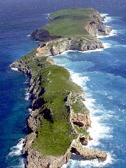
John and Viv deploy the TOAD each night and make 3 or 4 passes over the reef to assess coral coverage and other bottom features. They were particularly happy to have found several areas of reef with the coral Euphyllia paraancora. This coral is found in the tropical Western Pacific and the Indian Ocean, but it is not common. It is heavily harvested for the aquarium trade and more susceptible to bleaching than more robust coral species. It is listed as vulnerable and is further threatened by the predicted threats of climate change and ocean acidification. It was put on the IUCN Red List and is protected via CITES, both as of October, 2009.

Above: HARP Diagram
Above: HARP Diagram

One night we deployed a HARP, a High-Frequency Acoustic Recording Package used to study cetaceans (whales and dolphins). The scientist in charge of this equipment was not onboard but had arranged with the Chief Scientist to put out this equipment near Saipan. This HARP will sit on the seafloor for 2 years collecting sounds. HARPs record ambient ocean noise including low-frequency baleen whale calls, high-frequency dolphin clicks, sounds in between and man-made sounds from ships, sonar, and seismic exploration. When the HARP is retrieved, the sounds can be analyzed and we will learn more about the cetacean populations of the Mariana Islands.

Engine Room
Engine Room

A few days ago, Glen gave me a great tour of the engine room. It is beyond the scope of this blog to describe it here, but I can’t resist including a few pictures. I am always amazed by what it takes to keep a ship like this running. They call it an “unmanned engine room” because an alarm will ring if something needs attention like overheating or low oil pressure. It may be called “unmanned” but it takes a lot of man-hours to keep it that way. The engine room and machine shop are really clean and well organized―I didn’t see a drip of oil or a smudge of grease.

Right: One of 4 diesel engines that provided the electricity for the ship and run the electric motors that drive the propellers.

Engine Room
Engine Room
Engine Room
Engine Room

Right: Glen, first assistant engineer and my tour guide.

Glen, First Assistant Engineer

Linda Tatreau, MARCH 9, 2010

NOAA Teacher at Sea: Linda Tatreau
Onboard NOAA Ship Oscar Elton Sette

Mission: Fisheries Surveys
Geographical Area of Cruise: Equatorial Pacific
Date: March 9, 2010

TOAD

Sunset
Sunset

It would be easy to start every post with a beautiful sunrise or sunset photo. In this one, you can see Anatahan Island in the background. Just before the sunset, 3 large wahoo were caught. Poke and fried fish are the favorite items on recent menus (breakfast, lunch and dinner).

Steve, Frances and Mills show off their catch.
This photo/diagram shows how sonar waves ping the seafloor and also shows the bathymetric map that is made from the data.

We used the multibeam sonar to map shallow banks north of Farallon de Mendinilla and east of Anatahan and Sarigan. The multibeam work continued day and night and produced huge amounts of data that needed to be processed. I can only sit at the computer for short periods, but the map team members work 10 hour shifts and most of that time is spent processing the data and making new maps. There are always 2 or 3 people processing the data.

The TOAD seen with cameras facing forward.

Monday night, we put out the TOAD (Towed Optical Assessment Device). This camera is towed behind the ship and sends video directly to the control room. We were able to see some of the seafloor we had been mapping. The first run of the camera went for 2.25 hours, covered a distance of 3 miles and went to a maximum depth of 400 feet. The second run went for 3.5 hours, over 4.5 miles to a maximum depth of 300 feet. Towing the camera sounds easy, but someone must be on the controls to keep the camera from crashing into the bottom. The camera needs to be close to the bottom for the best video, but without someone on the controls, it can crash. Driving requires constant attention. Most of the seafloor had a sand coverage with some algae. Occasionally, there would be oohs and aahs over something other than sand and sea weed: sea stars, large sea cucumbers, sponges, sea urchins or the infrequent fish. I really enjoy watching real time video of previously unseen seafloor, but I found myself falling asleep on my feet. I finally had to give up and head to the bunk.

Steve & Viv prepare the TOAD for launch.

Today, we are near Saipan planning to do BRUV work during the day and the TOAD tonight. A nap might be a good plan so I can watch the TOAD through the night, but I don’t want to miss the BRUV action either.

Linda Tatreau, MARCH 5, 2010

NOAA Teacher at Sea: Linda Tatreau
Onboard NOAA Ship Oscar Elton Sette

Mission: Fisheries Surveys
Geographical Area of Cruise: Equatorial Pacific
DAte: March 5, 2010

YouTube: AUV, BRUVs and BotCams

Mike Marino, an officer on the ship, made a great little movie showing the work done during the first two weeks of this expedition.You can find it at

Linda Tatreau, MARCH 4, 2010

NOAA Teacher at Sea: Linda Tatreau
Onboard NOAA Ship Oscar Elton Sette

Mission: Fisheries Surveys
Geographical Area of Cruise: Equatorial Pacific
Date: March 4, 2010

Pinging and Playing

We continue to “kill dots” as we work our way around the island of Farallon de Mendinilla. The mapping here will be finished tonight and then we will head north to map the seafloor of a few seamounts and banks. Most of the recent questions on this blog have been about “killing dots,” as we edit the data from the multibeam sonar. I will tell you more about the map making process in a future post. Today I want to show you some of the fun things we do aboard ship.Fishing is everyone’s favorite activity, either for the catching or the eating. The best method is trolling using lures when the ship is traveling at about 10 knots. This only happens when the ship is heading from one study area to another. When using the multibeam, the ship travels at about 4.5 knots and the fish are less apt to bite a slowly moving lure.

Kenji making poke from a wahoo he caught.
Frances with mahi mahi skins she is drying to make a fishing lure. Before drying she had to remove all the meat and later all the scales were removed. The resulting skin is very tough.
Jonathan on the exercise bike pedaling to Rota. There is an exercise room on the ship with a treadmill, rowing machine and weights. Many of the crew members like the bike best because it’s out on the deck with the great view.
A few of the movies available.
Movies are popular during breaks. The ship has about 800 tapes including older movies and recent releases. Many of the crew members have personal collections as well.
The desk in my stateroom.
Each stateroom (bunkroom) has a monitor so the movies can be watched in the movie room, the lounge or the staterooms. The T.V. in the lounge also gets Fox News via satellite. The internet is a popular pastime. That also comes via satellite. The ship pays a set fee for the satellite service and there is no charge to us. There are three computers in the lounge available for everyone to use. There are internet connections on the bridge, in the science labs and in the bunk rooms for people with laptops. The library has a nice collection of books and board games so there is always something to do during non-working hours.
Bellow: That’s me looking for whales. These binoculars are called “big eyes.” They are used on trips when scientists are studying mammal populations. Using these binoculars from the highest point on the ship increases the likelihood of seasickness.
Big Eyes
Big Eyes
Here we are splicing lines to hold buoys. There have also been several knot-tying sessions.

Linda Tatreau, MARCH 2, 2010

NOAA Teacher at Sea: Linda Tatreau
Onboard NOAA Ship Oscar Elton Sette

Mission: Fisheries Surveys
Geographical Area of Cruise: Equatorial Pacific
DAte: March 2, 2010

BRIDGES

The BRIDGES of Farallon de Mendinilla and the Oscar Elton SetteWe lost half of the science team in Saipan. The fun work of surveying fish populations is over so the AUV, BotCam and BRUV teams have headed for home. A tsunami at sea is not felt by ships, but the tsunami warning came while we were still at the dock. We were alert and ready to depart, but fortunately for us and the entire Pacific, the tsunami didn’t materialize.

Me checking out the pings

We are now mapping the seafloor around the island of Farallon de Mendinilla. The ship goes back and forth over a given area much like “mowing the lawn,” in fact they frequently refer to it that way. We will be doing this for about 12 days. The data comes into the ship’s computers and the clean-up work begins. Two or three people work at the computers day and night cleaning the data. The sonar sends out 3 or 4 pings per second. Each ping has 101 beams. Every beam of the multibeam sonar makes a dot on the computer screen. Some of the dots lie outside the target area and must be zapped. This is time consuming, tedious work. I am learning and I cleaned three paths yesterday. I am incredibly slow and have to stop frequently to get additional instructions. (That’s me on the left, hard at work.)

The BRIDGE of Farallon de Mendinilla (or is it a tunnel? or a cave? )
The island is small (1.6 miles long by 0.25 mile wide) with only grass and shrubs―not even one coconut palm. There are a lot of birds: frigates, boobies, terns, and other species. We’ve seen whales on three occasions. The ones that were close enough to identify were humpback whales.
The island is small (1.6 miles long by 0.25 mile wide) with only grass and shrubs
The BRIDGE of the Oscar Elton Sette is where the officers drive the ship, plot courses, handle navigational concerns and communications. I’ve had two tours of the bridge and am amazed by the electronics and complexity of each system. Rather than a description, I’ll just give you a few pictures.

Eric showing one of the ship's many charts.
Eric showing one of the ship’s many charts.
The steering wheel is considerable smaller than I expected.

Chart table used for plotting the course. GPS is also used, but charts are kept in case the power fails.
The iridium phone works via satellite. The crew can use it for personal calls during non-business hours (East Coast to Hawaii). That doesn't leave much time but it is also available on weekends.
The iridium phone works via satellite. The crew can use it for personal calls during non-business hours (East Coast to Hawaii). That doesn’t leave much time but it is also available on weekends.
Mike is reflected in the radar. The red triangle just right of center is Farallon de Mendinilla.
This sign on the bridge lets the skipper know that there are fishing lines off the stern.

Linda Tatreau, FEBRUARY 28, 2010

NOAA Teacher at Sea: Linda Tatreau
Onboard NOAA Ship Oscar Elton Sette

Mission: Fisheries Surveys
Geographical Area of Cruise: Equatorial Pacific
Date: February 28, 2010


Old Dog, New Trick

What is the most exciting, most awesome, most unusual event of the expedition? These are the most common questions I have received from students following the blog. The whole trip has been exciting and awesome. It’s also been unusual as I don’t normally spend a lot of time at sea.
Unexpectedly for me, on February 23rd came the most exciting,most awesome and most unusual event of this trip. By then, I was familiar with the Autonomous Underwater Vehicle. I had read about it, talked about it, written about it and taken dozens of pictures. What I didn’t know was that Chris (see Meet the Science Team) was working to teach the AUV a new trick. AUVs run a preprogrammed route for about 4 hours and then return to the surface. It’s not until the AUV is back in its cradle on deck that the cameras can be retrieved. Only then can the photos be seen. Chris spent the trip devising a method whereby the AUV can send pictures to the ship while still underwater.
Seven miles of cabel used by the Remotely Operated Vehicle Jason II.
Keep in mind that the AUV is not attached to the ship. Remotely Operated Vehicles (ROVs) are attached to the ship via cables and can send pictures and receive instructions from the control room on the ship. On the AUV’s last dive, Chris’s program worked―underwater pictures on his computer. He got 13 photos at about 20 minutes each. The information is sent to the computer in small bits that must be assembled. HE DID IT! I wanted to break out the champagne in celebration, but there is none onboard so we had to settle for enthusiastic applause. I still get chicken skin (goose bumps) just thinking about the magnitude of his success.
AUV, no cables.

In the following paragraph, Chris talks about AUVs and communication.”Wirelessly communicating with Autonomous Underwater Vehicles (AUVs) is very difficult―the type of wireless communications that we rely on in our day-to-day lives does not work underwater. Most wireless systems, like WiFi or mobile phones, rely upon high frequency electromagnetic waves―millions or billions of cycles per second. Underwater, high frequency signals are attenuated, or blocked, over short distances. That is part of why when you are snorkeling or SCUBA diving everything looks blue―the higher frequency red light has been blocked out. To communicate with SeaBED AUVs, we rely upon sound waves, which use only around 12 thousand cycles per second. Echoes, other noise, and a number of other challenges presented by the ocean result in us having a very slow connection to the robot. Also, like using a walkie talkie, only one person can be talking at a time. If we are sending commands to the robot, it can’t be sending us information. Finally, sound travels slowly through the water, so it takes time for the message to even get to the boat (this is called latency). That all means we have to heavily compress images so that they are very small on disk before we transmit them, and we don’t get all the pieces in the right order. Putting together the image ends up being like putting together a puzzle―you have to make sure you have all the pieces, and then put them together in the right order. The compression means that the images look pretty rough, but they still give us an idea of what the robot is doing, and an early glimpse at the seafloor. For the rest, you have to wait until it comes back up! SeaBED AUVs can take over a thousand images every hour! ”

OK, me again. Chris will continue working on this project. He wants to make it easier and faster. With this new trick, the scientists will know, while the AUV is still below, that all systems are working and the AUV is taking quality photos.

Linda Tatreau, FEBRUARY 22, 2010

NOAA Teacher at Sea: Linda Tatreau
Onboard NOAA Ship Oscar Elton Sette

Mission: Fisheries Surveys
Geographical Area of Cruise: Equatorial Pacific
Date: February 22, 2010


Rota

Rota
Rota

This is day #3 working off-shore of the beautiful island of Rota. While working at Galvez Bank we could see Guam at a distance of about 14 miles, but it was just a big bump on the horizon. While working in this location, we are close to shore and can enjoy the view of tropical vegetation, white sandy beaches and carbonate cliffs. The work in Rota has included BRUVs, multibeam and the AUV.

Linda, Viv and Tony with Rota in the background.

The AUV work has gone smoothly. Launching occurs each evening about 8:00 with recovery at midnight. The AUV has 2 cameras, one facing downward to photograph the geography and one facing forward for better fish identification (it’s difficult to identify a fish from the top, looking down). At night the AUV takes only still photographs. A strobe illuminates the scene every 5 seconds and the cameras shoot in synchronicity. A 4-hour trip produces more than 2,500 photographs with each camera. Processing that many pictures is a time consuming job. The AUV also has a CTD and records data for future analysis. Chirs (see Meet the Science Team) is working on a program that will allow the AUV to send pictures to the ship in real time. To date, this has only been accomplished when a ship is directly over the AUV. Chris is very close to success―maybe tonight.

Linda cutting bait for the BRUV bait bags.
BRUV boys loaded up and ready go.
The BRUV team says this trip has been the easiest BRUV work ever. In the next breath, they say this trip has been the most difficult BRUV work ever. The easiest―Galvez Bank where launch and recovery were from the ship. Launching was accomplished by simply tossing them off the stern. They were brought back aboard using an electric winch. The most difficult―Rota where the work is close to shore and the ship can’t go. Now they are using a small boat. With all the equipment piled on the boat, there is barely space for 3 people―the driver and 2 to handle the BRUVs. They have 4 BRUVs nestled on the little boat along with all the associated lines and buoys . Add bait, bait bags, lunch and drink and there is not much working area. Once rigged, the BRUVs are tossed over the side in 100 to 150 feet of water. Recovery is accomplished using a hand winch―at 150 feet deep, that is a lot of manual turns of the handle. Difficult as it may be, yesterday they managed 13 BRUV drops in 8 hours.

OK, every entry in this blog has been mostly science. For me, that’s the greatest fun. For the next entry, I’ll try for some of the non-science fun onboard a ship.

Linda Tatreau, FEBRUARY 20, 2010

NOAA Teacher at Sea: Linda Tatreau
Onboard NOAA Ship Oscar Elton Sette

Mission: Fisheries Surveys
Geographical Area of Cruise: Equatorial Pacific
Date: February 22, 2010

Guppies

Sunset
Sunset
Yesterday was a picture perfect day at sea. The sunrise was accompanied by 6 dolphins frolicking in front of the bow. The day was sunny, the sea was calm and we could see the bottom in 100 feet of water. It doesn’t get better. Steve and Sparky are preparing video clips from the BRUVs. New footage shows a feeding frenzy of snappers and at one point, a stingray parks itself on top of the bait bag. I am anxious to post these clips, but I must be patient. The BRUV boys and the BotCam girl have 85 hours of video to watch. Analyzing it will take much longer.The preliminary bathymetric map of Galvez Bank is completed and shown below.

Bathymetric Map of Galvez Bank

There is a new page on the blog. Click on the page titled, “Mutibeam Sonar.” Joyce Miller gives the basic information on how the multibeam works and how they generate these great bathymetric maps.

We have said good-bye to Galvez Banks and, after a bit of multibeam work west of Guam in the middle of the night, we are cruising towards Rota.

Steve swinging in the long-line pit. This is the area that is used for recovery of the BotCams, BRUVs and the AUV. On other expedtions the area is actually used for long-line fishing as a survey method.


Pet guppies getting some sun and enjoying the view on the ship's deck.
Pet guppies getting some sun and enjoying the view on the ship’s deck.

Linda Tatreau, FEBRUARY 17, 2010

NOAA Teacher at Sea: Linda Tatreau
Onboard NOAA Ship Oscar Elton Sette

Mission: Fisheries Surveys
Geographical Area of Cruise: Equatorial Pacific
Date: February 22, 2010

Daily Routine

Sparky cutting bait

The days are settling into a routine. As the sun rises, the multibean sonar is lifted and secured or Eric turns off the echo sounder he uses for locating schools of fish. By 7:30 A.M., the camera teams are ready with the 2 BotCams and 8 BRUVs. The deployment depths have been determined so each rig is set with the appropriate length of line. The camera batteries have been charged over night (10 rigs make for a total of 20 cameras). The bait has been cut and stuffed into the bait bags. Deployment of all 10 sets takes about 1.5 hours. Each set of cameras runs for just over an hour so as soon as the last cameras are deployed, the first are ready to be retrieved. Retrieval is more time consuming. Each camera set is marked by 2 orange buoys. The ship must approach with the buoys on the lee side (sheltered from the wind ). A crew member then throws a line with a big 4-pronged hook to snag the line between the buoys. If the ship is too close, it runs over the buoys―too far away and they have to come around for another try which can take up to 30 minutes. Generally, the morning cameras are back on board in time for lunch. Afternoons are a repeat of the morning and the cameras are back on board just in time for dinner.

Mills with a mahi mahi

We have a couple of fishing enthusiasts on board. They put out troll lines whenever they get the chance, usually at sunrise or sunset when the captain kicks up the speed to about 10 knots to reach the next study location. There has not been much time for fishing but we have eaten a few mahi mahi. This makes everyone happy―the fishermen of course, and the rest of us for the fillets.

Night time operations with the AUV

After dinner, the AUV team prepares the vehicle for deployment. The AUV is the most time consuming project. They spend hours with the electronics and hours more getting it ready to go underwater. When the communications work, the AUV follows a pre-programmed path about 4 hours in duration. When communications cannot be established, they have to bring it back on board and try again the next night. They have been so busy that we have not yet been able to see their pictures. Soon, I hope. It will be interesting to see the differences between daylight and night time activities on the sea floor.

Linda Tatreau, FEBRUARY 15, 2010

NOAA Teacher at Sea: Linda Tatreau
Onboard NOAA Ship Oscar Elton Sette

Mission: Fisheries Surveys
Geographical Area of Cruise: Equatorial Pacific
Date: February 15, 2010

Autonomous Underwater Vehicle

Deployment
Autonomous Underwater Vehicle

The past two days have been spent working with the Autonomous Underwater Vehicle. On Sunday, the AUV was put in the water but never set free because it was having communications problems. On Wednesday, it was communicating perfectly, but just as it was to be released, the last line holding it to the ship became entangled and The AUV had to be brought back aboard. The afternoon deployment went perfectly. The AUV stayed on track for about two hours. It brought back pictures and video but I haven’t seen them yet.

The AUV without its protective housing.
There are many different kinds of AUVs. The AUV being used on this trip is called the SeaBed from Woods Hole Oceanographic Institute (WHOI). It can be programmed to fly slowly or hover over the seafloor to depths of 6,000 feet. It is used to gather detailed sonar images and pictures of the seafloor.
http://www.whoi.edu/page.do?pid=10078

Retrieval

WHOI’s newest vehicle is the Nereus. Nereus is actually a Hybrid Remotely Operated Vehicle (HROV). It can operate autonomously or by remote control. In May of 2009 it explored the depths of the Marina Trench at a depth of almost 7 miles. This was only the third time man has been able to see the deepest spot on Earth.
http://www.whoi.edu/page.do?pid=10076

AUVs are an excellent tool to explore depths not easily accessible to divers. Although they are expensive and sensitive high tech machines, they are not as expensive as Remotely Operated Vehicles (ROVs) and manned submersibles.

Linda Tatreau, FEBRUARY 13, 2010

NOAA Teacher at Sea: Linda Tatreau
Onboard NOAA Ship Oscar Elton Sette

Mission: Fisheries Surveys
Geographical Area of Cruise: Equatorial Pacific
Date: February 22, 2010

A HAPPY Valentine’s Day

Deploying the BotCam from a crane

The camera team got spectacular results with the BotCam and the BRUVs. I got to watch just a bit of the footage this morning. Everyone is talking about the great shot from the BotCam showing the stern of the ship and the propeller as the camera descends, then fading and picking up the sea floor. (You can see this video clip here.) The BotCam filmed lots of fish and a spotted eagle ray too.

Steve and Sparky preparing the BRUV for deployment.

The BRUV footage is beautifully clear. I watched only a short section and saw a white tip reef shark, grey reef shark, barracuda, red snapper (Lutjanus bojar), grouper and dogtooth tuna. Also seen were unicornfishes, groupers, Tanguisson wrasses and lots of tangs and butterflyfishes. The depth of the cameras was about 200feet.

Earlier today, the AUV (Autonomous Underwater Vehicle) was deployed. It travels the sea floor following a pre-programmed path for about 4 hours . It keeps itself about 8feet off the bottom. Unfortunately, it was not communicating with the ship, so it had to be retrieved for repairs. In 5 minutes they will deploy the TOAD. I’ll be back. Well, that was great fun and it worked perfectly. The TOAD (Towed Optical Assessment Device) lets us watch the video as the camera is towed above the sea floor. The ship was just drifting at a good speed for the camera. One of the scientists works the controls to keep the TOAD just a few feet off the bottom. This gives great video of the bottom cover, but the fish seem to shy from it. We did see some triggerfishes, jobfishes and a beautiful ray. We spent two hours watching the sea floor starting in an area about 90 feet deep with a lot of coral. We passed through a large sand flat and then dropped off the edge. It got deep so fast that the camera could not be lowered fast enough to keep sight of the bottom. The crew is bringing the TOAD back aboard and soon we will be working with the multibeam sonar to complete the map of Galvez Bank.

Linda Tatreau, FEBRUARY 12, 2010

NOAA Teacher at Sea: Linda Tatreau
Onboard NOAA Ship Oscar Elton Sette

Mission: Fisheries Surveys
Geographical Area of Cruise: Equatorial Pacific
Date: February 22, 2010

Sonar and CTD

Jeff & Jonathan prepare the CTD
Retrieving the CTD (check the feet)

All day Friday, all night, and into Saturday has been spent with the multibeam sonar collecting data and mapping the area of study. The “fish people” need an idea of the bottom contours to decide where to put the cameras. Yesterday afternoon, the scientists used a CTD tool to measure conductivity, temperature and density. The results of this test were used by the map makers to most effectively use the sonar data for accurate maps. Currently the camera crew is preparing to launch 5 sets of cameras. The BotCam (bottom camera bait station) has an anchor and floatation that will keep it a few feet above the bottom. The BRUVs (Baited Remote Underwater Video) will sit directly on the bottom. We should have fish data later tonight but, 10 cameras will make a lot of video to watch.

Linda Tatreau, FEBRUARY 11, 2010

We’re off!

With great anticipation (at least on my part) we departed Guam at 11:30 A.M. Thursday. The scientists have great expectations and most of them matched my excitement. The ship’s crew is mellow – they sail all the time. We went about a mile off shore and spent a few hours while scientists calibrated their equipment. We then went back into Apra Harbor so the multibeam sonar could be calibrated. During the night we actually set sail and are now at Galvez Banks, our first study site. The scientists are continuing their work with the sonar. This will probably take all day today and maybe part of tomorrow. We need the sonar to get good maps of the seafloor so the fish experts can place their gear in the best spots to find fish. We have at least four ways to survey the fish: acoustically, with an AUV (autonomous underwater vehicle), with a towed camera and several rigs that have 2 cameras each and use bait to attract fish. I will share more when the equipment is being used.