Helen Haskell: Changing Latitude, July 11, 2017

NOAA Teacher at Sea

Helen Haskell

Aboard NOAA Ship Fairweather

June 5 – 26, 2017

Mission: Hydrographic Survey

Geographic Area of Cruise: Southeast Alaska – West Prince of Wales Island Hydro Survey

Date: July 11, 2017

Weather Data 

Wind:  6mph coming from the south

Visibility: ~62.44 miles (100.48km) (to Mount Taylor on the horizon) but a little hazy

Air temperature: 72°F (22°C) getting to 94°F (34°C) by the afternoon

Cloud: 0%, but hopefully thunderclouds will build later and we will have rain

Location: Albuquerque, NM

Personal Log:  

Latitude.  It is a word I use regularly during the school year. In my 6th and 9th grade science classes, we review latitude as the angular distance north or south of the equator. We pull out maps, of New Mexico, of Antarctica, of our planet, and we explore.  In January of this year, we sponsored two SOCCOM floats (https://soccom.princeton.edu/) and this upcoming school year, we will chart where Sundevil Sam and Sundevil Lion are, as they send data back from the Southern ocean, data that my classes can access online.  Now, after my time on Fairweather, thanks to NOAA’s vast amount of resources, my students will be able to pull up the nautical charts of places I went (http://www.charts.noaa.gov/BookletChart/17408_BookletChart.pdf) and we can integrate even more mapping and bathymetry into our world. In the last five weeks I’ve gone from 35°N to ultimately as far north as 58° and back again, but in so many ways, my latitude has been much greater.


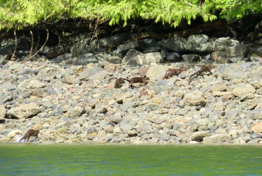
Latitude is also defined, in photography, as being the range of exposures photography paper can be given and still achieve a quality image.  So, applying this definition, there is no doubt that my latitude professionally and personally has increased as a result of my experiences on Fairweather this summer.  My exposure to hydrography, my exposure to new careers, my exposure to new places and my exposure to new people and new friends is significant, in some ways quantifiable, and in other ways immeasurable.    As I sit here in my New Mexico home, preparing to teach a desert field ecology class for the University of New Mexico next week, I find that my brain after a while wanders off from reviewing the ecology of desert species, and I begin to wonder where Fairweather is on route to Nome.  I wonder how the landscape has changed from the dense Sitka Spruce, hemlock and alder I got used to seeing from the ship in Southeast Alaska.  As I fill my birdfeeders and watch the goldfinch flock,  I wonder if the crew have seen more albatross species as they have gone north. As I spend a somewhat frivolous Sunday morning driving two hours north to play and cool down in Abiquiu Lake, near where the artist Georgia O’Keefe gained much inspiration, I am reminded of the Gulf of Alaska’s water temperatures, discovered on a wet day when bottom sampling west of Prince of Wales Island, and of the Argillite carvings produced by Haida artists not far from Ketchikan.


Latitude also refers to freedom in actions and choices.  I feel fortunate to teach at the school that I do, as I have a lot of latitude when it comes to my curriculum and a lot of support in allowing me to apply for opportunities such as Teacher At Sea.  This makes it very easy to incorporate the science of hydrography I have learned this summer into my existing curriculum.  I have latitude in exposing students to my experiences, and hopefully as a result, expanding theirs.  On the 21 days I sailed on Fairweather I was able to make time to review curricula Teachers At Sea have created in the past, and develop new hydrography lessons I hope many of us can use.  I was able to directly ask Fairweather hydrographers for support, and thanks to Sam Candio, I have images of the mud volcano and Queen Charlotte-Fairweather fault we surveyed, that I can use in the classroom next month.  I am using data collected by Hollings scholar, Carly LaRoche, in the classroom  -my 6th graders will analyze her maps and the data to see if there are correlations.


On the ship, after a few days, I also realized that I was now the student. I’ll admit that it was slightly humbling and when I got over the ‘I’m used to being in charge and doing’ feeling I relished the new position I found myself in.  While I had anticipated learning a lot about the science of hydrography and what it takes to sail and run a large science vessel, I hadn’t thought about the indirect observations I would make, about myself as a student and the consequences of my experiences as a student to my classroom.  I began to examine how I could tweak a lesson here and there to make it more applicable to my students experiences, and how even excellently explained concepts can be confusing initially, and repetition and re-introduction can be essential for some students.  I watched myself be overwhelmed by acronyms in the beginning and get excited 18 days in to the leg when I could remember one without looking it up. I never did quite remember what each of the computer software programs were for, and marveled at my hydrographer colleagues as they navigated HYPAC, HYSWEEP, CARIS, SIS and Charlene (or Sharr-lene at it became affectionately known in honor of one of the NOAA Corps officers).  I learned that I had a bit of a stumbling block when it came to learning what each program did, and it was a reminder to me that these stumbling blocks can be present for my students in the classroom setting too.

My degrees of latitude have changed significantly in the last two months since I found out, in the dusty remote gas station parking lot in southern Utah, that I would be going to be on a NOAA hydrography ship in Alaska.  The longer I have been home, the more I have realized what an incredible opportunity I was given by NOAA Teacher at Sea.  Life changing may sound ‘hokey’ but I think that is a good succinct summary.  I now have a profound understanding of the time consuming and often hard work needed to create nautical charts.  I have a new understanding of what it is like for the crew of Fairweather, and many other vessels, to spend weeks, and in their case, months, away from family and friends; I have a healthy respect and comparisons to make and share about the ecology and geology of Alaska.  I have new friends and new ideas.  And now, as a teacher, the real work begins in synthesizing this experience.

This weekend I spoke with my friend Jillian Worssam, a TAS alumna and incredible science teacher in Flagstaff, AZ, who has founded a program Scientists in the Classroom. Her work, ideas and community engagement are inspirational, and while I was on the ship, I shot her an email as I knew I wanted to make sure I did not lose ground, I did not want to lose momentum once I returned to ‘normal life’.  As a teacher, things pile up as the school year progresses, and I am profoundly aware that it’s so easy, when things ‘get crazy’ to fall back on what’s been done before. While that is not always a bad thing, it is a constant challenge to integrating new experiences  and new learning from professional development such as Teacher At Sea.  As a teacher, I have also learned, that while my brain is good, when I ‘beg, borrow and steal’ other people’s’ knowledge and ideas, my classroom becomes stronger and my students’ degrees of latitude increase.  My new NOAA contacts, both on the ships and on land, should have a heads up that this is only the beginning.

IMG_1876
Waiting for the temperature to drop to 50F so I can wear my Fairweather hoodie again…


Helen Haskell: Mud Volcano, Morale and Moving On, June 24, 2017

NOAA Teacher at Sea

Helen Haskell

Aboard NOAA Ship Fairweather

June 5 – 26, 2017

Mission: Hydrographic Survey

Geographic Area of Cruise: Southeast Alaska – West Prince of Wales Island Hydro Survey

Date: June 24, 2017

Weather Data

Wind:  20 knots

Visibility: 6 nautical miles

Barometer:  1016.0 hPa

Air temperature: 13.2C

Cloud cover: 100%

Location: Gulf of Alaska, 58°58.3N, 138° 49.7W


Science and Technology Log

In the last final week of this long three week leg, survey work on Fairweather has been varied. As data collection for this area has drawn to a close, it has been late nights for the sheet managers, who are making sure all of the holidays (the areas of missing data) are collected, crosslines are accomplished in all areas, and that they have what they need to do a complete report of the area.

IMG_0399
Some of the Fairweather crew getting ready to launch small boats for the last data acquisition.

Earlier this week the ship completed an additional smaller project out in the Alaskan gulf. Fairweather was tasked with collecting hydrographic data on a subsurface mud volcano that has been discovered southwest of Ketchikan near the Queen Charlotte –Fairweather fault system.  Sailing during the day to the location, the surveying began late evening.  Rather than using the small launches, Fairweather’s sonar was used.  The survey area was quite large and the boundary extended to the edge of Canadian waters. Just as with the small launches, casts had to be done to factor in the water’s salinity and temperature in order to get accurate data. The water column profiling measurement device for Fairweather is located on the stern and once launched can be operated electronically, by hydrographers.


Hydrographers were divided into shifts, working two four hour shifts, throughout the 24 hour data acquisition period.  From 12am-4am, hydrographers Hannah Marshburn and Drew Leonard, and I, check on the quality of data acquisition and monitored the related software.  As we sailed over the vent of the volcano hundreds of meters below the surface, the sonar picked up gas releases, probably methane, coming from the vent.  This volcano is potentially part of a volcanic field in this area.  I am excited to read and learn more about these mud volcanoes on the active fault in this area and to integrate it into my geology class at school.  For more information about mud volcanos in this region, visit https://eos.org/articles/active-mud-volcano-field-discovered-off-southeast-alaska

IMG_0317
Drew Leonard and Hannah Marshburn observe the sonar at work
IMG_0327
The mud volcano (within the elevated red area; the white triangle is our ship
IMG_0349
Possible methane plumes ‘caught’ by the sonar

Life and work on a ship requires the crew here to learn many things, both about the scientific mission and methodology but also about the ship itself and the safety protocols. NOAA provides training for crew in many different forms, some in situ, some electronically, and others during the non field-season in the form of  land-based workshops. Here on Fairweather, workbooks are provided to prepare officers and survey techs to help qualify them as Hydrographers-In-Charge (HIC).  Individuals work through these books and hand-on trainings to increase their understanding of the mission, the science content, their ability to work with survey systems, launches, field equipment and to serve as backup coxswains on the launches if necessary.

IMG_1577
The work

In wrapping up the work in the area west of Prince of Wales Island, one last task was to dismantle the Base Station that the hydrographers had set up at the beginning of the project. The Base Station houses a GPS and receiver that transmits the data to the ship.  


Back on the ship, a route was planned by the NOAA Corps officers  and charted both electronically and on the paper charts.  It was time for Fairweather to say goodbye to this region of Alaska and to begin the journey north.

IMG_1576
ENS Linda Junge plots the route to the Gulf of Alaska and beyond on the chart

While June 21 is a date associated with the solstice, it is also World Hydrography Day.  In 2005, the General Assembly of the United Nations adopted a resolution on oceans and law of the sea, and encouraged entities/nations to work with the International Hydrographic Organization (IHO). The idea is to increase knowledge of and promote safe marine navigation.  As a result, World Hydrography Day was formed and is used as a method to increase knowledge and understanding of hydrography to the general public. Currently only about 10% of the world’s oceans and 50% of the coastal waterways have been directly measured. Much of the rest of the world is dependent on estimates from satellite gravity based measurements or has no data.  Most people tend not to think about the role hydrography and knowledge of the seafloor plays in our day to day live. While there is the obvious correlation with safe navigation, seafloor knowledge is important for laying cables and pipelines, to develop maritime boundaries and to help make predictions of what tsunamis waves and hurricanes would do.  World Hydrography Day 2017 celebrates the 96th anniversary of the IHO.  To celebrate this day, other than continuing to acquire data for the project, the crew gathered together to watch a film from 1976 of Fairweather in Alaska conducting hydrography. While much of the technology has changed and the ship retrofitted, there was a lot of familiarity with the ship and with the job being done.  

Personal Log

Being on a ship for weeks at a time, working everyday can take its toll.  Over the last couple of days I can see in the faces of the survey crew that, just like the end of a school year, while there still a lot to do before ‘the end’ and people are tired, they are looking forward to a change of pace with their upcoming time in port. The ship is scheduled to be in Kodiak for over a week, allowing for mid-season repairs to be completed. Meanwhile the hydrographers will continue to work on data from this leg and look ahead to the upcoming ones; the deck crew will continue the multitude of tasks that always need to be done; the engineers will continue to fix, clean and monitor the launches, the engines and the myriad of equipment on the ship.  The NOAA Corps officers will continue their rotation of duties. The stewards will continue to provide food for everyone.  It’s the field season. Everyone is still busy, but there will be off-duty time on land and opportunities to explore the area.

IMG_1561 (1)
The Finer Things Club for this leg: (L, clockwise) with LT Manda, ENS Junge, Coxswain/deck crew Nick Granazio, XO Gonsalves, Hydrographers Hannah Marshburn and Steve Eykelhoff

One important concept that is apparent on Fairweather is keeping an eye on everyone’s welfare and well being.  Part of the XO’s (Executive Officer) role is to help with morale of all the crew, and to this end, the MWR (Morale, Welfare and Recreation) group is key in regular small events.  When the ship is in port, optional excursions are arranged and transportation is available to and from the town during evenings and weekend hours. On Sunday evenings, Sundae Sunday happens at 7pm where people come together to have ice cream; The Finer Things Club happens once per leg, and foods such as cheese and crackers, olives and chocolate are served; on World Hydrography Day, the MWR group arranged a ‘holiday hunt’ on the ship with prizes, and ‘hydrography/Fairweather charades’ was played that evening after we had watched the 1976 Fairweather film. Each evening the Fairweather ship’s store opens and folk can purchase their favorite soda or chocolate bar, or in my case, a Fairweather hoodie.


It will take three days approximately to get to Kodiak. Rather than going directly across the Gulf of Alaska from Southeast Alaska, Fairweather moved north through Tlevak Strait, which includes a rather narrow section of water with islands and rocks close on both sides.  Having had several weeks of cloud and rain, we were graced with clear blue skies and a warm evening as we headed north. Whales swam in the distance and small islands covered in vegetation rose vertically out of the water. On route we were able to stop for several hours in Warm Springs Bay on Baranof Island. Here the crew were able to explore on land for a while, hike to hot springs and a lake, and take in some more of the beauty of Alaska.  It was an incredible blue sky morning (only the third so far this summer according to the locals) , snow was on the peaks around us and bald eagles sat in the nearby trees.  


IMG_1618 (1)

Morale and wellness also come in the form of good food. During my time here on I have been fed excellent food three times a day by the stewards, Ava Speights, Ace Burke, Tyrone Baker and Rory Bacon.  The other day I was able to sit down with Ava, acting Chief Steward, and ask her about her job and how the food is planned and prepared for. She was busy making a menu for the upcoming legs of Fairweather and ordering food that would be shipped to Kodiak, and later on, shipped to Nome.    She discussed how the budget works and the lead time needed to get produce and supplies to these northern regions.   

As my time on Fairweather is coming to an end, I realize that each day contains new normals, and that, after over three weeks here, there will be several transitions to go through such as being back on land and not on a rolling ship, not having food made for me and dishes washed for me, and leaving cloudy cool 50°F weather and cloudy skies to heat waves in New Mexico.   I am taking back with me a large amount of new knowledge and ideas that I can integrate into my classroom and school.  I am also taking back life-changing memories and hopefully long term connections with people from Fairweather and a desire to come back to Alaska.  I know that once I get back to New Mexico more questions will come forth and the Fairweather crew should be prepared to be hearing from me as I figure out how best to use the science in the classroom and in my community.  It’s a little bittersweet leaving, knowing that the crew have four months or more of the field season, and that by the time they head back to dry dock for the winter, that we will be over halfway through the first semester of the next school year.  I am really thankful to everyone on board for teaching me so much and making this an incredible adventure for me.  


Word of the day: Turnover:  Part of the nature of ship life,  I have discovered is that crew come and go. The NOAA Corps officers have an approximate two year stint on a ship before a three year rotation on land.  Deck crew, stewards and engineers are often on ships for multiple seasons, but can apply to move locations and transfer to other ships.  ‘Augmenters’ are crew from all departments who come on to ships for one or two legs at a time to fill in when a ship is short-staffed or someone has taken vacation.  At the end of each leg, people leave the ship and new people join the ship.  The only certain thing here is that there is and always will be staffing changes.  

Fact of the day:  On our journey north of Tlevak Strait, Fairweather was using fuel at the rate of 0.15mpg.   We’ve seen a couple of much larger cruise ships recently and an even larger container ship. Estimate their fuel consumption!

What is this?:

IMG_0330 2

Acronym of the day:

MWR group – Morale, Welfare and Recreation group

Helen Haskell: Bottom Sampling! June 17, 2017

NOAA Teacher at Sea

Helen Haskell

Aboard NOAA Ship Fairweather

June 5 – 26, 2017


Mission: Hydrographic Survey

Geographic Area of Cruise: Southeast Alaska – West Prince of Wales Island

Date: June 17, 2017

Weather Data (on day of bottom sampling –June 14th)

Wind:  27 knots from the west (110° true)

Visibility: 10 nautical miles

Barometer:  1005.3 hPa

Air temperature: 9.4°C

Cloud: 100% cover, 1000’

Location

54°54.4’N  132°52.3’W


Science and Technology Log 

IMG_2004
Hollings Scholar Carly LaRoche, TAS Helen Haskell, and LT Damian Manda with a bottom sample.

If you have ever taken a look at a nautical map, other than just depths listed on it, there will be symbols and definitions that provide information to help with safety and knowledge of the area.  For example, asterix-like symbols represent rocks, and a branch-like symbol represents kelp. Also written on the maps is information about the seafloor and what it is composed of, such as gravel, sand, or bedrock.  Here in southeast Alaska, off the coast of Prince of Wales Island, much of the data that is currently on the charts was collected over 100 years ago.  Fairweather’s mission is to collect new information to allow these charts to be updated, and this includes information on the seafloor too.

The other day I was tasked with joining a survey crew to conduct bottom sampling.  The assigned bottom sample locations are provided by the Operations branch at headquarters. The sheet managers adapt the locations if they think there are better locations that will provide information for anchoring or to help characterize different regions in the area.  With less than glassy water conditions on a windy and rainy day, the boats were launched and we moved to our first sample area.

IMG_0252
A bottom sampler

The technology behind sampling is a little more antiquated than other parts of the research I’ve seen. It involves hooking up a self-closing scoop like device to a rope, and lowering it in to the water until it hits the seafloor.  Ideally, the trigger is released when it hits the seafloor and it closes. With closed scoops, the bottom sampler is winched up, ideally full of whatever material is located on the seafloor in that immediate location.  There were three different styles of these bottom samplers and we quickly had a firm favorite that seemed to work the best.  Easing the boat in the swell to the location, the coxswains, Dennis and Denek, would keep the boat in position so we did not tangle the rope in the motor.  We could tell from the rope going slack when the bottom sampler had hit the sea floor, and a mechanical winch made the return journey easy.


Dumping the contents in to a bucket we were able to see the diversity of the seafloor in just a few samples.  Occasionally rocks or shells would get stuck in the mechanism and we’d have to repeat the procedure, but overall we had tremendous success.

IMG_1863
Carly, Denek, the coxswain and me getting some respite from the rain

There are international protocols to follow in collecting bottom samples. These allow for communication and consistency of data on navigational charts.  In general, the main medium of the sample is described, such as sand, mud or pebbles, and an adjective used to describe it, such as broken, sticky or soft. Color is also assigned to the sample as well as appropriate size of the grains (fine, medium or coarse).  Symbols are used for all this data: For example, ‘the sample is mostly fine brown sand with mud and a little bit of broken shell’ would be written fne br S M brk Sh.  Protocols indicate that if sampling is attempted three times in one location and it doesn’t work then ‘unknown’ is documented in that location.

IMG_1926
Success in our sampling

At each of the sampling locations, we marked the spot on the chart and took latitude and longitude coordinates. We also documented additional observations we had about the sample, including findings that were not included as data choices. For example, in our second sampling site we found what we thought initially were mammal hairs.   Several sites later we struck ‘gold’ again, finding what appeared to be more hairs in a mud matrix. Upon reflection and discussion, it’s possible they are more likely decomposing kelp fibers.  It would be interesting to have the samples analyzed to identify what these fibers/hairs come from.   We also found whole clamshells as well as having a sample that only contained water. Our thoughts with the water only samples were that perhaps we were hitting bedrock rather than failing on obtaining any kind of sediments.  We also observed that in the more sheltered bays, the samples were very odiferous dark mud. In both of these occasions, the landscape surrounding the bay was heavily logged, and it would be interesting to see if there were correlations between the logging and the dark sediments, perhaps containing higher levels of carbon material washed in from terrestrial sources. In one of these areas, documentation from 100 years ago suggested that at that time, the seafloor was gravel.


Personal Log

The bottom-sampling day was challenging day weather wise, both for the coxswains and the science crew, but very rewarding.  Due to the rough seas it wasn’t a good day to collect sonar data, and on days like this, other parts of the total data collection are put in to place.  Part of our work that day was to also do crosslines (sonar data verification) but the water conditions were too hazardous in certain directions of travel, and so it was decided that we should focus on bottom samples.   To be frank, this was my favorite day as a Teacher At Sea so far. Truth be told, I was reminded that I quite enjoy sticking my hand in a bucket of mystery ‘goop’ and trying to figure out what it is composed of.  The diversity of samples was completely surprising and finding hair samples, twice, completely intriguing.  It was great also to observe upcoming OPS officer, LT Damian Manda at work logging the data, and realize again, the role technological knowledge plays a role in the success of this research. And, thank you to Coxswain Dennis Brooks for taking most of the photos for this blog entry.


IMG_2047
Me and Carly at the end of the day


Word of the day:

Hollings Scholarship Program: this NOAA program provides undergraduate students with a ten week internship at a NOAA facility and academic assistance, as well as an orientation and symposium. For more information: http://www.noaa.gov/office-education/hollings-scholarship

Fact of the day:

Backscatter is the intensity of acoustic energy received by the sonar after interacting with the seafloor. Backscatter data can be used to help determine the surface of the seafloor.  In softer areas, perhaps a surface of mud, returns a weaker signal, but a harder surface, such as bedrock returns a stronger signal.  Hollings scholar Carly LaRoche from American University is on the boat for several legs this summer and is collecting and analyzing backscatter data in the area. Bottom sampling of the area is allowing Carly to compare the backscatter data with the sediments collected to see if there are correlations.

What is this?

IMG_0270

(Answer from previous blog: part of the vertical struts of an old pier at a former salmon canning factory.)

Acronym of the day: Used in bottom sampling

NATSUR:  Nature of surface  -example: mud, gravel, coral

NATQUA: Qualifying terms for NATSUR -example: sticky, soft, calcareous

Helen Haskell: From Raw Data to Processed Data, June 16, 2017

NOAA Teacher at Sea

Helen Haskell

Aboard NOAA Ship Fairweather

June 5 – 26, 2017


Mission: Hydrographic Survey

Geographic Area of Cruise: Southeast Alaska – West Prince of Wales Island

Date: June 16, 2017

Weather Data

Wind:  3 knots from the east (272° true)

Visibility: 6 nautical miles

Barometer:  997.6 hPa

Air temperature: 9 °C

Cloud: 100% cover, 1000’

Location

54°54.4’N  132°52.3’W

Science and Technology Log

It would be easy to assume that once the small boat surveys are conducted and data from the larger sonar equipment on Fairweather is also acquired, that the hydrographers’ work is done and the data can be used to create navigational charts. As I have learned, pretty quickly, there are many parameters that affect the raw data, and many checks and balances that need to be conducted before the data can be used to create a chart. There are also a significant amount of hurdles that the crew of Fairweather deals with in order to get to their end goal of having valid, accurate data.  Some of the parameters that affect the data include tides, salinity of the water, temperature of the water, and the density of the data.

Tides:

Tides play a huge role in data accuracy.  But how do tides work and how do they influence navigational chart making? Tides on our planet are the effect on water due to forces exerted by the moon and the sun.  The mass and the distance from the Earth to these celestial bodies play significant roles in tidal forces. While the sun has a much greater mass than the moon, the moon is much closer to the Earth and it is distance that plays a more critical role.  Gravity is the major force responsible for creating tides. The gravitational pull of the moon moves the water towards the moon and creates a ‘bulge’. There is a corresponding bulge on the other side of the Earth at the same time from inertia, the counterbalance to gravity.  The moon travels in an elliptical orbit around the planet and the Earth travels in an elliptical orbit around the sun. As a result, the positions of the moon to the Earth and the Earth to the sun change and as a result, tide height changes.   The tides also work on a lunar day, the time it takes the moon to orbit the Earth, which is 24 hours and 50 minutes. So high tide is not at the same time in one area each solar day (Earth’s 24 hour day). There are three basic tidal patterns on our planet.  Here is southeast Alaska, the tides generally are what is called ‘semi-diurnal’, meaning that there are two high tides a day and two low tides a day of about the same height. Other areas of the world may have ‘mixed semi-diurnal’ tides, where there are differences in height between the two high and two low tides, or ‘diurnal’ tides, meaning there is only one high and one low tide in a lunar day.   The shape of shorelines, local wind and weather patterns and the distance of an area from the equator also affect the tide levels.  How does this affect the hydrographers’ data? If data is being collected about water depth, obviously tide levels need to be factored in.  Hydrographers factor this in when collecting the raw data, using predicted tide tables.  However, later on they receive verified tide tables from NOAA and the new tables will be applied to the data.

IMG_0211
The tide times of the day

Sound Speed Profiles:

Traveling down through the water column from the surface to the seafloor, several factors can change, sometimes significantly.  These factors include temperature, pressure and salinity.  These variables affect the accuracy of the sonar readings of the MBES (Multibeam Echo Sounders), so have to be factored in to account with the raw data analysis.  What complicates matters further is that these factors can vary from location to location, and so one set of readings of salinity, for example, is not be valid for the whole dataset.  Many fresh water streams end up in the waters off the islands of southeast Alaska.  While this introduction of freshwater has effects on the community of organisms that live there, it also has impacts on the hydrographers’ data.  To support accurate data collection the hydrographers conduct sound speed casts in each polygon they visit before they use the MBES.  The data is downloaded on to computers on the boat and factored in to the data acquisition.  The casts are also re-applied in post processing, typically on a nearest distance basis so that multiple casts in an area can be used.  In the picture below, the CTD cast is the device that measures conductivity (for salinity), temperature and depth.  It is suspended in the water for several minutes to calibrate and then lowered down through the water column to collect data. It is then retrieved and the data is downloaded in to the computers on board.


Data Density:

Hydrographers also need to make sure that they are collecting enough sonar data, something referred to as data density.  There are minimum amounts of data that need to be collected per square meter, dependent on the depth of the sea floor in any given area.  Having a minimum requirement of sonar data allows any submerged features to be identified and not missed. For example, at 0-20 meters, there need to be a minimum of five ‘pings’ per square meter.  The deeper the sea floor, the more the beam will scatter and the ‘pings’ will be further apart, so the minimum of five pings occupy a greater surface area.  Hydrographers need to make sure that the majority of their data meets the data density requirements.

Crossline Acquisition:

After much of the initial raw data has been collected, and many of the polygons ‘filled in’, the hydrographers will also conduct crossline surveys. In these surveys they will drive the small boat at an angle across the tracklines of the original polygon surveys. The goal here is basically quality control. The new crossline data will be checked against the original MBES data to make sure that consistent results are be acquired. CTD casts have to be re-done for the crossline surveys and different boats may be used so that a different MBES is used, to again, assure quality control.  At least 4% of the original data needs to be covered by these crossline surveys.

Shoreline verification:

Low tides are taken advantage of by the hydrographers. If the research is being conducted in an area where the low tide times correlate with the small boat survey times, then a vessel mounted LIDAR system will be used to acquire measurements of the shoreline.  Accurate height readings can be extracted from this data of different rocks that could prove hazardous to navigation.  Notes are made about particular hazards and photos are taken of them.  Data on man-made objects are also often acquired. Below are pictures produced by the laser technology, and the object in real life. (for more on LIDAT: http://oceanservice.noaa.gov/facts/lidar.html)


Night Processing:

Each evening once the launches (the small boats) return, the data from that day has to be ‘cleaned’. This involves a hydrographer taking an initial look at the raw data and seeing if there were any places in the data acquisition that are erroneous.  None of the data collected is deleted but places where the sonar did not register properly will become more apparent.  This process is called night processing as it happens after the survey day. After night processing, the sheet managers will take a look at remaining areas that need to be surveyed and make a plan for the following day.  By 6 a.m. the next day, the Chief Scientist will review the priorities made by the managers and let the HIC (Hydrographer In Charge) know what the plan in for their survey boat that day.

IMG_0281
Night Processing

Personal Log 

Throughout the Science and Technology log in this blog post, I keep referring to technology and computer programs.  What stands out to me more and more each day is the role that technology plays in acquiring accurate data.  It is an essential component of this project in so many ways, and is a constant challenge for all of the crew of Fairweather.  Daily on Fairweather, at mealtimes, in the post survey meetings, or on the survey boats themselves, there is discussion about the technology.  Many different programs are required to collect and verify the data and ‘hiccups’ (or headaches) with making this technology work seamlessly in this aquatic environment are a regular occurrence. I am in awe of the hydrographers’ abilities, not only in knowing how to use all the different programs, but also to problem solve significant issues that come up, seemingly on a regular basis.  Staff turnover and annual updates in software and new equipment on the ship also factor significantly in to technology being constantly in the foreground.  It often eats in to a large amount of an individual’s day as they figure out how to make programs work in less than forgiving circumstances.  Tied to all of this is the fact that there is a colossal amount of data being collected, stored and analyzed each field season.  This data needs to be ‘filed’ in ways that allow it to be found, and so the tremendous ‘filing system’ also needs to be learned and used by everyone.


Word of the day:   Fathom

Fathom is a nautical unit of measurement, and is the equivalent of 6 feet.  It is used in measuring depth.

Fact of the day:

Prince of Wales Island, west of which this research leg is being conducted is the fourth largest island in the United States. 4,000 people live on the island, that is 2,577sq mi.

What is this? 

fullsizeoutput_178

(Previous post: a zoomed in photo of ‘otter trash’ (Clam shell)

Acronym of the day:  

LIDAR: Light Detecting and Ranging


Helen Haskell: Watching the Wildlife, June 15, 2017

NOAA Teacher at Sea

Helen Haskell

Aboard NOAA Ship Fairweather

June 5 – 26, 2017


Mission: Hydro Survey

Geographic Area of Cruise: Southeast Alaska – West Prince of Wales Island Hydro Survey

Date: June 15, 2017

Weather Data:

Wind: 3 knots from the west

Visibility: 6 nautical miles

Barometer: 997.6 hPa

Air temperature: 9°C

Cloud: 100% cover, 1000’

Location:

54°54.4’N 132°52.3’W

Science and Technology Log:

While Fairweather is a hydrographic research ship, responsible for collecting data for navigational charts, one of the side reports the survey crew makes is a Marine Mammal Observation Log. When a marine mammal is spotted on a survey, its location is noted, the species is identified if possible and notes about the numbers, behavior and any other observations are documented. Along with documenting sightings of these animals, the coxswains also follow protocols for minimizing disturbance and impact to these creatures.

Since joining this leg of the hydrographic research, humpback whales (Megaptera novaeangilae) have been the most numerous whale species seen. These whales that spend the summer in South-east Alaska winter mainly in Hawaii. Mating happens during the winter and the calves are born 11 months later. The calves stay with their mother for about 11 months after they are born. Individuals can grow up to 60 feet in length and live 50 years. These large grey whales have numerous barnacles that attach to their skin and filter feed as the whale travels. It is thought that the whales find shallower rocky areas to swim alongside in order to rub off the barnacles. It was in some of the shallower survey areas that I first saw humpbacks.


Harbor seals have fast become one of my favorites during my time here in Alaska. Growing to about six feet in length, the harbor seal, Phoca vitulina, have a diet of shellfish, crustaceans and fish and appear to be non-migratory, staying here year round. They are grey in color and can weigh up to 250 lbs as a mature male. Data seems to suggest that in some areas of their range in Alaska, the populations are declining but in other areas, seem stable. As the seals give birth in the summer, we’ve been fortunate enough to see seal pups too on this leg of the research.


The Northern sea otter, Enhydra lutris kenyoni, has perhaps been the most numerous marine mammal so far on this trip. Appearing small next to the seals and whales, upon reading more about them, I learned that they not small creatures, as they measure up to five feet in length and weigh up to 100 lbs. Feasting on a diet of invertebrates, such as clams and sea urchins, the sea otters are often spotted floating on their backs and are often associated with kelp beds. The otter fur trade began in the 1700’s and by 1900 populations were on the brink of extinction. Legislation has allowed the populations to rebound in most areas in the last 100 years, and they are seen regularly by survey crews and from the bridge.


Another species I saw here, up a small shallow cove, was the river otter, Lutra Canadensis. Five heads popped up in front of me and then bobbed under. Seconds later the otters were up on land running in to the trees. Seemingly fast and sleek, they were not acting like sea otters. It was not any behavior we had observed before. A little bit of research confirmed our suspicions that these were indeed river otters. Sea otters rarely come out on land, and when they do, do not move swiftly, having more flipper-like back legs, making land movement more arduous. River otters are smaller than sea otters weighing up to 35lbs and are 40-60 inches in length.

IMG_0109

While obviously not a marine mammal, the bald eagle is pretty much a guaranteed daily sight as the surveys are being done. A friend referred to the bald eagle as an Alaskan pigeon, and while I have not experienced as many bird species or numbers of birds here as I thought I would, the eagle has been one of the main species sighted. With an estimated population of 30,000 in Alaska, more numerous here than any other state, that hasn’t always been the case. With bounties on them at the turn of the 20th century, and population reductions due to pesticides and habitat loss, especially in the lower 48 states, the bald eagle, Haliaeetus leucocephalus, was put on the Endangered Species List in 1967. Measures put in place both locally and nationally have been so successful that in 2007 the bald eagle was removed from the Endangered Species List.


Another species I have seen regularly but not up at close range, is the Marbled Murrelet, Brachyramphus marmoratus. These small, almost 10 inch long marine birds are in breeding plumage right now and, although they have been hard to see, due to distance and poor light conditions in the rain, are beautiful shades of brown and cinnamon. They build nests here in southeast Alaska in the mossy branches of old growth conifer trees or on the ground.

IMG_0346
A little blurry but here are the Marbled Murrelets


Personal log

While it’s easy to get sidetracked with the mammals and birds here, there is a host of other species here that play significant roles in the food web. Kelp has been one of the organisms that I’ve seen a lot while doing the small boat surveys, and on our first completely sunny day, I got the chance to get up close and personal with the kelp from the vantage point of a kayak. The Fairweather has several kayaks that on occasion the crew uses to explore the local area. Together with NOAA Corps Junior Officer ENS Peter Siegenthaler and Hollings scholar Carly Laroche, we filed a Small Boat Plan with the bridge, stating where we were going and our anticipated return time, picked up radios, and carried the kayaks down from the top deck. It’s a little tricky to get a small kayak in the water from a large ship, but with the help of a small boat, we launched and paddled, in almost glassy water, over towards the shoreline.

FullSizeRender (1)
Me in one of the kayaks

Being even closer to the water in a shallow keel-less boat, allowed us to paddle through those kelp forests, pick up the otter-opened clamshells and explore the intertidal community much more easily. We were also able get close to some of the terrestrial species, the Sitka spruce and the other trees species growing vertically out of often steep slopes, right down to the high tide mark. We paddled along these inter-tidal edges listening to hermit thrush sing from the trees up the hillsides as we debated how logging companies actually cuts trees on such steep slopes. It was a glorious day, a rare sunny, calm day in the early summer of southeast Alaska, and perfect for paddling. This area is filled with small islands and coves, waiting to be explored, especially at low tide, when more inter-tidal life is exposed. My fingers are crossed that the weather and water conditions will allow for more explorations by kayak before I have to leave Fairweather in Kodiak.


Fact of the day: KELP

There are three species of kelp found here in southeast Alaska: bull kelp, ribbon kelp and sugar kelp. Kelp is an algae, not a plant, although it does photosynthesize. It is an essential part of the ecosystem here and many species are dependent on it.

Word of the day: Baleen

Humpbacks are a baleen whale, meaning that they have these plates, up to 600, make out of a substance called keratin in their mouths that act as filters in feeding. The keratin is referred to as baleen and is similar to our fingernails. In an earlier blog posting I held up a piece of baleen in an art store in Ketchikan. Below is a picture of baskets woven out of strips of baleen.

IMG_0122

What is this?

(Previous post: The picture is of the sonar equipment on the bottom of the small boats).

IMG_0147

Helen Haskell: Data Acquisition Through Small Boat Surveying, June 12, 2017


NOAA Teacher at Sea

Helen Haskell

Aboard NOAA Ship Fairweather

June 5 – 22, 2017

Mission: Hydrographic Survey

Geographic Area of Cruise: Southeast Alaska – West of Prince of Wales Island

Date: June 12, 2017

Weather Data:

Temperature: 13°C

Wind 12 knots, 230° true

10 miles visibility

Barometer: 1016 hPa

90% cloud cover at 2000 feet

Location:  Dall Island, AK  54° 54.5’N  132°52.1W


Science and Technology Log:

The role of the Fairweather is to conduct hydrographic surveys in order to acquire data to be used in navigational charts. While the Fairweather has sonar equipment and collects lots of data in transit, much of the data collected on a daily basis is by using smaller boats, with a rotating crew of 3-4 people per boat. The Fairweather will sail to the research area and drop anchor, and for multiple days crews will use these smaller vessels to collect the raw data in an area.


“Sonar” was originally an acronym for Sound Navigation and Ranging, but it has become a word in modern terminology. The boats contain active sonar devices used by the NOAA scientists to calculate water depth, document the rocks, wrecks and kelp forests, and in general, determine hazards to boats. Ultimately their data will be converted in to navigational charts – but there is a significant amount of work and stages to be undertaken to make this a reality.

Attached to the small boats are Kongsberg Multi Beam Echo Sounders (MBES). These devices emit sound waves in to the water. The waves fan out and reflect off the bottom of the sea floor and return to the MBES. Based on the time it takes for the MBES to send and receive the sound waves, the depth of the sea floor can be calculated. As the boat moves through the water, thousands of pieces of data are collected, and collectively a picture of the sea floor can be built.

IMG_0356
The pink line is the sea floor

It sounds simple, right? But I am beginning to understand more about the complexities that go in to a project of this scope. It would seem simple perhaps, to drive a boat around, operate the MBES and collect data. As I have quickly come to understand, there is a lot more to it.

As mentioned before, due to the weather conditions in the geographic area of study and routine maintenance, the Fairweather has a field season, and a dry dock season. During the non-field season time, data is analyzed from the previous seasons, and priorities and plans are made for the upcoming seasons. Areas are analyzed and decisions made as to which regions the Fairweather will go to and sheets are determined. A sheet is a region within the project area. Each sheet is broken up in to polygons. On any given day, one small boat will cover 1-3 polygons, depending on the weather, the complexity of the area, and the distance of travel from the Fairweather.


There are many parameters that the scientists need to consider and reconfigure to acquire and maintain accurate data collection. A minimum density of soundings (or ‘pings’) is required to make sure that the data is sufficient. For example, in shallow waters, the data density needs to be a minimum of five soundings per one square meter. At a greater depth, the area covered by the five soundings can be 4 square meters. This is due to the fact that the waves will spread out more the further they travel.

A coxswain will drive the boat in lines, called track lines, through the polygon. As the data is collected the ‘white chart’ they are working with begins to get colored in. Purple indicates deepest water. Green and yellow mean it’s getting less deep. Red indicates shallow areas, and black needs to be avoided. In the pictures below you can begin to see the data being logged visually on the map as the boat travels.


Make an analogy to mowing a lawn. There are areas of most lawns where it is easy to push the lawnmower in straight lines, more or less. The same can be said for here, to some extent. In the deeper waters, not close to shore, the boats can ‘color in’ their polygon using relatively wide swaths that allow the sonar data to overlap just slightly. Every time the boat turns to go back in the opposite direction, the MBES is paused, and then started again once the boat is in position, making a new track line. Close to the shore, referred to as near shore, there are usually more hazards. In these areas, speed is slowed. Due to the increased potential of rocks and kelp beds in an unknown area, the boats do something called half-stepping, in-effect overlapping the ‘rows’ – think about re-mowing part of that section of lawn, or mowing around tree trunks and flower beds. As a visual image comes up on the screen, the coxswain and the hydrographers can determine more where their next line will be and whether they should continue surveying that area, or if there are too many hazards.

IMG_0354
Data aquisition

Full coverage needs to be achieved as much as possible. At times this does not happen. This can be as the result of several factors. Kelp increases the complexity of data collection. Kelp often attaches to rocks, and there are large ‘forests’ of kelp in the areas being surveyed. As the sonar also ‘reads’ the kelp, it’s not possible to know the true location, size and depth of the rock the kelp is attached to, and in some instances, to determine if the kelp is free floating.

fullsizeoutput_13e
Kelp

Steep slopes, rocks and kelp can also create ‘shadows’ for the MBES. This means that there are areas that no sounding reached. If possible the survey team will re-run a section or approach it from another angle to cover this shadow. At times, the rocky areas close to shoreline do not allow for this to be done safely.  A holiday is a term used by the survey crew to describe an area where data did not register or was missed within a polygon or sheet. During data collection, a day may be dedicated for boats to return to these specific areas and see if the data can be collected. On occasion, weather conditions may have prevented the original crew from collecting the data in the first place. Equipment malfunction could have played a role, as could kelp beds or hazardous rock conditions.

Survey crews are given several tools to help them navigate the area. Previous nautical charts are also superimposed on to the electronic chart that the surveyors are using. While many of these contain data that is out of date, it gives the crew a sense of what hazards in the area there may be. Symbols representing rocks and kelp for example are shown. The Navigable Area Limit Lines (NALL) are represented by a red line that can be superimposed on the map. Any area closer to shore than the NALL is not required to be surveyed.


IMG_0315
The red line is the Navigable Area Limit Line. Areas inland of this line do not need to be surveyed, as they are known to be entirely non-navigable.

On occasion, surveying will discover a Danger to Navigation (DTON). This might include a rock close to the surface in a deeper water area that is not shown on any map and which may pose imminent danger to mariners. In these instances these dangers are reported upon return to the Fairweather, and information is quickly sent to the Marine Chart Division’s Nautical Data Branch.

During the course of the day, the scientists are constantly checking the data against a series of parameters than can affect its accuracy. Some of these parameters include temperature, salinity of the water and the tide levels. More about these parameters will be discussed in later blog postings.

Personal log

The first part of the day involves the stewards getting coolers of food ready for the survey crew who will be gone all day. The engineers have fixed any boat issues from the previous day and re-fueled the boats and the deck crew have them ready to re-launch. A GAR score is calculated by the coxswain and the crew, to determine the level of risk for the days launch. The GAR score examines the resources, environment, the team selection, their fitness, the weather and the mission complexity. Each factor is given a score out of 10. Added up, if the total is 23 or less, the mission is determined ‘low risk’, 24-44 is ‘use extra caution’, and greater than 45 is high risk. On the first day I went on a boat, as a first timer, the GAR score was a couple of points higher in the ‘team selection’ section as I was new.

fullsizeoutput_167
Operational Risk Assessment Form

Another fascinating aspect of this research is the equipment on the ship needed to launch these small boats. Huge winches are needed to hoist the boats in and out of the water. Deck crew, with support from the survey crew are responsible for the boat hauling multiple times a day, and the engineers are on hand to fix and monitor the equipment.

After my first day out on the small boats, the data acquisition began not only to make more sense, but also my understanding of the complex factors that make the data collection feasible began to broaden. I had naively assumed that all the work was done from the Fairweather and that the Fairweather would be constantly on the move, rather than being anchored in one location or so for a few days. As we journeyed around small islands covered in Sitka spruce, I watched constant communication between the survey crew and the coxswain on the small boats. The survey crew are constantly monitoring the chart and zooming in and out so that the coxswain can get a better and safer picture of where to take the boat.   As well as watching the monitors and driving the boat, the coxswain is also looking ahead and around for hazards. There is a significant number of large floating logs ready to damage boats, and on occasion, whales that the boat needs to stay away from. It is a long day for all the crew.

fullsizeoutput_c0
Bekah and Sam monitor the incoming data to communicate quickly with Nick, the coxswain.

Aside from learning about the data acquisition being on the small boat, one of the joys was to be closer to some of the wildlife. While I will go in to more detail in later entries, highlights included catching glimpses of humpback whales, families of sea otters, and harbor seal pups.

IMG_0362
Yes, I got to drive…in the purple area.

Fact of the day: 

While animals, such as bats, have been using sonar for thousands or millions of years, it wasn’t until the sinking of the Titanic that sonar devices were invented and used for the locating of icebergs.  During World War I, a French physicist, Paul Langévin, developed a tool to be able to listen for submarines. Further developments lead to sonar being able to send and receive signals. Since then, major developments in sonar technology have led to many different applications in different science fields.

Word of the day: Nadir

On small boat surveys, nadir is the term used to describe the ocean floor directly below the boat. It is the low point below the boat.   

What is this?

What do you think this is a picture of? (The answer will be in the next blog installment).

fullsizeoutput_16c

(Answer from previous blog: part of a section of a dumbbell from the Fairweather workout room)


Acronym of the Day

HIC: Hydrographer In Charge


Helen Haskell: Life on a Ship, June 7, 2017

NOAA Teacher at Sea

Helen Haskell

Aboard NOAA Ship Fairweather

June 5 – 22, 2017

Mission: Hydrographic Survey

Geographic Area of Cruise: Southeast Alaska – West of Prince of Wales Island 

Date: June 7, 2017

Weather Data from the Bridge:

Latitude: 55 04.473 N

Longitude: 133 03.291 W

Wind: 9 knots from the east

Air temperature: 17C

Visibility: 10 miles

Barometer: 1004.2 hPa

Science and Technology Log

The mission of the Fairweather is to conduct hydrographic surveys for nautical charting. The Fairweather does this work in the waters off the United States Pacific coast, but principally in Alaskan coastal waters. The data is collected using sonar both by the Fairweather but also using a series of smaller boats that are launched as often as possible, each with a small crew of 3-4 people. These smaller boats are able to conduct the surveys much closer to the shoreline, and spend about 8-9 hours each day surveying a specific region. Many of the waters up here have had no recent data collected, and mariners are relying on charts that may have measurements taken in the 1800’s or 1900’s when technology was very different.

IMG_0282
NOAA Ship Fairweather

During the field season, Fairweather spends about 210 days at sea. During the rest of the year, the Fairweather stays at her homeport, allowing the crew to work on maintenance issues, take leave, work on the data and outfit the boat for the following season. During the field season, the boat conducts different legs of the research, spending 12-20 days out at sea at a time before returning to a port to re-supply. There are six departments on the ship: Command, Deck, Electronics, Engineering, Steward and Survey. Each person on the ship is hired with specific duties and responsibilities.

As a government vessel, the Fairweather is also available for use during the time of war or in case of an emergency. In the event of something along these lines, the ship and the officers would be transferred to the Armed Forces of the United States.

The Fairweather is named after the tallest peak in the Fairweather range in Alaska. The ship served in Alaskan waters for over 20 years but was decommissioned in 1988. In 2004, due to increasing demand for modern surveys in Alaska, it was retrofitted and put back in to the research fleet. Previously staterooms housed up to 4 people, but after the retrofit a maximum of two people share a room. The boat can house 58 people in 24 single staterooms and 17 double staterooms. The boat itself is 231 feet in length and 42 feet wide. Its cruising speed is 13 knots, with a survey speed of 6-10 knots.   The Fairweather has 7 levels, A-G, each containing many rooms and areas essential to the mission of this ship. Wires and pipes run throughout the ship with sensors monitoring equipments, sensors ready to trigger if needed. Lower levels of the ship contain tanks, ballast and engines. Diesel, drinking water and grey water are stored in the tanks. The next three levels contain staterooms, lots of machinery and storage, the Mess, the Galley, laundry, labs, the sick bay and one deck with small boat storage. The last two levels contain the ships Navigation Bridge, the data processing center, electronics office, and lots more equipment.

Personal Log

A few days in to my journey with the ship, things are starting to make more sense. While there are still doors I haven’t opened and rooms I am sure I have not been to, I feel that I am getting a better sense of the Fairweather and how it works, the roles that people play, and a slightly better understanding of what it means for home to be a ship.

There is a lot going on. Unlike many of the fisheries boats, where science staff works on a shift system, here on the Fairweather, much of the hydro data acquisition needs to be done on the small vessels during daylight. After the 8am meeting, boats are launched and the survey crew leave for the day. Meanwhile the rest of the scientists and survey crew works with the previously acquired data. Shift systems are in operation for most of the rest of the staff. There are always engineering projects and issues to sort out on a boat of this size, and engineers are always available and always problem solving. There are always NOAA Corps officers and deck crew on the bridge to monitor the ship and coordinate communication. From early in the morning there is always food to prepare, parts of the ship to be cleaned and decisions to be made, reviewed and modified. Somewhere around 4:30pm the survey boats return. Meal times and group meetings are places where most of the crew comes together to hear about how the day has gone and what is needed for the next day. After dinner, there is still work to be done. The day’s data needs to be processed in order for the plans for the next day to solidify. Small boats are checked after their day in the water, re-fueled and parts fixed if need be. After working hours the ship is patrolled hourly to make sure equipment is working and things are safe.


In between all these jobs, the crew does have down time. Those on a shift system hopefully manage to get some decent sleep, even if it is daytime. Laundry gets done. Personal emails are sent to communicate with families. Movies are watched in the lounge/conference room. Showers happen. People visit the exercise room. The ships store opens up for a while each night, allowing crew to splurge on a bag of chips or a candy bar. So, it’s a busy place. Whether it’s visible or not, there are always things going on.


In some very simple ways it is no different to your home or mine. There is food, shelter and water. In most other respects, it is very far removed from living on land. Most people don’t have breakfast, lunch and dinner with their work colleagues. Here we do. Most people don’t have bedrooms without windows in them. Here we do. Most people don’t have the floor swaying beneath their feet due to wave action. Here we do. And for what it’s worth, most people don’t get to look over the deck and watch curious sea otters swim by, knowing that a whale may breach any minute. Here we do.


Fact of the day:

NOAA has nine key focus areas: Weather, Climate, Fisheries, Research, Satellites, Oceans and Coasts, Marine and Aviation, Charting and Sanctuaries. NOAA employs 12,000 people worldwide, of which 6,773 are scientists and engineers studying our planet. NOAA’s roots began over 200 years ago with the establishment of the U.S. Coast and Geodetic Survey by President Thomas Jefferson. In 1870 the Weather Bureau was formed closely followed by the U.S. Commission of Fish and Fisheries. In 1970 these three organizations became the beginning of NOAA. For more information: http://www.noaa.gov/about-our-agency

Word of the day: Knot

Knot, in nautical terms is a unit of speed.  One knot is the equivalent of going one nautical mile per hour.

What is this?

What do you think this is a picture of? (The answer will be in the next blog installment).

IMG_0269

(Previous answer: The picture is of a light and whistle that are attached to my PFD (personal flotation device).

 Acronym of the Day

MPIC: Medical Person In Charge


Helen Haskell: Getting Underway, June 5, 2017

NOAA Teacher at Sea

Helen Haskell

Aboard NOAA Ship Fairweather

6/5/2017-6/26/2017

Mission: Hydro Survey

Geographic Area of Cruise: Southeast Alaska – West Prince of Wales Island Hydro Survey


Date: June 5th

Weather Data: Full cloud cover, rain showers.

Location: Ketchikan, 55.3422° N, 131.6461° W 

Personal Log

Today the boat is leaving Ketchikan. Breakfast is between 7-8 and as I sat with my plate of eggs and toast, I watch the hustle and bustle of life on a boat preparing it to get underway. There are many challenges to sailing a ship, and while I had a general idea, I did not understand how much organization, safety protocols, equipment and manpower it takes to make a boat run, complete science research, and be a safe place for people to live and work. This first couple of days on the boat have been not focusing on the science research being done here, but one of getting a sense of how a research vessel works, the myriad of roles and jobs that are done here and the multiple hats that most people wear.

The ship’s communication system put an all-hands-on-deck call to help with unloading food deliveries at port. Here we passed boxes one by one from the truck up on to the ship and in to the kitchen storage areas where the stewards will unload and store the food ready for our meals and snacks. There are three main meals per day: breakfast (7-8), lunch (11-12) and dinner (5-6). In between these times snacks and drinks are readily available. What I am finding too is that many people work a shift system, or are on the smaller boats away from the ship for a day. Food for them is packed or available and no one goes hungry. Snacks and drinks are available 24-7 too. The meals are diverse and food is plentiful. I hope to talk with the stewards to figure out how they plan the menus and order all the food, to feed about 50 people for a three-week period.

Next came a safety briefing and tour. The first thing I had to do was to practice putting on my emergency gear – how to describe it? This ‘dry-suit onesie’ would allow me to be in the Alaskan waters and survive. While my whole body is covered except for my eyes, the suit contains a life vest, and would allow me to easily float upright. As you can tell from the photo, the main issue I had was with my hair getting in my face, a common occurrence apparently for those of us with long hair. Next we learned about all of our stations and our role for different scenarios: fire, man-over-board, and a full ship evacuation. We learned about the different alarms that would be sounded, the types of fire extinguishers, where the medical office is, and where the AED’s are. We were also reminded that in each stateroom is a breathing device kit that is can be used to provide ten minutes of oxygen, should it be needed.

IMG_0164
Me in my emergency suit

Pulling out of port yesterday, the boat first only went a few hundred yards up the narrows. The next stage was to ‘top up’ on fuel – 18,000 gallons of fuel. The boat can hold much more but the cost in Ketchikan is less than further north so it pays to fill up now. As you can imagine there are big safety issues with fueling of boats and during this time, several temporary bans were put in to place on the ship so that no sparks of any kind were made (no cooking, welding etc). The fuel is stored in several large tanks. The tanks are not connected to each other and each can be turned off individually in the event of a fire or leak. Earlier that day too we had also filled up with water.

There are many conservation and environmental practices put in to place that I have already seen on the ship. There are many protocols put in to place to protect both the environment and to conserve resources. During the fueling, a ring (oil boom) was put around the ship so that if there were an accidental fuel spill or leak, it would be contained on the surface of the water. Laundry is ‘closed’ until next weekend and only full loads are allowed in order to conserve fresh water. Water can be made from seawater using equipment on the ship, but it costs $8/gallon to run the equipment, so conservation is the first measure put in place.

IMG_0167
Getting fuel in Ketchikan

We also have practiced emergency drills. In these drills, everyone has a station to go to and a job to do. The fire drill mimicked a fire in the generator room and a person receiving burns. What’s interesting to realize it that people wear multiple hats on the ship and so everyone needs to know what to do and how to help. Formal fire fighting equipment is worn by trained people, radios are used to communicate between groups, diagrams of the ship are pulled out and drawn on and labeled to keep account of who has been tasked to do what and where the situation is located. Out at sea, the fire department and the medics cannot be called. The staff members on the ship are the medics and the fire department. During the drill a person role-played being the burn victim, so not only were firefighters needed but also medics. After the drills, everyone meets to debrief. Ideas and observations are shared. Communication is crucial and common here.

IMG_0255
My emergency assignments

With communication at the forefront, there are many mechanisms put in place to make sure the people on board know the specifics of the mission each day and their role in the mission. There are different departments in the boat, but one cannot function without the other. People are hired as Survey crew, Engineers, Deck crew, Stewards, Electronic Tecnicians and as NOAA Corps officers. There are also visitors on the boat, such as myself, some who are with the boat for the whole season, others like myself for a few weeks. Schedules are placed around the boat indicating who is on what shift. Meetings are held at 8am each day with the science and deck teams to discuss where the small research boats are surveying that day. During these briefings safety reminders and weather conditions are discussed as well as the location of where each boat will be. Boats radio in each hour for safety. Department heads meet daily to share their updates, keeping everyone up to date with different aspects of the ship. Debrief sessions happen at the end of each research day after dinner. Everyone participates as no one person’s job is isolated here. Issues and concerns are dealt with and go in to the decision making for the following day. Communication is key.

IMG_0211 2
The morning meeting


Fact of the day:

The Fairweather is divided in to 26 fire zones to help with safety and fire fighting. All the doors operate manually and many internal doors are held open by a magnet. In the event of a fire, the doors can be closed instantly from the Bridge, using a switch to stop the magnets working.

Word of the day: Muster

This is the term used when all the people gathered in the correct place for the fire/emergency drill. Roll was taken and we had a ‘full muster’. 

What is this?

What do you think this is a picture of? (The answer will be in the next blog installment).

IMG_0257

(Previous answer: Rubber boots with spikes in to help with traction. Here on the boat, and in many parts of Alaska waterproof footwear is very useful. While the boots the staff here don’t have spikes in them, these were on display in the Southeastern Alaska Discovery Center.

 Acronym of the Day

EEBD: Emergency Escape Breathing Device

Helen Haskell: Getting to know Ketchikan, June 7, 2017

NOAA Teacher at Sea

Helen Haskell

Aboard NOAA Ship Fairweather

6/5/2017-6/22/2017

Mission: Hydro Survey

Geographic Area of Cruise: Southeast Alaska – West Prince of Wales Island Hydro Survey

Date: 6/4/17

Weather: Cloud cover 100%, mixed drizzle and rain, 12C feels like 8C

Location: Ketchikan, AK, 55.3422° N, 131.6461° W

Personal Log

Flying has its benefits and drawbacks. While it is not possible to see in nearly as much detail compared to as when you are in a car, looking out of the window, able to stop at will, on a plane the bigger stories, the bigger picture becomes more apparent more quickly. Leaving Albuquerque at 9am, the sun had been up for a while, the ground warm and the air temperature already in the 70’s. No patches of snow anymore in the Sandia Mountains that skirt the city. Looking down from my window seat moments after take off, I had to smile as we flew right over my school. I could see my classroom roof, the track, and the school garden. In the three-hour flight heading to Seattle the landscape began to change, and geologic features we had been talking about in my 9th grade class this year came in to view. Passing over the red rock of Utah, we began to see more snow at lower elevations, the Great Salt Lake, and finally Mt Rainier. The next flight from Seattle to Ketchikan promised even more change for this desert rat. We flew up the Inside Passage, seeing island, bays and inlets, and increasing amount of snow and cloud.

Due to flight distance and potential delays, I was flown in to Ketchikan one day ahead of schedule, and the Fairweather was in port for another day. So, myself along with most of the rest of the crew had time to explore Ketchikan and the surrounding area. A short van ride in to town from the Coast Guard Station where the Fairweather is docked, it’s immediately obvious how the town has undergone change over time.

My knowledge of the area began on the flight from Seattle when I was seated next to a logger. Looking out the window as we moved north across Vancouver Island and up the Inside Passage, he pointed out floating rafts of recently cut timber, explaining to me how it is towed and then loaded on to ships while on the ocean. We talked of the different species of wood and what he liked about his job, and of being outside in Alaska. As I stood in downtown Ketchikan I could see the hills rising up immediately east of town and marveled at the engineering used to build roads and communities in these conditions. However, times have changed in Ketchikan and the pulp plant has since closed down, and while there is still evidence of logging, industries have changed.

IMG_1451
Flying in to Ketchikan

Ketchikan is known as the salmon capital and all over town there is evidence of this business. All menus contain Alaskan caught salmon and other fish such as halibut and cod. Near the water is an anchor that was used to hold down Fish Traps, a device designed by a local Ketchikan resident to catch thousands of fish, and ultimately was banned when populations of salmon became decimated.

South-east Alaska is complex, geologically speaking, and as a result, Ketchikan, on Revillagigedo Island, built on a metamorphic rocks, is also a former mining town, with copper, iron, uranium and molybdenum deposits found nearby. In the late 19th and early 20th century, gold deposits were being explored. Walking around town, while I found no evidence of gold, walking up Creek Street, I learned about the women who, up until the 1950’s, had ‘houses of friendship’ as businesses, which today are tourist stores selling everything from t-shirts to locally produced art.

Today, Ketchikan is the host of many cruise ships that spend a day or so moored in one of the four piers. From these boats visitors disembark to explore the town. This is evidence again of Ketchikan’s evolution as a town. While salmon is still important, the thousands of tourists that come here in the summer have also changed the nature of the town, at least for several hours a day in the summer season. Crossing guards, today dressed in complete rain gear, stop traffic to let the throngs of people cross the main street. Stores, many locally owned, are filled with a range of goods, from cheap key chains to fine jewelry. Local Alaskan and north -west artists are getting more exposure as a result of these tourists. The town is evolving.

In one of the stores that sold art made by Alaskan tribal members, I learned about rain jackets that were made with seal intestines and necklaces carved out of a dark sedimentary shale like rock, heavy in carbon, known locally as Argillite. Found 80 miles south of Ketchikan, this rock is harvested from a mountain by the Haisa tribe, and carved in to fetishes of the wildlife in the area. Perhaps what I found the most fascinating were the baleen baskets and pots that were made. The baleen is carefully cut in to very thing strips and these strips are woven in to baskets, each with a small, carved handle made from walrus tusk.

I also visited the Totem Heritage Center, seeing examples of 150-200 year old Totems that had been carved by the local tribes, and under preservation. There are three tribes in the region, the Tlingit (pronounced ‘Klink-it), the Haisa and the Tsimshian. Totems were originally carved to honor individuals, commemorating events, or as house posts, sometimes supporting the main beam of the house, at other time, displaying the clan, based on matrilineal lineage.

I also went to the Southeast Alaskan Discovery Center. Here, I watched a film on the history of Ketchikan and some of it’s influential historical residents as well as a short clip about Tongass National Forest, making me anxious for the ship to set sail so I could see more of what was to offer in this vast ecosystem.  Specimens of plants and animals found in the temperate rainforest and the surrounding waters gave me a little more insight in to what I might potentially see on our journey to Kodiak. While Bald Eagles are almost as common as the pigeons hanging out by the Coast Guard station where we are moored, I am hoping to see more wildlife as the research begins.

Word of the day: Muskeg

A Muskeg is a:

  1. A larger relative of the muskrat found here in Alaska OR
  2. A term used to describe a female muskox OR
  3. A habitat found in Southeast Alaska

A Muskeg is a habitat, an open bog that acts like a giant sponge here in Southeast Alaska. The soils in muskegs are saturated, receiving 50-300 inches of rain annually. The soils contain a significant amount of sphagnum mosses and sedges that hold water and release excess water in to the streams and rivers. The sedges and mosses partially decompose and build up, so several feet of material may contain thousands of years of organic matter. The peat mosses actually release chemicals that subdue decomposition and over time, layers of peat build up. As organic matter does not decay, the nutrient availability in these areas is low, making it hard for many plant species to survive there. By studying these bogs and taking core samples of the material, scientists are learning about vegetation change in Alaska over the past 14,000 years. Organic material is radiocarbon-dated and pollen and leaf fragments are identified to determine what species were presented at different times.

Fact of the day:

Alaska is five times the size of New Mexico, and consists of 586,412 square miles of land, with 60% managed by the Federal Government, 25% by the State of Alaska, and 10% by Native corporations and villages.

What is this?

What do you think this is a picture of? (The answer will be in the next blog installment).IMG_0115 (1)


Acronym of the Day

One immediate observation I have had being here is that there are many acronyms used and part of my job is to learn what they mean -and it is a bit like learning a new language. So each blog, I’ll share with you and acronym or two:

NOAA: National Oceanic and Atmospheric Administration

CO: Commanding Officer

XO: Executive Officer

Helen Haskell: Alaska, Here I Come… May 22, 2017

NOAA Teacher at Sea

Helen Haskell

Aboard NOAA Ship Fairweather

June 5 – 22, 2017

Mission: Hydro Survey

Geographic Area of Cruise: Southeast Alaska – West Prince of Wales Island Hydro Survey

Date: May 22, 2017

Weather Data

If anyone has been to New Mexico, you will have experienced the blue skies, the sunshine, and a range in temperatures, with storms blowing in, and dust devils swirling sand and debris all around.  This week, in the lead up to my trip we seem to have had it all.  Snow just to the west of the city, blue skies, cooler than average temperatures for May, and sudden rainshowers.  Today however, it is 90F and the swamp cooler is being turned on for the first warm but windy day of the summer.  

Science and Technology Log

So what is a hydrographic survey?  The Fairweather is one of NOAA’s many research vessels, but unlike many of the others that focus on life in the ocean, the Fairweather conducts surveys using SONAR to examine the ocean floor. This is an aspect of ocean navigation that most of us don’t consider, but looking for changes to the ocean or river floor, as a result of plate tectonics, natural disasters, coastline changes, and even sunken vessels.  Here’s a link to more information: http://oceanservice.noaa.gov/navigation/hydro/ 

Personal Log

Living in the desert Southwest, I am and I feel far from the ocean. Water is a scarcity in the desert, but when we find it we are drawn to it, even if it is a spring seeping out of the rock up a dry wash. Just a couple of weeks ago I was on a boat, a beautiful 18 foot sea kayak, paddling with some of my students at Lake Powell.  Paddling up to explore side canyons with tall orange sandstone walls rising hundreds of feet, seeing willows and cottonwoods trying to re-establish as water levels recede, I wondered where and when I would be going with NOAA Teachers At Sea. Out of internet range for a week can do wonders for the soul, but I was eager to learn about my NOAA TAS placement.  

On the drive back to Albuquerque, NM, we pulled into the small gas station in White Mesa, near Blanding, UT.  My phone ‘beeped’ and emails came flooding in. Buried in the list of unread messages was the email from Jennifer Hammond, welcoming me back from my trip and giving me basic details  – Alaska to do hydrography…. I think perhaps I began jumping up and down at that point but you’d have to ask one of the students who was there….the reality is though, I would have been excited with any location and any science mission, but I’ve never been to Alaska and as someone who teaches geology, including bathymetry and subduction zones and other aspects of the ocean floor, this couldn’t be more relevant.

Over the last couple of years I have been fortunate to increase my professional development and personal experience with learning about the ocean. Slowly I am incorporating oceanography more and more into my desert classroom. Some people ask why, when we are hundreds of miles from any coast line.  Not surprisingly there is always more to the story, beginning in New Mexico millions of years ago.  My modern desert region had several geologic episodes where it hosted inland seas, and students can visit the top of our Sandia Mountains that skirt the eastern edge of the city and find brachiopods and crinoids, fossils in the Pennsylvanian limestone and remnants of the ocean now securely seated at 10,000 feet.   The geologic connection is in fact an easy one to make. The challenge for me as a teacher is connecting my students to this modern day ecosystem so many miles away, one that many of them have not seen, or at least have not spent time with, and, in reality, have learned very little about.  Our oceans, as we know, are instrumental in the planet’s systems… Without securing a knowledge of how oceans function, we are unable to understand how Earth fully works and how our daily actions and choices have global impacts.

Back in the classroom, I shared my news with my students. In the lead up to the end of the school year we’ve been examining the website that contains information on the Fairweather, discussed SONAR, hypothesized what it would be like to live on a ship, and used Google Earth to figure out where Ketchikan and Kodiak, AK are.  Our discussions further our quest to learn more about density, buoyancy and how boats float.  A challenge was issued and students experimented trying to make a glass vial have neutral buoyancy – for it to not sink or float.

IMG_1282
Students experiment with ways to make a glass vial have neutral buoyancy

Students also began to create a list of questions that they would like me to answer while I am on the Fairweather…..stay tuned for some of the answers.

Questions about the ship and location of research Questions about living on a ship Science-related questions
How many rooms are on the ship?

How do ships not sink since they are made of metal?

Would it matter if there was a big animal under the ship?

What happens to all the sewage?

Is there a weight limit on the boat?

Who is the Captain?

What is the fastest it may go?

Will it snow where you are going and if so will it affect the boat or the research?

Does the boat sail every summer?

How many miles are you travelling?

What temperature will it be?

What are some jobs on the boat?

Is there ice in the ocean where you are going?

What does the ship’s mast do?

What is the hardest part about taking care of the boat?

How long did it take to build?

If you fall off, what do you do?

Can you take a shower?

What does the ship provide me?

When do I get to sleep on the boat?

Do we catch any of the food we eat?

How much food is brought on the ship for a voyage?

Are the seas going to be rough?

What is included in the bedroom?

How hard is it to work on the ship?

Will you have to wear dirty clothes? Do they have a washer and dryer?

Will you fish?

Will you go swimming?

How many people are traveling with you?

Do you get seasick?

Are there going to be other women on the boat?

Do the other workers get seasick?

What age could you go on a trip like this?

Do you share a room?

How does the SONAR actually work?

Does Ms Haskell get to operate the SONAR machinery?

Do you do any research about ocean life?

How accurate is the scanner?

How deep is the trench up by the Aleutian islands?

What is the deepest the ocean will be?

Will you see whales?

What is the favorite animal you have seen on the ship?

What’s it like to feel an earthquake on a ship?

Are there any sunken ships or warships like the USS New Mexico up there?

Are the oceans deeper or shallower than others?

The next month promises to be a great adventure and a fantastic way for me as a teacher to learn more current science research, to explore an area of the world I have never been, and for the ‘desert dwelling ocean rookie’ to become well acquainted with the diversity of jobs and life on a research ship.  As a ‘birder’ I hope to add new birds to my life list, maybe see a new mammal or two, and incorporate much more understanding of this part of the world into my classroom and community.  Stay tuned.