Mission: Fisheries: Pacific Hake Survey (More info here)
Geographic Region: Pacific Ocean, off the coast of California
Date: July 3, 2023
Introduction and Background
Hello! My name is Lisa Carlson and I am an elementary school teacher in Virginia Beach, Virginia. I have taught third, fourth, and fifth grade general education with Special Education and English as a Second Language (ESL) inclusion. This coming fall I will be a second grade teacher, continuing with ESL inclusion! Although I was surprised to move down from fourth grade, I try to maintain the belief that everything happens for a reason, and the only constant in life is change.
For example, if I not missed out on previous opportunities to join NOAA as a Teacher at Sea due to the pandemic, a short career change, and other extenuating circumstances; I wouldn’t be writing this blog from a hotel room in San Francisco, California, anticipating boarding and seeing July 4th fireworks from the deck tomorrow.
– – ⚓ – –
My introduction to NOAA’s Teacher at Sea program began in the fall of 2017. After student teaching in the fall/winter of 2016 in a third grade class, and permanent subbing in a fifth grade in the winter/spring of 2017, I accepted a position for my own third grade classroom.
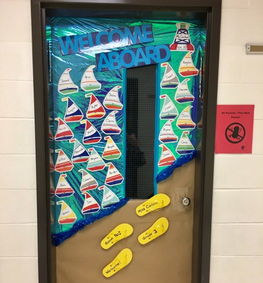
My classroom came together with a nautical theme, shades of blues and calm colors, nautical paintings by my Mom, lots of cleaning and moving by my Dad, sailboat name tags on the door, and our own 3D sailboat in my class library. It soon got around that my room was one to go see!
Door decorations for my first third grade classroom!
Classroom decor: life ring painting, handmade pilings, fish and life ring pillows, sea creature lights, and 3D sailboat
Our Technology Integration Specialist, a NOAA Teacher at Sea Alumnus, visited my room and explained the program to me. The application was due on my birthday, less than a month from when I learned about the opportunity.
– – ⚓ – –
So, I applied in November 2017, 2018, and 2019. One year I just wasn’t selected, one year administrative input was not turned in on time, and other hiccups along the way. Then, my 2019 application was accepted, and I was over the moon in January 2020 to learn that I was a finalist. Of course, we all know what happened that March; and the 2020 and subsequent 2021 sailing seasons were canceled. Slowly, a few teachers were able to sail in the summer of 2022, and I was able to read their blogs from afar with the belief of everything happening for a reason.
“For three decades, the Teacher at Sea program has helped teachers participate in annual NOAA research surveys conducted by our scientists. Teachers from around the country embark on a two to three week expedition at sea. They gain invaluable on-the-job experience and communicate their journey through a series of blogs and lesson plans.”
I am so excited for this opportunity and experience after five and a half years of anticipation. So follow along, wish us fair winds and following seas, and as many schools of Pacific Hake as possible to sample from and research!
– From my king sized bed hotel room, and last night ashore:
Temporarily reassigned teacher, and sailor at heart.
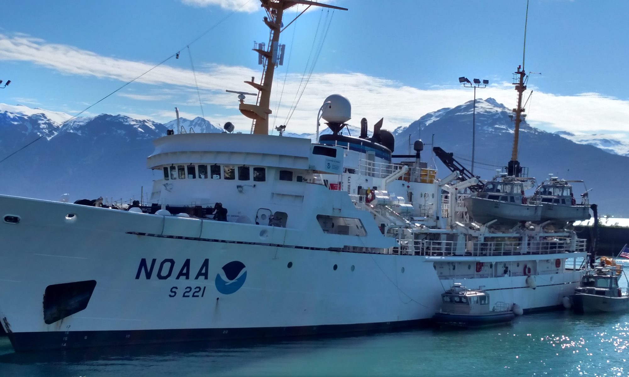
NOAA Ship Bell M. Shimada was built by VT Halter Marine, Inc. in Moss Point, Mississippi. The ship was commissioned on August 25, 2010 and is currently homeported at NOAA’s Marine Operations Center—Pacific in Newport, Oregon. The ship primarily studies a wide range of marine life and ocean conditions along the US West Coast, from Washington state to southern California.
The ship’s design allows for quieter operation and movement through the water, giving scientists the ability to study fish and marine mammals without significantly altering their behavior.
Bell M. Shimada conducts acoustic and trawl surveys. For acoustic studies, the ship uses a multibeam echo sounder (MBES) that projects a fan-shaped beam of sound that bounces back towards the ship. The ship’s MBES, one of only three such systems in the world, acquires data from both the water column and the seafloor. Scientists can detect fish when the boat passes over them, measuring the signal reflected by the fish to estimate their size and number. The system can also create a map and characterize the sea floor.
MBES
Science team working in the acoustic lab
Hydrovents?
The ship conducts trawl sampling with a standardized, three-flange, four-seam bottom survey net equipped with a skipping rock sweep: sweeps with large rubber discs that allow the nets to be towed over rocky and uneven seabeds. Trawls sample fish biomass in a given study area. This helps scientists learn what species are in observed schools of fish and collect other biological data.
Trawl system
The ship’s wet lab allows scientists to sort, weigh, measure and examine fish. Data is entered directly into the ship’s scientific computer network. The Bell M. Shimada Bird and Marine Mammal Observation Stations are equipped with sensors to help researchers identify and track protected species.
Wet Lab
Gear to use in wet lab
Bell M. Shimada was named by a team of students from Marina High School in Monterey, California, who won a regional NOAA contest to name the ship. The ship’s namesake served in the Bureau of Fisheries and the Inter-American Tropical Tuna Commission. He was known for his contributions to the study of tropical Pacific tuna populations, which were important to the development of West Coast commercial fisheries after World War II. Bell M. Shimada’s son, Allen, is a fisheries scientist with NOAA Fisheries.
Personal Log
This has been an experience that I never imagined, on Thursday, August 11, when I entered the port and saw the ship in the distance, I felt a lump in my throat, it is much larger and more imposing than I imagined. The scientist in charge of the expedition, Beth Philips, welcomed me to the ship. She was extremely jovial and pleasant and gave me a tour of the ship, which let me tell you, this is a labyrinth. The crew has been excellent, all with a kind and respectful treatment towards me. On the other hand, I hope I can loosen up a bit more with everyone on the ship since I’m a bit in my head because of my English speaking.
I want to introduce you to the excellent team of scientists
Science Team: John Paul, Ethan Beyer, Toby Auth, Steve de Blois, Michael Gutiérrez (me) and Beth Phillips
Celebrating Beth’s Birthday!
In just a few days of meeting them, they have taught me a lot. They have all been patient and have explained and answered questions regarding the work they do on the high seas. Their knowledge and experiences have led me to create great admiration for them. In the next blogs you will learn more about each of them and you will see them in action!
Not Just One, But Two Puerto Ricans on the High Sea!
LT Erick Estela
That’s right I’m not the only Puerto Rican on NOAA Bell M. Shimada, this is LT Erick Estela from Ciales, Puerto Rico. Erick is one of the NOAA Corps officers serving at sea, on land and in the air to support NOAA’s environmental science and management mission. Erick have been serving with NOAA Corps nine and a half years. We met in the middle of a drill and it was very exciting to know that there’s another Puerto Rican on board. Puerto Rico is proud to have Erick in such an important role within NOAA!
LT Erick driving the ship
Welcome to the Bridge
Central Control System
Around fishing fleet (green boats)
Radar image
Live images around the ship
Before I go, I want to share some photos taken by Teacher at Sea Alumni Association Manager Britta Culbertson, who met us at Whidbey Island to wave goodbye from shore. Thank you for the beautiful photos and for all your support. Thanks also to TAS Alumni Denise Harrington for your messages of support, much appreciated!
NOAA Bell M. Shimada from Whidbey IslandNice view of the mountains and seabird NOAA Bell M. Shimada
See you in my next blogs where I will be talking about our study of hake populations and the data received from the echo sounder. I’m gone fishing, see you next time!
Weather at 1600 Pacific Standard Time on Thursday 11 July 2019
Happy to report we’re back to a much calmer sea state! I finally made it up to the flying bridge again since it isn’t raining or choppy anymore. It’s the first time in two days I’ve needed to wear sunglasses. The ocean looks almost level with scattered patches of wavelets which indicates about a 5 knot wind speed. It reminds me of the surface of my palms after I’ve been in the water too long – mostly smooth but with lots of tiny wrinkles. Check out this awesome weather website to look at what the wind is doing in your area!
A weather map from Windy.com
PERSONAL LOG
Stretch everyday. I should stretch everyday. I do not. On the ship it’s even more of a necessity. One of the scientists calls it “Boaga” – like mixing “boat” with “yoga.” Try doing yoga on the ship and the rocking might cause you to tumble, but I enjoy a good challenge. Fitness requires strength and flexibility, so if I do some yoga and have to work harder to stay balanced since the ship is rocking, all the better.
A combination of the good food, constant access to homemade snacks, and lack of natural ways to burn calories on the ship, I need to turn to deliberate exercise. I just haven’t started that routine yet. The ship does have a nice, albeit small, gym on the same floor as my stateroom. It includes free weights, kettlebells, a treadmill, and a few other pieces of equipment. Now that our first week is coming to a close, my goal for today – and everyday forward – is to develop a routine for stretching and cardio. Sigh. Otherwise the five pounds I’ve already gained will turn into fifteen. And I have no desire to work off fifteen pounds of belly fat when I get home.
THE SCIENCE
“Trawl” has its origins in Latin. The original word meant “to drag” and it still carries a similar denotation. Fishermen use trawl as a noun, verb, and adjective. On NOAA Ship Reuben Lasker we use a Nordic 264 Surface Trawl to conduct the Coastal Pelagic Species Survey each night. The trawl is spooled onto a giant iron net reel which connects to the deck with sixteen 2.5 inch bolts and is securely welded. We try to get three trawls in per night, but sometimes we don’t quite make it. Poor weather, issues with the net, or sighting a marine mammal can all put a quick end to a trawl.
Now let’s use it as a verb. The origin “to drag” deals more with how you operate the net than the construction of the net itself. To trawl for fish like we do each night means to slowly unravel 185 meters in length of heavy ropes, chains, and nylon cord mesh into the water off the stern with an average of 15,000 pounds of tension while the ship steams at a steady rate of about 3 knots. Getting the net into the water takes about 15 minutes.
Scott Jones, Chief Bosun, took me on a tour of the equipment. Two reels below deck spooled with cable the diameter of my forearm, one even larger reel on the fantail to house the net and ropes, a winch to lift the weight of the trawl as it transitions from deck to water, plus two work stations for the Chief Bosun to manually monitor and control all those moving pieces. There are three additional nets on board in case they need to replace the one we’ve been using all week, but the deck crew are pretty adept at sewing and mending the nets as needed.
As I stand on the bridge watching the net snake its way into the water behind the ship, everything pauses for a brief moment so the deck crew can use daisy knots to sew floatable devices into the kites. Later, they attach two more of these floats to the headrope (top line). The floats keep the mouth of the net open vertically. A couple minutes later they stop to attach 250lb Tom weights to the footrope (bottom line) of the trawl opening. When fully deployed, this roughly 25 meter vertical opening is as tall as an 8-story building!
It’s like watching choreography – every detail must be done at exactly the right moment, in the right order, or it won’t work. The Chief Bosun is the conductor, the deck crew the artists. Hollow metal doors filled with buoyant wood core – together weighing more than a ton on land – are the last to enter the water. Each hangs on large gallows on the starboard and port side of the ship, just off stage, until they’re cued to perform. These doors are configured with heavy boots and angled in the water to act as a spreading mechanism to keep the net from collapsing in on itself.
If unspooled properly, the net ends up looking like an enormous largemouth bass lurking just under the surface.
Commercial fishermen use all kinds of nets, long lines, and pots depending on the type of catch they’re targeting, fishing regulations, and cultural traditions. But if we use “trawl” as an adjective, it describes a specific kind of net that is usually very large and designed to catch a lot of fish all at one time. It looks like a cone with a smaller, more narrow section at the very end to collect the fish.
I imagine something like a cake decorating bag that’s being used to fill a mini eclair. Except, instead of squeezing delicious icing into the pastry, we’re funneling a bunch of fish into what fishermen call a “codend.” This codend (pronounced cod-end, like the fish) houses the prize at the end of the trawl! When they haul everything back in – taking a little longer, about 45 minutes to complete the haul back – they end up with (hopefully) a codend full of fish to study.
Two Mini Eclairs Filled with Pastry Cream
A trawl net can either be used like we are to collect fish close to the surface or it can be weighted and dropped to the sea floor in search of groundfish. We’re searching for pelagic fishes that come up to the surface to feed at night, so it makes sense for us to trawl at the surface. Think of pelagic fish as the fishes in the water. Sounds funny to say, but these fishes don’t like to be near the seabed or too close to the land by the coast. They like to stay solidly in the water. Think of where anchovies, mackerel, tuna, and sharks like to hang out.
To catch groundfish on the other hand, we’d need to trawl the bottom of the ocean since they prefer to stay close to the ocean floor. Trawling the seabed in the Northeast Pacific Ocean would bring in flavorful rockfish and flounder, but we’re not looking for groundfish during this survey. One very lucrative and maybe less known groundfish in this area is the sablefish. In commercial fishing, they use bigger nets, and a trawl can bring in tens of thousands of pounds in just one tow. When I spoke to someone on board who used to work on a commercial trawl boat, he said catching sablefish are a pain! They live in very deep waters. Plus, the trawl must hit the seabed hard and drag along the bottom in order to catch them. This causes huge tears, many feet wide, in the mesh. He said they used to keep giant patches of mesh on the boat deck so they could patch up the holes in between trawls. When I get home, I’m definitely going to purchase sablefish and try it for dinner.
Trawl Net Spooled on the Net Reel on the Fantail
Chief Bosun Scott Jones at a Control Station
Trawl Entering the Water
Codend Floating in the Water
Trawl Net Snaking off the Stern
Floats Sewn into the Kites
Floats When They’re Not Sewn In
Daisy Knot
Getting Ready to Add the Tom Weights (chains)
Reversing the Process – Hauling the Net back on Deck
Prepping the Codend before Emptying the Catch
Emptying the Catch
TEACHING CONNECTIONS
I’ve never once wondered how the fish I buy at the grocery store ends up on my plate. Now I can’t seem to stop asking the scientists and deck crew questions. There are all these regulations to follow, methods to learn based on what type of fish you’re targeting, and so much that someone would need to understand about traveling in the ocean before even attempting to fish commercially. I’ve been immersed in a world I don’t recognize, and yet the fishing industry impacts my life on a daily basis. We are so far removed from what we eat.
The other aspect to the trawling topic that interests me is just how effortless it looks. The deck crew make such an intricate task look, truly, easy. An article on BBC News called Can 10,000 Hours of Practice Make You an Expert? does a nice job of summarizing how this might be possible. Of course, it doesn’t hurt that I’m currently reading Grit: The Power of Passion and Perseverance by Angela Duckworth, that I’ve already read Outliers: The Story of Success by Malcolm Gladwell and Mindset: The New Psychology of Success by Carol Dweck, and that as a teacher I’m familiar with Ericsson’s work on deliberate practice. I know how many years and cumulative hours they each must have put in to make it appear seamless.
Like most teachers, I want my students to find a career that they love enough to practice with such diligence. I want them to find a vocation instead of just work to pay the bills. I feel very much led to making sure my students have access to as much information as possible about post-secondary career and training options. For that reason, I’m glad to have met these folks and learn from them so I can share their practice with the hundreds, possibly thousands of teenagers I’ll teach over the course of my career.
It’s easy for me to do this as a reading specialist since I can read career profiles with students, let them annotate the text, and then engage them in a discussion on a regular basis. Reading, analyzing, and discussing text are kind of my bread and butter. For other disciplines, it might take a bit of a re-work to fit this in, but certainly not impossible. A science, math, art, STEM, you-name-it teacher could post a career profile specific to their discipline to their digital classroom space each week for students to read at their leisure. Or you could bring discipline specific literacy skills into your classroom by incorporating short texts into your lessons a few times each quarter.
I’m planning now to read a career profile with my
students one time per week. I’ll keep the texts short so that reading,
annotating, and discussing the text will stay under 15 minutes. Some careers from the ship they might find
interesting are the Chief Bosun position or a NOAA
Corps Officer, but I’ll share a wide variety of career profiles from many
disciplines based on the students’ interests once I meet them this year.
I departed Chattanooga, TN, for San Francisco, CA, on May 28th to participate as a NOAA Teacher at Sea on Leg 2 of NOAA’s Juvenile Rockfish Recruitment and Ecosystem Assessment Survey. My job as a Teacher at Sea will be to share my experience and knowledge acquired over the next 10 days working alongside NOAA scientists with MY AUDIENCE. Who is my audience? You! I hope that you all can be my students! You, my McCallie students and colleagues, my friends, my swimming community and my family members. My intention here is to explain in layman’s terms what I learned, and especially, what I thought was cool.
After tapas in North Beach with my San Francisco friends Cathy Delneo and Evan Morrison, they dropped me off at Pier 15 to sleep in my stateroom on the NOAA Ship Reuben Lasker. I felt rocking even while docked in the San Francisco Bay, but I slept great and am happy to report that my CVS brand “less drowsy” Dramamine tablets seem to be working as I am prone to motion sickness. This morning Evan and I got to explore the ship and take a bunch of photos of The City from the top deck of the ship, called the Flying Bridge. I imagine I will be spending many hours up here over the next 10 days!
Karah and Evan on the Flying Bridge the morning of departure.
Meeting the Science Team
The first science team member I met was Kelly Goodwin, Ph.D., an environmental molecular biologist from NOAA National Marine Fisheries Service (NMFS), Southwest Fisheries Science Center (SWFSC) La Jolla, and NOAA Atlantic Oceanographic and Meteorological Laboratory. Kelly is here along with Associate Researcher Lauren Valentino to collect environmental DNA (eDNA) from water collected at three depths (5 meters, the chlorophyll maximum, and 100 meters) during deployment of the Conductivity, Temperature and Depth (CTD) Rosette. There will be more about these marine scientists and the cool biotechnology they will be employing to come in a future post!
Next, I met my stateroom bunkmate Flora Cordoleani, Ph.D., of NOAA NMFS, SWFSC,Fisheries Ecology Division (FED). Her research lab at the University of California Davis focuses on the management of the endangered king salmon in the Central California Valley. I will definitely interview her for a future blog!
Meet the rest of the team: Doctoral student Ilysa (Ily) Iglesias, NMFS SWFSC FED/ University of California Santa Cruz (UCSC), works in John Field’s Lab. Ily will be analyzing the myctophids (one of the most abundant mesopelagic fish groups) collected on this survey and elucidating their role in the trophic cascade. She was on the cruise last year as well and I can already tell is psyched about this opportunity and wants to teach everyone.
John Field, Ph.D., was on the previous leg of the cruise and is the Principal Investigator for this project while Keith Sakuma, of NMFS SWFSC FED, is the Chief Scientist and has been working on this survey for 30 years as of this cruise!
Kristin Saksa of NMFS SWFSC FED/ Moss Landing Marine Lab (MLML) and Kaila Pearson, NMFS SWFSC FED, of Scripps, who are both working on master’s degrees in marine science.
Jarrod Santora, Ph.D., an ecologist from NMFS SWFSC FED/UCSC, will be on the day shift. Brian Hoover, Ph.D., an ornithologist who works for the Farallon Institute for Advanced Ecosystem Research (FIAER), will be observing birds and marine mammals on the day shift.
Keith Hanson is a NOAA Corps Officer representing NMFS SWFSC FED and is also a valuable member of the science team.
Night shift fish sorting crew. From left: Karah Nazor, Ph.D., Flora Cordoleani, Ph.D., Kristin Saksa, Keith Sakuma, Keith Hanson, Kaila Pearson, and Ilysa Iglesias.
After a welcome aboard orientation and safety briefing given by NOAA Corps Officer David Wang, we enjoyed a delicious reuben sandwich in the galley (cafeteria) of the Reuben Lasker. Meals are served at 7 AM, 11 AM and 5 PM. Since I will be on night shift I can request to have meals put aside for me to eat whenever I want. Below is a typical menu. The food is superb! See a menu from one of our last days below.
Menu for my last day.
After a noon departure the engineers spent a couple of hours testing the dynamic positioning system just north of the Bay Bridge. This system takes inputs from ocean conditions such as the tide, wind, waves and swell and uses the propulsion and thrusting instruments on board to maintain a fixed position on the global positioning system (GPS). Most of the night shift science crew used this opportunity to nap since we had to stay up all night!
Kaila Pearson woke me up just in time as we exited San Francisco Bay to take in the spectacular view of passing under the Golden Gate Bridge. It was a gorgeous sunny day in San Francisco and I felt super grateful to be a part of this research team, excited to get to know the team of amazing (mostly) female scientists I had just met, and ready to start fishing! It was fun to get to serve as a impromptu San Francisco tour guide as we departed the Bay, since I am quite familiar with this landscape. This body of water was my first open water swimming playground when I used to live in San Francisco during my postdoc at UCSF and was a member of the South End Rowing Club.
Our departure from the San Francisco Bay. Photo taken on the flying bridge. From Left: Kaila Pearson, Flora Cordoleani, Ph.D., Lauren Valentino, and Ilysa Iglesia with Teacher at Sea Karah Nazor, Ph.D., in front.
Night 1 of Cobb Trawl and Fish Sorting
We arrived at our first trawl line, Monterey Bay, around 11:00 P.M. My job as part of the night crew is to participate in marine mammal watches before and during fishing, and then to sort, count and measure the different species of animals collected, as well as bag and freeze specimens for various research organizations. The fishing method used on this survey is a modified Cobb midwater trawl. The net is deployed to fish at 30 meters depth and has a 9.5 mm codend liner (mesh at the end of the net where the fish gather). Trawl operations commence just after dusk and conclude just before dawn, with the goal of conducting up to 5 trawls per night. The duration of fishing at target depth before “haul back” of the net can be either 5 minutes or 15 minutes. Five minute trawls are used in areas of high abundance of gelatinous organisms such as jellyfish in order to reduce the size of the catch (e.g., fishing the additional 10 minutes would result in catches large enough to damage the net).
From left, Keith Hanson, NOAA Operations Officer, and Chief Scientist Keith Sakuma, help release the catch from the first haul of the survey.
At first glance, it appeared the catch consisted mostly of Northern anchovies.
UCSC graduate student Ilysa Iglesias examines the first sort of the first haul, with the organisms arranged by species.
There are two marine mammal watches per trawl: the inside watch and the outside watch. The inside watch goes to starboard side of the bridge 30 minutes prior to reaching the planned trawl station. If any marine mammals such as sea lions, seals, dolphins or whales are spotted within one nautical mile of the planned trawl station, then the ship must move. This protocol is employed for mitigating interaction with protected marine species.
If the inside watch does not see any marine mammals, then trawl operations can begin. This is when the outside mammal watch takes over and looks for marine mammals during net deployment, trawling, and haul in. The outside watch is conducted one floor above the fishing deck, and the person must wear foul weather gear, a life vest, and a helmet. This is summer, but it is the Pacific, and it is COLD out there. If a marine mammal is spotted by the outside watch then the trawl net must immediately be reeled in.
I spotted a school of dolphins in Monterey Bay during haul back and reported the sighting via radio to the bridge officers and recorded my observations in the lab on the provided data sheet in the lab.
The duration of the entire fishing operation from net deployment, dropping the two “doors” (large metal plates weighing 900 pounds each) used to spread the net mouth open, fishing, haul in, properly wrapping the net on the winch, and finally, dispensing the harvested fish into the collection buckets, takes between 45 minutes to an hour and a half, depending on conditions.
Our first catch consisted primarily of Northern anchovies (Engraulis mordax) and California market squid, Doryteuthis (Loligo) opalescens. Ily was excited by the presence of a few plainfin midshipman, Porichthys notatus, and showed us their beautiful pattern of large photophores located on their ventral surface. These fish are quite hardy and survive the trawling procedure, so as soon as we saw one in the bucket, we placed it in a bowl of sea water for release after obtaining its length. Photophores are glandular organs that appear on deep sea or mesopelagic fish and are used for attracting prey or for confusing and distracting predators.
Northern anchovies, Engraulis mordax,, are one of the most abundant species we catch.
Photophores on ventral surface of Plainfin midshipman, Porichthys notatus.
Mesopelagic depths start around 200 meters, a depth at where 99% of the sunlight can no longer penetrate, and extend down to 1000 meters below the ocean surface. Above the mesopelagic zone is the epipelagic zone where sunlight reaches from the ocean surface down to 200 meters and, in California, corresponds to the ocean above the continental shelf.
In this survey, we will conduct trawls at 30 meters, which is technically the epipelagic zone, so why do we catch deep sea creatures? Many deep sea creatures participate in a daily vertical migration where they swim up into the upper layer of the ocean at night as that area is relatively rich in phytoplanktonic organisms. Phytoplankton are the sun-powered primary producers of the food chain, single-celled photosynthetic organisms, which also provide the majority of the oxygen we breath.
After the first night of work I feel confident that I can identify around 10 species of mesopelagic fish and forage organisms, the California Headlight Fish (more to come on these amazing myctophids from my interview with Ily), a juvenile East Pacific red octopus, Octopus rubescens, (alive), and ctenophores! Thanks to the Tennessee Aquarium’s Sharyl Crossly and Thom Demas, I get to culture ctenophores in my classroom.
Two large photophores in between the eyes of a Californian Headlightfish, Diaphus theta
Small octopus – Octopus rubescens.
Karah Nazor with a handful of ctenophores! These are Hormiphora – Undescribed Species.
Scientist Spotlight: Ornithologist Brian Hoover
Brian Hoover, Ph.D., an ornithologist who works for the Farallon Institute for Advanced Ecosystem Research (FIAER) in Petaluma, CA, observes birds and marine mammals on the day shift of this NOAA research cruise.
Brian Hoover, Ph.D., at his office in the San Francisco Bay
Brian Hoover, Ph.D., and Jarred Santora, Ph.D., watching for birds and marine mammals as we went underneath the Golden Gate Bridge.
Brian is from Colorado and earned his doctorate
at UC Davis in 2018. On this cruise we will be traversing through
biological hotspots that occur near islands, underwater canyons, and where
there is strong upwelling of the cold and nutrient rich deeper waters of the
California Current. Small fish feed on these nutrient rich waters, and
birds feed on these fish. Hotspots on this cruise included the Gulf of the
Farallons (just south of the Point Reyes upwelling plume) , the Channel Islands,
and Monterey Bay with its submarine canyon. Brian’s hours on the ship are from
7am to 7pm.
Brian can be found perched on the flying bridge during the day shirt with a pair of binoculars in his hand and his laptop off to his right on a table. Every time a bird or marine mammal is spotted within 300 yards of the ship to the right of the mid centerline of the bow, Brian records the species and numbers of animals observed in his database on his laptop. The objective of Brian’s work aboard the ship is to study how what is present underwater correlates with birds observed above the water. In other words, he aims to find correlations between the distribution and abundance of seabirds and marine mammals to the species and abundance of prey we collect during our night trawls and data collected from the ship’s acoustic krill surveys which collect data during the day. Brian explains that such information teaches us about what is going on with the bird’s prey base and how well the ecosystem is functioning as a whole. His observations allow him to observe shifts in the system over time and how this affects tertiary and apex predators. To find trends in these datasets, he used R software, Python, and ArcGIS mapping software to run spatial statistics and linear models.
Since 2010 Brian has been on 12 to 13 cruises and this is his third on the Reuben Lasker. Brian is excited to perhaps spot the Cooks Petrel, Pterodroma cookii, or the Short-tailed albatross, Phoebastria albatrus, which only lives in a volcano in japan. His favorite birds are the storm petrels because these birds are small and live in open ocean, only coming onshore to breed once a year. His dissertation focus was on the reproduction and behavior of the leeches storm petrol. He explains that seabirds have an incredible sense of smell which they utilize to find a mate and food. Brian was able to collect blood samples from burrowing birds for genotyping. He found that the major histocompatibility complex (MHC) molecules located on antigen-presenting cells may play a role in odor detection and mate selection in these birds. He found that males chose and avoided particular genotypes combinations and that healthier birds had more diverse MHCII complexes.
Brian is a sensory ecologist and studies how
seabirds interact with their environment through observations of their
behavior and physiology. When Ily asked Brian how do the seabirds know where
the fish are in the open ocean, he explained that birds have a sense of smell
that is as good or better than any commercial sensor that detects sulfur.
Why have some seabirds evolved to be so good at sniffing out traces of sulfur
in the ocean breeze up to 10 miles away from its source? Brian explained that
sulfur is an important part of the photosynthetic pathway for phytoplankton
(algal cells) and that when krill eat the algae, the algae releases the
chemical dimethyl sulfide (DMS). Marine plastic debris floating on the
sea surface also release DMS and provides an explanation as to why seabirds eat
plastic.
Weather Data from the Bridge
Date: 2018/10/21
Time: 12:52
Latitude: 029 23.89 N
Longitude 094 14.260 W
Barometric Pressure 1022.22mbar
Air Temperature: 69 degrees F
The isness of things is well worth studying; but it is their whyness that makes life worth living.
– William Beebe
My last sunset aboard the Oregon II.
Science and Technology Log
Today is our last day at sea and we have currently completed 53 stations!At each station we send out the CTD. CTD stands for Conductivity, Temperature and Depth. However, this device measures much more than that.During this mission we are looking at 4 parameters: temperature, conductivity, dissolved oxygen and fluorescence which can be used to measure the productivity of an area based on photosynthetic organisms.
Some of the science team with the CTD.
Once the CTD is deployed, it is held at the surface for three minutes.During this time, 4,320 scans are completed!However, this data, which is used to acclimate the system, is discarded from the information that is collected for this station.
The crane lifts the CTD from the well deck and deploys it into the water.
Next, the CTD is slowly lowered through the water until it is about 1 meter from the bottom.In about 30 meters of water this round trip takes about 5 minutes during which the CTD conducts 241 scans every 10 seconds for a grand total of approximately 7,230 scans collected at each station.
The computer readout of the data collected at one of the stations.
Our CTD scans have gathered the expected data but during the summer months the CTD has found areas of hypoxia off the coast of Louisiana and Texas.
Data from CTD scans was used to create this map of hypoxic zones off the coast of Louisiana in summer of 2018.
Personal Log
The gloomy weather has made the last few days of the voyage tricky. Wind and rough seas have made sleeping and working difficult. Plus, I have missed my morning visits with dolphins at the bow of the ship due to the poor weather.But seeing the dark blue water and big waves has added to the adventure of the trip.
The gloom is lifting as a tanker passes in the distance.
We have had some interesting catches including one that weighed over 800 pounds and was mostly jellyfish.Some of the catches are filled with heavy mud while others a very clean. Some have lots of shells or debris.I am pleasantly surprised to see that even though I notice the occasional plastic bottle floating by, there has not been much human litter included in our catches.I am constantly amazed by the diversity in each haul.There are species that we see at just about every station and there are others that we have only seen once or twice during the whole trip.
A few of the most unique catches.
I am thrilled to have had the experience of being a NOAA Teacher at Sea and I am excited to bring what I have learned back to the classroom to share with my students.
Challenge Question:
Bonus points for the first student in each class to send me the correct answer!
These are Calico Crabs, but this little one has something growing on it?What is it?
Calico crabs… but what is that growing on this small one?
Did you know…
That you can tell the gender of a flat fish by holding it up to the light?
The image on the top is a female and the one of the bottom is the male. Can you tell the difference?
Today’s Shout Out!
Kudos to all of my students who followed along, answered the challenge questions, played species BINGO, and plotted my course!You made this adventure even more enjoyable!See you soon 🙂