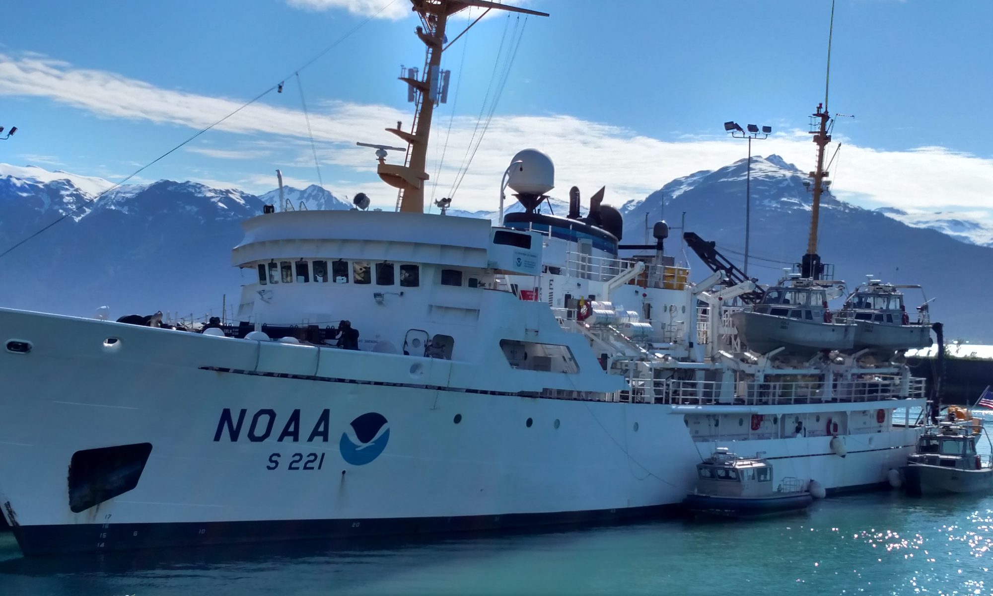
NOAA Teacher at Sea Joanie Le Aboard NOAA Ship Henry B. Bigelow August 5 – 16, 2014
Mission: Deep-Sea Coral Research Geographic area of the cruise: 40 miles SE of Cape May, New Jersey Date: August 5, 2014
In full survival gear during our first “abandon ship” drill.
Weather information from the Bridge:
Air Temperature: 25.5° Celsius
Wind Speed: 10 knots
Wind Direction: 330°
Weather Conditions: clear
Latitude: 37° 37.7′ N
Longitude: 74° 06.8′ W
Science and Technology Log
After almost a full day at sea, we are only hours away from the first watch and the first glimpse of data. Preparations commence, and anticipation is high.
For the next two weeks, we’ll study the deep-sea corals that occur in submarine canyons off the east coast. They have been found in every region of the United States, but for this mission we’ll target canyons in the Northeast region, investigating canyons east of New Jersey, Delaware, Maryland, and Virginia.
Deep-Sea Corals are similar to the familiar shallow-water corals, but cannot harness sunlight for energy through photosynthesis. Instead, they rely on nutrients from the water including detritus (non-living organic matter) and plankton. It is believed that Deep-Sea Corals find both shelter and bountiful grub on the steep-sided canyon walls where the faster-moving currents bring in the day’s meal. Surprisingly, many are just as beautiful and colorful as their shallow-water counterparts, like this bamboo coral photographed at Mytilus Seamount during the NOAA OER US Northern Canyons mission last year.
Bamboo Coral (Jasonisis sp.) Photo credit NOAA.
Though not the hot snorkeling destination, the Deep-Sea Corals in this region are important habitat providers as well as sensitive indicators of ecosystem health. They are long-living but slow-growing and do not recover quickly. Both bottom trawling and possible energy harnessing (off-shore wind farms and oil and gas acquisition) are possible threats to their survival.
Because bottom trawling is so detrimental to the coral communities, we’ll use TowCam to survey the area. Deploying the TowCam is a delicate process, with sensitive and pricey equipment on the line. After a few test deployments yesterday, the team began picking our dive locations. There is plenty to consider when finding a dive spot, including the topography of the sea floor and slope of the canyon walls. We also use the results generated by a habitat suitability model that predicts where deep-sea corals are likely to occur. Scientists must strike a balance between the steeper, high-probability cliffs and the gentler slopes.
The crew prepares TowCam for the first test deployment.Brian Kinlan using Fledermaus to plan our first dive.
Personal Log
Life aboard a ship is surely not easy. The constant rocking and clanging of cold metal will take a while to get used to, and I will sadly miss many daytime hours with our 12 hours on-12 hours off watch schedule. And while waking at 3 AM to greet a deathly dark ocean view may not seem like summertime fun to most, this first morning underway has convinced me that a couple weeks at sea is a treat I won’t soon forget.
Storms and subsequent rainbows with dolphins cavorting in the Okeanos Explorer’s bow wake get you asking the big questions.
Why are we here?
Not in the larger philosophical, sense but why is the Okeanos Explorer at 29⁰N, 79⁰W? With 95% of the ocean unexplored, why did NOAA choose the Blake Plateau (Stetson Mesa) to map? I went to Derek Sowers, the Expedition Coordinator for this cruise, to find out.
Derek is a Physical Scientist with NOAA’s Office of Ocean Exploration and Research (OER), which is the program that leads the scientific missions on the Okeanos Explorer. In preparation for the ship’s explorations this year, OER staff asked many scientists and ocean managers in the Gulf of Mexico and along the U.S. Atlantic southeastern seacoast for priority areas for ocean exploration.The main purpose for the Okeanos Explorer is to explore largely unknown parts of the ocean and then put the data and discoveries out there for other scientists to use as a foundation for further research and improved stewardship. OER staff boil all these ideas down to a few and talk about the pros and cons of the final exploration focus areas. Once an operation’s area is determined for a cruise, OER then asks scientists what additional science can be done in these areas while the ship is planning to go there.
Much of this “extra” science benefits other parts of NOAA – such as the scientists that study fisheries and marine habitat. To manage this extra scientific work, the ship often hosts visiting scientists. On the current cruise, Chris Taylor from NOAA Fisheries Oceanography Branch joined the cruise to lead the plankton tow and oceanographic measurement work to search for Bluefin Tuna larvae in this part of the ocean and to understand the ocean chemistry here. It is important to NOAA to multi task and utilize the ship 24/7 to accomplish numerous scientific objectives. During March and April, lots of details were nailed down and by the middle of April Derek knew that the expedition could include time to do the plankton tows and extra water sampling.
Top View of Bathymetric image of Blake Plateau
Now, just like a family vacation, things happen along the way that require everyone to make changes. A road could be closed, someone could get sick, the car could break down. These expeditions are no different. So, how do decisions happen at sea?
The crew of the Okeanos Explorer are responsible for safe operation of the ship and for supporting the visiting scientists in accomplishing their objectives for the cruise. The visiting scientists, as led by the Expedition Coordinator, must make decisions about how, where, and what needs to get done to accomplish the science objectives of the cruise. The Expedition Coordinator discusses these plans with the ship’s Operations Officer and she consults with the head of the various department on the ship (Deck, Engineering, Medical, etc.) and the Commanding Officer to most effectively support safely achieving the science team’s goals. There is a daily Operations Meeting for all of these leaders to meet and ensure coordination throughout the day so that things run smoothly on the ship. The Commanding Officer is responsible for making sure the crew implements their duties, while the Expedition Coordinator (often called the Chief Scientist) is responsible for making sure the scientists implement their duties.
For complex decisions, like our present decision whether or not to go inshore to get a replacement plankton net, lots of factors are weighed and the final call is with the Expedition Coordinator and the CO. The Expedition Coordinator weighs trading off seafloor mapping time with getting more plankton data and decides if it is worth it to go get the net. Commander Ramos must decide if it is safe and reasonable to do so and makes the final decision of where and what the ship does.
For seafloor mapping work that happens 24 hours a day, there are three teams of two people who “stand watch” on 8 hour work shifts (called a “watch”). Each watch has a watch leader that works at the direction of the Expedition Coordinator. The Watch Leader ensures the quality of the mapping work accomplished during their 8 hour watch. The ship’s Survey Technician, Jacklyn James, works closely with the visiting mapping scientists to run all of the complex computer systems under standard operating procedures.
Here is an example of how routine small decisions are made. Let’s say that Vanessa Self-Miller (see personal log) is on duty as the Watch Leader and wants to have the ship move over 500 meters to get better sonar coverage of the seafloor below.
Vanessa uses the intercom to call the deck officer on the bridge and tells the officer she would like the ship to move over 500 meters. The officer checks the AIS (see last blog) and sea conditions to see if this would be a safe maneuver for the ship. The reasons for not approving the mapping team’s request would almost always be safety based. Most of the time, the officer says “Sure Thing. Roger That.” and in the space of a few minutes the ship has changed course as requested.
The answer to “why are we here?” is a complex, time-consuming endeavor, but when it works, like on this expedition, it is magic to watch unfold.
Personal log –
Wish you were here.
The storm was not one of those Illinois summer thunderstorms that come racing in from Iowa – gathering energy like a 5th grade class the last few weeks of school. Nope. No simultaneous lightning thunder howitzers that you feel in your spine; just some lightning and wind gusts to 50 knots, but I sure wanted to see how things looked from the bridge once I heard the foghorn. The bridge on the Okeanos Explorer is one of my favorite places on this ship. I always ask permission for entry and if the circumstances allow, the officer on duty will grant it.
Operations Officer Lt.Rose’s IPod was playing Pink Floyd while she divided her attention between the myriad of dials and screens and talking navigation with mapping intern Kalina Grabb. AB Tepper-Rasmussen and NOAA Corps Officer LTJG (Lieutenant Junior Grade) Bryan Begun peered into the foggy soup and monitored the AIS.
The irony of the moment struck me because while the crew unconsciously played percussion on the brass rail overhead or mumbled lyrics and David Gilmour and Roger Waters sang about not needing an education, there was so much education and proof of education going on in this little room. That is the defining image I’ll always have of this space on the Okeanos Explorer. It is a place where the acquisition and exhibition of knowledge are so evident and invigorating. You can’t spend more than 4 minutes in this space without learning something or being amazed at how smart these people are and how devoted they are to use that knowledge to carry out the science of this mission. On this particular night, the skies lifted and we had hopes of seeing a launch at Canaveral, 40 miles to the west. Lt. Rose announced to the whole ship that a double rainbow could be seen portside and even the dolphins responded to her call to educate the right side of our brains.
Dolphins after the storm (picture courtesy of John Santic)Lieutenant Junior Grade Begun and Mapping Intern Kalina Grabb checking the error of the gyrocompass using the azimuth
What else have I been doing?
In addition to spending time on the bridge- I have been helping with the XBT launches, using the photometer to add data to the NOAA’s Aerosol Project – with the ever faithful Muffin from good ol’ Hampshire Elementary and preparing for a night launch of CTD and plankton tows – more on that nextblog.
Launching the XBT – taken by Expedition Coordinator, Derek SowersPhoto taken by mapping intern Danielle LifaviPreparing for night launch of CTD and plankton tows.(photo taken by LTJG Bryan Begun)
DID YOU KNOW?
Vanessa Self-Miller
Like all women, Vanessa Self-Miller’s mom was great at multi-tasking. While she got things rolling for the evening in the household, Vanessa was her mom’s guinea pig for the next day’s science lessons for her 6th grade students at Jackson Middle School in Jackson, Louisiana. She also instilled a love of the scientific method in her daughter.
Her father was a math guy and found out early that Vanessa was going to be the 3rd wheel with her brother on typical father son activities that involved mechanics or being out in nature. That nurturing and her work ethic prompted Vanessa to get a degree in physics at Southern University in Baton Rouge, Louisiana. She went on to work for the U.S. Navy as a hydrographer doing a lot of mapping harbors and near the shore. She received her masters degree in Hyrdrographic Science from University of Southern Mississippi.
Now she is thrilled to be a physical scientist/hyrdrographer for NOAA. While it is a challenge to coordinate job related travel with her husband and two children, she loves working for NOAA. NOAA respects a work-life balance and that allows her to pursue her passions in life. She wants to encourage all students but especially the young girls to start early in their path to a career in science. She feels that how parents nurture their girls is important in their seeking employment in the fields of science.
On a personal note, any time a question came up from this naive teacher or any of the mapping interns, Vanessa was able to answer it completely and without pause. She encourages all the 5th graders out there, male or female, to pursue their scientific oceanographic dreams. NOAA will need today’s fifth graders to investigate sea level rise and all the Ocean Engineering energy products that our country will need twenty years from now. There will always be a need for scientists who love to explore and want to work for NOAA.
NOAA Teacher at Sea Dave Murk Aboard NOAA Ship Okeanos Explorer May 7 – 22, 2014
Mission: EX 14-03 – Exploration, East Coast Mapping Geographical Area of Cruise: Off the Coast of Florida and Georgia – Western portion of the Blake Plateau (Stetson Mesa) Date: May 10, 2014
Weather data from Bridge:
Temperature 25 degrees celsius (can you convert to Fahrenheit?)
WInd – From 160 degrees at 14 knots (remember north is 0 degrees)
Latitude : 28 degrees – Longitude: 79 degrees.
Science and Technolgy Log:
Two of the goals for this expedition. (There are a lot more)
Expedition coordinator Derek Sowers said his best case scenario for this mission is to meet all the cruise objectives. The main one- an aggressive 24/7 campaign to map as much seafloor as possible within top priority mapping areas offshore of the Southeast United States and along the canyons at the edge of the Atlantic continental shelf.
L – R – Chief Scientist Derek Sowers, Vanessa Self-Miller, Kalina Grabb
In addition to that mapping goal, he wants the visiting fisheries scientist on board to get good water samples for the Ocean Acidification Program and good samples from the plankton tows. Last but not least, he “wants the mission team to have a great learning experience.”
The ship has three different sonars, each of which is good for different things. One sonar sends out a single beam of sound that lets you see fish and other creatures in the water column. Another sonar sends powerful sounds that bounce back off the bottom and gives you information about the geology (rocks and sediment) of the seafloor. Perhaps the most impressive sonar onboard is the multi-beam sonar. You know how your garden hose has a setting for jet spray when you want to aim it at your brother who is 10 feet away? The water comes out in a straight narrow line. But there’s also another setting called ‘shower” or wide spray. The multibeam sonar is like combining the best of both of these sprays into one and sends out a fan of sound that allows the scientists to map a broad section of the seafloor. By measuring how long it takes this sound to reach a patch of seafloor and return to the ship, it is possible to estimate the distance and that is how the shape of the seafloor can be mapped. Using this technology enables NOAA to map the seascape in order to better protect marine habitat and reduce harm from human activities. Mapping the marine protected areas off the east coast of Florida and Georgia is important because there are deep sea corals in this area and it is important fisheries habitat.
Chris Taylor – NOAA Fisheries
This cruise features a visiting scientist from NOAA Fisheries, named Chris Taylor. Chris’s part of the expedition includes collecting water samples and towing a net that can collect very small creatures called plankton. Chris is specifically examining the plankton he catches to see if bluefin tuna use this part of the ocean to lay eggs and raise young tuna. Samples from the net will go back to a lab to be analyzed to make sure they are bluefin and not yellowfin tuna.
Chris spent most of this windy but warm night tying a rope to the net that he’ll use for HOPEFULLY – catching some baby Bluefin Tunas. Like insects, Bluefin tuna go through an egg stage THEN a larva stage. When they are very small they drift with the currents with the rest of the ocean community. Once a larva is over 7 millimeters, they can avoid the net. But If we find some Bluefin tuna – it may mean that we have found a new spawning ground for Bluefin tuna in the southern North Atlantic.
Personal Log:
Lt. Emily Rose instructs AB Tepper-Rasmussen in radar navigation techniques.
Two people who make this ship run so well:The operations officer – Lieutenant Emily Rose. Officer Rose can usually be found on the bridge of the NOAA ship Okeanos Explorer. Today she was teaching a course on small craft navigation before I caught up with her. The thing she really loves about this position is that there are new set of challenges each day. She is always learning (and I’ll add that she is almost always sharing that knowledge with others) but the ship is her first responsibility. The most difficult thing is getting up every morning before 3:00 a.m. and being away from everyone back home.
Electronics Technicians Conway and Okeson
Chief Electronics Technician Richard Conway and Electronics Technician Will Okeson are the Tech guys and they are always busy. Since Okeanos Explorer is America’s premier ocean exploration ship, there are a lot of computers, miles of cable and lots of video equipment to maintain. Richard and Will’s favorite part of the job is when all the parts work together and the public can see their product and when they can trouble shoot and help the science team reach their objectives. The most difficult thing it so be away from families when there is a crisis or joyous moment.
Two things about my personal experiences so far on EX-14-03 (our mission)
Using photometer to monitor aerosol properties. (photo taken by Mapping Intern Kalina Grabb
First – – “SCIENCE RULES” to quote Bill Nye. Every Okeanos Explorer crew member and scientific crew member are all about the science of the mission. When one of the science crew is going to launch something called an XBT over the side, they call and get an OK from the bridge (where the captain or second in command and the crew that are on “watch” are located). No one hesitates to ask questions of each other. Why is this? What is that? Where is the nearest ship? What’s for lunch? (just kidding ! Chief Steward Randy posts a menu every day and it beats out Golden Corral any day of the week for tastiness and diversity). But the important thing of the mission is the science and every single person on the ship works to make the mission a success.
Second – RESPECT – There is so much respect shown on the Okeanos Explorer. It’s respect for other people, for the ship, for the environment, for rules and for commons spaces. Yesterday while on the bridge, Ensign Nick Pawlenko was taking over from Commander Ramos and they both showed such respect for rules and for each other by going over all the observations of the ship’s speed, the weather conditions and whether there were any other ships in the area. When breakfast was over – I saw Operations Officer Rose stick her head in the galley (kitchen) and thank Chief Cook Ray and Chief Steward Randy for a great meal. No one slams doors since it might wake the crew and scientists who are on night duty. Everyone cleans up after themselves. If you ever have a question and if the crew or scientists can answer it, they will. There is respect for the environment when we separate our garbage each meal. If only the whole world was like the Okeanos.
MYSTERY PICTURE – Here are two photos – what’s different about them? And WHY?? That’s the million dollar question (or an even better prize –bluefin tuna larva in our trawl nets )
Today’s blog is all about post processing, or “cleaning up” the data and being on night shift. It is a balmy, sliver moon night at port here, in Kodiak. We have come a long way in the last two weeks, during which survey crews have been working hard to finalize a Cold Bay report from last season before they devote themselves entirely to North Kodiak Island. I am in the plot room with Lieutenant Junior Grade Dan Smith who is on Bridge Duty from midnight until 4 a.m. with Anthony Wright, Able Seaman.
Able Seaman Anthony Wright consults with Ensign Steven Wall about conditions on the bridge and reports “all conditions normal.”
People work around the clock on Rainier whether it be bridge watch, processing data, or in the engine room. One thing that makes the night shift a little easier is that there is no shortage of daylight hours in Alaska: within two months, there will be less than an hour of complete darkness at night.
After watching Commander Brennan guide us north, with all the work it entails, it is a great sight to see him enjoy a 10 p.m. sunset with his wife (by phone).
In previous blogs, I described how the team plans a survey, collects and processes data. In this blog, I will explain what we do with the data once it has been processed in the field. Tonight, Lieutenant Dan Smith is reviewing data collected in Sheet 5, of the Cold Bay region on the South Alaskan Peninsula. In September, 2013, the team surveyed this large, shallow and therefore difficult to survey area. The weather also made surveying difficult. Despite the challenges, the team finished collecting data for Sheet 5 and are now processing all the data they collected.
Cold Bay Sheet Map. Recall the shallow areas are shaded light blue, and as you can see much of the north end of Sheet 5 is blue.
While I find editing to be one of the most challenging steps in the writing process, it is also the most rewarding. Through the editing process, particularly if you have a team, work becomes polished, reliable and usable. The Rainier crew reviews their work for accuracy as a team and while Sheet 5 belongs to Brandy Geiger, every crew member has played a part in making the Sheet 5 Final Report a reality, almost. On the left screen, Lieutenant Smith is looking at one line of data. Each color represents a boat, and each dot represents the data from one boat, and each dot represents a depth measurement computed by the sonar. The right screen shows which areas of the map he has already reviewed in green and the areas he still needs to review in magenta.
Lieutenant Smith looks for noise after midnight.
While the plot room is calm today in Kodiak, there have been times when work conditions are challenging, at best.
.
The crew continues on, despite the weather, so long as work conditions are safe.
Several days ago, Lieutenant Smith taught me the difference between a sonar ping that truly measured depth, and other dots that were not true representations of the ocean floor. Once you get an eye for it, you kill the noise quickly. In addition, when Lieutenant Smith finds a notable rise in the ocean floor he will “designate as a sounding.” Soundings are those black numbers on a nautical chart that tell you how deep the water is.
This line shows three colors, meaning three boats sent pings down to the ocean floor in this area.
If the line has dots that rise up in a natural way, the computer program recognizes that these pings didn’t go as far down as the others and makes a rise in the ocean floor indicated with the blue line. It is the hydrographer’s job to review the computer processed data. One of the differences between a map and a nautical chart is the high level of precision and review to ensure that a nautical chart is accurate.
This nautical chart of Cold Bay went through many layers of analysis, processing and review before becoming published as a nautical chart that can be used as a legal document. It may be updated after Brandy Geiger and NOAA’s hydrography work in the area is completed.This is a topographical map of the same area, Cold Bay, that provides some information about landmarks but not necessarily the same legal standing or authority.
Now let’s kill some noise on this calm May evening.
In this image of a shipwreck on the ocean floor most sonar pings reached the ocean floor or the shipwreck and bounced soundings back to the survey boat. Look carefully, however, and you see white dots, representing pings that did not make it down to the ocean floor. Many things can cause these false soundings. In this case, I predict that the pings bounced back off of a school of fish. Here, the surveyor kills the “noise” or white pings by circling them with the mouse on his computer. It wouldn’t be natural for the ocean floor or other feature to float unconnected to the ocean floor, and thus, we know those dots are “noise” and not measurements of the ocean floor.
Lieutenant Smith estimates that at least half of his survey time is spent in the plot room planning or processing data. The window of time the team has in the field to collect data is limited by weather and other conditions, so they must work fast. Afterward, they spend long, but rewarding hours analyzing the data they have collected to ensure its accuracy and to provide synthesized information to put into a nautical chart that is easy to use and dependable. Lieutenant Smith believes that in many scientific careers, as much time or more time is spent planning, processing and analyzing data than is spent collecting data.
Personal Log
As we post process our data, I too, begin post processing this amazing adventure. I am hesitant to leave: I have learned so much in these two short weeks, I want to stay and keep learning. But at NOAA we all have many duties, and my collateral, wait–my primary duty is to my students and so, I must return to the classroom. I will leave many fond memories and a camera, floating somewhere in Driver Bay, behind me. I will take with me all that I have learned about the complexity of the ocean planet we live on and share my thirst to know more back to the classroom where we can continue our work. I will miss the places I’ve seen and the people I met but look forward to the road or channel of discovery that awaits me and my students.
I am also taking with me a NOAA souvenir flag, full of memories from the North Kodiak Island crew — my new friends.
Did You Know? The Sunflower Sea Star is the largest and fastest moving sea star travelling up to one meter per minute.
Here we taking a quick break during a tide gauge set up to look at sea stars and anemones.
Below are a few photo favorites of my time at sea.
Me and Starla Robinson, checking out waterfalls along the Inside Passage.
Carrying a drill across the tide pools. Photo by Brandy Geiger
The new, unique and pink, replacement helmet.
My peeps.
Ship motto “Teamwork, Safety First,” is followed and an operational risk assessment completed by all at the morning safety meeting.
The start of a great adventure: leaving Newport.
The sun rays coming through looked magical.
Captain Keith Sternberg swings the compass as we pass by the San Juan Islands.
Here I am operating the crane which moves boats up over the ship and over two other levels of boats.
Views like this became normal, but still stopped me , no matter what I was doing.
Safety first: here I am with Lindsey Houska in our full immersion suits.
The fateful moment when I lost my blue helmet during a man overboard drill.
Here I am strenuously lifting a 1,600 pound launch with a davit.
Jim Kruger, Chief Boatswain, makes maneuvering the fast rescue boat look a lot easier than it is.
Much like the the lab reports we do in class, hydrographers have a tremendous amount of work to do prior to going into the field. As we make the transit from Rainier’s home port of Newport to our charting location of Kodiak Island, hydrographers are working long hours in the plotting room planning their season’s work. Today’s log is about a software program called CARIS that hydrographers use to plan their project and guide data collection through the season. This morning, Ensign Micki Ream planned her season’s work in the Plot Room on CARIS. This afternoon, she walked out the plot room door and onto the bridge where she navigated Rainier through the narrow Blackney Passage of the Inside Passage. Prior to taking over the bridge, I watched as Ensign Ream as she plotted her project area for the season. She has been assigned Cape Uganik, an area of North Kodiak Island in the vicinity of Raspberry Island. The area was chosen to survey due to boat traffic and because the last survey completed was in 1908 by lead line. Here you can see the original survey report and an image of how data was collect at that time (1908 Survey of Ensign Ream’s Survey Area). Ensign Micki Ream explained that the charts were called “sheets,” because originally, they were sheets of paper, sent out with the surveyor into the field. While we still call them sheets, they are now in electronic form, just like the sheet below representing one of two project areas ENS Ream will most likely work on this summer.
Ensign Ream’s task is to break this large polygon into smaller manageable parts. Challenge: print a copy of this map and come up with 30 smaller polygons to assign to your team to survey before you scroll down to see Ensign Ream’s plan.
Why make polygons instead of sending several launches out to your work area and tell them to start on opposite ends and meet in the middle? The polygons are a way for hydrographers to break a large amount of work into manageable tasks. Commander Rick Brennan, the Commanding Officer, explains “polygons are designed based upon the depth of the water, the time it will take to complete, and the oceanographic condition, particularly speed of sound through water. Areas that are suspected to have a higher variability in sound speed will get smaller polygons to manage errors from sound speed.”
Also, imagine sending several launch boats out into a large area to work without telling them where to go. Polygons provide a plan for several boats to work safely in an area without running into each other. It allows areas to be assigned to people based upon their skills. The coxswains, boat drivers, with a lot of experience and skill, will take the near shore polygons, and the newer coxswains will take less hazardous, deeper water.
Another reason to break your sheet into polygons is to maintain team moral. By breaking a large task into small assignments people feel a sense of accomplishment. As she divided her large polygon into 30 smaller polygons, Ensign Micki Ream kept in mind many variables. First, she considers the depth of the water. The sonar produces a swath of data as the survey vessel proceeds along its course. As the water gets deeper, the swath gets wider, so you can make a bigger polygon in deeper water. As she drew her polygons, she followed contour lines as much as possible while keeping lines straight. The more like a quadrilateral a polygon is, the easier it is for a boat to cover the area, just like mowing a rectangular lawn. In her polygons, she cut out areas that are blue (shallow), rocky areas and kelp beds, because those areas are hazardous to boats. While the hydrographer in charge and coxswain (boat driver), should use best practices and not survey these areas by boat, sometimes they rely on the polygon assignment.
Here is Ensign Ream’s Proposal for how to complete this summer’s work. How does it compare to your proposal?
Once she has drawn up her plan, Ensign Micki Ream roughly measures the average length and width of her polygons and puts that data into a Polygon Time Log form that a co-worker created on Rainier last season. The form also takes into account the depth and gives an estimate of time it will take to complete the polygon. This Time Log is just one of the many pieces of technology or equipment that crew invents to make their lives and jobs easier.
Polygon Time Logs estimate how long it will take to complete a sheet.
The fun part of this process is naming your polygons so that hydrographers in the field can report back to you their progress. Traditional alphabetical and numerical labels are often used, but Ensign Micki Ream is naming some of her polygons after ’90s rock bands this year. Once the polygon is named, the sheet manager, Ensign Ream, develops a boat sheet for a hydrographer in charge (HIC): this is their assignment for the day. Typically, they send out three to four people on a launch, including the HIC, coxswain and an extra hand. There are always new people aboard Rainier, so there are often other people in the launch being trained. There are enough immersion suits for 4 people but ideally there are three people to help with launching the boat and completing the day’s work. Communication between the HIC and coxswain is essential to get data for ocean depths in all areas of their polygon as they determine the direction to collect data in their work area. Now, at least, the hydrographer and coxswain know where to start and stop, and are confident that their sheet manager has done her best to send them into a safe area to collect the data needed to make new charts.
Since Ensign Ream’s polygon plan is an estimate, the time to complete each polygon may be longer or shorter than estimated. Variables such as the constantly changing depth of the ocean, weather, experience and equipment of the crew collecting data, and a myriad of other variables, known and unknown, make scheduling and completing surveys a constantly moving target. There are two guarantees however: flexibility is required to work on the crew and ultimately winter will force a pause to Rainier’s work.
Spotlight on a Scientist
Although I have been on Rainier for only several days, I am blown away by the incredible skills crew members acquire in short amounts of time. Ensign Micki Ream is the perfect example: In January, 2013, she joined the NOAA Corps which provides operational support for NOAA’s scientific missions. During a six month officer training, she was trained in the basics of navigation. On June 2, 2013, she joined Rainier crew. In February, 2014 NOAA sent her to a one month Basic Hydrography School where she learned hydrography principles and how to use various software programs. Throughout her short time at NOAA, she has had significant and varied on the job training with scientific, managerial and navigational work.The rest of her skills are on the job training with an end goal of Officer of the Deck (similar to a mate in commercial sailing) and Hydrographer in Charge.
Here, Ensign Ream is modifying polygon names from 90’s rock bands to the 12 Days of Christmas. There is plenty of room for creativity!
Ensign Micki Ream does have a background in science which she is putting to use every day. Originally from Seattle, she started her career with NOAA in June, 2009, after obtaining a Marine Biology degree at Stanford University. Her first position was with the Office of National Marine Sanctuaries Program, which provided her with an internship and scholarship to acquire a Master’s Degree, also from Stanford, in Communicating Ocean Science. Just a little over one year after coming to NOAA Corps, she is a hydrographer in training and safely navigating a very impressive ship as part of a bridge team, including highly skilled navigational experts such as Ensign J.C. Clark and Commander Brennan. Where else could you get training, experience and on the job support in so many diverse areas but with NOAA Hydro?
Ensign Ream consults with Lieutenant Russel Quintero, the Field Operations Officer, about the best way to navigate through a narrow passage during her upcoming bridge watch.
Personal Log
The food is absolutely amazing on board. Tonight’s dinner options were roast prime beef, cut to order, au jus, creamy smoked salmon casserole, farro vegetable casserole, baked potatoes with fixings, asparagus and several different kinds of cake and fruit. In the evenings, snacks are also available. My biggest challenge has been to pace myself with the the quantity of food I eat, particularly since taking long hikes after dinner is not an option. I feel very well cared for aboard Rainier.
This is the front door to the snack freezer. For me, the answer is clearly “No.”