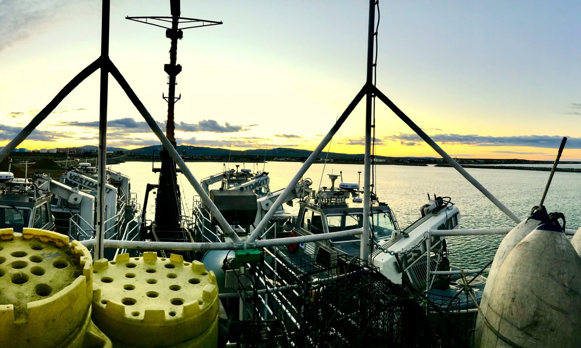
Stacey Morris: Off to Sea! July 29, 2026

NOAA Teacher at Sea

Stacey Morris

Aboard NOAA Ship Reuben Lasker

July 26-August 10, 2026

Mission: Integrated West Coast Pelagics Survey

Geographic Area of Cruise: West Coast Pacific Ocean

Date: July 29, 2026

Weather Data from the Bridge

Latitude:  40° 00.3’N

Longitude: 124° 46.1’W

Wind Speed: 22 knots

Air Temperature: 16.0 ° C/ 60.8 °F

Science and Technology Log

Interview with Zach Skelton, wet lab lead, marine biologist

What is the purpose of the Survey?

Targeted Pelagic species

The goal of the survey is to give a general assessment of the stocks of coastal pelagic species (CPS), which are anchovy, mackerel, and sardine. And in order to do that, we estimate biomass off of acoustic signals. So we run a transect (a set course that our ship follows to gather constant observations and marine specimens), use sonar, and map out bait balls (where the fish gather) on those transects. And then from there, we can estimate biomass. Then we use our nighttime trawling to help verify the species proportions and also the size distribution and age distributions within those species. We run these east-west transects about every 10 miles up the coast from the Mexico border to the Canadian border. Historically, we have worked with both Mexico and Canada and have gone into Mexico and Canadian waters. But this year, we are just in U.S. waters. We run those transects to the continental shelf, and so the distance of those transects is going to vary based on the coast. For instance, off Southern California, where we have the Channel Islands that are off far off the coast, those transects can run up to  110 miles, but in norther California, it’s a lot shorter because the continental shelf is a lot closer, more like 35 to 40 miles. 

Acoustic imagery of fisheries

Generally the daytime acoustic trawl (using sonar) is paired with the following nighttime trawl to help estimate those species proportions and biomass for that specific 24-hour day period. One of the hard things to do with CPS (the target fish species) is that they tend to be a lot deeper and in tighter balls during the day, and it’s harder to fish for them when they dive that deep. But during the nighttime, they come up to feed on what’s called the scattering layer. The scattering layer is  basically this migration of invertebrates and small pelagic fishes that hang out in the twilight zone during the day to avoid visual predators, and then they make this (diel) vertical migration up from the depths to the surface at night to feed on all the phytoplankton and zooplankton that are up in the water column. So during the day they’re in tight schools avoiding visual predators, but at night they’ll scatter and they’ll spread out and feed on all those other smaller fishes and invertebrates. So we tend to only fish at night time while the CPS are up near the surface and spread out. We also have a nearshore survey, as we are inhibited by our ability to go into shallow waters based on the size of our boat; we have transducers and a beam that extend far below the surface, and we can’t go into super shallow waters. We contract out other fishing vessels, like the  Long Beach Carnage and the Lisa Marie, and they will pick up the inshore portions of our trawls. That way we can extend our survey into the areas in which young CPS like sardine and  anchovy tend to aggregate.

Personal Log

Travel Day to the ship:

The flight to San Francisco went smoothly and I checked out the bird’s eye aerial view of our southern route that we were soon to repeat on our return trip north along the western coastline of Califronia and Oregon. The hotel was in a lively part of downtown Oakland, and in the morning, I wandered the streets of China town, where street vendors haggled over vegetables and fruits, and there were many small stores selling a variety of products that I wished I had time to peruse.

Coffee & Grab ‘n Go items

But I was eager to get to the ship, and caught an Uber to the Coast Guard base in Alameda. I arrived at the guard station and the Reuben Lasker‘s Executive Officer, LCDR John Katchenago, met me. He took me to the ship, which looked small next to the Coast Guard cutter docked alongside it. But the NOAA Ship Reuben Lasker is plenty big and I quickly became lost as John showed me around the ship. He was very kind to give me a quick overview of where everything was and introduced me to the Operations Officers,  LCDR Michael Fuller and LT Ariane Huddleston. They told me a little about their background and history and about how they fit in with NOAA (I will introduce them more in detail later on in a future blog post!). The scientists were next on board and my berth is among theirs–speaking of which, we each get our own on this survey, no need to share rooms, which I guess is uncommon. They are very comfortable living quarters, with their own bathroom with shower, a comfortable bunkbed with linens, a locker for your clothes, a small refrigerator, a desk and a porthole. There’s even a TV! AND…wifi! I wasn’t sure if I’d be able to keep my Duolingo and Wordle streak going on this trip, but I’m in luck! 

NOAA Reuben Lasker watercolor painting

Kevin Stierhoff, Chief Scientist/Acoustician, and Melissa Liotta, fish biologist/survey coordinator, two of the scientists on the survey, were going out for our final meal on land and I joined them in exploring Alameda. When we returned, we met the rest of the science crew that had arrived onboard, Chris F. –fish biologist surveyor, Zach Skelton–marine biologist/wet lab lead, and Brad Erisman, life history program lead/wet lab. 


Day 1:

I stayed up late unpacking and getting settled in my berth, but still woke up refreshed and ready for the day ahead. Breakfast was at 07:00 and I can tell I’ll need to use the onboard gym with all the tasty goodies available. There are ice cream bars whenever you want, along with other grab and go snacks. Breakfast had empanadas, pancakes, bacon, sausage, all sorts of ripe, fresh fruit, eggs, and AN ESPRESSO MACHINE. I also got to see the rest of the crew, as everyone eats at the same time. At least for now…soon we’ll have a night crew and a day crew with opposite schedules. The kitchen will save your meals though, if you are working, so you never have to go without. 

After breakfast, we did safety drills, and I found out where I need to go in case there is an emergency and how to deploy a life raft if needed. There are different horn signals that let you know what emergency is happening, such as the fire alarm (continuous bells on the general alarm for 10 seconds), man overboard (3 long bells),  and abandon ship (“get the heck off the ship nooooww”– more than 6 short bells and one long bell). I also got to try out putting on my “Gumby” suit (immersion suit), which is a big, red, lobster-looking thing that will keep you warm if you think you might be going overboard. It was a little awkward squeezing into it, but more comfortable than a wetsuit, if not as stylish. 

Emergency Gumby suit

Lunch followed, and it’s definitely not cafeteria food. Tasty chicken and porkshops, a salad bar, garlic potato wedges or rice, sauteed green beans… I might never leave!

The gangway was then lifted by a crane, and I knew this was it… no turning back now, although why would I with those cooks onboard?? We started through the channel, cut through the sailboat forest in front of us, passed all the freighters and cargo cranes sitting idle on the weekend. The San Francisco skyline faced us and we eased into the bay. The bay bridge cut across our bow and we sailed under on our way to circle around Alcatraz. It was a beautiful vista, looking at it all from an angle that most people don’t get to see. Remnants of an old Spanish fort nestled under the Golden Gate, and we ducked under this famous span as the cars streamed overhead. Open waters loomed ahead of us as we said goodbye to land. 

I’ve never been seasick but I took everyone’s advice and took Dramamine the last couple of days to get acclimated to it. The ship does have an interesting roll to it. It was built with a flat bottom in the stern and is very maneuverable. It also has an open center section where they can lower the acoustic equipment for surveying fish. However, it creates an odd circular rolling motion that I can see could lead to feeling nauseous. I feel okay so far, but I think I’ll continue with the dramamine. 

Day 2

Today was mainly spent trying to adjust to a night schedule. I fitfully napped throught out the day, but I was able to catch some z’s before we went down for our first trawl. Everyone was buzzing with excitement to see what we would find. We were pretty tired by the end of the night, but everyone was satisfied with our large catch and a successful night of capturing data. I’ll go into more detail about our survey data in my next blog!

Deploying the net for fishing

Did you Know?

There is a traditional Japanese art form called Gyotaku (from gyo meaning “fish” and taku meaning “stone impression”). Developed in the mid-1800s, it involves applying ink or paint directly to a dead fish and pressing paper or fabric onto it to create an exact, life-size replica of the animal. (Ponytail Journal)

Gyotaku attempt

We tried it last night, but we quickly found out why it’s an art. You need the proper paper and a a lot of practice. But it was fun to try and very unique!

Stacey Morris: Bon Voyage, July 24, 2026

NOAA Teacher at Sea

Stacey Morris

Aboard NOAA Ship Reuben Lasker

July 26 – August 10, 2026

Mission: Integrated West Coast Pelagics Survey

Geographic Area of Cruise: West Coast Pacific Ocean

Date: July 24, 2026

Weather Data from Eugene, Oregon – Mahlon Sweet Field (KEUG)

Latitude: 44.13333° N
Longitude: 123.21444° W
Wind Speed: North at 8 mph
Air Temperature: 28°C / 82°F

Introduction

portrait photo of Stacey
Stacey

Hi! My name is Stacey Morris, Spanish & College/Career teacher at Churchill High School, in Eugene, Oregon. Tomorrow, I begin an incredible journey as a NOAA Teacher at Sea, and I couldn’t be more excited! This opportunity combines my love of education with the chance to experience science in action alongside NOAA scientists and crew members. I’ll be stepping aboard a research vessel to learn firsthand how ocean science is conducted and why it matters.

school logo - a stylized profile of a knight in armor, drawn in red lines against a white background
CHS Lancer: Credit https://www.chs.4j.lane.edu/

As an educator, I know that some of the best learning happens outside the classroom. My goal is to bring this experience back to my students in meaningful ways. I’ll be sharing what I learn about the many careers that make ocean research possible—not just the scientists, but also the officers, the engineers, deck crew, and others who keep a research mission running. I hope these stories will help my College Success students explore career pathways they may never have considered.

While I’m excited, I’m also nervous, as I know this adventure will push me outside my comfort zone, a lot! I’m looking forward to asking questions, learning from experts, making new friends, and experiencing life aboard a NOAA research vessel. Every day will bring new opportunities to discover something I can share with my students – I hope I can keep up with everything! 

in a scanned old photograph, yellow around the edges, a man looks calmly down at a snake in his right hand. another snake is curled on his left shoulder
Stacey’s father

My father, who passed away just shy of 98 years old in March, was the one who inspired me to apply to NOAA. He was a high school biology teacher with a passion for marine science. We spent many vacations poking around in tide pools, and he was always curious about the creatures, critters, and plants surrounding us. He was so excited to hear that I was accepted, and I know that he is with me in spirit on this trip. 

Throughout this voyage, I’ll post updates about the research we’re conducting, life aboard the ship, the people I’ll meet, and the amazing science happening at sea. Whether you’re one of my students, a fellow educator, family member, or simply curious about NOAA’s work, I invite you to follow along.

I just found out yesterday that I will be deploying three drifter buoys that we can track as they float and collect data. They will be decorated with CHS Lancer stickers, so even the fish will know our name. 🙂 

Tomorrow the adventure begins, and I can’t wait to share the journey with all of you!

Science and Technology Log

¡Vámonos, la aventura empieza!

Cheyanne Vanderdonckt: Departure Day Approaches, July 22, 2026

NOAA Teacher at Sea

Cheyanne Vanderdonckt

NOAA Ship Oregon II

July 27 – August 12, 2026

Mission: Shark/Red Snapper Bottom Longline Survey

Geographic Area of Cruise: Gulf of America (Gulf of Mexico)/Atlantic Ocean

Current Location: Baltimore, MD

Date: July 22, 2026 

About Me

Cheyanne is sitting in a sailboat smiling on a sunny day. In the water in the background there are other sailboats.
Sailing in the Baltimore Inner Harbor in November 2025 with the schooner Lady Maryland in the background.

My name is Cheyanne Vanderdonckt and I am a special educator in the Baltimore City Public School System in Baltimore, Maryland. I have been teaching first and second graders at Moravia Park Elementary for 17 years. My favorite thing about my job — besides working with amazing children — is that I get to learn and try new things all the time. I am so excited to have been chosen to go on a wonderful learning adventure this summer aboard NOAA Ship Oregon II with the Teacher at Sea program! I will be participating in the Shark/Red Snapper Bottom Longline Survey departing from Pascagoula, Mississippi on July 27. I have been learning shark facts all year from a couple of my students who are very interested in the topic. When I told them what I would be doing this summer and they heard the word shark, they were in awe. I can’t wait to share my experiences with them!

Why Teacher at Sea?

I have been fascinated by the water and tales of seafaring from a young age. Most of my exploration took the form of voracious reading, but I also found ways to get in or on the water as much as possible. I spent the majority of my childhood in Florida, where I loved to canoe on the rivers with alligators sunning themselves on the shores. In the last couple of years, I have begun learning to sail with a local nonprofit that operates right in downtown Baltimore on the Inner Harbor. As I built my confidence on the water, I started to think about how I could help connect my students with the wealth of opportunities our waterfront provides — from recreation to scientific learning to marine careers.

Most of my students love science and the outdoors. They have the natural curiosity of childhood and they love hands-on exploration. Our lessons inevitably lead to them asking more and more questions. I love being able to say “I don’t know but we can find out!” when a student asks a question that goes beyond the set curriculum lesson for the day. This means that our work has sparked an interest or even a passion. That being said, I also recognize that I need to develop my own scientific literacy if I want to provide them with the highest quality science instruction. Every summer I take advantage of teacher trainings in science to build my own capacity in this area. When I learned about the Teacher at Sea program, I realized that this was the perfect opportunity for my professional growth that would also enable me to bring value experiences back to my students and the wider school community.

What I Hope to Learn and Bring Back to Baltimore

The photo shows a view of the Domino Sugar factory across the water with some sailboats in front of it.
The famous Domino Sugars factory in Baltimore’s Inner Harbor. Having a working port in our city is a great opportunity to connect students with marine careers.

I talk a lot with my students about careers in science, technology, engineering and math (STEM). Information about STEM careers is now embedded in the math and science curricula. However, I notice that many of the pictures presented to students show people indoors, sitting in front of computers or looking at a test tube. We don’t have as many images of scientists working outdoors or engaging in heavier tasks. My students love to move around, be outside, tinker with things, and generally be active. I always emphasize to them how critical reading and writing are to scientific careers. But I also want them to know that being a scientist can be an active career that can involve working outside, going on adventures, getting dirty and engaging in satisfying labor. Because I am a special educator, I am also interested in finding the ways that my students’ different ways of experiencing the world can be an asset in the science of the future.

Having a firsthand experience of a research cruise will help me understand the skill sets involved and the possibilities that await my students. Although they are a bit young to fully comprehend all of the technical details (and — if I’m being honest — I may struggle with it, too!), they will be able to see the types of work that scientists and mariners do at sea. I’m hoping that my work experience will aid me in designing learning experiences that help them learn not just scientific concepts but the types of technical and physical skills needed to succeed in these careers. For instance, the ability to identify and sort different species of fish may be a specialized skill but it is built on the foundations of careful observation and pattern recognition. How can I bring my students engaging experiences that build these skills? How can I keep learning exciting and motivating so that they carry that wonderful curiosity and sense of exploration into their futures? How can I connect them with experiences of our natural world that inspire awe and wonder?

Packing My Bag and Unpacking Big Feelings

In the past couple of weeks, I have been getting more and more information about my upcoming research cruise: what to bring, tasks to complete before leaving, a map of the ship, my shift and room assignment. On a practical level, I am checking and double-checking my packing list. I have a grown son who lives overseas and I have taken over his bedroom as my staging area. I’ve also been digging through his old Boy Scouts camping gear for anything that might come in handy. (He won’t mind that I took his head lamp!) Of course, space is limited, so I must resist the urge to think that I can prepare for any eventuality with more stuff. That’s all part of the learning process. I’ve also met with a Teacher at Sea mentor who answered my questions and assured me that “excited and nervous” are both appropriate feelings at this point. I am feeling just like my students probably do before beginning a new year of school. As teachers, it is not enough to just focus on information. We also have to attend to the emotions involved in learning. Allowing myself to be a beginner at something new and challenging helps remind me that my students are also feeling this way when I ask them to try something new. The support I want right now is the support I need to be prepared to give them.

On Saturday, July 25, I will be flying to Pascagoula, Mississippi, where I will spend two nights before the ship departs on Monday, July 27. Although I lived on the Gulf coast of Florida for 22 years, I have never been to this area before and I’m excited to have a day to explore before I report to the ship. This spring I read The Gulf: The Making of An American Sea by Jack Davis to learn more about this amazing body of water. I learned about the artist Walter Anderson who spent a lot of time on Horn Island. There is a museum dedicated to his work in Ocean Springs that I may have time to visit.

Thank You!

Thank you so much for joining me on this journey. I look forward to sharing everything that I will learn and experience. Although I am the one boarding the ship, I have received so much support from my family, friends, colleagues and administrators that have made all of this possible. I am truly grateful for all of this.

Jennifer Widdig: Charting New Waters, June 26, 2026

View of one of the launch vessels in its berth aboard NOAA Ship Thomas Jefferson. it is very foggy.

NOAA Teacher at Sea

Jennifer Widdig

Aboard NOAA Ship Thomas Jefferson

June 17 – June 30, 2026


Mission: Hydrographic Survey
Geographic Area of Cruise: Lake Erie and Lake Ontario
Date: Friday, June 26, 2026

Weather Data from the Bridge

Latitude: 043o20′ N
Longitude: 077o18′ W
Sky Conditions: Cloudy
Visibility: 9 miles
Wind Speed: 9 knots
Wind Direction: W
Dry Bulb: 18oC
Web Bulb: 18oC

Science and Technology Log

Jen smiles for the camera as she stands at the railing of NOAA Ship Thomas Jefferson, wearing a life vest, her right hand on the metal frame containing the conductivity, temperature, and depth meter (CTD). The apparatus is attached to a line (a rope) that extends out of the photo. the sky and water are bright blue.
Getting ready to deploy the Sea-bird CTD

Surveying has finally begun! Before any data can be collected with the multibeam sonar system, the survey technicians first deploy a Sea-Bird CTD (Conductivity, Temperature, and Depth) instrument. This important piece of equipment measures the water’s conductivity, temperature, and depth throughout the water column.

Why is this necessary? The multibeam sonar determines water depth by sending sound waves to the lake bottom and measuring how long it takes for the echoes to return. However, sound does not travel at the same speed through all water. Changes in temperature, especially at the thermocline where warmer surface water meets colder deeper water, can significantly affect sound velocity. If these variations are not accounted for, the depth measurements could be inaccurate.

two women sit, and a third leans, at a desk with an array of 10 stacked computer monitors.
Survey technicians working at the acquisition station on NOAA Thomas Jefferson

Once the Sea-Bird CTD has been recovered, the survey technicians move to the acquisition station to begin collecting hydrographic data. This is where the real mapping of the lake floor begins.

At the acquisition station, technicians have access to navigation information through HYSWEEP, a software program that displays the planned survey lines and the vessel’s position in real time. Because the survey team and bridge officers are looking at the same information, technicians can communicate precise directions to help keep the vessel on the correct track lines.

The team collects crosslines across each survey sheet. These lines provide an initial overview of the seafloor terrain and later serve as an important quality-control check. By comparing the crossline data to the primary survey lines, technicians can verify the accuracy of their measurements.

Another key display is the Seafloor Information System (SIS), which shows the depth data being collected by the multibeam sonar. As the vessel travels back and forth along carefully planned survey lines, the sonar data appears on the screen like strokes from a paintbrush. Each pass adds another strip of seafloor information until the entire survey sheet has been “painted” with depth measurements.

The survey vessel must travel in straight, parallel lines because the data collected during turns is often unreliable. When the ship turns, turbulence and bubbles form beneath the hull. These bubbles interfere with the sonar signals, preventing them from reaching the bottom and returning accurate depth measurements. On the data display, these disruptions appear as black streaks or gaps, similar to those shown below.

photo of a computer screen displaying color-coded depth measurements in overlapping zig zagging lines
Crosslines on SIS of two sheets complete
photo of a computer screen displaying color-coded depth measurements through a swath approximately the shape of a quarter circle. there are black vertical streaks and a curved line of black dots revealing areas where data was not collected as the ship turned.
Depth data during the ships turn. (Not logged)

During this leg of the mission, the NOAA Ship Thomas Jefferson was finally able to deploy both of its survey launches. This marked the first time this season that both small boats could be used, following repairs to a broken DAVIT cable that had previously limited operations.

Before any launch leaves the ship, the survey team gathers to complete a Float Plan, brief and conduct an Operational Risk Management assessment using a GAR (Green, Amber, Red) score. This process evaluates factors such as weather, crew readiness, equipment status, and mission complexity to determine whether it is safe to proceed.

a group of people, most in navy sweatshirts, stand around a table or sit in chairs in a room inside NOAA Ship Thomas Jefferson
Small boat safety brief
photo of a printed paper sharing the Float Plan for June 24, 2026, SL 2903 / 2904. one section lists Passengers and Crew, another the itinerary, another an Operational Risk Management score sheet. It is initialed at the bottom.
Small boat float plan with GAR score

Once approved, the launches are deployed using the ship’s davit system. The davit lifts the boat over the ship’s rail, and after it is safely positioned, the launch crew boards. The davit then carefully lowers the boat into the water where it begins survey operations.

The survey launches play a critical role in hydrographic mapping. Each boat is equipped with multibeam sonar and side-scan sonar systems that allow surveyors to collect detailed seafloor data in areas too shallow for the ship to safely navigate. By working close to shore and in confined areas, the launches help ensure complete coverage of the survey sheets and provide valuable information for updating nautical charts and identifying potential hazards to navigation.

Deployment of small boat
Recovery of small boat

Because the 2903 launch had not been deployed yet this season, the crew encountered several issues that needed to be addressed during their launch. To tackle these challenges, the Commanding Officer (CO), Executive Officer (XO), engineers, Operations Officers, survey technicians, and available officers gathered for a debrief to discuss solutions and develop a plan moving forward.

One aspect that I found particularly interesting was learning how replacement parts are obtained while the ship is underway. When a needed part is not available onboard, it is often shipped to the nearest port. The crew then evaluates the ship’s schedule, available transportation options, and operational priorities to determine the most efficient way to retrieve it. What might seem like a simple repair on land requires careful coordination and planning at sea.

These debriefs serve another important purpose as well. In addition to troubleshooting equipment issues, they allow the team to review the day’s operations, assess progress, and develop a detailed plan for overnight activities and the following day’s survey work. It was another reminder of the amount of teamwork, communication, and problem-solving required to keep a hydrographic survey mission running successfully.

a group of 8 people, mostly in navy blue NOAA Corps uniforms, stand around a room in discussion
Small boat debrief

Personal Log

It has been really rewarding to take part in more activities on board. I’ve had the opportunity to deploy the Sea-bird CTD and assist with both the launching and recovery of the small boats, which has given me a much better appreciation for how coordinated and precise these operations need to be and how many hands are needed. Thank you to Chief Scientist Sarah Thompson and Bosun Alex Bischoff for the opportunities to help out along side them. I’ve also really enjoyed observing the work on the bridge and seeing how navigation, communication, and decision-making all come together in real time to keep operations running safely and efficiently.

One of the biggest adjustments for me has definitely been the 4:30 p.m. dinner time! Eating three full meals between the hours of 7am and 4:30pm is slowly killing me, but it is SO hard to skip a meal when everything is so good. I’ve also been surprised by how cool the temperatures have been while on board which has been really nice. I have spent most of the time in pants and light sweaters.

My photo was also added to the crew board, which made me feel even more like part of the team and included in the daily life of the ship. Overall, being exposed to so many different roles and responsibilities on board has been eye-opening. If I had known earlier about the range of careers involved in hydrography and ship operations, I absolutely would have considered this path when I was younger.

a group of 5 polaroid photos pinned to a cork bulletin board under a small title, separately pinned, that reads "Augmenters." Each photo is hand-labeled. The first is a photo of Jen sitting at a computer, labeled "TAS Widdig." The other augmenting crew are identified as ENS Ruiz, ENS [illegible], 2C Grant, CC Wright.
Newbies photos on the board on NOAA Ship Thomas Jefferson

Did You Know?

Ports are not required to maintain current depth information for their slips, which can increase the risk of vessels running aground. Can you see the dock in the background we are backing in to in Osewgo?

View down the starboard side of NOAA Ship Thomas Jefferson from an upper deck; we can see one of the launch vessels in its berth. it is very foggy and we can barely make out the horizon.
NOAA Ship Thomas Jefferson backing into Port of Oswego

Amber LaMonte: Ctrl + Alt + Ecosystems to Equipment: A Side-Quest for the Techies, June 8, 2026

Amber posing inside a ship's bridge, with four NOAA Corps officers wearing dark blue uniforms. Amber is wearing her blue Teacher at Sea t-shirt. They are smiling, with windows showing a view of the sea in the background.
An honor to take a photo with (from left to right) XO Pestone, Lt Urquhart, Lt Zoller and CO Sinquefield

NOAA Teacher at Sea

Amber LaMonte

Aboard NOAA Ship Pisces

May 31 – June 10, 2026

Mission: Northeast Ecosystem Monitoring Survey (EcoMon)
Geographic Area of Cruise: Gulf of Maine
Date: June 8, 2026

Data from the Bridge
Greenwich Mean Time (GMT): 11:44 PM
Latitude: 043° 33.456’ N
Longitude: 070° 38.739’ W
Doppler Wind Speed: 17.4 knots (kt)
True Wind Speed: 14.06 knots (kt)
Wave Height: 5’
Air Temperature: 9.44°C/49°F
Wet Bulb Temperature: 7.9°C/46.2°F
Bottom Depth: 168 m
Sky: Clear

For this post, I tried to step aside from my biologist bias (it was an insightful challenge) and highlight the technical aspects of running an ecosystem science operation. I have provided numerous links to illustrate the path to various careers and future research being conducted with NOAA.

A close-up view of the white side of a blue and white buoy with the text 'Class of 2028' written in black marker.
Here comes 2028
A close-up view of the buoy portion of the drifting buoy, decorated with the words 'LaMonster,' 'York High School,' and the logo of 'Pacific Gyre', with blue and black artwork on a white background.
                                                        Last Buoy
            Deploying the last buoy with my Shipmate Ave Cieplinski

Global drifter buoy #3, a.k.a. LaMonster, for those of the class of 2028 taking my course and ready to learn all about our planet and ocean!  We are now in the Gulf of Maine after making our way through Georges Bank, where this drifter was deployed at 40°14.560’N 067°39.008’W on the southernmost station of this region.

The Gulf of Maine is a semi-enclosed sea bordered by Massachusetts, New Hampshire, Maine, New Brunswick and Nova Scotia. Beneath the surface, Georges Bank helps shape currents and separates the Gulf from the Atlantic south of Cape Cod. Just beyond this boundary, the cold Labrador Current and warm Gulf Stream meet. Inside the Gulf, coastal geography redirects these waters, forming a gyre that pushes cold water southward.

Map illustrating the general circulation patterns in the Gulf of Maine during the stratified season, with bathymetric contours marking areas of different depth. Blue arrows  depict shallower currents occurring at less than 75 meters deep while red lines depict deeper currents occurring more than 150 meters deep.
Currents Map of the Gulf of Maine (Source: WHOI)

What I find most intriguing is how this balance is shifting; the Labrador Current now carries more freshwater from melting ice, while the Gulf Stream is moving north. These changes matter; many marine species depend on specific temperature ranges, so even small shifts in currents can reshape entire ecosystems. I chose to deploy at this location so that my students will hopefully see the data pattern showing how quickly the drifter moves into the Gulf Stream.

Science and Technology Log

Illustration of a data-collecting ocean drifter equipped with an antenna, surface float, sensors for measuring sea surface temperature, and a subsurface drogue, transmitting information via satellite.
Components of a Drifter
(Source: NOAA Global Drifter Program)

A global drifting buoy, or drifter, is an instrument designed to measure sea surface temperature along with variables such as atmospheric pressure, wind, wave height, and salinity. As these buoys move naturally with ocean currents, onboard sensors collect data and transmit it to satellites, allowing scientists to track their positions over time and map ocean circulation patterns. These drifters provide essential data to validate satellite data and improve forecasts. A critical feature of each drifter is its drogue, or sea anchor, which extends about 20 meters (65 feet) below the surface. Connected by a long tether, the drogue ensures the drifter follows ocean currents rather than being pushed by wind: without it, the instrument would drift like a lightweight object at the surface.

Through our participation in the Adopt a Drifter program, this technology becomes tangible for students. They can follow real drifters and analyze authentic data in near real time; in this way, they’re actively engaging with live information and thinking like scientists as they interpret it. I cannot wait for students to discover the origin story next year! At the time of writing this post, the LaMonster had made its way across a degree of longitude in only a few days.

Screenshot from the interactive map of the Global Drifter Program (GDP) Array

The data generated by these drifters are compiled into a comprehensive dataset providing hourly estimates of sea surface temperature and ocean currents. The buoys last around 400 days but scientists are already trying to improve the power capability, read here. Managed and quality-controlled by NOAA’s Drifter Data Assembly Center (DAC) at the Atlantic Oceanographic and Meteorological Laboratory (AOML), the dataset ensures accuracy and consistency. Rich metadata, such as deployment details, drogue status, drifter type, and identification information, further supports meaningful analysis and real-world scientific investigation such as used here.

Methodology & Careers

(1) Nick Vang, Survey Tech, in front of the continuous flow water system. (2) Computer view of the multi-beam sonar data. (3) Styrofoam cup before and after placement, along with the CTD at depths to illustrate the pressure. (4) Single beam sonar output viewed as the CTD and bongos are deployed. (5) Nick demonstrates the software needed to run and interpret the numerous radars on board.

Meet Nick Vang, a survey tech with NOAA currently serving as an augmenter, a role in which he not only runs operations in the acoustics lab but also coordinates with the science team, deck crew and bridge to ensure the execution of the mission runs smoothly. I just love that title “augmenter” and have decided to use it next in lieu of “teacher” ( I’m kind of joking, but not really; I probably will work it in at some point). This is because we know that, as teachers, we are not just running operations in one particular room on one particular day, but rather focusing on the bigger picture of the whole school year as our mission.

In the acoustics lab, the EM2040 is a high-resolution scientific multibeam sonar system used to collect detailed data from both the water column and the ocean floor. In simple terms, the system works by sending out a cone-shaped sound wave, often called a “ping”, toward the seafloor down to 300 meters. This sound reflects off the ocean bottom and returns to the ship, allowing onboard computers to calculate the distance traveled. From this information, a map of the seafloor begins to take shape.

The survey tech team refines the raw data by correcting factors such as tides, sound speed and vessel offset, ensuring the measurements align accurately. The techs go through a training program when hired that is specific to using the software used by NOAA ships. One area in which software has advanced is its ability to read any “noise” that is not the actual bottom and compute the depth accurately. The processed data is then transformed into a bathymetric model, a detailed representation of the seafloor, which is used to precisely determine optimal station locations.

(1)  The rotary vane hydraulic steering gear that controls the bow thruster. (2) Pumps for the RO (Reverse Osmosis) system. (3) An emergency fire station. (4) Chief Engineer Adam Butters leading the tour. (5) One of 4 diesel engines aboard NOAA Ship Pisces.

The Pisces operates as a diesel-electric vessel, similar in concept to a hybrid car, thereby reducing emissions and supporting NOAA’s goal of achieving net-zero emissions by 2050. The vessel is also equipped with a bow thruster, which is especially useful when holding position. This system works with the dynamic positioning system to keep Pisces precisely in place, counteracting currents and eliminating drift.

We took a tour of the engine room and Chief Engineer Adam Butters guided us through some of the key systems that keep the ship running. The engines and equipment were impressive, and it was clear that the engineering team put in a lot of work to make our mission possible. The engine room was very loud and hot; we wore earplugs for protection, but I could not hear myself think. We started at the water maker unit, which uses reverse osmosis (RO), which turns ocean water into fresh water for drinking, cooking and bathing. Fun fact: this removes all the minerals from the water, so I added an electrolyte mix to my water bottle each day.

Next, he showed us the systems that support the lab. He pointed out the refrigeration system that keeps chlorophyll samples frozen at -80°C. It was interesting to see the equipment that powers everything behind the scenes. The ship’s electrical system is also complex, producing 600 volts of electricity, which is stepped down to power large machines and even further for everyday outlets like the ones in our rooms. In addition, we saw a centrifuge that cleans diesel fuel by separating impurities and water using specific gravity.

(1 ) CO demonstrates use of a sextant. (2) ENS Keene-Connole supervising. (3) CO supervising. (4) Mrs. LaMonte, XO Pestone, Lt Urquhart, CO Sinquefield and Lt Zoller. (5) Lt Zoller. (6) Original Rolls-Royce equipment. (7) CO Sinquefield and Lt Zoller explaining sample station positioning

For me, it was an honor to chat with the commissioned NOAA officers aboard for this survey. My visit to the Bridge included a demonstration of the sextant lesson CO plans to teach as the ship makes its next sail to the Canary Islands, instructions for some of the basics in driving the ship and an explanation of how to read the ship’s navigational screen during sample station deployments.

I’ve learned that the NOAA Commissioned Officer Corps (NOAA Corps) is one of the nation’s eight uniformed services and its officers play a key role in carrying out NOAA’s mission. With a relatively small group, about 360 officers, they support a wide range of scientific and operational programs both at sea and in the air.

While some officers earn a 4-year STEM-based degree, others attend maritime colleges that offer personalized education with career-ready placements. After being selected, officer candidates train at the NOAA Corps Training Center at the U.S. Coast Guard Academy before being commissioned as ensigns. From there, many begin their careers at sea, with about 80 percent of officers serving aboard NOAA ships at some point.

What stood out to me most is the variety in their careers. Officers rotate between sea, aviation, and land assignments every few years, building experience in different roles while supporting NOAA’s work from multiple angles.

Personal Log

First Light Timelapse

I continue to be absolutely amazed at the first light of each day. Each morning, I determine the travel orientation of this ship and which deck, bow or stern, port or starboard, I should visit for the best view.

A breakfast plate featuring pancakes topped with maple syrup, crispy bacon, quinoa, and scrambled eggs, with a glass of orange juice and a bottle of organic maple syrup in the background.
A very nutritious breakfast

And the food in the galley continues to be excellent, I had a chance to chat with both cooks (Mike x2) and they both absolutely are very appreciated by the crew. Mealtimes on the ship are special, as nearly everyone stops their tasks for a welcome break and nourishment. Several times, the bridge would announce over the radio that they were holding the start of the station until after mealtime.

Did You Know?

My students are familiar with Marine Protected Areas (MPAs) as I open the year by teaching about them, that while the world has ONE ocean, I highlight the importance of designating our oceans as distinct sections. The MPA distinction allows students to jump right in, looking at some of the charismatic marine fauna and learning what it means to be a stakeholder. Below is a map of the MPAs located within our national waters and an overview of Stellwagen Bank, a sanctuary where we conducted some of our samplings.

Map of the Pacific Ocean highlighting various National Marine Sanctuaries, including locations like Olympic Coast, Greater Farallones, and Hawaiian Islands Humpback Whale.
Map of U.S. National Marine Sanctuaries (Source: https://sanctuaries.noaa.gov/ )
Topographic map showing the Gulf of Maine and Stellwagen Bank area with geographical features and locations labeled.
Stellwagen Bank National Marine Sanctuary https://stellwagen.noaa.gov/pgallery/

The nutrient-rich waters of Stellwagen Bank have long made it a cornerstone of New England’s maritime story, supporting productive fisheries and returning whales, making it a whale-watching destination. This is where I was able to witness mother-calf pairs forage and learn with security and protection. This ecological vibrancy highlights the power of marine protected areas to sustain both wildlife and human use. Within federal waters, the 842-square-mile sanctuary stretches from south of Cape Ann to north of Cape Cod and is New England’s only national marine sanctuary.