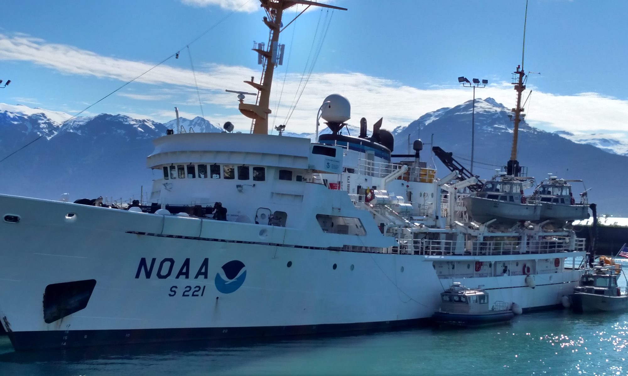
Jordan Findley: Underway, June 10, 2022

NOAA Teacher at Sea
Jordan Findley
Aboard NOAA Ship Pisces
June 9-22, 2022

Mission: SEAMAP Reef Fish
Geographic Area of Cruise: Gulf of Mexico
Date: June 10, 2022

Weather Data

Partly cloudy
Temperature: 82 °F
Wind: northeast, 10 kt.
Waves: 2 ft.

Track NOAA Ship Pisces

Science and Technology Log

NOAA Ship Pisces will conduct a survey of reef fish located on the U.S. continental shelf and shelf-edge of the Gulf of Mexico (GOM) from April 19 through June 22, 2022 (we are doing the last leg of the survey). 536 sites have been selected to be sampled with Spherical/Satellite array, bandit reels, and CTD during daylight hours and mapping at night.

CTD Operations

CTD casts will be conducted twice a day. CTD stands for conductivity (ability to pass an electrical current), temperature, and depth and it is an instrument that measures just that. The CTD is the key to understanding the physics, chemistry, and biology of the water column. The CTD will also collect water for eDNA (Environmental DNA) sampling. Organisms leave traces of their DNA in their environment (e.g. hair, skin, feces) and from that, scientists can run genetic tests to determine what species are present in a given area.

Camera Operations

Camera operations will utilize three Spherical/Satellite camera arrays. The cameras are baited and sit on the seafloor for 30 minutes. During the soak, the cameras capture footage of the biodiversity. Scientists use the footage to complete a stock assessment analysis. That data combined with other research helps scientists estimate the abundance of fish populations.

Fishing Operations

Bandit reels (basically industrial fishing poles) are deployed after cameras are retrieved. The bandit reels are set up like longlines. The line sits vertically in the water column. When the weighed end of the line reaches the bottom, a surface float is attached to the line. Ten baited hooks are evenly spaced on the bottom 20-30 ft. of the line. All fish captured on the bandit reels are identified, measured, weighed, and have the sex and maturity determined. Select species will have otoliths (ear bones) and gonads collected for age and reproductive research.

Mapping Operations

Bathymetric mapping (basically 3D mapping of the seafloor) will be conducted in and around selected sites at night with the EM 2040 sonar. Sonar emits sound pulses and detects their return after being reflected. Science is cool. A CTD cast will be conducted to obtain speed-of-sound for proper processing of data.

a bathymetric chart of Southeastern U.S. waters, from Texas to around the east coast of Florida. inshore is shallow, colored in reds and oranges, marking the continental shelf. The deepest portions of the Gulf of Mexico are still much shallower than the Atlantic waters east of Florida.
Bathymetry of the Northern Gulf of Mexico and the Atlantic Ocean East of Florida. Photo courtesy of NOAA Geophysical Data Center.

Personal Log

I was dropped off at my hotel at around 8 PM on Tuesday and could see the ship from the road. It sinks in. (NOT THE SHIP! – This had me laughing out loud.) This is actually happening. Suddenly there’s no time for checking in; I headed straight to the wharf, luggage in tow. Completely awestruck, like a giddy school girl, I proceed to walk up and down the length of the boat numerous times taking an embarrassing number of photos. The crew is just staring at me, I’m sure getting a kick out of this crazy tourist. A lovely gentleman (also geeked about the boat) leaned in, “cool boat, huh?”… I’M GOING ON THAT BOAT THURSDAY. Good lord, Jordan, be cool. I basically screamed in his face. He was the sweetest, and a teacher himself. “I know the trip is going to be everything you wanted.” I melt. Gee thanks, Pat.

Our departure was delayed a few hours, which gave me some time settle in and awkwardly roam the ship. This thing is massive (compared to what I know).  I believe it has seven levels. My attempts to open and close doors quickly became a comedy act for any spectators. I was introduced to my roommates at 6 AM. Ain’t nobody trying to chit-chat at 6 AM. I share a stateroom with Amanda Ravas, NOAA Fisheries Biologist, and Caroline Hornfeck, graduate student at the University of West Florida. Caroline is collecting water for eDNA sampling. They are around my age (or at least I’d like to think so), and have been so kind and helpful. It is their first time on Pisces as well, but each are experienced and very knowledgeable. They’ve made me feel right at home, and I feel are going to be a major part of my experience out at sea.  Women in science – go team!  

Operations Officer (NOAA Corps), LT Christopher Duffy, was so kind as to take me under his wing and invite me to the bridge (control room) to observe departure. This was so cool. Navigation is quite the operation. I guess now that I’ve seen it, duh, this boat is massive and the port was so busy with vessels of all sizes. Seven NOAA officers worked together to get us underway safely. Lots of standing on watch and communication involved. They were constantly shouting commands and numbers, and repeating. All confirmed communication was acknowledged with a “very well.” I found this amusing. One of my favorite lines heard while observing was, “There’s a pleasure boat on the port quarter.” “Very well.”

I will now start saying “very well” in my everyday life.

Last mention for now – I haven’t been seasick (so far)! Those that know me well know that is a major accomplishment for me. (As if I had say in the matter).

I am so happy to be here and to have the opportunity to learn from all of the crew (in every department). I am already so impressed by each of them.

Did You Know?

Well most of us do know that water and electricity make a dangerous pair; but, did you know that it’s not water itself that conducts the electricity? It’s the minerals and such dissolved in it. The saltier the water, the more electricity it conducts. Pure water is actually an excellent insulator and does not conduct electricity, but you will never find pure water in nature. Whoa. I went down a rabbit hole with conductivity.

Also random, but kind of fun, the NOAA Teacher at Sea Program started in 1990, the year I was born. NOAA Ship Pisces was commissioned in 2009, the year I graduated high school.

Linda Kurtz: Navigating Fair Winds and Following Seas – Fairweather Edition, August 13, 2019

NOAA Teacher at Sea

Linda Kurtz

Aboard NOAA Ship Fairweather

August 12-23, 2019


Mission: Cascadia Mapping Project

Geographic Area of Cruise: Northwest Pacific

Date: 8/13/2019

Weather Data from the Bridge

August 12th
Latitude & Longitude: 43◦ 50.134N, 124◦49.472 W
Windspeed: 19mph
Geographic Area:  Northwest Pacific Ocean
Cruise Speed:  12 knots
Sea Temperature 20◦Celcius
Air Temperature 70◦Fahrenheit


Science and Technology Log

Yesterday, we embarked on this Hydrographic Survey Project, leaving Newport and heading out to the Pacific Ocean.  The 231-foot Fairweather is manned by 35 people and they are all essential to making this research run smoothly, keeping the ship on course, maintaining the ship, and feeding all of us!  Why is this Hydrographic survey mission important?  We’ll take a “deep dive” into hydrographic surveys in an upcoming blog, but there are several overlapping reasons why this research is important.  On previous hydrographic maps of the sea floor, there are “gaps” in data, not giving scientists and mariners a complete picture of this area.  The data is used for nautical safety, setting aside areas where there are likely abundant undersea wildlife as conservation areas, looking at the sea floor to determine if areas are good for wind turbine placement, and most importantly to the residents off the Pacific coast, locating fault lines –especially subduction zones, which can generate the largest earthquakes and cause dangerous tsunamis.  More about this and the science of Hydrography in a later post.  For now, we’ll focus on Navigation.


Science Word of the day:  NAVIGATION

The word NAVIGATION is a noun, defined: the process or activity of accurately ascertaining one’s position and planning and following a route.

synonyms: helmsmanship, steersmanship, seamanship, map-reading, chart-reading, wayfinding. “Cooper learned the skills of navigation.”


Time to leave port: 12:30 pm August 12th: 

As we were pulling away from the dock and headed out of Newport, someone was navigating this very large ship through narrow spaces, avoiding other boats, crab traps, and other hazards, and I began wondering… who is driving this ship and what tools do they have to help them navigate and keep us safe?  Navigation is the science of “finding your way to a specific destination.”  So, I made way to the bridge to find out. There was so much to learn, and the bridge crew was very patient taking me through who worked on the bridge as well as the various tools and technological resources they used to guide the Fairweather exactly where it needed to be.  First the humans who run the ship, then the tools!

On the bridge you have 3 key members in charge of navigation and steering the boat.  These are not to be confused with the CO or Commanding Officer who always oversees the ship but may always not always be present on the bridge (or deck). The CO is kind of like a principal in a school (if the school were floating and had to avoid other buildings and large mammals of course.) 

 1st in charge of the bridge watch is the OOD or Officer of the Deck.   The OOD is responsible for making all the safety decisions on the deck, giving commands on how to avoid other vessels and wildlife such as whales!  The OOD oversees the deck and reports regularly to the CO as needed. 

2nd in charge of the bridge watch is the JOOD or Junior Officer of the Deck.  The Junior Officer is responsible to the CO and OOD and uses both technology driven location data and plot mapping with paper to locate the position of the ship and use that location to plan the course for the ship.

The 3rd member of the bridge team is the helmsman.  The helmsman is the person who is actually driving the ship while following the commands of the OOD and JOOD.  Tools the helmsman uses include magnetic compasses on deck and electronic heading readouts to adjust course to stay on a particular heading (or direction of travel.)  The helmsman has another duty as lookout.  The lookout watches the ocean in front of the ship for land objects (we saw a lighthouse today), ocean mammals such as whales (we’ve seen 3 so far) or debris in the ocean so Fairweather can navigate around them.

Kevin Tennyson
Officer of the Deck (OOD): Kevin Tennyson
Calderon and Ostermyer
Junior Officer of the Deck (JOOD) Jeff Calderon and Helmsman Terry Ostermyer


There are so many devices on the bridge, I’ll share a few of them and their functions.  This blog post would take DAYS to read if we went over them all!

Let’s explore: what tools does the crew aboard Fairweather use for NAVIGATION?

Radar is a system that uses waves of energy to sense objects. These waves are in the form of high frequency radio waves which can find a faraway object and tell how fast it is moving. 

Radar is very useful because it can sense objects even at night and through thick clouds.   Radar helps the Fairweather navigate by detecting objects and vessels in the immediate area.  On Fairweather, you can see the objects that are near or could be in the determined path of travel.

RADAR
RADAR showing other watercraft and objects that could come into contact with Fairweather, for safe NAVIGATION.
Close up of RADAR
Close up of RADAR screen showing blue lines (indicative of speed) trailing other detected objects

While the picture above shows where the objects and vessels are, the “blue trail” shows how far they have traveled in 6 minutes.  A longer blue trail means a faster moving vessel and a shorter or no tail means little or no movement.  This tool also helps the Fairweather crew determine the path of travel of the other vessels so they can either navigate around or warn the other vessel of the Fairweather’s heading. 

Fairweather bridge crew also must follow what STEM students call the 4C’s: Communication, Collaboration, Critical Thinking, & Creativity.

To communicate while at sea, the crew must communicate via radio.

radio
Communication is essential for safe navigation.

Notice the abbreviations for the MF/HF or Medium Frequency/High Frequency, which has the longest range and you can communicate via voice or text. VHF or Very High Frequency are voice radios only.  Marine VHF radios work on a line-of-sight basis. That is, they can transmit and receive to and from another antenna as long as that antenna is above the horizon. How far is that? Standing on the bridge of a ship, the distance to the horizon is usually about 10-12 miles.  So, if there is a vessel within that 10-12 mile or so range, the Fairweather crew can communicate with them via the VHF radio.


Weather Tools:

It is crucial to gather weather data and analyze the information from various weather instruments onboard to keep the Fairweather safe. Sopecreek Elementary has a Weather Station too!  As you look through the photos below, see if you can find what weather instruments (and readings) Fairweather uses and compare and contrast with Sopecreek’s WEATHER STEM station!  What type of instruments do you think are the same, and which are different?

Weather Data
Data from the bridge on Day 2
Weather Data Time Series
weather data updates
Weather data updates – the ship can NAVIGATE to avoid dangerous weather


With all of tools discussed above, the Fairweather is approaching the Cascadia Margin that needs to be surveyed using science of Hydrography and Bathymetry (more about those concepts coming soon!)

The area to be survey has already been identified, now the ship must approach the area (the red polygon in the middle of the screenshot below).  Now the crew must plot a course to cover the area in horizontal “swaths” to aid in accurate mapping.  The bridge and the hydrographic survey team collaborate and communicate about speed, distance between horizontal lines, and timing of turns. 

See the initial area to mapped and the progress made in the first two days in the pictures below!

Cascadia Margin chart
Cascadia Margin: 1st Region the Fairweather is mapping
mapping progress
Progress mapping – navigation the survey area – colored lines indicate where the ship has been


Personal Log

It’s been a great start to this Teacher at Sea adventure!  There is so much to take in and share with my students (I miss you so much!) and my fellow teachers from across the country!  Today, we went from sunny skies and calm 2-4 foot seas, to foggy conditions and 6-8 foot seas!  The ship is definitely moving today!  I keep thinking about STEM activities to secure items and then testing against the varying degree of pitch on the ship!  For safety, the entire crew is tying up any loose items and securing all things on board, we’ll have to think of STEM challenges to simulate this for sure! 


Did You Know?

When steering a ship, an unwritten rule is you don’t want the speed of the ship (in KNOTS) and the degree of the turn of the rudder (in DEGREES) to exceed the number 30! 


Question of the Day: 

How many possible combinations of KNOTS and DEGREES are there? Can you draw or plot out what that would look like?


New Terms/Phrases:

Thermosalinigraph:  Measures the temperature and salinity of the water.

Challenge yourself: see if you can learn and apply the terms below and add new terms from this blog or from your research to the list!

ECDIS:  Electronic chart display information system

Longitude and Latitude

True North

Magnetic North


Animals Seen Today:

Dall’s Porpoise

Humpback Whale

Curious about STEM Careers with NOAA?  All the officers on deck had a background in some type of science but none were the same.  Everyone on board comes from different backgrounds but are united by the OJT (On the Job Training) and the common purpose of the hydrographic survey mission.   Learn more here:  https://www.noaa.gov/education

Taylor Planz: A Story of Undocking, July 25, 2018

NOAA Teacher at Sea

Taylor Planz

Aboard NOAA Ship Fairweather

July 9 – 20, 2018

Mission: Arctic Access Hydrographic Survey

Geographic Area of Cruise: Point Hope, Alaska and vicinity

Date: July 25, 2018 at 10:25am

Weather Data from the Bridge
Latitude: 33.4146° N
Longitude: 82.3126° W
Wind: 1 mph N
Barometer: 759.968 mmHg
Temperature: 26.1° C
Weather: Mostly cloudy, no precipitation

Science and Technology Log

I’m going to take you back in time to July 13, a day when a once-in-a-leg event took place. We awoke that morning to a strong breeze blowing NOAA Ship Fairweather towards the dock in Nome. Normally a breeze blowing a docked ship is fine, but that day was the start of our long awaited departure to Point Hope! 0900 was quickly approaching, and Ensign Abbott was excited for his first opportunity as conn during an undocking process! With XO Gonsalves at his side for support, he stepped up to the control center outside the bridge on the starboard side.

Ensign Abbott takes the conn
Ensign Abbott takes the conn during undocking with XO Gonsalves by his side

As you may or may not know, taking the conn is no small feat. “Conn” is an old name for the conning officer, or controller of the ship’s movement. The conning officer used to stand on the conning tower, an elevated platform where the ship’s movement could be monitored. Although the conn no longer stands on a conning tower, the name and role remain the same. The conn makes commands to the rest of the ship and, during docking and undocking, controls the two engines, two rudders, bow thruster, and the lines attaching the ship to the dock. Each part causes the ship to move in specific way and has a very important function in undocking.

ENS Abbott did a great job deciding which parts of the ship to maneuver which way and when. The process was so technical that I cannot begin to describe it. However, the persistent westerly wind just kept drifting the ship back into its docking station. Every time we got the ship positioned the way we wanted, it would push right back into its starting place. The situation turned hazardous because we had a giant barge docked in front of us, a fishing vessel docked behind us, and the wall of the dock to our starboard side. The only direction we could go without danger of crashing into something was to the left. Unfortunately you cannot move a ship side to side very far without forward or backward movement, so there are strategies for moving the ship in a forward to backward motion while simultaneously moving left or right.

In our situation, the best thing to do was to slowly back the ship out while swinging the stern end into the harbor. Once out enough to account for the westerly wind, the engines could push forward and the ship could safely exit the harbor. Unfortunately all did not go as planned and when the engines went forward, the wind pushed the ship so far towards the dock in a short amount of time that the stern narrowly missed a collision with the wall of the dock! It was a close call! The conn was unlucky in the fact that he was assigned control of the ship during weather conditions no sailor would elect, but he did his best and it was a great learning lesson for everyone!

Fast forward to July 19. The members of the NOAA Corps new to ship docking and undocking had a brief in the conference room. They discussed all of the physics involved in the undocking from the week prior, debriefed the challenge the wind posed, and reviewed the different types of maneuvers for undocking. Then they shifted the conversation to planning for the next day’s docking maneuver. XO Gonsalves, with a vast array of unique skills in his toolbox, turned on a PlayStation game that he created for his crew to practice docking and undocking! Docking a ship is a skill with the unique problem that you cannot simply practice it whenever you want to. The only attempt offered to the crew during this leg was on the morning of July 20. It was a “one and done” attempt. Lucky for them, XO thought outside the box! With the video game, they could practice as often as they wanted to and for as long as necessary to get the skill down.


The challenge presented to the crew was to dock and then undock the boat seen in the photo above eight different times with varying obstacles to work through. Examples of obstacles were having a small docking space, turning the boat around, and wind adding a new force to the boat. Three controllers were needed for the job. The first controller, and the little tiny person at the front of the boat, controlled the bow thruster. The bow thruster could push the boat left or right in a jet propulsion-like manner. Using the bow thruster on the port side pushed the boat right, and using the bow thruster on the starboard side pushed the boat left. The XO also assigned this person the roll of the conn, so they had to call out directions to everyone playing the game. The next person controlled the engines. This was a difficult task because there is a port and a starboard engine, and each engine can go forward or backward. The conn could give a simple order like “all ahead” or a more difficult order like “port ahead, starboard back” (trust me, that one is not easy). The last person controlled the rudders. The rudders worked in unison and could be turned right or left. The rudders can be fine-tuned in reality but in the game, due to the controller’s limitations, we used the commands of “half rudder” and “full rudder” to choose how significantly the rudders should be turned. You can see a small clip of the game in action below. Turn up the volume to hear the conn. As a reminder, the Corps members participating are learning the process, so you may hear a variety of commands as they fine tune their vocabulary to use more specific language.


On the morning of July 20, the docking process was smooth with no surprise forces at play on the ship. The NOAA Corps did an excellent job with the maneuver. As soon as we thought we would get a chance to relax, a food order arrived with 2,700 lbs of food that needed to be hauled from the top deck of the ship down to the bottom. Horizontal forces affecting the ship were no comparison to the vertical force of gravity pulling all those boxes down towards Earth, but we used an assembly line of 20 people passing boxes down the stairwell and we all ended the day with a good workout!

Personal Log

It seems fitting to begin my last blog with the story of undocking the Fairweather in Nome at the start of the leg. This is not the end of my Teacher at Sea journey but the start of my work, integrating my personal experience into something relevant for my students in a physical science classroom. Since returning home, I completed my first media interview about my time at sea. Ironically teaching others about myself led to my own epiphanies, namely refining my “why” to becoming an educator. I told Amanda, my interviewer, how I spent my childhood soaking my shoes in ponds trying to catch frogs, harvesting new rocks for my shoe box collection under my bed, and following the streams of water every April when snow melted away. I grew up with a curiosity for all things natural and scientific. Science classes were simply an outlet for my inquisitive mind, so it was easy to be engaged in school. Below are a few photos of me in high school, memories of times that inspired my love for the ocean. That natural wonder, excitement, curiosity I had for the world around me as a child and young adult…that’s what I want to instill in my students. My experience on the Fairweather helped me find new tools for my “teaching toolbox” and new ideas for my curriculum that I hope will inspire more students to become curious about their worlds. You’re never too old to discover the intrigue of the natural world. When you begin to understand that the purpose of science is to explain what we observe, your desire to uncover the secrets will grow!


The ability of a ship to make 3,000,000 lbs of weight float on water, that is intriguing. The idea of using sound waves, something we interact with constantly on land, under the water to map what we cannot see, that is amazing. Collecting an array of data that, to the untrained mind seem unrelated, and putting them together into a chart used by mariners all over the world, that is revolutionary. NOAA hydrographic ships connect science and the economy in a way not dissimilar to how I hope to connect education and career for my students. This experience inspired me in ways beyond my expectations, and I cannot wait to share my new knowledge and ideas in my classroom!

Did You Know?

The Multibeam Echosounder on the ship obtains ocean depths accurate to 10 centimeters. The average depth of the ocean is 3,700 meters, or 370,000 centimeters, according to NOAA. That is an average percent accuracy of 99.997%!


Eric Koser: The Impact of the Work

NOAA Teacher at Sea
Eric Koser
Aboard Ship Rainier
June 22-July 9
Mission: Lisianski Strait Survey, AK
July 4, 2018: 1000 HRS

Weather Data From the Bridge
Lat: 55°57.7’          Long: 133°55.7’
Skies: Clear
Wind Light and variable
Visibility 10+ miles
Seas: <1 ft
Water temp: 7.2°C
Air Temp: 14.1°C Dry Bulb, 12.5°C Wet Bulb

Pelican Harbor
The harbor at Pelican, Alaska.

The Impact of the Work
“We’re a part of history!” This notion, shared by a colleague on a launch yesterday, brings home the importance of the work of this team and NOAA’s Hydrographic Branch. Lisianski Inlet was last surveyed in 1917 by lead line! The charts of the inlet were old and not likely accurate. This week – fresh data has been collected by Ship Rainier and her launches to bring the next century of mapping tools below their shores.

Pelican Harbor in the town of Pelican, Alaska was last surveyed between 1970 and 1989.–until we surveyed it yesterday with Rainier Launch RA-3. Our team drove in and out between each of the docks in the harbor, carefully pinging sound waves off of the floor of the harbor to construct a new digital map of the bottom.

Pelican Guys
Guys on a mission…walking to pickup the HorCon.

Pelican HorCon
This is the Horizontal Control station, or HorCon, setup on the breakwater at Pelican before we took it down.

Part of our task yesterday, in addition to conducting MBES survey from our launch, was to dock in Pelican and retrieve our HorCon (a GPS reference radio setup on land that we have used there all week). As we walked through the very small town carrying two car batteries in backpacks, a pair of antennas, tripods, and other gear back to the launch – surely people were interested in what we were up to. Several people stopped to chat as we made our way from the pier, along the boardwalk, and down to the docks to go back to our launch. People asked who we were – and if we were the NOAA team that was in town. There was much appreciation expressed to NOAA for the work being done in the inlet to update the nautical charts. Here in Pelican, the water is the primary mode of transport. Accurate nautical charts provide security and safety.


Pelican
Here is a bit of history on the city!

Main Street, Pelican, Alaska


Pelican
It’s a comfortable place, here in Pelican!

There are no roads to Pelican. A few cars are in town – to pull trailers and move equipment. But the primary mode of land transport is four-wheelers. The ‘main street’ is really a raised boardwalk that runs along the rocky shore – and is the heartbeat of the community.   Folks that live up or down the inlet from the town get there in small launches – there are no roads. A ferry comes to Pelican twice a month and is how cars and trucks come and go here. A seaplane comes through a few times a week—often bringing tourists in and out – and the mail. It’s a beautiful spot centered in a small inlet on the edge of the Pacific Ocean.


Pelican Seaplane
The fastest transportation in many parts of Alaska.

Pelican House
A house up the shoreline from Pelican.

Science and Technology Log

It’s mission accomplished for Lisianski Inlet!

Nautical charts are broken up into sheets. And within each sheet, areas are broken down into smaller polygons for data collection. Each launch (small boat), as well as the ship itself, can bring in multibeam data with the equipment mounted on each hull to complete plotting polygons and eventually complete sheets.

The hydrographic survey team is working away today in the plot room and on “the holodeck” of Ship Rainier (an office area on the top of the ship behind the plot room) processing the data we have collected the past several days. A combination of ship and launch multibeam data in addition to bottom samples and shoreline updates have been collected. Now the work of the scientists continues and becomes data processing.

Holideck
Part of the hydrographic team on the holodeck.

As the data is combined, it is reviewed and refined to make a complete picture of the survey area. Once the team on the ship has completed their work, the data goes to the Pacific Hydrographic Branch of the Office of Coast Survey of NOAA. Here, the PHB team reviews that data again and assures it meets the specifications and standards needed to become finalized for use.

From PHB, the data is passed to two places. One is the NCEI (National Center for Environmental Information) office. They archive all of the raw and processed data including the digital surfaces themselves and the descriptive reports written by the hydrographers here.

The data also goes to the Marine Chart Division, an office of NOAA Coast Survey. Here is where the nautical charts are produced in both ENC and RNC (electronic and paper versions). It is this branch that publishes the data for use by mariners and the general public. Anyone can see the charts at nauticalcharts.noaa.gov (try the “Chart Locator”).

Nautical Chart
Here is a finished chart we are using to navigate today. Notice the two buoys in purple and green on the chart, and the narrow space between them.

Flybridge Approach
This is the view from the flybridge as we approach these same two buoys that are indicated on the chart.


Who is on board?

Tyanne
Tyanne Faulkes is a hydrographic scientist with NOAA.

During this leg of the trip, we have a visiting scientist from NOAA’s is here on board. Tyanne Faulkes works as a physical scientist for the Pacific Hydrographic Branch of NOAA. She is a part of the team that processes the data from the hydro teams on NOAA Ship Rainier and NOAA Ship Fairweather. Her job is to assure that the data meets NOAA’s specifications–so that they can provide evidence of dangers of navigation and accurate depth information for all mariners.

Tyanne loves to be involved in making maps of the sea floor – and getting to see things others have not seen before! She loves that NOAA provides data for free to scientists around the world. Her job includes not only desk work, but also opportunities to make many mapping trips to understand where the hydro data comes from. Ms Faulkes has a bachelors degree in geography and GIS. It was a paid internship just out of college with NOAA that initially brought her to this work. And – she has a ton of fun with what she does. As a kid, Tyanne loved oceanography. Her GIS education tied well with the internship – and it all came together to take her where she is today!

Tyanne Mountains
When she’s not chasing the bottom of the oceans, Tyanne also loves to climb mountains!

She some advice to students – “Learn how to code!”

“Building Python scripts is a very powerful tool to allow us to automate the data review process. Being able to write the code – or at least understand the basic concepts that put it together – allows one to be much more efficient in your work!”

Understanding the concept of an algorithm that can save one hours of work is a very good asset. “I wish in college someone would have taught me how to do this!” One easy example is a bulk file renaming tool that the launch teams use. After collecting 50 some separate files of data in a day, this tool will take the individual file names and append any number of things to the filenames – all automatically.

Want to get involved? Next week, Tyanne and her team at NOAA’s Western Regional Center at Sand Point in Seattle, WA are hosting an annual camp for middle school and high school students! Students from across the US can apply to come to this camp each summer and have great experiences learning all about oceans and hydrography! Check it out on the web: NOAA Science Camp – Washington Sea Grant.


Eric Koser: Hydrography 101 – and the Tools to Make it Happen, June 28, 2018

NOAA Teacher at Sea

Eric Koser

Aboard NOAA Ship Rainier

June 22 – July 9, 2018

Mission: Lisianski Strait Survey

Geographic Area: Southeast Alaska

Date: June 28, 2018: 0900 HRS

Weather Data From the Bridge
Lat: 57°52.59′ Long: 133°38.7′
Skies: Broken
Wind 1 kt at variable
Visibility 10+ miles
Seas: calm
Water temp: 5.6°C

Science and Technology Log

Long Line Boat
A typical longline fishing boat. The fishing lines get spread out behind the boat from the large booms on either side.

The ultimate focus of Rainier is to assure accurate navigational charts are available to all mariners. This task is critical to the safety of many industries. About 80% of all the overseas trade in the US (by weight) is moved over water. Here in SE Alaska, it appears the largest industry is commercial fishing. Many boats fish both with nets and long lines to catch halibut, rockfish, cod, and several varieties of salmon.

Another major industry here is certainly tourism. As we conduct our work, we often see very large cruise ships. It’s an interesting juxtaposition to be in a narrow inlet surrounded by mountains, ice, and wildlife and then come across a large ship.  We passed the brand new ship Norwegian Bliss around 11 PM on our transit to Tracy Arm. This ship is 1,082 feet long, carries a crew of 2,100 people and has a guest capacity of 4,004 people! The safe navigation of all of these vessels depends upon the accuracy of charts produced by NOAA.

Norwegian Bliss
The cruise ship Norwegian Bliss as we passed her port to port in the evening.

The freely available charts offered by NOAA are created with three essential steps. First, the bulk of the depth data in this area is measured with MBES (Multi-Beam Echo Sounder). This creates a three-dimensional digital image of the bottom.

Secondly, important features to navigation that are shallow are best identified by our launches which travel along the shorelines and inspect for rocks, ledges, and other potential dangers. The locations of features are identified by GPS location and charted digitally by hydrographers on each launch.

Thirdly, bottom samples are collected by launch crews to confirm the type of material present on the bottom.

The MBES systems aboard Rainier and the launches come from Kongsberg Maritime. Two transducers (devices that transmit and receive) work in tandem. The transducer that is oriented front to back sends out an array of sound signals in a wide beam. The width of the beam on the sea floor depends directly on the depth – deeper water allows the beam to spread farther before reflecting. The transducer that is oriented side to side in the water receives a narrow swath of the ‘pings’ of sound that were transmitted. The time it takes any ping to get to the bottom and reflect back to the ship is recorded. The greater the time, the larger the depth.

MBES on a launch
This shows the position of the MBES on the bottom of one of several launches.

MBES transducers
This is the pair of MBES transducers on a launch, looking from the bow towards the stern.

Hydro Sonar
This image, courtesy of NOAA, depicts an MBSS beam below the ship and the mapped results off the stern.

A couple of issues provide challenges to this technique. One, the speed of sound in water depends on several factors. The salinity (concentration of salt in the water),  the conductivity (how easily electricity passes through the water), and the temperature each fluctuate as the depth changes and affect the speed of the sound waves. As hydrographers receive data, the system has to account for these changes in speed to produce an accurate depth measurement. One way to do this is with a static CTD sensor. This device is lowered from the launches all the way to the bottom as it measures the speed of sound in the water.  It provides a set of three charts as the depth changes which are used to adjust the time data from the MBES accordingly. There is also a version of the CTD, called a MVP (Moving Vehicle Profiler or ‘fish’), that can be pulled behind Rainier as we are moving and take dynamic data.

Here is a NOAA article on hydrographic surveying.  Here is further explanation of MBSS.

Deploying Depth Profiler
Here the crew lowers the profiler “fish” into the water.

Speed Profiler Data
These three plots represent the speed of sound, temperature, and salinity (from left to right) vs. depth (on the vertical axis).

A second issue is GPS signal drift. Over time, the location information can shift slightly. To account for this potential problem, the scientists place a HORCON (Horizontal Control) station onshore in the area where they are mapping. I described this tool in my previous post.

Another interesting technology that is currently being developed is called “backscatter” mapping. Here scientists look not only at the time it takes the sound waves to bounce back to the transducer, but also at the quality of the return signal. Different materials on the seafloor reflect the sound differently – hard surfaces like rocks have a sound signature that is much different than soft surfaces like silt or plants. NOAA is continually improving the tools they use to learn!

Here is an example of the chart that we are updating in Tracy Arm.

Personal Log

I had a chance to take the helm yesterday! It’s interesting how sensitive the steering on this large vessel really is. The rudders are able to turn from “amidships” or their center position, up to about 35° to either side. But while traveling at about 8 knots, we tend to use a maximum of about 5° of rudder to alter the ship’s direction. While at the helm, we keep close track of the heading (compass bearing) of the ship as indicated by the gyro compass and magnetic compass on board. Then we provide steering input to hold the ship to the course ordered by the CONN. I had the chance to help steer around several icebergs as we transited into Tracy Arm. Careful attention to detail – and willingness to promptly follow commands make for success!

Helm
My opportunity to take the helm of Rainier.

I also took an opportunity to head out in a kayak from the ship where we are anchored! Two of my new colleagues and I paddled across this bay and had a great chance to look very closely at pieces of ice. The ice is really beautiful and forms many interesting shapes. The quiet of the bay – hearing only the distant waterfalls, birds, and our paddling was beautiful!

Iceberg
This piece of ice drifted through Tracy Arm from the glacier. It was temporarily ‘grounded’ on the bottom by the receding tide.

It’s crazy to consider the ice we were seeing may have been formed thousands of years ago in the glacier – and it just now melting as it floats away.

Did You Know?

President Thomas Jefferson signed a mandate in 1807 ordering a survey of the nation’s coasts. This fundamental task is always ongoing, with 95,000 miles of US Coastline.

About 90% of any floating piece of ice will be submerged below the salt water.  Because the density of frozen fresh water just slightly less than salt water, the ice floats very low in the water!  Read more here!

Who is Onboard?

I’d like you to meet HST (Hydrographic Survey Technician), Amanda Finn! Ms. Finn has been with NOAA since last September – and started working aboard NOAA Ship Rainier in October of 2017. As an HST, Amanda works with the team of hydrographers to collect MBES data from either the ship or any of the launches. Amanda graduated from the University of Connecticut in 2016 with a bachelor of science degree in GeoSciences and a minor in Oceanography. At the end of her college experience, she knew that seafloor mapping was her passion but wasn’t sure how to make that into a job. But it all came together when she found NOAA through a friend of a friend!

HST Amanda Finn
HST Amanda Finn with recently acquired depth data for Lisinaski Inlet!

Amanda was performing at her first harp concert (another skill!) when she met a relation of a hydrographer who works on a NOAA ship! Based on her experience, her advice to students is: “When things don’t seem to be going the way you want, take time to focus on something else you like instead. In good time, things will work out!”

One positive challenge Amanda shares working here on a hydro ship is developing an understanding of systems integration. Many different pieces must come together to create the finished charts. The people aboard Rainier make the experience very positive!  The passion for seeking the unknown is the drive to continue!