Amanda Dice: Fish Sticks with a Side of Science, August 29, 2017

NOAA Teacher at Sea

Amanda Dice

Aboard NOAA Ship Oscar Dyson

August 21 – September 2, 2017


IMG_1553
We have made it to the most northern point on the survey.

Mission: Juvenile Pollock Fishery Survey

Geographic area of cruise:
Western Gulf of Alaska

Date: August 29, 2017

Weather Data: 10.2 C, rainy/stormy

Latitude: 59 20.0 N, Longitude: 152 02.5 W


Science and Technology Log

The main focus of this survey is to gather information about juvenile walleye pollock, Gadus chalcogrammus. Juvenile pollock less than 1 year of age are called young-of-the-year, or age-0 juveniles. Age-0 walleye pollock are ecologically important. Many species of birds, mammals and other fish rely on them as a food source. Adult pollock have a high economic value. Pollock is commercially fished and commonly used in fish sticks and fish and chips. This study is interested in learning more about the size of current juvenile pollock populations, where they occur, and how healthy they are.

IMG_1132
An age 0 juvenile pollock is shown below an adult pollock.

In order to collect a sample, a trawl net is lowered into the water off of the back of the ship. The deck crew and bridge crew work together to release the right amount of wire and to drive the ship at the right speed in order to lower the net to the desired depth. The net is shaped like a sock, with the opening facing into the water current. In order to keep the mouth of the net from closing as it is pulled through the water, each side is connected to a large metal panel called a “door”. As the doors move through the water, they pull on the sides of the trawl net, keeping it open. When the doors are ready to be put in the water, the fishing officer will instruct the winch operator to “shoot the doors”!

IMG_1272
The deck crew bring the trawl net back on deck. One of the metal “doors” can be seen hanging off of the back of the ship.

Sensors help monitor the depth of the upper and lower sides of the net and relay a signal to computers on the bridge, where the data can be monitored.

Screen Shot 2017-08-29 at 7.44.24 PM
Sensors on the trawl net relay data to computers on the bridge which show the position of the net in the water.

Once the net is reeled in with a large winch, the catch is placed on a sorting table, in a room just off of the back deck called the fish lab. Here, the science team works to sort the different species of fish, jellyfish, and other kinds of marine animals that were caught.

IMG_1217
Crew members stand below a winch and empty the catch from the trawl net into a large bin.
IMG_1576
The catch is then sorted on the sorting table in the fish lab.

Juvenile pollock are sorted into their own bin. If it is a small catch, we weigh, count, and measure the length of each one. However, if it is a large catch, we take a smaller sample, called a subsample, from the whole catch. We use the weight, lengths, and count of animals in the subsample to provide an estimate count and average size of the rest of the fish caught at that station, which are only weighed. This information is compiled on a computer system right in the fish lab.

IMG_1097
Here I am measuring some fish.


IMG_1117
Data from the catch is collected on computers in the fish lab.


The focus of this study is juvenile pollock, but we do catch several other species in the trawl net. The presence of other species can provide information about the habitats where juvenile pollock live. Therefore, data from all species collected are also recorded.

Screen Shot 2017-08-29 at 8.36.24 PM
Here are some other interesting species we caught: 1. jellyfish (with a partially digested pollock inside it!) 2. lumpsucker 3. herring 4. spider crab

A small sample of juvenile pollock are frozen and saved for further study, once back on land. These fish will be analyzed to determine their lipid, or fat, content and calorie content. This data reveals information about how healthy these fish are and if they are getting enough food to survive through the cold Alaskan winters.

Other agencies within NOAA also conduct scientific surveys in this area. These studies might focus on different species or abiotic (non-living) properties of the Gulf of Alaska marine ecosystem. The data collected by each agency is shared across the larger NOAA organization to help scientists get a comprehensive look at how healthy marine ecosystems are in this area.


Personal Log

As we move from one station to the next, I have been spending time up on the bridge. This gives me a chance to scan the water for sea birds and marine mammals, or to just take in the scenery. Other members of the crew also like to come up to do this same thing. I have really enjoyed having this time every day to share in this activity (one of my favorite past-times) with other people and to learn from them how to identify different species.

IMG_1192
Here I am outside of the bridge, posing with some glaciers!


Did You Know?

You can find the exact age of many fish species by looking at a bone in their ears! Fish have a special ear bone, called an otolith. Every year, a new layer will grow around the outside of this bone. As the fish ages, the otolith gets larger and larger. Scientists can find the exact age of the fish by cutting a cross section of this bone and counting the rings made from new layers being added each year.

IMG_1099
A small otolith of an age 0 juvenile pollock
IMG_1168
Larger otoliths from an adult pollock

Jenny Smallwood: Adventure Awaits, August 29, 2017

NOAA Teacher at Sea

Jenny Smallwood

Aboard NOAA Ship Oscar Dyson

September 4 – 17, 2017


Mission: Juvenile Walleye Pollack Survey

Geographic Area of Cruise: Gulf of Alaska

Current Location: Virginia Beach, Virginia

Date: 8/29/2017


Weather Data from the beach

Currently Virginia Beach is experiencing Potential Tropical Cyclone 10.  The temperature is topped out at 75°F.  The winds are out of the NE at about 13 mph right now.  That’s expected to increase to 25-35 mph with gusts up to 50 mph this afternoon.  Forecasts predict mild flash flooding and some tidal flooding around the 2 pm high tide.

Potential Tropical Cyclone 10
Potential Tropical Cyclone 10 Wind Speed Probability Map. Image courtesy of the National Hurricane Center

Introduction – Personal Log

My name is Jenny Smallwood, and I’m a school and youth programs educator at the Virginia Aquarium & Marine Science Center in Virginia Beach, Virginia.  I’m in my 11th year as an educator, which included 8 years as a high school science teacher.  These days I get to hang out with and educate scouts, school groups, and other visitors to the Aquarium.  One of the coolest things I’ve experienced working here is watching as a student sees the ocean for the very first time!  It was that experience that helped me realize how important it is to share the oceans and oceanic research with people who can’t experience it themselves.  I want to bring my Teacher at Sea experience to those individuals who don’t have the Chesapeake Bay or an ocean in their backyard.  I want to help them experience the life of a marine researcher.

Outside of my role as an educator, I love to go on all the adventures.  My husband, Lee, and I enjoy traveling and have nicknamed ourselves “adventure nerds.”  We even have a theme song.  Like I said, we’re nerds.  I’m super excited about this latest adventure with Teacher at Sea.  I’m still amazed that I was one of the few chosen for this year’s research cruises.

Eldfell Volcano
Warming our hands from the heat emitted by Eldfell, a volcano located on the Westman Islands in Iceland.

Science and Technology Log

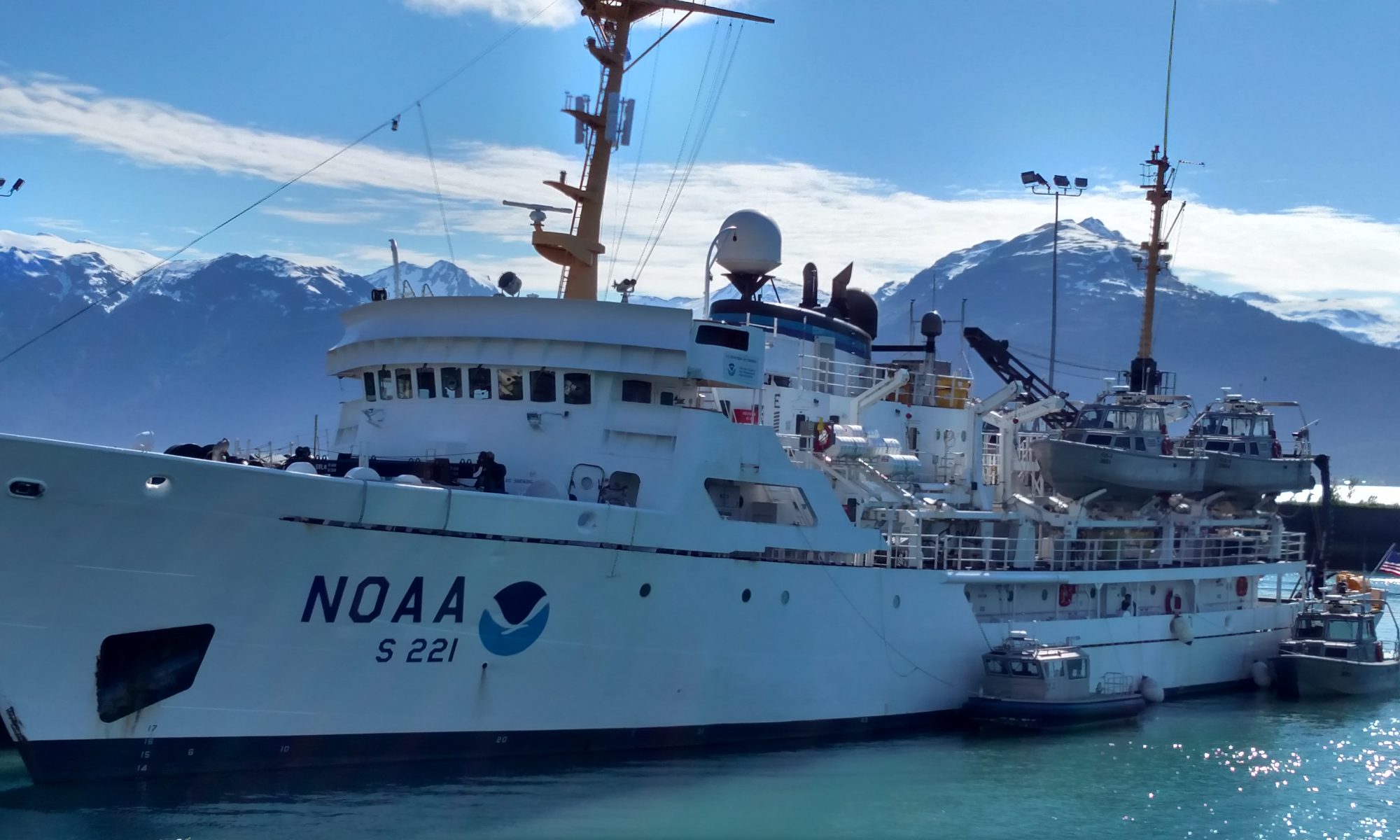
The Oscar Dyson is a NOAA research vessel used for fisheries surveys important to fisheries management.  Commissioned in 2005, this 208.6 feet long ultra-quiet survey ship is considered one of the most technologically advanced fisheries survey vessels in the world.  That’s right.  This ship is super stealthy so we can sneak up on the fish.  It also has numerous labs onboard, including a wet, dry, bio, and hydro lab.

Oscar Dyson
The Oscar Dyson near Dutch Harbor, Alaska. Courtesy of NOAA.

On this trip, the Oscar Dyson will pull out of Kodiak, Alaska and make its way southwest through the Gulf of Alaska to take up position for Leg 2 of the EMA-EcoFOCI Juvenile Walleye Pollock and Forage Fish Survey.

Leg 2 Map
Leg 2 Sampling Station Map in the Gulf of Alaska. Image courtesy of NOAA

What does that mean exactly?  Well, it means that scientists will collect Walleye Pollock data to get an idea of what the population looks like.  They’ll also take zooplankton samples, smaller prey fish samples, and collect environmental data to see how these factors might be affecting Pollock.  Basically scientists and policy makers need information in order to properly manage this fishery, and this is where NOAA comes in.  I can’t wait to learn more about the application of this research as scientists learn even more about the ecology of Pollock. 

To collect these samples, scientists will be using a variety of tools.  Bongo nets will be used to collect zooplankton samples.  From what I’ve learned so far, it sounds like specially mounted equipment collects water data along with the plankton.  A Stauffer trawl net will be used to sample fish species.  A CTD rosette (CTD stands for conductivity, temperature, and density) will be used along the way to corroborate that the other water data equipment is indeed working correctly.  Scientists, like mathematicians, do love to double check their work.


Did You Know?

Did you know that NOAA is part of our daily lives?  Both the National Weather Service and the National Hurricane Center are part of this organization.  To learn more about the National Hurricane Center, Hurricane Harvey, or Potential Tropical Cyclone 10, visit their website: http://www.nhc.noaa.gov/


Amanda Dice: Ending Week 1 at Line 8, August 26, 2017

NOAA Teacher at Sea

Amanda Dice

Aboard Oscar Dyson

August 21 – September 2, 2017


Mission: Juvenile Pollock Fishery Survey

map cropped
Oscar Dyson moves across the Shelikof Straight to collect the Line 8 samples

Geographic area of cruise: Western Gulf of Alaska

Date: August 26, 2017

Weather Data: 13.2 C, cloudy with light rain

Latitude 57 36.6 N, Longitude 155 .008 N


Science and Technology Log

As part of this survey, the scientists onboard collect data from what is known as “Line 8”. This is a line of seven sampling stations, positioned only a few miles apart, near the southern opening of Shelikof Straight between Kodiak Island and the Alaskan Peninsula. Water samples are taken at different depths at each sampling station to measure several different properties of the water. This study is focused on profiling water temperature and salinity, and measuring the quantities of nutrients and phytoplankton in the water.

IMG_0988
The CTD rosette is lowered into the water using a winch – as seen from above.

To collect this data, a conductivity and temperature at depth (CTD) instrument is lowered into the water. This instrument can take water samples at different depths, by using its eleven canisters, or Niskin bottles. The water collected in the Niskin bottles will be used to determine the nutrient quantities at each station. The rosette of Niskin bottles also has sensors on it that measure phytoplankton quantities, depth, temperature, and how conductive the water is. Scientists can use the readings from conductivity and temperature meters to determine the salinity of the water.

Each Niskin bottle has a stopper at the top and the bottom. The CTD goes into the water with both ends of each Niskin bottle in the open position. The CTD is then lowered to a determined depth, depending on how deep the water is at each station. There is a depth meter on the CTD that relays its position to computers on board the ship. The survey team communicates its position to the deck crew who operate the winch to raise and lower it.

IMG_1164
Niskin bottles are lowered into the water with the stoppers at both ends open.

When the CTD is raised to the first sampling depth, the survey crew clicks a button on a monitor, which closes the stoppers on both ends of Niskin bottle #1, capturing a water sample inside. The CTD is then raised to the next sampling depth where Niskin bottle #2 is closed. This process continues until all the samples have been collected. A computer on board records the depth, conductivity and temperature of the water as the CTD changes position. A line appears across the graph of this data to show where each sample was taken. After the Niskin bottles on the CTD are filled, it is brought back onto the deck of the ship.

IMG_1173
They let me take control of closing the Niskin bottles at the sampling depths!
CTD screen cropped
I used this screen to read the data coming back from the CTD and to hit the bottle to close each Niskin bottle. The purple horizontal lines on the graph on the right indicate where each one was closed.

Water is collected through a valve near the bottom of each Niskin bottle. A sample of water from each depth is placed in a labeled jar. This study is interested in measuring the quantity of nutrients in the water samples. To do this it is important to have samples without phytoplankton in them. Special syringes with filters are used to screen out any phytoplankton in the samples.

Screen Shot 2017-08-26 at 8.28.56 PM
Syringes with special filters to screen out phytoplankton are used to collect water samples from the Niskin bottles.

The “Line 8” stations have been sampled for nutrient, plankton, and physical water properties for many years. The data from the samples we collected will be added to the larger data set maintained by the Ecosystems and Fisheries-Oceanography Coordinated Investigations (Eco-FOCI), Seattle, Washington. This NOAA Program has data on how the marine ecosystem in this area has changed over the last few decades. When data spans a long time frame, like this study does, scientists can identify trends that might be related to the seasons and to inter-annual variation in ocean conditions. The samples continue to be collected because proper nutrient levels are important to maintaining healthy phytoplankton populations, which are the basis of most marine food webs.


IMG_1171
Collecting water samples from a Niskin bottle.

Personal Log

As we travel from one station to the next, I have some time to talk with other members of the science team and the crew. I have really enjoyed learning about places all over the world by listening to people’s stories. Most people aboard this ship travel many times a year for their work or have lived in remote places to conduct their scientific studies. Their stories inspire me to keep exploring the planet and to always search for new things to learn!

Did you know?

Niskin bottles must be lowered into the water with both ends open to avoid getting an air bubble trapped inside of them. Pressure increases as depth under water increases. Niskin bottles are often lowered down below 150 meters, where the pressure can be intense. If an air bubble were to get trapped inside, the pressure at these depths would cause air bubble to expand so much that it might damage the Niskin bottle!

Amanda Dice: Bongos in the Water, August 24, 2017

NOAA Teacher at Sea

Amanda Dice

Aboard NOAA Ship Oscar Dyson

August 21 – September 2, 2017


Mission: Juvenile Pollock Fishery Survey

Geographic area of cruise: Western Gulf of Alaska

Date: August 24, 2017

Weather Data: 11.5 C, Foggy

Latitude 56 35.5 N, Longitude 153 21.9 W

IMG_1101
This map on the bridge helps everyone keep track of where we are and where we are headed next.

Science and Technology Log

At each sampling site, we take two types of samples. First, we dip what are called bongo nets into the water off of the side of the boat. These nets are designed to collect plankton. Plankton are tiny organisms that float in the water. Then, we release long nets off of the back of the boat to take a fish sample. There is a variety of fish that get collected. However, the study targets five species, one of which is juvenile walleye pollock, Gadus chalcogrammus. These fish are one of the most commercially fished species in this area. I will go into more detail about how the fish samples are collected in a future post. For now, I am going to focus on how plankton samples are collected and why they are important to this survey.

IMG_1096
Juvenile walleye pollock are fish that are only a few inches long. These fish can grow to much larger sizes as they mature.

As you can see in the photos below, the bongo nets get their name because the rings that hold the nets in place resemble a set of bongo drums. The width of the nets tapers from the ring opening to the other end. This shape helps funnel plankton down the nets and into the collection pieces found at the end of the nets. These collection devices are called cod ends.

IMG_0993
Bongo nets being lowered into the water off of the side of the ship.
IMG_1092
This is the collection end, or cod end, of the bongo nets.

This study uses two different size bongo nets. The larger ones are attached to rings that are 60 centimeters in diameter. These nets have a larger mesh size at 500 micrometers. The smaller ones are attached to rings that are 20 centimeters in diameter and have a smaller mesh size at 150 micrometers. The different size nets help us take samples of plankton of different sizes. While the bongo nets will capture some phytoplankton (plant-like plankton) they are designed to mainly capture zooplankton (animal-like plankton). Juvenile pollock eat zooplankton. In order to get a better understanding of juvenile pollock populations, it is important to also study their food sources.

IMG_1081
Here I am, helping to bring the bongo nets back on to the ship.

Once the bongo nets have been brought back on board, there are two different techniques used to assess which species of zooplankton are present. The plankton in nets #1 of both the small and large bongo are placed in labeled jars with preservatives. These samples will be shipped to a lab in Poland once the boat is docked. Here, a team will work to identify all the zooplankton in each jar. We will probably make it to at least sixty sampling sites on the first leg of this survey. That’s a lot of zooplankton!


IMG_1121
A jar of preserved zooplankton is ready to be identified.

The other method takes place right on the ship and is called rapid zooplankton assessment (RZA). In this method, a scientist will take a small sample of what was collected in nets #2 of both the small and large bongos. The samples are viewed under a microscope and the scientist keeps a tally of which species are present. This number gives the scientific team some immediate feedback and helps them get a general idea about which species of zooplankton are present. Many of the zooplankton collected are krill, or euphausiids, and copepods. One of the most interesting zooplankton we have sampled are naked pteropods, or sea angels. This creature has structures that look very much like a bird’s wings! We also saw bioluminescent zooplankton flash a bright blue as we process the samples. Even though phytoplankton is not a part of this study, we also noticed the many different geometric shapes of phytoplankton called diatoms.


sea angel
A naked pteropod, or sea angel, as seen through the microscope.

Personal Log

Both the scientific crew and the ship crew work one of two shifts. Everyone works either midnight to noon or noon to midnight. I have been lucky enough to work from 6am – 6pm. This means I get the chance to work with everyone on board at different times of the day. It has been really interesting to learn more about the different ship crew roles necessary for a survey like this to run smoothly. One of the more fascinating roles is that of the survey crew. Survey crew members act as the main point of communication between the science team and the ship crew. They keep everyone informed about important information throughout the day as well as helping out the science team when we are working on a sample. They are responsible for radioing my favorite catchphrase to the bridge and crew, “bongos in the water.”

IMG_1105
A sign of another great day on the Gulf of Alaska.

Did You know?

You brush your teeth with diatoms! The next time you brush your teeth, take a look at the ingredients on your tube of toothpaste. You will see “diatomaceous earth” listed. Diatomaceous earth is a substance that contains the silica from ancient diatoms. Silica gives diatoms their rigid outer casings, allowing them to have such interesting geometric shapes. This same silica also helps you scrub plaque off of your teeth!

diatoms
Diatoms as seen through a microscope.


Chelsea O’Connell-Barlow: Get ready, get set, SAIL!!! August 26, 2017

NOAA Teacher at Sea

Chelsea O’Connell-Barlow

Aboard NOAA Ship Bell M. Shimada

August 28 – September 13, 2017


Mission:  Pacific Hake Survey – Leg V

Geographic Area of Cruise:  Northwest Pacific Ocean, off the coast of Washington

Date:  August 26, 2017


Weather from the Bridge…or Backyard

At home in Decatur, GA we are celebrating a weekend break in the humidity.  The sun is shining and the sky is filling with a variety of imagination provoking Cumulus clouds.

Latitude:  33.767782

Longitude:  -84.299283

Wind Speed: 6mph

Wind Direction:  E

On Monday I will travel 2,759 miles to Port Angeles, WA where I will board the Bell M. Shimada.  I look forward to cooler temperatures and the invigorating salty air.


Science and Technology Log:

I have yet to meet the scientists and crew of the Shimada so I have no first hand info to share.  However this is a great opportunity to introduce the main focus of this survey… Merluccius productus, Pacific Hake.

Pacific Hake or Pacific Whiting (photo courtesy of http://www.nmfs.noaa.gov/)
(photo courtesy of http://www.nmfs.noaa.gov/)

Pacific Hake is an important species to both humans and many species in the marine ecosystem off of the Pacific Northwest coast of both the United States and Canada.  There is a cooperative effort to manage these fish that involves the governments of both the U.S. and Canada, fisheries scientists and fisherman.  Such a collaboration and intentional effort  amongst so many groups is a great model and example for other issues at large.  Here is some background reading related to the Pacific Hake Survey.

Personal Log:

I have taught middle school science at Renfroe Middle School (RMS) in the City Schools of Decatur for 10 years.  Renfroe is full of wonderfully intelligent, thoughtful and supportive people – students and staff.  Currently, I work with 7th grade students as we explore ecology, evolution, genetics, cells and anatomy.  I am thrilled to have this adventure at sea to share with my students and friends.  I look forward to bringing back real-world research and developing curriculum that we can ALL benefit from.

As an inquisitive and adrenaline hungry person I love the combination of adventure and challenging work, so I am thinking that my time on the Bell M. Shimada may be about as ideal of a learning opportunity as I could imagine. In addition to being a classroom teacher at RMS, I also work as a Mentor in The Nature Conservancy’s Leaders in Environmental Action for the Future (LEAF) program. LEAF provides an opportunity for Mentors and Interns to spend an intensive month focused on all aspects of conservation. This program encourages all involved towards hands-on environmental stewardship experiences and to broaden the boundaries of our comfort zone.  For both my RMS students and LEAF mentees I take this Teacher At Sea opportunity to put into action the message that I often share with them…learning is a life long goal and risk-taking is a way to enhance the connection that you feel with the world.

I want to thank my colleagues and students for a heart warming send-off and I promise all plenty of awesome photos and updates to come.

Teacher At Sea RMS send-off
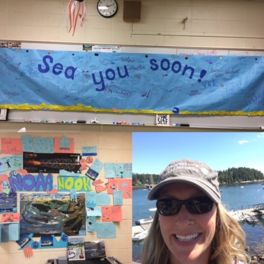
A lovely RMS bon voyage complete with oodles of creative & pun filled cards.


Did you know?

According to Atlas Obscura, in 1914 the town of Port Angeles had such an issue with sewage flooding that they opted to raise one of the town’s main streets by 10-14 feet.  This engineering challenge was accomplished by moving soil from a neighboring hill completely by hand…no mechanical interventions.  To this day you can tour the underground areas and see store fronts frozen in time.  This lovely seaside town is where I will embark on my voyage.