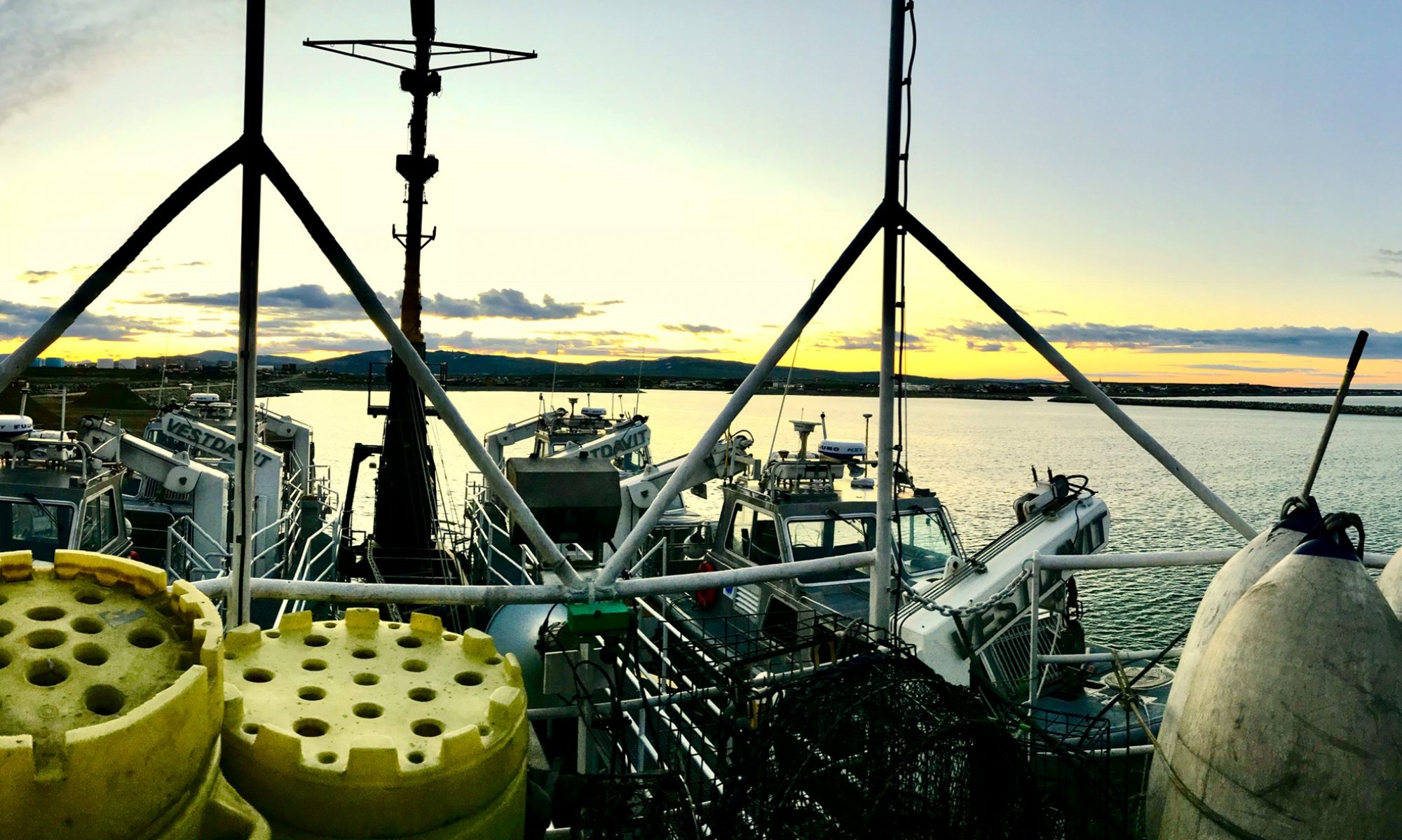
Frank Hubacz: ADCP Deployment, May 2, 2013

NOAA Teacher at Sea
Frank Hubacz
Aboard NOAA ship Oscar Dyson
April 29 – May 10, 2013


Mission: Pacific Marine Environmental Laboratory Mooring Deployment and Recovery
Geographical Area of Cruise: Gulf of Alaska and the Bering Sea
Date: May 2, 2013

Weather Data from the Bridge:

Partly sunny, WindsN 5-10 knots
Air Temperature 1.3C

Relative Humidity 60%

Barometer 1008.2 mb

Surface Water Temperature 2.8C

Surface Water Salinity 31.37 PSU

Science and Technology Log

As I described previously, one of the instruments being deployed on this cruise is an Acoustic Doppler Current Profiler (ADCP), which measures speed and direction of ocean currents across an entire water column using the principle of Doppler shift (effect).  The Doppler Effect is best illustrated when you stop and listen to the whistle of an oncoming train.  When the train is traveling towards you, the whistle’s pitch is higher. When it is moving away from you, the pitch is lower. The change in pitch is proportional to the speed of the train.  The diagrams below illustrates the effect.

Doppler Effect
Doppler Effect
Another view of the Doppler Effect

The ADCP exploits the Doppler Effect by emitting a sequence of high frequency pulses of sound (“pings”) that scatter off of moving particles in the water. Depending on whether the particles are moving toward or away from the sound source, the frequency of the return signal bounced back to the ADCP is either higher or lower. Since the particles move at the same speed as the water that carries them, the frequency shift is proportional to the speed of the water, or current.

The ADCP has 4 acoustic transducers that emit and receive acoustical pulses from 4 different directions. Current direction is computed by using trigonometric relations to convert the return signal from the 4 transducers to ‘earth’ coordinates (north-south, east-west and up-down. (http://oceanexplorer.noaa.gov/technology/tools/acoust_doppler/acoust_doppler.html).  The most common frequencies used on these units are 600 KHz, 300 KHz, and 75 KHz.  The lower the frequency the greater the distance that the wave can propagate through the ocean waters.

Determining current flow helps scientist to understand how nutrients and other chemical species are transported throughout the ocean.

Typical 4 beam ADCP sensor head. The red circles denote the 4 transducer faces.

Prior to sailing, ADCP mooring locations are selected by various research scientists from within NOAA.  Next, engineers develop a construction plan to secure the unit onto the ocean floor.  Once designed, the hardware needed to construct the mooring is sent to the ship that will be sailing in the selected mooring locations.  Prior to arriving at the designated location it is the responsibility of the science team to construct the mooring setup following the engineering diagram shipped with each ADCP unit. ADCP moorings can be constructed to hold a wide variety of measuring instruments depending upon the ocean parameters under study by the research scientist.

ADCP Construction Diagram

The moorings are built on the ship’s deck starting with an anchor.  The anchor weight is determined based upon known current strength in the area where the mooring will be located.  Anchors are simply scrap iron railroad train car wheels which bury themselves into the sediment and eventually rust away after use.  The first mooring unit that we assembled had an anchor composed of two train wheels with a total weight of 1,600lbs.  Although this mooring was built from the anchor up this is not always the case.  When setting very deep moorings the build is in the reverse order.

Selecting the anchor
Anchor on the back deck
Anchor on the back deck below the gantry

Next, an acoustic release mechanism is attached to the anchor by way of heavy chains.  This mechanism allows for recovery of the ADCP unit as well as the release mechanism itself when it is time to recover the ADCP.  The units that we are deploying will remain submerged and collect data for approximately 6 months.

Acostic Release Mechanism
Acoustic Release Mechanism
Bill attaching the acoustic release mechanism

Finally, an orange closed-cell foam and stainless steel frame containing the actual instrumentation is connected to the assembly and then craned over the back deck.  The stainless steel frame has a block of zinc attached to it which acts as a sacrificial anode.  Sacrificial anodes are highly active metals (such as zinc) that are used to prevent a less active metal surface from rusting or corroding away.  In fact, our ship has many such anodes located on its hull. Once the entire unit is in position, a pin connected to a long chord is pulled from a release mechanism and the unit is dropped to the ocean floor.  Date, time, and location for each unit are then recorded. 

Hoisting ADCP
Hoisting ADCP
ADCP unit assembly
ADCP unit assembly
Assembling mooring unit
Ready for launch
Ready for launch

To recover the unit, an acoustic signal (9-12 Khz) is sent to the ship from the sunken mooring unit to aid in its location.  Once located, a signal is used to activate a remote sensor which powers the release mechanism to open.  The float unit then rises to the surface bringing all of its attached instruments along with it.  The stored data within the units are then secured and eventually sent along to the research scientist requesting that specific mooring location for ocean current analysis.

Recovering a mooring with a rope lasso

Personal Log

On my first day of “work” I was able to watch the science teams deploy three different ADCP moorings as well as conduct several CTD runs.  I will discuss CTD’s in more detail in future blogs.  I was impressed by the camaraderie among all of the science team members regardless of the institution that they represented as well as with members of the deck crew.  They all work as a very cohesive and efficient group and certainly understand the importance of teamwork!

Adjusting to my new work schedule is a bit of a challenge. After my work day ended today at 1200 hours, I fell asleep around 1500 hours for about 4 hours.  After trying to fall back asleep again, but to no avail, I decided to have a “midnight” snack at 2000 hours (8pm).  I finally fell asleep for about 2 more hours before showering for my next shift.  I think I now have more empathy for students who come to my 8am chemistry class and occasionally “nap”!

A wide selection of food is always available in the ship’s galley. I have discovered that I am not the only one taking advantage of this “benefit”!  I will definitely need to reestablish an exercise routine when I return home.  We are currently heading for Unimak Pass which is a wide strait between the Bering Sea and the North Pacific Ocean southwest of Unimak Island in the Aleutian Islands of Alaska.

Did you know that since the island chain crosses longitude 180°, the Aleutian Islands contain both the westernmost and easternmost points in the United States. (172° E and 163° W)!

180 longitude

Angela Greene: “Surface Active Groups and Good Medicine” May 5, 2013

NOAA Teacher at Sea
Angela Greene
Aboard NOAA Ship Gordon Gunter
April 29-May 11, 2013

Mission: Northern Right Whale Survey
Geographical Area of Cruise: Atlantic Ocean out of Woods Hole, MA
Date: May 5, 2013

Weather Data from the Bridge: Air temperature-8.4°C or 47°F, Sea temperature-8.4°C or 47°F, Wind Speed 14 knots, Winds are out of the northeast, Barometric Pressure- 1024.4 mb, wave height- 1-2 feet.

Science and Technology Log:  To say the environment aboard the NOAA Ship Gordon Gunter changes when a right whale is spotted during a watch duty, would be a major understatement.  The goal is to find a Northern Right Whale, and when we do, the frenzy begins.

Me with Whale
Believe it or not, that white splash is a Northern Right Whale. Photo credit Mark Baumgartner

A quick decision must be made as to whether the small boats will be launched.  The small boats enable the scientists to get extremely close to the whales.  This proximity allows them the chance to photograph whales from many angles for later identification.  This distance may also provide an opportunity for scientists to use a crossbow to acquire a biopsy sample.  The sample will provide genetic information needed to determine the gender, parents, and siblings of the whale.  The biopsy also can give a toxicity level of the animal.

Crossbow
Holding the crossbow used to collect whale biopsy sample. Photo credit Eric Matzen

Being in the small boats also gives the team of four the opportunity to scoop a fecal sample from the ocean that a right whale may present.  Poop samples can give diet information and hormone levels.  Checking hormone levels enable scientists to determine the stress levels of the whale and whether or not the whale is pregnant.

Whale Poop
Whale Poop in a baggie.

Our team spotted a right whale, and the boats were launched.  The small boat was able to get extremely close to what is called a SAG, or “surface active group”.  This particular group of four Northern Right Whales was so close to the small boat that it looked as if the whales were performing a show for the scientists!  It was one of the most incredible events I have ever witnessed!

small boat blow
Small boat and a right whale blow. Photo taken under NOAA fisheries permit number 775-1875
good fluke
Small boat and a right whale fluke. Photo taken under NOAA fisheries permit number 775-1875

During the SAG event, many photos were taken under a NOAA fisheries permit, which is necessary due to the endangered status of the species.  It’s interesting to note here, that the public is not allowed to be within five hundred yards of a Northern Right Whale without a permit, making the opportunity to be in the small boat a momentous occasion.

A fecal sample was acquired, which is considered a rare opportunity, however a biopsy was not in the cards for this small boat launch.

Biopsied Last year
Northern Right Whale photo taken from small boat- a biopsy was acquired from this whale on last year’s trip. Photo Credit Jennifer Gatzke. Photo taken under NOAA fisheries permit number 775-1875
Stateroom
My stateroom. You may notice the trash can right next to my bunk.

Personal Log:  This is difficult fieldwork, indeed!  Two days of rough seas made our flying bridge observations come to a grinding halt.  I woke up Friday morning knowing I had a 7:00 am watch duty, and was throwing up the nothingness in my stomach.

My roommate came back to our stateroom with the news that many others, including the crew, were also experiencing seasickness.  I took an odd sense of comfort hearing that other people were also ill.  We were in the middle of ten foot ocean swells that made the boat feel like the inside of Maytag washing machine.  My roommate’s water bottle fell out of her top bunk and landed squarely on my forehead, and our desk chair toppled over on its side. Motion sickness medications work wonders, but make me incredibly sleepy.  Seems like everyone was either sleeping or watching movies… basically just surviving until calmer waters.

This morning’s sunrise brought much happier seas, and the whale watch continues.  It’s cold enough for me to finally don the “Mustang Suit” as everyone tells me I will feel more comfortable than my lined jeans and Tecumseh Arrows jacket.  I am hoping for my chance to get to be in the small boat!

Animal Sightings Log: 

Aquatic-

Right Whale

Sei Whale

Fin Whale

Minke Whale

Humpback Whale

Atlantic Whitesided Dolphin

Harbor Porpoises

Birds-

Herring Gull

Wilson’s Storm Petrel

Northern Gannet

Sooty Shearwater

Northern Fulmar

Atlantic Puffin

Angela Greene: “Entangled with Superheroes” May 2, 2013

NOAA Teacher at Sea
Angela Greene
Aboard NOAA Ship Gordon Gunter
April 29-May 11, 2013

Mission: Northern Right Whale Survey
Geographical Area of Cruise: Atlantic Ocean out of Woods Hole, MA
Date: May 2, 2013

Weather Data from the Bridge: Average Air Temperature- 7°C or 44.6°F, Winds out of the north, Sky Conditions-clear

Science and Technology Log:

Lowering CTD
Deploying CTD cast. “All in a days work.”

Time seems to be flying by on the NOAA ship Gordon Gunter as one day quickly runs into the next.  I am learning so many new things, and doing brand new tasks that I am not sure where to begin telling my story.  Every time something awesome happens I want to write it down, but something even more awesome happens.  It’s such a busy work environment for the crew and the scientists!

I am on the ship with a scientist whose job is to “disentangle” whales. Of course I had a million questions such as, “Disentangle whales from what?” The first night on board, we were treated to a “science talk” from David Morin of the Large Whale Disentanglement Program, Protected Resources Division of NOAA.

Large whales can swim into and get entangled by gear of commercial fishermen. Apparently they swim into the gear, panic while attempting to get free, and make the entanglement worse. The gear can be in the form of long ropes, buoys, and even lobster pots.

Trident gillnet
Disentanglement team trying to remove a gill net from a large whale. Photo credit Provincetown Center for Coastal Studies under fisheries permit number 932-1489.
Cutting tools
Tools used for disentanglement. Photo credit Provincetowne Center for Coastal Studies.

Sometimes the whales can free themselves either fully or partially, but all too often they have to learn to cope with all the gear wrapped around fins, flippers, or flukes. The entanglement can become so tight and restrictive that it actually embeds into the flesh of the animal, creating deep gashes, and scars.

When an entangled whale is spotted and reported, a disentanglement team springs into action.  A large boat takes them to the reported location and a small rubber boat gets them as close to the whale as possible.  With cameras mounted on head-gear, the disentanglement team must first assess the type of gear and configuration of the entanglement.  Obviously every case is different, with a wide range of fishing gear, and different species and sizes of whales.  Right then the small boat a plan is launched and put into motion to attempt to free the whale from its bindings using a variety of sophisticated cutting tools mounted to large poles.

Yellowfin lift
Disentanglement is a dangerous job. Photo Credit Florida Fish and Wildlife under fisheries permit # 932-1489.

Dave has been in situations where the whale has become frightened and slapped a fluke down on the small rubber boat.  One swift move from a whale could be the end of a crew attempting disentanglement.    This doesn’t stop Dave from telling the details of his work with passion and admiration for the opportunity to work with whales.  I’ll stick with teaching!

Big Eyes
Me and “Big Eyes” Photo Credit Mark Baumgartner

My job during the right whale survey has, so far, been very addicting!  We run ninety minute “watch shifts” on the flying bridge searching for any signs of life, particularly whales.  The flying bridge, the highest point on the ship, gives you the best vantage point when looking out into the ocean for marine life.

Blow
A “Blow”

There are three stations that I rotate through every thirty minutes while “on watch”. Station one is a set of “Big Eyes”, or really large binoculars. The view of the ocean using the “Big Eyes” is specific and fantastic! During that thirty-minute segment of my watch duty, I scan my side of the ocean, which is bisected by the bow of the ship. I look for any signs of life such as a splash, a “blow”, a dorsal fin, a fluke, or even “suspicious water patterns”. If I think I have spotted marine life such as a dolphin, seal, or a whale I shout out “SIGHTING” to the data recorder. I have to tell the data recorder very specific data about my animal sighting, which is added to a computer program.

The middle station on the fly bridge of watch duty is the data recorder. This is the scariest job for me because sometimes multiple sightings have to be recorded at once. The third position of watch duty is thirty additional minutes on a second set of “Big Eyes”.

Data Collection
Me as “Data Collector” Photo Credit Allison Henry

My very first official sighting was a Mother Sei whale and her calf. Her dorsal was long and sickle shaped as she arched through the glassy water. Then her baby arched right after she did. It was amazing! The process of being on watch is smooth, simple, calm, and easy. I’ve adjusted well to it and look forward to scanning the water. However all this peacefulness changes dramatically when the sighting is a Right Whale… I sighted one today…

Fluke
“Could it be a fluke?”

Personal Log: Many people know that my hobby is “collecting scientists”! I have a rather eclectic sampling of amazing people that I have acquired through the years. Each one of them has an amazing supernatural ability that sets them apart from the normal human. Each of them is a superhero. Watching the scientists on this field experience solidifies my hypothesis. My chief scientist, Allison Henry has the superpower of being able to identify a right whale by glancing at the animal or a photograph the same way I could look at a yearbook and identify a student in my class. This is not a normal skill possessed by regular humans. Scientist, Dave, untangles whales, much like I untangle the Christmas lights each year. Normal people don’t untangle large mammals in the ocean. Aside from possessing supernatural abilities, the new scientists in my collection exude a passion toward their chosen career paths. While these superpowers set them apart, I think that passion is what connects them to us. Maybe my job as an educator is to recognize the passion in each student and encourage him or her to find the superhero within.

Frank Hubacz: Our First Day at Sea, April 29, 2013

NOAA Teacher at Sea
Frank Hubacz
Aboard NOAA ship Oscar Dyson
April 29 – May 10,  2013

Mission: Pacific Marine Environmental Laboratory Mooring Deployment and Recovery
Geographical Area of Cruise: Gulf of Alaska and the Bering Sea
Date: April 29, 2013

Weather Data from the Bridge:

Partly cloudy, Winds 10 – 15 knots
Air temperature: 4.0 C
Water temperature: 5.3 C
Barometric Pressure: 1014.14 mB
 

Science and Technology Log

The primary mission of this cruise is to deploy and recover moorings in several locations in the Gulf of Alaska and the Bering Sea.  These moorings collect data for a group of scientist under the auspices of the Ecosystems & Fisheries-Oceanography Coordinated Investigations (EcoFOCI) which is a joint venture between the NOAA Pacific Marine Environmental Laboratory (PMEL), and the NOAA Alaska Fisheries Science Center (AFSC).  Participating institutions on this cruise include NOAA-PMEL, AFSC, Penn State, the National Marine Mammal Laboratory (NMML), and the University of Alaska (UAF). This interdisciplinary study helps scientist better understand the overall marine environment of the North Pacific.  This understanding will lead to a better management of the fishery resources of the North Pacific Ocean and the Bering Sea.

To ensure that time at sea is maximized for data collection, a day or so before leaving Seward, Alaska, the science crew begins assembling their various monitoring instruments under the directions of Chief Scientist for this project, William (Bill) Floering, PMEL.

William Floering, Chief Scientist
William Floering, Chief Scientist.
Dan Naber from University of Alaska
Dan Naber from University of Alaska.

Some of the equipment that will be deployed includes an Acoustic Doppler Current Profiler (ADCP), which measure speed and direction of ocean current at various depths.  This data helps physical oceanographers determine how organisms, nutrients and other biological and chemical constituents are transported throughout the ocean.  Argos Drogue drifters will also be deployed to help map ocean currents. Conductivity, temperature, and depth (CTD) measurements will be conducted at multiple sites providing information on temperature and salinity data.  Additionally, “Bongo” tows will also be made at multiple locations which will allow for the collection of zooplankton.  The results of this sampling will be used to characterize the netted zooplankton and help to monitor changes from previous sampling events.  In future blogs I will describe these instruments in greater detail.

The furthest extent of our mission into the Bering Sea is very much weather and ice dependent with much variation this time of the year in the North Pacific Ocean.  Current ice map conditions can be found at http://pafc.arh.noaa.gov/ice.php.

Operation Area

Cruise Area
Cruise Area

Personal Log

As I rode in the shuttle bus from Anchorage to Seward, Alaska on Friday, April 27, and then onto the pier where the Oscar Dyson was docked, I was immediately impressed by its size and overall complexity.

Traveling to Seward, Alaska.
Oscar Dyson in port.

Upon arrival I was met by Bill Floering, Chief Scientist on the cruise.  He gave me a tour of the overall ship and then I settled into my room, a double.  Just like being back in college myself, and being the first to the room, I had my choice of bunks and therefore selected the lower bunk (I did not want to fall out of the top bunk if the seas turned “rough”).  Arriving early provided me time to become oriented on the vessel given that I have never been aboard such a large ship before. I also had the opportunity to walk into Seward, AK, with a member of the science team, for a dinner downtown with extraordinary views of the surrounding mountains.

My stateroom!

My stateroom!

Seward
View from Seward, Alaska.

On Saturday, April 27, the rest of the science crew arrived and my roommate, Matthew Wilson, moved in.  Matt is from the Alaska Fisheries Science Center (AFSC) based in Seattle, Washington.  That evening we traveled into town again for another great dining experience…halibut salad with views of Resurrection Bay.

Matt Wilson from the Alaska Fisheries Science Center
Matt Wilson from the Alaska Fisheries Science Center.

Sunday, April 28, was a busy day of sorting and setting up various instruments for deployment.  Winds were very strong, with snow blowing over the peaks of the mountains, glistening in the brilliant sunshine.

Scott McKeever from the Alaska Fisheries Science Center
Scott McKeever from the Alaska Fisheries Science Center.
Scott at work on an ADCP buoy.
Installing instruments
Here I am helping to install instrumentation.
View of Seward Harbor.

Monday, April 29, our day began with a safety meeting followed by our science meeting.  At that time we were assigned to our work shift.  I will be working from 12 midnight to 12 noon each day during the cruise.  Once the ship sets sail, the science crew is working 24 hours per day!

Science team meeting with Bill and crew.
Science team meeting with Bill and Survey Tech Douglas Bravo.

At 1500 hours we set sail!  The Journey begins!

Releasing tie lines.
Off we go!
Off we go!
Related articles

Emilisa Saunders: A Desert Dweller Goes to Sea, April 30, 2013

NOAA Teacher at Sea
Emilisa Saunders
Aboard NOAA Ship Oregon II
May 14 – 30, 2013

Mission: SEAMAP Spring Plankton Survey
Geographical Area of Cruise: Gulf of Mexico
Date: Tuesday, April 30, 2013

Personal Log

Hello, and welcome to my blog! My name is Emilisa, but you can call me Emmi. I’m about to go on the adventure of a lifetime, and I’m so glad you’ve decided to join me.

Annular Eclipse
Standing in the light of an annular eclipse at the Springs Preserve.

For six years now, I’ve worked at the Springs Preserve in Las Vegas, Nevada, where I have the best job: I’m a Naturalist, which means I get to teach kids and their families about nature. Some of you may know me from the Nature Exchange, which is a natural item trading center where kids bring items they’ve collected from nature – rocks, fossils, sea creatures, dead bugs, plant parts, etc. – to learn about those objects and trade them for other natural items from all over the world. This program is so much fun, more than 8000 kids have signed up to trade in the past six years. It’s a ton of fun for me, too. Every day I soak up whatever knowledge I can about the natural world so that I can show kids all that there is to love about nature, science and learning.

Last Fall, I heard about a program that lets teachers explore nature and science in the most amazing way: the teachers help scientists study sea creatures from aboard an actual research ship at sea! This program is called Teacher at Sea, and it is offered by the National Oceanic and Atmospheric Administration, or NOAA. NOAA is in charge of studying the weather, climate, oceans and shores. They share what they learn with all of us, and help to protect our environment and natural resources. Through the Teacher at Sea program, NOAA chooses 25-30 teachers each year to spend several weeks aboard ships, learning about how NOAA scientists study amazing ocean environments, about the jobs that people do at sea, and about how teachers can use science skills to study the natural world.

As soon as I heard about the Teacher at Sea program, I knew I had to apply. What an amazing opportunity! I sent my application and waited very impatiently for a couple of months. I checked my email every day, even when I knew it was far too early to find out. Finally, I got the email I had been waiting for: I had been chosen for the program! On May 14th, I’ll be heading out to sea to study plankton in the Gulf of Mexico on the NOAA ship Oregon II!

NOAA Ship Oregon II
NOAA Ship Oregon II, courtesy of NOAA

The Oregon II is like a floating science lab. It sails out of Pascagoula, Mississippi, and is 170 feet long, which is more than half the length of a football field. On the ship, scientists collect samples of living creatures from the Gulf of Mexico, the Caribbean Sea, and the Atlantic Ocean, so that they can study how healthy the oceans are. There are labs right on board the ship, and the scientists bring samples back to be studied in labs on shore, too.

You can actually track the ship while it’s at sea to see where we are in the Gulf! Just click here and select the Oregon II: NOAA Ship Tracker

The Narrows
Hiking the Narrows at Zion National Park with my husband, Doug.

Now, I love adventures that let me spend time in nature. I love to hike and go for long runs, and I’m even learning to SCUBA dive with my husband, Doug. Even so, this is going to be a very new experience for me. I grew up in the tiny state of Vermont, which has lots of mountains and snow, but no oceans. I spent my summers swimming in lakes and ponds and only traveled to the Atlantic Ocean a few times. I spent just a few hours here and there on whale watching boats, and that’s it! Then, nine years ago, I moved even farther away from the ocean to Las Vegas, in the middle of the Mojave Desert, where I fell completely in love with the hot, dry land and the tough creatures, large and small, that survive here.  I love to take trips to the ocean as often as possible, but I definitely spend most of my time landlocked!

When I’m on the Oregon II, I’ll be seeing, doing and learning things I never have before. I’ll get to know what it’s like to eat, sleep, work and live on a ship, and I’ll meet all the people who work hard to make the ship run. For the first time, I’ll also get to work with scientists and learn about the skills and tools they use to study creatures in the ocean. I can’t wait to meet all of these people who work at sea!

On this cruise, we’ll be collecting and studying plankton, which are the tiny plants and animals that drift in the ocean currents. Some of them are so small that we can’t see them without a microscope, but the entire ocean depends on them for food, and the whole world depends on them for the oxygen that we breathe. The plankton that we’ll be looking at the most closely are bluefin tuna eggs and larvae; larvae are very young fish. I still have a lot to learn about plankton, but I came across this amazing video; it’s beautiful to watch and is very interesting, too!

But there is one thing that I’ve learned by studying nature and teaching kids about the environment: everything is connected. Even though I’ll be travelling far away and studying ocean life, I’ll be able to come back to Las Vegas and teach families all about how our actions here in the desert affect other habitats all over the world. I am so excited that being a Teacher at Sea will help me show the kids I meet at the Springs Preserve all about how healthy oceans keep our desert healthy, too, and how they can grow up to be the scientists or ship crewmembers who protect our oceans.

I hope you check back on this blog from time to time to learn more about NOAA, plankton, and life at sea! I can’t wait to get started!