Susan Just, June 21, 2006

NOAA Teacher at Sea
Susan Just
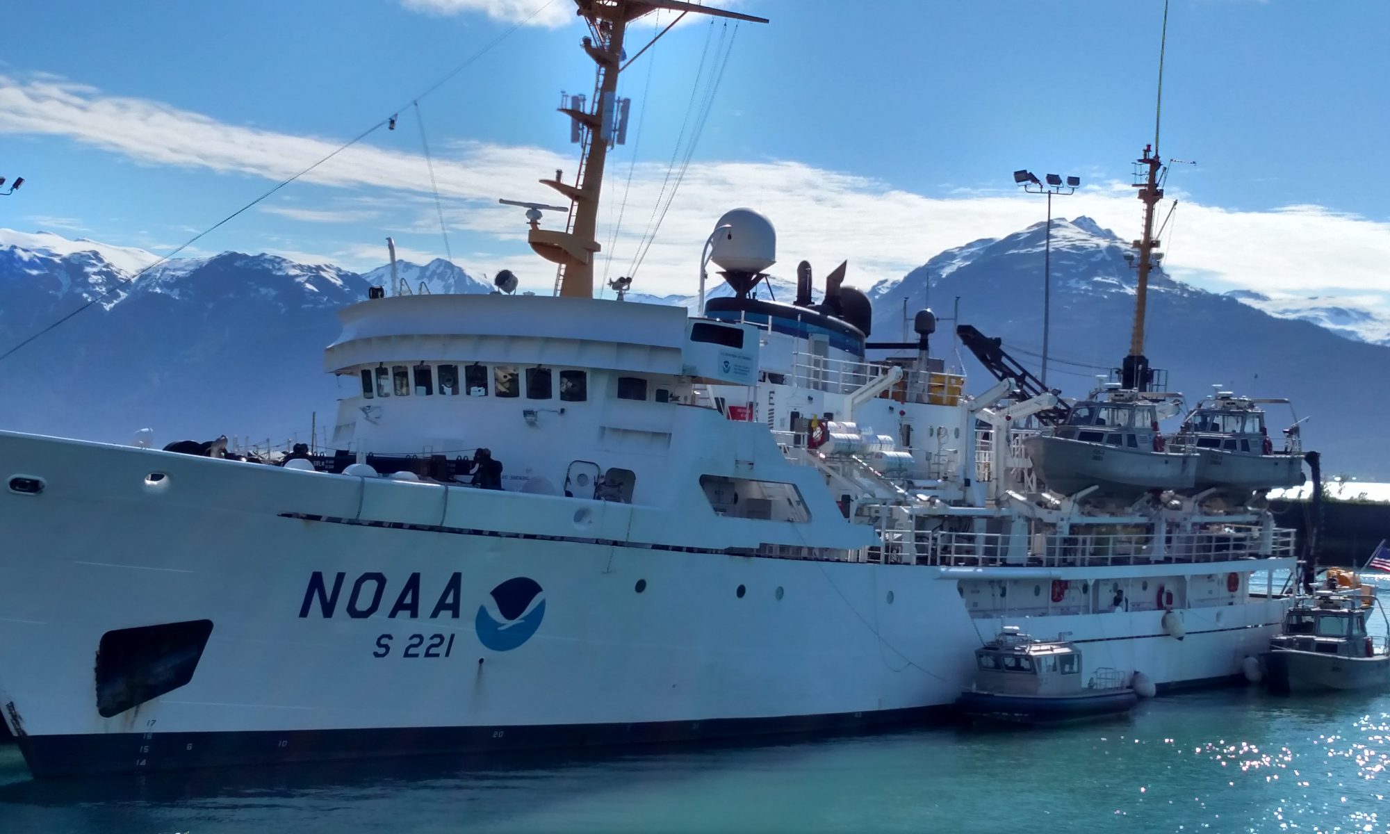
Onboard NOAA Ship Oregon II
June 15 – 30, 2006

Mission: Summer Groundfish Survey
Geographical Area: Gulf of Mexico
Date: June 21, 2006

Weather Data from Bridge 
Visibility: 10 nautical miles (nm)
Wind direction: 105 ◦
Wind speed: 10
Sea wave height: 1-2
Swell wave height: 2-3
Seawater temperature: 27.7
Sea level pressure: 1012.8
Cloud cover: 2/8 Cumulus

Science and Technology Log 

Things started out fairly normal this morning.  There were fish waiting on the deck when our watch began. We then steamed to a new location. This station went as planned. On the next station the trawl went out and things were going well. We were processing fish when we smelled something strange. We concluded that there was something burning and we went out onto the deck.

Yes, something was burning. It was a clutch. This was an engine part, not an actual fire. There was no need for a fire alarm to sound. The problem was recognized. Although we are now short one Power Transfer Output (this is what takes engine power and uses it for winches and other power tools) we can continue our mission.

Personal Log 

The engine problem was really no big deal. It was much like burning up a clutch in a car. The smell is pretty awful and there is a little smoke but no fire. The smoke comes from the rubbing together of the surfaces under pressure. It was great to see the various ship’s personnel work together so smoothly and quickly to discover and correct any problems.

After going off watch and showering, I made a mistake. I did not remember that we have weekly drills. So, there I was, fresh out of the shower standing in the middle of the room when the alarm sounded and my roommate came running in to gather survival gear and personal flotation devices. I jumped into the nearest clothing, my pajamas, and joined in the drills.

Question of the Day 

As part of the Commerce Department, what is the goal of NOAA science research?

Answer: To collect information which can be used to answer the scientific and policy questions which impact our shared environment.

Susan Just, June 20, 2006

NOAA Teacher at Sea
Susan Just
Onboard NOAA Ship Oregon II
June 15 – 30, 2006

Mission: Summer Groundfish Survey
Geographical Area: Gulf of Mexico
Date: June 20, 2006

Weather Data from Bridge 
Visibility: 8-10 nautical miles (nm)
Wind direction: 023 ◦
Wind speed: 11.6
Sea wave height: 1-2
Swell wave height: 2-3
Seawater temperature: 27.8
Sea level pressure: 1012.5
Cloud cover: 3/8 Cumulus

Science and Technology Log 

Most of this watch will be spent steaming to the first southern station. Our ETA (estimated time of arrival) is 8:00 am.  We are planning to do a full station meaning CTD, Neuston, and a Trawl. It is midnight now and I am hoping to get an interview with our Chief Scientist prior to beginning the station.

The first Bongo is scheduled for noon. Dan Carlson, a graduate student at Florida State University, is aboard researching his master’s thesis. He is utilizing the water samples from the Bongo to learn more about the development and origination of red tides which bloom in the Gulf of Mexico.

I have just been put “in charge” of the Neuston for this station. That means I am responsible for seeing that the net is dragged for ten minutes, that the organisms which are gathered are washed down into the cod end and that the sample is then gathered are delivered to the plankton transfer table.

Personal Log 

The Chief Scientist has been actively engaged with data collection and correction activities. I understand that a server has failed and that all time/date information must be hand entered into all data sheets. This is time consuming but very necessary for the sake of accuracy.

Question of the Day 

What is red tide?

Answer: It is an organism, named Karenia Brevis, which produces a neurotoxin which, in turn, is toxic to virtually all sea life.

Susan Just, June 18, 2006

NOAA Teacher at Sea
Susan Just
Onboard NOAA Ship Oregon II
June 15 – 30, 2006

Mission: Summer Groundfish Survey
Geographical Area: Gulf of Mexico
Date: June 18, 2006

Weather Data from Bridge 
Visibility: 10 nautical miles (nm)
Wind direction: 124 ◦
Wind speed: 11.6
Sea wave height: 1-2
Swell wave height: 2-3
Seawater temperature: 27.9
Sea level pressure: 1014.4
Cloud cover: 5/8 Cumulus

Science and Technology Log 

There will be no fish caught today. The OREGON II is steaming to port in Galveston. One of the two radars has failed. The ship is required to have two functioning radars in the event that one should fail. Therefore, we must return to port and make repairs.

When the radar was lost, we were underway to the tip of Texas, off the coast of Brownsville, to begin surveying in preparation for the Gulf Coast shrimping season. We expect to make port this afternoon and get underway south again sometime Monday.

Personal Log 

I don’t mind having this time off from the fish. Part of my mission is to write lesson plans that correspond to the activities aboard. This will give me time to work on the plans.

Question of the Day 

What does the radar do?

The radar serves as a set of electronic “eyes.” It recognizes obstacles in the distance so that they can be avoided by making necessary course corrections.

Susan Just, June 17, 2006

NOAA Teacher at Sea
Susan Just
Onboard NOAA Ship Oregon II
June 15 – 30, 2006

Mission: Summer Groundfish Survey
Geographical Area: Gulf of Mexico
Date: June 17, 2006

Weather Data from Bridge 
Visibility: 8-10 nautical miles (nm)
Wind direction: 356◦
Wind speed: 11.1
Sea wave height: 0-1
Swell wave height:1-2
Seawater temperature: 28.2
Sea level pressure: 1016.7
Cloud cover: 5/8 Cumulus, Altocumulus

Science and Technology Log 

This watch began, again, with fish waiting on the deck. We processed that catch just as we had all the others. While we were processing, another catch of fish were being collected. A CTD was also performed. When the fish catch has been processed, it is necessary to return the processed organisms to the sea. There is a shoot in the wetlab designed for this purpose. The shoot has not been working properly so far on this cruise. During our watch it backed up completely. Water was rising up through the drain in the floor. Clearing the blockage took several hours.

The catch was sitting on the deck and we had no reason to believe that we would get the shoot clear any time soon. The Watch Leader elected to process the catch “dry” so we separated and identified the species without the benefit of water to clean the organisms. Following this catch, the shoot was cleared and the lab was cleaned. We are now making our way south to assess the Texas Gulf Coast shrimp prior to the beginning of their season..

Personal Log 

What a mess! Each organism had to be dipped into water just so that we could be sure it was identified properly. We found hundreds of little shrimp that are not even harvested for food purposes.

Question of the Day 

Where do the shrimp live?  Answer: In the mud on the bottom of the sea.

Susan Just, June 16, 2006

NOAA Teacher at Sea
Susan Just
Onboard NOAA Ship Oregon II
June 15 – 30, 2006

Mission: Summer Groundfish Survey
Geographical Area: Gulf of Mexico
Date: June 16, 2006

Weather Data from Bridge 
Visibility: nautical miles  8-10 (nm)
Wind direction: 205.5 ◦
Wind speed: 11.3
Sea wave height: 0-1
Sea swell height: 1-2
Seawater temperature: 28.7
Sea level pressure: 1016.6
Cloud cover: 5/8 Altostratus and cirus

Science and Technology Log 

Tonight we began with a Neuston. Now I know that a Neuston is a rectangular frame to which has been attached a “sock” style net with a round portion at the bottom known as the “cod end.” The Neuston drags at the surface and catches sargassum (sea weed) and also plankton. Why? I’ll need to find out.

Next we pulled in the Bongos. These are round shaped “sock” nets with cod ends. In the cod ends, plankton and other sea life are collected from either the bottom or a maximum depth of 200 feet. The “catch” from both the Neustons and the Bongos are placed into jars with formaldehyde as a preservative. Forty-eight (48) hours later they are transferred to alcohol. They are then shipped out for processing.

The CTD was performed to capture water samples and hydrological data. All of the information is assembled and accompanies the samples to the lab for processing. Finally, we weighed and sorted the catch. Each species is identified by its scientific nomenclature which means we hear a great deal of latin in the wet lab.

Personal Log 

OK, I’m not quite as confused now. I had a great night’s sleep. I am beginning to learn some of the scientific names and I have gotten my fingers onto the computers that record the data regarding the organisms we classify. I’ve started having intelligent conversations with people and I am beginning to make sense of the activities aboard the ship.

Question of the Day 

What is the purpose of collecting the organisms in the Neuston and the Bongos? Answer: Plankton data is part of a long-term study regarding trends in fish populations.