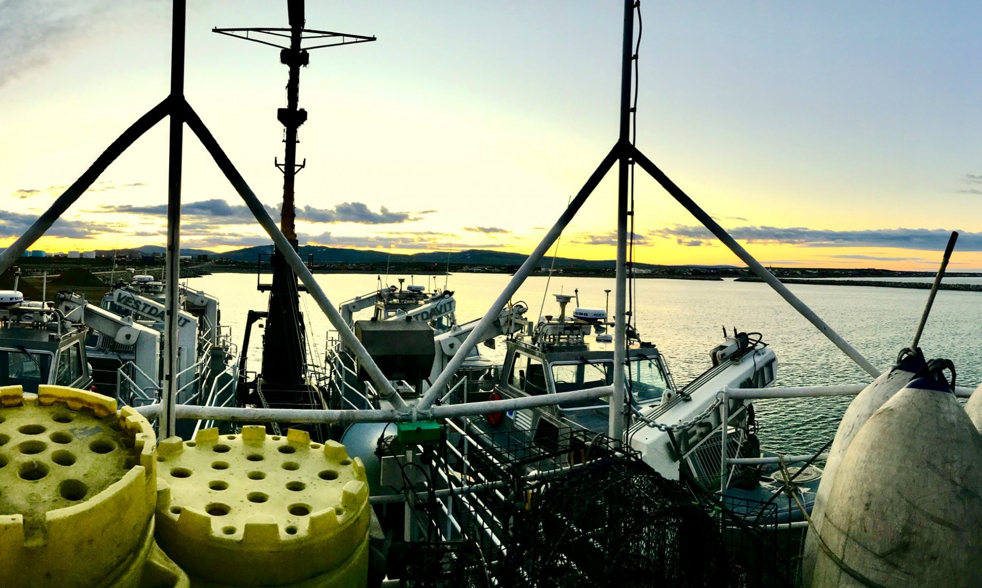
James Miller, August 22, 2005

NOAA Teacher at Sea
James Miller
Onboard NOAA Ship Rainier
August 13 – 27, 2005

Mission: Hydrographic Survey
Geographical Area: North Pacific, Alaska
Date: August 22, 2005

Location: Anchored in Fish Range Bay; north of Mitrofinia Island
Weather: Sunny, low 70’s
Wind: variable
Seas: 1-2 foot swell
Itinerary:  Working in Fish Range Bay area for couple of days

Science and Technology Log 

Due to the deteriorating weather forecast for the entire area around Mitrofania Island we are packing up and moving out.  There were two things that needed to be done today. First, a tide gauge that the crew installed on Mitrofania earlier in the season had to be removed.  The gauge sent tide information via satellite to a facility on the mainland.  Second, the differential global positioning system (DGPS) that was also installed on the Island earlier in the season had to be removed.  The DGPS was installed to enhance GPS signals when launches are surveying in the area.

I was assigned to help break down the DGPS with two officers and a survey technician. We headed out early in one of the skiffs for the island.  The DGPS consists of a tall antenna mounted on aluminum framing which is supported by lines tied off to stakes in the ground. It also has a watertight box that acts as the main processor for transmitting and receiving.  The processor is powered by six 12v car batteries, which get charged by a series of solar panels. Soon after being dropped off we realized we all forgot to bring bug dope, and soon after that the bugs were swarming.  It’s amazing the motivational power of flying, pestering insects.  We had the station apart and lugged down to the beach in under an hour.  Unfortunately the amount of gear and people exceed the capacity of the skiff, so it required more than one trip.  I drew the short straw along with one of the officers to wait on the island for the skiff to return.  It took about an hour so we did a little treasure hunting along the beach at the high tide line.  Earlier in the season, some of the crew found antique fishing trap floats made of blown glass.  I’m unsure of how old they are, but let’s just say very.  We didn’t find anything as interesting.

Personal Log 

I’m sorry to be leaving Mitrofania Island, partly because it is so beautiful, and also because it marks the end of the work for this leg of the trip.  We got underway for Chiginigak Bay around 4:00pm to basically run from the oncoming storm.  The travel time was about 8 hours.  The seas had already started to build when we left. For the first half of the trip we were traveling with the seas, which made for a smoother ride, however, we had to turn broadside (parallel) to the seas for the second half. When running broadside to the sea the ship pitches from side to side at pretty steep angles. I was typing up some logs in the computer room when all the books and games on the shelf came tumbling down, what a mess.  Anyway, it certainly wasn’t as bad as we anticipated and we arrived in the bay some time around midnight.

Before bed I went up to the bridge to see how the ship was handling in the seas.  One of the newer officers to the ship gave me some more navigation lessons, which was cool.

Sleeping hasn’t been a problem, even with the constant noise of the engines and rolling of the ship. In fact, I sleep deeply and have to drag myself out of bed in the morning. My cabin doesn’t have a porthole so NO light gets in.  It could be the middle of the day and I wouldn’t know it.

Despite all the fun I’m having, I have to say I really miss my home and family.  I give the crew a lot of credit for doing this all year long.  One of the crewmembers said that longing for home is a great feeling, it keeps you going, and that’s why you can’t make the ship your home.  Seems like good advice for newcomers on the ship.

James Miller, August 21, 2005

NOAA Teacher at Sea
James Miller
Onboard NOAA Ship Rainier
August 13 – 27, 2005

Mission: Hydrographic Survey
Geographical Area: North Pacific, Alaska
Date: August 21, 2005

Location: Anchored Northeast side of Mitrofinia Island
Weather: Sun and clouds, low 60’s
Wind: 5-10kts
Seas: Calm
Itinerary: Working around Mitrofinia Island

Huge halibut
Huge halibut

Science and Technology Log 

To ensure completion of some of the longer lines located further out in the open ocean, the ship spent the day running surveying lines.  The RAINIER is also fitted with sonar transducers and is used when the lines are 8 miles or longer. I was assigned to work in the plotting room with the surveyors cleaning up data that was collected the previous day.

Many processing steps must be performed on the bottom contour data before it makes it onto a chart.  On the ship, the surveyor performs a basic “cleaning” of the data with powerful computers, and very sophisticated software.  The surveyors pull up the bottom contour data on the screen and analyze it for stray signals.  It is very cool software because they look at the bottom in 3-D and from any angle.  At first it doesn’t look like much but a chaotic grouping of lines; however, after the surveyor selects areas and stray signals to cut out, the bottom contour emerges.  The surveyor definitely develops an eye for understanding these 3-D images, but it didn’t take long before I was performing some of the basic cleaning tasks.  I also downloaded some of the images onto a disk to be used in a PowerPoint presentation.

I had an interesting conversation with one of the surveyors whose background is geology. He said that this entire area is a geologists dream.  He described how much of the area was probably form by Mt. Veniaminof volcano, which is visible in the distance and is still active. The thing is immense and stands above all the other surrounding mountains. Additionally, he has also seen clear evidence of structures formed by seismic activity.

Personal Log 

It was actually nice to have a day off from the launches.  I had time to do some laundry and get caught up with some e-mails.  I’m definitely used to the daily routine and I’ve finally learned all the crew and officers names and responsibilities.

We’re scheduled to leave the area in the afternoon tomorrow because of very poor weather forecasts. Winds to 40kts seem to make the captain a bit nervous, so we’re going to run for cover in Chignik Bay on the peninsula about 80 miles or so northeast of the Mitrofania Island. Since it might be my last opportunity to fish, after dinner I went out to the fantail to try for halibut. I was determined and planned to put in some serious time.  After about a half hour I hooked and landed a 25 pounder, and then ten minutes later lost a 15 pounder. Then within another 20 minutes I caught one about the same size as the first.  By this time many of the crew started fishing. I saw LT Evans wrestling with a fish on the other side of the boat. It was apparent he had something big, so I put my rod down to watch as he slowly reeled it up. About 20 minutes later this hulk of a halibut appeared, it was huge. It took two harpoons, and me and another guy to haul the fish up onto the boat. We didn’t have a scale but it was estimated at over 100 pounds.  It also took all night for LT Evans to clean it and bag it.

James Miller, August 20, 2005

NOAA Teacher at Sea
James Miller
Onboard NOAA Ship Rainier
August 13 – 27, 2005

Mission: Hydrographic Survey
Geographical Area: North Pacific, Alaska
Date: August 20, 2005

Location: Anchored in Fish Range Bay; north of Mitrofania Island
Weather: Sunny, low 70’s
Wind: variable
Seas: 1-2 foot swell
Itinerary:  Working in Fish Range Bay area for couple of days

Science and Technology Log 

I was assigned to RA-3 today to do some deep-water surveys northeast of the Island. Had a big breakfast of waffles and eggs because I figured with the rough seas I wouldn’t be interested in eating much for lunch.  I was one of three assigned to the launch. In addition to myself, there was an officer and coxswain.  The past couple days I was the fourth, so I felt good that they trusted me enough working with the boat and equipment that I made up the third spot.

We were delayed about an hour because they couldn’t lower our launch into the water. One of the tracks on the boom that lowers the launch bent the day before so the wheels couldn’t pass through. They had to pull out torches and all sorts of equipment to repair it. Within an hour they were able to temporarily fix it to get the launch in the water but it took the rest of the day to finish the job.  The crew is incredibly skilled and ready to fix anything that breaks onboard.

The survey lines we had today were about 8 miles long.  Considering we can only cruise at about 7 knots when surveying, it took about an hour to complete one line.  The weather wasn’t too bad until we got out into the open ocean.  It was just sloppy. A three to five foot chop tossed us around. In addition, what made it worse was that the survey lines ran parallel to the seas; we were getting tossed from side to side for hours on end.  I was amazed that the sonar signal could accurately collect the bottom data in such rough seas. Apparently the POS System that senses and records all the movement of the boat using an accelerometer is designed to compensate for these situations.

Again, the first thing we had to do was send down the cast.  The cast is the device that collects water temperature, salinity, and density at varying depths, which is then used to calibrate the sonar. We were in 300 feet when we sent it down and it took forever for it to hit bottom and bring it back up.  The pitching boat made it all the more challenging.

We had a very knowledgeable and seasoned coxswain onboard.  He is a big burly guy with a white beard like Santa Claus, and he’s the type that can drink cold black coffee and lukewarm clam chowder in 5 foot seas.  He also made us do two man-over- board drills. When we weren’t paying attention, he would throw a fender overboard and yell out man-over-board.  I learned quickly that they take these drills very seriously.  During the first one, the officer was at the helm, and I had to pull in the fender (person).  During the second one, I was at the helm, and had to turn the boat around and approach without running it over. It definitely broke up the day.

Personal Log 

I have to say I was glad when the day was over.  When I got back onto the ship my head was spinning. Luckily I had no problem with seasickness though and was able to perform my job on the launch.  Had a big dinner of ziti and chicken and then went back to the fantail to try my luck at halibut fishing.  After about an hour, I called it quits. No luck today. At 7:00 a skiff was running people to the beach for a beach party.  It was a good time, but as the sun started setting the bugs started biting.

I’m barely finding time to work on my logs.  Although tomorrow I’m not scheduled to be on a launch and I might be able get caught up.  I’d also like to get up to the plot room where they begin processing the data.

The ship will be getting underway tomorrow to do some deep-water surveying itself. I think we’ll be anchoring on the northeast side of the Island to get out of the bad weather that’s heading our way.  Unfortunately the weather will be with us until we get back to Seward. We will be making a stop off at Kodiak Island for refueling which will be cool. Officer Evans said I might be able to check out the sights for a couple of hours.

James Miller, August 19, 2005

NOAA Teacher at Sea
James Miller
Onboard NOAA Ship Rainier
August 13 – 27, 2005

Mission: Hydrographic Survey
Geographical Area: North Pacific, Alaska
Date: August 19, 2005

Location: Anchored in Fish Range Bay; north of Mitrofania Island
Weather: Sunny, low 70’s
Wind: variable
Seas: 1-2 foot swell
Itinerary:  Working in Fish Range Bay area for couple of days

Science and Technology Log 

I am assigned to launch RA-5 today, which will be working what are called holiday lines. These are small areas that didn’t get adequate coverage the first time they were scanned. Most of the lines were situated very close to shore near the peninsula and a bunch around Mitrofania Island. Being assigned to holidays is very labor intensive for the coxswain (boathandler) because he/she is constantly turning the boat and working very close to shore. Often we had to put somebody (usually me) on the bow to watch we didn’t plow into any rocks. The geology in the area is strange in that it could be 300 feet one second and then 3 inches the next, so running onto rocks is always a concern especially when working close to shore.

The entire crew is working extremely hard to finish up this area on this leg of the trip. The RAINIER is scheduled to be in Prince William Sound on the next leg and will continue surveying until mid-October.  Between November and March the ship is in its homeport of Seattle, WA, getting repairs and preparing for the next season.

There are a few crewmembers onboard who are college students either working for the summer or taking time off to make some money.  Then there are some crewmembers, such as the Chief Steward, that have been on the RAINER for over 30 years.

The surveyors rotate between collecting data at sea and processing the data at NOAA Headquarters.  They are required to be at sea for several months out of the year.  Most of them have a four-year college degree and majored in geology or Graphical Information Systems (GIS), but there are a couple of assistant surveyors with associate degrees.

The officers are onboard for two years before moving on to their next assignment.  They rotate between two years at sea and three years on land.  It’s clearly a difficult lifestyle for those who want a family.  They all have four-year college degrees and usually majored in some sort of engineering, math, or one of the sciences.  After signing on to the NOAA Corps, they are sent to Kings Point Merchant Marine Academy for 3 months of intensive training before getting their first assignment.

Personal Log 

Since we worked so close to shore, my day on RA-5 was great for getting some pictures of wildlife.  There are puffins, and loons everywhere.  When the launch approaches they try to fly but can’t seem to get their fat little bodies airborne, so they skid across the water for about thirty feet and then dive.  Along the shore of the peninsula there were a lot of fresh bear tracks. The grizzly bears in this area are among the largest in the world due to their high protein diet of salmon.  Unfortunately, we didn’t get to see any. Several Sei whales breached near the boat, which was really cool.  It happened very quickly, but I think I was able to get some pictures.  We also saw lots of bald eagles.  They nest high up on the bluffs and when they get hungry they swoop down and grab a puffin or small gull.  The highlight of the day was the seals.  There’s a large rock structure on the south side of the Island that a family of seals inhabit.  The survey we were doing required us to get right up next to the island.  There were at least two dozen seals some of which were huge—over 1000 pounds!  When we approached they stood up and barked at us. Got some great pictures!

When we returned to the ship I decided to do some fishing off the fantail for halibut. Yesterday someone caught a 50-pounder in Fish Range Bay.  After about 45 minutes of bouncing this glow-in-the-dark squid on the bottom, wham.  It felt like I was snagged. It only turned out to be about a 20-pound halibut, but it fought like mad.  My arms were killing me from reeling it up from 200 feet of water.  These fish get over 300 pounds–I can’t imagine!  I just finished cleaning the fish and writing some logs, it’s midnight.  Assigned to RA-3 tomorrow for deep-water surveying.  I’ve got to prepare myself for some rough seas and a long day.

James Miller, August 18, 2005

NOAA Teacher at Sea
James Miller
Onboard NOAA Ship Rainier
August 13 – 27, 2005

Mission: Hydrographic Survey
Geographical Area: North Pacific, Alaska
Date: August 18, 2005

Location: Anchored in Fish Range Bay; north of Mitrofinia Island
Weather: Sunny, low 70’s
Wind: variable
Seas: 1-2 foot swell
Itinerary:  Working in Fish Range Bay area for couple of days

Science and Technology Log 

Got up early this morning (6:30am) so I could eat a big breakfast and get my gear loaded into the launch and. I was assigned to launch RA-3 with an Officer, a Surveyor, and a Coxswain (boat handler). Last night I was briefed on all the safety equipment on the launches as well as how to board and disembark.  The survey launches are 29-foot aluminum boats with a small cabin that houses the survey computers. There’s a total of 6 survey launches, two of which are water jet powered for shallow surveys, and the remaining launches have single inboard diesel engines.

The launches are also fitted with either multibeam or single-beam sonars.  The multibeam sonars scan a wide path of the bottom, about three times the depth of the water. For example, if we are in 50 feet of water the sonar cone is scanning a path about 150 feet wide. The multibeam sonars are less powerful than single beam sonars, therefore, are primarily used in shallower waters.  The single beam sonar scans a much narrower path and also uses a more powerful signal and is often used in deeper water.  An astonishing fact for the day is that a single sonar could cost as much as $500,000.  The launch I was in today was fitted with a multibeam.

Our Plan of the Day (POD) indicated that we would be scanning areas around Fish Range Bay. The POD has the track lines that you are to work on laid out on a paper chart. The track lines are also set up on one of the onboard computers.  There are basically three main computers onboard that are all interconnected.

One computer acts as a GPS and has all the track lines we are to follow pre-programmed.  The coxswain also has a terminal at the helm so he/she can steer the boat onto the track line. It’s kind of like a PacMan game for the coxswain, or as they call it “mowing the lawn”.  Depending on where you are working, the track line can be as long as 8 miles long or longer.  We were working relatively close to the shore so our lines for the day were no longer than one mile.

Another onboard computer is designed to record data related to the movement of the boat. As the boat scans a track line the boat rolls (side to side motion), pitches (from front to back), and heaves (up and down).  The sonar single coming from the bottom of the boat is similar to the shape of an ice cream cone.  These motions have an impact on the way the signal records or sees the bottom. So to ensure the quality of the bottom data collected, this motion information is fed into a complex algorithm that will calculate a percent error and apply it to the data.  It’s truly some amazing stuff.

A third computer shows the actual sonar signal and the data it is collecting.  On one of the screens you can see how the signal changes with the motion of the boat.  Another screen shows the track lines you create with each pass of the sonar.  See, the track lines are set up parallel to each other and close enough so that there is overlap.  As you complete a track line the screen shows the actual signal coverage.  On the boat they call this “mowing the lawn” because that is exactly what it looks like you are doing on the computer.  Scanning every inch of the bottom.  Another screen produces a 3-D image of the bottom, and yet another screen shows the motion of the boat in the form of sinusoidal curves.

In addition, before we can begin scanning the bottom we also have to lower a gauge called a cast down to the bottom to record temperature, salinity, and density of the water. After we retrieve it, we hook it up directly to the computer to download the information.  These factors have an impact in the way that the sonar signals travel through the water column; therefore, this data is also fed into the algorithm to ensure high quality readings.

It’s truly amazing how much effort and attention is given to obtaining an accurate image of the ocean bottom.  Their philosophy simply seems to be, if we’re going to do it, let’s do it right!

Personal Log 

It was a very interesting day and I learned much.  I had an opportunity to rotate into each of the positions including steering the launch on track lines and operating the computer.  Since the weather was so good, the CO extended the working day, so we were in the launches for about ten hours today. At lunch, I couldn’t resist fishing for halibut, so I dropped a line down for about ten minutes and caught my first.  It was very small for AK halibut standards, but definitely a trophy fish where I come from.  It’s after eleven o’clock and I’m exhausted.  I looked on tomorrows POD and I’m on RA-5 (the leaker).  This should be interesting!