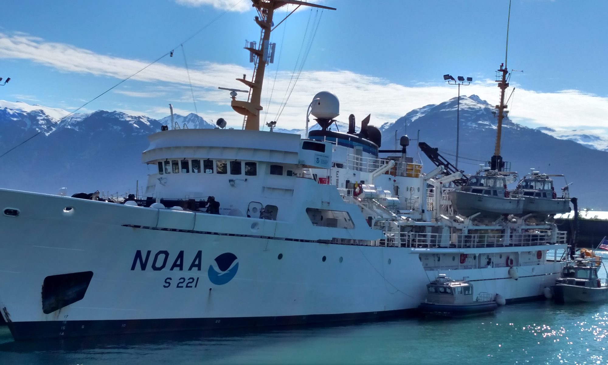
NOAA Teacher at Sea Elizabeth Bullock Aboard R/V Walton Smith December 11-15, 2011
Mission: South Florida Bimonthly Regional Survey Geographical Area: South Florida Coast and Gulf of Mexico Date: December 13, 2011
Weather Data from the Bridge
Time: 4:45pm
Air Temperature: 23.5 degrees C
Wind Speed: 15 kt
Relative Humidity: 68%
Science and Technology Log
I'm deploying a drifter!
Last night, we deployed our first drifter. There will be three deployed over the course of this cruise. The frame of this drifter is built by the scientists at AOML (Atlantic Oceanographic and Meteorological Laboratory). Afterwards, they attach a satellite transmitter so they can track where the drifter goes. This helps them measure the surface currents.
What are some other types of research being conducted onboard? I’m glad you asked! Two NOAA researchers, Lindsey and Rachel, are studying water chemistry and chlorophyll. They take samples of surface water from the CTD to study CO2 and the full carbonate profile. They also use water collected at many different depths to study the chlorophyll content. Chlorophyll is an indicator of the amount of phytoplankton in the water.
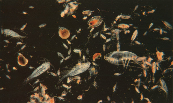
The particular copepod that she is studying is food for the larval stages of some commercially important species of fish such as bill fish (which include blue marlin, sail fish, white tuna, and yellowfin tuna) and different species of reef fish. If a species is commercially important, it means that many people depend on this particular fish for their livelihoods.
Here is one of the species of copepods that Sharein is studying.
Do you think you would be interested in working at sea? You would be a good candidate if you:
1) Like meeting new people and working as part of a team
2) Are interested in the ocean, weather, and/or atmosphere
3) Don’t mind getting your feet wet
Personal Log
When we were on our way to the Tortugas, we didn’t have cell service and the TV in the galley had no signal. It was nice to be disconnected for a while. Although there are still 29 computers onboard which all have the internet, so we’re hardly off the grid!
It was hard at first to adjust to the night shift, but everyone onboard was really supportive. Working the night shift means that you work from 7pm to 7am.
NOAA Teacher at Sea Elizabeth Bullock Aboard R/V Walton Smith December 11-15, 2011
Introduction
Hello! My name is Elizabeth (Liz) Bullock and I work for the NOAA Teacher at Sea Program (TAS). Before I worked at NOAA (the National Oceanic and Atmospheric Administration) I was in graduate school at Clark University in Worcester, MA studying Environmental Science and Policy. As my final project, I created an environmental curriculum for the Global Youth Leadership Institute (GYLI). Through this experience, I realized how much I love both science and educating others about the importance of the natural world.
What will we be studying? The scientists on this survey are very interested in knowing about the strength and health of the ecosystem. They can judge how strong it is by looking at various indicators such as water clarity, salinity, and temperature. They can also record information about the phytoplankton and zooplankton that live in the water.
Question for students: Why do you think it is important to learn about the phytoplankton and zooplankton? What can they tell us about the ecosystem? Please leave a reply with your answers below by clicking on “Comments.”
Here is a map of the route the R/V Walton Smith will be taking.
The R/V Walton Smith will be leaving Miami, FL and traveling around the Florida Keys into the Gulf of Mexico.
I am so excited and I hope you will follow along with me on this journey of a lifetime!
Weather Data from the Bridge
Latitude: 56.95N
Longitude: 162.93 W
Wind Speed: 10 Knots
Surface Water Temperature: 10.5 C
Air Temperature: 55F
Relative Humidity: 97%
Science and Technology Log:
Well, at this time tomorrow, the Oscar Dyson will be tied up in port at Dutch Harbor. This is our end destination for Leg I of the BASIS survey. I will write-up a summary/conclusion either at that time or shortly after getting back into town. For now, I will fill you in on some material that I promised. As noted in earlier blogs…I have been intentionally writing in a trophic bottom up approach. That is, I started my first blog entries with descriptions of the primary producers, the Phytoplankton. I covered this extensively and correlated it to the oceanographic work that has been going on aboard this ship. It seemed logical to work from the base of the food chain and work my way up the trophic levels to the more complex consumers.
However, before I close the chapter on Phytoplankton take a look at the picture I took below. When I stepped outside and saw this, I thought I had been transported to the Caribbean. Clear skies, calm seas, tropical blue waters are not typical descriptions for the Bering Sea. If you look closely enough, you can even see the shadow of the clouds on the surface of the sea. Science is the field of making observations, forming hypothesis, designing and conducting experiments and drawing conclusions about the natural world we live in. So…what would you make of this observation? What has caused this temporary “mirage” of tropics? Clearly something is going on here.
Coccolithophores 08-28-11
Well, although not 100% certain, the most likely explanation is what would be called a Coccolithophore bloom. These are single-celled algae which are characterised by special calcium carbonate plates as seen in photo below under magnification.
Coccolithophore
Under certain conditions, (some speculate that wind pattern changes fail to mix the water column favoring cocolithophore blooms as opposed to other plankton) coccolithophores can create large blooms turning the water brilliant shades of blue pending on the species of coccolithophore blooming at the time. Ed (Chief Scientist) was telling me of a major bloom that had occurred back in the late 90’s. I researched it a bit and the following picture is of this bloom in the same general vicinity where we are now. Amazing to think of how microscopic plants can influence a region on the scale of an entire sea and be seen from space. *Note: this is not a false colored Image
Coccolithophore Bloom 98 Bering Sea
There is also some speculation that these types of blooms may be linked to sub-average runs of salmon (and even impact seabirds negatively in the area). Some hypothesize that this may be due to the idea that salmon prey heavily upon euphausiids (see picture I took below on 08-28-11 and the one centered beneath for a closer look taken from NOAA) and the euphausiids have difficulty subsiding on the extremely small coccolithophores. Remember what I was saying about visualizing the flow of energy as a pyramid and the effects of taking out a few or many blocks that make up the base of the food chain.
euphausiids 08-28-11Euphasiid
Ok, to make this easier for the reader, I am going to stop this blog here and start a new one dedicated to the zooplankton…..I got a little sidetracked with the whole coccolithophore bloom event…….
Personal Log
Earlier this morning we were greeted with some higher winds and consequently some larger seas. As my friend back East says conditions got “Sporty.” Here is a picture from where we launch the CTD. Winds were out of the SW gusting to 30 knots and seas were in the 10′ range with some larger swells thrown into the mix to keep things interesting.
Weather Data from the Bridge
Latitude: N
Longitude: W
Wind Speed: 20-23kts Tue,Wed. seas 9′ Thu 8/25 = calm
Surface Water Temperature: C
Air Temperature: 55F
Relative Humidity: 70%
Science and Technology Log
We are on Day II of our travels to get to our first sampling station located in the SE Bering Sea. We will begin our fishing operations today! We have had decent weather thus far although we did just go through Unimak Pass (see picture below of location) which is a narrow strait between the Bering Sea and the North Pacific Ocean. This passage offered a time of heavier seas. I’m guessing that like any strait, the currents may become more funneled and the seas “confused” as they squeeze through this area. It’s kind of analogous to it being more windy in between buildings of a major city vs. suburbia as the wind is funneled between skyscrapers. I also imagine this to be a popular crossing for marine mammals as well.
Interesting to think that both marine mammals and humans use this passage to both get to the same things: a food source and a travel route. It’s a migratory “highway” for marine mammals, and a heavily-trafficked area for humans in international trade and commercial fisheries.
Anyway, the Bering Sea is a very unique body of water. It really is the way that I imagined it. It is as though you are looking through a kaleidoscope and the only offerings are 1000 different shades of grey. It is rainy, foggy, and windy. I can appreciate how this sea has been the graveyard for so many souls and fishing vessels in the past who have tried to extract the bounties it has to offer.
unimak pass
As of Wednesday, the 24th, we have finished 4 stations of the 30 that have been planned for Leg I of this study (Leg II is of similar duration and goals). I was involved with helping the oceanographic crew with their tasks of collecting and evaluating various parameters of water chemistry. To do this, an instrument called a “CTD”– an acronym for Conductivity, Temperature, and Depth — is lowered. This instrument is the primary tool for determining these essential physical properties of sea water. It allows the scientists to record detailed charting of these various parameters throughout the water column and helps us to understand how the ocean affects life and vice-versa.
One aspect that I found very interesting is the analyzing of chlorophyll through the water column. All plant life on Earth contains the photosynthetic pigment called chlorophyll. Phytoplankton (planktonic plants) occupy the photic zone of all water bodies. Knowing that we live on a blue planet dominated by 70% coverage in water, we can thank these phytoplankton for their byproduct in photosynthesis, which is oxygen. Kind of strange how you often symbolize the environmental movement with cutting down of the rainforests and cries that we are eliminating the trees that give us the air we breath. This is true, but proportionately speaking, with an ocean-dominated sphere, we can thank these phytoplankton and photosynthetic bacteria for a large percentage of our oxygen. Additionally, being at the base of the food chain and primary consumers, these extraordinary plants have carved a name for themselves in any marine investigation/study.
The procedure to measure chlorophyll involves the following: water from the Niskin Bottles (attached to the CTD, used to “capture” water at select depths) is filtered through different filter meshes and the samples are deep-frozen at -80F. To analyze chlorophyll content, the frozen sample filter is immersed in a 90% solution of DI (Distilled Water) and acetone which liberates the chlorophyll from the phytoplankton. This is then sent through a fluorometer.
Filtering water from CTD for Chlorophyll Measurements
Fluorescence is the phenomena of some compounds to absorb specific wavelengths of light and then, emit longer wavelengths of light. Chlorophyll absorbs blue light and emits, or fluoresces, red light and can be detected by this fluorometer.
Fluorometer; Berring Sea 08-25-11
Amazing to think that with this microscopic plant life, you can extrapolate out and potentially draw some general conclusions about the overall health of a place as large as the Bering Sea. Oceanographic work is remarkable.
CTD Berring Sea 08-24-11
Personal Log
The crew aboard the Oscar Dyson have been very accommodating and more than willing to educate me and take the time to physically show me how these scientific investigations work. I am very impressed with the level of professionalism. As a teacher, I know that most often, the best way to teach students is to present the material in a hands-on fashion…inquiry/discovery based. This is clearly the format that I have been involved in while in the Bering Sea and I am learning a tremendous amount of information.
The food has been excellent (much better than I am used to while out at sea). The seas have been a bit on the rough side but seem to be settling down somewhat (although, I do see a few Low Pressure Systems lined up, ready to enter the Bering Sea…..tis the season). Veteran seamen in this area and even in the Mid-Atlantic off of NJ, know that this is the time of year when the weather starts to change). On a side note, I see that Hurricane Irene has its eyes set on the Eastern Seaboard. I am hoping that everyone will take caution in my home state of NJ.
Lastly, it’s amazing also to think of the depth and extent of NOAA. With oceans covering 70% of our planet and the entire planet encompassed by a small envelope of atmosphere that we breathe, it is fair to say that the National Oceanic and Atmospheric Administration is a part of our everyday lives. I am in the Bering Sea, one of the most remote and harsh places this planet has to offer and across the country, there are “Hurricane Hunters” flying into the eye of a hurricane that could potentially impact millions of people along the Mid Atlantic………..Both operated and run by NOAA!
NOAA TEACHER AT SEA CATHRINE PRENOT FOX ONBOARD NOAA SHIP OSCAR DYSON JULY 24 – AUGUST 14, 2011
Mission: Walleye Pollock Survey
Location: Kodiak, Alaska
Date: August 11, 2011
Weather Data from the Bridge
Latitude: 57deg 22.630N, Longitude: 152.02° W
Air Temperature: 13.6° C
Water temperature: 9.0° C
Wind Speed/Direction: 12kn/240°
Barometric Pressure: 1020.1
Partly cloudy (5%) and sun
Science Log:
Stern of the Oscar Dyson
Somewhere back in my family history there must have been a fishmonger, because I’ve been channeling something or someone. The entire process of watching the acoustic footprint of the ocean under the ship, deciding where to physically sample (trawl) populations, and then seeing and processing the fish that live 100 meters or more below us? Fascinating. Add to this camera drops to get snapshots of the ocean floor (more amazing footage this morning), and interesting ‘Methot’ plankton tows to sample what is available for the fish to eat and give a more accurate and complete picture? How many adjectives can I use?
Before we dive too far into the depths, let me explain/refresh what plankton are. Plankton are any drifting organisms that inhabit the water columns of bodies of water. In fact, their name derives from the Greek for “wanderer,” and it would be helpful if you thought of them as drifters in the current…from deep in the ocean to up on the surface. They are generally broken down into plant-like-photosynthesizing plankton (phytoplankton) and animal-like plankton (zooplankton).
Phytoplankton are “photosynthesizing microscopic organisms that inhabit the upper sunlit layer of almost alloceans and bodies of water” (wikipedia). If you have taken biology or forensics with me, I have described some of them ad nauseam: diatoms? Those organisms that are in every body of water on the planet? Ah, yes. I can see it all coming back to you.
Zooplankton encompass a diverse range of macro and microscopic animals. They generally eat the phytoplankton or one another. Examples include krill, copepods, jellyfish, and amphipods.
In the great food web of life, other organisms eat the zooplankton. Among them was a pod of 50+ Humpback whales in the Barnabas Trough off of Kodiak Island. They were exciting enough that I went from being sound asleep to dressed and on the bridge in less than five minutes. Issue 12, Humpback Whales: Better than any alarm clock I have ever known delves into these organisms (Cartoon citations 1, 2, 3 and 4).
Our chief survey technician, Kathy Hough, took a lot of photos the following day as we traveled from Barnabas Trough to Alitak Bay. The three photos that follow and descriptions are courtesy of Kathy.
Adventures in a Blue World, Issue 12
Whale tail: Individual humpback whales can be identified by the black/white pattern on the ventral side of the fluke (tail). The pattern is like a human’s fingerprint, unique to one animal.There is evidence of three whales in the photo above: the closest whale’s rostrum (blow hole) is visible. The second whale is diving and you can see the peduncle (the stocky part of the tail before the fluke). The glassy area in the back of the photo is evidence of a recent dive and is called a “footprint.”This Humpback was last seen in this area in 2004, and has not been seen since. The white marks on its fluke are from a killer whale attack! Kathy emailled photos of the whales to observers, and they were able to identify individuals!All hands on deck… 100+ Humpback Whales. Darin and Staci.
Our team of scientists sample plankton using a Methot net, which is fine mesh and captures macroscopic organisms. We sample plankton for the same reason that we physically trawl for fish: we need to make certain what we are “hearing” is what is down there, with a focus on the types and sizes of the plankton. Additionally, knowledge about what and where plankton populations are will help with modeling the entire ecosystem. If you know where the food lives, its abundance and composition, by extension you have a much greater understanding of the predators, both pollock and whale.
(If you get a chance, check out this video about how whales hunt with bubble nets; fascinating!)
Personal Log
Bowditch
I try to spend time on the bridge every morning before breakfast. I bring up a cup of tea and watch the horizon lighten until the sun pushes its way up above the lingering clouds. This morning, I saw the green flash for the first time. The green flash is not a superhero. It is not a myth. It is not a sailor’s fish tail. It is real. Furthermore, if you still don’t believe me, the green flash is in the “bible” of maritime studies, The American Practical Navigator (Bowditch, if you are on a first name basis). I was told by Ensign David Rodziewiczthat “if it is in Bowditch, it must be true.” So there.
The green flash appears on the horizon just after the sun sets or just before it rises. For one moment on that spot the sky looks as if someone broke a green glow stick and smeared a distant florescent mark. As fast as it was there, it is gone. The name is appropriate: green flash. It occurs because light is bent slightly as it passes through the atmosphere (refraction); this bending is greatest on the horizon. Since light is made up of different colors with different wavelengths, the bending causes the colors to be seen separately. Bowditch says it is like offset color printing (nice metaphor, eh?). The red end of the spectrum is first to rise. The blue end of the spectrum is scattered the most by the atmosphere, leaving behind the momentary and memorable second of green.
Evidently, to see the green flash is considered very good luck. I already feel very lucky. I am in one of the most beautiful places in the world, on a ship with interesting and intelligent people, driving around the Gulf of Alaska learning about science and occasionally checking out whales. If I can get luckier than this… well… wow.
Tomorrow is the last day of our cruise, but I have a few more cartoons up my sleeves, so keep checking back. In the meantime, thank you to the incredible staff of the Oscar Dyson, the scientists of MACE, my rockin’ cohort Staci, and the NOAA Teacher at Sea program.
Until our next adventure,
Cat
p.s. Whales have the worst morning breath I have ever smelled. I know it isn’t really their fault–imagine having 270-400 baleen sheets on either side of your mouth that you could get krill stuck in…