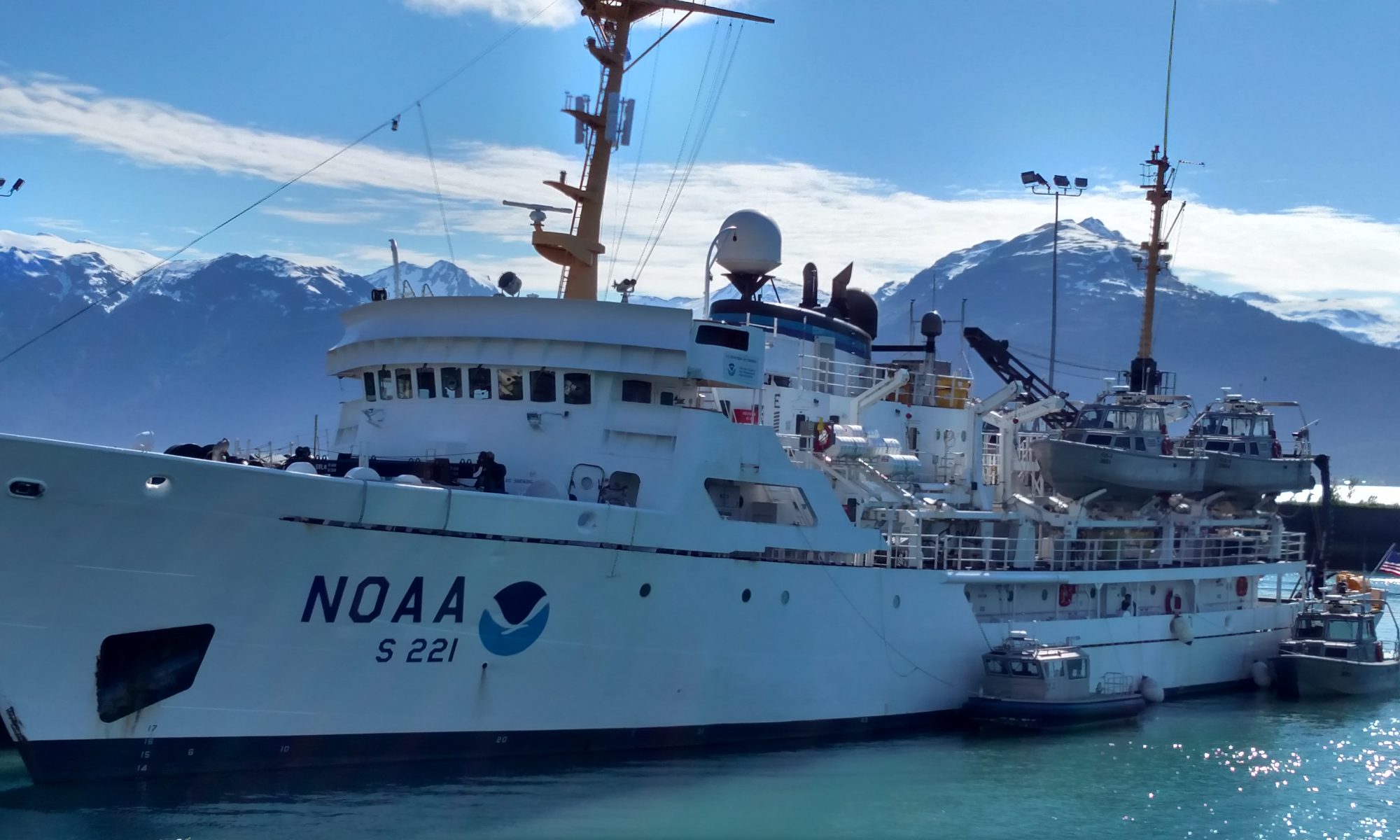
NOAA Teacher At Sea: Elizabeth Warren Aboard NOAA Ship Pisces
Mission: Reef Fish Surveys Geographical Area of Cruise: Gulf of Mexico Date: July, 8 2010
I’m Here!!!
After a day of travel I’m on the ship! I flew from Seattle in through Atlanta. I went for a walk in the Atalanta airport during my layover, when I finally sat down there were two people laughing about the oil spill. I couldn’t believe it! Of course after they had moved on I thought of all different things I could have said to them.
From Atalanta I flew into the Gulfport Airport in Biloxi. I met the other teacher at sea; Anne-Marie from Los Angeles. Anne Marie teaches 3rd and 4th grade science and language arts at a magnet school. She had spent the previous couple of weeks traveling around the south. We were met by a young marine biologist working on his Master’s degree named Travis.
Travis
At the Shed
Travis is working with NOAA and getting paid to get his Masters degree. Gotta love the sciences! He is doing research on a specific type of shark. He will be going out on a smaller vessel doing long line fishing technique. As the bottom of the scientist barrel he was sent to collect the teachers and a birder named Scott. Travis took us to a fun little outdoor BBQ place called The Shed. According to Travis, The Shed has been on the travel channel. I can understand why.. it was good and very quirky. I love listening to the people here talk with their southern accents.It’s been “darlin”, “hon”, and “ya-all” all over the place.
Signs indicating the impact of Katrina
Yesterday before the ship left Anne Marie and I went on an adventure in Pascagoula. The town was tiny! We were able to walk the entire down town in under an hour. I was trying to find a rubber ducky to bring with me on the ship so we went in every little store we could find. In one of the antique shops we met a retired teacher and her two little dogs. She told us all about the town and how Katrina impacted their lives. She told us how the water in her store had been up to her waist and how businesses can’t survive int he downtown. Everywhere we went there were signs of the impact Katrina had on this area and also the spill. In the downtown one of the shops had been taken over by BP as a claims office. People could go in and file claims due. As if the community hasn’t gone through enough.
NOAA Teacher at Sea Melinda Storey Onboard NOAA Ship Pisces June 14 – July 2, 2010
Mission: SEAMAP Reef Fish Survey Geographical Area of Cruise: Gulf of Mexico Date: June 15, 2010
Weather Data from the Bridge
Time: 2000 hours (8 pm) Position: latitude = 29.46.02 N, longitude = 088.08.4 W Present Weather: some cumulus clouds Visibility: 9 nautical miles Wind Direction: Variable Wind Speed: Light Wave Height: 0 feet Sea Water Temp: 32.6 degrees Celsius Air Temperature: Dry Bulb = 31 Celsius, Wet Bulb = 30.8 Celsius
Science and Technology Log
This portion of the log will be written by me and my fellow Teacher at Sea, Nicolle von der Heyde from St. Louis, MO. Since we will be cruising for a couple of days to reach our first destination off the coast of southern Texas, we thought we would briefly describe our mission on board Pisces and our first observations of oil in the Gulf of Mexico. We are participating in the first leg of the SEAMAP (Southeast Area Monitoring and Assessment Program) Reef Fish Survey along the continental shelf from Brownsville, TX north to the Flower Garden Banks National Marine Sanctuary. The Chief Scientist on this mission is Paul Felts. Our task will involve sending video cameras down into the water column and onto the ocean floor to record the abundance and relative size of reef fish associated with various geographical features. The video cameras will be submerged for about 45 minutes at a time, starting one hour after sunrise and continuing until one hour before sunset. If conditions are good, Mr. Felts believes we can submerge the cameras about 7-8 times a day. We will view some of the recorded data on the ship to make sure the equipment is working properly, however the analysis will take place back in the laboratory in Pascagoula, MS.
The Pisces left the port of Pascagoula at around 1130 hours (military time, aka 11:30 am) but did not leave the bay until about 1730 hours (5:30 pm).
The Pisces in portNicolle von der Heyde and Melinda Storey standing in front of the docked Pisces
During this time, the ship was cruising back and forth in the bay as engineers conducted tests of the acoustics on the ship. The Pisces, just commissioned in November of 2009, is the quietest vessel in the NOAA fleet and has some of the latest technology on board. Making a ship quiet may not seem like a big deal, but when you are trying to research marine life in an undisturbed natural environment, silent observation is everything. When the engineers finished their testing, a small boat arrived to take 4 of the engineers back to shore. Three other engineers and one intern remained on board to join us on our voyage.
Small boat
The signs of oil extraction in the Gulf were apparent the moment we boarded the Pisces in Pascagoula. Across the channel from our ship were two old oil rigs no longer in service, one damaged from Hurricane Katrina and destined to be returned to the bottom of the sea to be made into an artificial reef. This is often done with old military battleships as well as they are sunk to the ocean floor and fish begin to use the vessels as a habitat and to hide from predators. Oil booms were placed around the Pisces and other ships in the channel for protection in case oil made its way into the port.
Oil Boom
As we headed out to sea, we were surprised at the great number of ships and oil rigs that dotted the horizon. We saw lots of huge tankers that were just anchored, waiting in line to off load their oil into the Chevron refinery. One of the crew told us there are around 43,000 oil wells in the Gulf. Some wells just have pipes attached and pump oil directly through pipes into the refinery. Some wells have rigs that drill deep into the ocean floor. The Deepwater Horizon that exploded in the Gulf was this type of rig. We also saw one rig that had a flame coming out at the very top of the rig. This was the burning off of natural gas. Our Commanding Officer told us that they “burn off” natural gas for two reasons – safety and economics. All rigs let off a certain amount of excess gas and it’s more economical to burn it off rather than pipe it all the way back to the mainland. Also, burning off the excess gas keeps it from building up pressure, which is very dangerous.
It wasn’t until a few hours after leaving the bay that the officers on the bridge notified us that we were traveling through the oil slick. As we looked over the deck of the bridge, we saw a rainbow of sheen on the surface and even some reddish “emulsified” oil. On the map on the next page, you can see the ship’s route (labeled PC in red) as we passed through the oil slick shown in blue.
Rainbow sheen from oilEmulsified oilRoute of the Pisces
Personal Log
We are finally on our way! This is a picture of the other Teacher at Sea and myself in front of our ship, the Pisces.
Nicolle von der Heyde, from St. Louis, MO, teaches 8th grade science. I am from Birmingham, AL, and teach Gifted students in grades 3-6. I’m so glad to have another teacher to talk to! We are so excited thinking about all the science experiments and lessons that we can bring back to our students. Our minds are just whirling! I was surprised when ENS Schill said we each had our own staterooms.
My stateroom
I later found out that some of the scientists scheduled to be on this cruise had been reassigned to other missions related to the oil spill in the Gulf. In addition, some of the tasks in our original mission, like longlining (fishing) for sharks and rays, had also been cancelled due to the oil. At first, I was somewhat disappointed that we would not be capturing sharks or hauling in large amounts of fish to sample, then I snapped out of it as soon as I reminded myself that I was about to set sail on the trip of a lifetime on board a research vessel with NOAA!
Yesterday was our first day on ship and right off the bat as we left port, we saw about 20 dolphins riding the bow wave. It was so much fun watching them arc in the water and splash around! Some even swam upside down and sideways! The babies, or calves, stuck real close to their moms! As we peered over the side of the ship we could actually see into their blow holes! What a view!
DolphinsDolphins
I was also very pleased to see that there are two women who are Junior Officers – Ensign Kelly Schill and Ensign Laura Gibson. Here you can see Ensign Schill as she prepares our navigation. She is also the Medical Officer. There are three female Commanding Officers in the NOAA fleet. Maybe one of our Ensigns will become a CO one day.
Ensign Schill preparing the navigation of the Pisces
Here you see our CO (Commanding Officer), Jeremy Adams, as he sits in his Captain’s Chair scanning the horizon. He’s the one who spotted the dolphins which sent the crew rushing to the bow of the ship. The officers, who wear blue uniforms, have been so gracious and patient as they explain things to us.
Commanding Officer Jerry Adams
Right now I’m sitting in the bow of the ship as I watch a bird “catching a ride” on the top of a weather pole. It’s interesting to see birds such as terns and pelicans so far from shore. The XO (Executive Officer) says we are 90 miles from shore.
Today we had a Fire drill and a Man Overboard drill – just like in school. The scientists “mustered” (or gathered) in the conference room where our Chief Scientist had to take a head count just like teachers do during our drills. We’ll have an Abandon Ship drill next week. I thought you would like to see the orange Fast Rescue Boat that we would use if we had to abandon ship.
Fast Rescue Boat
My husband and I went to Gulf Shores right before this trip and saw the oil that had washed ashore. I was expecting “globs” of oil like we’d seen on TV but what we saw was very liquid – oil pooled in puddles. It looked like someone had splattered buckets of motor oil on the beach. There were lots and lots of volunteers cleaning the beach but not too many people on vacations. We saw lots of homes and condos with few cars in the parking lots.
Volunteer Cleaning up the BeachOil on the coast
The economic hit that businesses are taking on the Gulf Coast is terrible. Our XO told us that NOAA is hiring boat owners to drive through the densest part of the oil to get data. The smaller boat owners have “closed” boats which means they do not take in sea water for everyday usage like the big NOAA ships. They take their water with them in containers. If the NOAA ships go through heavy oil, the oil could get sucked up and lodged in their water filters and do damage to the equipment. Maybe this way some of the small charter boat owners can recoup some of the money they are losing since no one is chartering boats to go deep sea fishing.
New Term/Vocabulary
Bow – front part of the ship Stern – back part of the ship Port – left Starboard – right Bow wave – the waves at the front of the ship as it travels through the water Muster – to gather in one place
“Something to think about”
What qualities would you look for in a Commanding Officer? Do you think a woman will ever become an Admiral in the NOAA fleet?
Just select the ship you want to follow and it will give you our position. Click the last map option to see a map of the oil slick and our path through it.