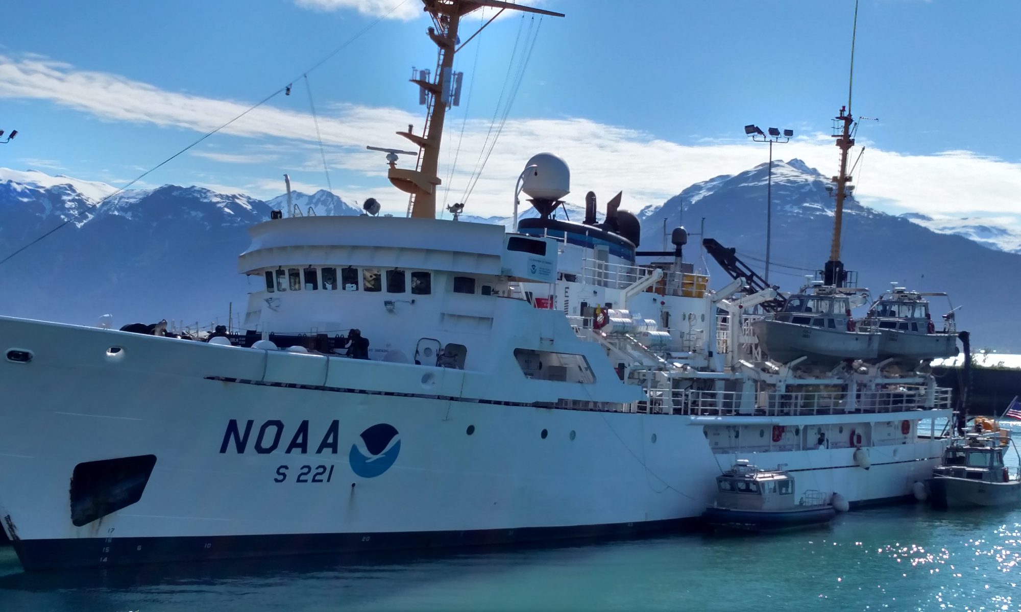
Tom Savage: Surveying the Coastline of Point Hope, Alaska, August 12, 2018

NOAA Teacher at Sea

Tom Savage

Aboard NOAA Ship Fairweather

August 6 – 23, 2018

Mission: Arctic Access Hydrographic Survey

Geographic Area of Cruise: Point Hope, northwest Alaska

Date: August 12, 2018

Weather data from the Bridge

Wind speed 8 knots
Visibility: 10 nautical miles
Barometer: 1010.5 mB
Temp:  8.5 C     47 F
Dry bulb 8   Wet bulb 6.5
Cloud Height: 5,000 ft
Type: Alto Stratus
Sea Height 2 feet

Science and Technology

Why is NOAA taking on this challenging task of mapping the ocean floor?  As mentioned in an earlier blog, the ocean temperatures worldwide are warming and thus the ice in the polar regions are melting. As the ice melts, it provides mariners with an option to sail north of Canada, avoiding the Panama Canal. The following sequence of maps illustrates a historical perspective of receding ice sheet off the coast of Alaska since August 1857.  The red reference point on the map indicates the Point Hope region of Alaska we are mapping.

This data was compiled by NOAA using 10 different sources. For further information as how this data was compiled visit https://oceanservice.noaa.gov/news/mar14/alaska-sea-ice.html. 

The light grey indicates  0-30% Open Water – Very Open Drift.  The medium grey indicates 30 – 90 % Open drift – Close Pack.  The black indicates 90 – 100% very close compact.

Sea Ice Concentration August 1857
Ice Concentration August 1957
Sea Ice Concentration August 2016

Ships that sail this region today rely on their own ships sonar for navigating around nautical hazards and this may not be as reliable especially if the ships sonar is not properly working (it’s also problematic because it only tells you how deep it is at the ship’s current location – a sonar won’t tell you if an uncharted hazard is just in front of the ship). Prior to mapping the ocean floor in any coastal region, it requires a year of planning in identifying the exact corridors to be mapped. Hydrographers plot areas to be mapped using reference polygons overlaid on existing nautical charts.  Nautical charts present a wealth of existing information such as ocean depth, measured in fathoms(one fathom is equal to six feet) and other known navigation hazards.

As mariners sail closer to the shorelines, the depth of the ocean becomes increasingly important.  Because of this uncertainty in the depth, the Fairweather herself cannot safely navigate safely (or survey) close to shore.  In order to capture this data, small boats called “launches” are used. There are a total of four launch boats that are housed on the boat deck of the Fairweather. Each boat can collect data for up to twelve hours with a crew of 2-5. Depending on the complexity of the area, each daily assignment will be adjusted to reasonably reflect what can be accomplished in one day by a single launch. Weather is a huge factor in the team’s ability to safely collect data. Prior to deployment, a mission and safety briefing is presented on the stern of the ship by the Operations Officer. During this time, each boat coxswain generates and reports back to the operations officer their GAR score (safety rating) based on weather, crew skills and mission complexity (GAR stands for Green-Amber-Red … green means low risk, so go ahead, amber means medium risk, proceed with caution; red means high risk, stop what you’re doing).  In addition, a mission briefing is discussed outlining the exact area in which data will be collected and identified goals.


Safety Briefing
Safety Briefing by LT Manda – photo by Tom Savage


Deploying a launch boat
Deploying a launch boat – photo by Tom Savage

The sonar equipment that transmits from the launch boats is called EM2040 multi beam sonar. A multi beam sonar is a device that transmits sound waves to determine the depth of the ocean. It is bolted to the hull that runs parallel to the boat, yet emits sound perpendicular to the orientation of the sonar. In the beginning of the season, hydrographers perform a patch test where they measure the offsets from the sonar to the boat’s GPS antenna, as well as calculating any angular misalignments in pitch, roll or yaw. These measurements are then entered in to software that automatically corrects for these offsets.

deploying CTD
TAS Tom Savage deploying the conductivity, temperature and density probe ~ photo by Megan Shapiro

The first measurement to collect is the ocean’s conductivity, temperature and depth. From this information, the scientists can determine the depths in which the density of the water changes. This data is used to calculate and correct for the change in speed of sound in a given water column and thus provide clean data. The boats travel in pre-defined set lines within a defined polygon showing the identified corridor to be collected. Just like mowing a lawn, the boat will travel back and forth traveling along these lines. The pilot of the boat called the Coxswain, uses a computer aided mapping in which they can see these set lines in real time while the boat moves. This is an extremely valuable piece of information while driving the boat especially when the seas are rough.

Coxswain
Coxswain Zucker – photo by Tom Savage

The coxswain will navigate the boat to the position where data collection will begin inside a defined polygon. Since the multibeam echosounder transmits sound waves to travel through a deep column of water, the area covered by the beam is wide and takes longer to collect. In such stretches of water, the boat is crawling forward to get the desired amount of pings from the bottom needed to produce quality hydrographic data. The reverse is true when the boat is traveling in shallow water. The beam is very narrow, and the boat is able to move at a relatively fast pace. The boat is constantly rolling and pitching as it travels along the area.


Hydrographer Megan analyzing the data

As the boat is moving and collecting data, the hydrographer checks the course and quality of the data in real time. The depth and soundings comes back in different colors indicating depth. There is at least four different software programs all talking to one another at the same time. If at any point one component stops working, the boat is stopped and the problem is corrected.  The technology driving this collection effort is truly state of the art and it all has to operate correctly, not an easy feat. Every day is different and provides different challenges making this line of work interesting.  Troubleshooting problems and the ability to work as a team is crucial for mission success!


Personal Log

I have found the work on the Fairweather to be extremely interesting. The crew onboard has been exceptional in offering their insights and knowledge regarding everything from ship operations to their responsibilities.  Today’s blog marks my first week aboard and everyday something new and different is occurring. I look forward in developing new lesson plans and activities for my elementary outreach program. Prior to arriving, I was expecting the weather to be mostly overcast and rainy most of the time. However, this has not been the case. Clear blue skies has prevailed most days; in fact I have seen more sun while on the Fairweather than back home in Hendersonville in the entire month of July!  For my earth science students, can you make a hypothesis as to why clear skies has prevailed here? Hint, what are the five lifting mechanisms that generate instability in the atmosphere and which one(s) are dominant in this region of Alaska?

Question of the day.  Can you calculate the relative humidity based on the dry and wet bulb readings above?      Data table below……    Answer in the next blog

What is the relative humidity?


Until next time, happy sailing !

Tom

Thomas Savage: Which radars are used on the bridge? August 6, 2018

NOAA Teacher at Sea

Tom Savage

NOAA Ship Fairweather

August 6 – 23, 2018


Mission: Arctic Access Hydrographic Survey

Geographic Area of Cruise: Point Hope, northwest Alaska

Date: August 6, 2018

Weather data from the Bridge

Wind speed 14 knots
Visibility: 5 nautical  miles
Barometer: 1007.5 mB
Temp:  8.5 C     47 F
Cloud Height: 10,000 ft
Type: Alto Stratus
Sea Height 2 feet

Science and Technology 

The focus of the NOAA ship Fairweather is to generate and update existing maps of the ocean floor called hydrography. The ship is outfitted with state of the art mapping equipment which uses single and multibeam sonar in capturing the physical topography of the ocean floor (more on this in a future blog).  The region we are mapping is located off the coast of Point Hope in north west Alaska.  It takes an amazing amount of technology especially navigational tools located in the bridge to navigate the ship within this challenging region called the Chukchi Sea.  There are two types of radar on the bridge used to navigate the ship using different radio frequencies, the X band and S band.

The X Band radar generates radio waves with 3 cm and 9 GHz, respectively. The radar is positioned high above the bridge and has the ability to pick up ships up to 40 miles in the distance. During the best weather conditions, officers on the bridge can see the horizon at a distance of 6 miles with the highest powered binoculars and make out other vessels out to about 14 miles. This radar extends the visual range of officers especially identifying ships that are not visible through the use of binoculars. This radar is useful for detecting smaller objects such as small boats in the vicinity of the ship, due to its ability to better resolve smaller objects.

The S Band radar generates radio waves with 9cm and 3 GHz … for context, a microwave oven operates at around 2.5 GHz; a car radio receives at 0.1 GHz (though most people think in MHz… e.g. “You’re listening to The Mountain on 105.9 (MHz)”… the lower frequency of the radio means it’s even less affected by rain and can travel even farther – both good things if you’re running a radio station). This type sound wave have longer distances between each crest. As a result, the sound wave can better track larger objects than the X band and objects at greater distances. In addition, this radar can be used to detect ships through walls of rain. This radar is used by weather forecasters to track types of precipitation, direction and severity and to identify possible rotations that could develop tornado. Another unique property of this radar is its ability to track precipitation on the other side of mountains. In this region of Point Hope, the Brooks Range is visible to the east and knowing the precipitation and direction is important for planning ship operations.


X Band Radar
Ensign Tennyson operating the X Band Radar

Another vital role of these radars is to track current position of the ship when anchored. By using four known coordinates of physical objects on land, in our case, the Brooks Range, located to our east, and known peninsulas are targeted. Officers will use the alidade (and compass rose) located outside the bridge to get their bearings and confirm the ships geographic coordinates. This information reveals whether the ship’s anchor is being dragged.

Alidade
Ensign Tennyson operating an alidade


Geography – Point Hope is located just above the Arctic Circle; why is NOAA mapping this region?  The sea ice in this region of Point Hope continues to disappear as a reflection of increased global temperatures. This has generated an opportunity for merchant ships to sail north of Canada instead of using the Panama Canal. The mapping of the ocean floor will provide mariners accurate maps resulting in safer passage.

Personal Log

My journey began at 6 am as my plane from the Asheville airport departed. Traveling over Alaska viewing the Rockies and glaciers from the window has been inspiring and reveals how big Alaska really is.  As soon as I landed in Nome, Alaska, around 1 am eastern time, I was reminded again how important it is to be flexible when participating in any NOAA research. After meeting up with the junior officer at the airport, he informed me that the ship is leaving in two hours due to an approaching storm. Scientists conducting research on board a ship at sea are always at the mercy of mother nature. Everyone on board NOAA’s hydrographic ship Fairweather has been exceptionally welcoming and nice which made my transition to life at sea smooth. The tradition of excellent food on board NOAA ships continues!!

Flying out of Asheville


I am looking forward to learning as much as I can during this three week adventure and bring back inspiring lessons and labs to the classroom. It is always my hope and vision to provide real world science in action to excite and encourage our students to explore and possible explore careers in science.

Until next time, happy sailing !

~ Tom


Taylor Planz: A Story of Undocking, July 25, 2018

NOAA Teacher at Sea

Taylor Planz

Aboard NOAA Ship Fairweather

July 9 – 20, 2018

Mission: Arctic Access Hydrographic Survey

Geographic Area of Cruise: Point Hope, Alaska and vicinity

Date: July 25, 2018 at 10:25am

Weather Data from the Bridge
Latitude: 33.4146° N
Longitude: 82.3126° W
Wind: 1 mph N
Barometer: 759.968 mmHg
Temperature: 26.1° C
Weather: Mostly cloudy, no precipitation

Science and Technology Log

I’m going to take you back in time to July 13, a day when a once-in-a-leg event took place. We awoke that morning to a strong breeze blowing NOAA Ship Fairweather towards the dock in Nome. Normally a breeze blowing a docked ship is fine, but that day was the start of our long awaited departure to Point Hope! 0900 was quickly approaching, and Ensign Abbott was excited for his first opportunity as conn during an undocking process! With XO Gonsalves at his side for support, he stepped up to the control center outside the bridge on the starboard side.

Ensign Abbott takes the conn
Ensign Abbott takes the conn during undocking with XO Gonsalves by his side

As you may or may not know, taking the conn is no small feat. “Conn” is an old name for the conning officer, or controller of the ship’s movement. The conning officer used to stand on the conning tower, an elevated platform where the ship’s movement could be monitored. Although the conn no longer stands on a conning tower, the name and role remain the same. The conn makes commands to the rest of the ship and, during docking and undocking, controls the two engines, two rudders, bow thruster, and the lines attaching the ship to the dock. Each part causes the ship to move in specific way and has a very important function in undocking.

ENS Abbott did a great job deciding which parts of the ship to maneuver which way and when. The process was so technical that I cannot begin to describe it. However, the persistent westerly wind just kept drifting the ship back into its docking station. Every time we got the ship positioned the way we wanted, it would push right back into its starting place. The situation turned hazardous because we had a giant barge docked in front of us, a fishing vessel docked behind us, and the wall of the dock to our starboard side. The only direction we could go without danger of crashing into something was to the left. Unfortunately you cannot move a ship side to side very far without forward or backward movement, so there are strategies for moving the ship in a forward to backward motion while simultaneously moving left or right.

In our situation, the best thing to do was to slowly back the ship out while swinging the stern end into the harbor. Once out enough to account for the westerly wind, the engines could push forward and the ship could safely exit the harbor. Unfortunately all did not go as planned and when the engines went forward, the wind pushed the ship so far towards the dock in a short amount of time that the stern narrowly missed a collision with the wall of the dock! It was a close call! The conn was unlucky in the fact that he was assigned control of the ship during weather conditions no sailor would elect, but he did his best and it was a great learning lesson for everyone!

Fast forward to July 19. The members of the NOAA Corps new to ship docking and undocking had a brief in the conference room. They discussed all of the physics involved in the undocking from the week prior, debriefed the challenge the wind posed, and reviewed the different types of maneuvers for undocking. Then they shifted the conversation to planning for the next day’s docking maneuver. XO Gonsalves, with a vast array of unique skills in his toolbox, turned on a PlayStation game that he created for his crew to practice docking and undocking! Docking a ship is a skill with the unique problem that you cannot simply practice it whenever you want to. The only attempt offered to the crew during this leg was on the morning of July 20. It was a “one and done” attempt. Lucky for them, XO thought outside the box! With the video game, they could practice as often as they wanted to and for as long as necessary to get the skill down.


The challenge presented to the crew was to dock and then undock the boat seen in the photo above eight different times with varying obstacles to work through. Examples of obstacles were having a small docking space, turning the boat around, and wind adding a new force to the boat. Three controllers were needed for the job. The first controller, and the little tiny person at the front of the boat, controlled the bow thruster. The bow thruster could push the boat left or right in a jet propulsion-like manner. Using the bow thruster on the port side pushed the boat right, and using the bow thruster on the starboard side pushed the boat left. The XO also assigned this person the roll of the conn, so they had to call out directions to everyone playing the game. The next person controlled the engines. This was a difficult task because there is a port and a starboard engine, and each engine can go forward or backward. The conn could give a simple order like “all ahead” or a more difficult order like “port ahead, starboard back” (trust me, that one is not easy). The last person controlled the rudders. The rudders worked in unison and could be turned right or left. The rudders can be fine-tuned in reality but in the game, due to the controller’s limitations, we used the commands of “half rudder” and “full rudder” to choose how significantly the rudders should be turned. You can see a small clip of the game in action below. Turn up the volume to hear the conn. As a reminder, the Corps members participating are learning the process, so you may hear a variety of commands as they fine tune their vocabulary to use more specific language.


On the morning of July 20, the docking process was smooth with no surprise forces at play on the ship. The NOAA Corps did an excellent job with the maneuver. As soon as we thought we would get a chance to relax, a food order arrived with 2,700 lbs of food that needed to be hauled from the top deck of the ship down to the bottom. Horizontal forces affecting the ship were no comparison to the vertical force of gravity pulling all those boxes down towards Earth, but we used an assembly line of 20 people passing boxes down the stairwell and we all ended the day with a good workout!

Personal Log

It seems fitting to begin my last blog with the story of undocking the Fairweather in Nome at the start of the leg. This is not the end of my Teacher at Sea journey but the start of my work, integrating my personal experience into something relevant for my students in a physical science classroom. Since returning home, I completed my first media interview about my time at sea. Ironically teaching others about myself led to my own epiphanies, namely refining my “why” to becoming an educator. I told Amanda, my interviewer, how I spent my childhood soaking my shoes in ponds trying to catch frogs, harvesting new rocks for my shoe box collection under my bed, and following the streams of water every April when snow melted away. I grew up with a curiosity for all things natural and scientific. Science classes were simply an outlet for my inquisitive mind, so it was easy to be engaged in school. Below are a few photos of me in high school, memories of times that inspired my love for the ocean. That natural wonder, excitement, curiosity I had for the world around me as a child and young adult…that’s what I want to instill in my students. My experience on the Fairweather helped me find new tools for my “teaching toolbox” and new ideas for my curriculum that I hope will inspire more students to become curious about their worlds. You’re never too old to discover the intrigue of the natural world. When you begin to understand that the purpose of science is to explain what we observe, your desire to uncover the secrets will grow!


The ability of a ship to make 3,000,000 lbs of weight float on water, that is intriguing. The idea of using sound waves, something we interact with constantly on land, under the water to map what we cannot see, that is amazing. Collecting an array of data that, to the untrained mind seem unrelated, and putting them together into a chart used by mariners all over the world, that is revolutionary. NOAA hydrographic ships connect science and the economy in a way not dissimilar to how I hope to connect education and career for my students. This experience inspired me in ways beyond my expectations, and I cannot wait to share my new knowledge and ideas in my classroom!

Did You Know?

The Multibeam Echosounder on the ship obtains ocean depths accurate to 10 centimeters. The average depth of the ocean is 3,700 meters, or 370,000 centimeters, according to NOAA. That is an average percent accuracy of 99.997%!


Taylor Planz: Teachers Must Give Progress Reports, July 20, 2018

NOAA Teacher at Sea

Taylor Planz

Aboard NOAA Ship Fairweather

July 9 – 20, 2018

Mission: Arctic Access Hydrographic Survey

Geographic Area of Cruise: Point Hope, Alaska and vicinity

Date: July 20, 2018 at 10:14am

Weather Data from the Bridge
Latitude: 64° 29.691′ N
Longitude: 165° 26.275′ W
Wind: 4 knots S
Barometer: 767.31 mmHg
Visibility: 10 nautical miles
Temperature: 11.8° C
Sea Surface: n/a
Weather: Overcast, no precipitation

Science and Technology Log

Despite a few setbacks, the crew of NOAA Ship Fairweather worked diligently to complete as much surveying as possible around Point Hope during this leg of the mission. Three small boats were sent out last Saturday, July 14th to each survey part of a “sheet”. A sheet is an area of ocean assigned to a hydrographer to survey and process into a bathymetric map. A bathymetric map is the colorful map produced from survey data that shows ocean depth using colors of the rainbow from red (shallow) to blue (deep). Ultimately, that sheet will be added to a nautical chart. Hydrographer Toshi Wozumi kindly showed me the progress that the ship has made towards the Point Hope survey mission below. The soundings were conducted with “set line spacing” of between 100m and 1,000m between each line in order to cover a satisfactory amount of ground in a feasible timeframe. When a more detailed map is necessary, there will be no empty space between lines and this is known as “full coverage”.

Point Hope survey progress from Leg II

Point Hope is such a unique little piece of land. All of the light blue you see on the map above is actually fresh water from inland. Skinny slices of land separate the salty Arctic water from the fresh water. Hydrographer Christina Belton told me that this area experiences a lot of erosion. In the area we surveyed, you can see an unusually straight line between the deep blue-colored seafloor and the relatively shoal yellow- to green-colored seafloor (shoal is a synonym for shallow, but of the two it is the more common word used by hydrographers). This distinct line is a sand bar where sediment collects from erosion and water currents. I am really interested to see how the bathymetric map develops as the season goes on! Hydrographers are expecting this survey to be very flat and unexciting, but you never know what will show up!

2018 proposed Point Hope survey sheets

The tiny little polygon at the bottom left of the picture above is a section of a PARS corridor. PARS is an acronym that stands for Port Access Route Studies, and these studies are initiated by the US Coast Guard when an area may be in need of routing changes or new designated routes for a number of different reasons. According to the US Coast Guard, the Eastern Bering Sea is a relatively shallow sea with depths ranging from 20 – 250 feet. This in combination with outdated nautical charts containing sparse data points can make for dangerous conditions for mariners trying to navigate in and around the Bering Sea. In addition Arctic sea ice is retreating more and more each year, and there is a growing interest in travel through the Northwest Passage, formerly covered in sea ice year round. I have heard that a cruise ship will soon travel the Northwest Passage, and tickets start at $37,000 per person. Any takers?

Section of NOAA's Point Hope to Cape Dyer Nautical Chart
Notice the difference in the soundings to the right of the map (north of Point Hope) and to the left of the map (west of Point Hope). The points to the north were conducted in the 1800s by Russia, and the points to the west were conducted in the mid-1900s by the US. This section shows why more surveying is needed in northern Alaska. Photo source: http://www.charts.noaa.gov/PDFs/16123.pdf

NOAA Ship Fairweather was tasked with surveying a small section of the PARS corridor. We worked on this project during our return trip to Nome. A bathymetric map was not prepared by the time I left the ship, so I was not able to see the data. However, this data will be a very important addition to the US Coast Guard’s maps. You may notice on the map of the proposed survey sheets that the northern border of the polygon follows a longer line. This is the International Date Line and also the border between the US and Russia. NOAA Ship Fairweather had to take special precautions to ensure we did not enter international waters without permission, so we ran a couple of soundings the short way on the edge of the polygon before changing our lines to go the long way. The short lines gave us room to turn the ship around without entering Russian waters. If you have ever mowed your lawn, running lines on the ship is just like mowing lines on your grass. When you get to the end of your yard, you need room to turn the lawn mower around before mowing in the opposite direction. In fact, hydrographers informally refer to the act of collecting data with the MBES as “mowing the lawn”!

NOAA Ship Fairweather will continue to collect data in the Point Hope region for a couple more months. The ship is projected to use 53 days at sea to finish the project. However, this time of year can be difficult for navigating the Bering Sea due to frequent storms. This work requires patience and flexibility, as I witnessed during my time on the ship. In the end, the maps and nautical charts they create will be increasingly valuable as more marine traffic will use the Arctic Ocean during the months when there is no sea ice.

Personal Log

This morning we docked the ship in Nome. It was a bittersweet feeling to step on land once again. I grew to enjoy waking up each morning with water in all directions. The light rocking motion in the evening helped me sleep like a baby! I learned a lot of new information in a short period of time. I also made some new friends among the Fairweather crew and the visitors. Together we endured the 12′ seas of Tuesday’s storm in addition to the Blue Nose initiation! The initiation will forever remain a Navy (and NOAA Corps) secret, but I suppose I can show you the after picture! The ceremony itself was quite a messy ordeal, so we had to rinse off before going back inside the ship. What’s the best way to rinse off at sea? You guessed it! Ice cold Arctic sea water! Not to worry though; safety was the first priority and there were no cases of hypothermia onboard. Upon completing the initiation, the 24 crew members below metamorphosed from slimy wogs to polar bears! The remaining 20 or so crew members had previously earned the name of polar bear.

24 soaking wet but proud Polar Bears!

One thing I learned while aboard NOAA Ship Fairweather is that living and working in the same place with the same people is a unique experience. Your work time and off time are confined to the same spaces. You are always around the same 40 – 50 people. In addition, working in remote areas means fewer modern conveniences like TV and cell phone service. You can’t go out to eat or go shopping until you arrive back in port. It’s not for everyone. What I can say though is that not a single person aboard the ship complained about any of these things! Everyone onboard has learned to adapt to the unique challenges and benefits of their workplace. There are many things to enjoy too! It was so nice not having to cook or do dishes for two weeks! You get to live more simply, which means fewer things to worry about day to day, like getting to work on time and getting to the gym/grocery store/post office/anywhere before it closes or gets too crowded. It’s also a fun place to be! Events like the blue nose initiation boost morale and give everyone fun things to plan and look forward to. I thoroughly enjoyed the mindset shift and gained an appreciation for this kind of work. I will also miss it!

Did You Know?

The most recent soundings for the coastal area north of Point Hope were taken in the 1800s when Russia owned Alaska. They were measured with lead lines, and as you can see in the Point Hope nautical chart, there was a large distance between each measurement.

Answer to Last Question of the Day

What are the eligibility requirements to be in the NOAA Commissioned Officer Corps?

To be eligible for appointment into the NOAA Corps, you must

  • be a US citizen of good moral character
  • be able to complete 20 years of active commissioned service before you turn 62
  • have a baccalaureate degree from an institution accredited by the US Department of Education
  • have at least 48 semester hours in science, math, or engineering related to NOAA’s missions
  • pass a mental and physical examination
  • be able to maintain a “secret” security clearance
  • be able to pass a test for illegal drug use.

Sources:
US Coast Guard (2017). Appendix B – Hydrographic Quality Analysis. Bering Sea PARS. https://www.navcen.uscg.gov/pdf/PARS/Bering_Strait_PARS_Appendix_B.pdf.

Taylor Planz: What’s It Like to Be a…, July 19, 2018

NOAA Teacher at Sea

Taylor Planz

Aboard NOAA Ship Fairweather

July 9 – 20, 2018

 Mission: Arctic Access Hydrographic Survey
Geographic Area of Cruise: Point Hope, Alaska and vicinity
Date: July 19, 2018 at 10:53am

Weather Data from the Bridge
Latitude: 65° 15.541′ N
Longitude: 168° 50.424′ W
Wind:  10 knots NW, gusts up to 20 knots
Barometer:  765.06 mmHg
Visibility: 8 nautical miles
Temperature: 7.4° C
Sea Surface 7.2° C
Weather: Overcast, light drizzle

Interview Issue!

NOAA hires employees with many different career specialties. So many in fact that I cannot cover them all in one blog post. In an effort to give you a glimpse into some of the day to day happenings of the ship, I chose three different people with widely varying careers to interview today. The first is Oiler Kyle Mosier, who works in the engineering department. Next is Erin Billings, a meteorologist from the National Weather Service visiting NOAA for this leg of the mission. Finally, ENS Jeffrey Calderon who works for the NOAA Commissioned Officer Corps as the Medical Person In Charge.

Oiler Kyle Mosier

Oiler Kyle Mosier
Oiler Kyle Mosier


What is your job on NOAA Ship Fairweather?
“I am an oiler in the engineering department, and my job is to do maintenance work and watches when we are underway. During my work day, I complete a list of maintenance items called a SAMMS list. On a given day, I might clean strainers, air supply, or air filters. We have 5 fan rooms; fan rooms 1 and 3 go to our staterooms, so I make sure those are always clean.”

What tool do you use in your work that you could not live without?
“An adjustable wrench. We use wrenches just about every day, so if I only had one wrench (and one tool) it would be the one that can adjust to many sizes.”

What do you think you would be doing if you were not working on a NOAA ship?
“My dream job is to be a successful writer. I got started in high school just writing for fun, and I got better as I went through college. I also took an art class in college, and the teacher let me work on my own project ideas. I made my first book cover in that class, for a book called “Natalie and the Gift of Life”. I brought back my original character Natalie years later because I loved that first book so much, and I’m a much better writer now versus back then. My most recent book is “Natalie and the Search for Atlantis”.”

What advice would you give to students who may be interested in a job like yours?
“Some people only get certified to be an Oiler, but I went to the Maritime Academy and got my QMED certification (Qualified Member of the Engine Department). I recommend this pathway because it qualifies you to be an electrician, oiler, junior unlicensed engineer, and work in refrigeration. You’re not stuck with one job; instead, you have many different choices for what kind of job you do.”

Erin Billings

Meteorologist Erin Billings

Tell me about what you do for a living.
“I am general forecaster for the National Weather Service in Fairbanks, Alaska. I produce forecasts for northern Alaska and the adjacent waters. As an organization, we forecast for approximately 350,000 square miles of land area.”

What do you enjoy most about your work?
“It’s like putting all the pieces of a puzzle together. Forecasting is a lot about pattern recognition. People also rely a lot on forecasts, so I feel like my job is important for people as they plan their day, their weekend, and even their vacations.”

What parts of your job can be challenging?
“When you have a lot going on and the weather is frequently changing, it can be hard to choose what area gets looked at first as well as managing the time it takes to do that. I work rotating shifts as well, so my work hours are always changing and sometimes I work 7 days in a week. I love what I do though, so there’s a trade off.”

What advice would you give to students who may be interested in a job like yours?
“In order to get in to a meteorological position, you should find a way to set yourself apart from other people. Get a good foundation of science and math, but focus on something else you can bring to the table. Examples could be learning a foreign language, learning computer programming, or completing an internship or relevant volunteer position. Setting yourself apart will make you more competitive than everyone else who is applying for the same job and has the same degree as you.”

Ensign Jeffrey Calderon

Ensign Jeffrey Calderon

What is your job on NOAA Ship Fairweather?
“I am a Junior Officer with the NOAA Commissioned Officer Corps. My job is administration of the ship, which is broken down into collateral duties. Each duty needs to be completed to keep the ship operating smoothly. I am the Medical Person in Charge, so I keep track of all the medicines, make sure they haven’t expired, order medical supplies, and inspect medical equipment. I can also perform CPR and first aid. I can follow a doctor’s order to administer medication, including IVs. I am also in charge of all of the keys on the ship; there are about 300. I have to get them back from people when they leave and make copies when needed. I am the auxiliary data manager on the ship. I collect weather data, inspect the sensors (anemometer, barometer, etc), and upload the data to an online system. I also drive and navigate the ship and the small launch boat.”

What do you enjoy most about your work?
“I like being on a ship because I get to travel and see things that I will remember all my life. On the Fairweather, I get to see the aurora borealis, mountains, fjords, whales… things that not everyone gets to see. It also forces me to face new challenges; there’s always something I have to master and learn. I may have to fight a fire on the ship or go out on a launch and rescue somebody on the water.”

What do you miss the most when you are at sea?
“I miss having a real bed. I miss the privacy too. My stateroom is a 2-person stateroom.”

What advice would you give to students who may be interested in a job like yours?
“Pick a science-related path. It will be challenging, but it will be worth it in the long run. Science degrees will better prepare you for challenging careers, and it will prove to future employers that you can persevere through challenges. NOAA is also looking for people with good moral character, so stay out of trouble.”

Question of the Day
What are the eligibility requirements to be in the NOAA Commissioned Officer Corps?

Answer to Last Question of the Day
As mentioned above, northern Alaska reaches temperatures colder than most people can even imagine! Nome’s record low temperature occurred on January 27, 1989. Without using the internet, how cold do you think Nome got on that day?

The coldest temperature on record in Nome, Alaska is -54° Fahrenheit! Brrrr!