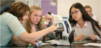
I’m currently at home in Broomfield, Colorado (a suburb of Denver and Boulder). It’s a typical, hot and dry summer day at 27 degrees C (81 degrees F) at 10:30am. I’m about 1,400 miles away from Pascagoula, Mississippi, where I will be joining the team on our ship, The Oregon II, in just a few days!
Once on board, I will be assisting with the third and final leg of the SEAMAP Summer Groundfish Survey.
SEAMAP stands for the Southeast Area Monitoring and Assessment Program. Since this program began in 1981, scientists from NOAA and other organizations have been collecting data about the number, types, and health of fish and other marine organisms, as well as the characteristics of the water in of their ocean homes throughout the Gulf of Mexico, Caribbean and parts of the Atlantic Ocean. This information helps us not only to understand how these ecosystems are changing over time, but also to make informed decisions about how we humans are using valuable ocean resources.
As you can imagine, the ocean is a large and complex environment, so collecting all of that information is a big task! To make it more manageable, SEAMAP is broken down into many smaller projects, each of which focuses on specific regions or aspects of the area. The GroundfishSurvey focuses on monitoring fish and other organisms that live near the ocean floor. (This includes some species that we humans catch and eat, like shrimp, halibut, cod, and flounder.)
The Oregon II is equipped with a variety of scientific and fishing equipment. Because our mission is focused on groundfish, I expect that we will be using a lot of the Oregon II’s fishing gear, especially its trawls. A trawl is a type of weighted net that can be pulled along the floor of the ocean. (Check out this video of how a bottom trawl works.)
After we bring our catch aboard, I imagine that most of my time will be spent helping to identify, describe, count, and catalogue all of the fish and other marine species that we encounter. I can’t wait to get on board, see some new species, and learn more about the methods we will use to collect all of this data in a scientifically rigorous way.
I will be the third Teacher at Sea to work on the SEAMAP Summer Goundfish Survey this year, so I have been lucky to learn a lot from the two teachers who have already been to sea. Check out their blogs to see how the project is going so far:
Chris Murdock from Iowa City, Iowa was on the first leg (June 7 to 20, 2017).
Melissa Barker from Lafayette, Colorado was on the second leg (June 22 to July 6, 2017).
I am honored to have been accepted into the Teacher at Sea program. It was my love of learning that led me to a career in teaching in the first place, so I really appreciate the opportunity immerse myself in a new scientific adventure, and I can’t wait to share the experience with my 9th grade biology students when I get home. I hope that they will be as inspired as I am by the real work that scientists do. There is so much still to learn about the world around us, especially in new frontiers like our oceans – the skills and concepts we learn in class are only the beginning!
Like most of my students, I have always lived in landlocked states. I’ve visited a few beaches, collected some shells, and splashed in the waves, but have very little experience with the ocean beyond that. I’ve definitely never been on a ship like the Oregon II before, so I’m curious to see what challenges await aboard. I think the most difficult part will be adjusting to the sounds, smells and motion of a fisheries ship. I’m expecting tight quarters, loud engines and fishing equipment, stinky fish, and probably some seasickness. We’ll see if that turns out to be true…
Back home in Colorado, I enjoy hiking, biking, gardening, cooking and exploring the amazing outdoors with my wonderful husband, Mike, and our hilarious two-year old daughter, Evie.
My family out for a hike in the beautiful Colorado mountainsMe, My husband, Mike, and our daughter, Evie
Did You Know?
The SEAMAP program has been going on for over 35 years and makes all of the data it collects freely available to other scientists, government agencies, the fishing industry, and the general public.
The Teacher at Sea program was established in 1990 and has sent over 700 teachers to sea!
Questions to Consider:
Research: How has all of the data collected over the years through SEAMAP been used?
Reflect: What might have happened if this data was not available?
Predict: What types of things do you think we will do while on the Oregon II to make sure that our data is collected in a “scientifically rigorous” way?
NOAA Teacher at Sea Carol Schnaiter Aboard NOAA Ship Oregon II June 6 – June 21, 2014
In just a little over two weeks, I will be leaving the green, flat fields of the Midwest to board the NOAA ship Oregon II and sail out of Pascagoula, MS! This is a wonderful opportunity to work with a scientific research team to learn what lives below the water and to bring this back to my students. I am honored to have been selected as part of the 2014 NOAA Teacher At Sea class and look forward to this exciting adventure. While on the ship we will be doing a summer groundfish survey. I am really looking forward to finding out more about this groundfish survey. We have been learning about the food web, so my students will be interested in learning about this too!
Learning about invasive species of the Great Lakes
Presently I am finishing my thirty-fourth year of teaching, with the past fourteen years being the kindergarten through fourth grade science teacher at Amboy Central School in Amboy, IL. Amboy is a beautiful, rural town of about 2400 people in Northern Illinois and no matter what direction you leave Amboy, you will see farms and fields. I have lived in Amboy for the past thirty-four years with my husband, Jeff. We have two daughters; Amanda who is married to Jeremy and they live in MA and Jessica who will be leaving for OK in the fall, and our faithful dog, Ginger. The Midwest has been my home for my entire life and after this long, cold winter we just survived, I am looking forward to being in the Gulf for two weeks.
Working together to clean up at the Amboy Marsh!
Being the elementary science teacher is a very rewarding, dream job and I am grateful that the school board and administration continue to support this program. I am able to see every student in our school, plus having a science room full of experiments, live animals, and technology is great. There is never a dull moment in our room as we are always finding new ideas to learn about. Right now the third and fourth grade students are just finishing their units on invasive species, so I will be keeping my eyes out for anything that should not be in the Gulf! I am also a NOAA Climate Steward and I am hoping to learn how the changing climate is affecting the Gulf and to add this information to our unit in fourth grade.
Family at daughter Amanda’s wedding
I enjoy traveling to visit family and friends and learning about new things-you can never know too much! I will post to this blog while at sea, so please be sure to check back after June 7th!
NOAA Teacher at Sea John Clark Aboard NOAA Ship Henry B. Bigelow September 23 – October 4, 2013
Mission: Autumn Bottom Trawl Survey Geographical Area of Cruise: North Atlantic Date: September 18, 2013
Introduction
Thank you for reading about my adventures at sea. My name is John Clark and I’m entering my 7th year teaching science at Deltona High School in Deltona, Florida. Our community is just off I-4 between Orlando and Daytona Beach. Teaching is my second career, after working in the telecommunications field, and I love getting students excited about science. I’ve even earned a few awards for being successful at it. I’m married to the love of my life, Jill, who is also a teacher. In our lives are three grown children and seven grandchildren. With great blessings, I share that they are all healthy, happy, and live close enough for us to see them regularly. At home we have replaced the kids with two cats and a dog.
My wife Jill with grandson RionJills husband – me, John ClarkSabi dog in the pool with granddaughter Morgan
In a few days, anticipation will be replaced by action as I board a plane headed for my NOAA Teacher at Sea experience I’ve waited for all summer to begin. I’ll be sailing aboard NOAA Ship Henry B. Bigelow, a ship specially built for NOAA to carry out the type of fisheries research I’ll be taking part in. I’ll be working side by side with experienced scientists who not only are knowledgeable in how to do the research conducted on board but also have the skill to share their knowledge with volunteers like me who have limited background in the science behind the work. It is the experience of a lifetime that I hope will energize my students about studying science as we carry out lesson plans developed from the experience and I share with them the stories of my time at sea. I’m sure a giant boat-eating squid will be in there somewhere.
NOAA Ship Henry B. Bigelow
Officially, I’m taking part in 2013 Autumn Bottom Trawl Survey conducted by the Ecosystems Survey Branch of the NOAA Fisheries Service. That’s a long fancy way of saying that the ship is going to drag a net for a short period of time near the bottom of the ocean and then collect data on the types of fish we catch as well as the environment they live in. Affectionately called a “critter cruise”, I now join a long line of Teacher at Sea alumni who have taken part in the biannual surveys of North Atlantic marine life. And there are a lot of critters to learn to identify as I’m finding out from watching the CD I was sent to be better prepared to support the research team. There are two types of Dogfish which look suspiciously like little sharks, flounders that are left eyed or right eyed depending on which side they decided to leave up, and squid distinguished by the length of a pair of fins down the side of the body. All you do is hold them upright, tentacles hanging toward the ground, and take a look. And don’t forget the large lump fish which is described as have the texture of a dog’s chew toy. Whatever the species, the role of the research volunteer is to sort them out and then collect data for the scientists to study.
Scientists sorting a catch aboard the Bigelow
What can be overlooked in the preparation is the part about how to handle fish. I do not like to touch fish so I will be facing my fears even while wearing gloves. And I really don’t like it when they flop around. I envision I’ll be the one with the hand in the wrong place when the shark twists around to see who is holding its tail or, at a minimum, squeeze too hard on the species that will poke you with a poison spine if you upset them. Other good advice I’ve learned from the CD is that there is a 100% recovery from seasickness and if the seas get rough, wedge yourself into your bunk with your life vest so you don’t roll around and fall out. My two year old granddaughter, Ireland, was watching the video with me while I studied and all she could say was “Oh my.”
NOAA Teacher at Sea Chris Peters Onboard NOAA Ship Oregon II July 10 – 19, 2013
Weather and Location: Time: 21:24 Greenwich Mean Time (5:24 p.m. in Rockville, MD)
Latitude: 29.1970
Longitude: -85.9904
Speed (knots): 3.00
Water temperature: 28.10 degrees Celsius
Salinity (PSU = Practical Salinity Units): 34.07
Air temperature: 29.00 degrees Celsius
Relative Humidity: 68%
Wind Speed (knots): 17.15
Barometric Pressure (mb): 1018.96
Depth (m) = 187.2
As you can see if you have been following the Ship Tracker website, we have been making our way back towards Pascagoula. We still have some stations to work, and won’t be reaching the dock until Friday morning, but we will continue to head in that direction. The weather has gotten a bit windier, with much larger swells over the last couple of days. This has made collecting the plankton even more interesting. With the wind frequently above twenty knots, handling the equipment becomes much more dangerous. Some procedures need to be changed a bit for the sake of safety. Luckily, the deck crew, Tim, James, and Chuck, are on top of things. They are pretty funny to work with, too!
Our deck crew – James, Tim (chief boatswain), and Chuck
Science and Technology Log
Water Titrations to Check Cissolved Oxygen Levels
The plankton stations have continued, with the biggest changes being how much sargassum (seaweed) we have needed to rinse out and go through, and the different kinds of tiny animal life we have observed. I mentioned in an earlier blog that the scientists must periodically do water titrations to verify that the readings taken from the CTD are correct and nothing is malfunctioning. I had an opportunity to perform some real chemistry as Kim Johnson, the chief scientist, walked me through the water titration steps.
First we had to collect the water samples from the CTD. Remember, we are testing the oxygen levels, so it is important to collect the water samples without allowing bubbles to form, which might add oxygen to the sample. You would be surprised at how hard this is! A flexible tube is attached to one of the three Niskin Bottles on the CTD tank, and before any water is put into the jars, all of the air bubbles in the tube must be squeezed out. This is an art! Then the water can be transferred to the jars through the tube, holding the end of the tube against the side of the beaker to avoid making bubbles. The stoppers are then gently put into the glass jars, again to avoid the addition of oxygen to the samples. It is important to keep the water samples from getting too hot if you are not going to do the titrations right away. Can you think of why heat might create a problem when doing a titration? Also, we test three samples. Why do you think testing three beakers is important?
Now we are ready to start the mad chemist part! The chemicals used, and their amounts, are very specific, and the directions are posted in the lab so that you can always check your memory. First, two milliliters of manganous sulfate is added to each sample. The stopper is replaced after adding each substance, and the jars are turned upside down and back several times to mix the solution. The second substance added is two milliliters of azide-iodide solution. After the solution is gently mixed, the jars need to stand for ten to twenty minutes. When you come back after twenty minutes, you will see that there is a cloudy substance in each jar. This first part of the process causes the chemical bond between the hydrogen and the oxygen to break, and the oxygen forms new bonds with the added chemicals.
Using the pipettes to add the chemicals to the waterA cloudy substance forms after the manganous sulfate and azide-iodide are added and mixed.
At this point, the oxygen is fixed and we don’t need to worry about introducing more oxygen to the samples. Next, we added two milliliters of sulfuric acid to each jar. This must be done very carefully because sulfuric acid is very harmful. However, once it is added, the sulfuric acid is neutralized and the solution in the sample jars is not harmful. (Remember the acid/neutral/base tests we did in class with lemon juice, vinegar, and Alka Seltzer, using a pH scale?)
The sulfuric acid changes the color, and after mixing, causes the cloudiness to disappear.
Now we have a yellowish liquid and I will be adding phenylarsine oxide, drop by drop. This is the titration part. When the color turns clear, we can look at how much phenylarsine oxide was needed and that will tell us how much dissolved oxygen was present in the sample. This new chemical will bond with the oxygen molecules and cause a color change. However, because the change from yellow is hard to see, I added one milliliter of a starch solution for the only purpose of turning the sample blue. This way the color change back to clear is easier to see.
Notice the color change after the starch is added (the blue beaker).
The sample is poured into a wide-mouthed beaker and a magnetic stirrer is added to the beaker. This is a small, magnetic bar that spins when it is on the metal stand. Drops of the phenylarsine oxide are allowed to slowly drip from a burette into the sample. A burette is a very tall, thin, glass pipe-like container that allows easy adjustment of the flow of liquid, and allows for easy reading of very small amounts.
The burette is allowing the phenylarsine oxide to mix with the water solution, one drop at a time.
Once the sample starts to lose its color, you know you are close. One or two more drops and you will shut the valve on the burette and read the amount that was mixed into the sample.
Notice the color change towards the end of the titration.Once the color change is complete, the titration is finished, and the burette is read for the dissolved oxygen content.
My samples showed dissolved oxygen amounts of 6.4, 6.5, and 6.5 milligrams per liter. The CTD showed dissolved oxygen of 6.4 mg/l. Since our results were very close, we are confident that the CTD is working well.
Remember, levels below 2% are considered hypoxic. 6.4% is a very healthy dissolved oxygen reading. This is what we expect as we move further from developed land, but it is still reassuring to see the healthy levels.
Later I tried another titration without supervision and found consistent readings of 4.9 mg/ mg/l oxygen. However the CTD reading was 4.35 mg/l. I guess I need more practice!
Buoy Rescue Mission
Yesterday we had the opportunity to participate in a buoy rescue mission. Another organization had deployed a wave buoy, or a wave runner, in the middle of the Gulf of Mexico that had been damaged, and was no longer able to give correct readings on things like current and wave height. We were in the area, and agreed to retrieve the buoy. As we got closer to the GPS signal, we spotted a large orange ball with an eight foot (about) antenna sticking out of it. Oregon II’s small motor boat was launched and we set about collecting the buoy.
As we reached it, the deck crew and the CO noticed some things about the buoy that were inconsistent with the description.
Wrong buoy!
After making a telephone call, the CO told the crew to come back to the ship. We had come across the wrong buoy! Off we went in search of the correct one, which we found about half a mile away. This one looked more like a surfboard and was fairly easy to get aboard the ship, using the crane. That mission was accomplished, but we all marveled at the odds of finding two wave buoys within half a mile of each other in the middle of the Gulf of Mexico!
Using the crane to lift the wave runner onto the deck.Chuck Godwin and LTJG Matthew Griffin, who helped rescue the wave runnerThe part of the wave runner that looks like a surfboard sits on top of the water and has solar panels. It is attached to the slatted part that acts as a glider, and uses wave energy as it rises and falls to propel the board through the water.
Personal Log
A Week at Sea
While I am still enjoying the cruise and the work, I have had a few days of queasiness. Taking the seasick medicine helps a lot, so I am sticking with that for a few days. Nights have been fine, and the rocking of the ship really is like being rocked in a cradle. I hope I’ll be able to sleep when I am in a stationary bed back home!
Being on a cruise on a small ship brings me back to my days of living in a college dormitory. You are living in very close quarters, eating every meal together, spending large amounts of time together, and really getting to know the people who are on your watch. I have had a great group to work with – people with a lot of knowledge, and great senses of humor! Victoria, a college intern, has been a newbie with me. We have learned a lot from the other scientists, Andre and Joey, on our watch, as well as from our chief scientist, Kimberley Johnson. Tim, James, and Chuck are the deckhands on our watch, and they do most of the heavy work, like lifting the equipment and running the J frame, winches and cranes. Sometimes we are working with the equipment for forty-five minutes at a time. The deckhands, while very serious about safety, keep us laughing the entire time. As I am finishing this entry, we are heading towards home. It will be nice to be on land again, but I will also miss the many different personalities I was lucky enough to get to know.
Did You Know?
The Gulf of Mexico covers an area that is about 615,000 square miles.
An area named “Sigsbee Deep” is located in the southwestern part of the Gulf. It is more than 300 miles long and more than 14,383 feet deep at its deepest point. It is often referred to as the “Grand Canyon under the sea”.
The Gulf’s coastal wetlands cover over five million acres, which is an area equal to about one-half of the area of the U.S. It is the home to twenty-four endangered and threatened species and critical habitats.
It is estimated that 50% of the Gulf’s inland and coastal wetlands have been lost and that up to 80% of the Gulf’s sea grasses have been lost in some areas. The continual loss of wetlands (about a football field a year) around the Mississippi Delta, a large land area near where the Mississippi River flows into the Gulf of Mexico, changes how hurricanes impact the coast of the Gulf. With fewer wetlands to absorb the impact of the hurricane, the hurricanes hit the populated areas with much greater force.
NOAA Teacher at Sea Sarah Boehm Aboard NOAA Ship Oregon II June 23 – July 7, 2013
Mission: Summer Groundfish Survey Geographic area of cruise: Gulf of Mexico Date: June 30, 2013
Weather at 20:40 Air temperature: 29.8 °C (85.64° F)
Barometer: 1007 mb
Humidity: 65 %
Wind direction: 221 °
Wind speed: 8.4 knots
Water temp: 29.2° C
Latitude: 29.05° N
Longitud: 88.69 ° W
Science and Technology Log
I have been on board for a week now and have learned a lot about the fish of the Gulf of Mexico. We have collected data on over 300 different species at 129 trawl stations So what happens with all this data?
Our work out here is part of SEAMAP – South East Area Monitoring and Assessment Program – a joint venture between NOAA and the states to better understand the populations of fish and invertebrates along the coast of the Gulf and Atlantic. The information we are collecting on Oregon II is combined with the data from other ships that do surveys in closer to land. The groundfish surveys began in the 1950s and happen each summer and fall. All this data tells a story of each species – how many individuals there are, how big they are, and where they prefer to live. This information can then be used to better manage the fishing industry so that marine populations stay strong.
We gather data about every species we pull up in our nets, but we pay special attention to the ones that are fished commercially like shrimp and red snapper. There are several shrimp species out here, but one we see a lot of is the brown shrimp.
Brown Shrimp
The brown shrimp are found from Massachusetts to the Gulf. They live for about 1 ½ years and can be up to 7 inches long. Their lives start as eggs deep in the waters of the Gulf and Atlantic. After they hatch, tiny baby shrimp float in to the shallow water of estuaries (coastal areas where fresh river water mixes with sea water). They grow larger in the protected waters of the estuaries and eventually migrate out into deeper, saltier water. They live on the bottom of the sea, moving out farther into deeper water as they grow larger. You can learn more about brown shrimp on NOAA’s Fish Watch website.
For most species we haul in we record length on up to 20 individuals, and weight and sex for only every 5th individual. But for brown shrimp we measure the length, weight and sex of up to 200 individuals. Sometimes we pull up a lot of shrimp like the 419 brown shrimp in just one trawl last night. To tell male from female you flip the shrimp over and check the spot in between its walking legs (in front) and swimming legs (in back). A female has a wider plate. A male has extra fuzzy bits on the inside of the front swimming legs.
The shrimp on the left is a female and the one on the right is male.
Shrimp fishing is a big industry here in the Gulf. Last year 221 million pounds of shrimp were taken by fishing boats from the states along the Gulf. Commercial fishing boats use similar nets to ours, but they are larger and trawl underwater for much longer. Just like we pull up many fish in addition to shrimp, shrimping boats have a large bycatch. Part of our research is to monitor the bycatch species to help make management decisions that protect them, too. NOAA works with the fishing industry to develop nets with Bycatch Reduction Devices that allow unwanted fish to escape.
A fishing boat trawling for shrimp
Let me answer a few more student questions. Jared, we don’t wear lab coats; we mostly wear old t-shirts and shorts that definitely get wet, muddy and slimy working with the fish. A lab coat would help keep me clean, but it is hot and humid in our lab and the extra layer would be uncomfortable. Sabrina, we have found some plastic and other trash in the water, but have not seen any animals tangled in it. Deliana, we do all our work from the ship, so we don’t swim underwater with the fish. When they do surveys of reef fish earlier in the year they send a video camera underwater to learn more about the fish, but the scientists still stay on board.
Clockwise from top: Rough Scad, Silver Jenny, Dusky Anchovy, Long Spine PorgyShoal Flounder on the left and Big Eye Sea Robin on the right
Julissa asked about colors of our fish. Most of our fish come in two colors – silver or brown. We catch fish that live on the bottom of the sea or swim near the bottom and these colors help them camouflage with the sand and mud. But there are some that have splashes of color.
Dwarf GoatfishLesser Blue Crab
Personal Log
Several students had questions about food on board, so let me reassure you I am eating well.
Stewards Walter and Lydell
The two stewards on board, Walter and Lydell, are responsible for feeding 30 people on board. The food is good, plentiful and there are several options at each meal. One challenge is that people on board are working different schedules and can’t always make meal times. If you ask ahead of time, they will save you a plate of food for later. There are also snacks and sandwich fixings available all the time. To give you an idea of what I am eating, yesterday I had a freshly baked muffin and juice for breakfast, a chicken fajita and Mexican veggies for lunch, fried rice, stir fry and a salad for dinner, and then some ice cream with fruit for a late night snack.
How much food does it take to feed 30 people for 2 weeks? Walter gave me a few numbers for this trip: 80 pounds of chicken, 35 dozen eggs, 100 pounds of potatoes, 12 gallons of ice cream, and a whole lot of coffee. Jennixa wondered what would happen if we ran out of food – the answer is that we would head back to land and buy more. But I’m pretty sure Walter has enough on board. Damian asked if we eat what we catch – and yes, some of the shrimp and red snapper have gone to the galley after being measured. They were delicious.
CDCPS science students – How are the colors of fish an adaptation to survival?