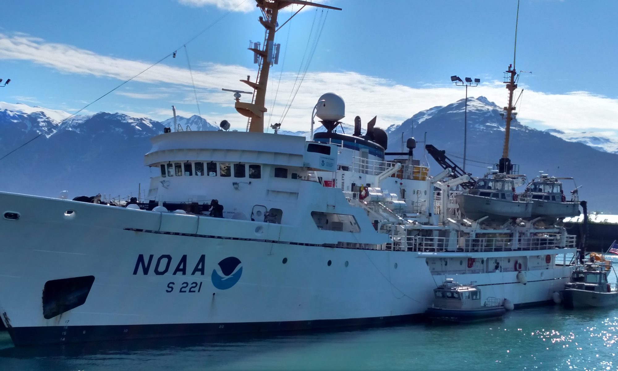
Cary Atwood, July 26, 2005

NOAA Teacher at Sea
Cary Atwood
Onboard NOAA Ship Albatross IV
July 25 – August 5, 2005

Mission: Sea scallop survey
Geographical Area: New England
Date: July 26, 2005

Weather from the Bridge
Visibility: Clear
Wind direction: NNW (230)
Wind speed: 15 knots
Sea wave height: unknown
Swell wave height: unknown
Seawater temperature: 11.4° C
Sea level pressure: 1012 millibars
Cloud cover: Dense Fog

Question of the Day 

What do scallops need in order to survive within their habitat?

Yesterday’s Answer 

The scientific name of the Atlantic Sea Scallop is Lacopectin magellanicus.  Lacopectin means “smooth scallop.

Science and Technology Log 

The real work of the ALBATROSS IV mission is accomplished during the four six-hour shifts with a crew of six workers each.  On my watch, they are Sean, watch chief, Bill, Avis, Dvora, Noelle and myself. Working as a team, we accomplish great things in each tow, which takes about 30 minutes to process.  Here’s how it unfolds.  The eight-foot dredge basket is specially designed to capture all sizes and ages of scallops for research.  It is dredged from a depth up to 100 meters to the surface for a fifteen-minute time period.

After each tow comes out of the water, fishermen release it from the cable and it’s deposited on the fantail, also known as the back deck of the ship.  The fantail is a huge open area complete with a non-skid surface–very important when the boat is on an intense rock and roll session. With our “Helly’s” on (the yellow and orange storm gear you see in the pictures) and tall rubber boots, I take a picture of the mound, along with Bill, who holds up a whiteboard indicating the catch number, the tow and the strata (level) where we do the dredging. Once that is done, orange baskets, white buckets and kneepads are hauled to it. On our hands and knees we look for what might seem like buried treasure; sifting through the debris of the sea.  We toss scallops and many varieties of fish, into the baskets until we have combed through every inch of them.  Once the sort is done, we all move into the covered lab area for a variety of assessments, including the weight and length measurements of each scallop, as well as any ground fish that are caught.  Even though some of the work is manual, computers play a very important role in accurate capture of the data. One instrument we use is a long, flatbed magnetically charged scanner. Once we put a scallop shell on the bed and hold a magnetized wand against it, it reads out the measurement onto a touch computer screen.  Computers such as this one have relieved some of the tedium of the work, making it more accurate and faster.  The same is done with fish, and depending upon the tow, we will keep crabs and starfish out.

All of this data is uploaded into the FSCS – Fisheries Scientific Computer System which compiles the data from the survey.  This valuable data is used to assess populations and biomass for the scallop fishery and then make management decisions for present and future fishery use. The watch crews and scientists love it because it has saved so much time, and compilation of the data is considerably easier and less time consuming in the long run.

Personal Log 

Sleep of any length of time is longed for, but never received.  Due to our 6 hour on, 6 hour off shifts, at best we can manage 5 hours.  Today I am feeling very zombie like as my body adjusts to this schedule. I rarely see John, my other TAS compadre since he works opposing shifts from mine.  When we do meet, we share notes and commiserate about the work and our need for sleep!

One of my favorite haunts on board in my free time is the bridge and the upper bow.  It is a quiet, calm place with great views–and a really strong pair of binoculars and field guides. The ever shifting texture of the water always captures my attention when I am outside; from the glossy velvet of early mornings, thick fog during the day, complete with fog rainbows!-and the ethereal brightness of sunset through the fog.

Another constant is the “ocean motion”.  We are in a constant state of rocking–at times delicate and other times, the swells are deep and we will roll with them.  I am very glad I have an ear patch to mitigate the possibility of seasickness….now I can just enjoy the ride!

Cary Atwood, July 25, 2005

NOAA Teacher at Sea
Cary Atwood
Onboard NOAA Ship Albatross IV
July 25 – August 5, 2005

Mission: Sea scallop survey
Geographical Area: New England
Date: July 25, 2005

Weather from the Bridge
Visibility: Clear
Wind direction: NNW (230)
Wind speed: 15 knots
Sea wave height: unknown
Swell wave height: unknown
Seawater temperature: 11.4° C
Sea level pressure: 1012 millibars
Cloud cover: Dense Fog

Question of the Day 

What is the scientific name of the Atlantic sea scallop, and what does the Latin name mean?

This question will be answered in tomorrow’s log.

Science and Technology Log 

Day one: the adventure begins! I arrived last night from Boston into Wood’s Hole–what a cool respite from the heat of western Colorado! A short walk later, I was in front of the ALBATROSS IV, the ship that would be my home for the next 11 days.  Tony, the lead fisherman, welcomed me aboard and showed me to my stateroom.  Soon after, Kris, the watch chief for our other work shift, and Noelle, who is working on her master’s thesis showed up. I took the remaining top bunk and moved my gear in.  Our room has two portholes. The most exciting porthole is the one in the shower stall; my eyes are almost dead even with the water line outside….it almost feels like I live in an aquarium!

The mission of the ship on this cruise is the sampling of Atlantic sea scallops.  Why are scallops being sampled?  The scientific work revolves around the close monitoring of scallop populations up and down the New England coastline from Cape Hatteras in the south, to the outer extremes of Georges Bank to the north.

Over the past 30 years, unregulated commercial fishing of scallops has had a huge negative impact on scallop populations.  Because this area holds the largest wild scallop fishery in the world, it has great economic importance not only to the fishermen who dredge to make their living, but also to the economies up and down the coastline.  Historically, commercial fishing could be done by anyone who had a seaworthy vessel and the ability to dredge. Prior to the early 1970’s not much data had been gathered about numbers and locations of scallops, hence the need for surveys to acquire data and impose limits to prevent total decimation of this species.  In my next entry I will explain more about the nitty gritty work that must be accomplished each day by watch crews.

Personal Log 

Old ship sits in port
hiding new technology beneath its decks
Salt spray and seagull call
Grey clapboard houses rest close to water’s edge
As whitecaps signal a change in weather
We are on our way!

Until next time,
Ms. Atwood

Mike Lynch, June 30, 2005

NOAA Teacher at Sea
Mike Lynch
Onboard NOAA Ship Delaware II
June 20 – July 1, 2005

Mission: Clam and Quahog Survey
Geographical Area: New England
Date: June 30, 2005

Weather Data

Latitude: 3726.163N
Longitude: 07444.980W
Wave Height: 1 foot
Swell Height: 1
Foot Weather: clear
Visibility: unlimited
Wind Speed: 7 mph

lynch_log10Scientific Log

The last couple of days aboard the DELAWARE II have been a constant buzz of activity. We have moved north to the New Jersey Coast. This is prime surfclam territory, and sure enough we are into them. Our chief scientist Victor Nordahl has selected this site for a depletion survey. A depletion survey is an event that starts with finding an area of heavy population density. For our purposes and equipment, this was an area that yielded five bushels of clams in a single tow. Once the location is found, the exact GPS coordinates of longitude and latitude are used as a locator for each successive tow. Using the information recorded by the Ship’s Sensor Package (SSP), the exact trackline of the tow is ascertained and becomes the template for the depletion event. The concept of the depletion is to repeatedly cover the same track line for as many as 40 to 60 tows. With each tow, clams are counted and on every fifth tow, they are measured and samples are taken. The purpose of this event is to monitor how quickly the dredge reduces the population. Through this process, the scientists can calculate the effectiveness of the equipment in capturing the species. In essence we are calibrating the equipment. In fact, we are running non-stop stations in one of the muddiest areas we have seen. It is an exhausting process that goes on 24 hours a day and works the bridge, deck crew and science teams very hard. I have developed a real respect for how strenuously this crew works. Everyone pitches in, and works as a team.

The depletion event is rapidly coming to an end. It will be followed by our last duty at sea. Our next mission will take us off the coast of Massachusetts, where we capture clams and take samples to determine the levels of Red Tide infection. Closure of fisheries for red tide, is usually a job for state agencies, but it is also an opportunity for NOAA to do further scientific research. While steaming to our destination, we are working on swapping out the SSP package on the dredge. The second unit will be used on these final tows to ensure its reliability for future surveys. On our next watch, the DELAWARE II will be concluding the third and final leg of the Clam Survey. The ship will steam to its homeport of Woods Hole, Massachusetts. The ship will be in port for four days. During this time, much of the equipment that is used in the clam survey will be disassembled and moved into storage for three years, when the next clam survey will be once again conducted by the Northeast Fisheries Science Center.

lynch_log10aThe three and a half ton dredge and the Crane carriage will be stored, but other technological devices will be used in an DELAWARE II, however seems to never be at rest. In three days, the ship is scheduled to leave on a Marine Mammal Observation Cruise for the next two months. This survey will be conducted in order to measure and monitor marine mammals in the Georges Bank, Southern New England, Long Island, New Jersey and Delmarva Regions. An Autumn Trawl Survey will follow this. The trawl survey is a multi species finfish survey that collects biological data, such as maturity stages, food habits, predator/prey relationships and migratory patterns. This same Trawl survey will also be conducted in the spring. The regions to be surveyed will be the Mid-Atlantic (inshore and offshore), the Georges Bank and the Gulf on Maine. This winter, the DELAWARE II will be conducting a Winter Trawl Survey that uses a modified net system that targets flatfish such as summer fluke and yellowtail flounder. The Winter Trawl Survey will focus on the Mid-Atlantic, Southern New England and the Georges Bank regions. The DELAWARE II will also participate in a Fishing Power Survey that are a series of experiments designed to yield a correction factor for changes in either survey equipment or vessels. This year the DELAWARE II will be conducting these tests with the HENRY BIGELOW, a new vessel being built in Mississippi, and scheduled to replace the DE II’s sister ship, the ALBATROSS IV.

To find out where the DELAWARE II is, at any given time, NOAA provides a web site that includes a track line of all of its research vessels. Wherever these vessels are you can be assured that they are working diligently to accomplish the goals of the Northeast Fisheries Research Center. The goals start with research and monitoring fish stocks and their environments. The surveys endeavor to provide data that will assist in understanding and predicting changes in marine ecosystems, living marine resources, fisheries, habitats, ecosystem condition, and the generation of national benefits. The outcome of this research is the production and dissemination of scientific advice for management programs based on an ecosystem framework, and finally, you can be assured that NOAA will be endeavoring to engage stakeholders in the process of decision-making. NOAA is a team builder in stewardship. You can also be assured that NOAA will be involving educators in order to provide outreach to students and society at large.

lynch_log10bIn closing, I need to extend my thanks and appreciation for the opportunities that were afforded me aboard the DELAWARE II. True to NOAA’s goals of education and outreach, the crew extended tremendous courtesy and patience while indoctrinating me into the area of marine science, research and life at sea. Without exception, all of the crew were helpful and willing to share their expertise and time. I must extend particular thanks to Charles Keith, Kris Ohleth, Richard Raynes, Erin Kapcha and Jeff Taylor. Each of these crewmembers extended themselves way beyond the call of duty in helping me to understand the shipboard policies, routines and the goals and objectives of our research. Also a special thanks to Cindy Travers, a Coast Guard Cadet who taught me a great deal about seamanship and positive attitude.  Each of these people embodies a dedicated spirit that goes well beyond the parameters of their specific duties. Special thanks also goes to Dennis Carey, the Chief Steward who is the most important, and hardest working person on the vessel. I also wish to extend my thanks to all aboard the DELAWARE II, the crew believes in their mission and are sacrificing personal gain for public service. In short, they are an inspiration.

Life at sea is arduous. It is hard work, long hours, inclement conditions and deprivation of creature comforts. Life at sea is also a community, a brotherhood and a commitment. To NOAA, and the crew of the DELAWARE II, thank you, I learned a great deal and am deeply grateful.

Mike Lynch, June 27, 2005

NOAA Teacher at Sea
Mike Lynch
Onboard NOAA Ship Delaware II
June 20 – July 1, 2005

Beautiful sunset
Beautiful sunset

Mission: Clam and Quahog Survey
Geographical Area: New England
Date: June 27, 2005

Weather Data

Latitude: 3938.834N
Longitude07316.810W
Wave Height: 1 foot
Swell Height: 3 Foot
Weather: cloudy
Visibility: obscured
Wind Speed: 14 mph

Science and Technology Log

Today’s log will continue the exploration of the DELAWARE II, her crew, and the concept of an ocean going vessel as a self-reliant community. This log, like the last on this theme, is inspired by a sudden revelation; Clams can be stinky. Actually, clams themselves probably aren’t all that stinky, but constant application to clothing over a prolonged period of time at accelerated temperature certainly produce stink. Having come to this hypothesis, I concluded that the solution was laundry. (Pretty scientific, huh?)

Using the hose
Using the hose

Laundry on board the DELAWARE II, in itself, doesn’t pose a large problem. You wait until about 2 AM, go down past the galley and into the Ship’s Store, and you find two sets of washers and driers. Simple, there is really nothing to it, until you begin to investigate the processes that are involved in providing laundry service. Where does all the fresh water come from? How does the onboard electrical system work? Where does the wastewater and soap go? To find answers to these questions I interviewed Lieutenant Jeff Taylor, who is scheduled to become the X.O. (Executive Officer) off the DELAWARE II.

The first question dealt with fresh water. “Water, water everywhere, but not a drop to drink”. I’m not exactly sure who said that, but it pretty much explains where we are. We have not seen land in over a week, so where is all this fresh water coming from? Lieutenant Taylor explained the process. Fresh water is used onboard for drinking, washing, cooking, and of course, laundry. Initially the answer is simple, 5,000 gallons of water is taken onboard when dockside. This water is supplied to different areas of the ship using an electrical pumping system; the electricity is supplied by generators that are powered by diesel… simple! But what happens when we start to deplete the water? The answer to this is an onboard water purification process that uses an evaporation system to create fresh water. Jeff explained that sea water was taken onboard through what are called sea chests. The seawater is then run through coils that are heated to boiling by the diesel power plant that powers the ship. The resulting steam produces fresh water and the remaining salt solution is returned to whence it came. Simple, we have just distilled fresh water from salt. The newly created water is now pumped into the holding tanks to replenish the water source. The potable water tank is subjected to a bromine treatment, and we are good to do laundry. The creation of fresh water in this manner really is a big deal. It in essence removes one of the three elements that limit the time a ship may stay out at sea: water, food, and fuel. Fresh water is in constant supply to the thirty-man crew of the ship. Fresh water is pumped to each of the staterooms, two common bathrooms, the galley, the ship’s store, the emergency showers, and the wet deck in the science area. The nine fire stations and the onboard hydrants on each of the decks use seawater.

Part of the waste disposal system

The second question deals with power generation. Power generation onboard the DELAWARE II is supplied by two “Ship’s Service Generators”. These are diesel powered 375 amp generators. On this survey, one of the generators is used to power the ship’s electrical needs and the other is dedicated to the Clam Survey equipment, primarily the winches and the 440 service to the underwater pump. Usually only one generator is used at a time, and runs for 250 hours between oil changes. There is also an emergency generator onboard that supplies a 70-amp service. The generators, as well as the ship’s two powerful engines, are diesel powered. The ship’s diesel capacity is approximately 40,000 gallons, enough for 19 days at full operation, 24 hours a day. The last component of the laundry equation is the matter of wastewater. There are two distinct wastewater systems onboard the DELAWARE II. These are “grey water” and “black water” systems. Grey water comes from sinks, showers, and laundry. Disposal of grey water is a simple enough process, it can be pumped overboard. The Environmental Protection Agency and the United States Coast Guard, however, strictly regulate black water, or human waste disposal. No black water may be disposed of within three miles of the United States’ coastline. Beyond three miles, processed waste may be disposed of, and beyond the twelve-mile mark; untreated human waste may be pumped overboard.

Aboard the DELAWARE II, a Marine Sanitation Device (MSD) treats all black water. The sewage treatment is essentially a large holding tank, with a macerator. Biologicals are added (yeast), and the black water is treated and released. There are also regulations and protocols for the disposal of garbage at sea. A wet and dry garbage log is kept on the bridge. If the galley wants to dispose of left over food, they must request permission; specify the amount, the type, the time and the day on the report. These items would fall into the category of wet garbage. For things like cardboard and paper, a similar log with similar notations is kept. For dry garbage, it must be reduced to pieces 1” or smaller if released between 3 to 12 miles of the coast. Oil and plastics can never be dumped at any location. The wet and dry garbage logs are routinely checked and cross-referenced to the materials that were taken aboard. The DELAWARE II does not dump much, if any, dry garbage, but instead uses a compactor, bags and wire gages to store the garbage for shore disposal. Well, my laundry is done, and what seems like an everyday mundane task turns out to be a wonder of applied science. Things smell better now.

Mike Lynch, June 26, 2005

NOAA Teacher at Sea
Mike Lynch
Onboard NOAA Ship Delaware II
June 20 – July 1, 2005

lynch_log7Mission: Clam and Quahog Survey
Geographical Area: New England
Date: June 26, 2005

Weather Data

Latitude: 3726.163N
Longitude: 07444.980W
Wave Height: 1 foot
Swell Height: 1
Foot Weather: clear
Visibility: unlimited
Wind Speed: 7 mph

Scientific Log

Navigation from the bridge

Today’s log will be an outline of a typical day aboard the DELAWARE II Clam Survey. Our day begins with an 11:10 wakeup call. A quick routine and I am out the door. Coffee in  the galley, a few guys watching the final minutes of game seven of the NBA finals. I quickly take advantage of the time to organize my folder of materials that has fallen into disarray. There is very little space other than the galley to do any written work on board. Every available space is filled with equipment of some sort related to our survey. There are no tables or chairs in our staterooms, these are only for sleeping. It’s now 11:50 PM, and time to go aft to relieve the other crew. There are six people on this crew, and they are all busy measuring clams and weighing meat weights. They are happy to see us and noticeably tired.  Within minutes, we are coming on to our first station. Stations are either randomly selected by the computer or selected by our chief scientist. Unlike a commercial fisher, we survey many different strata and depths. We are not exclusively concerned with the areas of highest concentration of biomass, but instead want to obtain data that will give an overall glimpse of the entire ecosystem. It is my job to go up to the bridge as we approach the station and coordinate the Shipboard Computer System (SCS) with the activities of the deck crew and the Officer On the Duty (OOD). This morning, Ensign Nathan Priester, Navigator, is on duty.

Radar navigation
Radar navigation

The first activity on the SCS is to synchronize the computer clock to a constant satellite feed and software called Dimension Four. Once I am assured that the computer clock has not drifted I open the program software to the clam survey data. This screen requires that I enter information that will catalog the data for each specific event at designated areas called stations. Station numbers are related to exact coordinates of latitude and longitude for the desired tow. Today we are off the coast of Virginia at Latitude: 33651.231N. Longitude: 07526.591W. Next to be entered are the numbers for strata (general area) and the tow number (the number of tows in that strata). The computer will then use this data to not only monitor the aspects of the tow, but also as a file to catalogue the species data that will later be recorded on deck. The next information has to do with the depth of the tow. A number is entered that correlates to the length of the hauser that is to be released. A hauser is a 3” rope that is used to tow the dredge once it is on the bottom. Today the hauser length will be 110 ft.; I also need to enter the information for the winch cable. The winch cable is heavy wire that is used to lower and raise the dredge.

Charting our course
Charting our course

The length out is slightly longer than the designated hauser length; this means that when the dredge reaches the bottom the tension is transferred over to the more flexible hauser for the tow. Today’s cable information is designated 125 ft and the Crane. Having entered this info, my next job is to go to the back of the bridge and activate two switches that will lower the hydrophone. This is a device that is lowered down beneath the ship that communicates with the Survey Sensor Package (SSP) adhered to the dredge. This sensor package provides a constant stream of information regarding dredge position, attitude to the bottom, speed, depth, temperature, and more. This communication will also provide a track line that can be monitored on the bridge and the wet lab.  Now we are ready for a crew is on the radio and the OOD, on the bridge, has a video feed of the stern deck. The crew calls in that the dredge is being taken off the chains, and I input the start of the “event” in the computer. An internal clock starts running and monitoring data. When the dredge is 10 meters out the crew asks for “Power On”, I now enter this into the SCS, and the 440-volt power is turned on to the pump and the sensor package.

More ship equipment
More ship equipment

At this point the sensor package is being read by the hydrophone, and a constant stream of data is being entered. The pump is now delivering water at high pressure through a manifold with a dozen nozzles. This pressurized water is blown onto the substrate (ocean floor) creating a slurry of clams, substrate and shell hash in front of the oncoming dredge. When the dredge comes to the end of the cable, the tension is transferred to the shorter hauser line and the crew announces “on the hauser”. This is my cue to enter “start tow”. This command starts an internal clock that measures a tow of exactly five minutes. With five minutes to spare, I now need to enter further cruise information and input weather data. The OOD keeps the vessel going a constant 1.3 knots. He then tells me the average rpm of the tow. Today we are averaging 135 rpm’s.  The weather data consists of the percentage of cloud cover (20%), the visibility (clear), the wave height (2ft.), the swell height (3ft.) and the swell direction (160 degrees). At the end of the five-minute tow, the deck crew announces, “haul back”, and I input “end timed tow”. The next command I input will indicate off the hauser, meaning that the cable winch has now retrieved the tension. The next command is ‘off the bottom”, and then power off. When I input each of these commands into the computer I await the call for last ten meters. This signals the end of the computer event and I exit the program, cross off the station on the log so that the number is not inadvertently reused, and electronically retrieve the audio phone back onboard. This part of my job usually takes about 25 to 20 minutes. It is now time to go aft, put on my oilers, and go out to sort the dredge contents, and input species data. That will be the subject of a future log. This process is repeated on an average of eight times per shift. There are four shifts; each crew has two shifts per day. The vessel and data collection operates 24 hours per day.

Personal Log

We are now off the coast of Virginia. There is lots of military traffic out of Norfolk. We are fishing the shallower waters of the Delmarva Peninsula. We are in surfclam territory. We are having limited success which is consistent with the data of previous surveys that would suggest that clam populations are moving to colder off shore locations and further north. We are doing a lot of measurements of meat weight and saving samples in various strata for universities and scientists that have requested samples for research. All is well, the weather is great the people on board are super, and, have I mentioned the food is great?