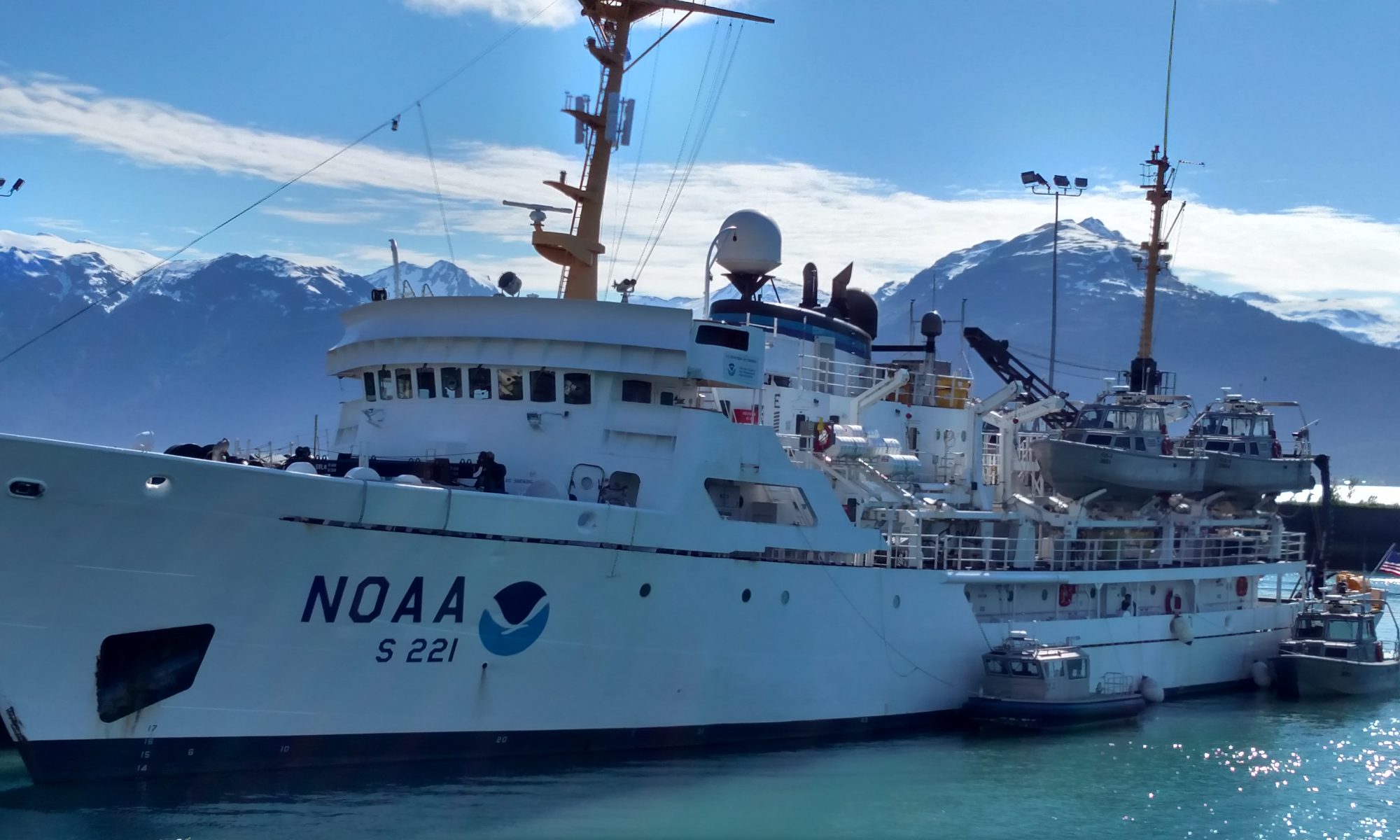
Diane Stanitski: Day 18, August 28, 2002

NOAA Teacher at Sea

Diane Stanitski

Aboard NOAA Ship Ka’imimoana

August 16-30, 2002

Day 18: Wednesday, August 28, 2002

The FOO (Field Operations Officer)’s quote of the day: 

“Better three hours too soon than a minute too late.”
– William Shakespeare

Weather Log:
Here are our observations at 0900 today:
Latitude: 3°39.88’S (into the Southern Hemisphere!)
Longitude: 140°00.36’W
Visibility: 12 nautical miles (nm)
Wind direction: 100°
Wind speed: 13 kts
Sea wave height: 4-5′
Swell wave height: 6-8′
Sea water temperature: 27.1°C
Sea level pressure: 1011.7 mb
Cloud cover: 2/8, Cumulus, Cirrus

Hurricane Genevieve lives!

Science and Technology Log:

I stayed up until I couldn’t keep my eyes open anymore last night. I finished the script and lesson plan for today’s broadcast with my graduate students in the Atmospheric Environment class. When I awoke at 0600, I realized that the fish bite test was already in progress on the fantail of the ship. I quickly prepared for my morning broadcast and then went outside to see if I could help place fish heads (mostly red snapper) on the lines that were being tested. The objective of the test was to qualitatively determine the fish-bite protection of a new armored mooring cable. The current cable that is used, nilspin, is very heavy while the cable to be tested is much lighter, but has a greater diameter. The test cable consists of a polyester core wrapped with electrical wires with up to two layers of special cloth armoring with a PE jacket. The cable diameter is ~221 mm. The test consisted of towing three 100 m cables (no armor, single, and double) simultaneously from the stern while the boat moved at 1-2 kts. Fish heads were attached every 3 meters to each cable. I was asked to take notes on the procedure since it was a new experiment and to use a multimeter to ensure that the lines were actually measuring electrical conductivity in case of a fish bite. Occasionally, I managed to assist with the deployment of the lines by helping place mesh bags alongside the line, opening the bag and inserting a partially frozen and slimy head of a fish, attaching the bag to the cable with wire ties, and then placing electrical tape over the wire tie and ends of the bags to keep them attached. It took approximately 2-1/2 hours to prepare the fish lines and deploy them. I really enjoyed it. There’s something exciting about having a group of people working together toward a common goal, especially when science is involved.

We started the broadcast soon after the fish bite test was running and I had the opportunity to interview a number of people on board who hadn’t been highlighted in a past broadcast. They were great! This was a more scientific webcast mostly focused on El Nino and the research conducted on the ship. I loved every minute and learned a great deal in the process. The video is 51 minutes long and can be accessed at on our videos page. Check it out when you have time.

I asked Lobo, our Chief Engineer, how portable water is created on the ship. He provided a great overview of the process. Seawater is converted into fresh water by vacuum distillation. In the end, the water is used for drinking, as process water, and for domestic purposes. The seawater to be distilled evaporates at a temperature of about 40°C (very low temperature for evaporation to occur) as it passes between the hot plates in an evaporator on board. The evaporating temperature corresponds to a vacuum of approximately 93%, which is maintained by the brine/air ejector. The vacuum serves to lower the evaporation temperature of the feed water. Having reach boiling temperature – which is lower than at atmospheric pressure – the feed water undergoes a partial evaporation, and the mixture of generated vapor and brine enters the separator vessel, where the brine is separated from the vapor and extracted by the combined brine/air ejector. The vapors that are generated pass through a demister where any drops of seawater that are entrained are removed and fall to the bottom of the distiller chamber. The vapors continue to the condenser where they condense to fresh water as they pass between cold plates. The freshwater that is produced is extracted by the freshwater pump and led to the freshwater tank. We can store approximately 3000 gallons of water on board.

I conducted a CTD test by myself for the first time tonight at 7:30 PM. Everything worked and we decided to test zucchini, a green pepper, a potato, and a round loaf of bread to see what happens to it when it’s submerged to the extreme pressure at 1000 meters below the water surface. When we finished the CTD cast where we sampled water at 1000m, 800 m, 600 m, 400 m, 200 m, 150, 100 m, 60 m, 40 m, 25 m, 10 m, and the surface, we brought the sampling cylinders up with the food. The potato looked and felt the same, the zucchini was squishy, the green pepper looked exactly the same but it had a crack on the side and was full of water. It must have burst on the way down and filled with water. In this case, the pressure would have been the same from the inside to the outside so no change in size took place. The bread looked like pita bread. It had been placed in plastic wrap, 2 zip-lock bags, and another plastic sleeve, but still managed to get wet. Interesting experiment.

Just after the CTD returned to the surface, I went to the starboard side of the ship to throw in an AOML, a device that measures water currents across the ocean surface (more on this tomorrow). AOMLs float away into the distance but transmit their data on a realtime basis. They are occasionally retrieved, but usually remain in the Pacific forever.

Personal Log:

I am receiving all of your emails – thank you! It’s great to hear that your first week of classes is going well. I will highlight several of your questions in tomorrow’s log!

Congratulations to Steve Osmanski who knew that the term “knot(s)” is a unit of maritime speed goes back to the days of sailing ships, when speed was measured by throwing a wooden device called a “chip log” over the stern of the ship. The chip log had a line attached with knots spaced along it. When the log was thrown overboard, a timing device (usually a 30-second sandglass) was turned and the number of knots that passed through the user’s hand as the line unreeled during the 30 seconds was the ship’s speed in nautical miles per hour. It was reported to the officer of the deck as so many “knots.” The distance between knots in a log line is calculated at 1.688 feet for every second in your timing interval; so a 30-second log line would have knots 50.64 feet (50 feet, 7 and 2/3rds inches, just about). Many of you answered this correctly, but Steve was first!

John and I played Yahtzee tonight in the third round of the match. I managed to win again so I move into the semi-final round.

Question of the day: How long is the Ka’imimoana? Check out Teacher at Sea web site for all the details.

Closer to land, but wishing I was further out to sea…
Diane

Diane Stanitski: Day 13, August 23, 2002

NOAA Teacher at Sea

Diane Stanitski

Aboard NOAA Ship Ka’imimoana

August 16-30, 2002

Day 13: August 23, 2002

The FOO’s quote of the day: “Happiness depends upon ourselves.”
– Aristotle

Weather log:
We started this morning with some cloud cover but with bright sunlight illuminating the buoy deck where our live broadcast was about to be filmed. Moments after we finished, the skies opened up – downpour! Here are our observations at 2200 this evening:
Latitude: 5°48.6’N
Longitude: 140°1.7’W
Visibility: 8 nautical miles (nm)
Wind direction: 350° (constantly shifting)
Wind speed: 10 kts
Sea wave height: 2-3′
Swell wave height: 4-5′
Sea water temperature: 28.4°C
Sea level pressure: 1011.9 mb
Cloud cover: 8/8, rain with cumulus clouds

Here’s the update on what is now Hurricane Fausto, currently located at 15.3°N, 120.0°W and heading 280° (just north of west) at 14 kts. Its central pressure has dropped to 959 mb and its maximum sustained winds are 105 kts, gusting to 130 kts. It’s still running strong.

Science and Technology Log:

I believe that our live broadcast went quite well today, but only after being disconnected twice after only seconds of the first two takes. No harm done in the end. The interviewees were great! They are all such interesting and unique people with fascinating lives. After reviewing the show later, we discovered that a loud buzz muffled some of the interviews. The problem was detected and will be fixed before Monday’s broadcast.

Congratulations to Holly Smith, one of my graduate students at Shippensburg University, who answered our KA quiz question, “What is a Kelvin wave?” correctly. Her answer is “A Kelvin wave is a warm pacific wave that forms near Indonesia and travels east toward the Americas. It can carry warm air and a bit of rain with it too!” Yes, although Kelvin waves can form anytime, this wave is often highlighted during El Niño events because the weakening or reversing of wind direction in the tropics permits the warm water in the western Pacific to move eastward shifting the high sea-surface temperatures from the western to the central Pacific, which affects the atmospheric circulation. It also tends to shut off the upwelling in the eastern Pacific, which reduces the number of marine organisms in that region. Holly, you’ll receive a NOAA T-shirt for your efforts and knowledge – great job!

I volunteered to do the CTD test by myself this afternoon with a little (ok, a lot of) help from Jason, the survey technician. I think I’ve got it down at this point and will gladly assist with these readings that need to be taken approximately every six hours. It’s a time intensive job and tonight’s 3 AM readings will take around 3 hours and sample water from the bottom of the ocean, near 4000 meters depth.

After the CTD sampling, I interviewed Larry Wooten, our technician on the ship, in order to discover how he arrived at the Ka’imimoana. Larry had been in the Air Force in South Dakota as a missile technician. He then went to South Dakota State University to become an electronic engineering technician. He said that he typically spends 6 months on the ship and 6 months off during the year so he can return to Seattle to spend time with his wife and daughter. He is able to do almost anything on the ship, however, the majority of his time is now spent as network administrator (helping with software applications and fixing computers) and less on hands on electronics. Overall, a great guy ready to help in a flash.

Personal Log:

Shortly after Larry’s interview, we had a fire drill followed by an abandon ship drill. The fire was supposedly in the computer lab, the location where we’re all supposed to go in case of a fire. So, I found myself on the upper deck with two other scientists. It was only after much searching that we discovered all of the other scientists in the forward lounge. Whoops! Now I know where to go in both situations. The abandon ship drill went well. We all had to don our gumby suits this time to ensure that we know how to quickly suit up in case we need to go directly into the water. We also have to bring long pants and a long-sleeved shirt in case we end up spending a long time in the rescue boats in the sun. Fortunately, everything is extremely safe on the ship, but the drills help us to know what to do in all situations.

I received an excellent question from Austin at the National Weather Service in Phoenix, Arizona. He is wondering how the MGO, Kelvin wave, and thermocline are all linked. Now that we know about Kelvin waves based on Holly’s correct answer, you can see the relationship with the thermocline. But, what about the Madden-Julian Oscillation? This is a phenomenon named after the two scientists who initially discovered the oscillation. This oscillation triggers an extremely wide band of convective activity that sweeps from west to east across the equator every 30-60 days. It has been hypothesized that the MJO could possibly be a trigger for El Nino.

In just a few moments I play the Captain in Scrabble. It’s my favorite game that I often play with my Mom and best friend, Lisa. I’ll get back to you regarding the outcome.

The question of the day for all of you is: 

What causes a halo to form around the moon (or the sun)?

Keep in touch,
Diane


Diane Stanitski: Day 12, August 22, 2002

NOAA Teacher at Sea

Diane Stanitski

Aboard NOAA Ship Ka’imimoana

August 16-30, 2002

Day 12: August 22, 2002

Weather log:
We currently have nearly overcast skies again with rain falling from cumulus and stratocumulus clouds. Our observations at 0800 this morning are:
Latitude: 10°38’N
Longitude: 141°26’W
Visibility: 12 nautical miles (nm)
Wind direction: 200° (direction from which the wind is blowing)
Wind speed: 13 kts
Sea wave height: 4-6′
Swell wave height: 6-8′
Sea water temperature: 27.6°C
Sea level pressure: 1010.0 mb
Cloud cover: 7/8, rain from cumulus and stratocumulus clouds

I awoke last night to swells approaching 8′ and the ship rockin’ and a rollin’! We were in the tail end of a low pressure system with lots of convection (new word from yesterday’s log) causing turbulence in the air and seas. A bottle had fallen over in the bathroom and it continued to roll back and forth hitting the walls for about 10 minutes before I was awake enough to realize the source of the sound; I then climbed down the ladder from the top bunk to rescue the bottle.

Right now, we are attempting to avoid Tropical Storm Fausto, which is currently located to our east and heading 275° (just north of west) at 11 kts. Its central pressure is 994 mb and its maximum sustained winds are 55-65 kts with 12′ seas. The Hurricane Prediction Center’s 72-hour forecast shows 75 kt winds with the possibility of gusts to 90 kts on the 25th with continued movement NW. We should slide just south of the storm and might feel some effects, but they’ll likely be minimal. Aaah, wonderful tropical weather in August! Check out www.weather.gov and view their tropical weather or hurricane page to determine the actual path of the tropical storm.

Science and technology log:
We conducted another live test broadcast this morning with the main Office of Global Programs office and Caption Colorado, the company that will provide captioning for the broadcast. It was 18 minutes long and the transfer was a success. The decision has been made that we’ll do a 20 minute live broadcast tomorrow (Friday) to be received at 4:00 PM EST in the U.S. If you miss Friday’s live broadcast, be sure to contact Jennifer at jennifer.hammond@noaa.gov before next Monday to tune into our upcoming broadcasts next week. I’m also anxious to hear from more of you about your interests in oceanography and climatology and the questions that you have for me that I’ll share with our global audience next week. I will do my best to find the answers!

The first official CTD data collection took place last night at 7:30 PM (1930) and a 3:30 AM reading this morning also proved to be successful. I awoke at 2 AM to see if Jason and Paul needed help, but it wasn’t yet time to conduct the test so I happily went back to bed. I did assist with today’s CTD at 12:20 this afternoon. I was so amazed at the entire process. First, the ship must stop and hover for approximately 1 to 1-1/2 hours over the same spot while the CTD sampling takes place. There are 12 depths at which water samples are collected in large cylinders between the ocean’s surface and 1000 m down (See yesterday’s photos for a picture of the CTD cylinders.). Just think of the pressure being exerted on the cylinders at over 3000 ft below the surface! Kirby, one of our two NASA scientists, gave me a styrofoam cup that was intentionally sent down with the cylinders and it’s now a small crushed, but perfect cup. I can’t wait to show my students! The person who controls the CTD from the computer end must work in close cooperation with the winch operator who is in charge of carefully lowering the heavy CTD device into the water and releasing it at different rates of speed to various depths. Any air bubbles that are present must be pushed out of the cylinders so the CTD is first lowered to 10 m, raised to just below the surface, and then lowered again to the greater depths. If the ship’s schedule is not rushed (unlike today), the CTD is lowered to approximately 200 meters off the ocean floor, which could be down to almost 5000 meters, our current depth below this ship! We only had time to lower the sensors to 1000 m today, and then the winch operator raised the CTD to 12 different depths where the carousels (cylinders) were “fired” to allow the bottles to flush and for samples to be collected. Lastly, two samples were taken at the surface. Once the CTD was lifted out of the water, Nadia, my roommate, collected water samples (see photo log) from each of the 13 cylinders to study salinity levels, which tells us something about the conductivity of the water. One reason that this is useful is because the degree of salinity in the water is related to flow of warm and cold ocean currents to and from higher latitudes, and may have been responsible for sudden shifts in climate in the past based on the slowing of our global currents! I have found that it’s incredibly important to ask why each study on the ship is significant to place it in context and to understand the big picture.

John and I met in the early afternoon to create the storyboard for tomorrow’s broadcast. We will highlight the Captain or Skipper of the ship; our Chief Scientist; Medical Officer; Lobo, the Chief Engineer; and Doretha, the Cook. We’ll also have an opportunity for you to win a NOAA T-shirt if you respond with the correct answer to our KA quiz question.

The Chief Scientist and I played 2 out of 3 Yahtzee games tonight just after dinner. It looks like I’m heading to the next round, lucky me! That’s about all that Yahtzee is, luck, but an awful lot of fun. I was invited to ride the RHIB tonight to make our way to a buoy that needed repair. The evening ride was beautiful! There was a full moon with a gorgeous halo around it (good question for tomorrow’s log) and approximately 4′ swells that made it just a bit rocky. There were six of us in the boat. Two scientists hopped onto the floating buoys and started making repairs because there was major damage to the anemometer and the precipitation gauge. One of them started feeling seasick because you’re swaying (just a bit) back and forth and you’re about 8′ above the ocean surface. He hopped off and they asked if I’d like to jump on to help with the buoy repair! Wow! (Mom, please skip this part…I couldn’t help myself.) It was safe, yet thrilling. I helped get the new rain gauge in order and placed small spikes on the top to keep birds from sitting on the edge of the sensor making their own contributions to the contents of the inner gauge. I also helped test it by pouring water through as Dave downloaded data from all the sensors to a computer and checked to make sure they were up and running. I couldn’t believe how lucky I was! I was floating on a buoy in the middle of the Pacific Ocean helping to fix meteorological instrumentation! The ship was all lit up in the distance about ½ a mile from the buoy. We found the exact location of the buoy because of the ship’s radar that spotted it right away and led us to the floating donut. I’ll include some (very dark) photos of this adventure tomorrow.

Well, I’m going to review my notes for tomorrow’s broadcast before heading to bed. It has been another grand day on the great Pacific.

The question of the day for all of you is: What are crepuscular rays? Yes, please consult your meteorology text sitting on your shelf, the Web, or my photo log, to find out. Then, email me to let me know how smart you are!

The FOO’s quote of the day: “Adversity is the first path to truth.”
– Lord Byron

Hope to hear from you soon,
Diane

Diane Stanitski: Day 11, August 21, 2002

NOAA Teacher at Sea

Diane Stanitski

Aboard NOAA Ship Ka’imimoana

August 16-30, 2002

Day 11: August 21, 2002

Weather log:
I awoke and went out on the buoy deck this morning to find rain falling from overcast skies! Here are our observations at 0800 this morning:
Latitude: 13°28’N
Longitude: 143°28’W
Visibility: 12 nautical miles (nm)
Wind direction: 100° (direction from which the wind is blowing)
Wind speed: 15 kts
Sea wave height: 4-5′
Swell wave height: 5-7′
Sea water temperature: 27.4°C
Sea level pressure: 1012.2 mb
Dry bulb temperature: 25.0°C
Wet bulb temperature: 24.0°C
Cloud cover: 8/8, rain from altostratus clouds

If you’ve been mapping out our course on a “chart” of the Pacific Ocean (as I’m sure you all are!), you may have noticed that we’ve made a sudden shift to the south! Why? To divert away from a tropical depression forming to our east! The Commanding Officer, CDR Mark Ablondi, made the decision late last night, after French class, to reverse the order of our trip. Instead of visiting the buoys from north to south along 125°W and then cruising west toward the 140°W line, we’ll first head south along the 140°W meridian and then toward 125°W. Flexibility is key to the success of the trip, especially when considering the safety of the crew. A tropical wave is heading our way with a tropical depression behind it. To our north there are a series of subtropical high pressure cells which will cause the tropical depression to slide due west, very close to our original path, thus the reason for the change. We’re hoping to avoid all signs of the storm. However, we currently have overcast skies and rain falling from beautiful altostratus clouds. The only thing constant about the weather is change – gotta love it!

Science log:
Our most exciting part of the morning so far has been a live test broadcast with Jennifer Hammond at NOAA’s Silver Spring office and others who will enable a future broadcast to come live to you. We had to attempt it three times because we kept getting disconnected. Larry, our very important computer technician on board, is looking into the cause of the problem. We’ll try another live broadcast test tomorrow morning before our first general broadcast, hopefully later this week (stay tuned on the web site for further information).

The constructed buoy that was going to replace the one to be removed at 8°N, 125°W, will now be used for the 2°N, 140°W replacement. Because ocean currents are much stronger near the equator, the buoys require more flotation. This means that two extra fiberglass inserts are placed inside the buoy (sort of like adding the donut hole to the donut). This will enable the buoy to float more effectively.

We tested the CTD profiler early this afternoon. CTD stands for conductivity, temperature, and depth. This instrument continuously records data as it is lowered through the water column to nearly the bottom of the ocean. It also collects water samples at preselected depths. Water is then brought to the surface from these depths and analyzed for salt and nutrient content. I have been asked to take some of the CTD measurements since we’ll be doing them a few times every day and I’m told it takes 1-2 hours. I’m very interested to see what it entails. I think that Jason will train four of us tomorrow.

Well, I reread my logs and decided that I need to provide some context as to why we’re all on the Ka’imimoana in the first place. El Niño! You’ve all heard the term, I’m sure, but what does it mean, and should it concern us?

Here is the story…
El Niño, Spanish for “the boy” or “the Christ Child”, is a phenomenon that refers to a warm ocean current that typically occurs around December (Christmas-time) off the west coast of Peru and lasts for many months. This appears to be related to a warming of the entire tropical Pacific Ocean.

Let’s go back even further… Under normal ocean and atmosphere conditions (during non-El Niño years), the trade winds in the Pacific blow from east to west across the tropical Pacific Ocean, dragging the ocean water beneath with them (due to friction). Because the water is being moved toward the western Pacific, it piles up such that the actual surface of the water near Indonesia can be up to approximately ½ meter (~1.5′) higher than off the west coast of South America – amazing! The sea surface temperature near Indonesia is also about 8°C (how many °F?) warmer than near South America because it has been warmed by the sun as it crossed the Pacific near the equator. Near South America, cold subsurface water then emerges at the ocean surface to take the place of the water that moved westward. This process is known as “upwelling” and brings cold, nutrient-rich water to the surface, which is attractive to many fish species, including the anchovy.

Warm ocean water is important for many reasons, primarily because it has a direct relationship with the atmosphere above it. Above warm water, evaporation increases, winds at the surface flow together, and clouds form. Thunderstorms form much more easily under these conditions causing rain. Heat is transferred from the ocean to the atmosphere in this process, known as “convection”. This shows why there is such a direct and important link between the ocean’s temperature and the winds in the atmosphere. Convection usually occurs over the warmest water and winds blow toward the warm rising air from all directions. Energy is transferred and this is one of the important flows across earth. I always tell my students that the earth constantly tries to maintain a balance and this is why there is movement. Earth is dissatisfied with excess heat near the equator and cold air hovering around the poles. In a move toward equilibrium, the wind flows and the ocean currents move…energy is being transferred! Okay, I could go on for days about this because I love it so much. Let’s move on to El Niño. During El Niño events, which typically occurred every 3-7 years in the past, but may be happening more often now, large-scale winds that normally blow from east to west across the Pacific Ocean diminish, and occasionally even reverse direction. Now, the warm water that is typically found in the western Pacific moves toward the eastern Pacific and, voila!, little upwelling occurs along the coast of South America resulting in fewer nutrients for the phytoplankton and other marine life that survive on the nutrients brought from below. With warmer water in the eastern Pacific, the process of convection shifts eastward with the warm water so the rising air and ensuing storms are found closer to the central Pacific.

Why is this important? El Niño results in changes to temperature and rainfall on a GLOBAL basis. For instance, because convection shifts eastward, parts of northeastern Australia often experience a major drought while the coast of Chile can receive severe floods. The 1997 El Niño event, one of the strongest ever experienced and recorded, resulted in heavy rains over the southern U.S., record rains in California, and a mild winter in the mid-western states of the U.S. At times, the monsoon that affects Southeast Asia arrives much later than normal. We are on the Ka’imimoana to help predict upcoming El Niño events . This is done with the help of 70 buoys that are located on the tropical ocean surface between 8°N and 8°S latitude. Sensors on these buoys measure atmospheric conditions like wind speed, wind direction, air temperature, relative humidity, radiation, and ocean temperature data from the surface to 500 meters below, to help determine if an El Niño event is occurring, or not. We do know that an El Niño is currently forming in the Pacific. Now, we need to ensure that all possible data are available by checking to make sure the sensors are functioning properly and that data are being sent via satellite to researchers who are using models to predict the severity of this event.

With early prediction of an El Niño, countries can adjust the types of crops that they grow, and plan in areas such as water resources, fisheries, and reserves of grain and fuel. Countries that have experienced the effects of El Niño in the past can also effectively plan in advance for drought, floods, and extreme weather, a consequence of the phenomenon, El Niño.

If you are a teacher, I’m writing a lesson plan related to the current El Niño conditions in the Pacific that you can use in your classroom. I will provide optional assignments so that you can use it from the middle school to college level. Please check my lesson plans in the next week to find this activity. Paul Freitag, Chief Scientist on board, is assisting with the exercise by providing current ocean temperature data and informed ideas.

Personal log:
I have remarked a few times today how helpful everyone is on the ship regarding questions that the new people have (that includes me!) or things that we need. This is a tremendous group of people. The Doc helped lower my bunk bed on the first day, after I spent 15 minutes trying every possible hole, button, lever, etc., until she discovered it was actually screwed into the wall. Doug McKay is helping me practice my knot tying which I started learning with my husband in Honolulu; I hope to be of some use on the RHIB or on the decks in the future when things need to be tied down.

John Kermond has answered every imaginable question, many times more than once. He has been very patient. The Chief Scientist endures my many inquiries about the TAO buoys and manages to come up with appropriate manuscripts and manuals whenever I need extra information. The Captain took the time to provide an overview of Pacific Ocean weather this morning before our test broadcast. It’s amazing how many questions I have each day. I even had to learn how to open the doors to go out on the deck. There is a lever that you lift to a certain point which allows you to exit; you then need to lower the lever again once you leave. This keeps the doors from flying open on their own and also keeps them water tight. I ended up sleeping with my stateroom door open the entire first night on the ship because I didn’t realize that it clicks shut only after much force. I woke up and the door was wide open. Taking a shower is always interesting. I’ve learned to stand with my feet wide apart to brace myself and I often use the walls for stability. Fortunately, I don’t even need to think about many of these details anymore. It’s remarkable how we all adjust to our surroundings.

Spiderman is the movie of choice tonight. I’m writing to you from my corner computer and peering out at a group of about 8 people sitting in the main lounge watching the movie. I haven’t watched any movies so far, but I am signed up for the game tournaments to start sometime later this week. In the first round I’m competing against the Commanding Officer (CO) in Scrabble (Yikes!), against the Chief Scientist in Yahtzee (Yikes again!), and am partners with our Cadet on board when we play Sequence. This is an evening program initiated by the Doc to keep morale high on the ship. Sounds good to me!

Well, I’m off to fold laundry before going to bed. Another outstanding day on the ship…I could really get used to this!

Hope all is well with you. Keep in touch!
Diane

Dana Tomlinson: Day 20, March 20, 2002

NOAA Teacher at Sea

Dana Tomlinson

Aboard NOAA Ship Ka’imimoana

March 1 – 27, 2002

Date: Wednesday, March 20, 2002

Lat: 5°S
Long: 95°W
Seas: 5-8 ft.
Visibility: unrestricted
Weather: mostly cloudy with isolated rainshowers
Sea Surface Temp: 82-86°F
Winds: SE 10-15 knots
Air Temp: 84-70°F

Today was a day of CTD’s, a live broadcast and a nighttime buoy visit. We are back to doing a CTD every degree, so Amy was a busy girl today (it gets even busier very close to the equator when she does CTD’s every half a degree). Our live broadcast was at 12:30 today as we are now on Central time. That was a bit dicey because John and I didn’t realize that the clock in the studio hadn’t been changed, so 20 minutes before show time, we were still thinking we had an hour and 20 minutes to go! Thank goodness I figured it out when I went down to eat and all the food had been put away because lunch was over!!

It just goes to prove, however, that preparation isn’t everything. We had a large “studio” audience (about 10-12 people standing behind the camera watching) and they all thought today’s broadcast was the best by far. All of the broadcasts will be put on the website as streaming videos in a few weeks when we return, so you can then decide for yourself. We had great guests: Clem, the Chief Steward who keeps our stomachs full of her yummy food (today’s delight: homemade bread pudding), Ensign Sarah Dunsford, Fred Bruns (the only original crew member since the KA has been working the TAO array), our bilingual trio of scientists Sergio Pezoa and Nuria Ruiz and our Ecuadorian observer, Juan Regalado, all topped off by a visit from oiler Ian Price (we’ve taken to calling him “Mr. Hollywood”). It was fun.

The nighttime visit to the buoy at 5°S 95°W was to check on the buoy’s anemometer. For a while now, the anemometer had been sending back low wind readings. The scientists weren’t sure if this was because there really were low winds in the area, or there was a problem. So, a little RHIB ride in the dark with a spare anemometer just in case did the trick. Turns out the bearings were bad in the old one, so they installed a new one (in the dark with spotlights in 8 foot swells). All in a day’s work for NOAA’s intrepid scientists Mike McPhaden, Brian Powers and Nuria Ruiz!

Question of the Day: 

Since we’re doing a CTD every degree, how often does Amy have to get up to do them? Or, how long is it between degrees of latitude going about 11 knots?

Answer of the Day: 

Mrs. Mackay’s class at Emory Elementary in San Diego CA were the first to come up with what the beam of a ship is: the width of the ship at its widest part (on the KA it’s 43 feet). Great job, you all!

Til tomorrow,
🙂 Dana