NOAA Teacher at Sea: Linda Tatreau
Onboard NOAA Ship Oscar Elton Sette
Mission: Fisheries Surveys
Geographical Area of Cruise: Equatorial Pacific
Date: March 4, 2010
Pinging and Playing
We continue to “kill dots” as we work our way around the island of Farallon de Mendinilla. The mapping here will be finished tonight and then we will head north to map the seafloor of a few seamounts and banks. Most of the recent questions on this blog have been about “killing dots,” as we edit the data from the multibeam sonar. I will tell you more about the map making process in a future post. Today I want to show you some of the fun things we do aboard ship.Fishing is everyone’s favorite activity, either for the catching or the eating. The best method is trolling using lures when the ship is traveling at about 10 knots. This only happens when the ship is heading from one study area to another. When using the multibeam, the ship travels at about 4.5 knots and the fish are less apt to bite a slowly moving lure.
Kenji making poke from a wahoo he caught.
Frances with mahi mahi skins she is drying to make a fishing lure. Before drying she had to remove all the meat and later all the scales were removed. The resulting skin is very tough.
Jonathan on the exercise bike pedaling to Rota. There is an exercise room on the ship with a treadmill, rowing machine and weights. Many of the crew members like the bike best because it’s out on the deck with the great view.
A few of the movies available.
Movies are popular during breaks. The ship has about 800 tapes including older movies and recent releases. Many of the crew members have personal collections as well.
The desk in my stateroom.
Each stateroom (bunkroom) has a monitor so the movies can be watched in the movie room, the lounge or the staterooms. The T.V. in the lounge also gets Fox News via satellite. The internet is a popular pastime. That also comes via satellite. The ship pays a set fee for the satellite service and there is no charge to us. There are three computers in the lounge available for everyone to use. There are internet connections on the bridge, in the science labs and in the bunk rooms for people with laptops. The library has a nice collection of books and board games so there is always something to do during non-working hours.
Bellow: That’s me looking for whales. These binoculars are called “big eyes.” They are used on trips when scientists are studying mammal populations. Using these binoculars from the highest point on the ship increases the likelihood of seasickness.
Big Eyes
Here we are splicing lines to hold buoys. There have also been several knot-tying sessions.
NOAA Teacher at Sea: Linda Tatreau
Onboard NOAA Ship Oscar Elton Sette
Mission: Fisheries Surveys
Geographical Area of Cruise: Equatorial Pacific
DAte: March 2, 2010
BRIDGES
The BRIDGES of Farallon de Mendinilla and the Oscar Elton SetteWe lost half of the science team in Saipan. The fun work of surveying fish populations is over so the AUV, BotCam and BRUV teams have headed for home. A tsunami at sea is not felt by ships, but the tsunami warning came while we were still at the dock. We were alert and ready to depart, but fortunately for us and the entire Pacific, the tsunami didn’t materialize.
Me checking out the pings
We are now mapping the seafloor around the island of Farallon de Mendinilla. The ship goes back and forth over a given area much like “mowing the lawn,” in fact they frequently refer to it that way. We will be doing this for about 12 days. The data comes into the ship’s computers and the clean-up work begins. Two or three people work at the computers day and night cleaning the data. The sonar sends out 3 or 4 pings per second. Each ping has 101 beams. Every beam of the multibeam sonar makes a dot on the computer screen. Some of the dots lie outside the target area and must be zapped. This is time consuming, tedious work. I am learning and I cleaned three paths yesterday. I am incredibly slow and have to stop frequently to get additional instructions. (That’s me on the left, hard at work.)
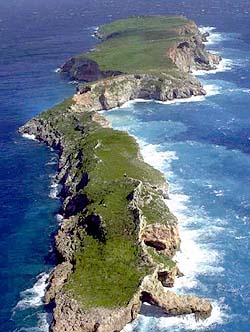
The BRIDGE of Farallon de Mendinilla (or is it a tunnel? or a cave? )
The island is small (1.6 miles long by 0.25 mile wide) with only grass and shrubs―not even one coconut palm. There are a lot of birds: frigates, boobies, terns, and other species. We’ve seen whales on three occasions. The ones that were close enough to identify were humpback whales.
The island is small (1.6 miles long by 0.25 mile wide) with only grass and shrubs
The BRIDGE of the Oscar Elton Sette is where the officers drive the ship, plot courses, handle navigational concerns and communications. I’ve had two tours of the bridge and am amazed by the electronics and complexity of each system. Rather than a description, I’ll just give you a few pictures.
Eric showing one of the ship’s many charts.The steering wheel is considerable smaller than I expected.
Chart table used for plotting the course. GPS is also used, but charts are kept in case the power fails.
The iridium phone works via satellite. The crew can use it for personal calls during non-business hours (East Coast to Hawaii). That doesn’t leave much time but it is also available on weekends.Mike is reflected in the radar. The red triangle just right of center is Farallon de Mendinilla.
This sign on the bridge lets the skipper know that there are fishing lines off the stern.
NOAA Teacher at Sea: Linda Tatreau
Onboard NOAA Ship Oscar Elton Sette
Mission: Fisheries Surveys Geographical Area of Cruise: Equatorial Pacific
Date: February 28, 2010
Old Dog, New Trick
What is the most exciting, most awesome, most unusual event of the expedition? These are the most common questions I have received from students following the blog. The whole trip has been exciting and awesome. It’s also been unusual as I don’t normally spend a lot of time at sea.
Unexpectedly for me, on February 23rd came the most exciting,most awesome and most unusual event of this trip. By then, I was familiar with the Autonomous Underwater Vehicle. I had read about it, talked about it, written about it and taken dozens of pictures. What I didn’t know was that Chris (see Meet the Science Team) was working to teach the AUV a new trick. AUVs run a preprogrammed route for about 4 hours and then return to the surface. It’s not until the AUV is back in its cradle on deck that the cameras can be retrieved. Only then can the photos be seen. Chris spent the trip devising a method whereby the AUV can send pictures to the ship while still underwater.
Seven miles of cabel used by the Remotely Operated Vehicle Jason II.
Keep in mind that the AUV is not attached to the ship. Remotely Operated Vehicles (ROVs) are attached to the ship via cables and can send pictures and receive instructions from the control room on the ship. On the AUV’s last dive, Chris’s program worked―underwater pictures on his computer. He got 13 photos at about 20 minutes each. The information is sent to the computer in small bits that must be assembled. HE DID IT! I wanted to break out the champagne in celebration, but there is none onboard so we had to settle for enthusiastic applause. I still get chicken skin (goose bumps) just thinking about the magnitude of his success.
AUV, no cables.
In the following paragraph, Chris talks about AUVs and communication.”Wirelessly communicating with Autonomous Underwater Vehicles (AUVs) is very difficult―the type of wireless communications that we rely on in our day-to-day lives does not work underwater. Most wireless systems, like WiFi or mobile phones, rely upon high frequency electromagnetic waves―millions or billions of cycles per second. Underwater, high frequency signals are attenuated, or blocked, over short distances. That is part of why when you are snorkeling or SCUBA diving everything looks blue―the higher frequency red light has been blocked out. To communicate with SeaBED AUVs, we rely upon sound waves, which use only around 12 thousand cycles per second. Echoes, other noise, and a number of other challenges presented by the ocean result in us having a very slow connection to the robot. Also, like using a walkie talkie, only one person can be talking at a time. If we are sending commands to the robot, it can’t be sending us information. Finally, sound travels slowly through the water, so it takes time for the message to even get to the boat (this is called latency). That all means we have to heavily compress images so that they are very small on disk before we transmit them, and we don’t get all the pieces in the right order. Putting together the image ends up being like putting together a puzzle―you have to make sure you have all the pieces, and then put them together in the right order. The compression means that the images look pretty rough, but they still give us an idea of what the robot is doing, and an early glimpse at the seafloor. For the rest, you have to wait until it comes back up! SeaBED AUVs can take over a thousand images every hour! ”
OK, me again. Chris will continue working on this project. He wants to make it easier and faster. With this new trick, the scientists will know, while the AUV is still below, that all systems are working and the AUV is taking quality photos.
NOAA Teacher at Sea: Linda Tatreau
Onboard NOAA Ship Oscar Elton Sette
Mission: Fisheries Surveys
Geographical Area of Cruise: Equatorial Pacific
Date: February 22, 2010
Rota
Rota
This is day #3 working off-shore of the beautiful island of Rota. While working at Galvez Bank we could see Guam at a distance of about 14 miles, but it was just a big bump on the horizon. While working in this location, we are close to shore and can enjoy the view of tropical vegetation, white sandy beaches and carbonate cliffs. The work in Rota has included BRUVs, multibeam and the AUV.
Linda, Viv and Tony with Rota in the background.
The AUV work has gone smoothly. Launching occurs each evening about 8:00 with recovery at midnight. The AUV has 2 cameras, one facing downward to photograph the geography and one facing forward for better fish identification (it’s difficult to identify a fish from the top, looking down). At night the AUV takes only still photographs. A strobe illuminates the scene every 5 seconds and the cameras shoot in synchronicity. A 4-hour trip produces more than 2,500 photographs with each camera. Processing that many pictures is a time consuming job. The AUV also has a CTD and records data for future analysis. Chirs (see Meet the Science Team) is working on a program that will allow the AUV to send pictures to the ship in real time. To date, this has only been accomplished when a ship is directly over the AUV. Chris is very close to success―maybe tonight.
Linda cutting bait for the BRUV bait bags.
BRUV boys loaded up and ready go.
The BRUV team says this trip has been the easiest BRUV work ever. In the next breath, they say this trip has been the most difficult BRUV work ever. The easiest―Galvez Bank where launch and recovery were from the ship. Launching was accomplished by simply tossing them off the stern. They were brought back aboard using an electric winch. The most difficult―Rota where the work is close to shore and the ship can’t go. Now they are using a small boat. With all the equipment piled on the boat, there is barely space for 3 people―the driver and 2 to handle the BRUVs. They have 4 BRUVs nestled on the little boat along with all the associated lines and buoys . Add bait, bait bags, lunch and drink and there is not much working area. Once rigged, the BRUVs are tossed over the side in 100 to 150 feet of water. Recovery is accomplished using a hand winch―at 150 feet deep, that is a lot of manual turns of the handle. Difficult as it may be, yesterday they managed 13 BRUV drops in 8 hours.
OK, every entry in this blog has been mostly science. For me, that’s the greatest fun. For the next entry, I’ll try for some of the non-science fun onboard a ship.
NOAA Teacher at Sea: Linda Tatreau
Onboard NOAA Ship Oscar Elton Sette
Mission: Fisheries Surveys
Geographical Area of Cruise: Equatorial Pacific
Date: February 22, 2010
Guppies
Sunset
Yesterday was a picture perfect day at sea. The sunrise was accompanied by 6 dolphins frolicking in front of the bow. The day was sunny, the sea was calm and we could see the bottom in 100 feet of water. It doesn’t get better. Steve and Sparky are preparing video clips from the BRUVs. New footage shows a feeding frenzy of snappers and at one point, a stingray parks itself on top of the bait bag. I am anxious to post these clips, but I must be patient. The BRUV boys and the BotCam girl have 85 hours of video to watch. Analyzing it will take much longer.The preliminary bathymetric map of Galvez Bank is completed and shown below.
Bathymetric Map of Galvez Bank
There is a new page on the blog. Click on the page titled, “Mutibeam Sonar.” Joyce Miller gives the basic information on how the multibeam works and how they generate these great bathymetric maps.
We have said good-bye to Galvez Banks and, after a bit of multibeam work west of Guam in the middle of the night, we are cruising towards Rota.
Steve swinging in the long-line pit. This is the area that is used for recovery of the BotCams, BRUVs and the AUV. On other expedtions the area is actually used for long-line fishing as a survey method.
Pet guppies getting some sun and enjoying the view on the ship’s deck.


