Mary Cook, January 3, 2005

NOAA Teacher at Sea
Mary Cook
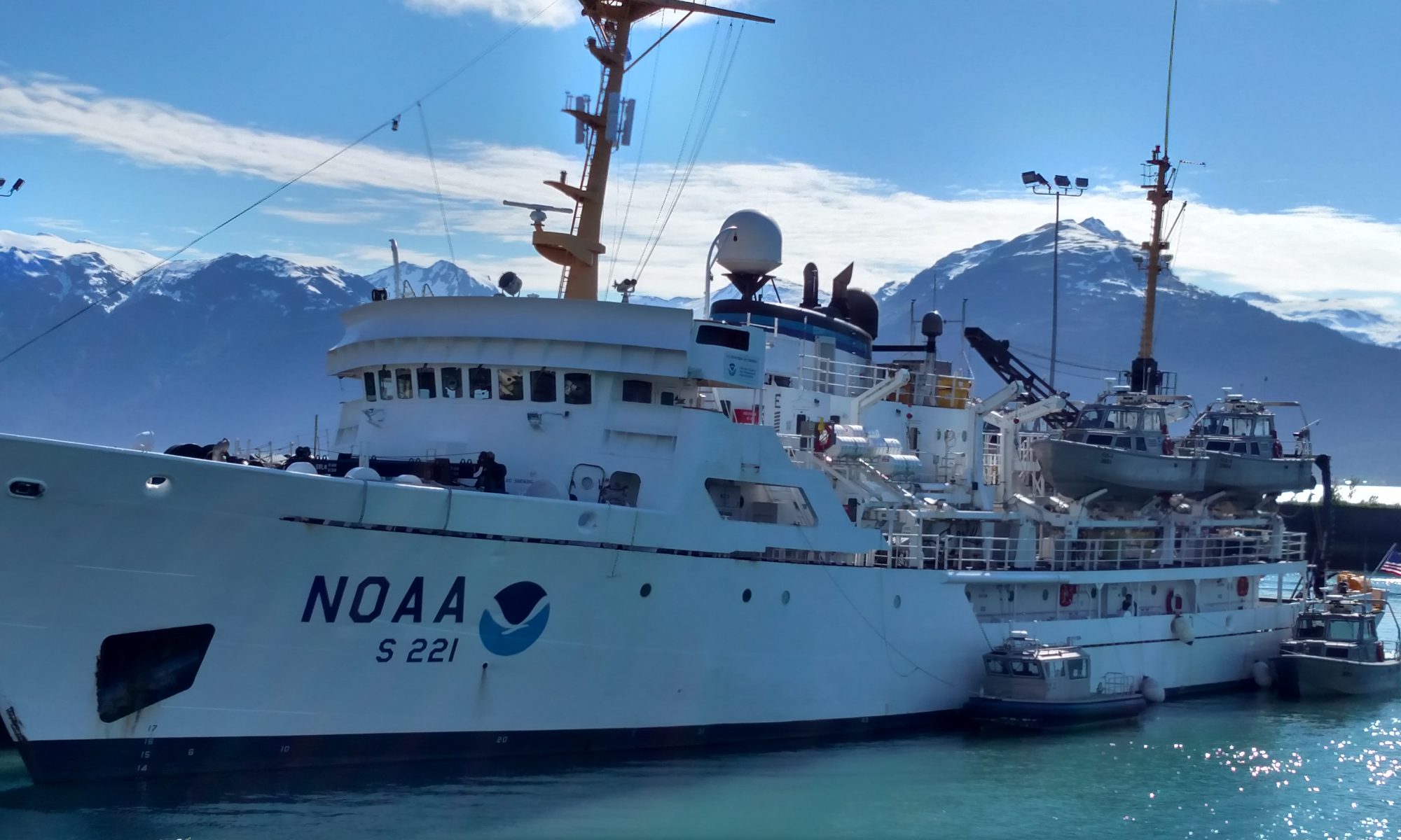
Onboard NOAA Ship Ronald H. Brown
December 5, 2004 – January 7, 2005

Mission: Climate Prediction for the Americas
Geographical Area: Chilean Coast
Date: January 3, 2005

Location: Latitude 45°49.53’S, Longitude 75°03.22’W
Time: 0930

Weather Data from the Bridge
Air Temperature (Celsius) 11.90
Water Temperature (Celsius) 13.55
Wind Direction (degrees) 343.52
Wind Speed (knots) 5.85
Relative Humidity (percent) 66.50
Air Pressure (millibars) 1016.06
Cloud Cover 6/8 Altocumulus
Sunrise 0615
Sunset 2152

Question of the Day

What is phytoplankton?

Quote of the Day

“Dream no small dreams for they have no power to move men.” Johann Wolfgang von Goethe

Science Log

This afternoon I interviewed Co-chief Scientist, Julio Sepúlveda, an oceanography graduate student from the University of Concepción. Julio did his Master’s thesis work for eight months at Woods Hole Oceanographic Institution in Massachusetts. In April, he’s leaving for Germany to spend three years continuing his education toward a PhD. in marine organic geochemistry. Julio has been kind enough to further explain the work they’ve been doing onboard the RONALD H. BROWN. The Chilean group of scientists include Pamela Rossel, Sergio Contreras, Rodrigo Castro, Alejandro Avila, and Luis Bravo. He says that their work has two parts: the water column process and the sedimentary record. The water samples and the sediment traps give a “picture of the moment”. They conducted the transect of samples starting at the shallow coastal waters and moving into the deeper offshore waters. These samples will provide a gradient of the nutrient concentrations at the Bay of Concepción which is part of an active upwelling location. To put it simply, they are looking at how the phytoplankton (plant-like microscopic organisms) uses the nutrients in the water. In particular they are looking at the nitrogen stable isotopes (nitrogen atoms with different masses) and their concentrations. They are trying to see how this is related to El Niño which greatly affects Chile and many places around the world. Julio explained that normally the upwelling brings cooler water containing nutrient-rich materials up to the surface. During El Niño events, the upwelling brings warmer, less nutrient-rich waters to the surface. This changes many things including the weather. The causes of El Niño are multi-varied air-sea fluxes that are not fully understood. In the last ten years the scientific community has been especially interested in knowing the possible influence of global warming in the El Niño variability. It seems that its frequency is changing and several articles indicate that El Niño is occurring more often. So their research provides a few “pixels” for capturing the entire “picture” of El Niño.

The second part of their research involves the core samples. The purpose of the core sampling is to collect the layers of sediments on the ocean floor. Julio described the layers to be like pages in a history book. Each layer tells the “story” of what was going on in the water at that location during that time. They are also looking at the degradation of the organic matter in the core samples. So, Julio says the water samples tell us about the present and the core samples tell us about the past. Using these methods of research, it is their intention to better understand the history of El Niño and better predict future El Niño events.

Personal Log

This morning we entered the fjords! Several of us were up and outside on the deck at 0630, “ooohing” and “aaahing”, taking pictures even though it’s very cold and windy out there. It is an irresistible attraction. We’re passing by the peninsula Tres Montes and we’re headed for the Bay of Tarn. All morning we’ve been sailing by emerald forest-covered mountains and black craggy rocks that have been eroded into peculiar shapes by the waves relentlessly smashing against them. The clouds are ominous and hanging low. The albatross are soaring with wings spread wide. An occasional whale sends a plume of spray into the air. I want these scenes to be indelibly saturated into my mind’s eye. I never want to forget this. No dwellings. No other ships. It’s just us. Just us and the birds and the whales. It’s good. It’s all good.

Until tomorrow,

Mary

Mary Cook, January 2, 2005

NOAA Teacher at Sea
Mary Cook
Onboard NOAA Ship Ronald H. Brown
December 5, 2004 – January 7, 2005

Mission: Climate Prediction for the Americas
Geographical Area: Chilean Coast
Date: January 2, 2005

Location: Latitude 41°47.12’S, Longitude 73°33.42’W
Time: 0830

Weather Data from the Bridge
Air Pressure (millibars) 1012.81
Relative Humidity (percent) 93.61
Wind Direction (degrees) 354.55
Wind Speed (knots) 7.03
Air Temperature (Celsius) 14.46
Water Temperature (Celsius) 11.62
Sunrise 0624
Sunset 2132

Question of the Day

What is a fjord?

Quote of the Day

“Withhold not good from them to whom it is due, when it is in the power of thine hand to do it.” King Solomon

Science Log

It’s raining! I haven’t seen rain since last year. The sky is thick with dark, billowing clouds and gray mist. Occasionally a patch of bright blue breaks through. But it only takes a few minutes until it’s eclipsed by a rain cloud. The land on both sides of the channel is shrouded in the mist and looks mysteriously enchanting. Only a few people onboard have ever been this way before and everyone is excited. Even these salty sailors are energized. Seals are popping up and playing all around. It looks like they’re chasing each other. We’ve passed a couple of small fishing villages and there are some ferryboats in the channel. The Chilean pilot told me that we’re in a very interesting place because of the strong current. Our ship is traveling against a three knot current at this time and they’ve brought more engines online just in case we need them. He said the current can get as high as eight knots! I heard Captain Wright say that the last time he was through here the ship was going with the current and traveling at 21 knots!

Bruce, the boatswain is now on constant anchor alert. There are many potential hazards when traveling the narrow channels so all hands must be prepared for anything.

I’ve been standing outside in a sheltered place under the ladderways for about an hour. At first it didn’t seem cold but as time went by I felt the chilly dampness in my muscles and had to zip up my jacket and put on my hood.

Something I’ve learned about this ship is that even when the scientists aren’t actively conducting research projects, science is always going on aboard the RONALD H. BROWN. At the top of every hour they always record the weather data, which includes about 50 entries, and then send it in to the National Weather Service every six hours. If the ship is within 200 miles of the coast of the United States or Canada or within 300 miles of a named tropical storm or hurricane they report every three hours. They record the ship’s location and speed, plus wind factors, temperatures, pressure, clouds, precipitation, wave size and directions, swells, and presence of ice. It seems to me that everything is written in code. They have the “Ship’s Synoptic Code Ready Reference” lying nearby and make use of it when filling out the charts. This information is entered into the National Weather Service computers and used for weather forecasting.

Personal Log

There’s a festive atmosphere throughout the entire ship. Everyone’s smiling and walking with a little extra spring in their step. These seasoned sailors are like little kids on Christmas morning, their eyes sparkling with anticipation. They’re out on the deck with their binoculars looking over the pastoral scenes of green rolling hills dotted with colorful houses and farms and churches connected by winding dirt roads. One of them said, “Just give me ten acres with a little house and I could settle down and live right here.” Several nodded in agreement. Then they spotted the big snow-capped mountains in the distance! Their dreams of settling down seemed to evaporate into thin air as their attention had been captured by the majestic and forbidding.

Our course is taking us through the Gulf of Corcovado and we’re just now passing the volcanic mountain for which the gulf is named. The pointy, snow-capped mountain is Mt. Corcovado and it stands 2300 meters in elevation which is about 7000 feet high.

The water is so smooth in this gulf that I can barely tell the ship is moving. It’s great! Seasickness is but a distance memory.

Officer Ayers just told me that I missed a fabulous display of bioluminescence last night about 0200. I said that I’d just stay up all night tonight so I could see that for myself. Then watch-stander Melton says, “Oh, now you want to be awake and out at 0600 tomorrow because we’ll be entering an extremely narrow channel. You can’t be sleeping through that.”

Decisions. Decisions.

Whales on the starboard bow! I ran out and saw three waterspouts and one tail. Pretty cool.

Tomorrow, my students and co-workers will be returning to school from their Christmas break. I hope they’ve all had a good vacation and come back with renewed energy and smiles. I can’t help thinking about them and wishing they could be out here in this never-ending, ever-unfolding story of exploration.

Until tomorrow,

Mary

Mary Cook, December 30, 2004

NOAA Teacher at Sea
Mary Cook
Onboard NOAA Ship Ronald H. Brown
December 5, 2004 – January 7, 2005

Mission: Climate Prediction for the Americas
Geographical Area: Chilean Coast
Date: December 30, 2004

Location: Latitude 36°21.31’S, Longitude 72°59.65’W
Time: 9:15

Weather Data from the Bridge
Air Temperature (Celsius) 14.33
Water Temperature (Celsius) 14.81
Air Pressure (millibars) 1015.24
Cloud Cover 3/8
Cloud Type: Stratus
Wind Direction (degrees) 325.6
True Wind Speed (knots) 1.26
Sunrise 636
Sunset 2112

Question of the Day

What is a light year?

Positive Quote of the Day

“The influence of each human being on others in this life is a kind of immortality.” John Quincy Adams

Science Log

Last night I went up to the bridge at about 2300 hours. Vickie, Jeff, and Jackie were stargazing in search of the Southern Cross. There it was, almost directly in front of the ship! It had just risen over the horizon and looked more like a baseball diamond than a cross. We also spotted Alpha and Beta Centauri. At about 4.3 light years away, these are among the closest stars to Earth other than our Sun. Vickie also pointed out Orion with his belt of stars and the seven sisters called Pleiades. I’m going to get out my textbook and read up on the Magellanic Clouds because I’m wondering if we can see those from here. Then Jackie looked over the edge of the ship in the wake and caught a glimpse of some momentary flashes of light! Bioluminescence! I stood there pressing my face against the window staring at the darkened waters waiting patiently for some more microorganisms to glow. Sure enough it happened. They looked like little sparks of lightening in a cloud. It happened several times. I’ll definitely be back on the bridge again in search of more wonders of the sea at night.

For this leg of the journey, I’ve been moved to a different stateroom. I’m now down below in the science quarters. The sounds are different down here. I can hear the water splashing up against the ship’s hull. It sounds like I’m in a perpetual carwash!

It’s a soothing sound, though. I slept like a bear in hibernation.

Today begins the science operations. Right now, the scientists are on the fantail preparing the drifting sediment trap with its radar-reflector, floaters and nighttime strobe light. We’ll deploy the instrument then leave it while we make a short transit to the next station for CTD casts and core sampling. Afterwards, we’ll return and retrieve the sediment trap. According to the work plan, we’ll do this same thing at six different locations across the continental shelf and slope off Concepción, Chile. Most of the CTD casts are in fairly shallow water with the deepest one going down to 980 meters. These scientists will be working 48 hours non-stop.

It’s beautiful here in the Bay of Concepción. The water is so smooth and glistening in the sunshine. We’re nearly surrounded by a crescent-shaped coastline and we can see houses, forests, and other ships. This afternoon, we saw several ghostly-white jellyfish pumping their way through the water. Jim pointed out little anchovies swimming nearby. Yum!

I spoke with Kevin Sullivan of the NOAA research branch in Miami and Jordan Watson from the Scripps Institution of Oceanography. They patiently explained some of the science to me. And I really appreciate that.

This is how the drifting sediment trap works. After the instrument collects the sediments from the water near the surface and is retrieved, it will be set aside for a few hours to allow the sediments to settle to the bottom of the tubes. Then a lever is turned that empties the sediments into bottles containing a preservative. Sediments can be particles from the air like dust or particles from the ocean such as little deceased sea creatures called diatoms.

The Rhumor gravity core sampler is basically a one meter long hollow tube with heavy weights attached to the top. After being lifted by the winch, it is slowly lowered into the water. When the tube gets about 10 meters from the ocean floor it is lowered very quickly and gravity rams it into the mud. In this process, the mud layers fill the hollow tube and as the core sampler is raised the pressure closes a valve that keeps the mud from coming out.

I’ve noticed on the SeaBeam readout that the depth here is only about 100 meters. That’s a huge contrast to a couple of weeks ago when we were in waters with a depth of 5000 meters!

It is my understanding that the rationale for their research is to explore the effects of nitrogen distribution and how that affects the marine algae nutrient usage in the present day water column. They are conducting the sampling in this location because of the upwelling that occurs which brings nutrients to the surface and because there are algae present that utilize the nutrients in these upwelling plumes. Likewise, they are interested in evaluating the amount of nitrogen left in the sedimentary record. This will help scientists better understand the history of the oceans.

Personal Log

Today has been a quiet but interesting day. All the science was new to me so I had to pay attention and ask lots of questions. It’s very rewarding to have people around who are eager to share with me what they are doing and the significance of it all in the whole scheme of things. I’ve learned a tremendous lot and my brain is kind of tired. Plus, I miss my mentor. She’s got enough energy for two people! I did take some time to go to the ship’s bow and watch the water skim by and look around for animals. I saw lots of birds and jellyfish. I like watching jellyfish because I never see jellyfish in Arkansas. To me they are intriguing critters because they are transparent. I can see right through them!

Well, I’m headed for the exercise room to rest my brain and work off that cake with chocolate icing that I ate for dessert. Then, after dark, up to the bridge for more stargazing in the Southern Hemisphere!

Until tomorrow,

Mary

p.s. Congratulations Brandon and Becky!

Mary Cook, December 29, 2004

NOAA Teacher at Sea
Mary Cook
Onboard NOAA Ship Ronald H. Brown
December 5, 2004 – January 7, 2005

Mission: Climate Prediction for the Americas
Geographical Area: Chilean Coast
Date: December 29, 2004

Question of the Day

What is sediment?

Quote of the Day

“Rust never sleeps.” Dan Wolfe

Special Edition Log: Part 2

We’ve just left the port of Valparaiso and we’re underway, headed for the inside passages and the Straits of Magellan!!! I’ve looked on the ship’s course chart and it’s going to be a great voyage!! We’ll be sailing between islands and there’ll be land on both side of the ship. I expect to see lots of wildlife-hopefully penguins and an albatross or two.

Bruce, the boatswain and Jeff, the chief computer technician have set me up in the science office with a desk, Internet, a big, comfy chair and a phone. And I’ve just found someone’s secret stash of Dr. Pepper’s under my desk. Yep, things are looking good.

I wanted to share with you about the Easter Island Museum that we went to yesterday. This will be my personal interpretation of what I saw since most of the museum’s information was in Spanish.

Easter Island is a volcanic island situated in the Pacific Ocean several hundred miles off the coast of Chile. The indigenous people or Rapi Nui made huge monolithic statues called maori and placed them all around the island. These gods are thought have been put in place for protection and worship. The native people had four quarries from which they extracted the stones and carved the features. Then they slid them into place with wooden rails and ropes. There are only four of these statues outside of Easter Island and one of them stands in front this museum. The Rapi Nui had a complex and organized society led by a chief. They made pottery, arrowheads, harpoon heads, and jewelry. They were great fishermen. It appears as though they had a sophisticated system of ocean navigation with bamboo and seashell “maps” that indicated currents and islands. (I love maps. So seeing this was “way cool”!) Sometime during the 1700’s the first white man arrived. Some of the Rapi Nui were taken as slaves. Different diseases were introduced that spread rapidly throughout the island. And so this was the beginning of the end for their culture. Today, Easter Island is part of the country of Chile and the maori are being restored and preserved as a world heritage site. So, that’s my take on the fascinating museum of Easter Island loaded with its artifacts of history, mystery and intrigue.

Tonight, my plans are to stay up late and go hang out on the ship’s bridge and search the dark waters for bioluminescence. Wow, that’s a big word. Bioluminescence refers to microorganisms that emit light when disturbed. I’ve heard about bioluminescence in the ocean but I’ve never witnessed it. Silas says it’s there almost every night so, hopefully, tonight we’ll see the ocean glow!!!! In Arkansas, we have lightning bugs that flash a glowing, neon green light. When I was a kid I loved catching them and holding them gently in my fist to watch the rays of green light shine between my fingers. It was fascinating, but they smelled like, I don’t know, lightning bugs. Anyway, I’ve heard that the bioluminescence in the ocean can be red or blue or green! I can’t wait. If I don’t see any tonight, I’ll go back every night until those little rascals get disturbed enough to emit a sparkle.

Tomorrow, we begin the scientific work with the University of Concepcion. According to the plan, a drifting sediment trap will be deployed, a CTD rosette cast will be conducted, and a sediment core sample will be taken.

The sediment core sampler looks like a rocket. It’s a long narrow metal cylinder with fins on the bottom. But instead of going up into space, it’s going down into the ocean floor. Co-chief scientist, Julio says it will collect sediments that were laid down thousands of years ago. This will enable them to better understand the history of the ocean.

Before I sign off for the day, I’d like to thank Alvaro Vera of the Chilean Navy for his thoughtfulness and generosity extended toward us during our stay in Viña del Mar. Alvaro invited all the Stratus 5 scientific crew over to his house for a barbeque in celebration of a job well done and the good working partnership between the Chilean scientists and the American scientists. It was great food and great fun-another fine example of Chilean hospitality.

Until tomorrow,

Mary

Mary Cook, December 28, 2004

NOAA Teacher at Sea
Mary Cook
Onboard NOAA Ship Ronald H. Brown
December 5, 2004 – January 7, 2005

Mission: Climate Prediction for the Americas
Geographical Area: Chilean Coast
Date: December 28, 2004

Question of the Day

What type of mountains are the Andes mountains?

Positive Quote of the Day

“I not only use the brains that I have, but all that I can borrow.” Woodrow Wilson

A Special Edition Log

This afternoon concluded my shore leave for Christmas. I have returned to the NOAA ship, RONALD H. BROWN. It felt good to walk across the gangplank-almost like home. Well, maybe not as good as home, but still I’m happy to be back. It’s going to be different because my mentor, Diane and all the scientists that I worked with have returned home. I already miss them. But the ship’s crew welcomed me aboard with smiles and inquiries about what I did on shore leave. I’ve met the co-chief scientists of the new science crew onboard, Kevin and Julio. They’ll be conducting CTD casts, sediment core samples and water sediment samples. I look forward to observing and helping out with these new science research projects.

My days in Valparaiso and Viña del Mar were wonderful. What an interesting and beautiful place. The cities are wedged in between the mountains and the ocean. The colorfully painted homes are built on the steep slopes and seemed to be stacked on top of each other. The streets are very steep and narrow. Every nook and cranny has something built in it-a doorway, a walkway, a stairway, a little garden or maybe a parking place. It’s seems that there is no space left unused. And I must say, the canine population is alive and well here, too. Everyone has a dog or two or three. Valparaiso and Viña del Mar have funiculars that carry pedestrians up and down the steep hillsides. The Chileans call them ascensors. A funicular is like a short railway that keeps the passengers in an upright position as it moves up or down the slope. The arrangement is two parallel tracks with a rail-car on each track. The two cars are connected by a cable and when one ascends the other descends. These funiculars are old. I saw 1887 engraved on the entrance of the Concepción funicular. They are also small with a maximum capacity of seven passengers! We searched out and rode three different funiculars, each being brightly painted with its own special design. The ride takes about three minutes. These really are short railways!

At night, it’s amazing to see all those city lights twinkling across the slopes and frankly, it’s mind-boggling to me to think about how many people live in such a congested area.

But the Valparaisians do it with finesse and great style. I’ve come to discover that the Chileans are very proud of their country, both their diverse culture and beautiful landscapes. As a result, they are a hospitable and courteous people who love to share and help others experience the depth of Chile’s wonders.

Christmas Day was a special day for me. It was definitely not the traditional Christmas with family, turkey and dressing, pumpkin pie, and gift-giving. For which, I have to admit, I felt a little reminiscent. I’ve realized that one of my favorite Christmas memories is seeing the pleasure in my mother’s face as she hugs all her kids, grandkids, great-grandkids, and the one great-great! Plus, I missed her famous fruit and nut roll made with vanilla wafers. (Mom, save some back for me until I get home.)

Well, on to my Christmas Day. It was very special to me because Diane, Jeff, Jason and I went hiking in the Andes Mountains across the border into Argentina. At over 10,000 feet, it was breathtaking in more ways than one. Having spent most of my life at about 200 feet elevation, hiking in these mountains was a shock to my system, to put it mildly. I was sucking in air like a vacuum cleaner! But I loved every minute of it. I think the sky is bluer, the snow is whiter and the mountains are more magnificent when the oxygen is thinner. We were following a dirt road up Santa Elena Mount (approx. 12,000 feet) in hopes of reaching the top where the “Christo Redentor” statue of Jesus with outstretched arms is overlooking the two countries of Chile and Argentina. We were just about to abandon our quest due the lateness of the day, when Diane rounded the corner of a switchback and gasped. There it was! We cheered and hugged and wished each “Merry Christmas”. Diane burst forth into song. Even though my body was relentlessly demanding more air, my fatigue had mysteriously left me. It was great to be on top and look out across the mighty expanse of the Andean mountains and valleys. We even caught a glimpse of Acongagua, the highest mountain outside of the Himalayas. Beautiful. Magnificent. Glorious. You know, sometimes there just isn’t a word to convey the feeling. As I reflected on what Christmas means to me, I thought how appropriate to be on a journey on Christmas Day in search of the symbol of peace and goodwill to all men.

As we began our descent, a beautiful blue-eyed, thick-furred dog took up with us. We thought he was hungry so we fed him some beef jerky sticks. That sealed our friendship and he was our constant companion for the next six miles to the border crossing. We tried to get him to go back but he was persistent and wouldn’t leave our side. I named him “Balto” after the famous sled dog from Alaska. “Balto” was a pleasure. When we sat down to rest, he’d sit down to rest and snuggle right up next to one of us with this look of contentment on his face. Sometimes he’d put his wet nose right up to ours. When we came to a waterfall he detoured to get a quick drink and then ran to catch up with us.

We knew “Balto” was someone’s pet because he was well-fed and such a gentle creature.

When we got to the border crossing and presented our papers to the officials, “Balto” was also met by the obviously self-appointed “canine border patrol” – a band of five not-so-friendly dogs. Did he back down? No way. “Balto” is definitely an alpha-male. Before we knew it “Balto” had trotted into the customs building like he owned the place!

We stopped in a nearby hostel for something warm to drink and then loaded into the car and headed back for the Hotel O’Higgins in Viña del Mar. As the full moon continued its path across the darkened sky, we trudged into the hotel, dusty, sunburned and exhausted, ready for a peaceful sleep on that Christmas night in central Chile.

Happy Holidays!

Until tomorrow,

Mary